July 28 , 2024.
Iceland , Mýrdalsjökull :
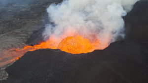
An increase in electrical conductivity began to be measured in the Skálm River yesterday evening, and this morning an increase in turbulence could be seen under the glacier. These were the signs that a glacial flood had begun beneath Mýrdalsjökull. The jökulhlaup started to be measured in Skálm around 1:20 p.m. today and it was a big flood, perhaps bigger than the last big flood which took place in 2011 and which came from Kötlujökli, in the eastern part of Mýrdalsjökli . According to information received from a pilot from the Norwegian Meteorological Agency, the runoff water comes from the Sandfellsjökull as it currently stands and flows down into the Skálmar Canal. From these images, it appears that the runoff has reached its maximum flow at the level of the glacier. However, the flood has not yet reached its peak on Highway 1. According to information from the road administration, water is flowing over the bridge over the Skálm River and onto the ring road in a section of approximately one kilometer east of the bridge.
Measurements show that the flow at Skálm has decreased significantly. The gauge is located on the bridge over Skálm near Highway 1, and therefore the Mýrdalsjökull flood peaked there. It may take several days for the flow to return to normal for the time of year. Scientists from the Norwegian Meteorological Agency and the University of Iceland carried out a patrol flight with a coast guard helicopter this afternoon. The photo taken during the flight shows in the distance the source of the flow at the Sandfellsjökull glacial spur, in the eastern part of Mýrdalsjökull. The Norwegian Meteorological Agency continues to monitor the area and closely monitor unrest and seismic activity beneath the glacier. It may take up to 24 hours for activity to return to what is called « normal background activity », so this scenario can be declared over. There is no sign in the Norwegian Meteorological Agency data that a volcanic eruption caused the melting of glaciers that occurred today.
Source : Vedur is
Photo : Sécurité publique/Björn Oddsson
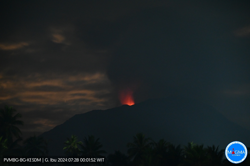
Indonesia , Ibu :
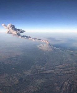
An eruption of Mount Ibu occurred on Sunday 28 July 2024 at 00:01 WIT with the height of the ash column observed at ±500 m above the summit (±1825 m above sea level). The ash column was observed to be gray with thick intensity, oriented towards the East. This eruption was recorded on a seismograph with a maximum amplitude of 28 mm and a duration of 102 seconds.
SEISMICITY OBSERVATIONS:
29 eruption earthquakes with an amplitude of 19 to 28 mm and a seismic duration of 28 to 152 seconds.
7 emission earthquakes with an amplitude of 5 to 14 mm and duration of the earthquake from 16 to 29 seconds.
10 harmonic tremors with an amplitude of 2 to 28 mm and an earthquake duration of 33 to 118 seconds.
133 Shallow volcanic earthquakes with an amplitude of 2 to 9 mm and an earthquake duration of 4 to 14 seconds.
34 deep volcanic earthquakes with an amplitude of 2 to 18 mm, and an earthquake duration of 8 to 14 seconds.
1 Distant tectonic earthquake with an amplitude of 15 mm, the earthquake lasted 46 seconds.
RECOMMENDATION
Communities around Mount Ibu and visitors/tourists are advised not to carry out activities within a radius of 4 km with a sectoral extension of 5 km towards the crater opening in the northern part of the active Mount Ibu crater .
In the event of ash falling, people who practice activities outside the home are advised to wear nasal, oral (mask) and eye (glasses) protection.
Source et photo : Magma Indonésie.
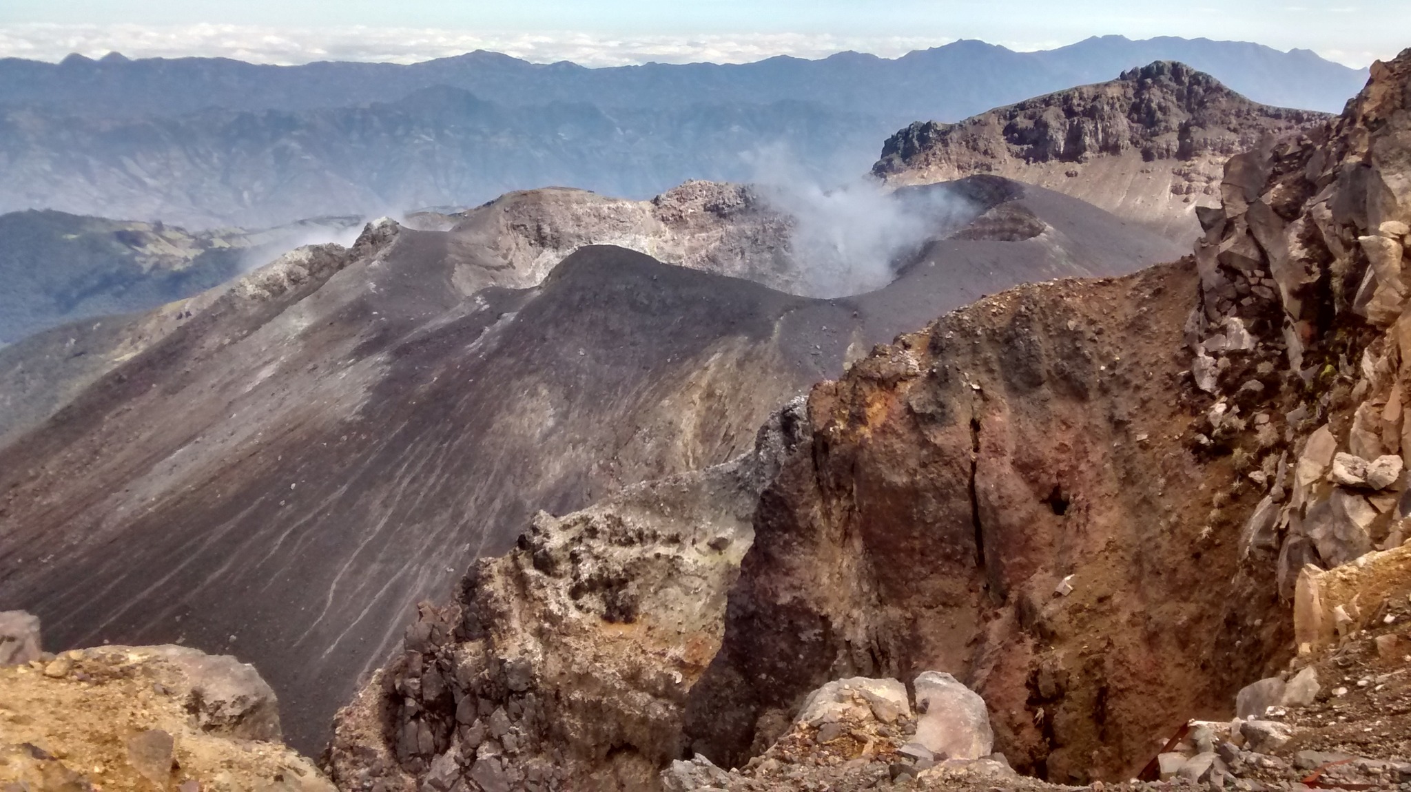
Colombia , Galeras :
San Juan de Pasto, July 23, 2024, 3:40 p.m. Galeras Volcano
Monitoring the activity of the Galeras volcano, the Colombian Geological Service (SGC), an entity attached to the Ministry of Mines and Energy, reports that:
In the week of July 16 to 22, 2024, the volcano’s activity maintained stable behavior. Compared to the previous week, the main variations in the parameters monitored were:
● Seismic occurrence was less; however, the energy released increased.
● The predominance of seismicity associated with fracturing of cortical material remains.
● Earthquakes linked to fracture processes were located near the volcanic summit, at distances less than 1 km, with depths less than 2 km from the summit (4200 m) and with a maximum magnitude of 0.3.
● Gas emissions were observed from the main crater and the fumarole fields of Las Chavas to the west and El Paisita to the north of the active cone, with white columns and variable dispersion depending on the wind.
● Other volcanic monitoring parameters showed stability.
Based on the above, the SGC recommends carefully monitoring its development through weekly bulletins and other information published through our official channels, as well as instructions from local, departmental authorities and National Disaster Risk Management Units ( UNGRD).
Volcanic activity remains on yellow alert: active volcano with changes in the behavior of the base level of monitored parameters and other manifestations.
Source : SGC
Photo : SGC ( 07/2024)
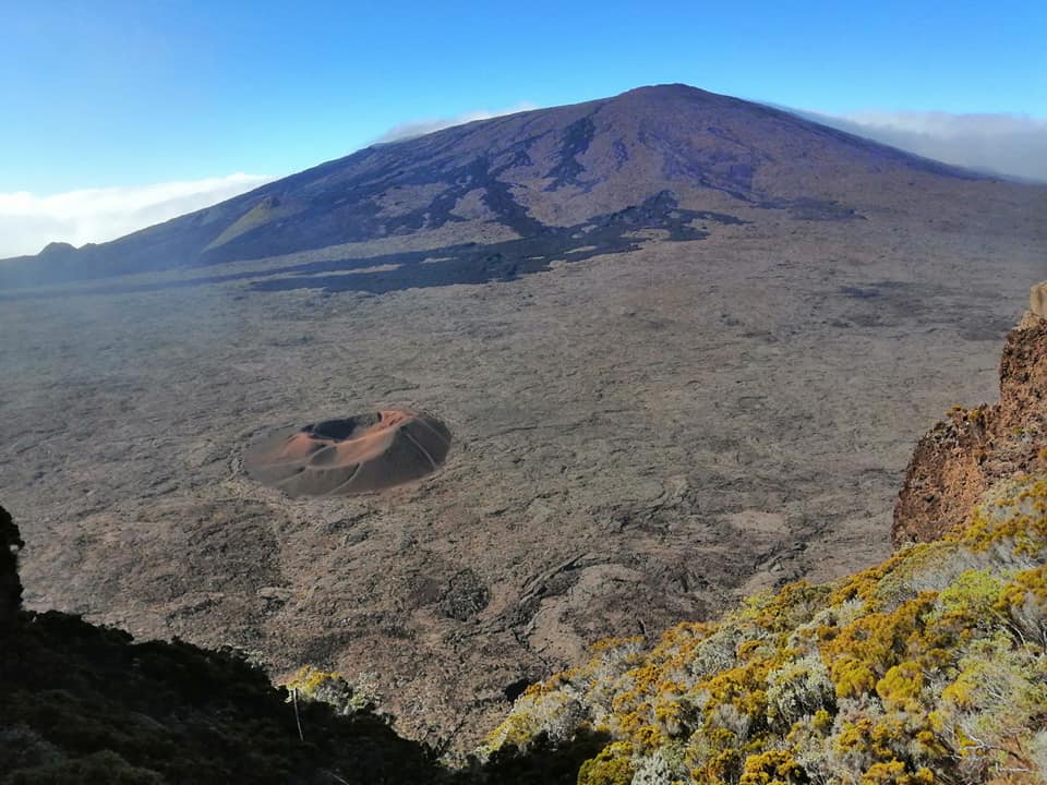
La Réunion , Piton de la Fournaise :
Press release from the Paris Institute of Globe Physics. Piton de la Fournaise volcanological observatory, July 25, 2024 – 2:15 p.m. (local time) – 10:15 a.m. (UTC time).
Earthquake felt.
On Thursday July 25, 2024, 1:39 p.m. (local time – 9:39 UT), an earthquake was lightly felt by residents of the island, mainly in the northern sector of the island.
This earthquake was recorded by the seismometers of the Piton de la Fournaise Volcanological Observatory. The first analyzes of this earthquake made it possible to locate it, at a depth of 11 km in the Roche Ecrite sector, 4 km northwest of Grand-Ilet. Its magnitude was measured at 2 on the Richter scale. There is currently considerable uncertainty over its
location.
OVPF staff are working to refine the location calculations for this event. Also information regarding location and intensity could evolve marginally.
This type of event, felt by the population, is recorded several times a year. This event is isolated and is of tectonic origin. To date, this earthquake has not been followed by aftershocks.
Call for testimonies on felt earthquakes: the real intensities (effects of an earthquake in a given location) can only be correctly determined by collecting testimonies. If you felt this earthquake, even slightly, you are invited to report it to the BCSF (French Central Seismological Bureau) on the site http://www.franceseisme.fr/
Source : direction de l’OVPF-IPGP
Photo : Nath Duverlie
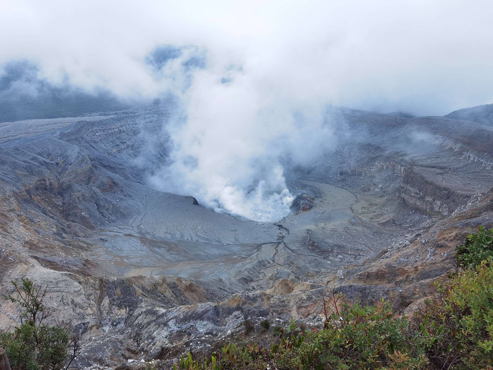
Costa Rica , Rincon de la Vieja / Poas :
Rincón de la Vieja Volcano
Latitude: 10.83
Longitude:-85.324
Altitude: 1,916 meters
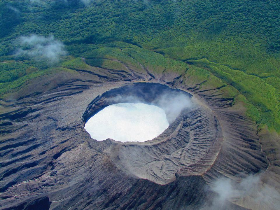
Activity observed:
A plume of steam is observed emerging from the crater. No significant eruptions or expirations have been recorded in the past 24 hours. The background tremor remains continuous and of moderate amplitude, with a frequency range between 0.85 and 8.0 Hz. Geodetic measurements show stability at the summit and base of the volcano.
Environmental conditions:
The wind blows towards the South-West.
Activity Level: Caution (3)
Poas Volcano
Latitude: 10.2
Longitude: -84,233
Altitude: 2,687 meters
Activity observed:
No outbreaks have been recorded in the last 24 hours. Seismic activity remains stable and continuous with a background tremor of slight amplitude with frequencies of 3 to 4 Hz. Frequent LP type earthquakes are detected. The CO2/SO2 ratio remains stable but an increase in the H2S/SO2 ratio is observed with values up to 0.7. In recent weeks, a contraction of the crater continues to be observed with subsidence to the north of the crater but without significant vertical movement towards the south.
Environmental conditions:
The wind blows from the South-West and the summit is cloudy.
Activity Level: Warning (2)
Source : Ovsicori.
Photos : Raul Mora / RSN / UCR ( 12/2020) , Silvio Neels ( Juin 2024)