July 14 , 2024.
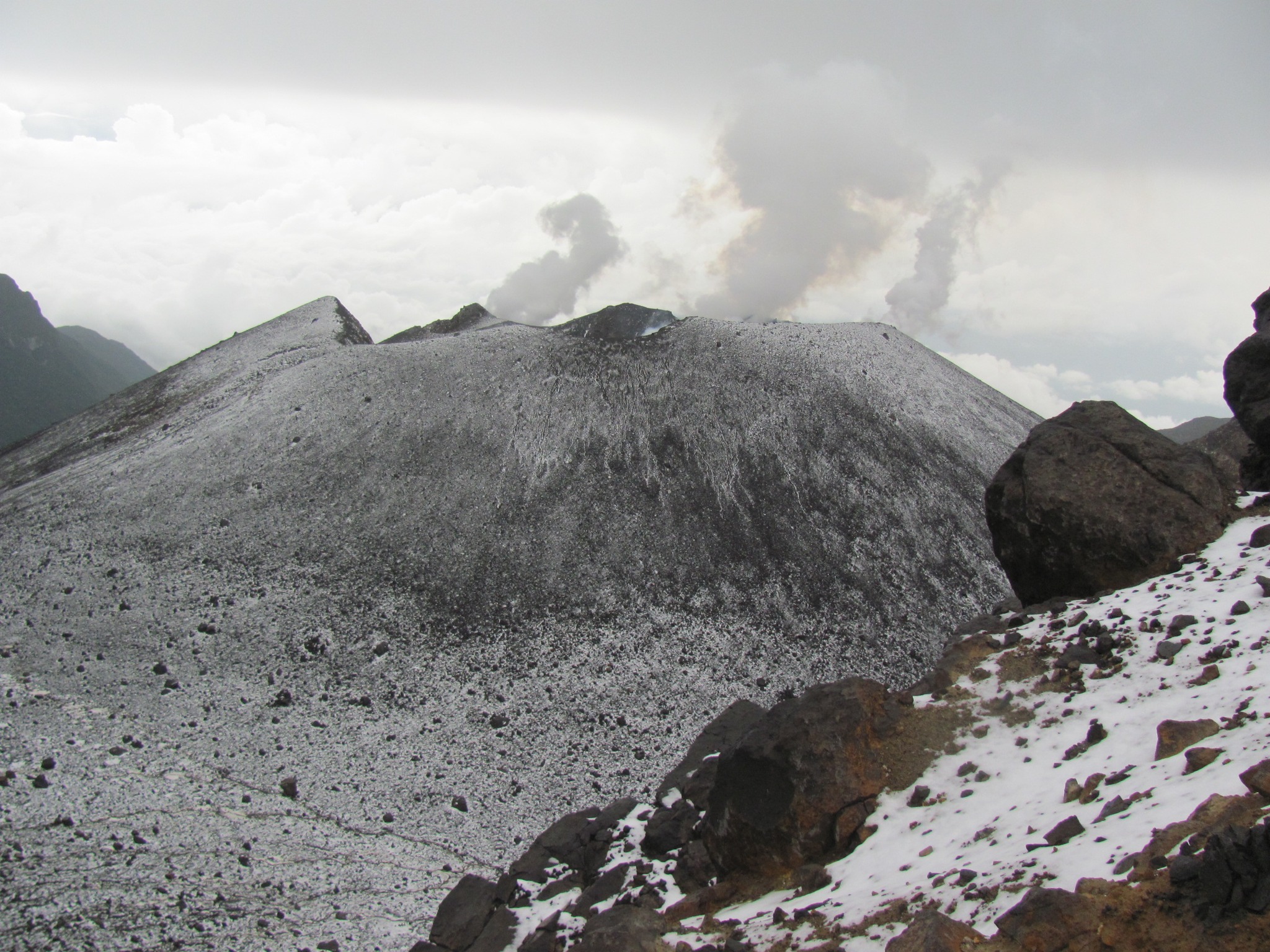
Italy / Sicily , Etna :
Press release on the activity of Etna, July 13, 2024, 12:25 p.m. (10:25 a.m. UTC).
The National Institute of Geophysics and Volcanology, Osservatorio Etneo, communicates that from the analysis of images from the surveillance camera network, it is possible to observe that the activity of the summit craters is only degassing at the level of the Crater South-East and Voragine.
Since around 06:00 UTC yesterday July 12, the average amplitude of the volcanic tremor has shown significant and rapid oscillations in the range of average values, where it is still maintained. The center of gravity of the sources of the volcanic tremor is located in the Southeast crater area, at an altitude between 2,400 and 2,800 m above sea level.
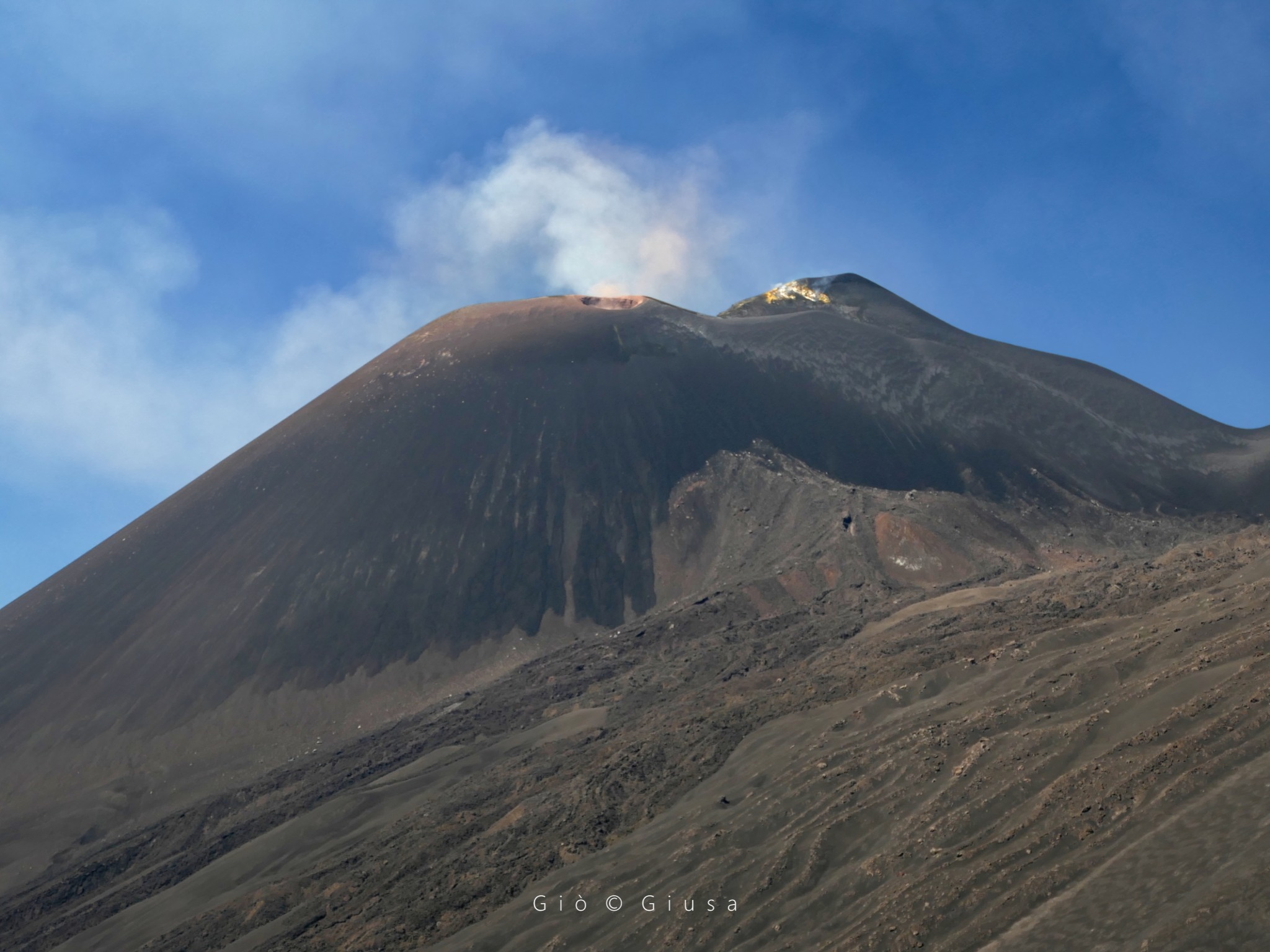
Infrasound activity has been increasing moderately since yesterday afternoon; the sources of the events are located both in the Southeast crater and in Voragine. Regarding deformations, so far the signals from permanent inclinometer networks and GNSS do not detect significant variations. Since the 7th day of this month, after the last paroxysmal event, the DRUV station borehole dilatometer continues to show a slow gradual compression.
Further updates will be communicated shortly.
Source : INGV.
Photo : Gio Giusa .
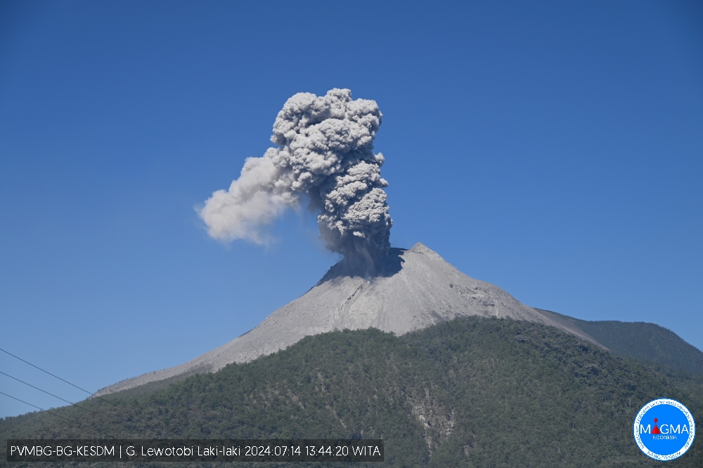
Indonesia , Lewotobi Laki-laki :
An eruption of Mount Lewotobi Laki-laki occurred on Sunday July 14, 2024 at 1:42 p.m. WITA with the height of the ash column observed at ±700 m above the summit (±2284 m above sea level ). The ash column was observed to be gray with thick intensity, oriented towards the North and Northwest. This eruption was recorded on a seismograph with a maximum amplitude of 35.5 mm and a duration of 283 seconds.
VOLCANO OBSERVATORY NOTICE FOR AVIATION – VONA
Issued : 20240714/0542Z
Volcano : Lewotobi Laki-laki (264180)
Current Aviation Colour Code : ORANGE
Previous Aviation Colour Code : orange
Source : Lewotobi Laki-laki Volcano Observatory
Notice Number : 2024LWK224
Volcano Location : S 08 deg 32 min 20 sec E 122 deg 46 min 06 sec
Area : East Nusa Tenggara, Indonesia
Summit Elevation : 5069 FT (1584 M)
Volcanic Activity Summary :
Eruption with volcanic ash cloud at 05h42 UTC (13h42 local).
Volcanic Cloud Height :
Best estimate of ash-cloud top is around 7309 FT (2284 M) above sea level or 2240 FT (700 M) above summit. May be higher than what can be observed clearly. Source of height data: ground observer.
Other Volcanic Cloud Information :
Ash cloud moving from north to northwest. Volcanic ash is observed to be gray. The intensity of volcanic ash is observed to be thick.
Remarks :
Eruption recorded on seismogram with maximum amplitude 35.5 mm and maximum duration 283 second.
Source et photo : Magma Indonésie.
Colombia , Galeras :
San Juan de Pasto, July 9, 2024, 3:20 p.m. Weekly activity bulletin: Galeras Volcano.
Concerning the monitoring of the activity of the GALERAS VOLCANO, the COLOMBIAN GEOLOGICAL SERVICE (SGC), an entity attached to the MINISTRY OF MINES AND ENERGY, reports that:
During the period from July 2 to 8, 2024 and compared to the previous week, an almost 51% decrease in seismic occurrence was recorded, maintaining energy levels in the same order of magnitude. The predominance of seismicity associated with rock fracture within the volcanic system was maintained, which was combined with the recording of fluid dynamic events within the volcanic system.
Some of the fracture earthquakes were located near the active cone, at distances less than 1 km from the crater and at depths less than 2 km from its summit (4,200 m above sea level); other events were located scattered in different directions of the volcanic zone, at distances up to 10 km and at depths less than 9.5 km; the maximum magnitude of recorded events was 1.3.
When the weather conditions were favorable in the afternoon, it was finally possible to observe small gas emissions coming from the fumarole fields of Las Chavas, to the West, and El Paisita, to the North of the active cone. The gas columns had a white color, low height and variable dispersion due to wind action. Other volcanic monitoring areas showed stability in their recordings.
Volcanic activity remains in a YELLOW ALERT state: active volcano with changes in the behavior of the base level of monitored parameters and other manifestations.
Source et photo : SGC
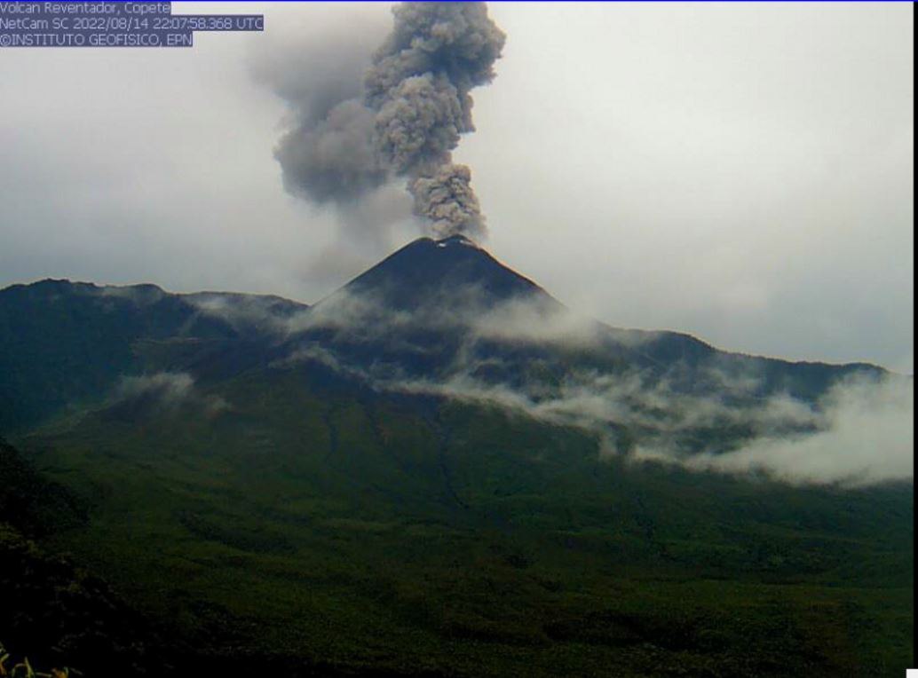
Ecuador , Reventador :
DAILY REPORT ON THE STATE OF REVENTADOR VOLCANO, Saturday July 13, 2024.
Information Geophysical Institute – EPN.
Surface activity level: High, Surface trend: No changes
Internal activity level: Moderate, Internal trend: No changes
Seismicity: From July 12, 2024, 11:00 a.m. to July 13, 2024, 11:00 a.m.:
Seismicity:
Due to data transmission problems, it was not possible to count volcanic events over the past 24 hours.
Precipitation/Lahars:
Yesterday afternoon, rain was recorded in the volcano area without generating mudslides or debris. **Heavy rains could remobilize accumulated material, generating mud and debris flows that would flow down the volcano’s flanks and flow into adjacent rivers**.
Emissions/ash column:
Due to weather conditions, it was not possible to observe gas and ash emissions using surveillance cameras or the GOES-16 satellite system. On the other hand, the VAAC agency in Washington has not published emissions reports for this volcano in the last 24 hours.
Observation:
Since yesterday afternoon at the close of this report, the volcanic sector has remained completely cloudy.
Alert Level: Orange
Source : IGEPN.
Photo : IGEPN ( archive)
Guatemala , Santiaguito :
Weather conditions: Clear weather.
Wind: East
Precipitation: 51.4 mm.
Activity:
The Santa María-Santiaguito Volcanic Complex Observatory shows volcanic activity in the Caliente Dome. During the night and some early morning hours, incandescence was observed intermittently in the dome, a product of the constant extrusion of blocky lava. This extrusion again feeds the upper part of the lava flow which extends along the southwest flank, as well as a small tongue of lava to the south, not exceeding 100 meters in length. A few weak to moderate explosions were observed which raised columns of ash to heights of up to 700 meters above the dome, producing pyroclastic flows at short distances towards the west, south-west, south and Southeast of the Caliente dome, stacking the materials in promontories on the mentioned flanks.
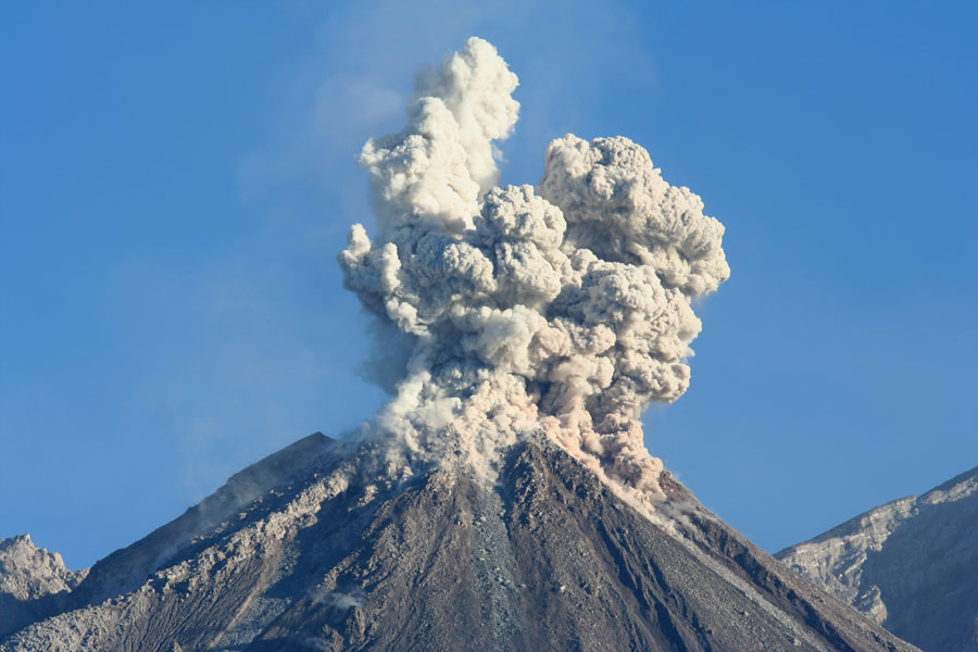
These explosions occur at a rate of 2 to 3 per hour and are accompanied by faint outgassing noises similar to those of an airplane turbine. Outgassing is constant, with weak to moderate columns of water vapor and other magmatic gases rising 250 meters above the dome. Due to wind direction, light ashfall may occur over San Marcos Palajunoj and Loma Linda. Afternoon and evening rain could cause lahars to descend into the channels that descend from the Caliente Dome. Activity remains at a high level, it is therefore possible that with explosions or under the effect of gravity, part of the accumulated materials collapse and that long-distance pyroclastic flows are generated towards the South-West , the South and the South-East.
Source : INSIVUMEH
Photo : Auteur inconnu.