May 15 , 2024.
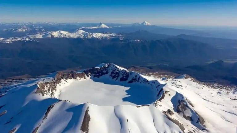
Chile , Puyehue – Cordon Caulle :
Seismology
The seismological activity of the period was characterized by the recording of:
337 seismic events of type VT, associated with the fracturing of rocks (Volcano-Tectonics). The most energetic earthquake had a Local Magnitude (ML) value equal to 3.2, located 3.9 km south-southwest of the volcanic edifice, at a depth of 4.8 km from the crater .
1 LP type seismic event, associated with fluid dynamics inside the volcanic system (Long Period). The size of the earthquake evaluated from the Reduced Displacement (RD) parameter was equal to 2 cm2.
1 TR type seismic event, associated with the dynamics maintained over time of fluids inside the volcanic system (TRemor). The size of the earthquake evaluated from the Reduced Displacement (RD) parameter was equal to 11 cm2.
3 HB type seismic events, associated with both rock fracturing and fluid dynamics within the volcanic system (Hybrid). The most energetic earthquake had a Reduced Displacement (DR) value of 24 cm2 and a Local Magnitude (ML) value equal to 1.5, located 1.5 km north-northwest of the volcanic edifice, at a depth of 4.3 km from the crater.
Fluid Geochemistry
No anomalies have been reported in emissions of sulfur dioxide (SO2) into the atmosphere in the area near the volcanic complex, according to data released by Tropopheric Monitoring Instrument (TROPOMI) and Sulfur Dioxide Instrument Group Ozone Monitoring System (IMO).
Satellite thermal anomalies
During the period, no thermal alerts were recorded in the area associated with the volcanic complex, according to the analytical processing of Sentinel 2-L2A satellite images, in combination of false color bands.
Geodesy
Geodetic observations, based on 4 GNSS stations installed on the volcanic system and on RADAR interferometry (InSAR) images, indicate that the inflationary process previously reported continues in the central sector of the Cordón Caulle graben, in particular the elements are observed following:
– Vertical displacement rate between 1 and 2 cm/month.
– Horizontal displacements with slight variations in magnitude, maintaining their trends, with maximum displacement rates of 1 cm/month.
– The distance between stations continues to increase, at rates less than 1.3 cm/month.
It should be noted that the area around the point of emission of the 2011 eruption exhibits active subsidence, a consequence of the cooling of the shallow magma body remaining from this eruption.
Surveillance cameras
The images provided by the fixed camera, installed near the volcanic complex, did not record degassing columns or variations linked to surface activity.
Satellite geomorphological analysis
From Planet Scope and Sentinel 2 L2A satellite images, no morphological changes are identified indicating new volcanic processes underway.
Volcanic activity remained at levels considered moderate. The technical volcanic alert is maintained in:
YELLOW TECHNICAL ALERT: Changes in the behavior of volcanic activity
Source : Sernageomin
Photo : Bariloche2000
Italy , Stromboli :
WEEKLY BULLETIN, from May 6, 2024 to May 12, 2024. (issue date May 14, 2024)
SUMMARY STATEMENT OF ACTIVITY
In light of the monitoring data, it appears:
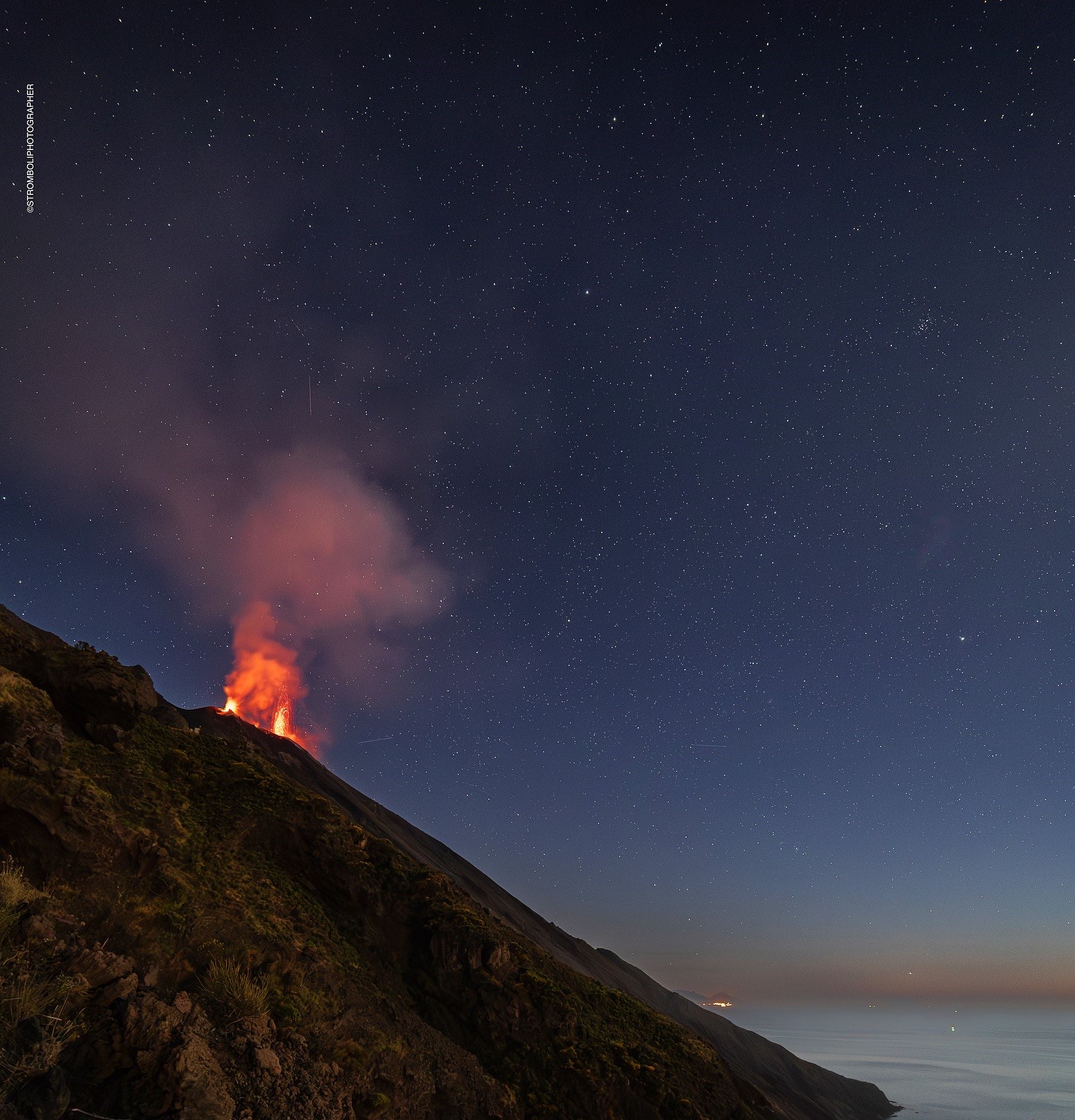
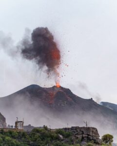
1) VOLCANOLOGICAL OBSERVATIONS: During this period, normal Strombolian activity with projection activity was observed. The total hourly frequency oscillated between high values (16 events/h) and very high values (27 events/h). The intensity of the explosions was mainly low and medium in the North and South-Central crater areas.
2) SISMOLOGY: The monitored seismological parameters do not show significant variations.
3) GROUND DEFORMATIONS: No significant ground deformation was detected
4) GEOCHEMISTRY: SO2 flux at medium level
The CO2 flux in the summit zone is at average values.
The C/S ratio in the plume is high.
The helium isotopic ratio in the thermal aquifer is at high values.
CO2 flow at Mofeta in the San Bartolo area: medium-low values.
CO2 flux in Scari: stable values at average levels.
5) SATELLITE OBSERVATIONS: Thermal activity observed by satellite was generally weak.
VOLCANOLOGICAL OBSERVATIONS
In the observed period, the eruptive activity of Stromboli was characterized through the analysis of images recorded by the INGV-OE surveillance cameras located at Pizzo (SPT), at altitude 190 m (SCT-SCV) and at Punta dei Corvi (SPCT) . The explosive activity was mainly produced by 2 (two) eruptive vents located in the northern area of the crater and by 2 (two) vents located in the south central area.
Observations of explosive activity captured by surveillance cameras
In the area of the North crater (N), with one mouth located in sector N1 and one in sector N2, explosive activity was observed which was mainly of low to medium intensity, and sometimes high (respectively up to 80 m, 150 m and more than 150 meters in height compared to the crater terrace). Furthermore, almost continuous and sometimes intense projection activity was observed in sector N1. The products emitted in eruption were mainly coarse materials (bombs and lapilli) and the average frequency of explosions varied between 11 and 21 events/h.
In the Central-South (CS) zone, sectors C and S1 did not show significant activity, while in sector S2, with two emission points, the explosions were of low and medium intensity (respectively (up to 80 and 150 meters in height relative to the crater terrace) emitting coarse materials mixed with fine materials. The average frequency of explosions varied from 5 to 9 events/h.
Source : INGV.
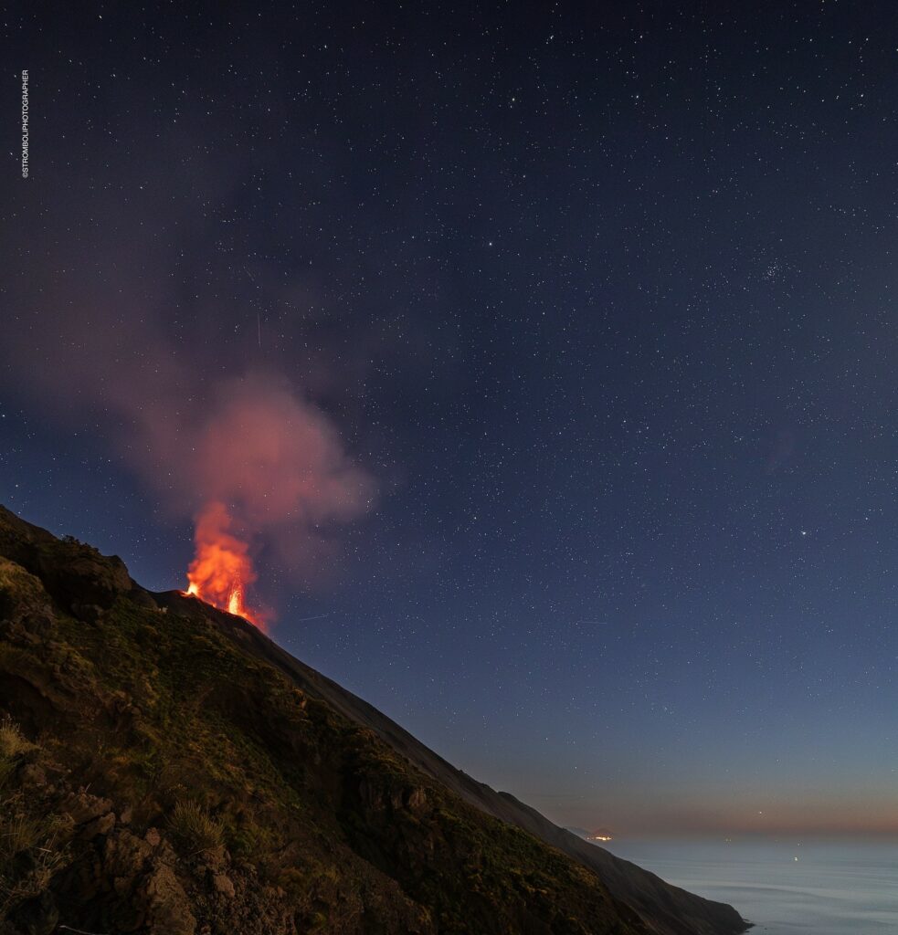
Photo : Stromboli stati d’animo , Sebastiano Cannavo.
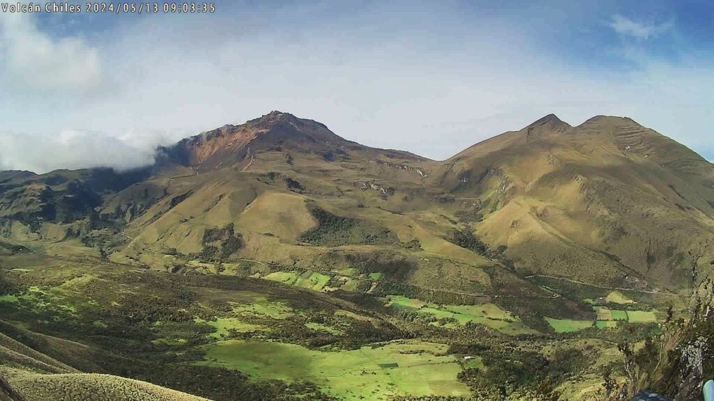
Colombia , Chiles / Cerro Negro :
San Juan de Pasto, May 14, 2024, 4:20 p.m. mr.
Weekly Activity Bulletin: Chiles Volcanic Complex and Cerro Negro (CVCCN)
Regarding the monitoring of the activity of the CHILES AND CERRO NEGRO VOLCANOES, the COLOMBIAN GEOLOGICAL SERVICE (SGC), an entity attached to the MINISTRY OF MINES AND ENERGY, reports that:
Compared to the previous week, for the period from May 7 to 13, 2024, a decrease in the number of earthquakes and an increase in seismic energy released was recorded.
Seismicity linked to rock fracture predominates, followed by earthquakes associated with the movement of fluids.
The locations of events associated with rock fracture continue to occur in 2 main sources, the first with earthquakes located towards the South-Southeast of the Chiles volcano, at distances up to 15 km from the volcano, with depths of up to 12 km from its summit (4,700 m above sea level) and a maximum magnitude of 1.5. The second source was concentrated in the collapse zone north of the summit of Chiles Volcano, at distances of 1.4 km, with depths less than 4.4 km from its summit (4,700 m above sea level). and magnitudes less than 1.5.
Volcanic deformation processes recorded by sensors installed on the ground and by remote satellite sensors continue. The evolution of activity in the CVCCN is the result of internal processes derived from the complex interaction between the magmatic system, the hydrothermal system and the geological faults of the area. Therefore, the probability of the occurrence of energetic earthquakes that can be felt by residents in the CVCCN zone of influence persists.
Volcanic activity remains in a YELLOW ALERT state: active volcano with changes in the behavior of the base level of monitored parameters and other manifestations.
Source et photo : SGC
Indonesia , Ibu :
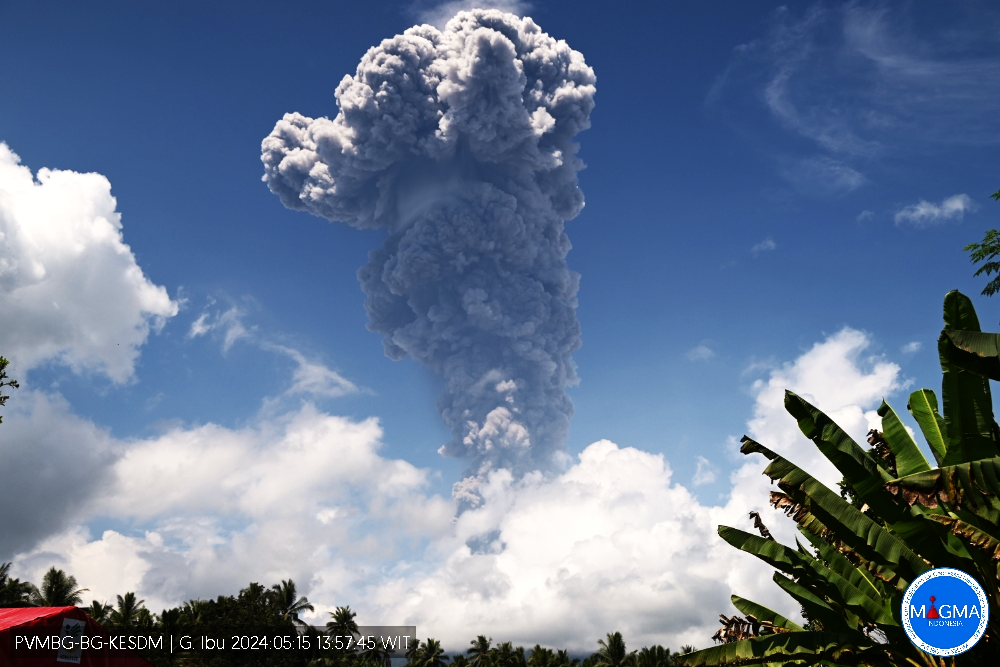
Mount Ibu exhibited an eruption on Wednesday, May 15, 2024 at 1:54 p.m. WIT with the height of the ash column observed at ±5,000 m above the summit (±6,325 m above sea level) . The ash column was observed to be gray with thick intensity, oriented towards the West. At the time of writing, the eruption was still ongoing.
VOLCANO OBSERVATORY NOTICE FOR AVIATION – VONA
Issued : May 15 , 2024
Volcano : Ibu (268030)
Current Aviation Colour Code : RED
Previous Aviation Colour Code : orange
Source : Ibu Volcano Observatory
Notice Number : 2024IBU008
Volcano Location : N 01 deg 29 min 17 sec E 127 deg 37 min 48 sec
Area : North Maluku, Indonesia
Summit Elevation : 4240 FT (1325 M)
Volcanic Activity Summary :
Eruption with volcanic ash cloud at 04h54 UTC (13h54 local).
Volcanic Cloud Height :
Best estimate of ash-cloud top is around 20240 FT (6325 M) above sea level or 16000 FT (5000 M) above summit. May be higher than what can be observed clearly. Source of height data: ground observer.
Other Volcanic Cloud Information :
Ash cloud moving to west. Volcanic ash is observed to be gray. The intensity of volcanic ash is observed to be thick.
Remarks :
Eruption and ash emission is continuing. Eruption recorded on seismogram with maximum amplitude 28 mm.
Source et photo : Magma Indonésie.
Alaska , Shishaldin :
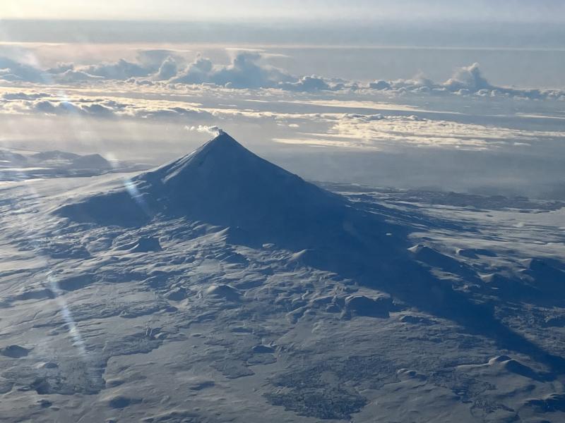
Unrest at Shishaldin Volcano continues. Elevated seismicity continues with periods of volcanic tremor and earthquake activity observed over the past day. Weak infrasound signals associated with gas bubbles bursting deep within the volcanic crater were also detected. Minor steaming from the summit crater and new minor ashy deposits extending as far as to ~2000 ft (~600 m) downwind were observed in clear satellite and webcam views. These deposits are likely related to wind remobilization of ash off of bare ground at the summit and potential small rockfalls on the steep inner walls of the summit crater. No ash clouds were detected in satellite or webcam views.
The last significant ash-producing eruption occurred in November 2023.
Local seismic and infrasound sensors, web cameras, and a geodetic network are used to monitor Shishaldin Volcano. In addition to the local monitoring network, AVO uses nearby geophysical networks, regional infrasound and lighting data, and satellite images to detect eruptions.
Source : AVO
Photo : Beesley, Nick

