March 26 , 2024.
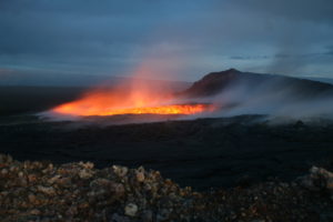
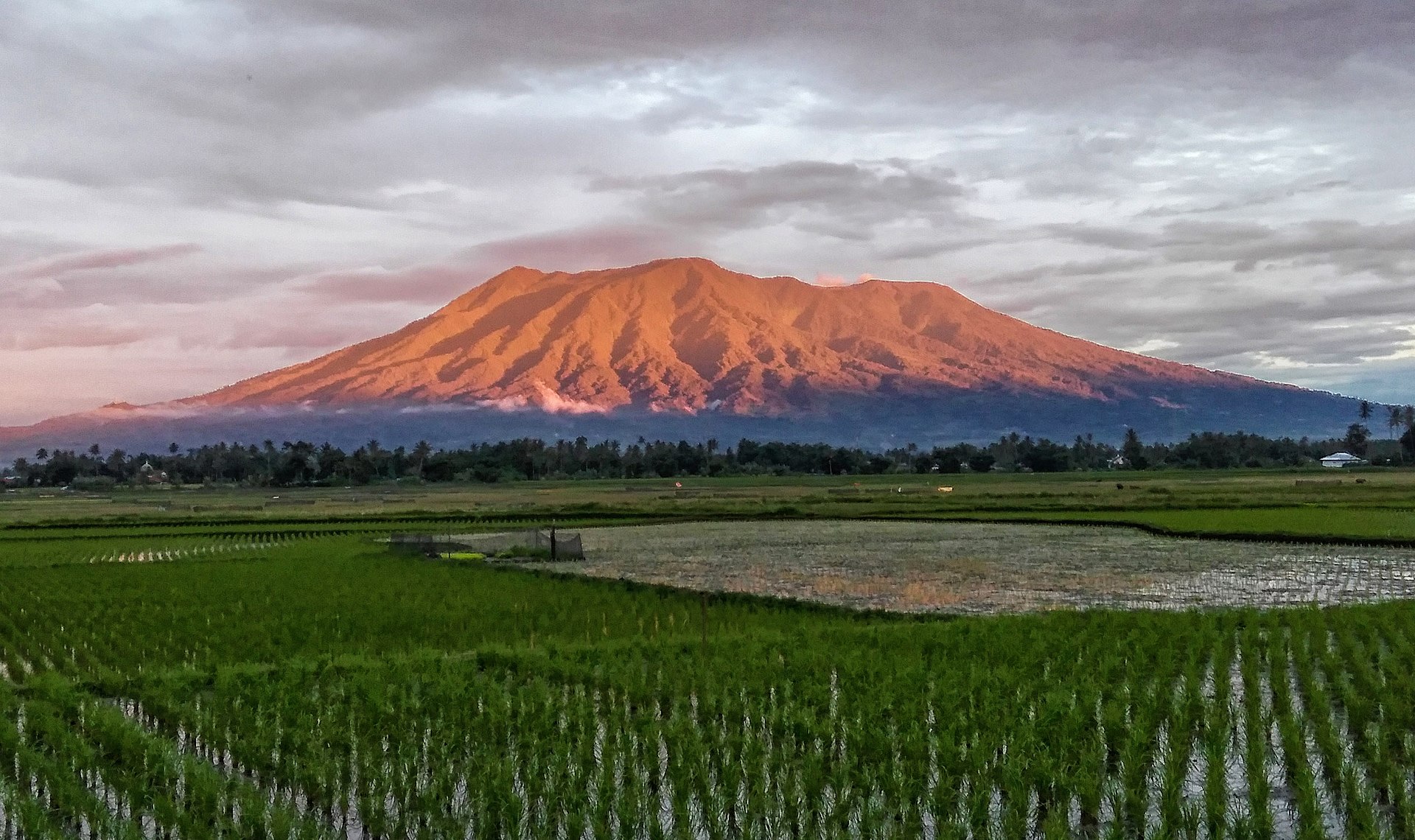
New Zealand , Ruapehu :
Uncommon style of earthquake activity at Mt Ruapehu. Volcanic activity remains low, and the Volcanic Alert Level remains at 1. Published: Tue Mar 26 2024 10:00 AM
In addition to a recent drop in lake temperature, in recent weeks Ruapehu has experienced some minor earthquake activity. Although the nature of the earthquakes is quite uncommon for Ruapehu, our analyses since our last bulletin do not raise any concerns. Other monitored parameters have not changed since last week’s bulletin, and volcanic activity remains low. The Volcanic Alert Level remains at 1 and the Aviation Colour Code at Green.
In early March 2024, we first observed an uncommon style of small earthquakes at Ruapehu. Subsequent re-examination of seismic data has revealed those earthquakes commenced at least as early as mid-February.
The earthquakes are small and were initially difficult to identify without careful examination of the data as they are uncommon at Ruapehu and only the larger examples are detected by our automatic systems. Over the last month, we have seen a maximum of six of these earthquakes a day, and on many days none at all.
Each earthquake consists of up to about 10 minutes of ground shaking, and is composed of a number of similar sub-events. While we are able to determine a location for some of the larger examples, the small size and style of the activity means our locations, especially depth, are quite uncertain. However, as they are recorded only by monitoring stations on the upper part of the volcano, we speculate that they originate near the summit area of the volcano within a few kilometres’ depth beneath the surface.
As the earthquakes do not typically last more than 10 minutes, they do not constitute volcanic tremor, and that remains low. The earthquakes are also quite different in appearance from volcanic tremor traditionally seen at Ruapehu.
While the earthquakes represent something new at Ruapehu, and we are working on understanding the details of the processes driving them, they are not thought to pose any concerns for eruptive activity. Other monitored parameters have shown no recent changes. The temperature of Te Wai ā-moe (Crater Lake) is now relatively stable at about 24 ºC, recent observations of the lake recognised nothing unusual, gas emissions from Ruapehu remain moderate, and volcanic tremor is low.
Monitoring indicators remain consistent with a low level of volcanic activity. As a result, the Volcanic Alert Level remains at 1. The Aviation Colour Code remains Green.
Mt Ruapehu is an active volcano and has the potential to erupt with little or no warning when in a state of minor volcanic unrest.
Source and photo : Geonet / Steven Sherburn / Duty Volcanologist.
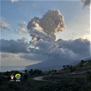
Indonesia , Marapi :
Mount Marapi erupted on Sunday March 24, 2024 at 05:38 WIB. No visual eruption was observed. This eruption was recorded on a seismograph with a maximum amplitude of 30.5 mm and a duration of 49 seconds.
Observation of seismicity:
1 emissions earthquake with an amplitude of 2.2 mm and duration of the earthquake of 19 seconds.
1 Continuous earth tremor with an amplitude of 0.5 to 1 mm, dominant value of 0.5 mm.
RECOMMENDATION
1. Communities around Mount Marapi and climbers/visitors/tourists should not enter and conduct activities within a 4.5 km radius of the eruption center (Verbeek crater) of Mount Marapi.
2. Communities living around the valleys/streams/river banks that originate at the top of Mount Marapi should always be aware of the potential threat of lahars that may occur, especially during the rainy season.
Source : Magma Indonésie.
Photo : Dody.bukittinggi
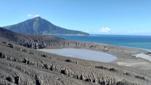
Peru , Sabancaya :
Analysis period: from March 18, 2024 to March 24, 2024, Arequipa, March 25, 2024
Alert level: ORANGE
The Geophysical Institute of Peru (IGP) reports that the eruptive activity of the Sabancaya volcano remains at moderate levels, that is, with the recording of an average of 19 daily explosions, with columns of ash and of gas up to 1700 m altitude above the summit of the volcano. Consequently, the volcanic alert level remains at the ORANGE level
The IGP recorded and analyzed the occurrence of 342 earthquakes of volcanic origin, associated with the circulation of magmatic fluids inside the Sabancaya volcano, as well as earthquakes linked to the fracturing of rocks. An average of 19 explosions were recorded daily.
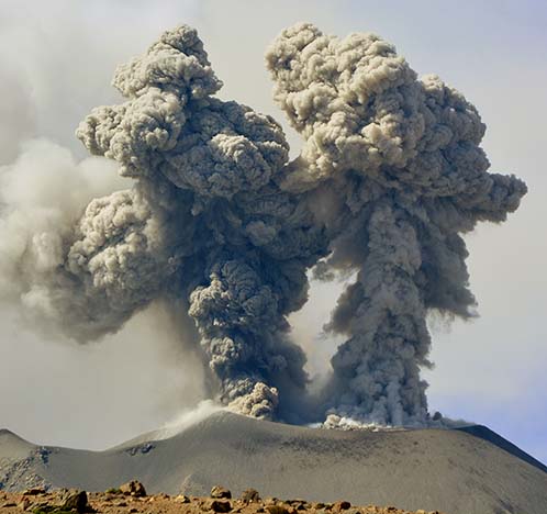
Columns of ash and gas have been observed at an altitude of up to 1700 m above the summit of the volcano. The predominant direction of these emissions was towards the South and West sectors of the volcano over a distance of less than 10 KM.
We continue to record a slight inflation process in the northern sector (around the Hualca Hualca volcano).
Satellite recordings identified the presence of 4 thermal anomalies, with a maximum value of 9 MW, associated with the presence of a lava body on the surface of the volcano crater.
Moderate emissions (866 tonnes/day) of sulfur dioxide (SO2) were observed.
RECOMMENDATIONS
• Keep the volcano alert level in orange.
• Do not approach within a radius of less than 12 km from the crater.
Source : Cenvul
Photo : IGP
Guatemala , Santiaguito :
14°44′ 33˝ North latitude;
91°34’13˝ West longitude.
Altitude: 2,500 meters
Weather conditions: cloudy weather.
Wind: southwest.
Precipitation: 0.0 mm.
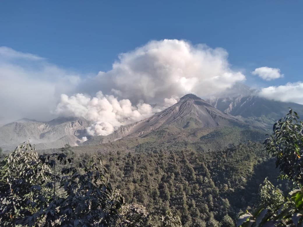
Activity:
The Observatory reports activity on the Caliente dome, with moderate and continuous degassing in the North and Northeast directions. There were 3 to 7 explosions per hour. Moderate to strong explosions raise columns of water vapor and ash to heights of up to 3,400 meters above sea level (10,498 feet) and cause pyroclastic flows to descend over short distances, mainly towards the eastern and southeastern flanks. The detachment of boulders from the dome and the edges of the lava flow continues to occasionally generate small avalanches. Heavy avalanches and noticeable sounds of volcanic activity are also recorded. During the night, periods of slight incandescence were noted around the Caliente dome. Activity remains at a high level, so there remains the possibility that with explosions or under the effect of gravity, part of the accumulated materials will collapse and long-distance pyroclastic flows will be generated towards the South-West. , the South, the South-East and the East.
Source : Insivumeh.
Photo : Noticias la Red GT San José del Golfo
Mexico , Popocatepetl :
March 25, 11:00 a.m. (March 25, 5:00 p.m. GMT)
Activity from the last 24 hours
14 exhalations were detected, accompanied by water vapor, volcanic gases and slight amounts of ash. Additionally, 554 minutes of very low to medium amplitude high-frequency tremors were identified.
The National Civil Protection Communications and Operations Center (CENACOM) reported light ash falls in the capital of Puebla, Nealtican, San Gregorio Atzompa, San Jerónimo Tecuanipan, Huejotzingo, San Lorenzo Chiautzingo, Juan C. Bonilla, San Miguel Xoxtla, Tlaltenango, San Pedro. Cholula, San Andrés Cholula, San Juan Cuautlancingo and Amozoc de Mota, in the state of Puebla.
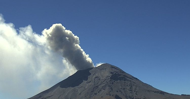
During the morning and at the time of this report, a continuous emission of water vapor and volcanic gases is observed, heading towards the North-East (NE).
The Popocatépetl volcanic warning fire is in yellow phase 2.
The scenarios planned for this phase are:
A few small to moderate explosions
Appearance of tremors of variable amplitude
Light to moderate ash rain in surrounding towns and some more distant towns
Ejection of incandescent fragments within the exclusion radius of 12 kilometers.
Source et photo : Cenapred.