March 19 , 2024.
Iceland , Reykjanes Peninsula :
Eruptive activity is relatively stable.
Eruptive activity is focused at two locations along the eruptive fissure. The risk assessment will be updated later today.
Updated 18. March at 16:50 UTC
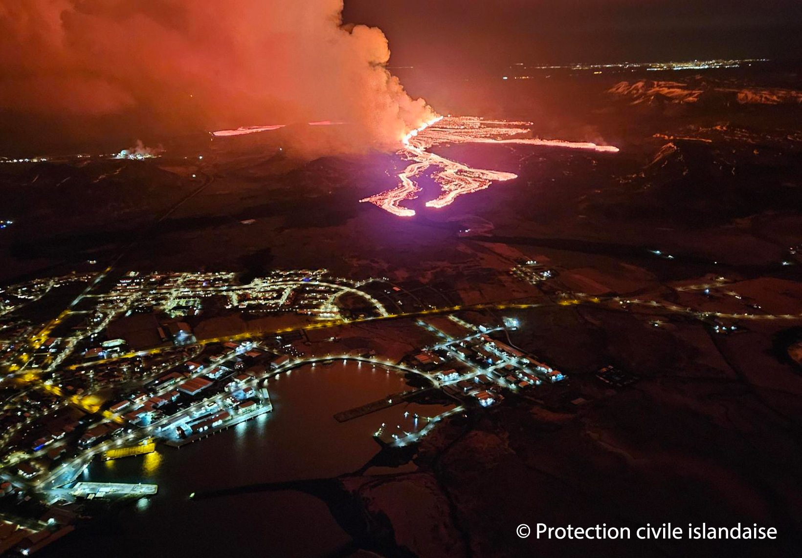
The volcanic eruption’s activity has been relatively stable since late yesterday.
There is a very slow movement of the lava flow towards the road Suðurstrandarvegur.
This morning, the lava flow was approximately 330 meters from the road. The margin has not advanced significantly since yesterday evening.
Eruptive activity has been relatively stable since yesterday afternoon. The eruption is focused at two locations along the eruptive fissure, but the northernmost craters that were active yesterday are not active now. The most active areas are near the southern end of eruptive fissure that opened on Saturday evening, with lava flowing from these locations southward towards the road Suðurstrandarvegur. This morning, the lava flow was approximately 330 meters from the road, with minor movement of the margin since yesterday evening. Observations of the area yesterday evening indicate that there is not significant activity or movement of the lava flow that crossed the road Grindavíkurvegur few hours after the eruption started.
The extent of the new lava is estimated to be 5.85 square kilometers, based on satellite imagery acquired at 14:56 yesterday, March 17. See the accompanying map. This area estimation, based on satellite data, contains greater uncertainty than calculations based on aerial photographs. If weather conditions allow, an aerial survey of the eruption site will be conducted later today, providing more accurate calculations of the area and volume of lava.
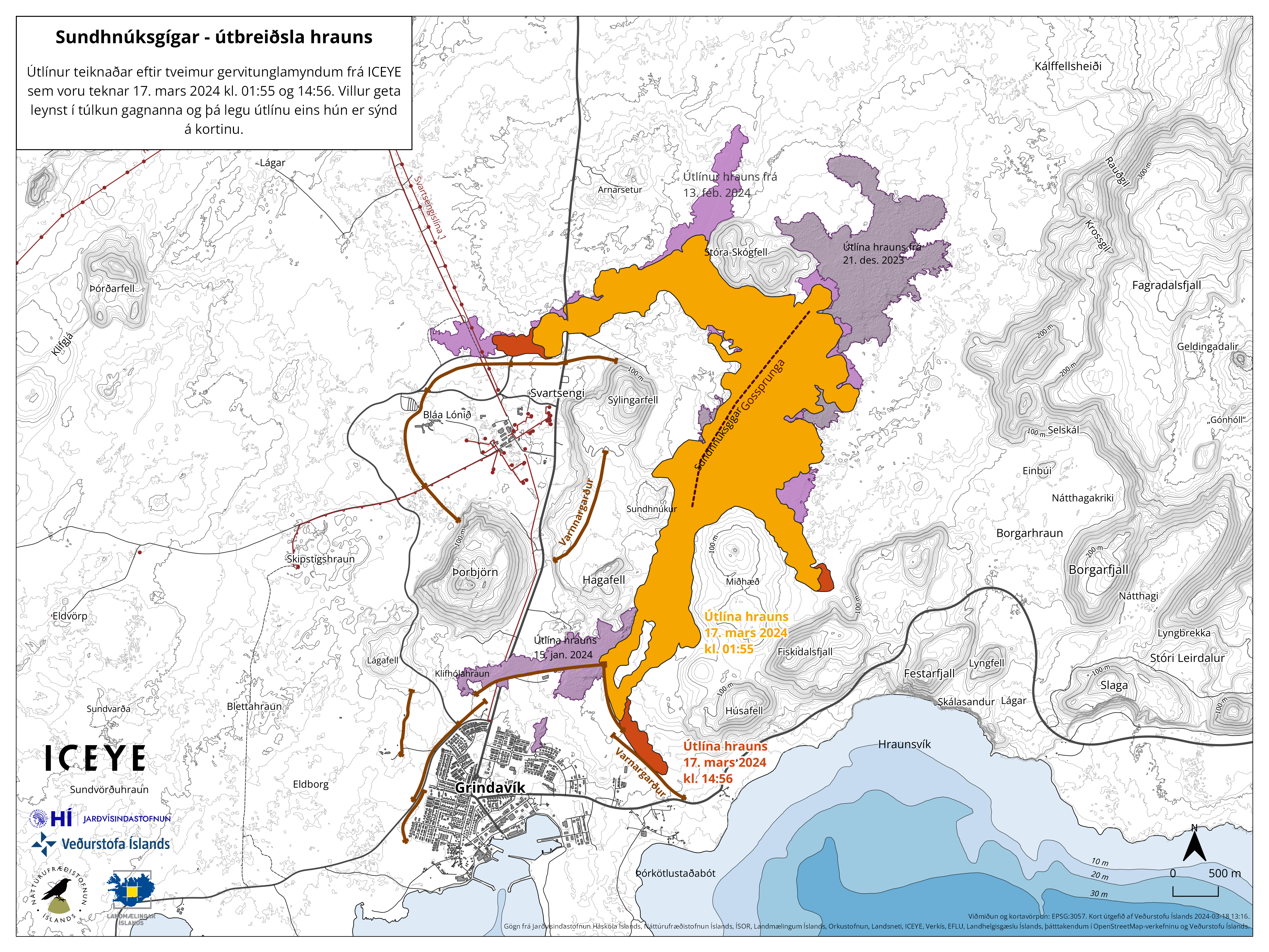
The outlines of the lava flow are drawn from satellite images from Iceye. The first image was taken on March 17 at 01:55 (orange color), which is about five and a half hours after the eruption began. The second image was taken at 14:56 on March 17, showing the outlines of the lava, as it was then, shown in red. Purple colors indicate lava flows from previous eruptions.
The weather forecast for later today brings wind from the southeast and east with a speed of 8-13 m/s at the eruption site, followed by decreasing winds from the south and southwest. Gas emissions will therefore drift northwest and west, with a shift to the north later today. Significant uncertainty exists in the strength of gas emissions. Wind from the southwest with a speed of 10-18 m/s is expected tomorrow morning, so the gas emissions will then travel to the northeast. It is unlikely that gas emissions will reach the Capital Region due to strong winds.
There is minor seismic activity near the eruption site and throughout the Reykjanes Peninsula. Only a handful of small earthquakes have been observed. The risk assessment will be updated later today.
Updated 18. March at 18:30 UTC
The Icelandic Meteorological Office has updated the hazard assessment to account for the latest data. The new hazard assessment takes effect today, Monday, March 18, and is valid until March 20, unless the situation changes. Zone 3 (the Sundhnúkur crater row), where the volcanic eruption is still ongoing, remains unchanged, with the hazard level remaining very high. The hazard level is assessed to remain high in Zone 1 (Svartsengi) due to gas emissions and lava flows. The same applies to Zone 4 (Grindavík), where the danger due to sinkholes above fissures, fault movements, lava flows, and gas emissions is considered high. Zone 5 has been downgraded to considerable risk (orange) and Zone 7 is now downgraded to some risk.
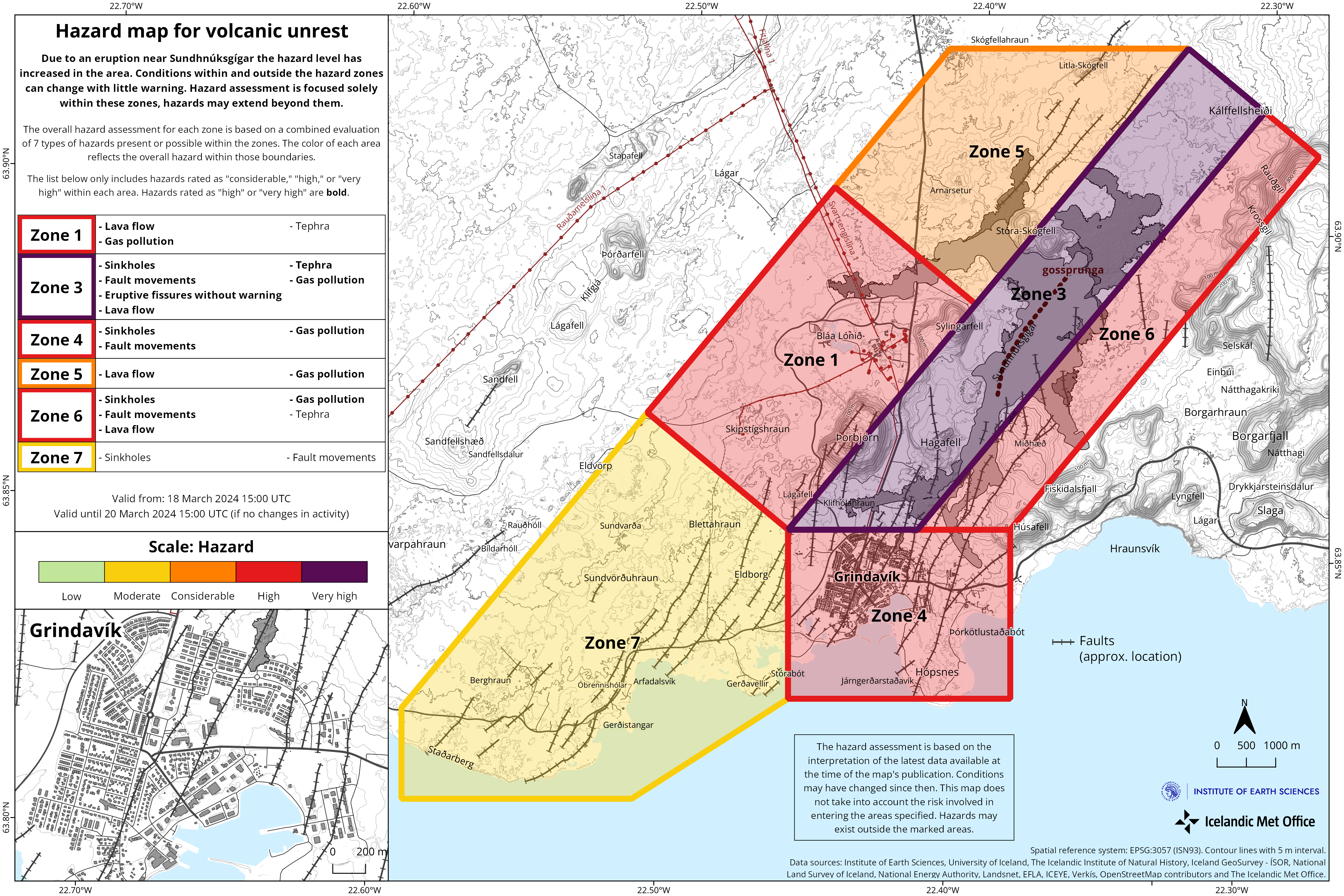
The reason for assessing the danger as greater in Zone 1 than in Zone 5 is the closer distance to the active end of the eruptive fissure. The weather forecast and gas dispersion forecast for the next few days will affect the assessment of gas pollution and ash in the hazard assessment.
Source : IMO
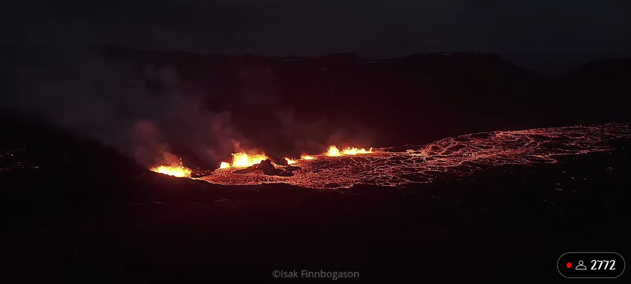
Photos : Protection civile islandaise , IMO , Isak Finnbogason
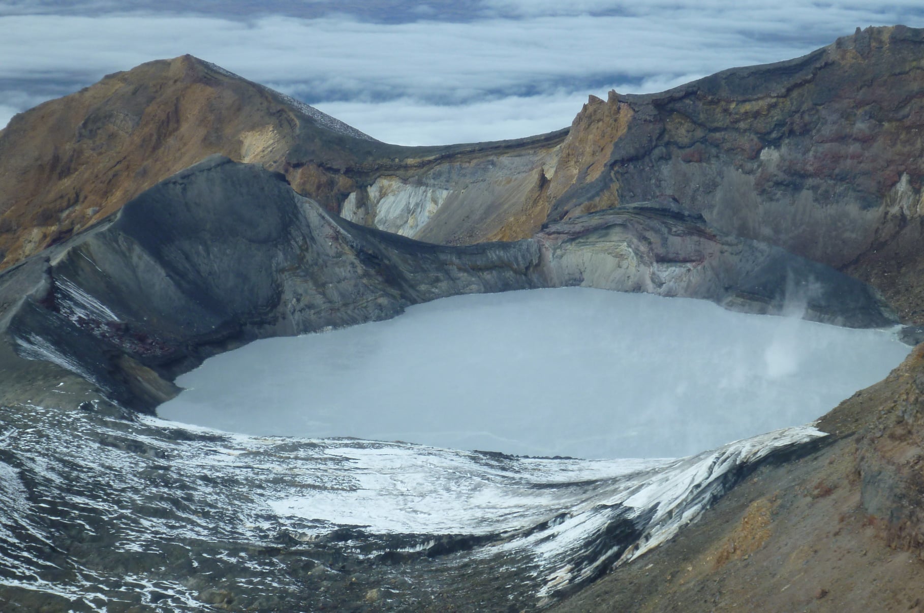
New Zealand , Ruapehu :
Te Wai ā-moe (Crater Lake) heating episode is over at Mt Ruapehu. Volcanic activity remains low, and the Volcanic Alert Level remains at 1.
Published: Tue Mar 19 2024 11:30 AM
Te Wai ā-moe (Ruapehu Crater Lake) has started to cool again, marking the end of the heating episode that started mid-October 2023. Temperature is currently 24 °C, down from its peak at 31 ºC on 14 February 2024. Other volcanic monitoring indicators remain within normal ranges and Volcanic activity remains low overall. The Volcanic Alert Level remains at 1 and the Aviation Colour Code at Green.
In mid-October 2023, the temperature of Te Wai ā-moe (Crater Lake) started increasing (Figure 1), peaking at 31 ºC on 14 February 2024. Temperature then began to decrease, marking the end of the heating episode. The lake temperature is now 24 ºC and the calculated heat flow into the lake is currently around 100 MW, typical of periods when the lake is cooling. Earlier in the heating episode the calculated heat flow ranged from 200 to 300 MW.
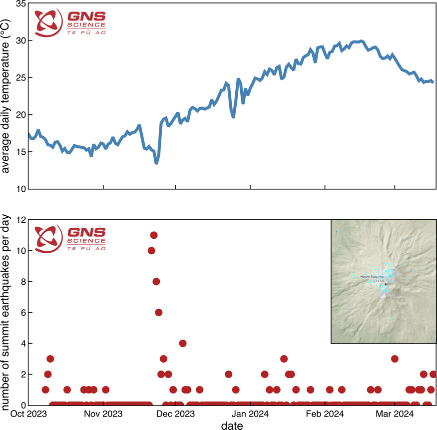
Figure 1: Plot of Te Wai ā-moe (Crater Lake) temperature (top) and number of earthquakes under the summit per day over time, from October 2023 to March 2024 (bottom – see inset for map of earthquake locations).
During the heating episode, our seismic monitoring equipment at Mt Ruapehu recorded a typical sequence of small earthquakes at 3-8 km depth clustered under the volcano (Figure 1). Earthquake size ranged from M0.3 to M2.4. This earthquake activity has continued as the lake cools. Volcanic tremor, a key indicator of volcanic fluid movement, remains low and other monitoring indicators are within normal ranges.
Our scanDOAS gas scanning equipment measured moderate levels of SO2 (sulphur dioxide) gas output from the lake as it warmed, and a slight decline is now apparent as it cools.
The recent earthquakes at moderate depth under the volcano may be in response to a deep volcanic process, however, the other monitoring parameters like volcanic tremor, heat flow, gas flow, and lake surface behaviour are all typical of a heating-cooling episodes in the crater lake. These are driven by shallower processes in the hydrothermal system, typical of the past processes seen in the crater lake.
Overall, all monitoring indicators are consistent with a low level of volcanic activity usually seen during a waning heating episode. As a result, the Volcanic Alert Level remains at 1. The Aviation Colour Code remains Green. Mt Ruapehu is an active volcano and has the potential to erupt with little or no warning when in a state of minor volcanic unrest. The Volcanic Alert Level reflects the current level of volcanic unrest. The Volcanic Alert Level should not be used to forecast future activity.
Volcanic Alert Level 1 indicates the primary hazards are those expected during volcanic unrest: steam discharge, volcanic gas, earthquakes, landslides, and hydrothermal activity. While Volcanic Alert Level 1 is mostly associated with environmental hazards, potential for eruption hazards also exists and eruptions can still occur with little or no warning. Volcanic Alert Levels 3, 4 and 5 are reserved for eruptions with varying impact distances.
Source : Geonet / Cameron Asher / Duty Volcanologist
Photos : Geonet
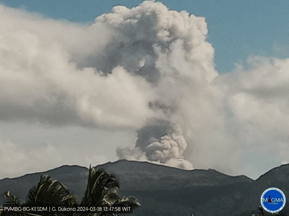
Indonesia , Dukono :
An eruption of Mount Dukono occurred on Monday March 18, 2024 at 2:51 p.m. WIT with the height of the ash column observed at ±1600 m above the summit (±2687 m above sea level). The ash column was observed to be white to gray in color with thick intensity, oriented towards the East. At the time of writing, the eruption was still ongoing.
SEISMICITY OBSERVATIONS:
9 eruption earthquakes with an amplitude of 5 to 34 mm and a seismic duration of 32.4 to 44.52 seconds.
8 deep tectonic earthquakes with an amplitude of 4-34 mm, and earthquake duration 46.71-140.37 seconds.
1 Continuous tremor with an amplitude of 1 to 4 mm, dominant value of 2 mm.
RECOMMENDATION
(1) People around Mount Dukono and visitors/tourists are advised not to do activities, climb or approach Malupang Warirang Crater within a 3 km radius.
(2) Since eruptions with volcanic ash occur periodically and the distribution of ash follows the wind direction and speed, so the ash landing area is not fixed, it is recommended for people around Mount Dukono to always have masks/nose and mouth coverings to use when necessary to avoid the threat of volcanic ash on the respiratory system.
Source et photo : Magma Indonésie.
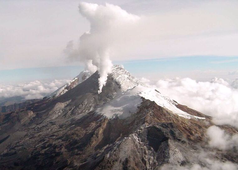
Colombia , Nevado del Huila :
Weekly bulletin on the activity of the Nevado del Huila volcano
Regarding the monitoring of the activity of the NEVADO DEL HUILA VOLCANO, the MINISTRY OF MINES AND ENERGY, through the COLOMBIAN GEOLOGICAL SERVICE (SGC), reports that:
In the week of March 5 to 11, 2024, seismic activity continued to present low levels, comparable to those recorded in previous months, both in number of events and in energy released. Images obtained from installed cameras showed low levels of degassing from the volcanic system.
Other parameters measured for the assessment of volcanic activity did not show significant changes.
During the period considered, the volcano continued to exhibit stable behavior.
The alert status for volcanic activity remains at: YELLOW ALERT: ACTIVE VOLCANO WITH CHANGES IN THE BEHAVIOR OF THE BASE LEVEL OF MONITORED PARAMETERS AND OTHER MANIFESTATIONS.
The COLOMBIAN GEOLOGICAL SERVICE will continue to monitor the evolution of the volcanic phenomenon and will inform in a timely manner of any changes that may occur.
Source et photo : SGC
Italy , Campi Flegrei :
Weekly bulletin, from March 4, 2024 to March 10, 2024. (Issue date March 12, 2024)
SUMMARY STATEMENT OF ACTIVITY
In light of the monitoring data, it appears:
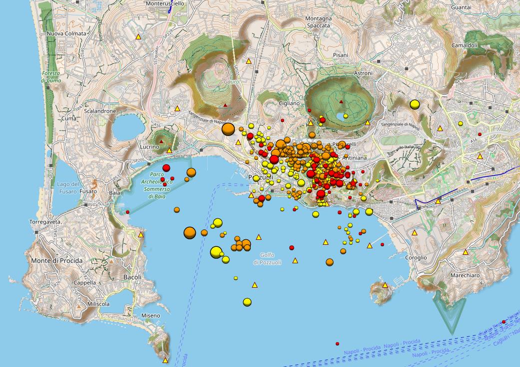
1) SISMOLOGY: In the week of March 4 to 10, 2024, in the Campi Flegrei area, 109 earthquakes of magnitude Md≥0.0 (Mdmax=2.6±0.3) were located.
2) DEFORMATIONS: Since the beginning of 2024, the average value of the lifting speed in the maximum deformation zone is approximately 10±3 mm/month at the Rione Terra GNSS station (RITE)
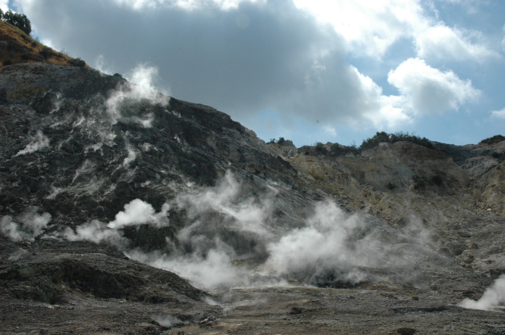
3) GEOCHEMISTRY: There are no significant variations in the geochemical parameters monitored in the reference period compared to the already known trends of increased flow rates and heating of the hydrothermal system. The temperature sensor installed in a fumarole emission 5 meters from the main Pisciarelli fumarole showed an average value of ~94°C, the condensation temperature of the fumarole fluid. The presence of the liquid remains in the Pisciarelli basin.
SEISMOLOGY
From March 4 to 10, 2024, 109 earthquakes of magnitude Md≥0.0 (Mdmax=2.6±0.3) were located in the Campi Flegrei area.
70 earthquakes occurred during 2 seismic swarms:
● the first, from 22:07 UTC on March 7, 2024, composed of 61 earthquakes of 0.0≤Md≤2.3 (±0.3), occurring in the area of Pozzuoli, Accademia, Solfatara;
● the second, from 15:06 UTC on March 10, 2024, composed of 9 earthquakes with 0.0≤Md≤2.6 (±0.3), occurring in the region of Pozzuoli, Accademia.
GEOCHEMISTRY
During the reference period, the monitored data from the geochemical network did not show significant variations in the acquired parameters, although confirming the heating and pressurization trends of the hydrothermal system and the increase in the flow of emitted fluids.
In the Pisciarelli area (outer north-eastern slope of Solfatare), which has shown in recent years the greatest variations in the degassing process, the values of the soil CO2 flux recorded continuously by the FLXOV8 station highlight the continuation of multi-year trends already identified. During the last week, CO2 fluxes measured from the ground did not show significant variations compared to previous periods.
Over the past week, there have been no significant changes in temperature, the average value of which was ~94°C, the condensation temperature of the fumarole fluid.
Source : INGV.
Photos : INGV , Stanley-goodspeed