February07 , 2024.
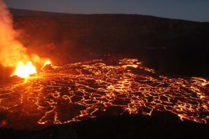
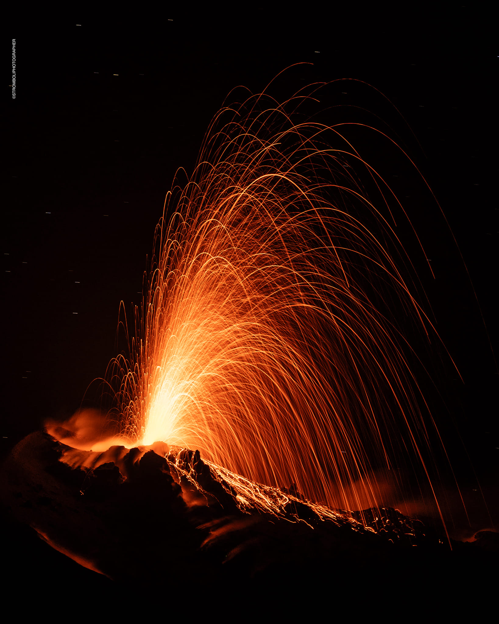
Italy , Stromboli :
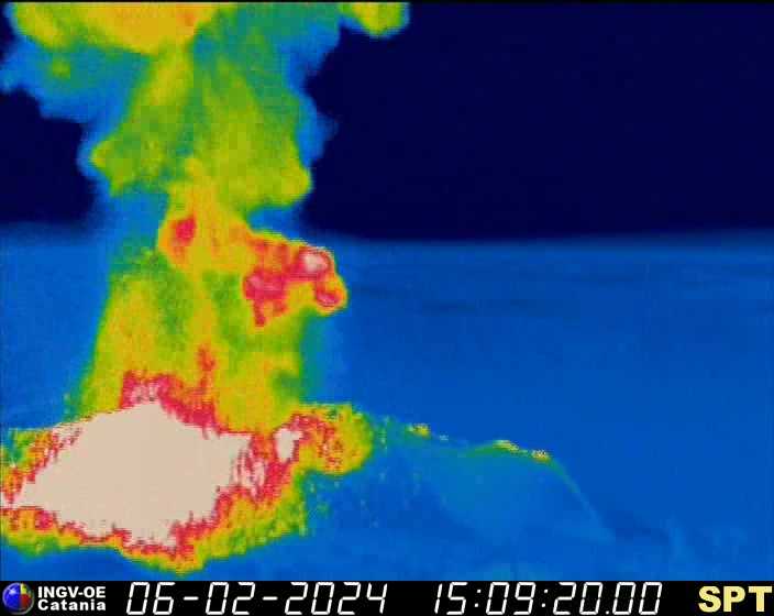
06 February 2024 16:41 (15:41 UTC) PRESS RELEASE ON THE ACTIVITY OF STROMBOLI
The National Institute of Geophysics and Volcanology, Osservatorio Etneo, communicates that at 3:09 p.m. UTC, surveillance cameras recorded an explosion of slightly higher intensity than usual from the Central-South crater area. This event is part of the ordinary activity typical of Stromboli.
From a seismic point of view, at 3:09 p.m., an event was recorded with an amplitude and waveform comparable to those observed in previous hours. No significant variation is observed in the average amplitude of the volcanic tremor and in the frequency of appearance of VLP events.
Ground deformation data from the inclinometer network showed no significant changes.
Further updates will be communicated shortly.
WEEKLY BULLETIN, from January 29, 2024 to February 4, 2024. (issue date February 6, 2024)
SUMMARY STATEMENT OF ACTIVITY
In light of the monitoring data, it appears:
1) VOLCANOLOGICAL OBSERVATIONS: Normal Strombolian activity was observed during this period. The total hourly frequency fluctuated between average values (10-13 events/h). The intensity of the explosions was low in the North crater area and variable from medium to high in the South-Central area.
2) SISMOLOGY: The monitored seismological parameters do not show significant variations.
3) GROUND DEFORMATIONS: The island’s ground deformation monitoring networks showed no significant changes to report for the period under review.
4) GEOCHEMISTRY: SO2 flux at medium level
CO2 flux in the summit zone: there are no updates.
C/S ratio in the plume: there are no updates.
Helium Isotope Ratio in Thermal Aquifer: There are no updates.
CO2 flux in Scari: stable values at average levels.
5) SATELLITE OBSERVATIONS: Thermal activity observed by satellite was generally low level with some rare and isolated thermal anomalies of moderate level.
VOLCANOLOGICAL OBSERVATIONS
In the observed period, the eruptive activity of Stromboli was characterized through the analysis of images recorded by the INGV-OE surveillance cameras located at Pizzo (SPT), at altitude 190m (SCT-SCV) and at Punta dei Corvi (SPCT). The explosive activity was mainly produced by 3 (three) eruptive vents located in the northern area of the crater and by 2 (two) vents located in the south central area.
It should be noted that the Pizzo camera, after the technical intervention, became continuously active again from February 3, while on February 4, due to cloud cover, the visibility of the crater terrace was not not sufficient for a correct description of the eruptive activity.
Observations of explosive activity captured by surveillance cameras
In the area of the North crater (N), with two vents located in sector N1 and one vent located in sector N2, explosive activity was observed mainly of low intensity (less than 80 m in height). The products emitted in the eruption were mainly coarse materials (bombs and lapilli). The average frequency of explosions fluctuated between 2 and 5 events/h.
In the South-Central zone (CS) sectors S1 and C did not show significant activity while in sector S2 the two active vents showed explosions of varying intensity, of average (less than 150 m from height) to high (greater than 150 m height) emitting fine materials mixed with coarse matter. The average frequency of explosions varied between 5 and 9 events/h.
Source : INGV.
Photos : INGV , Stromboli stati d’animo / Sebastiano Cannavo.
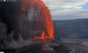
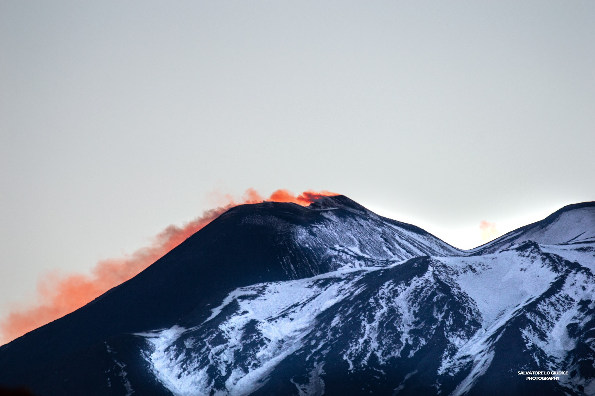
Italy / Sicily , Etna :
WEEKLY BULLETIN, from January 29, 2024 to February 4, 2024. (issue date February 6, 2024)
SUMMARY STATEMENT OF ACTIVITY
In light of the monitoring data, it appears:
1) VOLCANOLOGICAL OBSERVATIONS: Degassing activity from the Bocca Nuova crater and the South-East crater.
2) SEISMOLOGY: Low seismic activity due to fracturing. Average amplitude of the volcanic tremor at mid-level.
3) INFRASOUND: Moderate infrasound activity with sources located near the Bocca Nuova crater.
4) GROUND DEFORMATIONS: Over the past week, ground deformation monitoring networks have not recorded any significant changes.
5) GEOCHEMISTRY: SO2 flux at medium level
The soil CO2 flux presents average values.
The partial pressure of CO2 dissolved in groundwater presents values included in seasonal variability.
The helium isotopic ratio is high.
6) SATELLITE OBSERVATIONS: Thermal activity observed by satellite was generally weak.
VOLCANOLOGICAL OBSERVATIONS
During the week, monitoring of the activity of Etna was carried out using the surveillance cameras of the INGV – Osservatorio Etneo.
In general, during the observation period, the volcanic activity was characterized by continuous and variable degassing activity from the Southeast Crater (CSE) and the Bocca Nuova Crater (BN).
In particular, during the week, the Southeast Crater (CSE) continued to fuel continuous degassing from two emission points and the summit fumarole field and Bocca Nuova (BN) produced pulsed degassing. continuous from at least two vents located inside.
Occasionally, between February 1 and 2, hot gases emitted by Bocca Nuova (BN). produced faint glows visible during the night.
The Voragine crater (VOR) and the North-East crater (CNE) remain obstructed and are characterized by slight fumarolic degassing.
Source : INGV
Photo : Salvatore Lo Giudice.
Iceland , Reykjanes Peninsula :
Ongoing magma accumulation beneath the Svartsengi-Þorbjörn area continues . Still increased likelihood of a new magmatic dyke intrusion and ensuing volcanic eruption
Updated 5 February 16:00 UTC
Ongoing magma accumulation beneath the Svartsengi-Þorbjörn area continues, even though the rate of inflation has decreased slightly in recent days. Similar processes were observed before the previous dyke intrusions and eruptions north of Grindavík in January 2024 and December 2023. According to updated geodetic models based on satellite and GNSS data covering the interval from 16 January to 5 February, the volume of magma recharge to the Svartsengi reservoir is now estimated at about 9 million m3. From geodetic modelling of the January 2024 intrusion and eruption, it is estimated that approximately 9 to 13 million cubic meters of magma flowed from the Svartsengi magma reservoir, feeding the eruption that began near Hagafell on 14 January. Therefore, the estimated volume of magma recharge has now reached the lower limit of the amount believed to have been tapped in January. Consequently, there is an increased likelihood of a new magmatic dyke intrusion and ensuing volcanic eruption in the coming days to weeks.
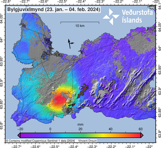
Latest satellite radar comparison, showing ground surface changes between 23 January and 4 February 2024. Red shading show the area of maximum inflation and grey shading shows area where measurements were not possible due to variations in snow cover between images.
Since last Friday, nearly 200 earthquakes have been measured in the area north of Grindavík, most of them around or below magnitude 1 at depth of 3-4 km. The largest earthquake occurred on the morning of Sunday, 4 February, near Sundhnúkur, and was a M2.2 at a depth of approximately 6 km.
The IMO continues to closely monitor the area, and the current hazard assessment map remains valid until 3:00 PM on 8 February, if there are no changes in activity.
Source et photo : IMO.
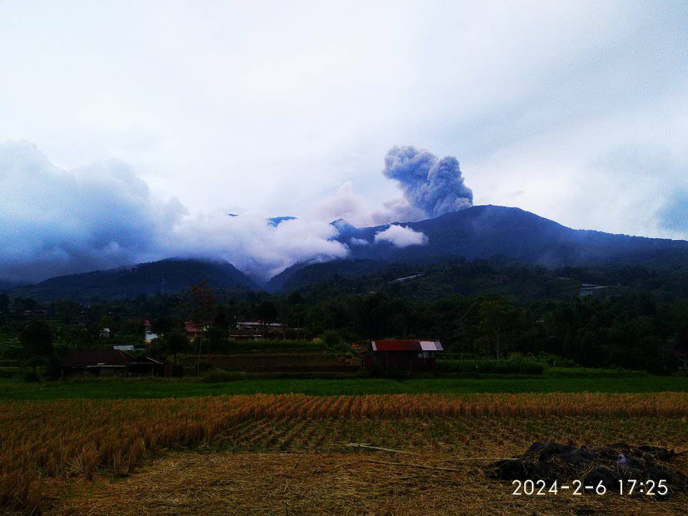
Indonesia , Marapi :
An eruption of Mount Marapi occurred on Tuesday, February 6, 2024 at 5:02 p.m. WIB with the height of the ash column observed at ± 800 m above the summit (± 3691 m above sea level). The ash column was observed to be gray to brown in color with thick intensity, oriented towards the North. This eruption was recorded on a seismograph with a maximum amplitude of 30.4 mm and a duration of 38 seconds.
SEISMICITY OBSERVATIONS:
3 emission earthquakes with an amplitude of 1.7 to 1.9 mm and duration of the earthquake of 40 to 47 seconds.
2 low-frequency earthquakes with an amplitude of 1.1 to 2 mm and an earthquake duration of 12 to 22 seconds.
1 hybrid/multiphase earthquake with an amplitude of 1.9 mm, and an earthquake duration of 18 seconds.
2 Shallow volcanic earthquakes with an amplitude of 1.9 to 3.13 mm and an earthquake duration of 10 to 22 seconds.
2 deep volcanic earthquakes with an amplitude of 2.2 to 2.3 mm, and an earthquake duration of 15 to 16 seconds.
1 Distant tectonic earthquake with an amplitude of 1.8 mm, and an earthquake duration of 62 seconds.
1 Continuous tremor with an amplitude of 0.5 to 1.5 mm, dominant value of 1 mm.
RECOMMENDATION
1. Communities around Mount Marapi and climbers/visitors/tourists should not enter and conduct activities within a 4.5 km radius of the eruption center (Verbeek crater) of Mount Marapi.
2. Communities living around the valleys/streams/river banks that originate at the summit of Mount Marapi should always be aware of the potential threat of lahars that may occur, particularly during the rainy season.
Source : Magma Indonésie.
Photo : Inyiak Hendri
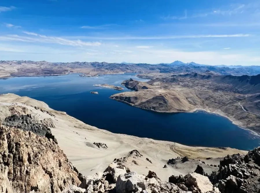
Chile , Laguna del Maule :
Seismology
The seismological activity of the period was characterized by the recording of:
1785 VT type seismic events, associated with the fracturing of rocks (Volcano-Tectonics). The most energetic earthquake had a Local Magnitude (ML) value equal to 1.8, located 3.5 km South-South-East of the center of the lagoon, at a depth of 7.2 km compared to the average height of the lagoon.
1 LP type seismic event, associated with fluid dynamics inside the volcanic system (Long Period). The size of the largest earthquake evaluated from the reduced displacement (RD) parameter was equal to 0.4 cm2.
Fluid geochemistry
No anomalies have been reported in the emissions of sulfur dioxide (SO2) into the atmosphere in the area near the volcanic complex, according to data published by the Tropospheric Monitoring Instrument (TROPOMI) and the Ozone Monitoring Instrument (OMI) Sulfur Dioxide Group .
Geodesy
Geodetic activity was characterized by:
– The available line lengths show slight changes in magnitude, while maintaining the direction of trends compared to the previous period, without highlighting significant changes in said trends. The line with the highest rate of change reaches 1.78 cm/month, a value equivalent to that measured in previous periods.
– A change in trend with a deflationary direction can be observed in the station located southeast of the lagoon during the last days of December and the first days of January, reaching a rate of variation of 1.2 cm/month.
– Thanks to InSAR, signals associated with a deformation of magnitude and pattern similar to the historical average recorded in the complex are observed, with a zone of maximum inflationary deformation near the center of the lagoon and with a zone of subsidence close to the Laguna fea sector.
In conclusion, we observe shifts in trends similar to previous periods, with slight variations in magnitude and in line with the inflationary process recorded since 2012 by the OVDAS geodetic monitoring network.
Satellite geomorphological analysis
Based on the analysis of PlanetScope Scene (3 m/px) and Sentinel 2 L2-A (10 m/px) satellite images in combination of true and false color bands, no morphological or
variations attributable to volcanic activity.
During the evaluated period, the appearance of VT and LP activity continues, remaining above its baseline threshold. However, VT earthquakes show a decrease in both the number of events and their energies, compared to the first half of January. Deformation rates continue with values similar to those historically recorded regarding inflation around the peninsula. On the other hand, in the Barrancas area, we continue to observe a subsidence process of lesser magnitude. Due to the above, a moderately active system is still evident and the technical alert is maintained in:
YELLOW TECHNICAL ALERT: Changes in the behavior of volcanic activity
Source : Sernageomin .
Photo : OAAV