February 05 , 2024 .
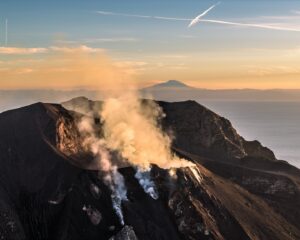
Hawaii , Kilauea :
Sunday, February 4, 2024, 9:18 AM HST (Sunday, February 4, 2024, 19:18 UTC)
19°25’16 » N 155°17’13 » W,
Summit Elevation 4091 ft (1247 m)
Current Volcano Alert Level: ADVISORY
Current Aviation Color Code: YELLOW
Activity Summary:
Kīlauea volcano is not erupting. Seismicity in the summit and along the Koa‘e fault system southwest of the summit continues to decrease over the last 24 hours. The intrusion of magma into this area appears to have slowed, and the likelihood of an eruption has decreased.
Summit Observations:
Seismicity and ground deformation beneath the summit and extending 5-7 miles (8-11 km) southwest of the caldera under the Koa‘e fault zone continues to decrease. Earthquake counts continues to decrease from 5–10 events per hour to 1–7 earthquakes; dispersed widely from the summit to the southwest. Depths remain consistent, 1–4 km (less than a mile–2.5 mi) below the surface and magnitudes range a maximum of 3+ to less than 1. In total, less than 150 earthquakes, down from ~300, have been recorded across this region over the past 24 hours, reflecting the continued decrease in seismicity.
Over the past day, tiltmeters near Sand Hill and Uēkahuna bluff have recorded very little change after the steep deflation of the past 2 days related to magma moving southwest. Sandhill is on a deflationary trend.
Global Positioning System (GPS) instruments have recorded up to 8 inches (20 cm) of horizontal motion at stations around the SWRZ and immediately to the south along the Koa‘e fault zone.
Sulfur dioxide (SO2) gas emission rates remain low. Field measurements indicated an SO2 emission rate of approximately 70 tonnes per day, on January 17, which was similar to measurements in October, November, and early December.
Patterns of earthquakes and ground deformation indicate that magma intruded beneath the south end of the caldera beginning on the morning of January 27th. This activity waxed and waned until Wednesday, January 31, when greatly increased seismicity and tilt indicated a dike was being emplaced, triggering episodic felt earthquakes and rockfalls within Halema‘uma‘u. By 5 p.m. HST on January 31st, seismicity migrated southwest of the caldera towards the Ko‘ae fault system and tiltmeters in the south caldera area began to record strong deflation. Modeling of tiltmeter, GPS, and satellite radar interferometry (INSAR) data suggest that magma within the initial dike migrated southwest into the new intrusion as it opened beneath the Ko‘ae fault zone. The overall decrease in seismicity and deformation suggests that this event is waning. However, renewed episodes of activity remain a possibility and an eruption could occur with little advanced warning.
Rift Zone Observations:
Seismicity in Kīlauea’s upper East Rift Zone and Southwest Rift Zone remained low in the past 24 hours. No unusual activity has been noted along the middle and lower sections of Kīlauea’s East Rift Zone. We continue to closely monitor both rift zones.
Source : HVO
Photo : USGS/ K. Mulliken
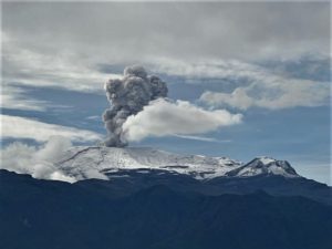
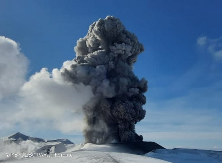
Russia / Kuril Islands , Ebeko :
VOLCANO OBSERVATORY NOTICE FOR AVIATION (VONA)
Issued: February 05 , 2024
Volcano: Ebeko (CAVW #290380)
Current aviation colour code: ORANGE
Previous aviation colour code: orange
Source: KVERT
Notice Number: 2024-07
Volcano Location: N 50 deg 41 min E 156 deg 0 min
Area: Northern Kuriles, Russia
Summit Elevation: 1156 m (3791.68 ft)
Volcanic Activity Summary:
A moderate explosive eruption of the volcano continues. According to visual data from Severo-Kurilsk, explosions sent ash up to 1.5 km a.s.l., and ash cloud drifted to the south of the volcano.
A moderate explosive eruption of the volcano continues. Ash explosions up to 6 km (19,700 ft) a.s.l. could occur at any time. Ongoing activity could affect low-flying aircraft and airport of Severo-Kurilsk.
Volcanic cloud height:
1400-1500 m (4592-4920 ft) AMSL Time and method of ash plume/cloud height determination: 20240205/0212Z – Visual data
Other volcanic cloud information:
Distance of ash plume/cloud of the volcano: 5 km (3 mi)
Direction of drift of ash plume/cloud of the volcano: S
Time and method of ash plume/cloud determination: 20240205/0212Z – Visual data
Source : Kvert
Photo : L. Kotenko. IVS FEB RAS / KVERT.
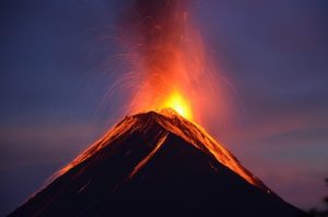
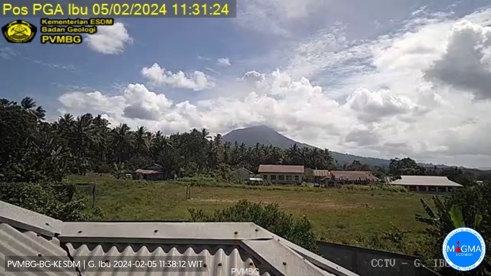
Indonesia , Ibu :
An eruption of Mount Ibu occurred on Monday, February 5, 2024 at 11:29 a.m. WIT with the height of the ash column observed at ±800 m above the summit (±2,125 m above sea level ). The ash column was observed to be gray with thick intensity, oriented towards the West. This eruption was recorded on a seismograph with a maximum amplitude of 28 mm and a duration of 68 seconds.
SEISMICITY OBSERVATIONS.
19 eruption/explosion earthquakes with an amplitude of 15 to 28 mm and a duration of 22 to 99 seconds.
1 avalanche earthquake with an amplitude of 2 mm and an earthquake duration of 31 seconds.
220 emission earthquakes with an amplitude of 2 to 14 mm and earthquake duration of 15 to 50 seconds.
2 harmonic tremors with an amplitude of 7 to 14 mm and an earthquake duration of 46 to 173 seconds.
250 shallow volcanic earthquakes with an amplitude of 2 to 14 mm and an earthquake duration of 4 to 14 seconds.
14 deep volcanic earthquakes with an amplitude of 3 to 11 mm, and an earthquake duration of 3 to 6 seconds.
7 distant tectonic earthquakes with an amplitude of 2 to 20 mm, and the duration of the earthquake was 33 to 135 seconds.
RECOMMENDATION
Communities around Mount Ibu and visitors/tourists are advised not to carry out activities within a radius of 2.0 km and a sectoral extension of 3.5 km towards the crater opening in the northern part of the crater active Mount Ibu.
In the event of ash falling, people who practice activities outside the home are advised to wear nasal, oral (mask) and eye (glasses) protection.
Source et photo : Magma Indonésie .
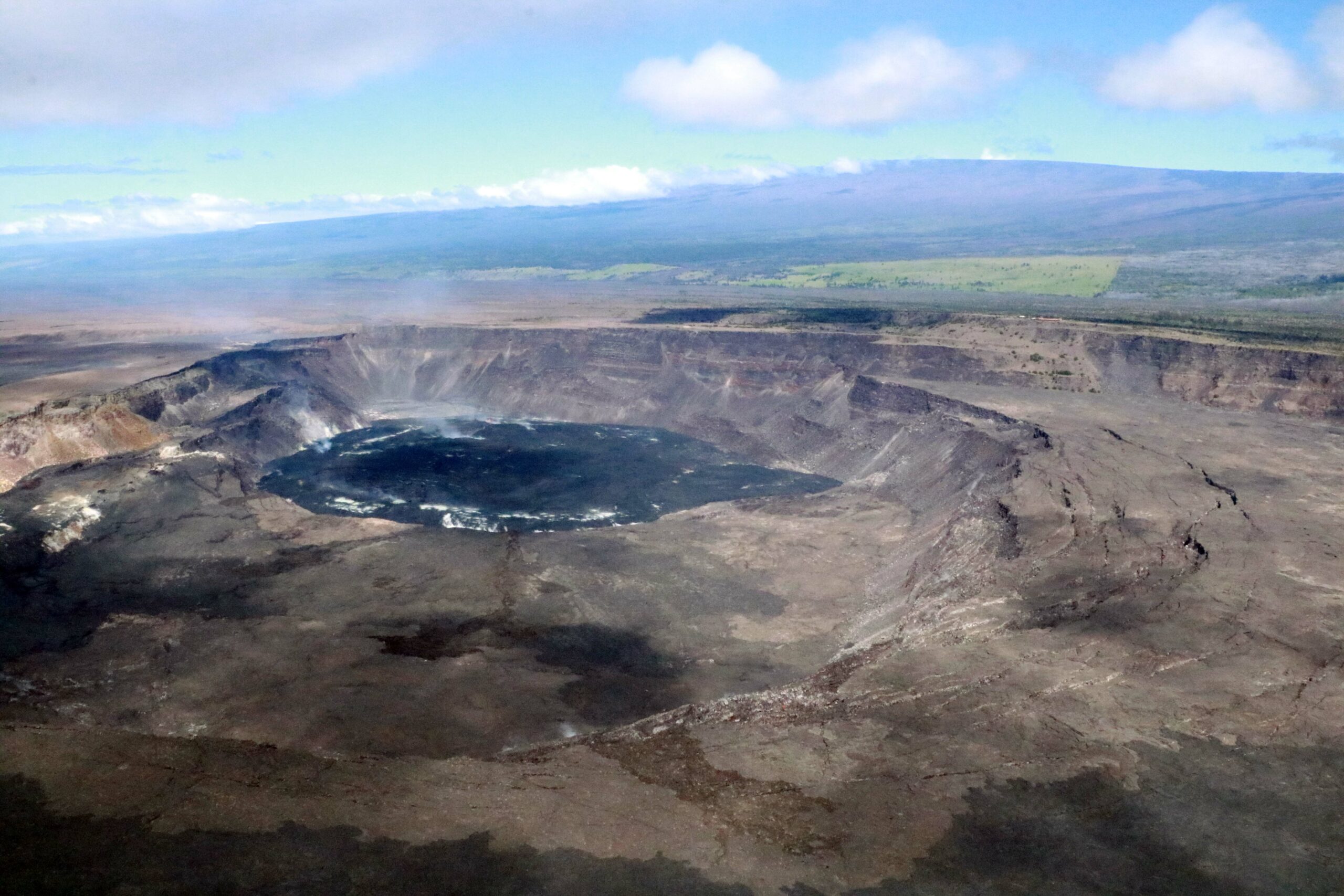
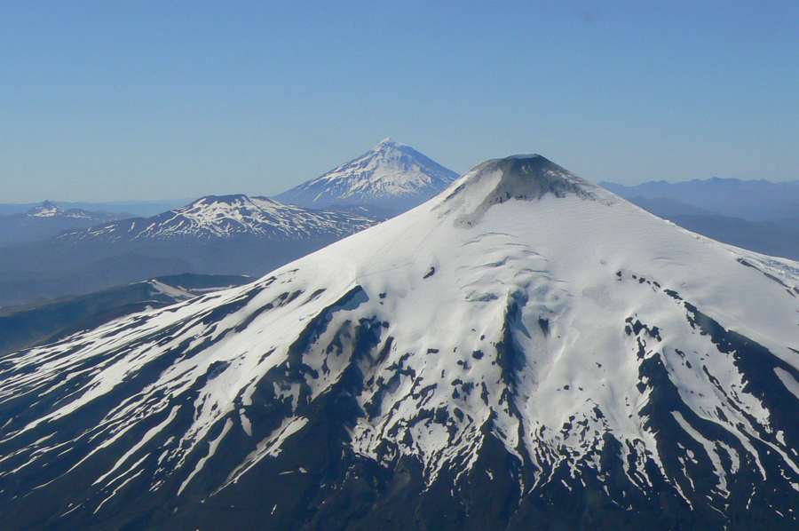
Chile , Villarica :
Special report on volcanic activity (REAV), regions of La Araucanía and Los Ríos, Villarrica volcano, February 4, 2024, 09:02 local time (mainland Chile)
The National Geology and Mining Service of Chile (Sernageomin) announces the following PRELIMINARY information, obtained through the monitoring equipment of the National Volcanic Monitoring Network (RNVV), processed and analyzed at the Southern Andean Volcano Observatory (Ovdas):
On Sunday February 4, 2024, at 8:40 a.m. local time (11:40 a.m. UTC), monitoring stations installed near the Villarrica volcano recorded an earthquake associated with fluid dynamics inside the volcanic system (long-period type).
The characteristics of this earthquake after its analysis are as follows:
ORIGINAL TIME: 08:40 local time (11:40 UTC)
REDUCED TRAVEL: 75.1 (cm*cm)
ACOUSTIC SIGNAL: 12.5 Pascals (Pa) reduced to 1 km
Observation :
After the long-term earthquake mentioned in this report, a second seismic event with similar characteristics occurred, with a lower reduced displacement value (68cm2).
no changes in the seismic behavior of the volcano have been recorded. In addition, no surface activity associated with this earthquake was observed.
The technical volcanic alert is maintained at YELLOW level.
Source : Sernageomin.
Photo : ameriquedusud.org
Mexico , Popocatepetl :
February 4, 11:00 a.m. (February 4, 5:00 p.m. GMT)
Activity from the last 24 hours
58 exhalations accompanied by water vapor, volcanic gases and ash were detected. Additionally, 676 minutes of high-frequency, low-amplitude tremors (11.26 h) were identified.
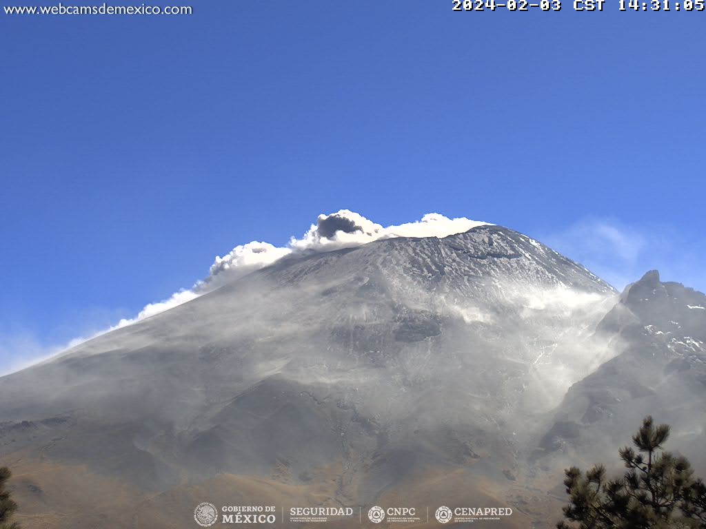
During the morning and at the time of this report, a continuous emission of volcanic gases and ash is observed, with dispersion towards the South-East (SE).
The Popocatépetl volcanic warning fire is in yellow phase 2.
The scenarios planned for this phase are:
A few smaller to moderate explosions
Appearance of tremors of variable amplitude
Source : Cenapred.