January 26 , 2024.
Kamchatka , Sheveluch :
56.64 N, 161.32 E;
Elevation 3283 m (10768 ft), the dome elevation ~2500 m (8200 ft)
Aviation Colour Code is ORANGE
An extrusive-effusive eruption of the volcano continues. A danger of ash explosions up to 6 km (19,700 ft) a.s.l. remains. Ongoing activity could affect low-flying aircraft.
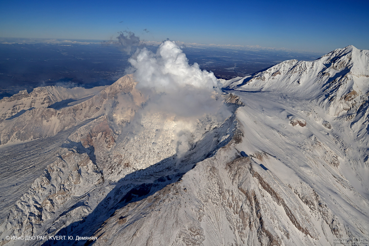
An extrusive-effusive eruption of the volcano continues: a lava is extruded in the explosive crater of the Young Sheveluch, it is accompanied by powerful gas-steam activity, and sometimes an incandescence of the lava dome. A powerful gas-steam activity is also observed at the area of the Karan dome. Satellite data by KVERT showed a thermal anomaly over the volcano on 20-25 January, the volcano was obscured by clouds during other days of the week.
Source : Kvert
Photo : Yu. Demyanchuk. IVS FEB RAS, KVERT
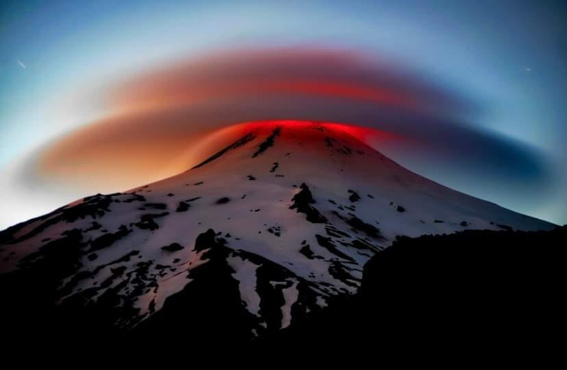
Chile , Villarica :
Seismology
The seismological activity of the period was characterized by the recording of:
A continuous tremor signal associated with the fluid dynamics inside the volcano, which during the period presented an energy variation, evaluated with the RSAM parameter, between 1.1 and 3.3 µm/s, values considered above their baseline level.
1028 seismic events of type VT, associated with the fracturing of rocks (Volcano-Tectonics). The most energetic earthquake had a Local Magnitude (ML) value equal to 3.9, located 3.3 km east-northeast of the volcanic edifice, at a depth of 3.3 km relative to to the crater.
17,402 LP-type seismic events, associated with fluid dynamics inside the volcanic system (Long Period). The size of the largest earthquake evaluated from the Reduced Displacement (RD) parameter was equal to 70 cm2.
2304 seismic events of type TR, associated with the dynamics maintained over time of fluids inside the volcanic system (TRemor). The size of the largest earthquake evaluated from the Reduced Displacement (RD) parameter was equal to 51 cm2.
Fluid geochemistry
The sulfur dioxide (SO2) emissions data obtained by the differential optical absorption spectroscopy (DOAS) equipment, corresponding to the Tralco station, installed 6 km east-southeast of the active crater, presented an average value of 886 ± 124 t/d, which is within the usual values for this volcanic system. The maximum daily value was 2,364 t/d on January 5.
Thermal anomalies by satellites
During the period, 37 thermal alerts were recorded in the area associated with the volcano, with a maximum volcanic radiative power (VRP) of 188 MW on January 8, a value considered high according to data processed by the Mid-Infrared Observation of volcanic activity. (MIROVA).
Through the analysis of Sentinel 2-L2A satellite images, radiance anomalies were detected in the area associated with the crater, reaching a maximum of 79,200 m2 on January 6, then decreasing to values close to 31,500 m2 towards the end of the fortnight.
During the period evaluated, the seismic behavior persists above its basic threshold, characterized by a large variability in the value of the average amplitude of the continuous seismic signal, with moderate to high values. For their part, discrete LP type signals have high productivity; in turn, increased energy and VT-like activity occurrence levels were recorded, some of them with an ML above 3.0, which merited the publication of special reports.
These changes in seismic behavior were associated with the appearance of explosive activity with Strombolian characteristics, which disperse incandescent materials in the near-crater area, permanent nocturnal incandescence and satellite thermal anomalies of moderate to high levels.
All of the above suggests a very active surface volcanic system with abrupt changes in behavior, linked to an unstable lava lake located at shallow levels. Therefore, the technical alert is maintained in yellow and a possible impact radius of 1 km measured from the center of the crater.
Source : Sernageomin
Photo : Marcela P Elgueda C
Colombia , Galeras :
Galeras Volcano Weekly Activity Bulletin
From the monitoring of the activity of the GALERAS VOLCANO, the MINISTRY OF MINES AND ENERGY through the COLOMBIAN GEOLOGICAL SERVICE (SGC) reports that:
Between January 16 and 22, 2024, seismicity maintained low levels, both in number and in energy released, similar to those recorded last week.
The seismicity linked to the fracturing of rocks in the volcanic edifice was located in a dispersed manner in different sectors of the Galeras volcanic complex, at distances up to 8 km from the active cone and with a maximum magnitude of 1.0. No earthquakes were reported as felt.
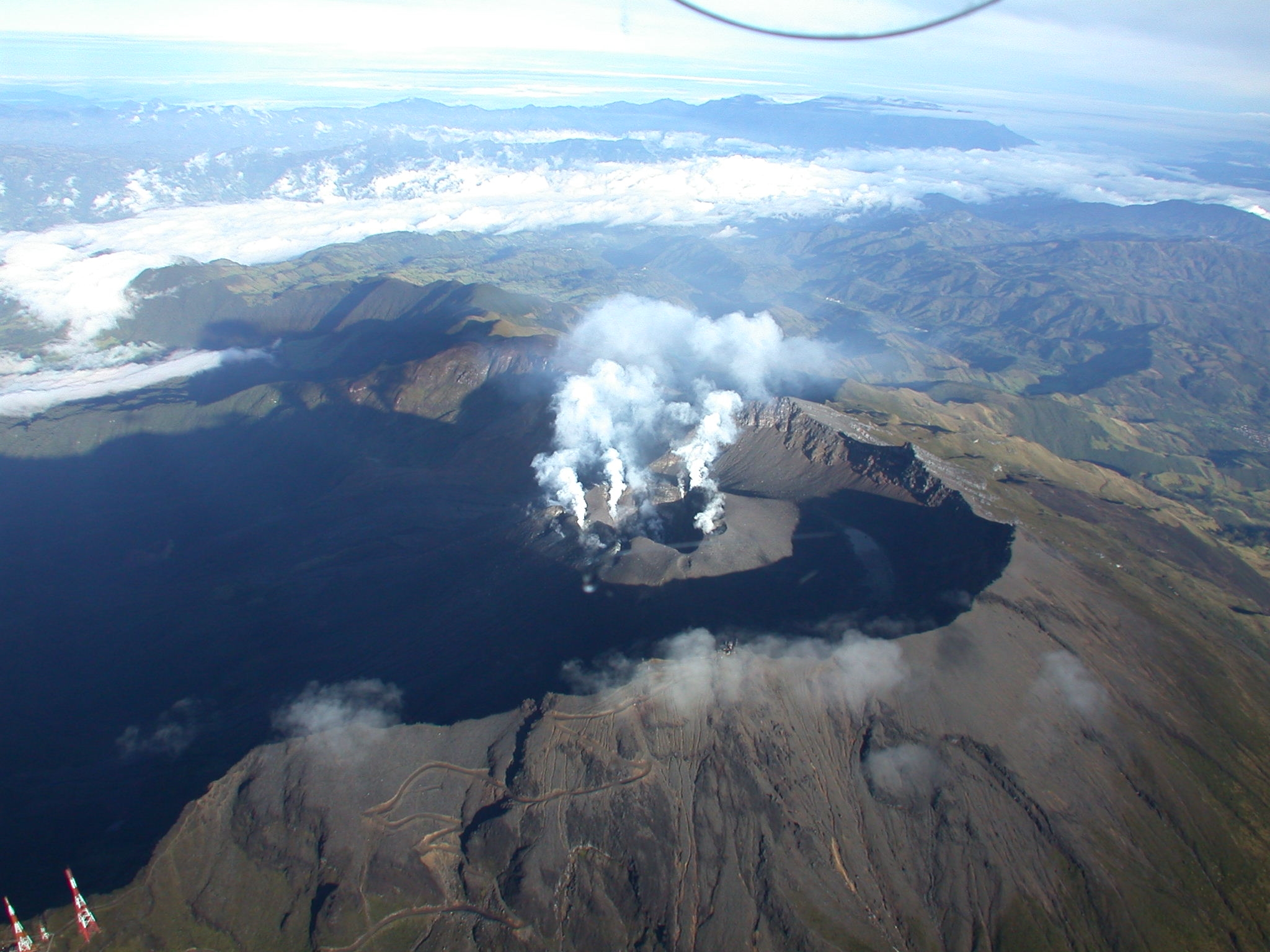
Few gas emissions were observed, which mainly come from the main crater and the fumarole fields of Las Chavas and El Paisita (located respectively to the West and North of the crater).
These emissions had white columns, low outlet pressure, and variable dispersion due to wind action.
Other volcanic monitoring areas showed stability in their recordings.
Volcanic activity remains on YELLOW ALERT Status: Active volcano with changes in baseline behavior of monitored parameters and other manifestations.
Source et photo : SGC
Hawaii , Kilauea :
Thursday, January 25, 2024, 9:01 AM HST (Thursday, January 25, 2024, 19:01 UTC)
19°25’16 » N 155°17’13 » W,
Summit Elevation 4091 ft (1247 m)
Current Volcano Alert Level: ADVISORY
Current Aviation Color Code: YELLOW
Activity Summary:
Kīlauea volcano is not erupting. Over the past day seismicity has been low and no unusual activity has been observed at the summit or the Southwest and East Rift Zones. Kīlauea summit remains pressurized; in recent months unrest has escalated quickly, and an eruption could occur in the future with little warning.
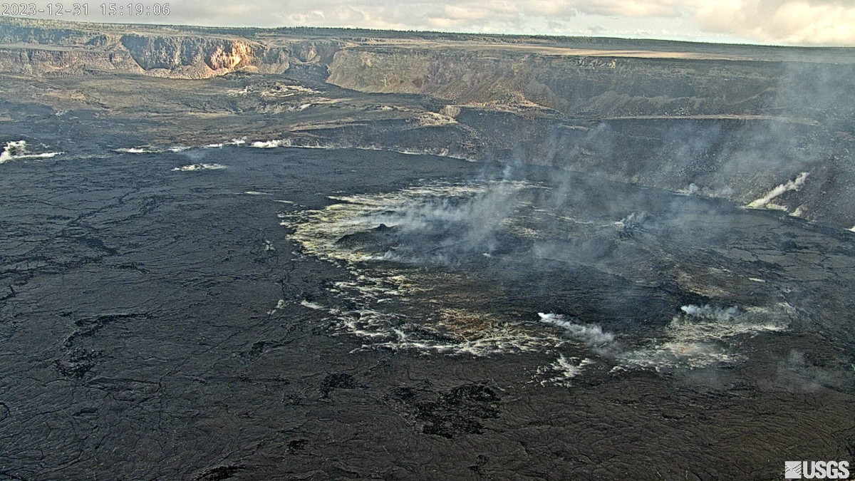
Summit Observations:
During yesterday’s partial telemetry outage, remaining instruments indicated no change in seismicity in Kīlauea’s summit region. After the return of the full network around 7pm HST, the seismicity rate continued to be low and show no change from the previous days. However, periods of increased seismicity can be expected to continue during repressurization of the summit magma reservoir, which has been ongoing since the end of the September 2023 eruption.
Kīlauea’s summit region remains at a high level of inflation. Summit tiltmeters at Uēkahuna and Sand Hill have shown little change in tilt over the past day.
Source : HVO
Photo : USGS
Guatemala , Fuego :
Weather conditions: Clear weather
Wind: North-East
Precipitation: 0.0 mm.
Activity:
The Observatory reports volcanic activity, which consists of weak, moderate, and a few strong explosions, which occur at a frequency of 4 to 7 per hour, raising columns of gas and gray ash to heights between 4,500 and 4,800 meters above sea level (14,763 to 15,748 meters). feet), which move towards the South and Southwest, carrying the ashes up to 20 kilometers or more.
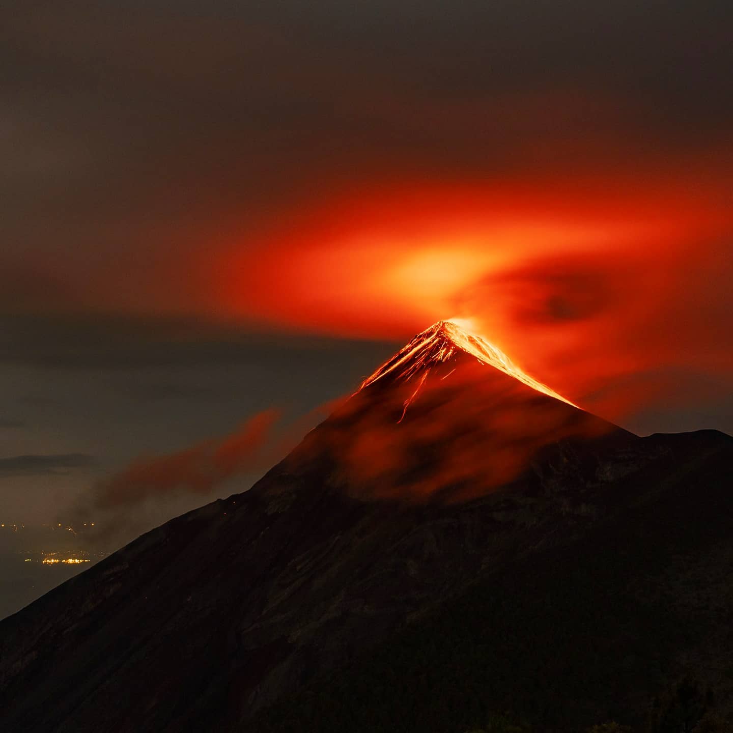
Due to the wind direction, weak falls of fine ash particles can occur on La Rochela, San Andrés Osuna, Finca Ceilan, El Porvenir and Panimache I. The explosions produce weak avalanches around the crater towards the Seca gullies , Taniluya and La Lajas. where some of the expelled material reached the vegetation. A pulse of incandescent material was also observed up to 400 meters above the crater. The activity is accompanied by low to moderate rumbling and shock waves. It must be taken into account that strong explosions expel ballistics towards the board.
Source : Insivumeh
Photo : Diego Rizzo