December 18 , 2022.
Alaska , Pavlof :
AVO/USGS Volcanic Activity Notice
Current Volcano Alert Level: ADVISORY
Previous Volcano Alert Level: WATCH
Current Aviation Color Code: YELLOW
Previous Aviation Color Code: ORANGE
Issued: Saturday, December 17, 2022, 11:33 AM AKST
Source: Alaska Volcano Observatory
Notice Number: 2022/A1462
Location: N 55 deg 25 min W 161 deg 53 min
Elevation: 8261 ft (2518 m)
Area: Alaska Peninsula
Volcanic Activity Summary:
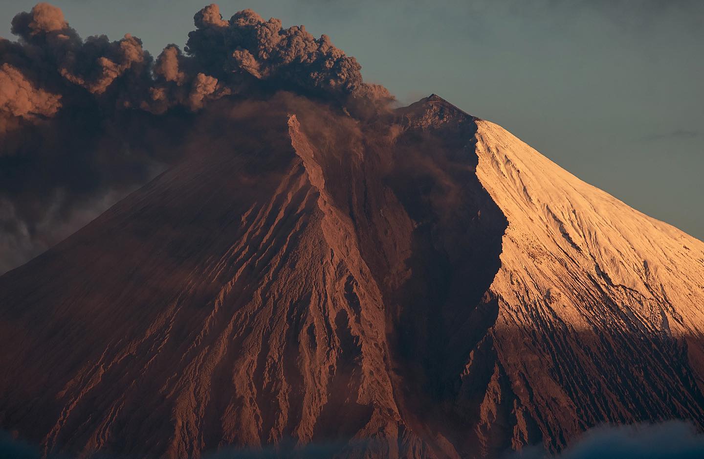
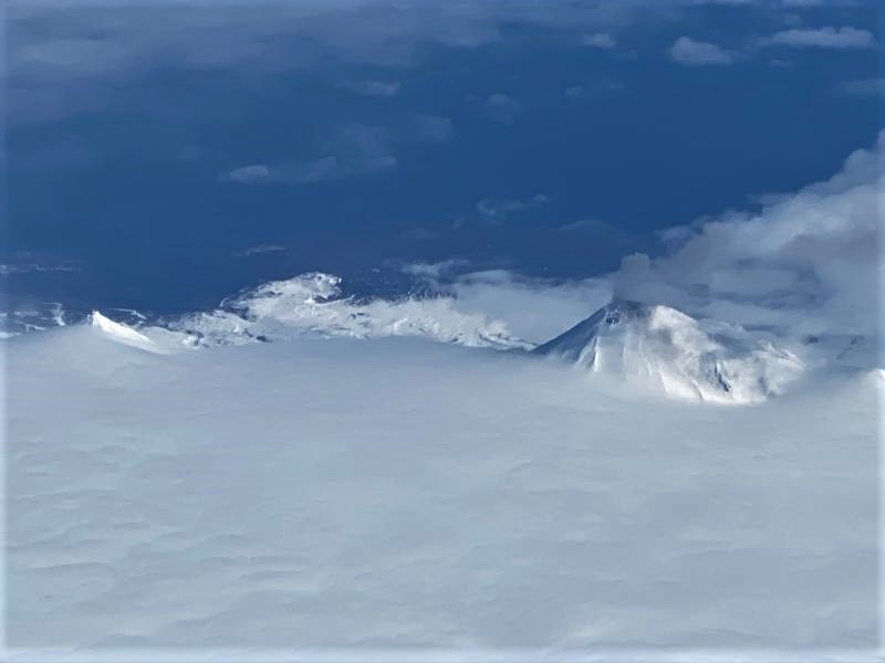
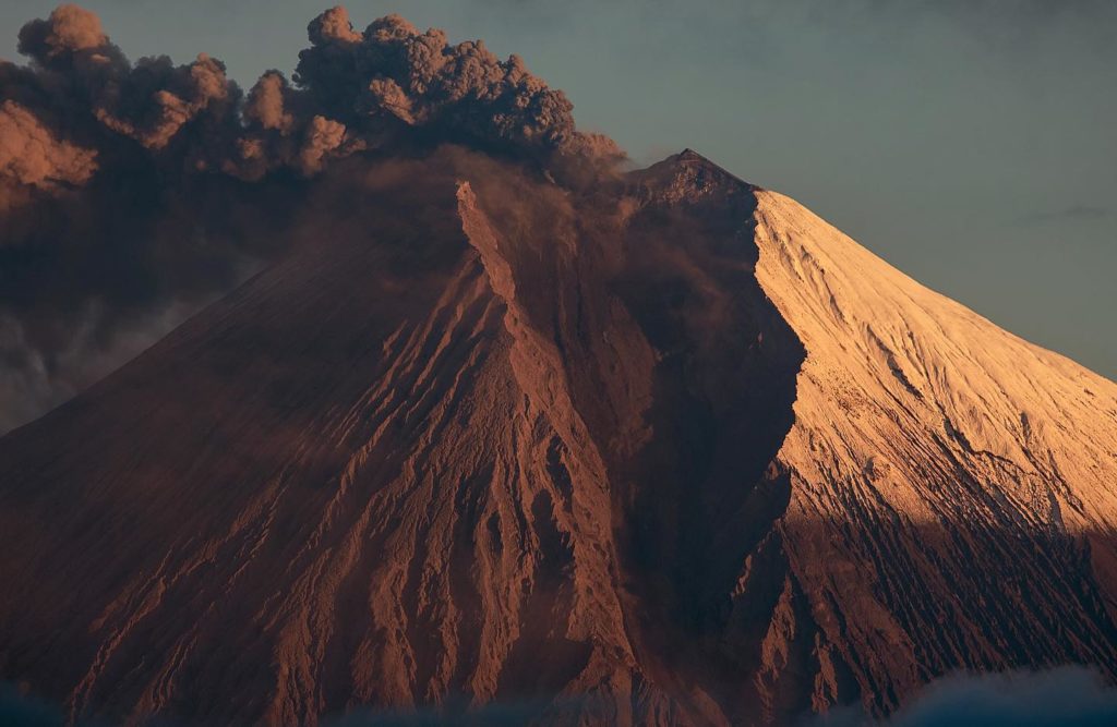
Eruptive activity at Pavlof Volcano has paused. Although seismicity remains above background levels with intermittent seismic tremor, no explosions have been detected since December 7, 2022. No elevated surface temperatures or incandescent lava have been observed in satellite and webcam images since December 2. Due to this decrease in activity, we are lowering the Aviation Color Code to YELLOW and Volcano Alert Level to ADVISORY.
Previous eruptions of Pavlof indicate that the level of unrest can change quickly and eruptive activity could resume with little or no warning. Pavlof is monitored by local seismic and infrasound sensors, satellite data, web cameras, and regional infrasound and lightning networks.
Remarks:
Pavlof Volcano is a snow- and ice-covered stratovolcano located on the southwestern end of the Alaska Peninsula about 953 km (592 mi) southwest of Anchorage. The volcano is about 7 km (4.4 mi) in diameter and has active vents on the north and east sides close to the summit. With over 40 historic eruptions, it is one of the most consistently active volcanoes in the Aleutian arc. Eruptive activity is generally characterized by sporadic Strombolian lava fountaining continuing for a several-month period. Ash plumes as high as 49,000 ft ASL have been generated by past eruptions of Pavlof, and during the March 2016 eruption, ash plumes as high as 40,000 feet above sea level were generated and the ash was tracked in satellite data as distant as eastern Canada. The nearest community, Cold Bay, is located 60 km (37 miles) to the southwest of Pavlof.
Source : AVO.
Photo : Ferguson-Gould, Tara / Alaska Volcano Observatory / University of Alaska Fairbanks, Geophysical Institute
La Martinique , Mount Pelée :
Weekly report on the activity of Mount Pelée for the period from December 09, 2022 to December 16, 2022.
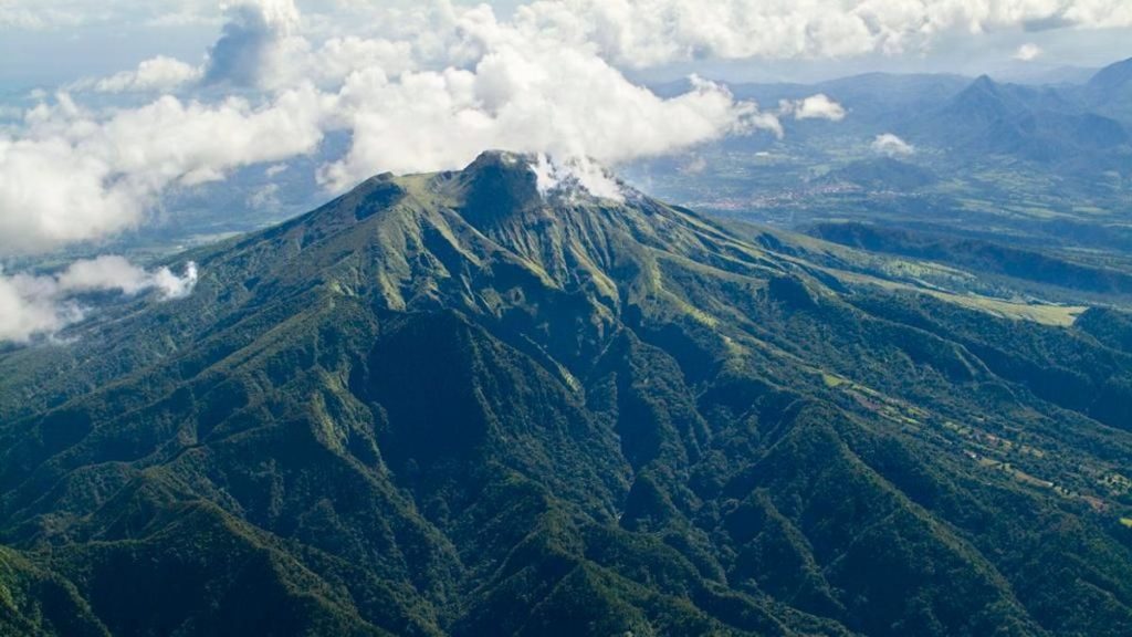
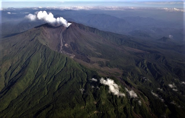
Between December 09, 2022 at 4 p.m. (UTC) and December 16, 2022 at 4 p.m. (UTC), the OVSM recorded at least 25 volcano-tectonic earthquakes of magnitude less than 1. Ten of these low-energy earthquakes could be located. They are identical to those of the well-known families on Pelee which are located inside the volcanic edifice around 0.4 km depth above sea level or about 1 km depth below the summit. This superficial volcano-tectonic seismicity is associated with the formation of micro-fractures in the volcanic edifice.
None of these earthquakes was felt by the population.
During volcanic reactivation phases of volcanoes similar to Mount Pelee, periods of higher seismic activity often alternate with phases of lower seismicity. Since the reactivation of the hydrothermal-magmatic system (end of 2018), several periods of zero or weak seismicity have been recorded by the OVSM, for example only 8 earthquakes between June 24 and August 8, 2022 (period of 2 months).
The areas of degraded vegetation located between Morne Plumé and the Chaude River were observed during a helicopter flight carried out on February 9 and May 5, with the support of Dragon 972, and confirmed by analysis of satellite and drone images. (overview of May 11) and satellite analysis (June 2022). A new area of degraded vegetation, located just north of the Chaude River, was observed from August 26th.
The alert level remains YELLOW: vigilance.
Source : OVSM/IPGP.
Photo : Parc naturel Martinique
Indonesia , Semeru :
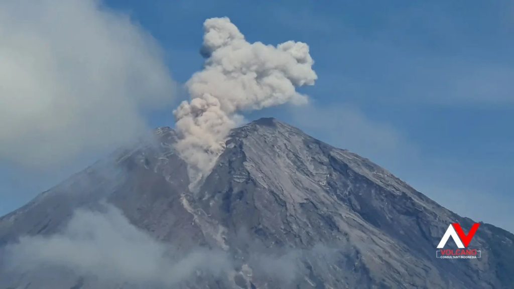
The Semeru presented an eruption on Sunday December 18, 2022 at 07:55 WIB with the height of the ash column observed at ± 700 m above the summit (± 4376 m above sea level). The ash column was observed to be white to gray with a thick, north-facing intensity. At the time of writing this report, the eruption was still ongoing.
VOLCANO OBSERVATORY NOTICE FOR AVIATION – VONA
Issued : December 18 , 2022
Volcano : Semeru (263300)
Current Aviation Colour Code : ORANGE
Previous Aviation Colour Code : orange
Source : Semeru Volcano Observatory
Notice Number : 2022SMR732
Volcano Location : S 08 deg 06 min 29 sec E 112 deg 55 min 12 sec
Area : East java, Indonesia
Summit Elevation : 11763 FT (3676 M)
Volcanic Activity Summary :
Eruption with volcanic ash cloud at 00h49 UTC (07h49 local).
Volcanic Cloud Height :
Best estimate of ash-cloud top is around 14003 FT (4376 M) above sea level or 2240 FT (700 M) above summit. May be higher than what can be observed clearly. Source of height data: ground observer.
Other Volcanic Cloud Information :
Ash cloud moving to north. Volcanic ash is observed to be white to gray. The intensity of volcanic ash is observed to be thick.
Remarks :
Eruption recorded on seismogram with maximum amplitude 20 mm and maximum duration 105 second.
Source : Magma Indonésie .
Photo : Andi volcanist .
Ecuador , Sangay / Reventador / Cotopaxi :
DAILY REPORT OF THE STATE OF SANGAY VOLCANO, Saturday December 17, 2022.
Information Geophysical Institute – EPN.
Surface Activity Level: High, Surface Trend: No change
Internal activity level: High, Internal trend: No change.
Seismicity: From December 16, 2022, 11:00 a.m. to December 17, 2022, 11:00 a.m.:
The data corresponds to 24 hours of transmission from the reference station (SAGA).
Blast (EXP) 950
Emission Tremors (TREMI ) 18
Rains / Lahars:
There was no record of precipitation in the volcano area. **In the event of heavy rains, these could remobilize the accumulated materials, generating mudslides and debris that would descend the flanks of the volcano and flow into the adjacent rivers.**
Emission / Ash Column:
In the afternoon, several ash emissions could be observed with heights of up to 1,500 meters above the level of the crater and heading west. The Washington VAAC reported 3 satellite-observed ash emission alerts, with heights up to 1,470 meters above crater level and southwest and west directions. So far, no ashfall reports have been received nationwide.
Other monitoring parameters.
The MIROVA system recorded 1 high thermal anomaly in the last 24 hours. The FIRMS system recorded 5 thermal alerts in the last 24 hours.
Observation:
At the time of publication of this report, the volcano sector is cloudy
Alert level: Orange.
——————————————————————————————————————————————–
DAILY REPORT OF THE STATE OF REVENTADOR VOLCANO, Saturday December 17, 2022.
Information Geophysical Institute – EPN.
Surface Activity Level: Moderate, Surface Trend: No change
Internal activity level: Moderate, Internal trend: No change.
Seismicity: From December 16, 2022, 11:00 a.m. to December 17, 2022, 11:00 a.m.:
The seismicity data correspond to 24 hours of emission from the reference station (REVS).
Explosion (EXP): 52
Long Periods (LP): 60
Emission Tremors (TREMI): 12.
Harmonic Trempor (TRARM): 2
Rains / Lahars:
There are no reports of rain in the area.
Emission / Ash Column:
Ash emissions were observed up to about 800 meters above crater level to the west. The VAAC agency in Washington has published 4 statements of ash emissions observed by satellite, with heights of up to 700 meters above crater level and heading west and southwest.
Other monitoring parameters.
No thermal anomaly has been recorded in the last 24 hours.
Observation:
In the early hours of the morning, the descent of incandescent blocks could be observed on all the flanks of the volcano up to about 400 meters below the level of the crater. Currently the area of the volcano is cloudy.
Alert level: Orange.
——————————————————————————————————————————————–
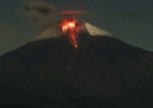
Information on the activity of the Cotopaxi volcano, SUNDAY DECEMBER 18, 2022
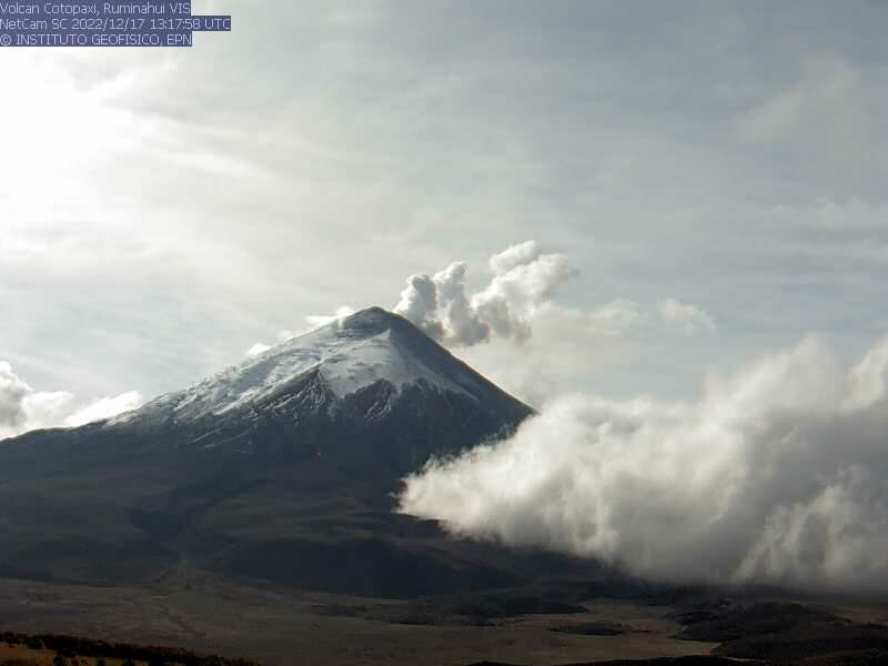
From 00:00 local time, the beginning of a seismic signal (emission tremor) was observed at the seismic station BREF which lasted about 20 minutes. According to satellite images (GOES-16), it is observed that the plume with a very weak ash load associated with this signal reaches a little more than 500 meters above the crater and is moving towards the South-West.
The ash falls associated with this small event are not expected, like others that have occurred in recent days. The IG-EPN will inform in a timely manner in case of detection of significant changes in the activity of the volcano. It is recommended to take appropriate measures and receive information from official sources.
Source : IGEPN.
Photos : Eqphos_fotografía , Patricio Ramon, 2005 (Instituto Geofisca, Escuela Politecnica Nacional),
Mexico , Popocatepetl :
December 17, 11:00 a.m. (December 17, 5:00 p.m. GMT)
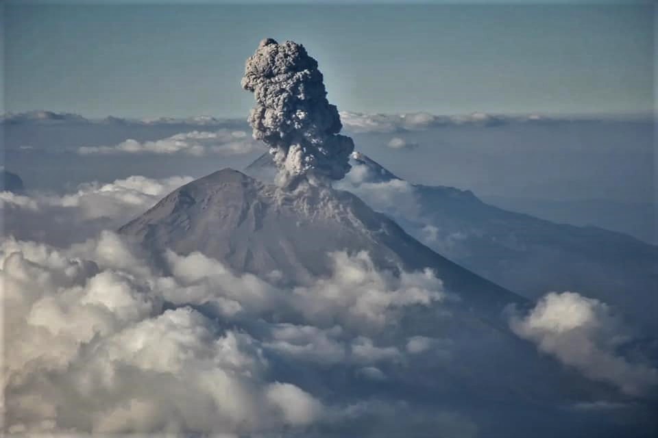
During the past 24 hours, according to the monitoring systems of the Popocatépetl volcano, 128 exhalations have been detected accompanied by water vapor, volcanic gases and slight amounts of ash.
Also, 206 minutes of low amplitude and high frequency tremors were recorded, as well as a volcano-tectonic earthquake detected yesterday at 12:22 p.m. with a magnitude of 2.4.
At the time of this report, the volcano is showing an emission of water vapor and gas in a northeast (NE) direction.
CENAPRED insistently reiterates the recommendation not to climb to the crater of the volcano because there is a possibility of explosions, as has been seen on several occasions in the past, involving the emission of incandescent fragments and in the event of heavy rains , to move away from the bottom of the ravines because of the danger of mudslides and debris.
The Popocatépetl volcanic alert traffic light is in YELLOW PHASE 2.
Source : Cenapred.
Photo : Roberto c Lopez

