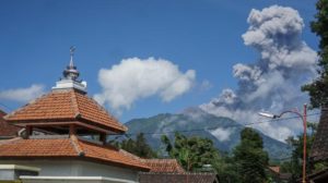
November 01 , 2022.
Kamchatka , Sheveluch :
VOLCANO OBSERVATORY NOTICE FOR AVIATION (VONA)
Issued: November 01 , 2022
Volcano: Sheveluch (CAVW #300270)
Current aviation colour code: ORANGE
Previous aviation colour code: orange
Source: KVERT
Notice Number: 2022-159
Volcano Location: N 56 deg 38 min E 161 deg 18 min
Area: Kamchatka, Russia
Summit Elevation: 3283 m (10768.24 ft), the dome elevation ~2500 m (8200 ft)
Volcanic Activity Summary:
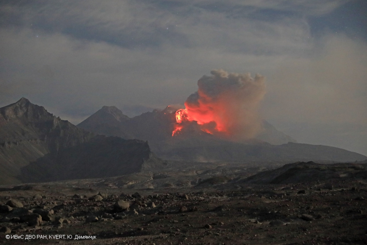
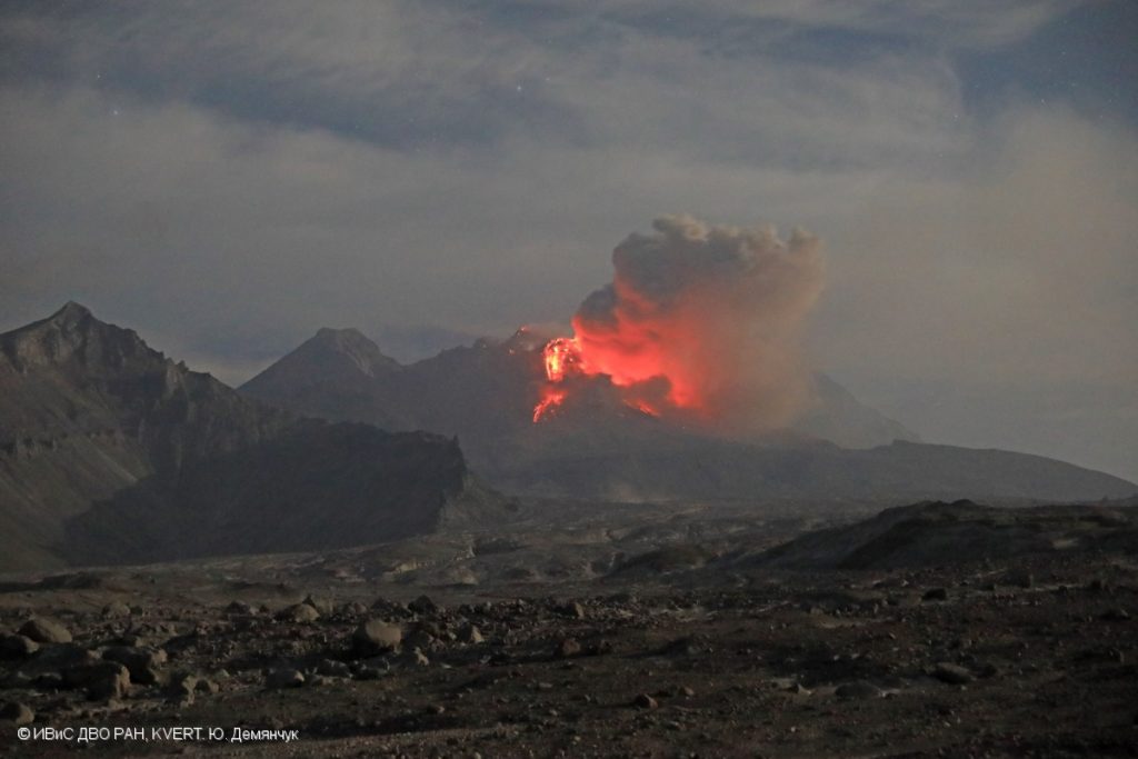
A growth of the lava dome continues, a strong fumarole activity, and an incandescence of the lava dome, explosions, and hot avalanches accompanies this process. Video and satellite data by KVERT show: the ash plume from hot avalanches which collapsing from the the eastern part of the lava dome is extending for 210 km to the east-south-east of the volcano.
The extrusive eruption of the volcano continues. Ash explosions up to 10-15 km (32,800-49,200 ft) a.s.l. could occur at any time. Ongoing activity could affect international and low-flying aircraft.
Volcanic cloud height:
3000-3300 m (9840-10824 ft) AMSL Time and method of ash plume/cloud height determination: 20221101/0510Z – Video data
Other volcanic cloud information:
Distance of ash plume/cloud of the volcano: 210 km (130 mi)
Direction of drift of ash plume/cloud of the volcano: ESE / azimuth 123 deg
Time and method of ash plume/cloud determination: 20221101/0400Z – Himawari-8 14m15
Source : Kvert.
Photo : Yu. Demyanchuk, IVS FEB RAS, KVERT
Ecuador , Sangay / Reventador :
DAILY REPORT OF THE STATE OF SANGAY VOLCANO, Monday October 31, 2022.
Information Geophysical Institute – EPN.
Surface Activity Level: High, Surface Trend: No change
Internal activity level: High, Internal trend: No change.
Seismicity: From October 30, 2022, 11:00 a.m. to October 31, 2022, 11:00 a.m.:
There was no interruption in the transmission of data from the reference station for seismic statistics.
Explosion (EXP) 925
Emission Tremors (TREMI ) 53
Long Periods (LP): 65
Rains / Lahars:
Rains were recorded in the area. No mudslide occurrence reports were received. **In the event of heavy rains, these could remobilize the accumulated materials, generating mudslides and debris that would descend on the flanks of the volcano and flow into the adjacent rivers.**
Emission / ash column:
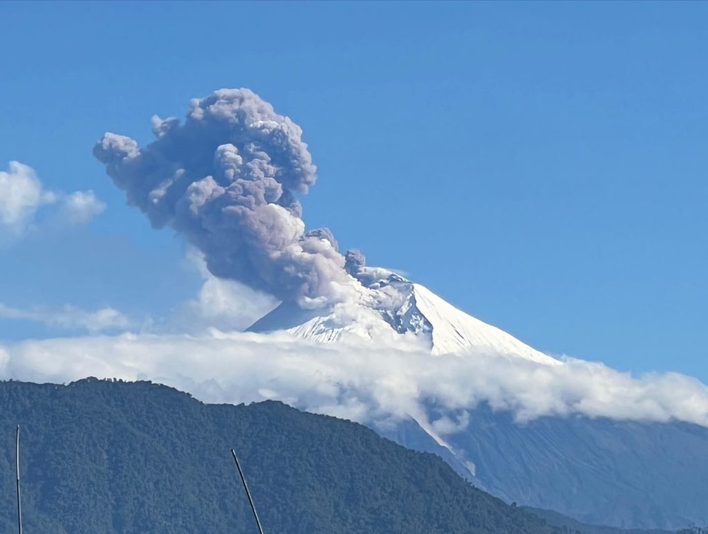
Today in the morning, several gas emissions were observed reaching heights of up to 2000 meters above the level of the crater, the direction of these emissions was constant towards the North-West, the VAAC recorded 4 alerts ash emission observed by the satellites which reached heights of 600 to 2100 meters above the level of the crater in the North, East and North-West directions.
Other Monitoring Parameters:
The FIRMS satellite system recorded 30 thermal anomalies, while MIROVA recorded 1 high (114 MW) and 1 moderate thermal anomaly.
Observation:
Yesterday afternoon, the volcano remained cloudy. During the night, it sometimes cleared and an incandescence was observed in the crater. Today during the morning, the weather became cloudy, however, during clear periods, the previously reported emissions were observed. Until the closing of this newsletter, there are no reports of ashfall
Alert level: Orange.
——————————————————————————————————————————————–
DAILY REPORT OF THE STATE OF THE REVENTADOR VOLCANO, Monday October 31, 2022.
Information Geophysical Institute – EPN.
Surface Activity Level: Moderate, Surface Trend: No change
Internal activity level: Moderate, Internal trend: No change.
Seismicity: From October 30, 2022, 11:00 a.m. to October 31, 2022, 11:00 a.m.:
The seismic statistics were carried out at the REVS seismic station, which did not present any interruptions in the transmission of data.
Explosion (EXP): 39
Long Periods (LP): 95
Emission Tremors (TREMI): 10.
Harmonic Trempor (TRARM): 5
Rains / Lahars:
Light rain was recorded in the area. No lahar reports were received.
Emission / ash column:
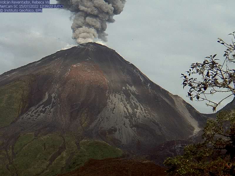
No emissions were observed through the cameras, however, the Washington VAAC reported 2 alerts of emissions observed by the satellites, whose heights were around 1700 meters above the level of the crater, the direction of the emissions was constant to the east.
Other Monitoring Parameters:
The FIRMS satellite system recorded 3 thermal anomalies, while MIROVA recorded 1 low thermal anomaly.
Observation:
Cloudiness was permanent in the area, preventing direct observation of surface activity.
Alert level: Orange.
Source : IGEPN.
Photos : AdriáLou Garay Vélez , Archive IGEPN.
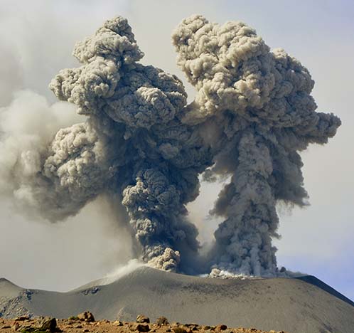
Peru , Sabancaya :
Analysis period: from October 24, 2022 to October 31, 2022, Arequipa, October 31, 2022.
Alert level: ORANGE
The Geophysical Institute of Peru (IGP) reports that the eruptive activity of the Sabancaya volcano remains at moderate levels, that is to say with the recording of an average of 28 daily explosions, with columns of ash and gas up to 2.5 km altitude above the summit of the volcano and their subsequent dispersion. Therefore, for the following days, no significant change is expected in eruptive activity.
The IGP recorded and analyzed the occurrence of 318 earthquakes of volcanic origin, associated with the circulation of magmatic fluids inside the Sabancaya volcano. An average of 28 explosions was recorded daily, in addition to recording Volcano-Tectonic (VT) type events associated with rock fracturing inside the Sabancaya volcano.
Monitoring the deformation of the volcanic structure using GNSS techniques (processed with fast orbits) does not show any significant anomalies. However, in general, an inflation process was observed in the northern sector (surroundings of the Hualca Hualca volcano). Visual surveillance identified columns of gas and ash up to 2.5 km above the summit of the volcano, which were scattered towards the eastern, southeastern and northeastern sectors of Sabancaya . Satellite recordings have identified the presence of 7 thermal anomalies, with a maximum value of 15 MW, associated with the presence of a lava body on the surface of the volcano’s crater.
RECOMMENDATIONS
• Keep the volcanic alert level orange.
• Do not approach within a radius of less than 12 km from the crater.
Source : Cenvul
Photo : IGP.
Guatemala , Santiaguito :
Activity:
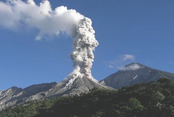
The Santa María-Santiaguito Volcanic Complex Observatory reports moderate degassing fumaroles 400 meters above the Caliente dome, which is moving southwest, as well as constant incandescence in the dome at night and early morning. Explosions accompanied by rumblings are sometimes recorded. Avalanches were also observed descending the western and southern flanks. The activity ahead of the active lava flow in the San Isidro and El Tambor channels continues with some boulder collapses, which generate ash clouds up to several hundred meters high, especially towards the « Zanjón Seco ».
It is recommended not to approach the lava flow, due to the intense heat it emits and the constant collapses that occur on its edges, which could cause burns and other serious injuries to those who come close. The extrusive activity remains at a high level and continues to accumulate material in an unstable manner in the lava flow, as well as in the dome of the Caliente dome, so it remains possible that some of this material collapses and generates pyroclastic flows over long distances to the South-West, South and East.
Source : Insivumeh.
Photo : La Hora.
Mexico , Popocatepetl :
October 31, 11:00 a.m. (October 31, 5:00 p.m. GMT)
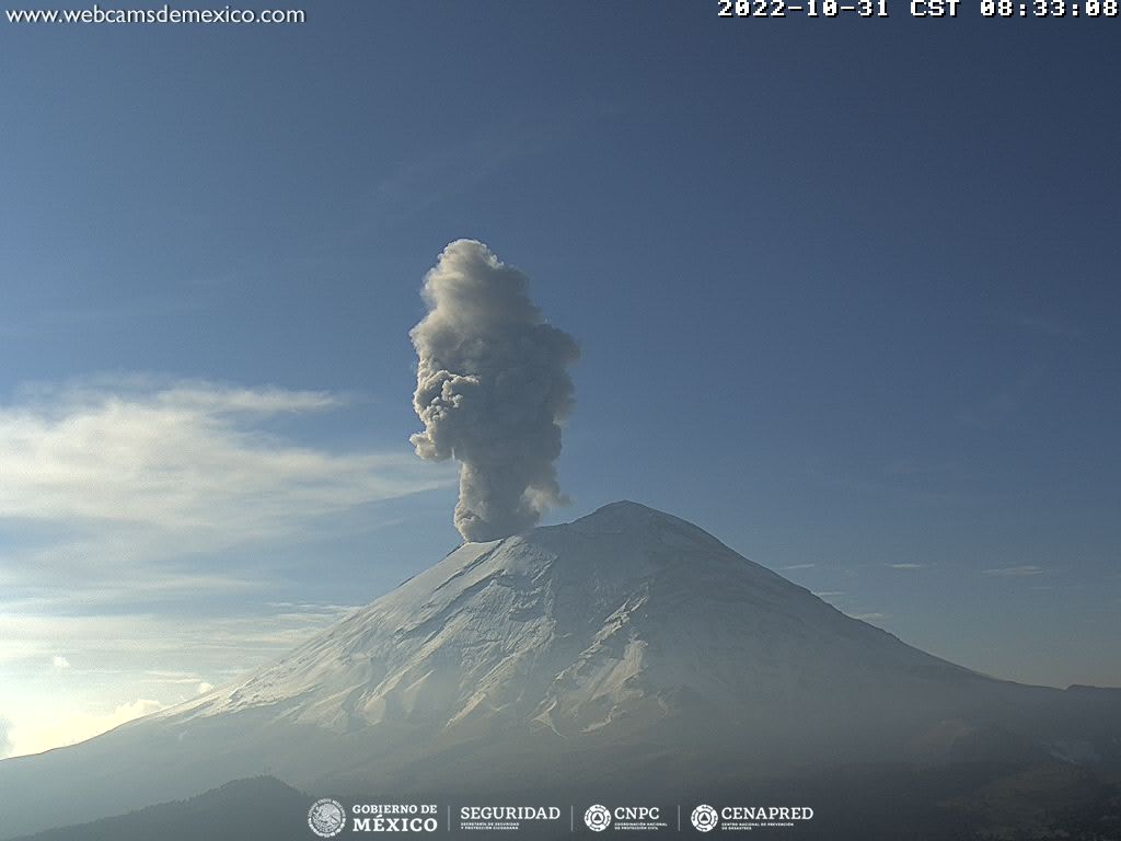
During the past 24 hours, according to the monitoring systems of the Popocatépetl volcano, 77 exhalations have been detected, accompanied by water vapor, volcanic gases and slight amounts of ash. 99 minutes of low amplitude tremor was also recorded.
During the morning, a slight emission of water vapor and volcanic gases was observed in a southeasterly direction.
CENAPRED urges NOT TO APPROACH the volcano and especially the crater, because of the danger of falling ballistic fragments and, in case of heavy rains, to stay away from the bottom of the ravines because of the danger of mudslides and of debris.
The Popocatépetl volcanic alert traffic light is in YELLOW PHASE 2.
Source et photo : Cenapred.

