October 14 , 2022.
Italy , Vulcano :
WEEKLY BULLETIN, from October 03, 2022 to October 09, 2022, (issue date October 11, 2022)
ACTIVITY BULLETIN SUMMARY
In the light of the surveillance data, it is highlighted:
1) Temperature of the crater fumaroles: Along the upper rim, the maximum emission temperature has extremely stable values around 372°C.
2) CO2 flux in the crater area: CO2 flux in the crater area: The CO2 flux in the crater area remains at medium-high values.
3) SO2 flux in the crater area: stable at a moderately medium-high level
4) Geochemistry of fumarolic gases: There are no updates.
5) CO2 fluxes at the base of the La Fossa cone and in the Vulcano Porto area: The CO2 fluxes recorded in the sites of Rimessa, C. Sicilia show stable values, always above background levels. The P4max site displays medium to low values, while at the Faraglione site there are values close to the background level.
6) Geochemistry of thermal aquifers: in the well of Camping Sicilia there are always high values of temperature and conductivity at medium-low levels; in the Bambara well, the level and conductivity values show no significant variations.

7) Local seismicity: Low occurrence rate of local micro-seismicity.
8) Regional seismicity: Absence of regional earthquakes of magnitude equal to or greater than 1.0.
9) Deformations – GNSS: No significant variation is observed in the time series of the GNSS stations.
10) Deformations – Inclinometry: No significant variation of the inclination data.
11) Gravimetry: There are no significant medium-long term changes.
12) Other Notes: Mobile GNSS. The GNSS mobile network acquires and transmits movements in real time at a frequency of 1 Hz. The historical series acquired so far do not show significant variations around the Porto di Levante area.
CO2 FLOW AT THE BASE OF LA FOSSA CONE AND IN THE VULCANO PORTO AREA
The CO2 fluxes at the base of the crater in the C. Sicilia and Rimessa sites show stable values, but always higher than those of the background level. The P4max site displays medium-low values modulated by the usual oscillations linked to variations in atmospheric pressure; in the Faraglione site, there are values close to the background level.
Source et photo: INGV.
Italy , Stromboli :
Current Activity .
Source : INGV.
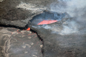
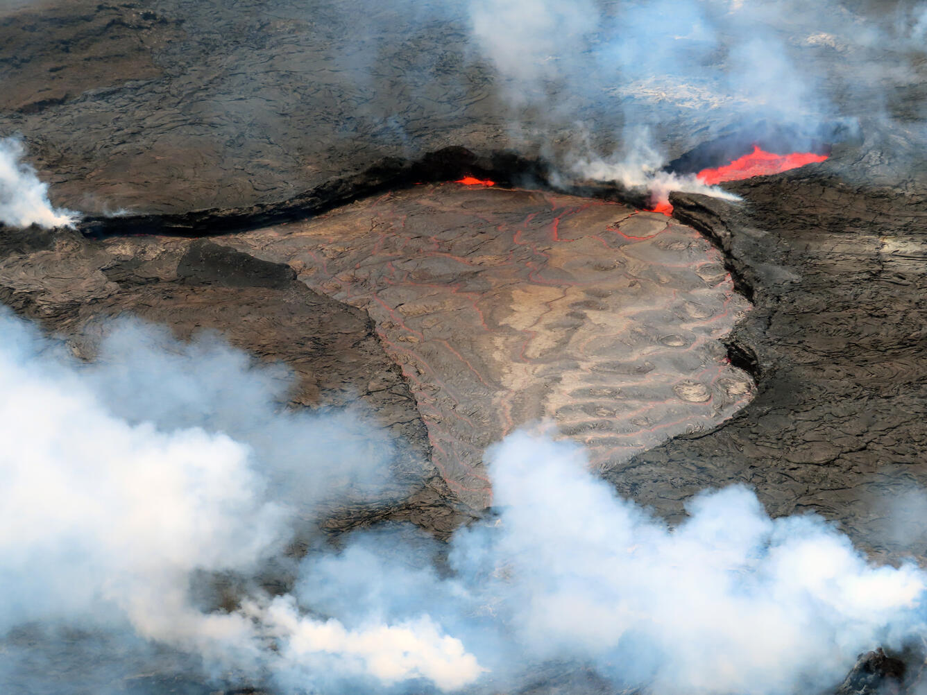
Hawaii , Kilauea :
19°25’16 » N 155°17’13 » W,
Summit Elevation 4091 ft (1247 m)
Current Volcano Alert Level: WATCH
Current Aviation Color Code: ORANGE
Activity Summary:
The summit eruption of Kīlauea Volcano, within Halemaʻumaʻu crater, continued over the past 24 hours. All recent eruptive activity has been confined to the crater. No significant changes have been observed at the summit or in either rift zone.
Halemaʻumaʻu Lava Lake Observations:
Eruption of lava from the western vent into the active lava lake and onto the crater floor continued over the past 24 hours. The active part of the lava lake has been steady over the past 24 hours. Overflight measurements from October 5, 2022, indicated that the crater floor had seen a total rise of about 143 meters (469 feet), since the beginning of this eruption on September 29, 2021.
Summit Observations:
Summit tiltmeters recorded continued slight inflationary deformation over the last 24 hours. Volcanic tremor remains above background levels. A sulfur dioxide (SO2) emission rate of approximately 1,800 tonnes per day (t/d) was measured on September 30, 2022.
Rift Zone Observations:
No unusual activity has been noted along the East Rift Zone or Southwest Rift Zone; low rates of ground deformation and seismicity continue along both. Measurements from continuous gas monitoring stations downwind of Puʻuʻōʻō in the middle East Rift Zone remain below detection limits for SO2, indicating that SO2 emissions from Puʻuʻōʻō are negligible.
Source : HVO.
Photo : USGS/ L. Gallant.
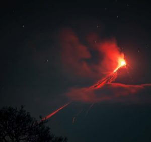
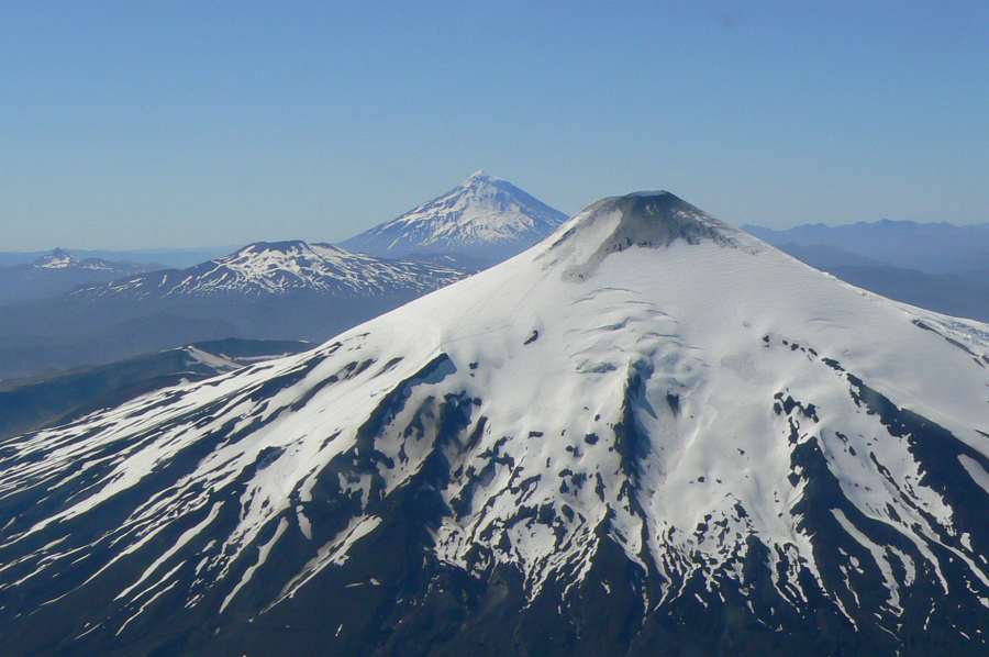
Chile , Villarica :
Seismology
The seismological activity of the period was characterized by the recording of:
11 VT-type seismic events, associated with rock fracturing (Volcano-Tectonics). The most energetic earthquake presented a value of local magnitude (ML) equal to 1.5, located 8.5 km east-south-east of the volcanic edifice, at a depth of 6.4 km from the crater.
1718 LP-type seismic events, associated with fluid dynamics within the volcanic system (Long Period). The size of the largest earthquake estimated from the reduced displacement parameter (RD) was equal to 17 cm2.
2 TR-type seismic events, associated with sustained fluid dynamics within the volcanic system (TRemor). The size of the largest earthquake estimated from the reduced displacement parameter (RD) was equal to 3 cm2.
Fluid Geochemistry
Data on sulfur dioxide (SO2) emissions obtained by optical differential absorption spectroscopy (DOAS) equipment, corresponding to the Los Nevados and Tralco stations, installed 10 km to the East-North-East (ENE) and 6 km east-southeast (ESE) of the active crater, respectively, showed an average value of 2010 ± 432 t/d, with a maximum daily value of 4806 t/d on September 5. According to the activity of the volcano, these values are higher than the levels considered normal.
Information on satellite anomalies of sulfur dioxide (SO2) emissions into the atmosphere in the area near the volcano, according to data published by the Troposphere Monitoring Instrument (TROPOMI) and Ozone Monitoring Instrument (OMI) Sulfur Dioxide Group, show no abnormalities.
Satellite thermal anomalies
During the period, 6 thermal alerts were recorded in the area associated with the volcano, with a maximum Volcanic Radiative Power (VRP) of 3 MW on September 29, a value considered low according to data processed by the Middle Infrared of Observation of Volcanic Activity. (MIROVA). Through the analysis of Sentinel 2L2A satellite images, 6 radiance anomalies were detected in the area associated with the crater, on September 2, 5, 10, 12, 27 and 30, with a maximum anomalous radiance zone of 9000 m2 on September 12.
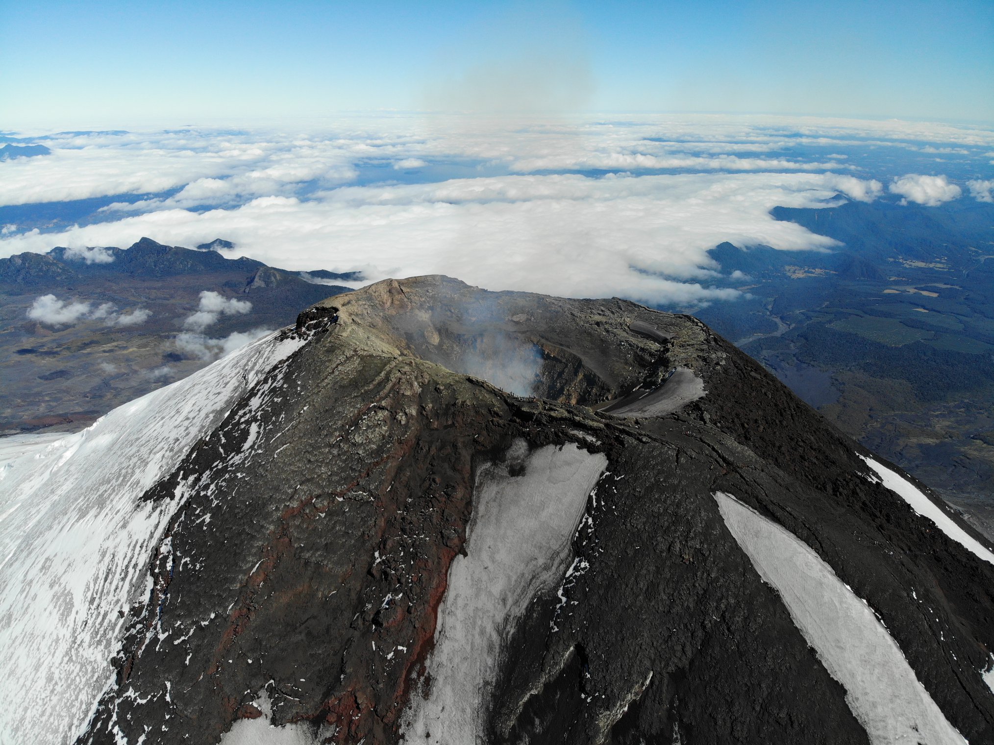
Surveillance cameras
The images provided by the fixed camera, installed near the volcano, recorded regular degassing, with a maximum column height exceeding 400 meters above the level of the crater, on September 24. Nocturnal incandescence was observed during the period evaluated, on days when weather conditions permitted. In addition, during the last days of the fortnight, passive degassing was observed and in some cases with a moderate contribution of pyroclasts highlighted in deposits near the crater.
Source : Sernageomin.
Photos : ameriquedusud.org , Take a Way .
Indonesia , Ili Lewotolok :
Mount Ili Lewotolok erupted on Friday, October 14, 2022 at 03:51 WITA with the height of the ash column observed at ± 1200 m above the peak (± 2623 m above sea level). The ash column is observed to be gray with a thick intensity towards the southwest. This eruption was recorded on a seismograph with a maximum amplitude of 38.1 mm and a duration of 50 seconds.
VOLCANO OBSERVATORY NOTICE FOR AVIATION – VONA
Issued : October 13 , 2022
Volcano : Ili Lewotolok (264230)
Current Aviation Colour Code : ORANGE
Previous Aviation Colour Code : orange
Source : Ili Lewotolok Volcano Observatory
Notice Number : 2022LEW27
Volcano Location : S 08 deg 16 min 19 sec E 123 deg 30 min 18 sec
Area : East Nusa Tenggara, Indonesia
Summit Elevation : 4554 FT (1423 M)

Volcanic Activity Summary :
Eruption with volcanic ash cloud at 19h51 UTC (03h51 local). Eruption and ash emission is not continuing.
Volcanic Cloud Height :
Best estimate of ash-cloud top is around 8394 FT (2623 M) above sea level, may be higher than what can be observed clearly. Source of height data: ground observer.
Other Volcanic Cloud Information :
Ash-cloud moving to south-west
Remarks :
Seismic activity is characterized by continuous volcanic tectonic earthquake.
Source et photo ( archive) : Magma Indonésie.
Colombia , Chiles / Cerro Negro :
Chiles and Cerro Negro volcanoes weekly activity bulletin
Volcano activity continues at YELLOW LEVEL ■ (III): CHANGES IN THE BEHAVIOR OF VOLCANIC ACTIVITY.
From monitoring the activity of VOLCANOES CHILES and CERRO NEGRO, the COLOMBIAN GEOLOGICAL SERVICE (SGC) reports that:
Between October 4 and October 10, 2022, a decrease in occurrence and energy released levels was observed, mainly due to the decrease in the swarm of fracture events underway since May 27. In general, seismicity was associated with rock fracture, with a maximum magnitude of 1.5. The earthquakes were located in 3 zones, the first in the southwest quadrant of the Chiles volcano at distances less than 5 km and depths less than 6 km from its summit (4700 m altitude).
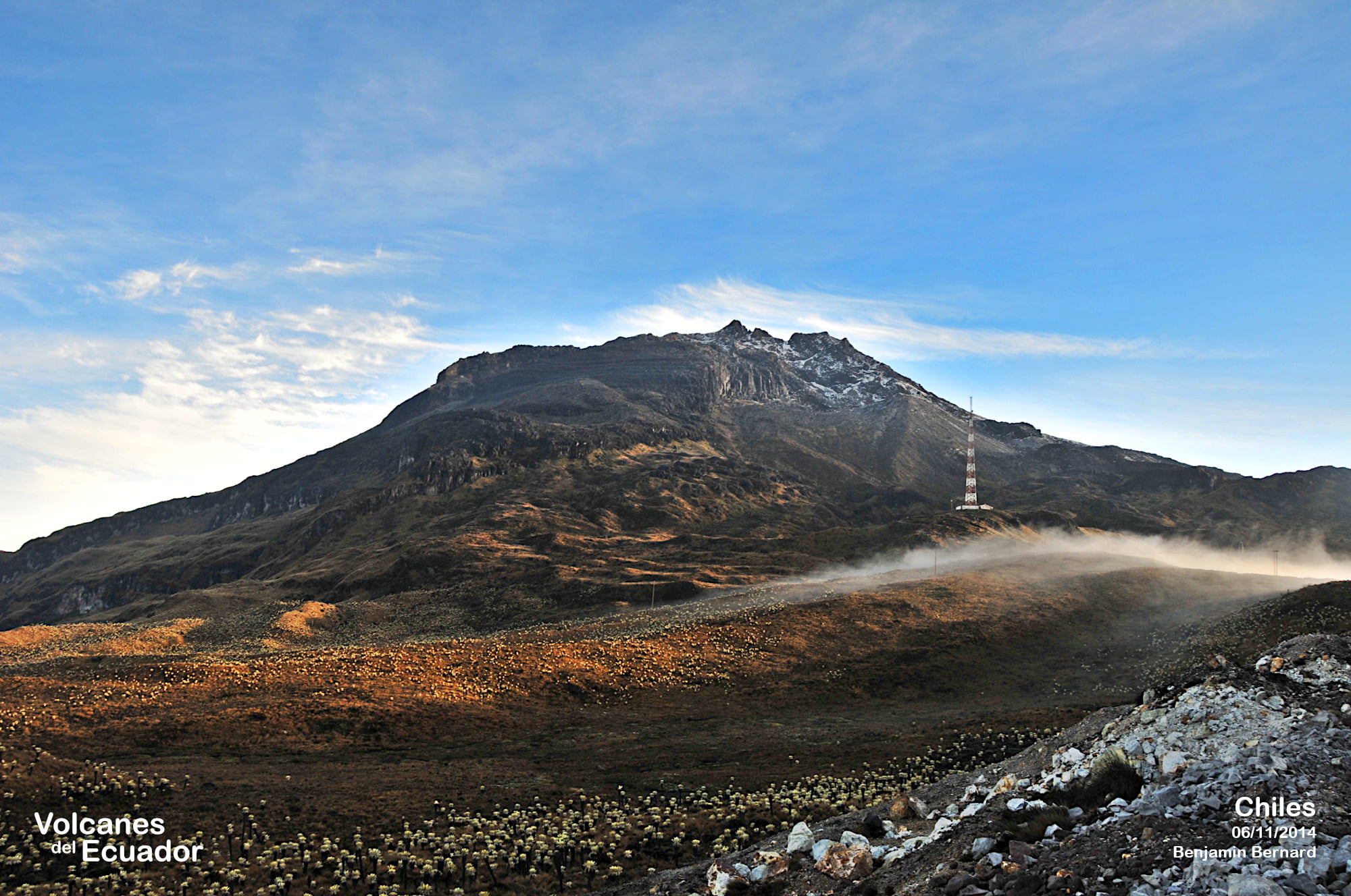
The second zone was located east of the Cerro Negro volcano at distances less than 2 km with depths less than 6 km and some earthquakes were located southeast of Chiles at distances between 8 and 10 km with depths between 7 and 10 km from its summit (4700 m above sea level). This swarm was accompanied by a process of soil deformation, observed instrumentally, since the end of March 2022 and which continues to this day.
Based on the current behavior of this seismicity and what has been historically recorded in this active volcanic region, the possibility of occurrence of high energy earthquakes that can be felt by the inhabitants of the volcanic influence zone is not excluded. .
Source : SGC.
Photo : Benjamin Bernard.