April 23 , 2022.
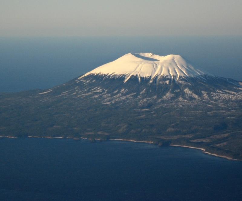
Indonesia , Anak Krakatau :
VOLCANO OBSERVATORY NOTICE FOR AVIATION – VONA
Issued : April 22 , 2022
Volcano : Anak Krakatau (262000)
Current Aviation Colour Code : ORANGE
Previous Aviation Colour Code : orange
Source : Anak Krakatau Volcano Observatory
Notice Number : 2022KRA41
Volcano Location : S 06 deg 06 min 07 sec E 105 deg 25 min 23 sec
Area : Lampung, Indonesia
Summit Elevation : 502 FT (157 M)

Volcanic Activity Summary :
Eruption with ash clouds at 10:30 UTC (17:30 local time). Eruption and ash emission is continuing.
Volcanic Cloud Height :
Best estimate of ash-cloud top is around 3062 FT (957 M) above sea level, may be higher than what can be observed clearly. Source of height data: ground observer.
Other Volcanic Cloud Information :
Visuals directly from the cctv were observed eruptions with the color of the thick black eruption smoke 800m from the top of the volcano, the wind direction slowly to the southwest.
Remarks :
Seismic activity is characterized by continuous volcanic tremor.
Source : Magma Indonésie .
Alaska , Edgecumbe :
Mount Edgecumbe Information Statement, April 22, 2022 ; Posted: April 22, 2022 .
Current observations
A swarm of earthquakes was detected in the vicinity of Mount Edgecumbe volcano beginning on Monday, April 11, 2022. There were hundreds of small quakes in the swarm, though the large majority were too small to locate. Over the past few days, earthquake activity has declined and is currently at background levels.
The recent swarm inspired an in-depth analysis of the last 7.5 years of ground deformation detectable with radar satellite data. Analysis of these data from recent years reveals a broad area, about 17 km (10.5 miles) in diameter, of surface uplift centered about 2.5 km (1.5 miles) to the east of Mt Edgecumbe. This uplift began in August 2018 and has been continuing to the present at a rate of up to 8.7 cm/yr (3.4 in/yr) in the center of the deforming area. Deformation has been constant since 2018, and there has not been an increase with the recent earthquake activity. The total deformation since 2018 is about 27 cm (10.6 inches).
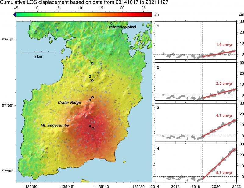
Main map: Kruzof Island with Mount Edgecumbe and Crater Ridge labeled. Cumulative displacement measured in the line of sight (LOS) of Sentinel 1 radar satellites from Nov 2014-Dec 2021 (positive LOS displacement means uplift and horizontal motion toward the satellite). All deformation is given with observations at the reference pixel removed (chosen away from volcano to only capture tectonic and glacial isostatic adjustment / uplift), resulting in predominantly volcanic motion shown. Red indicates up to 27 cm of inflation. Timeseries insets show deformation over time at locations numbered 1-4 on the main map. Vertical line shows onset of inflation in Aug 2018. We observe linear inflation of up to 8.7 cm/yr since then. Figure by Yitian Cheng and Ronni Grapenthin, AVO/UAFGI
Retrospective analysis of earthquake data in the area of Mount Edgecumbe shows that a small number of earthquakes started occurring under the volcano in 2020. The recent earthquake activity that started on April 11 was unusual in having a greater number of events, however. The earthquakes detected under the volcano since 2020 are all M3.0 or smaller. Note that only the largest of the earthquakes can be located by regional seismic networks; hundreds of very small additional events have been detected, but not located.
Prognosis
The coincidence of earthquakes and ground deformation in time and location suggests that these signals are likely due to the movement of magma beneath Mount Edgecumbe, as opposed to tectonic activity. Initial modeling of the deformation signal shows that it is consistent with an intrusion of new material (magma) at about 5 km (3.1 miles) below sea level. The earthquakes likely are caused by stresses in the crust due to this intrusion and the substantial uplift that it is causing.
Intrusions of new magma under volcanoes do not always result in volcanic eruptions. The deformation and earthquake activity at Edgecumbe may cease with no eruption occurring. If the magma rises closer to the surface, this would lead to changes in the deformation pattern and an increase in earthquake activity. Therefore, it is very likely that if an eruption were to occur it would be preceded by additional signals that would allow advance warning.
Source : AVO
Photo : Marriott, Duncan.
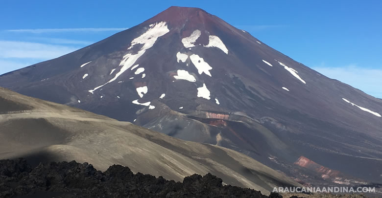
Chile , Lonquimay :
Lonquimay volcanic complex.
Seismic activity during the month was characterized by:
– The recording of 5 seismic events of type VT, associated with the fracturing of rocks (Volcano-Tectonics).
The most energetic earthquake presented a value of local magnitude (ML) equal to 1.3, located 3.3 km north-north-west of the volcanic edifice, at a depth of 12.0 km by relative to the crater.
– The recording of 4 LP-type seismic events, associated with fluid dynamics within the volcanic system (Long Period). The size of the largest earthquake estimated from the reduced displacement parameter (RD) was equal to 3 cm2.
No anomalies were reported in the emissions of sulfur dioxide (SO2) into the atmosphere in the area near the volcanic edifice, according to data published by the Tropospheric Monitoring Instrument (TROPOMI) and Ozone Monitoring Instrument (OMI) Sulfur Dioxide Group (http://so2.gsfc.nasa.gov/).
During the period, no thermal alert was recorded in the area associated with the volcanic edifice, according to data processed by the Medium Infrared Observation of Volcanic Activity (MIROVA) (http://www.mirovaweb .it/) and by the analytical processing of Sentinel 2-L2A satellite images, in combination with false color bands.
According to the data provided by 2 GNSS stations and the analysis carried out using radar interferometry, no variation was observed indicating changes in the internal dynamics of the volcano during the period evaluated.
The images provided by the fixed camera, installed near the volcano, did not record any degassing columns on the building or any variations linked to surface activity.

Crater of the Lonquimay volcano seen towards the North, Tolhuaca volcano in the background
No morphological variation is identified from the comparison of true color Planet Scope images during the time period evaluated.
According to the analysis carried out from seismology, remote sensing and deformation data, volcanic activity during this fortnight remained at low levels similar to those observed the previous fortnight. Although the activity during the fortnight is energetically weak, the variations recorded during the last month must be evaluated with a temporary space which makes it possible to suggest the return of the volcanic system to a stable phase.
Therefore, following the precautionary principle, the technical alert level is maintained at YELLOW TECHNICAL ALERT: Changes in the behavior of volcanic activity.
Source : Sernageomin
Photos : Sir Robert / wikiexplora.
La Martinique , Mount Pelée :
Weekly report on the activity of Mount Pelée for the period from April 15 to 22, 2022.
Between April 15, 2022 at 4 p.m. (UTC) and April 22, 2022 at 4 p.m. (UTC), the OVSM recorded at least 14 volcano-tectonic earthquakes of magnitude less than or equal to 0.1. These earthquakes were located inside the volcanic edifice between 0.5 and 1.0 km deep below the surface. This superficial volcano-tectonic seismicity is associated with the formation of micro-fractures in the volcanic edifice.
None of these earthquakes were felt by the population.
The zone of degassing at sea at shallow depth between St Pierre and le Prêcheur is still observed. The IGP took fluid samples in order to understand the origin of this degassing and to assess its possible relationship with the Mount Pelée hydrothermal system.
Based on analysis of satellite imagery, this area, consisting of topless, defoliated or downed tree trunks and ferns, and yellowing grasses and bushes, appeared in late 2019. It is located near the craters of the historic phreatic eruptions of 1792 and 1851.
The gas measurement mission at this zone of deteriorated vegetation carried out on February 8, 2021 shows the presence of diffuse and passive degassing of carbon dioxide (CO2, an odorless and colorless gas) locally reaching maximum concentrations of 5000 to 7800 ppm.
At the heart of the most deteriorated vegetation zone, fractures 20 to 60 cm wide and 2 to 3 m deep are visible on the ground (Figure 3) and can be followed over several tens of meters. Some of these fractures are clearly old but others, very frank and in which the dead vegetation has collapsed, could have formed very recently although their age is not known. There is no fumarole, emission of water vapor, or gas escaping visibly from an orifice or crack. Markers on the ground were installed on March 5, 2021 around the most important fractures so as to be able to follow their evolution over time.
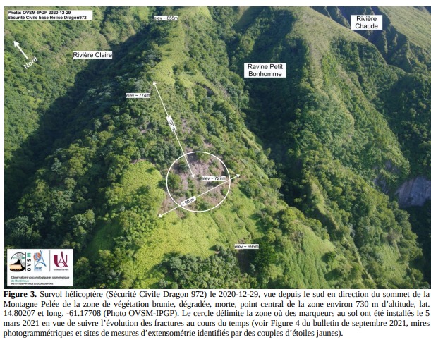
An extension of two areas of degraded vegetation located between Morne Plumé and the Chaude River was observed during a helicopter flight carried out on February 9, with the support of the Dragon 972, and confirmed by analysis of satellite images.
The alert level remains YELLOW: vigilance.
Source : Direction de l’OVSM IPGP.
Photo : OVSM IPGP
Read the full article : http://volcano.ipgp.jussieu.fr/martinique/Bulletins/2022/OVSM_2022_02_fra.pdf
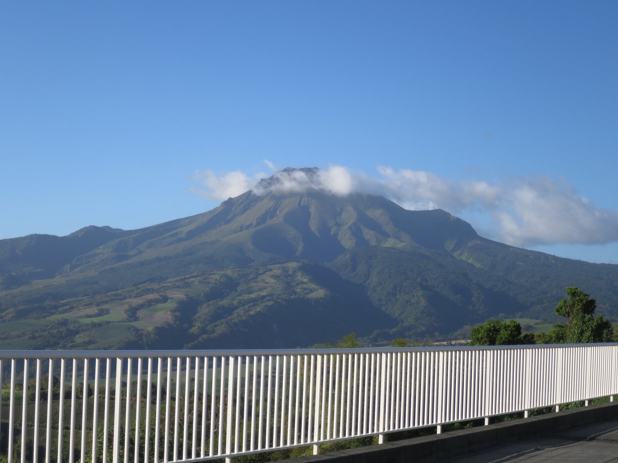
Mexico , Popocatepetl :
April 22, 11:00 a.m. (April 22, 4:00 p.m. GMT)
During the past 24 hours, according to the monitoring systems of the Popocatépetl volcano, 6 low intensity exhalations have been detected, accompanied by water vapor, gas and sometimes slight amounts of ash.
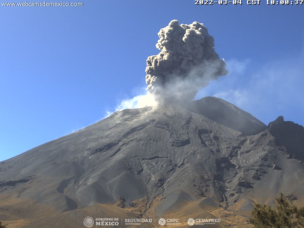
During the morning and at the time of this report, a low altitude emission composed of volcanic gases and water vapor is observed, which disperses towards the South-West.
CENAPRED urges NOT TO APPROACH the volcano and especially the crater, because of the danger of falling ballistic fragments and, in case of heavy rains, to stay away from the bottom of the ravines because of the danger of mudslides and debris
The Popocatépetl volcanic alert traffic light is in YELLOW PHASE 2.
Source : Cenapred .
Photo : Archive Cenapred.