April 08 , 2022.
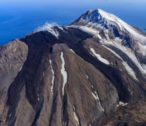
Alaska , Semisopochnoi :
51°55’44 » N 179°35’52 » E,
Summit Elevation 2625 ft (800 m)
Current Volcano Alert Level: WATCH
Current Aviation Color Code: ORANGE
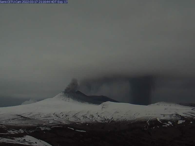
Low-level eruptive activity continues. Seismic tremor and small explosions were observed over the past day. Partly cloudy webcam views showed short-lived ash emissions interrupting steady steam emissions from the north crater of Mount Cerberus throughout the day, with local ash deposition observed. The steam plume extended up to 70 km (~43 miles) southwest of the active vent overnight.
Small eruptions producing minor ash deposits within the vicinity of the active north crater of Mount Cerberus and ash clouds usually under 10,000 ft (3 km) above sea level have characterized the recent activity. Small explosions and associated ash emissions may continue and could be difficult to detect, especially when thick cloud cover obscures the volcano.
Semisopochnoi is monitored by local seismic and infrasound sensors, satellite data, web cameras, and remote infrasound and lightning networks.
Source : AVO.
Photo :Saunders-Shultz, Che Pascal.
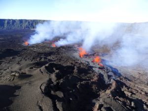
Hawaii , Kilauea :
19°25’16 » N 155°17’13 » W,
Summit Elevation 4091 ft (1247 m)
Current Volcano Alert Level: WATCH
Current Aviation Color Code: ORANGE
Activity Summary:
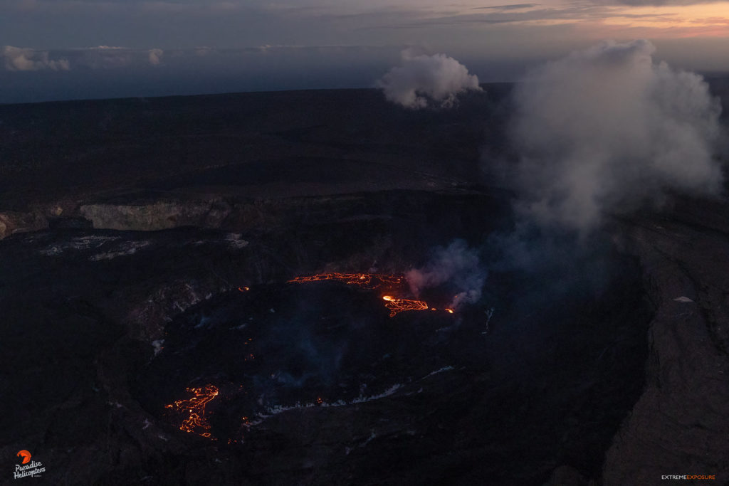
The summit eruption of Kīlauea Volcano, within Halemaʻumaʻu crater, continued over the past 24 hours. All recent activity has been confined to the crater, and there are no indications of activity migrating elsewhere on Kīlauea.
Halemaʻumaʻu crater Lava Lake Observations:
Eruption of lava from the western vent into the active lava lake (approximately 2.3% of the crater floor surface) and onto the crater floor continued over the past 24 hours. Yesterday morning and afternoon saw the continuation of lava ooze-outs near the northwestern and northeastern edges of the crater floor, before the breakout of an expansive ooze-out along the northern edge at 6:00 p.m.; lava activity persists in this area today, although its vigor is reduced. The active part of the lava lake showed continuous surface activity but its surface dropped slightly in association with summit deflation. Since the beginning of this eruption on September 29, 2021, the crater floor has seen a total rise of about 97 meters (318 feet). The volume of lava effused since the beginning of this eruption was approximately 64 million cubic meters (84 million cubic yards or 17 billion gallons) as measured on March 29, 2022.
Summit Observations:
Summit tiltmeters began tracking deflationary tilt yesterday evening, which continues today at a reduced rate. Volcanic tremor remains above background levels, although the amplitude has declined slightly in association with summit deflation. A sulfur dioxide (SO2) emission rate of approximately 3,200 tonnes per day (t/d) was measured on April 6, 2022.
Source : HVO.
Photo : Bruce Omori.
New Zealand , Ruapehu :
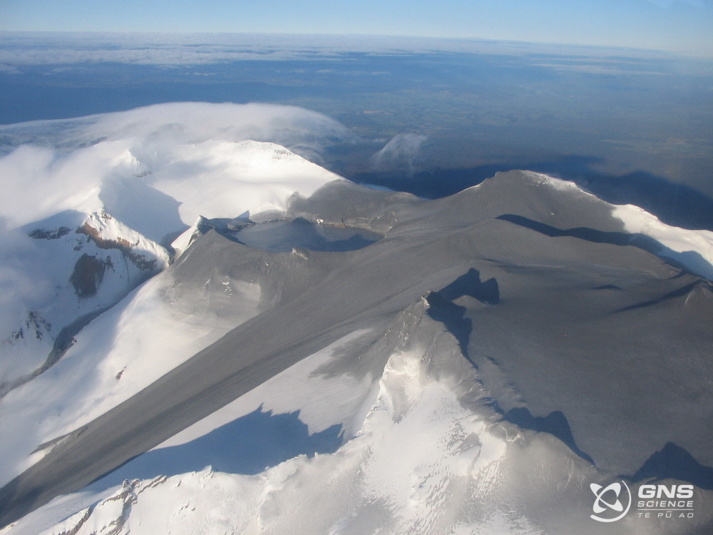
Mt Ruapehu remains one of our most active cone volcanoes. From our catalogue of observed volcanic activity since the 1830s, there are over 600 days of activity at Mt Ruapehu. From the catalogue we have also learnt that small eruptions only affect the summit plateau around the Crater Lake (Te Wai ā-moe), with larger, lahar generating eruptions occurring on average about once every 7 years. Noting averages are not always a great measure as volcanic activity is often clustered into episodes.
The most recent significant eruption was 25 September 2007, this was an explosive eruption, lasting about 7 minutes. During the eruption, explosions spread ash, rocks and water across the summit plateau, and produced lahars in two valleys including one in the Whakapapa ski field.
Ruapehu summit and lahar on Whangaehu Glacier after eruption 2007
Prior to this was a small eruption in October 2006 where the effects were minimal and confined to the lake basin and a similar event in July 2009 that produced a minor flood in the Whangaehu Valley. The most iconic activity at Mt Ruapehu in recent history were the eruptions of 1995-1996 when multiple eruptions through the crater lake occurred. They produced lahars and high ash plumes that deposited ash over a wide area after the lake was removed.
So, what’s happening at the volcano now?
Current unrest is primarily based on seismic activity, in particular volcanic tremor, this is a semi-continuous type of volcanic earthquake signal made by the movement of hot gases and or fluids within the volcano.
Recently completed analysis of the lake water and gas samples do not indicate significant changes in the geothermal system feeding into the lake. The amount of gas released through the lake has increased from the previous measurements but remains within the typically observed long term trends. The results to date are typical for the beginning of a heating cycle with the exception that tremor values are unusually high.
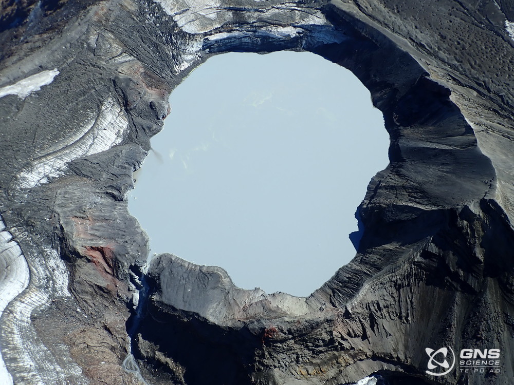
The crater lake is currently warming, and the lake temperature has now risen to 37 °C. The temperature of the lake typically ranges from ~12 °C to ~45°C, over periods of up to 12 months. These temperature cycles have occurred many times over the last 15 years with no eruptions.
During heating episodes, the lake often changes colour. The lake has now changed to a battleship grey colour caused by the suspended sediments that are stirred up by the steam and gas entering the lake from below. Sulphur slicks are present on the lake surface, these appear as Sulphur forms at the base of Crater Lake and can then get disturbed during a heating phase.
Research on the crater lake eruptive history has shown that the probability of an eruption increases when the lake is significantly warmer or cooler than the average lake temperature range, although eruptions are significantly more frequent when the lake is hot.
Source : Geonet / Brad Scott
Photos : GNS Science.
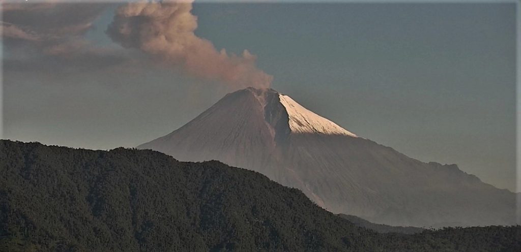
Ecuador , Sangay / Reventador :
DAILY REPORT OF THE STATE OF SANGAY VOLCANO, Thursday April 07, 2022.
Information Geophysical Institute – EPN.
Surface Activity Level: High, Surface Trend: No change.
Internal activity level: High, Internal trend: No change.
Seismicity: From April 06, 2022, 11:00 a.m. to April 07, 2022, 11:00 a.m.:
Explosion (EXP) 42
Long Periods (LP) 19
Tremors (TRE) 56
Rains / Lahars:
Thanks to the Windy system, 1.8 mm of rain was recorded in the area. **In the event of heavy rains, these could remobilize the accumulated materials, generating mudslides and debris that would descend on the flanks of the volcano and flow into the adjacent rivers.**
Emission / ash column:
The Washington VAAC reported 4 ash emission alerts with heights of 1,170 meters above crater level, heading west. Among the clouds, several steam and ash emissions were observed at heights above 1000 meters and in a westerly direction.
Gas:
The MOUNTS system recorded 448.8 tons of SO2 on 04/06/2022 at 1:55 p.m. TL.
Other Monitoring Parameters:
The FIRMS system records 57 thermal anomalies over the past 24 hours.
Observation:
The weather conditions are permanently cloudy.
Alert level: Orange.
——————————————————————————————
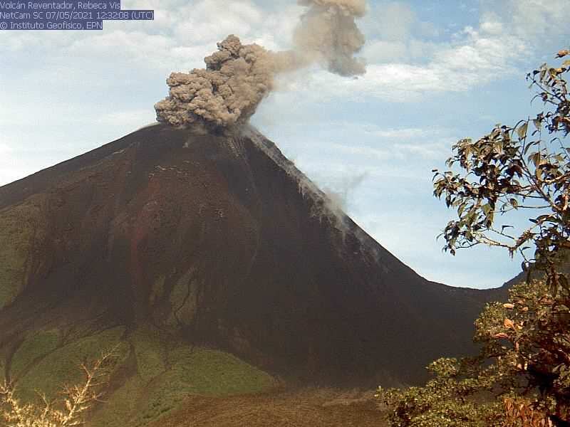
DAILY REPORT OF THE STATE OF THE REVENTADOR VOLCANO, Thursday April 07, 2022.
Information Geophysical Institute – EPN.
Surface Activity Level: High, Surface Trend: No change.
Internal activity level: Moderate, Internal trend: No change.
Seismicity: From April 06, 2022, 11:00 a.m. to April 07, 2022, 11:00 a.m.:
Explosion (EXP) 72
Long Periods (LP) 54
Emission Tremors (TREMI) 36
Rains / Lahars:
Through the Windy system, light rains were recorded in the area. No lahar was generated.
Emission / ash column:
This morning, several steam and ash emissions were observed with heights greater than 700 meters in a westerly direction. The Washington VAAC reported 4 gas and ash emission alerts with a height of 988 meters above crater level heading west.
Other Monitoring Parameters:
No thermal anomalies were recorded in the FIRMS and MIROVA systems.
Gas:
The MOUNTS system records 13.1 tons of SO2 on 04/06/2022 at 1:55 p.m. TL.
Observation:
During the night, an incandescence was observed at the level of the crater
Alert level: Orange.
Source : IGEPN
Photos : IGEPN ( archives).
Guatemala , Santiaguito :
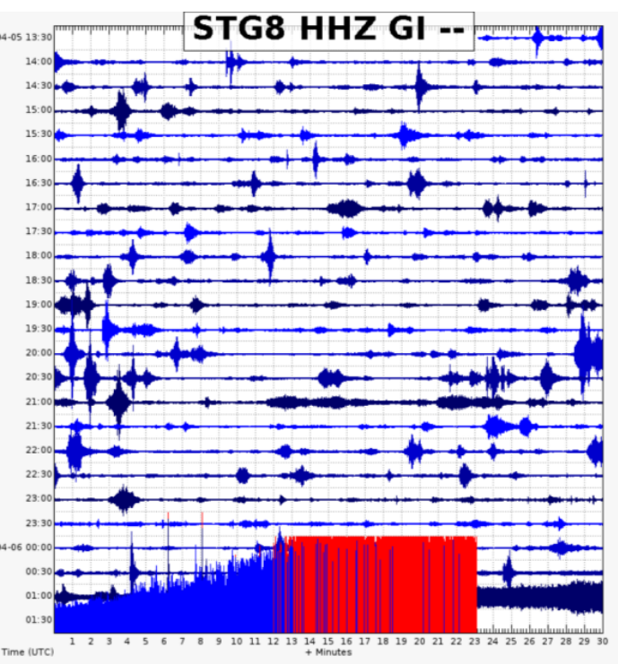
SPECIAL VOLCANOLOGICAL BULLETIN, April 06, 2022, 8:05 p.m. local time
Precipitation on the Santa María-Santiaguito volcanic complex is currently generating the descent of weak to moderate lahars in the course of the San Isidro River, a tributary of the Tambor River to the south-southwest of the volcano. This lahar can carry a pasty mixture of water which can be at a high temperature due to the high activity that the volcano has had on this flank, blocks of rock up to 3 meters in diameter and finer sediments, as well than tree trunks and branches. The lahar on its way produces vibrations in the ground which are recorded in the seismic stations close to the bed of the river, in this case the STG8.
If these rainy conditions persist in the region, the possibility of lahars descending in one of the channels of this volcano is not excluded.
INSIVUMEH maintains visual and instrumental monitoring of volcanic activity through its field observers, seismic stations and web cameras.
Source : Insivumeh

