March 06 , 2022.
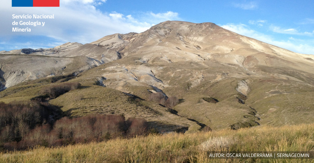
Chile , Puyehue / Cordon Caulle :
Special Report on Volcanic Activity (REAV), Los Lagos area, Puyehue / Cordon Caulle volcanic complex, March 04, 2022, 7:48 p.m. local time (mainland Chile).
The National Service of Geology and Mines of Chile (Sernageomin) publishes the following PRELIMINARY information, obtained through the monitoring equipment of the National Volcanic Monitoring Network (RNVV), processed and analyzed at the Volcanological Observatory of the Southern Andes ( Ovdas):
On March 04, 2022, at 7:28 p.m. local time (22:28 UTC), the monitoring stations installed near the Puyehue / Cordon Caulle volcanic complex recorded an earthquake associated with the fracturing of rocks (volcano-tectonic type) in the volcanic system.
The characteristics of earthquakes after their analysis are as follows:
ORIGINAL TIME: 7:28 p.m. local time (22:28 UTC)
LATITUDE: 40.492°S
LONGITUDE: 72.095°W
DEPTH: 2.5 km
LOCAL MAGNITUDE: 3.1ml
COMMENTS:
During the publication of this report, volcano-tectonic type events were recorded with lower local magnitudes, after the event above.
The volcanic technical alert remains at the Green level.
Source et photo : Sernageomin. ( Oscar Valderrama)
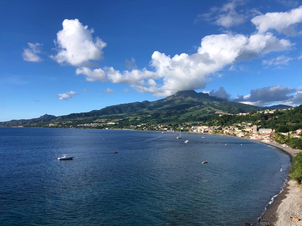
La Martinique , Mount Pelée :
Weekly report of the activity of Mount Pelée for the period from February 25 to March 04, 2022.
Between February 25, 2022 at 4 p.m. (UTC) and March 4, 2022 at 4 p.m. (UTC), the OVSM recorded at least 27 volcano-tectonic earthquakes of magnitude less than or equal to 1.1. These earthquakes were located inside the volcanic edifice between 0.7 and 0.9 km deep below the surface. This superficial volcano-tectonic seismicity is associated with the formation of micro-fractures in the volcanic edifice.
None of these earthquakes were felt by the population.
The zone of degassing at sea at shallow depth between St Pierre and le Prêcheur is still observed. The IGP took fluid samples in order to understand the origin of this degassing and to assess its possible relationship with the Mount Pelée hydrothermal system.
An extension of two areas of degraded vegetation located between Morne Plumé and the Chaude River was observed during a helicopter flight carried out on February 9, with the support of the Dragon 972, and confirmed by analysis of satellite images.
The alert level remains YELLOW: vigilance.
Source : Direction de l’OVSM IPGP.
Photo : rci.fm
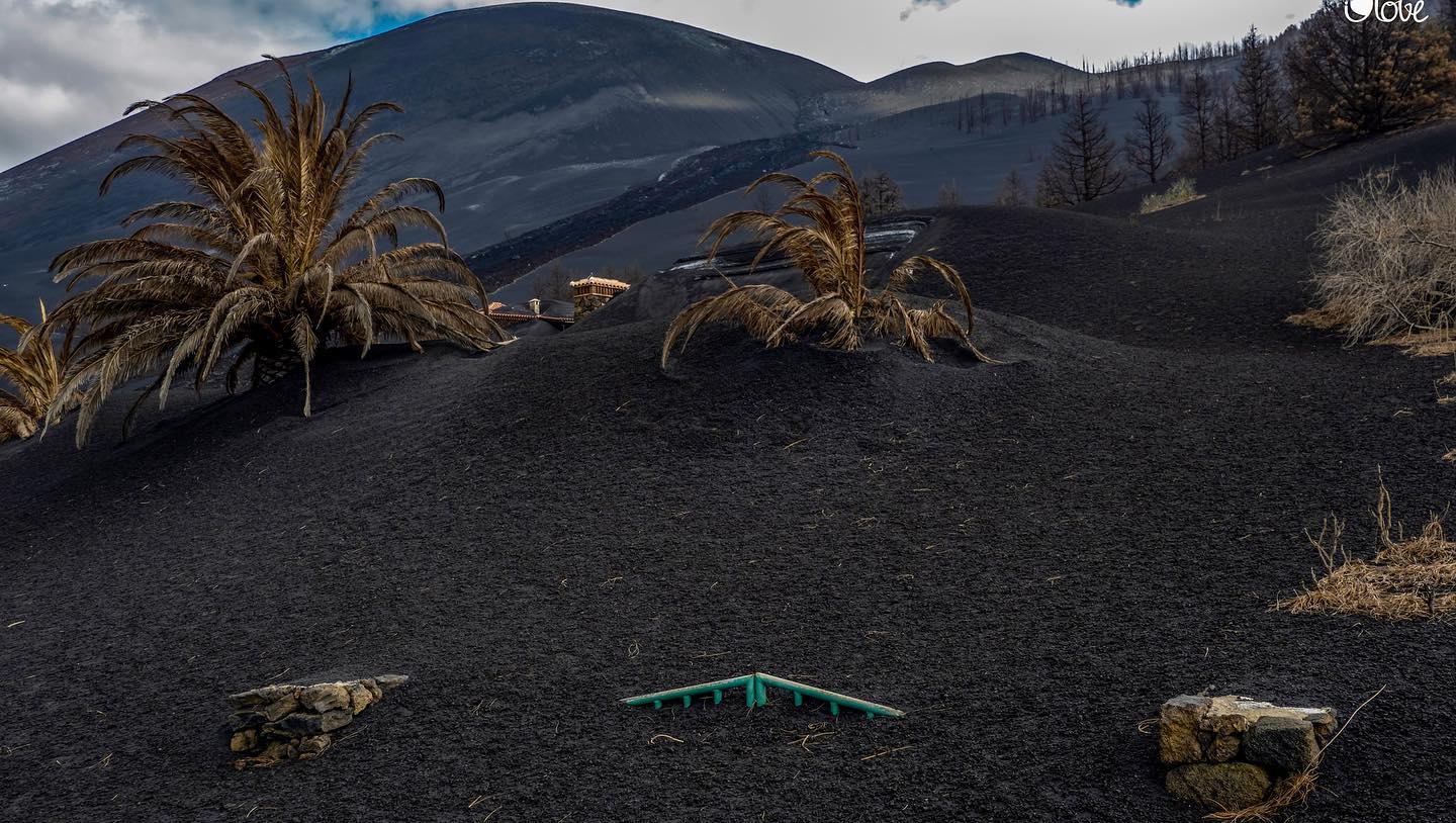
Canary Islands / La Palma , Cumbre Vieja / Tenerife :
Post-eruption activity on Cumbre Vieja, La Palma. 01 March 2022, 09:00 UTC.
In the last 7 days, since the last communication (February 22 at 9:00 UTC), 24 earthquakes have been located on the island of La Palma. The magnitudes are between 0.7 and 2.5 (mbLg). Two of these earthquakes were slightly felt by the population, with a maximum intensity of II-III (EMS98).
The location of the hypocenters continues under the central area of Cumbre Vieja, in the same areas as the previous days, at depths between 0 and 17 km. A single earthquake over this period, of magnitude 2.5 (mbLg), was located at a greater depth (34 km).
The network of permanent GNSS stations on the island does not show significant deformations that could be associated with volcanic activity.
March 05, 2022 – 9:45 p.m. Canary Islands. – La Palma had a small seismic swarm at a depth of 11-13 km
– This morning we had a small resumption of seismicity in La Palma, with a seismic swarm in the area of the Cumbre Vieja magmatic reservoir at 11-13 km depth which could indicate to us the closure of this one, this does not doesn’t seem like pressurization.
Tenerife is very quiet
Sources : IGN es , Volcanes y Ciencia Hoy .
Photo : I love the world.
Ecuador , Reventador :
DAILY REPORT OF THE STATE OF THE REVENTADOR VOLCANO, Saturday March 05, 2022.
Information Geophysical Institute – EPN.
Surface Activity Level: High, Surface Trend: No change.
Internal activity level: Moderate, Internal trend: No change.
Seismicity: From March 04, 2022, 11:00 a.m. to March 05, 2022, 11:00 a.m.:
Explosion (EXP) 19
Long Periods (LP) 23
Emission Tremors (TREMI) 22
Harmonic tremor (TRARM): 5
Rains / Lahars:
Rains were recorded in the volcano area but no lahars were generated.
Emission / ash column:
The Washington VAAC reported 3 emissions whose heights remained around 988 meters above crater level and in a westerly direction.
Gas:
The MOUNTS system recorded low values
Other Monitoring Parameters:
The FIRMS system records 1 thermal anomaly, while the MIROVA system records 1 moderate thermal anomaly (19 MW), during the last 24 hours.
Observation:
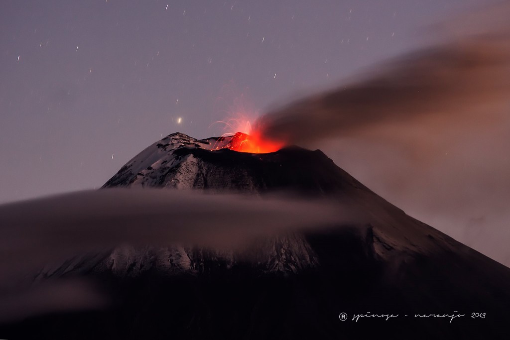
An emission from a height that exceeded 1000 meters above the level of the crater in a westerly direction was seen in the early morning. In addition, during the night, an incandescence was observed in the crater, accompanied by the descent of blocks up to 800 meters below the summit on the southeast flank. The sector was cloudy until the end of this press release
Alert level: Orange.
Source : IGEPN.
Photo : J-L Espinoza Naranjo .
Guatemala , Fuego :
Weather conditions: Clear weather
Wind: East at 25 km/h.
Precipitation: 0.0 mm.
Activity:
The Fuego Volcano Observatory reports 4 to 7 explosions per hour, with weak to moderate characteristics, which raise columns of gray ash to heights of 4,500 to 4,800 meters above sea level (14,764 to 15,748 feet). These spread westward over distances of up to 40 kilometers, causing light ash fall in Santa Sofía, El Porvenir, Panimaché I, Panimaché II and Morelia, as well as possibly on San Pedro Yepocapa and San Miguel Pochuta. The explosions produce moderate to strong avalanches, especially towards the Ceniza ravine, where a lava flow about 200 meters long has formed. Incandescent blocks are detached from the front of this flow and descend to the edge of the vegetation. During the night and early in the morning, incandescent pulses up to 300 meters above the crater were observed. The explosions produce low to moderate rumblings with shock waves that vibrate the roofs and windows of houses in communities near the volcano. Faint locomotive sounds are sometimes heard for periods of 5 to 10 minutes.
Source : Insivumeh.
Photo : Conred.

