October 24 , 2021.
Italy / Sicily , Etna :
Communication on ETNA activity, 23 October 2021, 10:35 (08:35 UTC).
The National Institute of Geophysics and Volcanology, Osservatorio Etneo, reports that at 08:20 UTC, the amplitude of the volcanic tremor is high.
The last tremor location, at 07:15 UTC, is near the Southeast Crater at a depth of approximately 3.0 km. The number of infrasound events during the last 10 minutes, at 08.07 UTC, is very high.
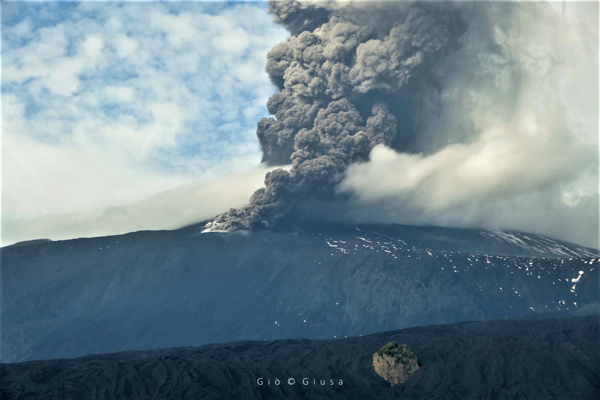
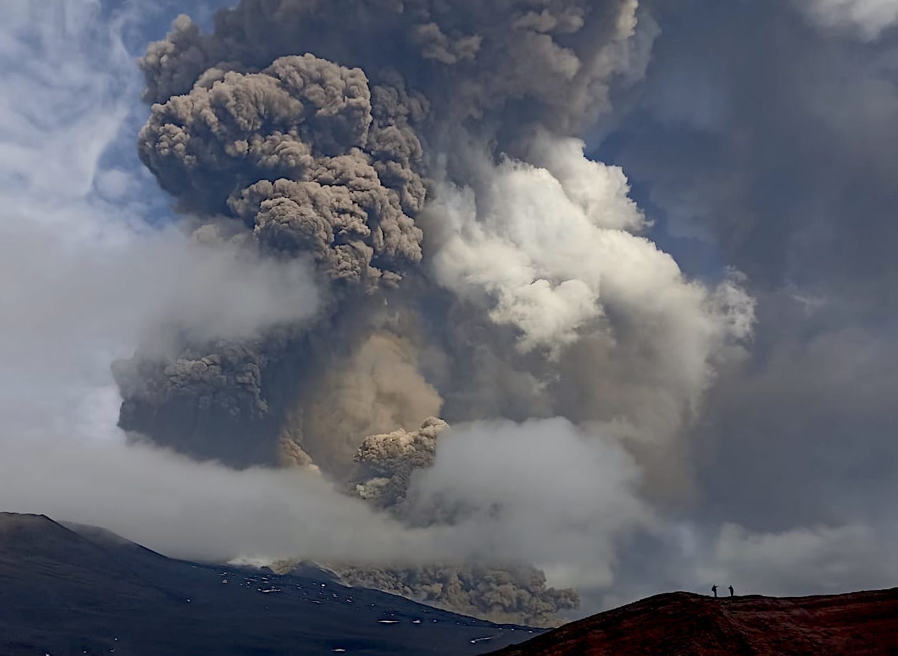
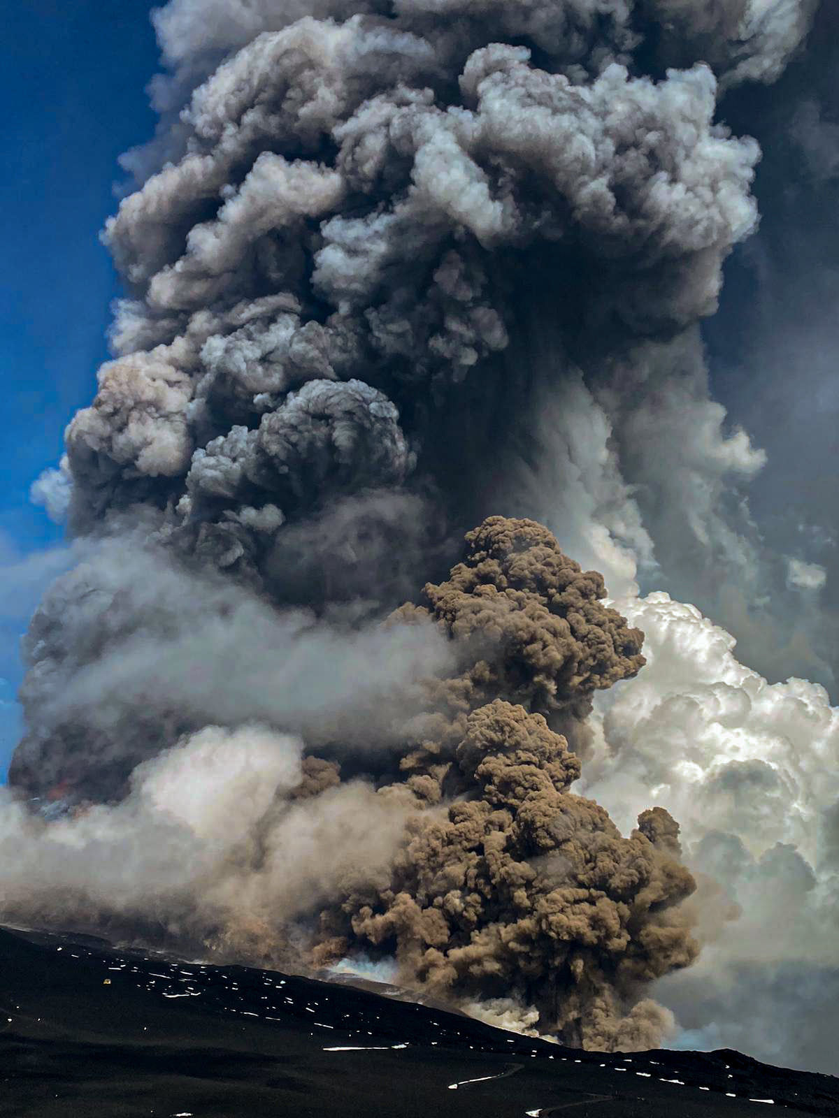
The last infrasound event is located near the Southeast Crater. From 08:15 UTC an increase in explosive activity is observed at the level of the Southeast Crater described in previous press releases. The activity produces an ash cloud that reaches an estimated height of 2 km above sea level and disperses eastward. Currently, the meteorological conditions allow a limited and discontinuous view of the phenomenon in progress from the network of cameras.
Some stations in the inclinometric network show slight variations in trend. The inclinometric station of the Cratere del Piano (ECP) shows a variation equal to approximately 0.8 microradians compatible with what was recorded during the last eruptive activities of the Southeast Crater.
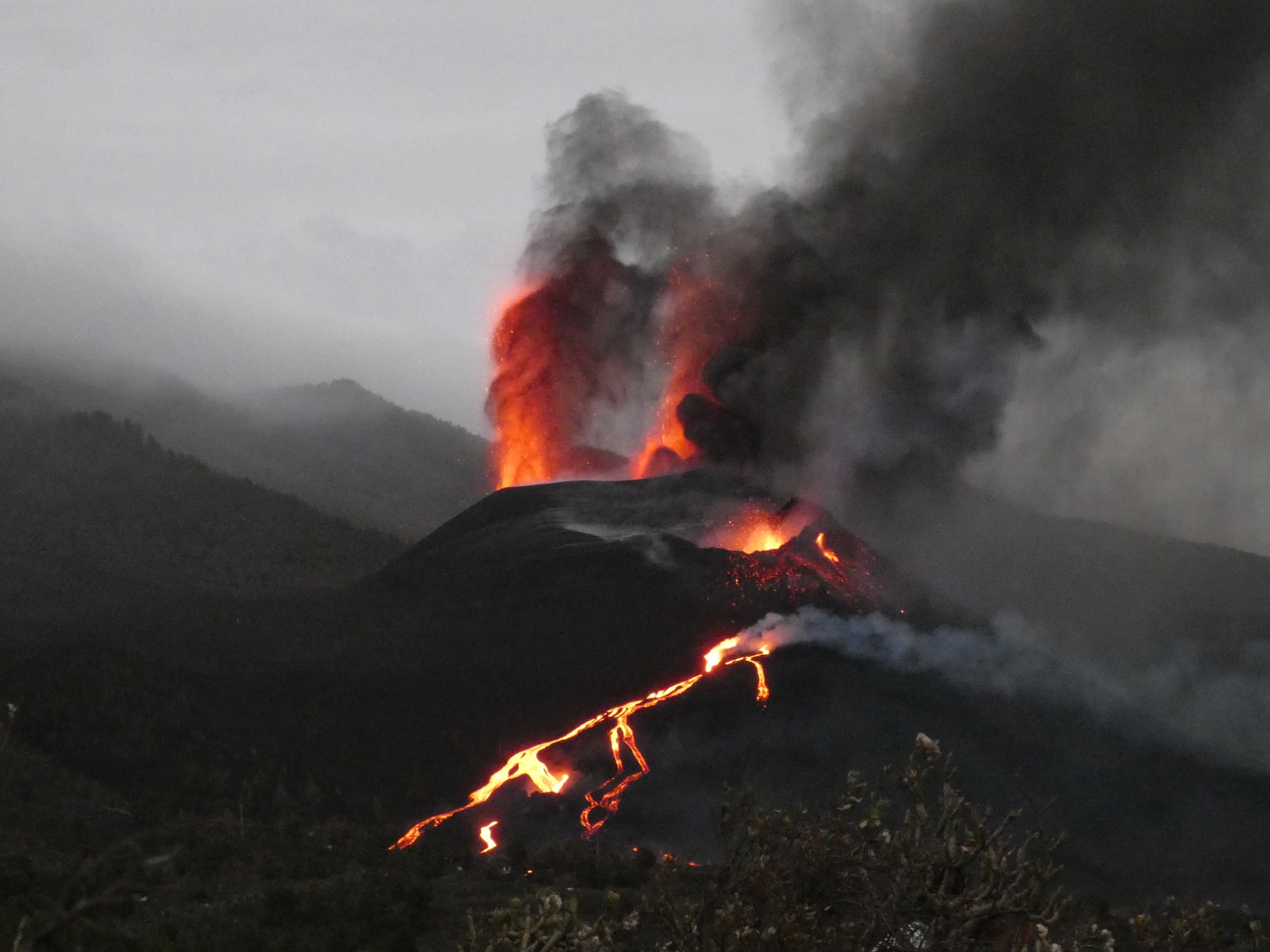
At 08:43 UTC , the Strombolian activity described in the previous press release rapidly evolved into the lava fountain stage.
At 08:49 UTC a flow of pyroclastic material was observed which detached from the east wall of the Southeast Crater towards the Bove valley.
11:34 (09:34 UTC): The activity of the lava fountain mentioned in the previous release continues. The ashes produced are directed by winds to the northeast. At approximately 08:48, 09:02 and 09:03 UTC, three flows of pyroclastic material occurred which detached from the east wall of the Southeast Crater, covering approximately 1.5 km in the Valle del Bove. There is also a lava flow from the eastern flank of the Southeast Crater which heads towards the Bove Valley. The current phenomena were observed with discontinuity by the network of cameras, due to unfavorable meteorological conditions. INGV staff in the field send direct information. At 09:37 UTC from the camera array, another flow of pyroclastic material was observed from the eastern flank of the Southeast Crater, which traveled approximately 1.5 km towards the Valle del Bove.
12:08 (10:08 UTC): At around 09:58 UTC, there was another flow of pyroclastic material from the eastern flank of the Southeast Crater. The flow split into two portions, the first heading south stopping after a few hundred meters, while the second heading towards the Bove Valley. The activity of the lava fountain, previously communicated, continues.
The activity produces an ash cloud directed towards the North-East, relapses of pyroclastic material have been reported in the towns of Piedimonte and Linguaglossa.
12:52 (10:52 UTC): around 10:20 UTC, the lava fountain of the Southeast Crater has ceased; a modest emission of ash continues. The lava flow which extends in the east direction continues to be fed. There have been reports of relapse of pyroclastic material also on Mascali.
INGV field staff report that there is a breach on the South-East side of the South-East Crater, from which the pyroclastic material flows described in previous press releases originate, and from which collapses. and small flows continue to be observed heading towards Valle del Bove reaching an altitude of around 2900.
After reaching the maximum amplitude at 10:00 UTC, the volcanic tremor began a rapid descent and at 10:20 UTC, its average values are further decreasing.
The last tremor location, at 09:15 UTC, is near the Southeast Crater at a depth of approximately 3.0 km. The number of infrasound events during the last 10 minutes at 10.12 UTC is very high.
The last infrasound event is located near the Southeast Crater.
Analysis of the inclinometric data of the paroxysmal event showed variations at different stations, with maximum cumulative values (equal to approximately 3 microradians) recorded at the Cratere del Piano (ECP) station. GNSS network data over the past few hours has not shown any significant changes.
19:32 (17:32 UTC): from the images of the surveillance camera network, it can be observed that the lava flow emitted by the eastern flank of the Southeast Crater which has spread into the Valle del Bove seems no longer be fed and gradually cool down. At 17.00 UTC the amplitude of the volcanic tremor is low. The last location of the tremor, at 4:15 p.m. UTC, is near the crater of Bocca Nuova at a depth of approximately 3.0 km.
The number of infrasound events in the last 10 minutes at 16.56 UTC is low.
The last infrasound event is located near the crater of Bocca Nuova. From the end of the paroxysmal event, the inclinometric network no longer shows any significant changes. The GNSS network does not show any significant changes either.
Further updates will be communicated shortly.
Source : INGV.
Photos : INGV ( Boris Behncke) , Gio Giusa , Guide Alpine Vulcanologiche Etna .
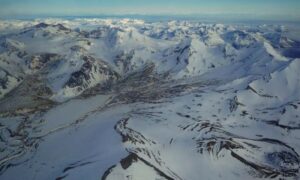
Spain / La Palma , Cumbre Vieja :
23 October 2021, 08:00 UTC. Eruptive activity continues on La Palma.
Since the last press release, 134 earthquakes have been located in the area affected by the volcanic reactivation of Cumbre Vieja, 18 of these earthquakes were felt by the population, the maximum intensity being in epicentral zone IV (EMS98) for 4 of these earthquakes .
The maximum magnitude was 4.3 mbLg during the earthquake at 7.28 a.m. (UTC) today, at a depth of 36 km.
12 earthquakes were located at a depth of about 30 km, the rest of the hypocenters of the period are located at a lesser depth, about 12 km.
The volcanic tremor signal maintains a high average amplitude, without intensification pulses.
The height of the emission column measured at 08:00 UTC is estimated at 3000 m.
The island’s network of permanent GNSS stations still does not show a clear tendency to warp from stations closest to eruptive centers, while at more distant stations a slight deflation is maintained, possibly related to deep seismicity. .
In the results obtained using InSAR, no significant variation was observed between the Sentinel1 images of October 16 and 22.
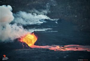
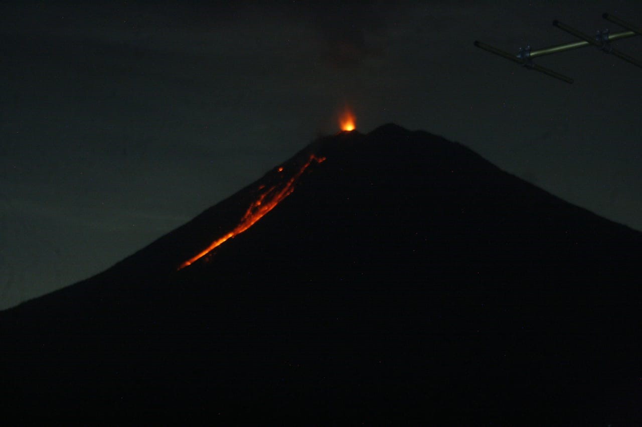
From the CAVE (Eruption Attention and Surveillance Center) lava spills are observed from the secondary cone.
Yesterday at 11:20 UTC, due to the decrease in the height of the volcanic ash cloud, the IGN issued a new VONA (Volcano Observatory Notice for Aviation) communicating that the maximum height of the cloud was 3500 m above the level from the sea. This VONA was sent, in accordance with the protocols of the International Civil Aviation, to the VAAC (Volcanic Ash Advisory Center) of Toulouse, to the ACC Canarias (Area Control Center) and to the AEMET (State Meteorological Agency) ).
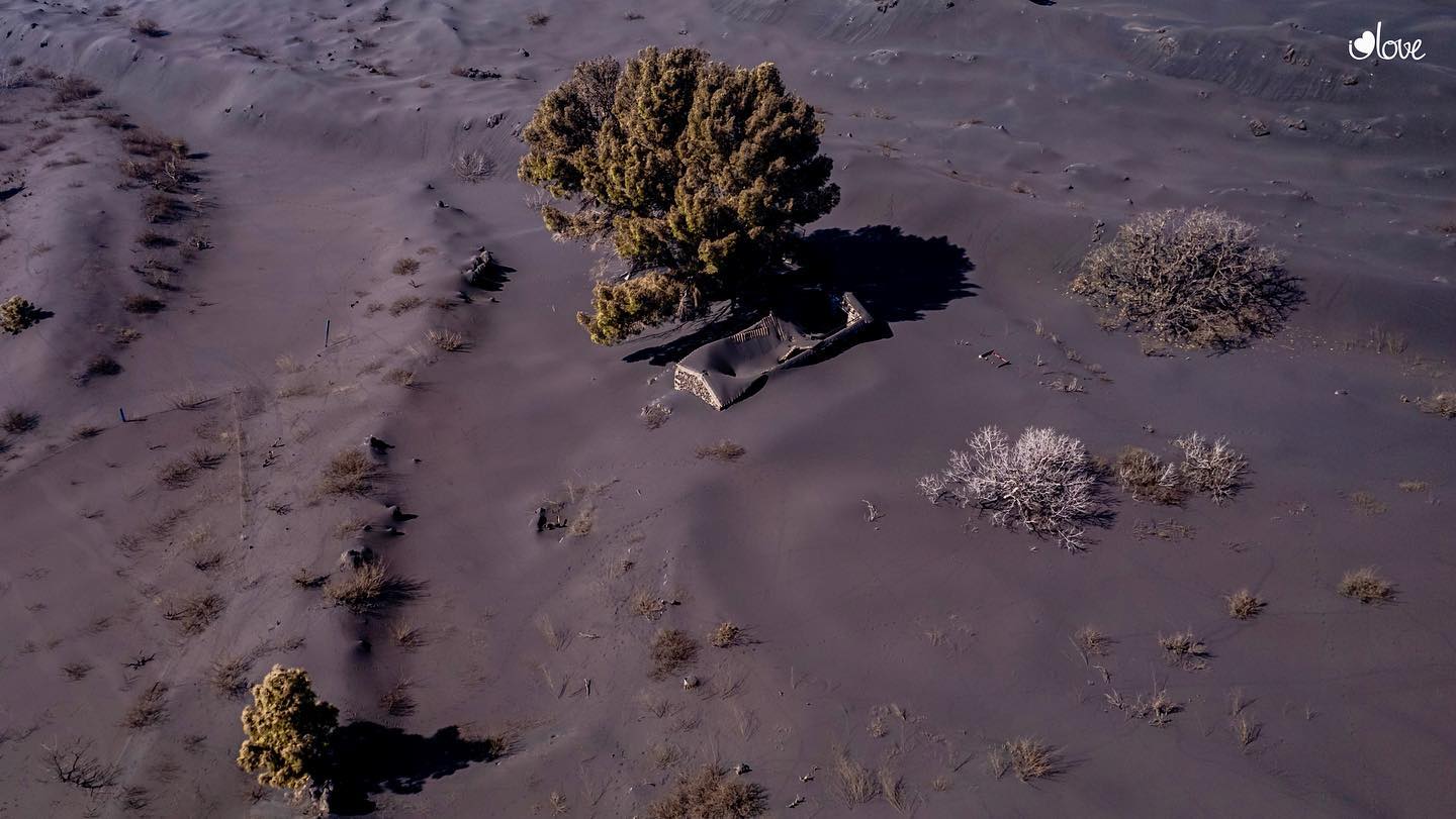
Part of the main cone of the Cumbre Vieja volcano on the island of La Palma suffered a collapse this morning, as reported by the Canary Islands Volcanological Institute (Involcan). Flows are currently slower and more viscous than in recent days and the gas and ash plume has reached 2,800 meters high, with an ash cloud heading south, allowing air navigation over the Isle. In this sense, the latest data from the European Copernicus program corresponding to yesterday suggests that the lava expelling the volcano had affected 886.6 hectares of surface in La Palma and destroyed 2,122 infrastructures, while the ash covered 6,800 hectares of land.
With regard to air quality, the levels of SO2 (sulfur dioxide) are below the thresholds dangerous for health and were only exceeded yesterday in PM10 particles due to the movement of ash in the stations of Santa Cruz de La Palma and Los Llanos de Aridane.
A 4.9 magnitude earthquake recorded at 38 kilometers deep rocked La Palma yesterday afternoon at 4:34 p.m. Canary Island time, the biggest shake since the volcano erupted just over a month ago.
Source : IGN es. El Pais.
Photos : i love the world , Micha Fürer .
Indonesia , Semeru :
Level of activity atLevel II (WASPADA). Mount Semeru (3,676 m above sea level) erupts intermittently. There are explosive and effusive eruptions, producing lava flows towards the south and south-eastern slopes, as well as ejections of incandescent rocks around the summit crater. The last eruption occurred on October 22, 2021, and the height of the eruption column was not observed.
The volcano is clearly visible until it is covered by fog. No smoke from the crater was observed. The weather is cloudy, the wind is weak in the West. The air temperature is around 23-34 ° C.
According to the seismographs of October 22, 2021, it was recorded:
57 eruption / explosion earthquakes
13 earthquakes of emissions
1 deep volcanic earthquake
1 felt earthquake
1 distant tectonic earthquake.
VOLCANO OBSERVATORY NOTICE FOR AVIATION – VONA
Issued : October 21 , 2021
Volcano : Semeru (263300)
Current Aviation Colour Code : ORANGE
Previous Aviation Colour Code : orange
Source : Semeru Volcano Observatory
Notice Number : 2021SMR61
Volcano Location : S 08 deg 06 min 29 sec E 112 deg 55 min 12 sec
Area : East java, Indonesia
Summit Elevation : 11763 FT (3676 M)
Volcanic Activity Summary :
Eruption with volcanic ash cloud at 02h00 UTC (09h00 local).
Volcanic Cloud Height :
Best estimate of ash-cloud top is around 12403 FT (3876 M) above sea level, may be higher than what can be observed clearly. Source of height data: ground observer.
Other Volcanic Cloud Information :
Ash-cloud moving to southwest.
Source : PVMBG , Magma Indonésie.
Photo : PVMBG.
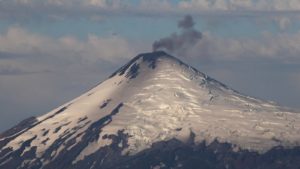
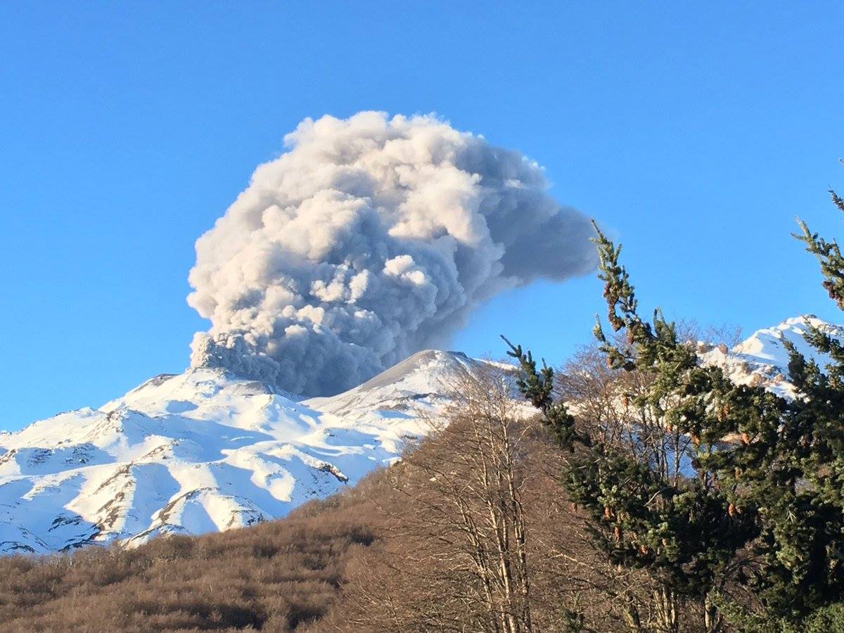
Chile , Nevados de Chillan :
Special Report on Volcanic Activity (REAV), Ñuble region, Nevados de Chillán volcanic complex, October 23, 2021, 4:12 a.m. local time (Continental Chile).
The National Service of Geology and Mines of Chile (Sernageomin) publishes the following PRELIMINARY information, obtained thanks to the monitoring equipment of the National Volcanic Monitoring Network (RNVV), processed and analyzed at the Volcanological Observatory of the Southern Andes ( Ovdas):
On Saturday 23 October 2021, at 03:44 local time (06:44 UTC), the monitoring stations installed near the volcanic complex of Nevados de Chillán recorded an earthquake associated with fluid dynamics (long period type) in the volcanic system.
The characteristics of earthquakes after their analysis are as follows:
ORIGINAL TIME: 03:44 local time (06:44 UTC)
LATITUDE: 36.856 ° S
LONGITUDE: 71.371 ° W
DEPTH: 2.9 km
REDUCED DISPLACEMENT: 670.77 (cm2)
ACOUSTIC SIGNAL: 94.27 pascals (Pa) reduced to 1 km
The characteristics of the surface activity are as follows:
MAXIMUM HEIGHT OF THE COLUMN: 400 meters above the point of emission
DISPERSION DIRECTION: Not visible
OBSERVATIONS:
At the time of this report, surface activity persists, characterized by pulsatile emissions of incandescent materials in the crater area.
The volcanic technical alert remains at the Yellow level.
Source : Sernageomin.
Photo : Noticias De Los Volcanes De Chile.
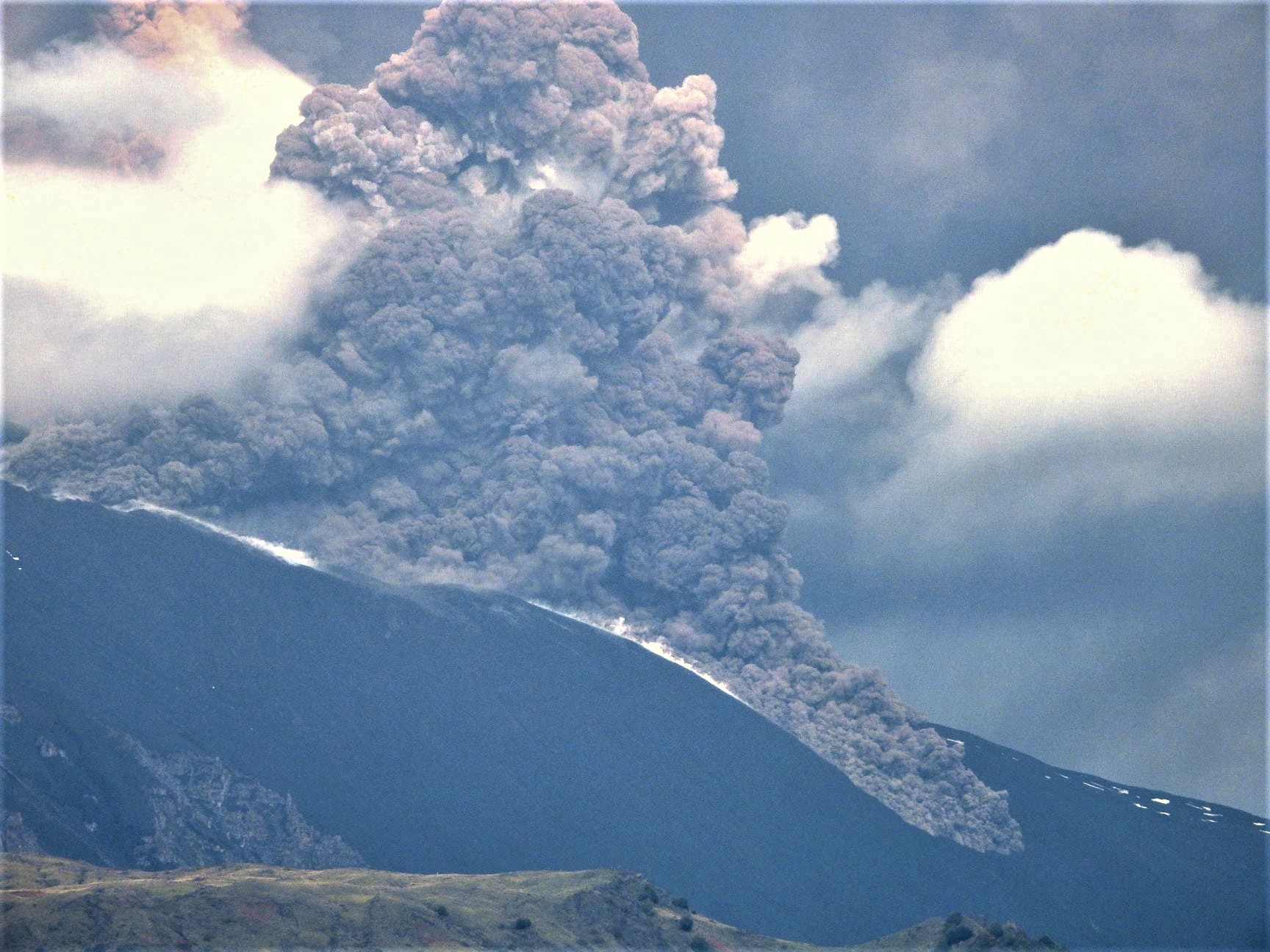
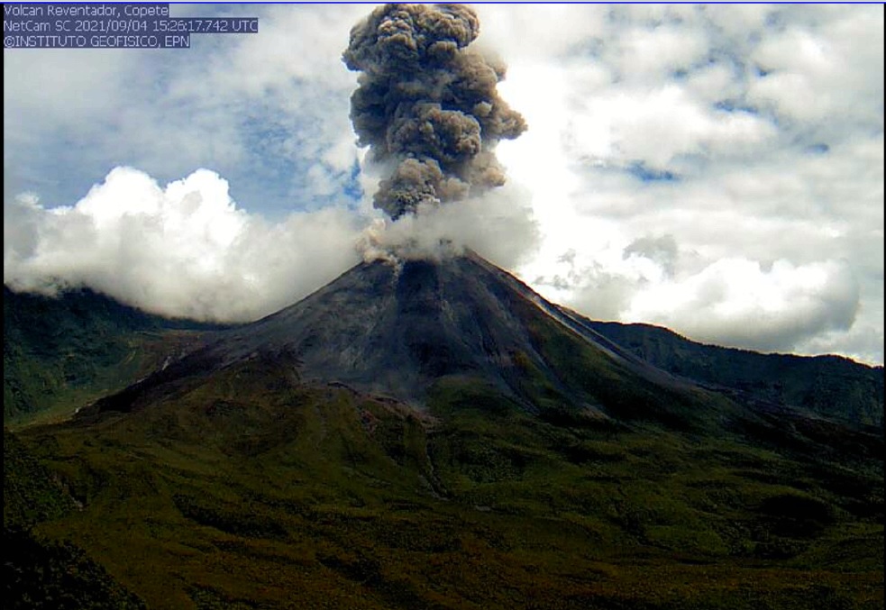
Ecuador , Reventador :
DAILY REPORT OF THE STATE OF THE REVENTADOR VOLCANO, Saturday 23 October 2021.
Information Geophysical Institute – EPN.
Surface activity level: High, Surface trend: No change.
Internal activity level: Moderate, Internal trend: No change.
Seismicity: From October 22, 2021, 11:00 a.m. to October 23, 2021, 11:00 a.m.
The seismic statistics were carried out at the Cascales station, due to the persistent intermittence in the local network of the Reventador volcano.
Explosion (EXP): 42 events
Rains / lahars: Light rains were recorded in the volcano area, which did not generate lahars.
Emission column / ash:
Several gas and ash emissions were recorded which exceeded 1000 altitude with the West and North-West direction. The Washington VAAC reported various ash emissions from 988 m to 1338 m altitude, in the northwest and west directions.
Other monitoring parameters:
MIROVA records 1 low thermal anomaly at Reventador in the last 24 hours.
Observation:
At night and early in the morning, several explosions, incandescence in the crater and the descent of incandescent material up to 500 m altitude on all sides of the volcano were observed.
Alert level: Orange.
Source et photo (archive) : IG-EPN.