November 12 , 2019.
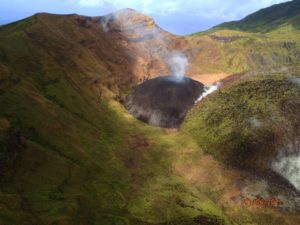
Peru , Ubinas :
Period of analysis: November 4 to 10, 2019. Arequipa, November 11, 2019
Current alert level: ORANGE
The Geophysical Institute of Peru (IGP) reports that the eruptive activity of the Ubinas volcano remains low. To date, the energy of earthquakes associated with the rise of magma at the surface has decreased. Sporadic emissions of bluish gas (of magmatic origin) and water vapor, observed with surveillance cameras, are recorded. In this scenario, the possibility of recording volcanic explosions and / or ash emissions is low.
During the period from 4 to 10 November 2019, the IGP recorded and analyzed a total of 935 seismic events associated with the eruptive process of the Ubinas volcano, with a predominant seismicity of the volcano-tectonic (VT) type, related to fracturing of rock inside the volcano, with an average value of 90 events per day, all with magnitudes less than M2.4. There was a slight increase in the number of seismic signals that would be related to the rise of the magma (hybrid type), which recorded an average of 58 earthquakes per day during this period. In addition, there has been no volcanic explosion since September 12th.
The surveillance cameras recorded light and sporadic emissions of blue gas (magmatic origin), with heights less than 1,000 m above the volcano’s summit. The monitoring of the deformation of the volcanic structure, using GNSS data (processed with fast orbits), presents no anomalies. The MIROVA satellite monitoring recorded 1 thermal anomaly with a value of 1 MW.
Source : IGP.
Photo : Auteur Inconnu
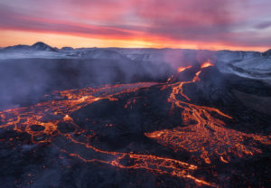
Alaska , Shishaldin :
54°45’19 » N 163°58’16 » W,
Summit Elevation 9373 ft (2857 m)
Current Volcano Alert Level: WATCH
Current Aviation Color Code: ORANGE
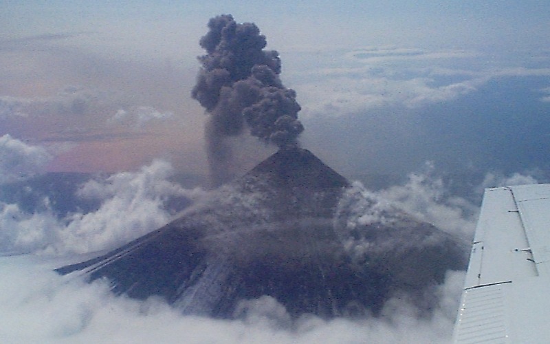
Ash plume rises from Shishaldin Volcano during strombolian eruptive activity at the summit crater. Shishaldin is one of the most active volcanoes in the Aleutian arc, erupting at least 28 times since 1775 (including the April 1999 activity); the previous eruption occurred in late 1995 and early 1996 and consisted of minor explosions that produced low-level steam and ash emissions. The volcano is situated on that part of the Aleutian volcanic arc where the maximum rate of subduction occurs (about 7.5 cm/year).
Activity at Shishaldin has increased significantly over the past day with fire-fountaining observed in web camera views throughout the evening and night. Strongly elevated surface temperatures have been observed at the summit and along the flanks since yesterday afternoon. Minor to moderate ash emissions (up to 12,000 feet a.m.s.l. drifting to the north) have been observed through web camera views as well as pilot reports. Seismicity over the past day increased significantly. Seismic tremor has stabilized and remains high over the past 6 hours. Infrasound from Shishladin has been observed at stations in Sand Point.
Shishaldin is monitored by local seismic and infrasound sensors, satellite data, a web camera, a telemetered geodetic network, and distant infrasound and lightning networks.
Source : AVO
Photo : R. McGimsey , 23 avril 1999.
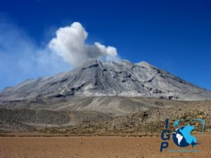
Kamchatka , Sheveluch :
VOLCANO OBSERVATORY NOTICE FOR AVIATION (VONA).
Issued: 20191111/2040Z
Volcano: Sheveluch (CAVW #300270)
Current aviation colour code: ORANGE
Previous aviation colour code: orange
Source: KVERT
Notice Number: 2019-171
Volcano Location: N 56 deg 38 min E 161 deg 18 min
Area: Kamchatka, Russia
Summit Elevation: 10768.24 ft (3283 m), the dome elevation ~8200 ft (2500 m)
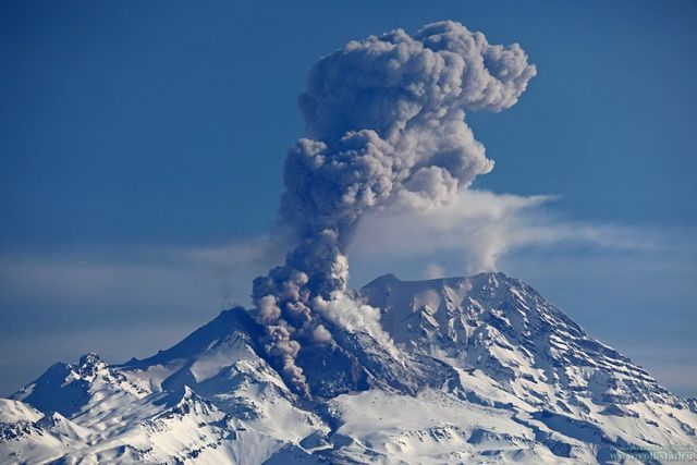
Volcanic Activity Summary:
An activity of the volcano continues. Satellite data by KVERT showed an ash cloud drifting about 55 km to the east-south-east from the volcano.
Explosive-extrusive eruption of the volcano continues. Ash explosions up to 32,800-49,200 ft (10-15 km) a.s.l. could occur at any time. Ongoing activity could affect international and low-flying aircraft.
Volcanic cloud height:
31160-32800 ft (9500-10000 m) AMSL Time and method of ash plume/cloud height determination: 20191111/1853Z – NOAA 18 (4m5)
Other volcanic cloud information:
Distance of ash plume/cloud of the volcano: 34 mi (55 km)
Direction of drift of ash plume/cloud of the volcano: ESE / azimuth 103 deg
Time and method of ash plume/cloud determination: 20191111/1853Z – NOAA 18 (4m5)
Start time of explosion and how determined: 20191111/1700Z – Video data
Source : Kvert .
Photo : volkstat ru.
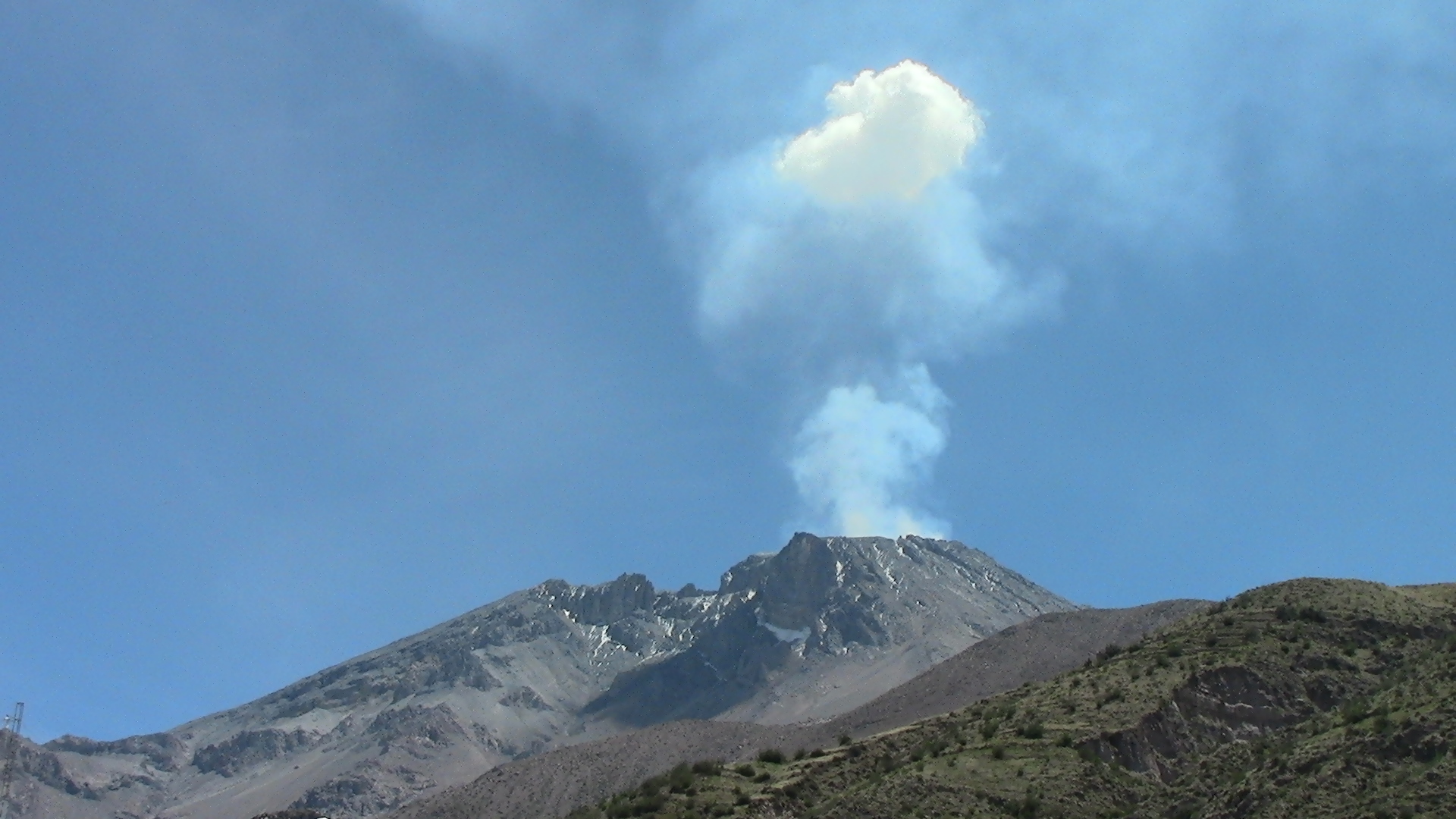
Peru , Sabancaya :
Period of analysis: November 4 to 10, 2019 Arequipa, November 11, 2019
Alert level: ORANGE
The Geophysical Institute of Peru (IGP) reports that the eruptive activity of the Sabancaya volcano is maintained at moderate levels; that is, with the recording of continuous moderate explosions and the resulting ash emission. Therefore, for the following days, no significant change is expected.
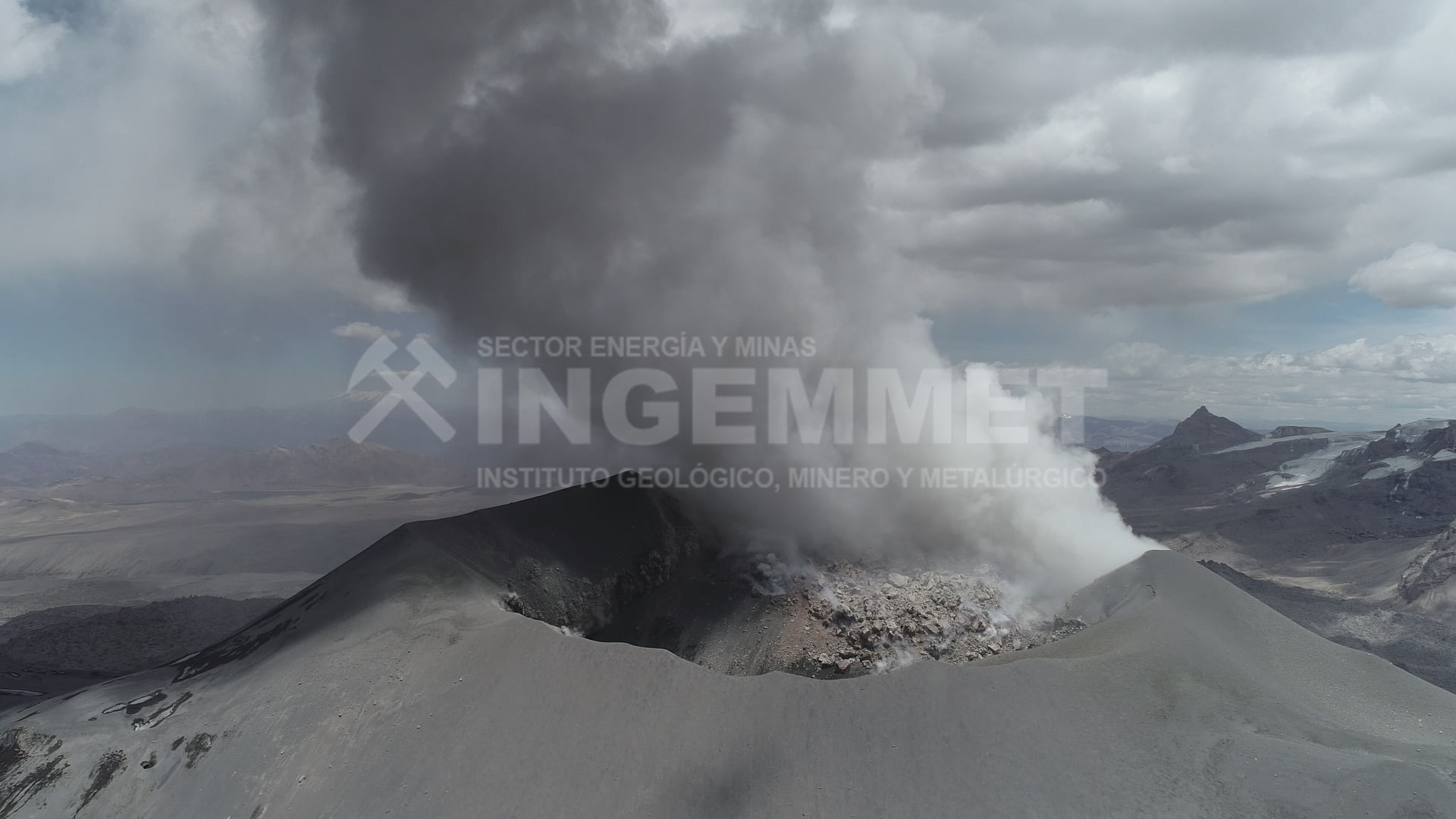
The analysis of records obtained from the seismic network of the Sabancaya volcano for the period from 4 to 10 November 2019 has identified the occurrence of about 2059 earthquakes of volcanic origin, the highest percentage being associated with the movements of magmatic fluids. During this week, an average of 58 explosions per day of average to low intensity were observed.
The monitoring of the deformation of the volcanic structure, using GNSS data (processed with fast orbits), presents no significant anomalies. Visual surveillance, using surveillance cameras, allowed us to identify the appearance of columns of gas and ash up to 2.5 km high at the top of the volcano, which dispersed in the western sectors, Southwest and South of Sabancaya. Satellite monitoring has identified 7 volcanic anomalies on the volcano with a value between 3 and 9 MW, associated with the presence of a lava dome in the volcano crater of about 240 m of diameter.
Source : IGP