August 31 , 2019.
Italy , Stromboli :
New paroxysm on Stromboli, August 28, 2019.
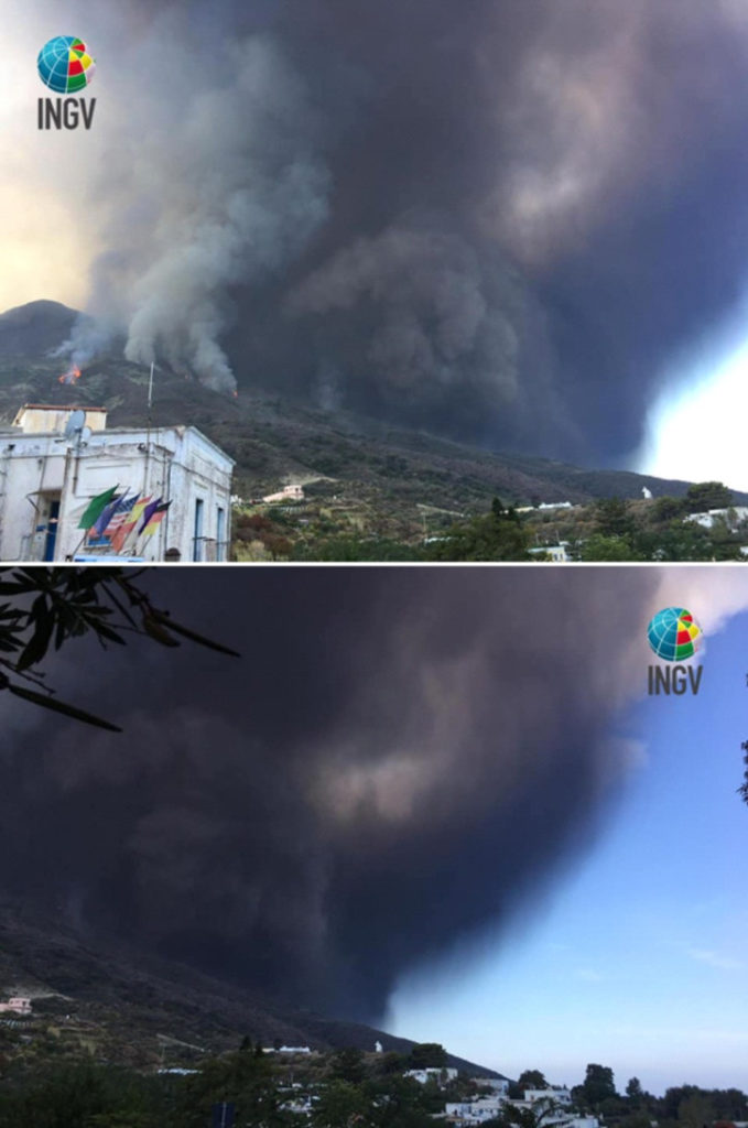
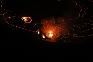
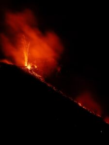
A new violent and high intensity explosive eruption occurred on Stromboli on August 28, 2019 at 12:17 local time (Figure 1).
Figure 1. – The two images illustrate Stromboli’s paroxysmal eruption on August 28, 2019, taken from the INGV center on the island. Photo of Alessandra Esposito (INGV Rome).
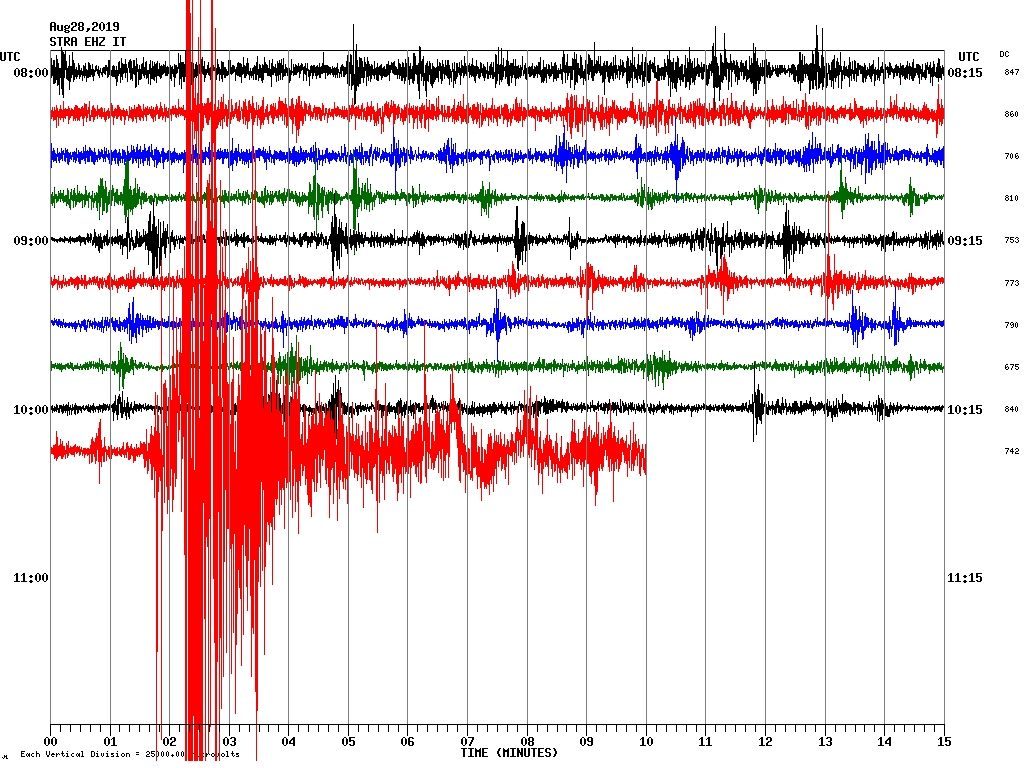
It was a new paroxysmal event that produced an eruption column that rose about 4 km above the summit area. The eruption was composed of three explosive events, recognizable by the seismic pattern of the STR4 station (Figure 2).
Figure 2. The seismic plot of the STR4 station shows the succession of events that characterized the paroxysm of August 28, 2019.
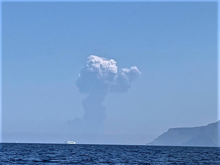
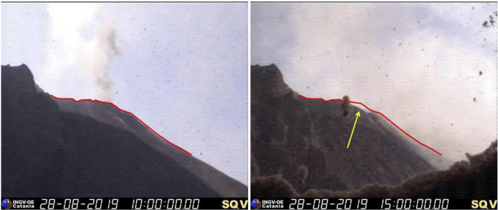
The first two explosions took place in the area of the Center-Sud crater and a third one, of less intensity, occurred twenty seconds later in the North zone. The latter was a lateral explosion whose products overflowed on the Sciara del Fuoco. Similarly, materials from the collapse of the eruptive column fell back into the Sciara, contributing to a high turbulence pyroclastic flow that then spread into the sea over several hundred meters (Figure 3). The explosion sequence introduced morphological changes in the northern zone of the crater terrace overlooking the Sciara del Fuoco (Figure 4).
Figure 3. The eruptive column rises on the crater of Stromboli, seen from the island of Salina. Photo of Diego Buda.
Figure 4. The photos taken by the INGV camera at 400 m altitude at the northern end of the Sciara del Fuoco show the partial collapse of the crater rim overlooking the Sciara del Fuoco, which occurred during the paroxysmal event.
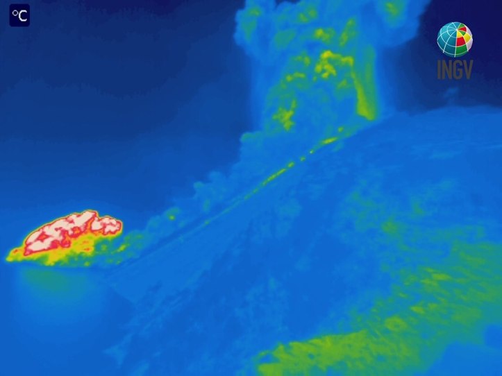
The paroxysm was taken up by the Etneo Observatory camera located along the northern boundary of the Sciara del Fuoco, at an altitude of 400 m (https://youtu.be/atPbjmvaC9s). Other images come from the new thermal camera installed on the south side of the Sciara del Fuoco: on the right, we can see the eruptive column that develops above the craters, while on the left we can see the pyroclastic flow which, after having traveled all the Sciara, flows into the sea where the hottest and lightest part continues to spread on the surface of the water (Figure 5).
Figure 5. Image taken with the thermal camera located in Punta dei Corvi, south of Sciara del Fuoco. In the image, the eruption column is distinguished on the right, while on the left, the pyroclastic flow has reached the coast line and is spreading over the water.
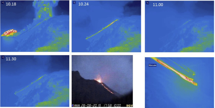
Once again, the morphology of the crater terrace has changed a lot. The complex of small cones of slag, which had developed around the eruptive mouths of the north crater center in recent weeks, was completely destroyed and the edge of the crater on the Sciara side collapsed, allowing the magma to overflow and to form a lava flow, which reached the coast at night (Figure 6).
Figure 6. The images, taken at different times, show the evolution of the August 28 eruption. After the paroxysm that generated the pyroclastic flow (top left), the Strombolian activity is resumed as well as the effusive activity, generated by an overflow of the North zone of the crater terrace. At 18:45, the casting reached the coast, as shown in the last image, taken from the thermal camera of the INGV 190 m north of the Sciara del Fuoco. The times shown on each image refer to the international UTC system (two hours after local time).
On the evening of August 29 at 21:23 (local time), the thermal and visible surveillance cameras made it possible to observe an overflow of lava from the northern zone of the crater terrace, which spilled onto the Sciara del Fuoco but is stopped at a medium-high altitude. As often happens, the material that comes off the lava front rolls along the Sciara to reach the shoreline.
At 22:43 (local time), a new sequence of explosions occurred in the Center-South zone of the crater terrace, with pyroclastic material falling on the town of Ginostra. Another explosion, of lesser intensity, was recorded at 11:29 pm. In the early hours of August 30, an overflow of lava from the Center-South crater generated a flow that reached the coast at dawn. However, the entry of lava into the sea lasted only a short time (Figure 7).
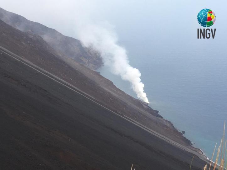
Figure 7. Entry into the sea of a lava flow emitted by the Central South crater area at dawn on August 30, 2019, seen from the northern ridge of the Sciara del Fuoco at 400 m altitude. Photo of Alessandro La Spina (INGV-Osservatorio Etneo).
This is the second paroxysmal event that affected Stromboli after that of July 3, 2019. Between the paroxysms of July 3 and August 28, the crater area was affected by intense Strombolian activity that affected all craters and small lava flows, particularly the Central-South Crater Zone. They spilled over the upper reaches of the Sciara without ever reaching the sea. Often, during the same period, the explosive activity was characterized by numerous ash emissions, especially the first week of August, when numerous ash fallout occurred in the town of Stromboli (area of S. Bartolo, Scari and Piscità).
This is not the first time that two paroxysmal events occur one after another: between November 1915 and July 1916 and between September and October 1930, several paroxysms took place over a few months.
COMMUNICATION on the volcanic activity of August 30, 2019, 13:59:50 (UTC) – STROMBOLI.
The National Institute of Geophysics and Volcanology, Osservatorio Etneo, reports that, during the overview conducted today by the staff of the INGV and through the analysis of the images of the cameras, it was found that the lava flow from the South Central Zone that started around 01:50 UTC on August 30 had stopped. As a result, the lava field cools gradually.
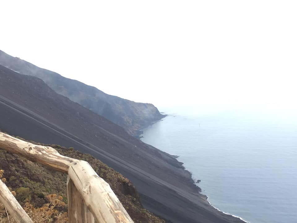
Photos of Alessandro La Spina, INGV, acquired during the surveillance and restoration of instruments damaged by recent explosive activities.
The flow of SO2 detected by the FLAME network from 09:00 UTC showed a moderate decrease placing the degassing regime at a medium-high level.
The average amplitude of volcanic tremor over the past few hours has shown a gradual decrease, reaching values comparable to those observed before the explosion sequence described in update release number 32. Currently, the amplitude shows fluctuations around mid-high values.
The Department of Civil Protection ordered the passage of the alert level for Stromboli Volcano from yellow to orange level and the activation of the operational phase « Rapid Alert », as provided for in the national emergency plan for the island of Stromboli. This decision was taken in the light of the assessments that were revealed at today’s meeting with the centers of competence, the Department of Civil Protection of the Sicilian region and acquired the opinion of the commission of large risks, which met today in Rome.
Source : INGV Vulcani.
Kamchatka , Sheveluch :
VOLCANO OBSERVATORY NOTICE FOR AVIATION (VONA).
Issued: August 30 , 2019
Volcano: Sheveluch (CAVW #300270)
Current aviation colour code: ORANGE
Previous aviation colour code: orange
Source: KVERT
Notice Number: 2019-128
Volcano Location: N 56 deg 38 min E 161 deg 18 min
Area: Kamchatka, Russia
Summit Elevation: 10768.24 ft (3283 m), the dome elevation ~8200 ft (2500 m)
Volcanic Activity Summary:
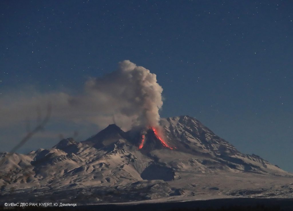
According to video data, exlposions sent ash up to 7.0-7.5 km a.s.l., ash emissions continues. Ash plume extend to the south-east of the volcano.
Explosive-extrusive eruption of the volcano continues. Ash explosions up to 32,800-49,200 ft (10-15 km) a.s.l. could occur at any time. Ongoing activity could affect international and low-flying aircraft.
Volcanic cloud height:
22960-24600 ft (7000-7500 m) AMSL Time and method of ash plume/cloud height determination: 20190830/0757Z – Video data
Other volcanic cloud information:
Distance of ash plume/cloud of the volcano: 31 mi (50 km)
Direction of drift of ash plume/cloud of the volcano: SSE / azimuth 158 deg
Time and method of ash plume/cloud determination: 20190830/0800Z – Himawari-8
Source : Kvert .
Photo : Yu. Demyanchuk. IVS FEB RAS, KVERT.
Mexico , Colima :
Weekly technical bulletin on the activity of the Colima volcano, Date: August 30, 2019 Newsletter n ° 136.
Seismic activity:
Last week, 23 high frequency (HF) events, 4 long period (LP) events, 20 landslides and 11.3 min of low amplitude trenches were automatically counted. There were also 2 lahars in the Montegrande Canyon and 1 in the Lumbre Canyon.
Visual observations:
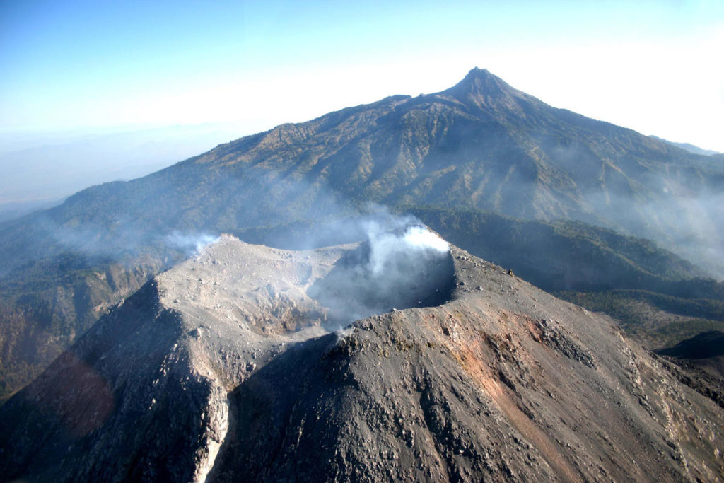
Intermittent steam and gas emissions from the northeast side of the crater continue to be recorded during the reporting period, although new fumaroles have also been observed in the western part. When clouds allowed, the fixed thermal camera located to the south of the volcano detected thermal anomalies related to the fumaroles activity during the last week.
Geochemistry:
On August 29, SO2 flow was measured, the value was below the detection level of the instrument.
Remote perception:
No thermal anomalies detected by the MIROVA satellite system were observed during the last week.
Diagnostic:
The volcano maintains an explosive activity of low intensity. The occurrence of these events indicates that the gas probably associated with the moving magma has reached surface levels. This activity can continue and increase in intensity over the following days or weeks. The staff in charge of monitoring the volcano monitors any changes and developments in the activity.
Possible scenarios from days to weeks:
1. Low to moderate explosions continue.
2. There is new growth of lava domes at the top with collapses of incandescent material and lava flows.
Source : UCOL.
Photo : proceso.com.mx ( archives).
Philippines , Taal :
TAAL VOLCANO BULLETIN 31 August 2019 8:00 A.M.
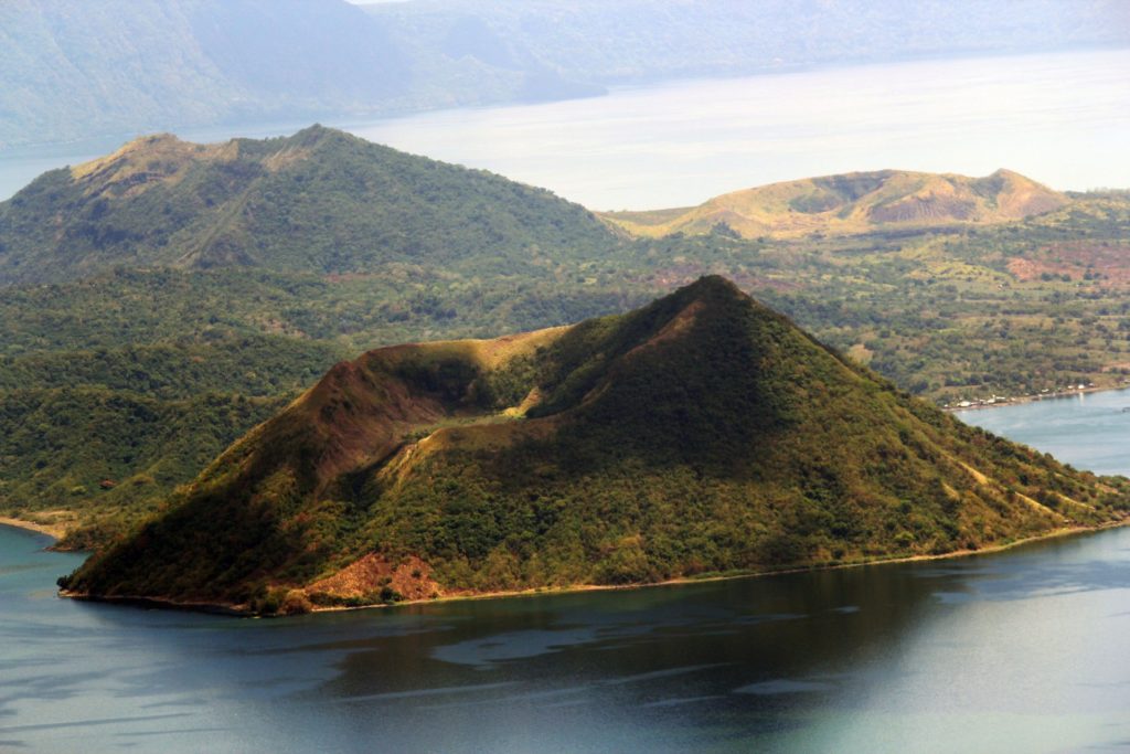
Taal Volcano’s seismic monitoring network recorded fourteen (14) volcanic earthquakes during the 24-hour observation period. Field measurements on 29 August 2019 at the eastern sector of the Main Crater Lake yielded a decrease in water temperature from 32.6°C to 32.3°C, a decrease in water level from 0.42 meter to 0.39 meter, and a decrease in acidity from a pH of 2.78 to 2.87. Ground deformation measurements through precise leveling surveys from 15 – 24 June 2019 indicated slight inflation of the edifice consistent with recent results from continuous GPS data.
Alert Level 1 remains in effect over Taal Volcano. This means that hazardous eruption is not imminent. The public, however, is reminded that the Main Crater should be strictly off-limits because sudden steam explosions may occur and high concentrations of toxic gases may accumulate. The northern portion of the Main Crater rim, in the vicinity of Daang Kastila Trail, may also become hazardous when steam emission along existing fissures suddenly increases. Furthermore, the public is also reminded that the entire Volcano Island is a Permanent Danger Zone (PDZ), and permanent settlement in the island is strongly not recommended.
Source : Phivolcs.
Photo : publicdomaine

