October 29 , 2018.
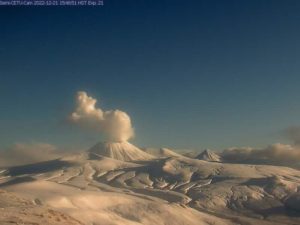
Alaska , Veniaminof :
56°11’52 » N 159°23’35 » W,
Summit Elevation 8225 ft (2507 m)
Current Volcano Alert Level: WATCH
Current Aviation Color Code: ORANGE

The eruption continues at Veniaminof volcano and is characterized by minor lava spattering and effusion of a lava flow from the cone in the ice-filled summit caldera. Seismicity consists of low-amplitude continuous tremor and satellite views of the volcano showed elevated surface temperatures from the active lava effusion. Diffuse ash emissions were observed in web camera images at times over the past day and the resulting plume typically dissipates rapidly. Ash emissions are typically not accompanied by an increase in seismic tremor and trace ashfall is possible in nearby communities if ash emissions increase under favorable wind conditions.
Veniaminof Volcano is monitored with a local real-time seismic network, which will typically allow AVO to detect changes in unrest that may lead to an explosive eruption. Rapid detection of an ash-producing eruption would be accomplished using a combination of seismic, infrasound, lightning, and satellite data.
Source : AVO
Photo : Laker , Mark , 26 Septembre 2018
Indonesia, Anak Krakatau :
Level II Activity Level (WASPADA). G. Anak Krakatau (338 m) has experienced an increase in volcanic activity since 18 June 2018.
Since yesterday and until this morning, the volcano was visually covered with mist. The smoke from the crater was not observed. The wind is blowing weakly to the east.
According to the seismographs, on October 28, 2018, it was recorded:
58 eruption earthquakes
24 deep volcanic earthquakes.
28 shallow volcanic earthquakes.
7 earthquake emission.
A tremor is recorded continuously with an amplitude of 2 to 32 mm (8 mm dominant value).
Anak Krakatau (Son of Krakatau) is the currently active part of the famous Krakatau volcano (also called Krakatoa).
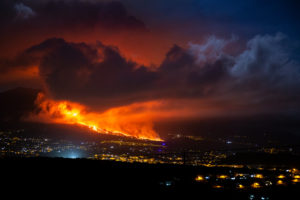
The video shows the Vulcanian / Strombolian activity in October 2018, filmed from the neighboring island of Rakata, a remnant of the volcanic structure that existed before the devastating eruption of 1883.
Probably due to a change in the characteristics of the ashes, the eruptions were suddenly accompanied by numerous static discharges, also called volcanic lightning.
In the first sequence, incandescent volcanic bombs are setting the vegetation on fire and causing large projections as they fall back into the sea around Anak Krakatau Island.
Recommendation: People / tourists are not allowed to approach the crater within 2 km.
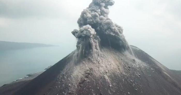
VONA: The latest VONA message received the color code ORANGE, published on September 22, 2018 at 6:56, for an eruption with ash column height of approximately 538 m above sea level or approximately 200 m above the summit. The column of ashes was moving South.
Source : PVMBG.
Video et commentaire : Photovolcanica ( Copyright Photovolcanica 2018 ) https://www.youtube.com/watch?v=AZRDI5wSWMQ
Photo : Le volcan Anak Krakatau le dimanche 19 août 2018. Crédit de Sutopo Purwo Nugroho, Agence de météorologie, de climat et de géophysique de l’Indonésie, BMKG / Twitter
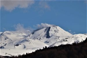
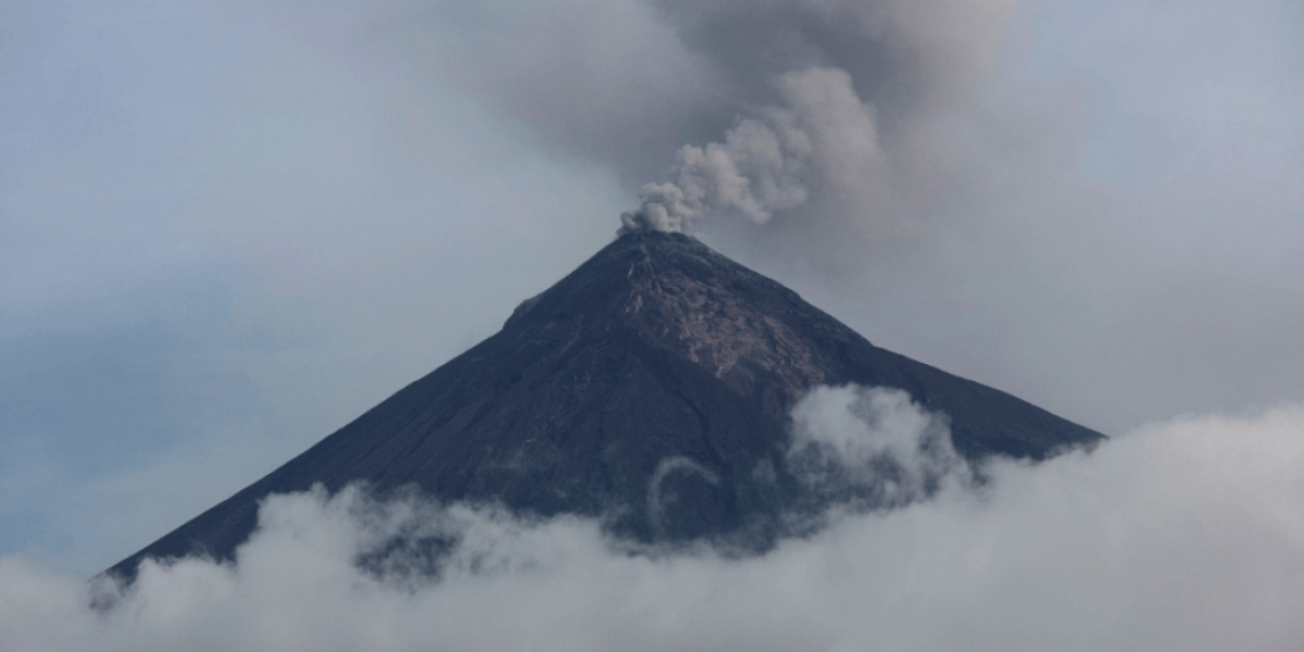
Guatemala , Fuego :
Type of activity: Vulcanian
Morphology: Composite Stratovolcano
Geographical location: 14 ° 28’54˝ N Latitude; 90 ° 52’54˝ Longitude O.
Height: 3,763msnm.
Weather conditions: Clear weather
Wind: North at 5 km / h
Precipitation: 59.6 mm
Activity:
Presence of white fumaroles at a height of 4100 meters, dispersed southwest and west. The activity generates 13 to 15 weak to moderate explosions per hour that expel columns of gray ash at a height of 4400 to 4600 meters (14435 to 15090 feet) scattered 15 to 20 km to the west and southwest. The explosions generate incandescent impulses of 200 to 300 m of altitude with weak to moderate avalanches on the contour of the crater, mainly towards the ravines Seca, Ceniza, Las Lajas and Taniluya. Low to moderate rumblings are heard, along with locomotive-like sounds, 2 minutes late. As a result of the explosions, fine particles of ash are generated and fall on Panimache I, Morelia, Santa Sofia, El Porvenir, Sangre de Cristo, Palo Verde finca, San Pedro Yepocapa, etc.
Source : Insivumeh
Photo : Inconnu
Mexico , Popocatepetl :
October 28, 11:00 am (October 28, 17:00 GMT)
In the last 24 hours, thanks to the monitoring systems of the Popocatépetl volcano, 172 exhalations have been identified, accompanied by water vapor, gas and small amounts of ash. Two volcano-tectonic earthquakes were recorded yesterday at 19:57. 20:32, with respective magnitudes of M1,3 and M1,2. During the night, there was no visibility to the crater of the volcano, due to the weather conditions.
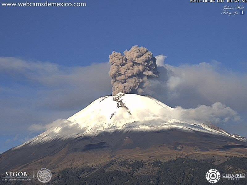
At the time of writing, it has been observed that emissions of water vapor, gas and ash were dispersed to the northwest.
CENAPRED urges DO NOT APPROACH the volcano and especially the crater, because of the risk of falling ballistic fragments, and in case of heavy rains to move away from the bottom of the ravines because of the risk of landslides and flows mud.
The volcanic warning light of the Popocatepetl volcano is located at Amarillo Phase 2.
Source : Cenapred
Photo : Archive webcamdemexico
La Réunion , Piton de la Fournaise :
Activity Bulletin from Sunday, October 28, 2018 to 14:00 (local time).
The eruption started on September 15th at 4:25 am local time continues. The intensity of the volcanic tremor (indicator of the eruptive intensity at the surface) remains relatively stable on very low values.
– No volcano-tectonic earthquake was recorded during the day of 27 October or during the current day.
– Inflation (swelling) of the building is always recorded. This inflation reflects the pressurization of a localized source beneath the summit craters (Bory-Dolomieu) at a depth of 1-1.5 km, related to the recharge of the superficial reservoir by deeper magma.
– SO2 emissions at the eruptive vent are low (near or below the detection limit).
– CO2 emissions from the soil at the volcano deposit remain low.
– The surface flow rates could not be estimated today because of lava flows that are too weak at the surface.
– The surface activity is always extremely weak. This night of very small resurgences were still visible on the downstream part of the main tunnel, about 1 km from the eruptive vent (Figure 1).
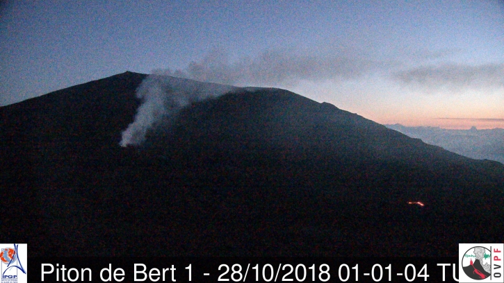
Figure 1: Shooting of the eruptive site from the OVPF-IRT webcam located in Piton de Bert on 28/10/2018 at 05:01 local time (01:01 UTC). (© OVPF / IPGP-IRT)
Alert level: Alert 2-2 – Eruption in the Enclos .
Source : OVPF . http://www.ipgp.fr/fr/ovpf/bulletin-dactivite-dimanche-28-octobre-2018-a-14h00-heure-locale