March 30, 2018.
Kilauea , Hawai :
19°25’16 » N 155°17’13 » W,
Summit Elevation 4091 ft (1247 m)
Current Volcano Alert Level: WATCH
Current Aviation Color Code: ORANGE
Activity Summary:
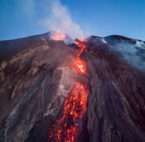
The eruptions at Kīlauea Volcano’s summit and East Rift Zone continue without significant changes. This morning’s measurement of the depth to the lava lake surface within the Halemaʻumaʻu Overlook vent was 28 m (92 ft) beneath the adjacent crater floor. Webcam views and overflight observations show that the Episode 61g lava flow is active above the pali, however there is currently no active lava on the pali or the coastal plain. Lava above the pali does not pose a threat to nearby communities at this time. Lava is not flowing into the ocean. Low rates of ground deformation and seismicity continue across the volcano.
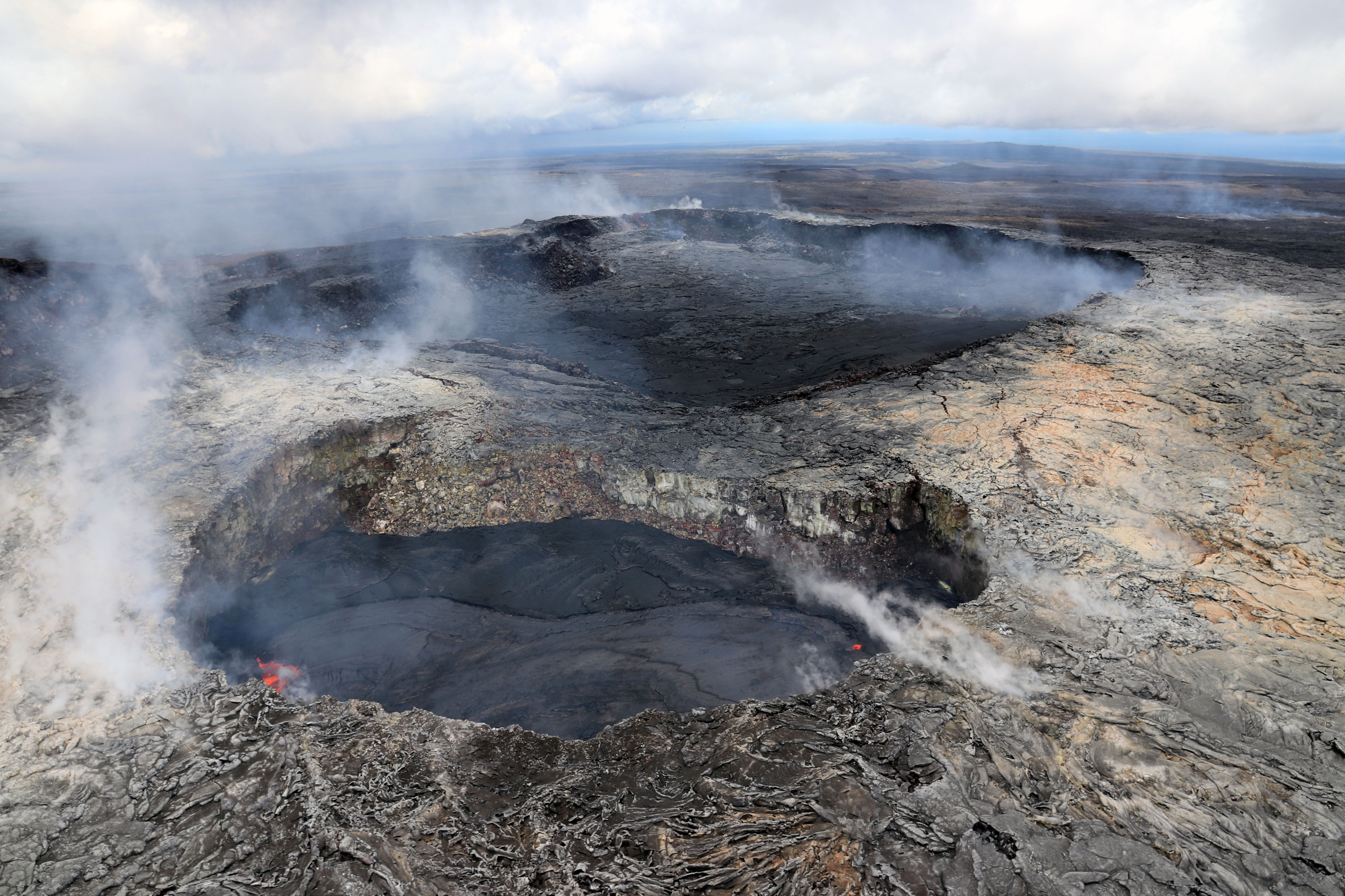
At Pu‘u ‘Ō‘ō on Kīlauea Volcano’s East Rift Zone, the ridge separating the main crater (top) from the west pit (bottom) has been subsiding over the past several months due to small rock falls and unstable ground. As the ground shifts, cracks along the ridge and on both sides of it continue to open. The lava pond within the west pit has risen several meters (yards) in the past month, and has produced overflows (darker lava) onto the floor of the pit as it rises. A small lava flow also erupted onto the floor of the main crater on March 25 and remained active through this evening (March 27). This flow is also darker in color and is visible in this image in the foreground of the main crater floor.
Summit Observations:
The surface of the lava lake within the Halemaʻumaʻu Overlook vent was measured this morning at 28 m (92 ft) below the adjacent Halemaʻumaʻu crater floor. Summit tiltmeters recorded deflation before turning to inflation at about 6:00 this morning. The seismicity in the summit area is within normal, background rates, with tremor amplitude fluctuations associated with lava lake spattering. Elevated summit sulfur dioxide emission rates persist.
Puʻu ʻŌʻō Observations:
The tiltmeter on Pu`u `O`o cone continued to measure inflationary tilt through yesterday, but little change in tilt has been measured since yesterday morning. Lava began flowing onto the floor of Puʻu ʻŌʻō Sunday night from a vent in the southeast of the crater. This lava flow continued to expand over the past day. Webcam views of spattering from the West Pit lava pond also continue. The sulfur dioxide emission rate from the East Rift Zone vents has been steady over the past several months and remains significantly lower than the summit emission rate.
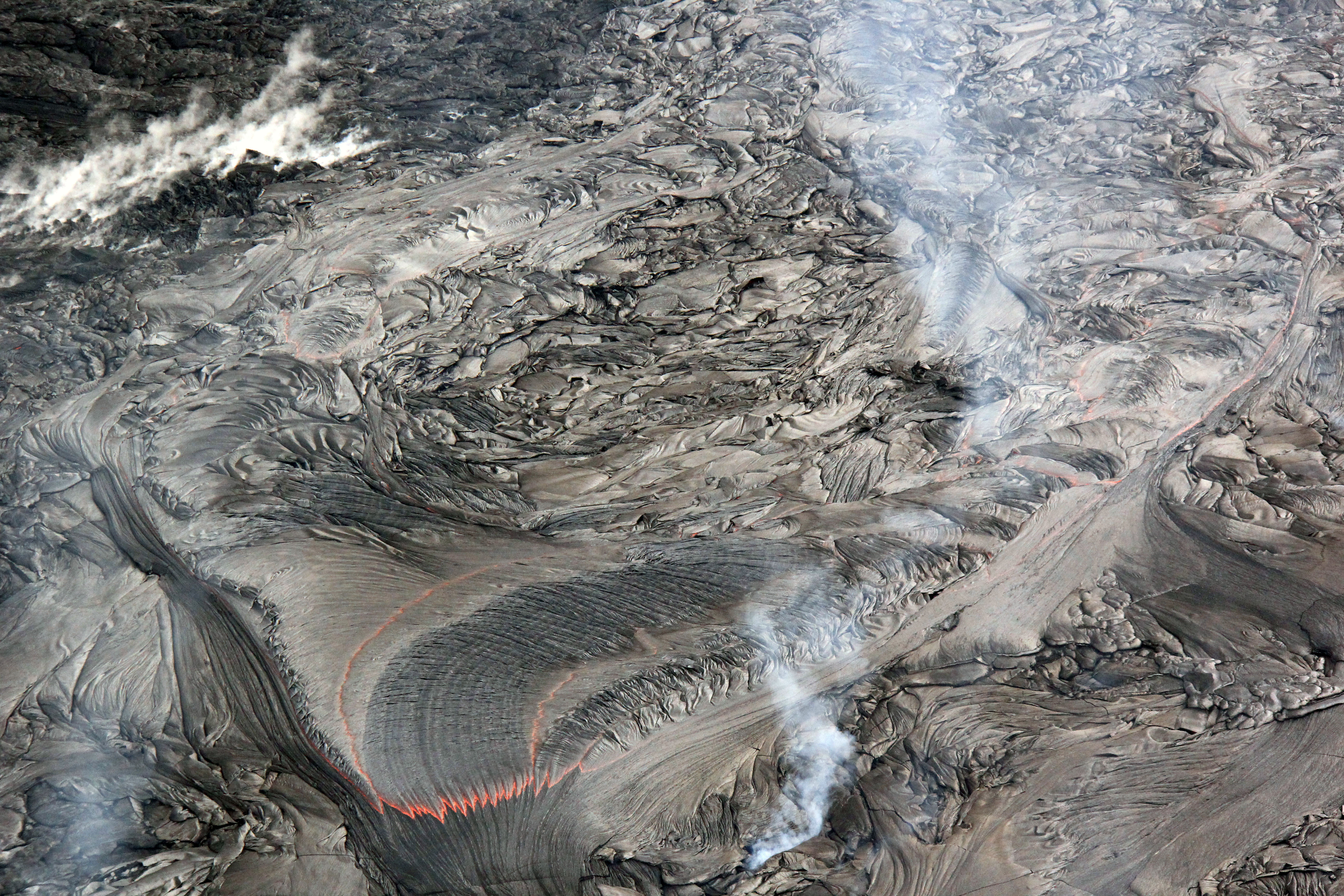
Active lava breakouts were scarce across the episode 61g flow field on Kīlauea Volcano’s East Rift Zone, with active flows confined to an area approximately 1–2 km (0.6–1.2 miles) from Pu‘u ‘Ō‘ō. This breakout from the lava tube consisted of fluid pāhoehoe.
Lava Flow Observations:
Overflight observations confirm that there is no lava flow activity from the Episode 61g lava flow on the coastal plain and pali. No lava is flowing into the ocean. Lava flow activity on the upper flow field, closer to Puʻu ʻŌʻō, continues and does not pose a threat to nearby communities at this time.
Source : HVO
Cerro Machin , Colombia :
Subject: Cerro Machín Volcano Activity Bulletin.
The level of activity continues at the level: Yellow activity level or (III): changes in the behavior of volcanic activity.
With regard to monitoring the activity of the Cerro Machín volcano, the COLOMBIAN GEOLOGICAL SERVICE informs that:
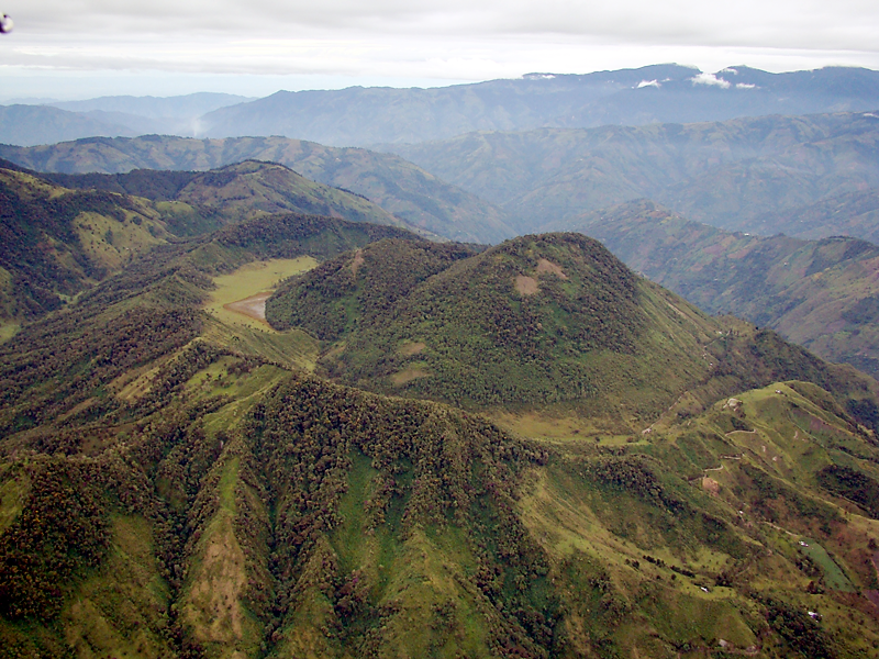
During the last week, the Cerro Machín volcano recorded a seismic activity associated with the fracturing of the rocks that make up the volcano. This seismic activity was located on the West – South – West flank of the main dome at depths between 2.0 and 11.0 km. The maximum magnitude recorded during the week was 2.1 ML (Local Magnitude) corresponding to the earthquake recorded on 24 March at 09h21 (local time), located west of the main dome, 3.5 km deep. The other monitored parameters did not show any significant changes.
The COLOMBIAN GEOLOGICAL SERVICE is attentive to the evolution of the volcanic phenomenon and will continue to inform in a timely manner of the changes that may occur.
Source : Ingeominas
Sabancaya , Peru :
The Geophysical Institute of Peru – IGP recorded the afternoon of Wednesday the descent of a lahar (flows of water, stone, mud and ash) in the vicinity of the Sabancaya volcano, Arequipa. The event was recorded by one of the seismic stations that integrates our surveillance network installed to monitor the eruption of the volcano.
The lahar started at 11:13 and passed our SAB station at 13:10, continuing its descent on the southeast flank of the volcano, towards the Sallalli River. The lahar ended at 3:30 pm, after having lasted about 3 hours and 40 minutes. According to the signal recording at the station, this lahar was smaller than that recorded on March 13th.
As we have pointed out several times, the presence of lahars is possible given the precipitation (rain, hail and snow) that still occur in the volcano area, as well as the accumulation of large volumes of snow.
We recommend that the population south-east of Sabancaya, consisting mainly of hamlets, move away from adjacent streams through which large flows of water laden with volcanic material may flow.
Source : IGP
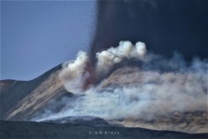
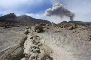
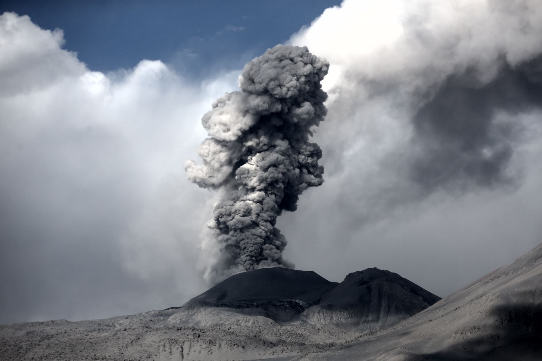
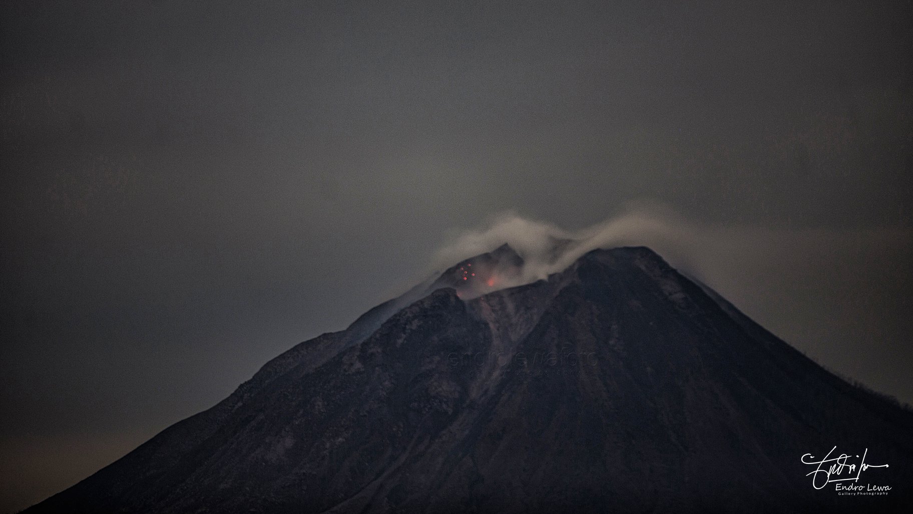
Sinabung , Indonesia :
Level IV Activity Level (AWAS). The Sinabung (2460 m altitude) has been erupting constantly since 2013.
Since yesterday until this morning the volcano has been observed until it is covered with fog. The smoke coming out of the crater could be observed of white / gray color, of low pressure, with a height of 50 to 200 m above the summit. Surface activity was not accompanied by eruption. The wind blows slightly to moderately to the northwest, north-east, east and south-east.
Thanks to the recording of seismographs of March 29, 2018, it was recorded:
5 earthquakes of emission.
3 distant tectonic earthquakes.
3 low frequency earthquake
4 phase / hybrid earthquakes
4 shallow volcanic earthquakes (VB)
4 deep volcanic earthquakes (VA)
1 local tectonic earthquake.
1 flood event / lahar with an amplitude of 13 mm, duration 4343 seconds
Recommendations:
Communities / visitors should not do activities within 3 km of the summit, and by sector, 7 km to the South-South-East, 6 km East-South-East and 4 km to the South-East. km northeast.
The deposits formed a dam upstream on the Laborus River. People living in downstream river basins and around the Laborus River need to be vigilant because these dams can collapse at any time and no longer retain water volume, resulting in downstream lahars / floods .
Vona: The last Vona code issued was a color code ORANGE, published on February 26, 2018 at 18:44, associated with the eruption at 13:39 where the height of the ash column was observed up to 3160 m above the sea level, about 700 m above the summit, the wind blowing south-southeast.
Source : Magma , VSI.
Photo : Endro Lewa