April 2 , 2025.
Iceland , Reykjanes Peninsula :
Updated on April 1st at 7.25 AM
An earthquake swarm began at around 6:30 AM this morning on the Sundhnúks Crater Row. The swarm is located between Sýlingarfell and Stóra-Skógfell, in a similar are as seen prior to previous eruptions.
The earthquake swarm was followed by a clear change in deformation and pressure changes in boreholes operated by HS Orka. Both independent measurements were a clear sign of the onset of a magma intrusion.
Updated April 1st at 9:45 AM
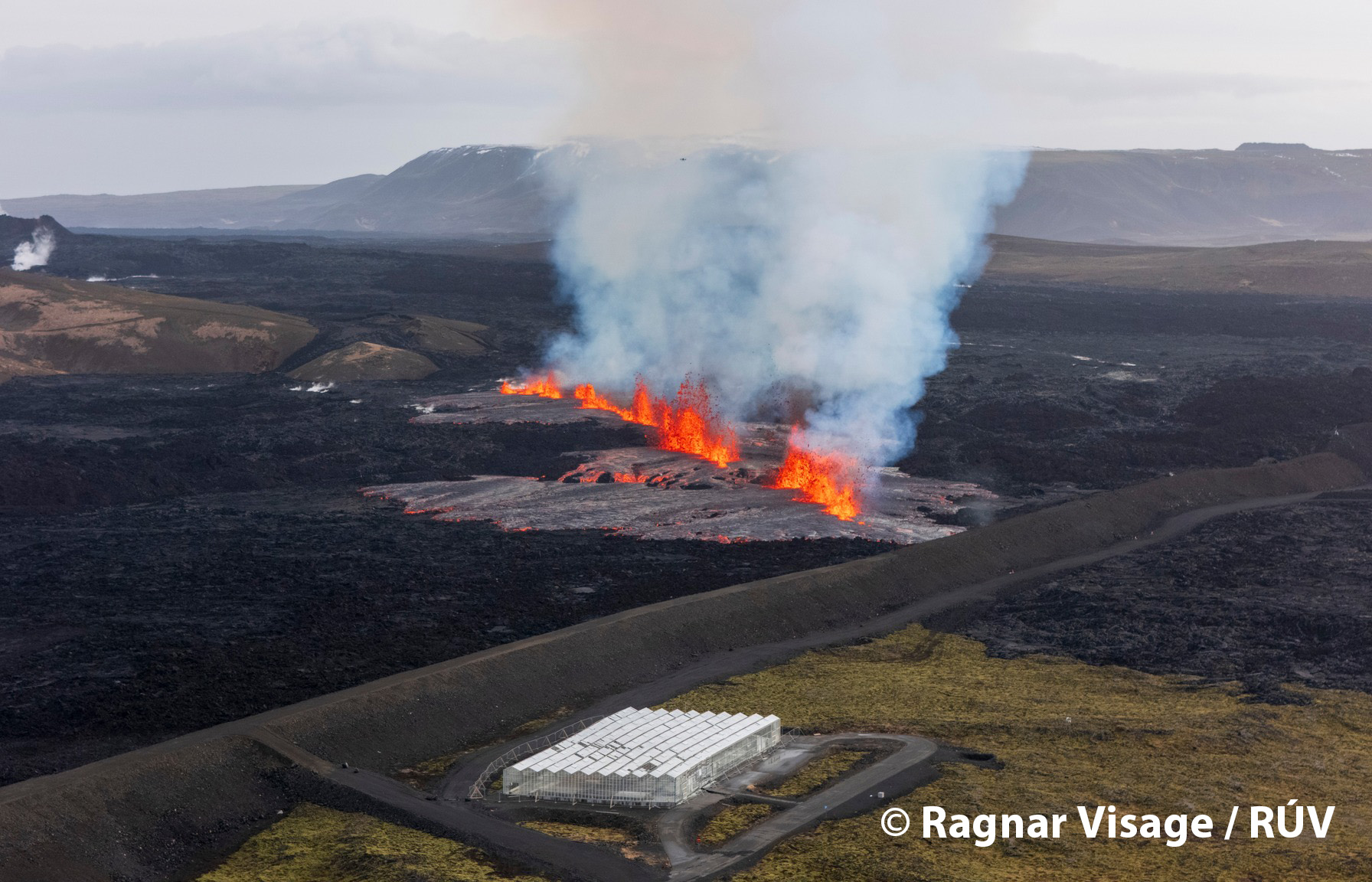
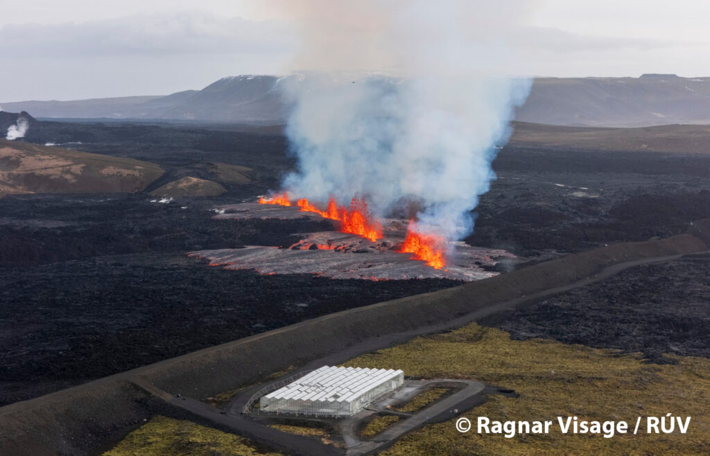
An eruption has started just north of the protective barrier near Grindavík.
A Coast Guard helicopter will take off shortly to confirm the exact location and size of the eruption.
The length of the magma intrusion under the Sundhnúkur crater row that has already formed is about 11 km, which is the longest measured since November 11, 2023.
Updated April 1st at 12:35 PM
The total length of the eruptive fissure is now about 1,200 meters and continues to extend southward.
The Icelandic Meteorological Office received a report that a hot water pipeline has broken in the northern part of Grindavík. This confirms that significant fault movements have occurred within the town.
Ongoing seismic activity is being recorded along the entire dike intrusion, with the most intense activity at the northeastern end. The intrusion now extends over 3 km further to the northeast than observed in previous eruptions. Deformation data also show continued displacement toward the northeast. This indicates that magma is still moving through the dike intrusion.
Updated April 1st at 18:30 PM
Volcanic activity north of Grindavík continues to decrease, with little visible activity on webcams or in recent drone footage. However, seismic activity continues. Earthquake activity near the southern part of the magma dike, close to Grindavík, has decreased, while activity at the northern end of the dike continues with similar intensity and has shifted even further north in recent hours. The seismic activity now extends almost 9 km farther north than the northernmost eruption fissure formed during the August 2024 eruption. The largest earthquakes have been around magnitude 3 and have been felt in Vogar, which is about 7 km northwest of the active area.
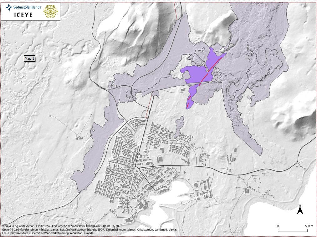
The map shows the lava extent as of 12:34 PM, formed by the eruption that began this morning. The map is based on ICEYE satellite imagery.
Deformation measurements show that magma is still flowing from Svartsengi into the dike beneath the Sundhnúkur crater row. The seismic activity suggests that the magma is moving northeast. Earthquakes are occurring at depths of approximately 4–6 km, and deformation data from this area is currently being analyzed. As long as significant seismic activity and deformation continue, there remains a possibility that magma could reach the surface again in the Sundhnúkur crater row or nearby where activity is most concentrated.
Source : IMO
Photos : Ragnar Visage / RÚV , IMO.
Hawaii , Kilauea :
Monday, March 31, 2025, 11:49 PM HST (Tuesday, April 1, 2025, 09:49 UTC)
19°25’16 » N 155°17’13 » W,
Summit Elevation 4091 ft (1247 m)
Current Volcano Alert Level: WATCH
Current Aviation Color Code: ORANGE
Activity Summary:
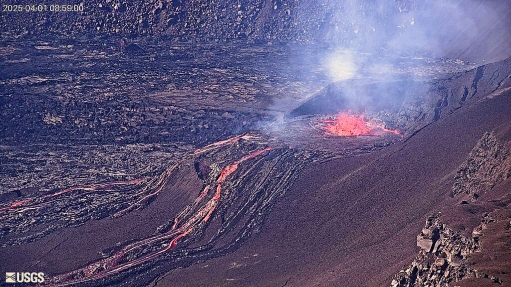
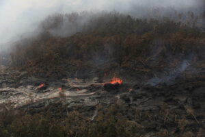
Episode 16 of the ongoing Halemaʻumaʻu eruption began at 10:57 p.m. HST on March 31 with the start of lava overflowing from the north vent.
Episode 16 was preceded by weak spattering in the north vent that began at approximately 5:20 p.m on March 31, 2025. Since 6:00 , spattering became continuous and increased to low fountaining (15-30 feet or 5-10 meters high). Lava level gradually rose in the vent and is now overflowing out of the north vent cone onto the floor of Halemaʻumaʻu. Each of the prior 15 episodes ultimately involved significant lava fountaining, with the fountains of episode 15 exceeding 1,000 feet (305 meters) in height. High lava fountains are likely to follow the current dome fountaining and lava flows within 24 hours or less.
Tuesday, April 1, 2025, 11:22 AM HST (Tuesday, April 1, 2025, 21:22 UTC)
Activity Summary:
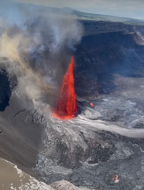
The high fountain phase of episode 16 of the ongoing Halemaʻumaʻu eruption began at 10:24 a.m. HST on April 1, 2025, about 12 hours after the start of the episode. Fountaining from the south vent rapidly increased to over 200 feet (70 meters) in height by 10:40 a.m. HST and exceeded 700 feet (215 m) by 10:50 a.m. HST. Low dome fountaining and overflows continue from the north vent.
Episode 16 was preceded by weak spattering in the north vent that began at approximately 5:20 p.m. HST on March 31, 2025. Since 6:00 p.m. HST, spattering became continuous and increased to low fountaining (15-30 feet or 5-10 meters high). Lava level gradually rose in the vent and began overflowing out of the north vent cone onto the floor of Halemaʻumaʻu at 10:57 p.m. HST on March 31.
At south vent, small spatter fountains were first observed by field crews at 8:30 a.m. HST on April 1, but they probably were active deeper in the vent prior to that time. The south vent became more active at 10:12 a.m. HST on April 1 and began producing significant lava flows. Fountains in this episode are likely to exceed 1000 feet (300 meters) similar to episode 15.
Inflationary tilt on the UWD tiltmeter reached around 8 microradians since the end of the last episode, recovering about 90% of the tilt lost from episode 15. UWD tilt began to deflate and seismic tremor greatly increase at same time high fountaining began. Seismic tremor initially began increasing around noon HST on March 31, 2025, followed by a sharper increase around 4:30 p.m. HST the same afternoon. Tremor and infrasound signals continued to steadily increase until rapidly increasing with the onset of high fountains.
Emissions of SO2 gas are elevated, and during recent episodes have reached 50,000 tonnes per day or more, and similar amounts of gas are expected to accompany any high fountaining activity that may occur during episode 16. Currently, winds at the summit are forecast to be weak, which may allow the plume of gas to spread around the summit region of Kīlauea. In addition, visitors to Hawaiʻi Volcanoes National Park and residents of adjacent areas may be exposed to Peleʻs hair and other small fragments of volcanic glass and tephra being carried in the plume, as they were during episode 15.
Each episode of Halemaʻumaʻu lava fountaining since December 23, 2024, has continued for 13 hours to 8 days, and episodes have been separated by pauses in eruptive activity lasting less than 24 hours to 12 days.
Source : HVO
Photos : USGS , David Otika ( capture d’écran)
Italy / Sicily , Etna :
WEEKLY BULLETIN, from March 24, 2025 to March 30, 2025. (Issue date: April 1, 2025)
ACTIVITY STATUS SUMMARY
Based on monitoring data, the following is highlighted:
1) VOLCANOLOGICAL OBSERVATIONS: Observations of the summit craters were intermittent due to extensive cloud cover.
2) SEISMOLOGICAL: Low seismic activity due to fracturing. Tremor amplitude is predominantly medium-low.
3) INFRASOUND: Low infrasound activity. 4) GROUND DEFORMATION: Over the past week, ground deformation monitoring networks have not recorded any significant changes.
5) GEOCHEMISTRY: SO2 fluxes between medium and medium-high levels, increasing since February 10.
Soil CO2 fluxes (EtnaGas Network) have increased slightly, reaching average values.
Partial pressure of dissolved CO2 in the aquifer (Ponteferro); for technical reasons, no update is available.
Isotope ratio of peripheral sites: Latest data (March 11, 2025) on medium-high values.
6) SATELLITE OBSERVATIONS: Thermal activity observed by satellite in the summit area was generally low.
VOLCANOLOGICAL OBSERVATIONS
Monitoring of Mount Etna’s volcanic activity was carried out by analyzing images from the INGV (Osservatorio Etneo) surveillance camera network.
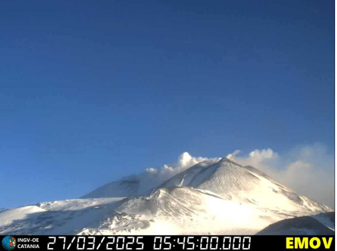
Observations at the summit craters were inconsistent due to the presence of extensive cloud cover.
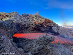
During the period studied, Etna’s activity was characterized by continuous degassing of varying intensity and regime in the summit craters, with a particularly significant degassing observed in the Northeast crater. On March 27, the Montagnola camera was used to observe degassing activity in the summit craters.
Source et photo : INGV
Italy , Stromboli :
WEEKLY BULLETIN, from March 24, 2025 to March 30, 2025. (Issue date: April 1, 2025)
SUMMARY OF ACTIVITY STATUS
In light of monitoring data, the following is highlighted:
1) VOLCANOLOGICAL OBSERVATIONS: During the period under study, ordinary Strombolian eruptive activity was observed, accompanied by spattering activity in the N2 sector. The total hourly frequency of explosions fluctuated around average values (11-15 events/hour). Intensity was low and medium in the North and South-Central crater areas.
2) SEISMOLOGY: The monitored seismic parameters do not show any significant variations.
3) GROUND DEFORMATION: The island’s ground deformation monitoring networks did not show any significant variations to report during the period under review. 4) GEOCHEMISTRY: SO2 flux at an average level
The soil CO2 flux in the Pizzo area (STR02) remains at high to very high values.
CO2/SO2 ratio in the plume (Stromboli Plume Network). The weekly average value is very high (C/S=31).
Dissolved helium isotope ratio (R/Ra) in the thermal aquifer: The data from March 4, 2025, show high values.
Soil CO2 flux in the San Bartolo area is at low values.
Soil CO2 flux in the Scari area is at average values.
5) SATELLITE OBSERVATIONS: The thermal activity observed by satellite in the summit area was generally low.
VOLCANOLOGICAL OBSERVATIONS
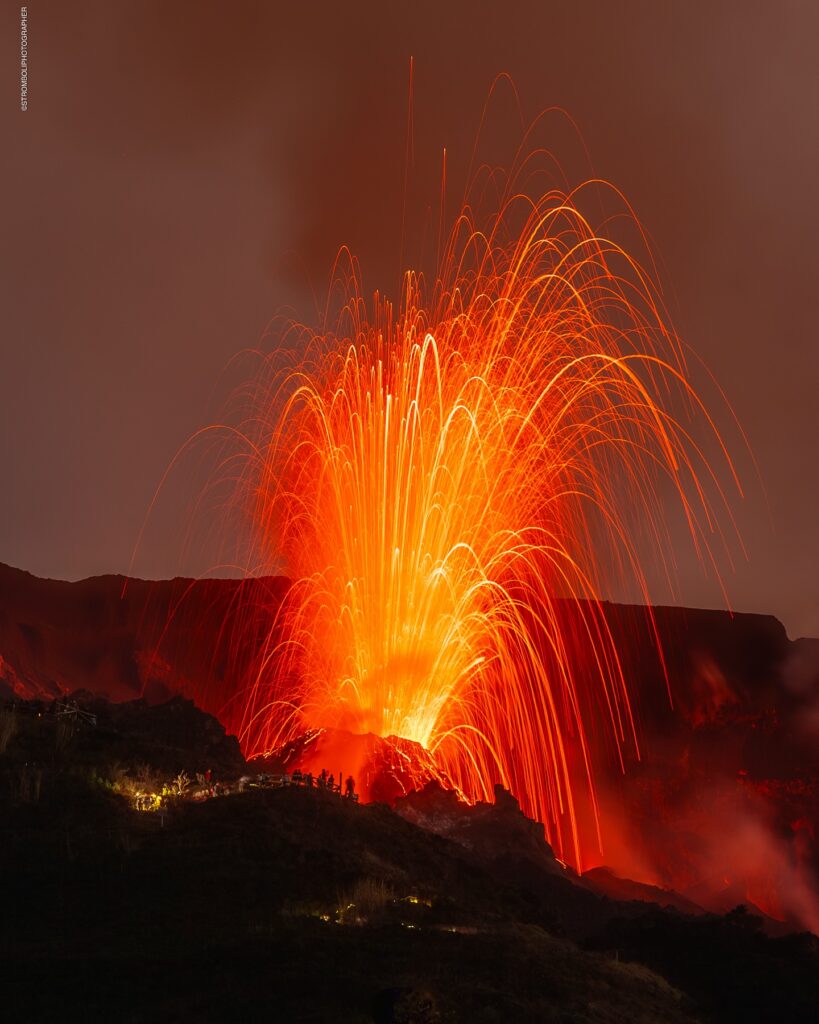
During the observation period, Stromboli’s eruptive activity was characterized by analyzing images recorded by INGV-OE surveillance cameras located at an altitude of 190 m (SCT-SCV) and at Punta dei Corvi (SPCT). The explosive activity was produced mainly by four eruptive vents located in the North Crater area and by at least two vents located in the Central-South Crater area.
Due to adverse weather conditions, visibility of the crater terrace on March 26, 27, and 28 was insufficient to accurately describe the eruptive activity.
Observations of explosive activity captured by surveillance cameras
In the North (N) crater area, four active vents were observed, producing low-intensity explosive activity (erupted products reached a height of less than 80 m) and sometimes medium-intensity explosive activity (product heights between 80 and 150 m). In the N2 sector, discontinuous and weak ejection activity was observed in the second part of the analyzed period (March 29-30). The ejected products consisted mainly of coarse materials (bombs and lapilli). The average explosion frequency ranged from 9 to 12 events per hour.
In the South-Central (SC) area, explosive activity was produced by at least two vents; the explosions were mostly of low and medium intensity, emitting fine materials (ash) mixed with coarse materials (lapilli and bombs). The average explosion frequency ranged from 2 to 3 events per hour.
Source : INGV
Photo : Stromboli stati d’animo / Sebastiano Cannavo .
Indonesia , Gede :
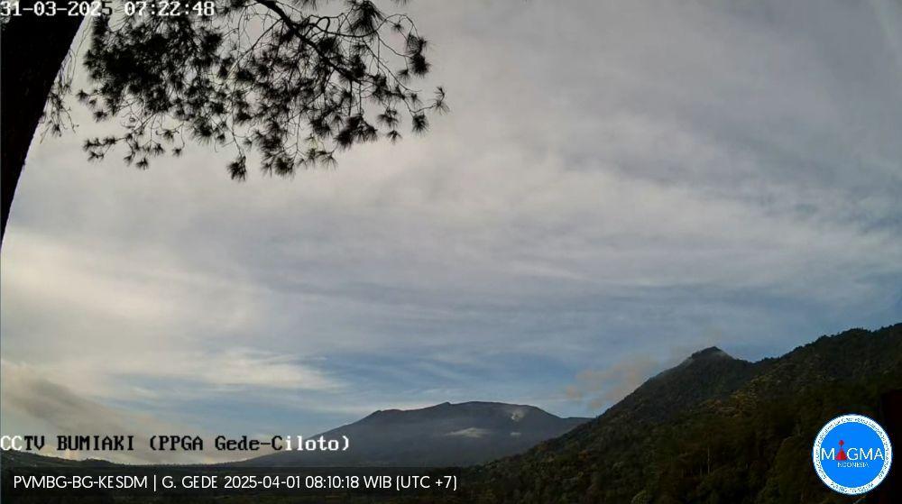
Increased seismicity of Mount Gede, West Java, on April 1, 2025.
Mount Gede (G. Gede) is a stratovolcano administratively included in the Cianjur, Sukabumi, and Bogor regencies in West Java province. With a maximum height of 2,958 meters above sea level, this volcano has been observed visually and instrumentally from the Gede Volcano Observation Post (PGA) located in the village of Ciloto, West Java.
The last eruption of Mount Gede occurred in 1957 from Kawah Ratu, with an eruptive column reaching 3,000 meters above the summit. However, currently, Mount Gede’s eruptive activity originates from the Wadon crater, with the height of crater smoke during the period 1–31 March 2024 generally ranging between 50 and 100 m above the summit.
On April 1, 2024, from 00:00 to 06:00 WIB, there was an increase in deep volcanic earthquakes (VA), reaching 21 incidents. As is known, the average frequency of volcanic earthquakes on Mount Gede during the period from March 1 to 31, 2025, was only 0 to 1 time per day. This indicates an increase in pressure on the volcano’s body, with the potential for danger in the form of phreatic eruptions or volcanic gas emissions around the crater, which can be life-threatening if the inhaled concentration exceeds the safety threshold.
Based on the results of visual and instrumental monitoring, the volcanic activity of Mount Gede until April 1, 2025 at 10:00 WIB is still set at Level I (Normal) with recommendations for people around Mount Gede and visitors/tourists not to descend, approach and spend the night within a radius of 600 meters around the Wadon Crater.
Source et photo : PVMBG

