March 18 , 2025 .
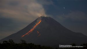
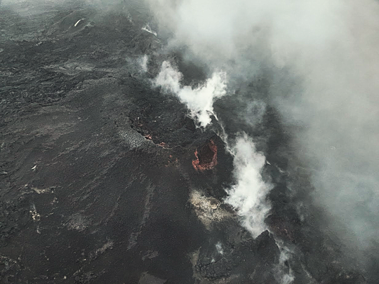
Iceland , Reykjanes Peninsula :
A new eruption is still expected in the Sundhnúk crater chain.
Updated March 17 at 5:00 PM
Magma accumulation continues, and the volume of magma beneath Svartsengi has never been this large since the eruption began in December 2023.
The most likely scenario is that this period of magma accumulation will culminate in a magma flow and eruption, which would occur first in the area between Sundhnúkur and Stóra-Skógfell.
Seismic activity has increased in recent days, indicating that pressure at the eruption sites is increasing.
It must be assumed that a volcanic eruption could begin in the very near future. Risk assessment unchanged and valid until March 18
No change in the location of seismic activity in the Sundhnúk crater series compared to the period before the last eruptions
On March 11, the Icelandic Meteorological Office reported changes in earthquake locations over the past few weeks, as they appeared to be located a few hundred meters east of the earthquakes prior to the recent events. Initially, these earthquakes were thought to be trigger earthquakes caused by increased pressure from magma accumulating beneath Svartsengi.
Experts at the Icelandic Meteorological Office have better identified the earthquake locations using high-resolution analysis. The location of an earthquake is determined by signals from several meters away in a given area, so interference from one meter can affect the location of the earthquake after it has passed. The influence of each seismometer in the area on the location results was examined. It revealed a disturbance on one of the gauges that caused the seismic activity to appear further east than previously.
Further troubleshooting and repairs are underway. As of Friday, March 14, earthquake reports have been temporarily amended to remove the use of the scale, which was causing interference with earthquake location calculations.
Seismic activity therefore remains in the same areas as before the last eruption, namely between Sundhnúkur and Stóra-Skógfell, where magma first surfaced during six of the seven eruptions since December 2023.
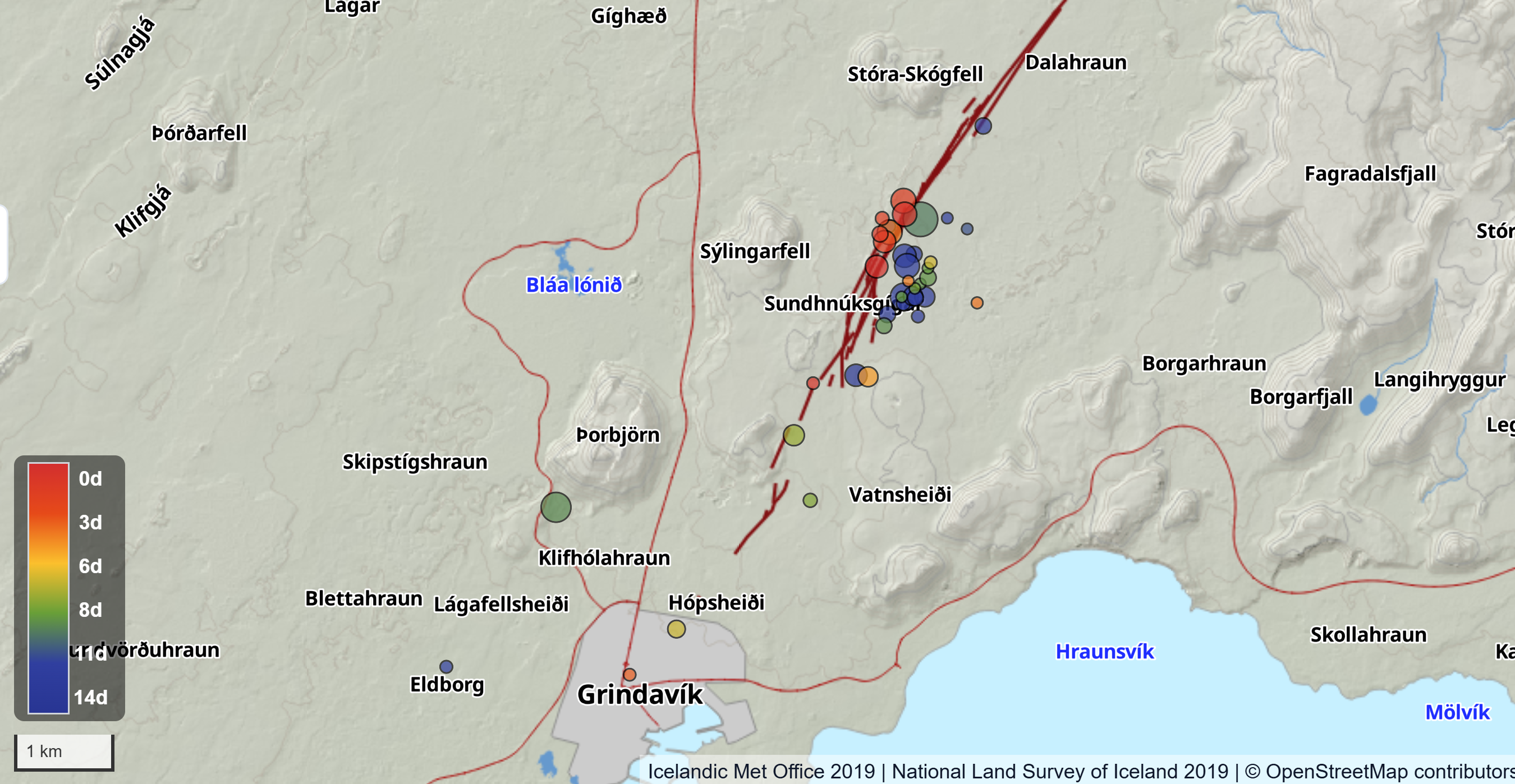
The map shows the location of earthquakes around the Sundhnúk crater chain over the past 14 days. The red circles indicate the locations of earthquakes that occurred within the past three days or since the path was temporarily altered due to a disturbance. The earthquakes can be seen to be occurring on or very close to volcanic fissures that opened since December 2023, represented by dark red lines. Other colors indicate the locations of earthquakes before the path was altered.
Source : IMO
Photos : Björn Oddsson – Protection civile, Commissaire national de la police islandaise . IMO .
Indonesia , Lewotobi Laki-laki :
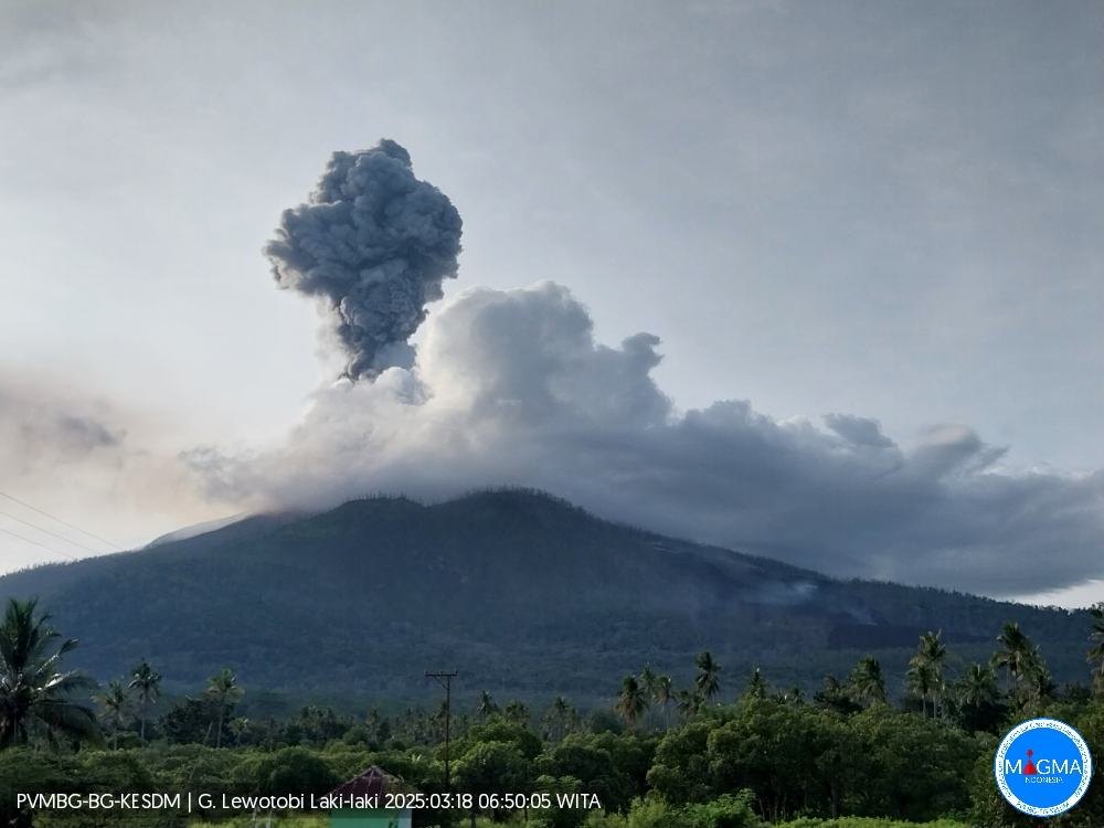
An eruption of Mount Lewotobi Laki-laki occurred on Tuesday, March 18, 2025, at 06:45 WITA with an observed ash column height of ± 1500 m above the peak (± 3084 m above sea level). The ash column was observed to be gray in color with a thick intensity, oriented toward the north and northeast. This eruption was recorded on a seismograph with a maximum amplitude of 2.9 mm and a duration of 248 seconds.
VOLCANO OBSERVATORY NOTICE FOR AVIATION – VONA
Issued : March 18 , 2025
Volcano : Lewotobi Laki-laki (264180)
Current Aviation Colour Code : ORANGE
Previous Aviation Colour Code : orange
Source : Lewotobi Laki-laki Volcano Observatory
Notice Number : 2025LWK160
Volcano Location : S 08 deg 32 min 20 sec E 122 deg 46 min 06 sec
Area : East Nusa Tenggara, Indonesia
Summit Elevation : 5069 FT (1584 M)
Volcanic Activity Summary :
Eruption with volcanic ash cloud at 22h45 UTC (06h45 local).
Volcanic Cloud Height :
Best estimate of ash-cloud top is around 9869 FT (3084 M) above sea level or 4800 FT (1500 M) above summit. May be higher than what can be observed clearly. Source of height data: ground observer.
Other Volcanic Cloud Information :
Ash cloud moving from north to northeast. Volcanic ash is observed to be gray. The intensity of volcanic ash is observed to be thick.
Remarks :
Eruption recorded on seismogram with maximum amplitude 2.9 mm and maximum duration 248 second.
Source et photo : Magma Indonésie .
Colombia , Galeras :
San Juan de Pasto, March 11, 2025, 4:15 p.m.
Monitoring the activity of the Galeras Volcano, the Colombian Geological Survey (SGC), an entity affiliated with the Ministry of Mines and Energy, reports that:
Between March 4 and 10, 2025, volcanic activity remained at low levels. Compared to the previous week, the main variations in the monitored parameters were:
• A decrease was observed in both the occurrence and the energy released by seismic activity. The predominance of earthquakes related to rock fractures within the volcanic system continues.
• In most cases, seismic activity was located scattered throughout the volcanic edifice, with magnitudes below 2 and depths up to 12 km from the volcano’s summit (4,200 m above sea level). On March 7 at 3:50 a.m., a magnitude 2.5 earthquake was recorded, located epicentrally 5 km northeast of the active cone, with a depth of 8.2 km, and at 10:08 a.m., another magnitude 2.0 event in a similar region. No earthquakes were reported as felt.

• Throughout the week, low-altitude white gas emissions were observed, with variable dispersion depending on the wind direction. The emission sources were located both in the main crater and in the fumarole fields of Las Chavas, to the west, and Paisita, to the north of the active cone.
• Other volcanic monitoring parameters showed stability.
Based on the above, the SGC recommends closely monitoring developments through weekly bulletins and other information published through our official channels, as well as instructions from local and departmental authorities and the National Disaster Risk Management Unit (UNGRD).
Volcanic activity remains on alert status. Yellow: active volcano with changes in the baseline level of monitored parameters and other manifestations.
Source et photo : SGC.
Guatemala , Fuego :
Weather conditions: Clear
Wind: East
Precipitation: 0.0 mm
Activity:
The observatory reports faint fumaroles emanating from the volcano at heights of up to 200 m above the crater and indicates that no rumbling or noise from the volcano has been heard. At night, a few incandescent blocks have been observed in the crater. INSIVUMEH seismic stations detect constant low-frequency, short-duration events, which does not exclude the possibility of weak, moderate, or strong explosions being recorded at any time.

The wind can lift the fine sediments accumulated in the ravines and the crater, so the ash will remain present and disperse to the communities near the volcano. Today, the wind is blowing from the southwest and west, so the ash could have a greater impact on communities such as Sangre de Cristo, Morelia, Panimache I and II, Los Yucales, Santa Sofía, El Porvenir, and others. These deposited materials can be evacuated in the form of lahars, which could even descend hot if it rains during the day, so it is recommended not to stay in or near these ravines during the presence of rain on the volcanic edifice.
Source : Insivumeh
Photo : Conred.
Mexico , Popocatepetl :
March 17, 11:00 a.m. (March 17, 5:00 p.m. GMT). Activity over the past 24 hours
14 low-intensity exhalations were detected, accompanied by water vapor and other volcanic gases, in addition to 159 minutes of low-amplitude tremor, of which 132 minutes were high-frequency and 27 minutes were harmonic.
During the morning, a slight, continuous emission of water vapor and other volcanic gases was observed, moving toward the south-southwest (SSW).
The Popocatépetl volcano fire alert is at yellow phase 2.
The scenarios predicted for this phase are:
A few minor to moderate explosions
Occurrence of tremor of varying amplitude
Light to moderate ashfall in surrounding towns and some more distant towns
Ejection of incandescent fragments within a 12-kilometer exclusion radius
Lahars could tumble down ravines due to ash accumulation on the slopes and their interaction with the rains expected in the coming weeks.
Possibility of pyroclastic flows not affecting populations.
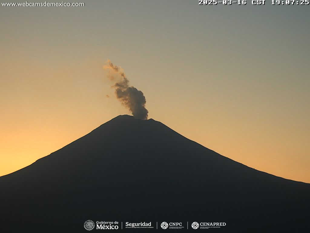
Source et photo : SGC