February 28 , 2025.
Italy / Sicily , Etna :
Etna Activity Statement, 27 February 2025, 22:29 (21:29 UTC)
The National Institute of Geophysics and Volcanology, Osservatorio Etneo, reports that from 20:30 UTC, from the images of the surveillance cameras, a Strombolian activity is observed at the Southeast crater. The forecast model for the dispersion of the possible volcanic cloud indicates a Southeast direction.
From a seismic point of view, the average amplitude of the volcanic tremor, since February 25, has shown a progressively increasing trend, which from about 13:30 UTC today has manifested itself in an even more pronounced way.
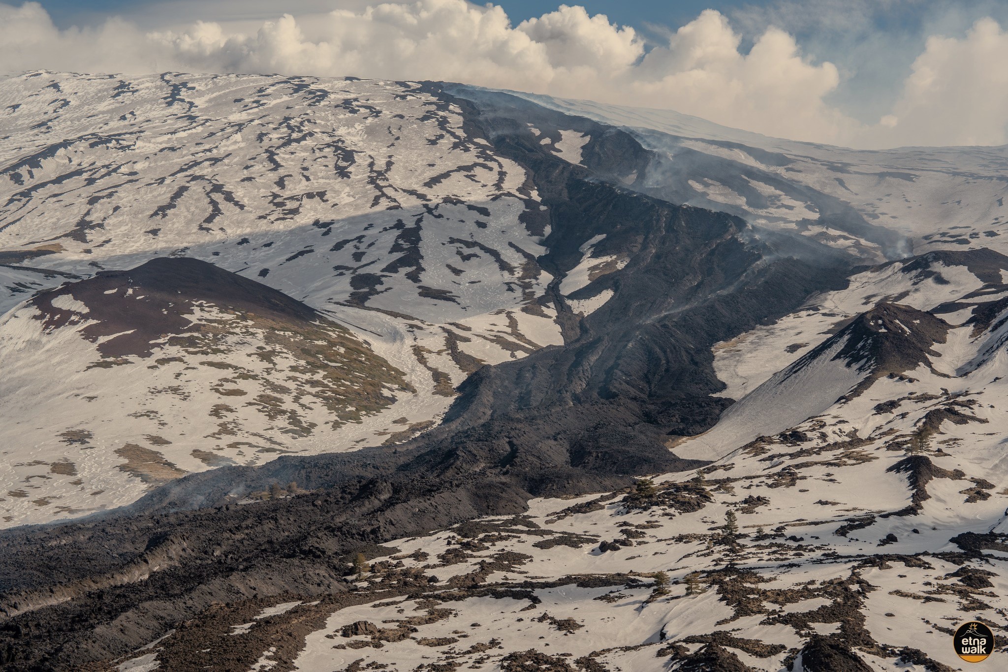
The average volcanic tremor amplitude is currently at a medium level with an increasing trend. The center of volcanic tremor sources is located near the Southeast Crater, at an altitude of approximately 3,000 m above sea level. Infrasound events have increased in activity since 19:30 UTC today, with events located at the Southeast Crater and medium to low event amplitude.
Deformation signals recorded by GPS and tiltmeter networks do not currently show significant variations.
Further updates will be provided shortly.
Source : INGV
Photo : Etna Walk / Giuseppe Distefano / Marco Restivo
Iceland , Reykjanes Peninsula :
Increased likelihood of an eruption on the Sundhnúkur crater row
Anticipate a potentially short warning prior to an eruption
Updated 25. February at 14:40 UTC
Land uplift continues, but has slowed slightly in recent weeks
The volume of magma accumulated beneath Svartsengi has exceeded the amount present before the eruption that began on November 20
It is anticipated that an eruption may start with very short warning
The most likely scenario is a fissure opening in the area between Sundhnúkur and Stóra-Skógafell
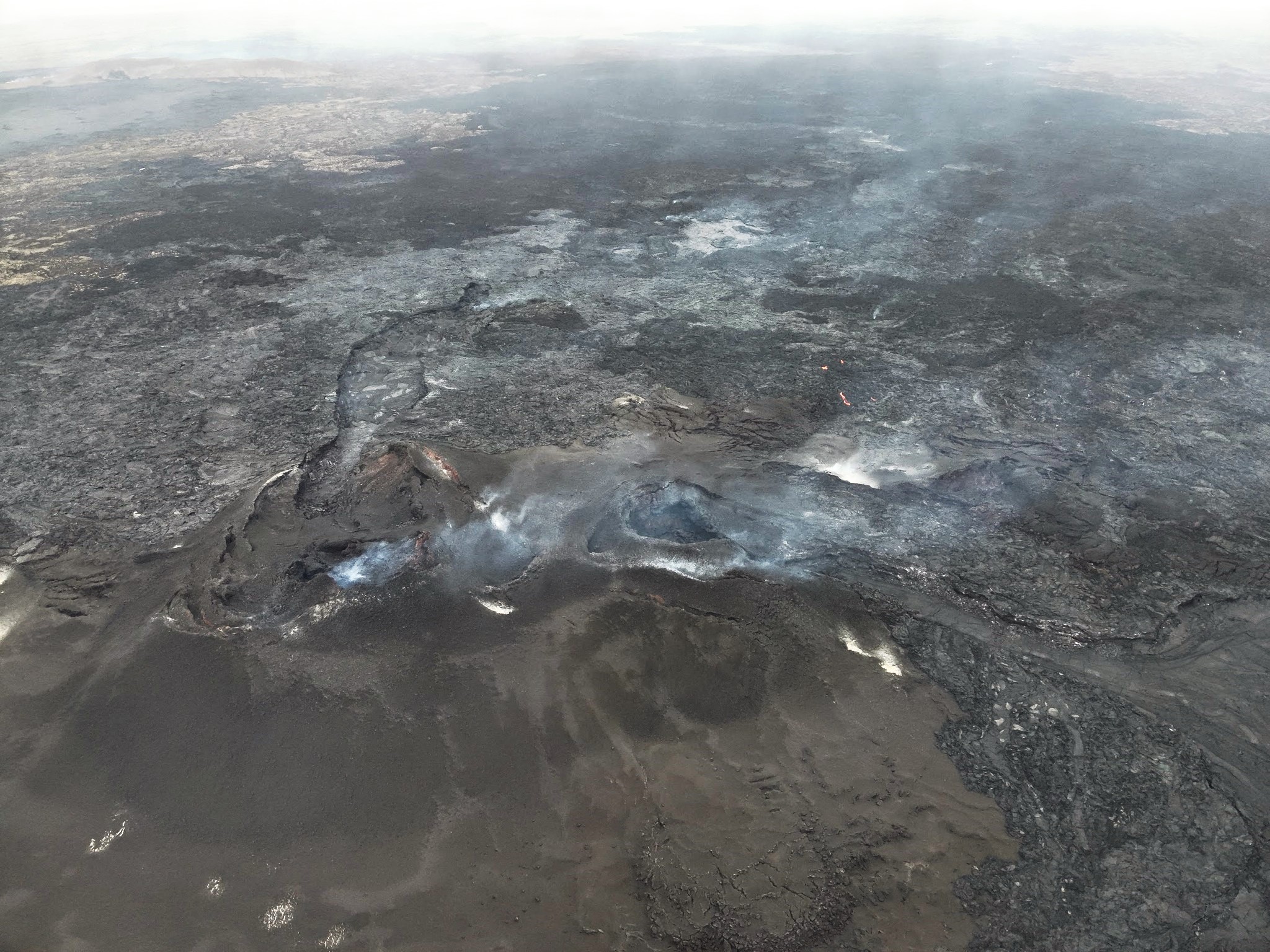
The area impacted by a volcanic eruption is determined by whether the eruptive fissures extend towards north or south
Seismic activity is gradually increasing
Deformation measurements indicate continued land uplift, although it has slowed slightly in recent weeks. Updated model calculations suggest that magma accumulation has exceeded the amount that was present before the eruption that began on November 20. The likelihood of the next event occurring within the coming days or weeks remains elevated.
Seismic activity in the area has been gradually increasing since January.
The hazard assessment has been updated with no changes and remains in effect until March 4, barring any changes in the situation.
Source : IMO
Photo : Ljósmynd: Almannavarnir/Björn Oddsson ,
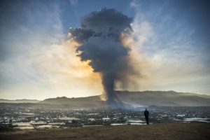
Indonesia , Dukono :
An eruption of Mount Dukono occurred on Friday, 28 February 2025, at 08:31 WIT with an observed ash column height of ±1500 m above the peak (±2587 m above sea level). The observed ash column was white to grey in colour with a thick intensity, oriented towards the east. At the time of writing, the eruption was still ongoing.
Seismicity Observation:
195 Eruption earthquakes with an amplitude of 6 to 34 mm and a duration of 34.67 to 76.93 seconds.
4 Distant tectonic earthquakes with an amplitude of 10 to 34 mm, and an earthquake duration of 72.74 to 107.94 seconds.
1 Continuous Tremor earthquake with an amplitude of 1-5 mm, dominant value 2 mm.
Recommendation
(1) People in the vicinity of Mount Dukono and visitors/tourists should not engage in activities, climb or approach the Malupang Warirang Crater within a radius of 4 km.
(2) Since volcanic ash eruptions occur periodically and the distribution of ash follows the direction and speed of the wind, so the area where the ash falls is not constant, people around Mount Dukono are advised to always carry masks/nose and mouth covers to use when needed to avoid the threat of volcanic ash to the respiratory system.
Source et photo : Magma Indonésie .
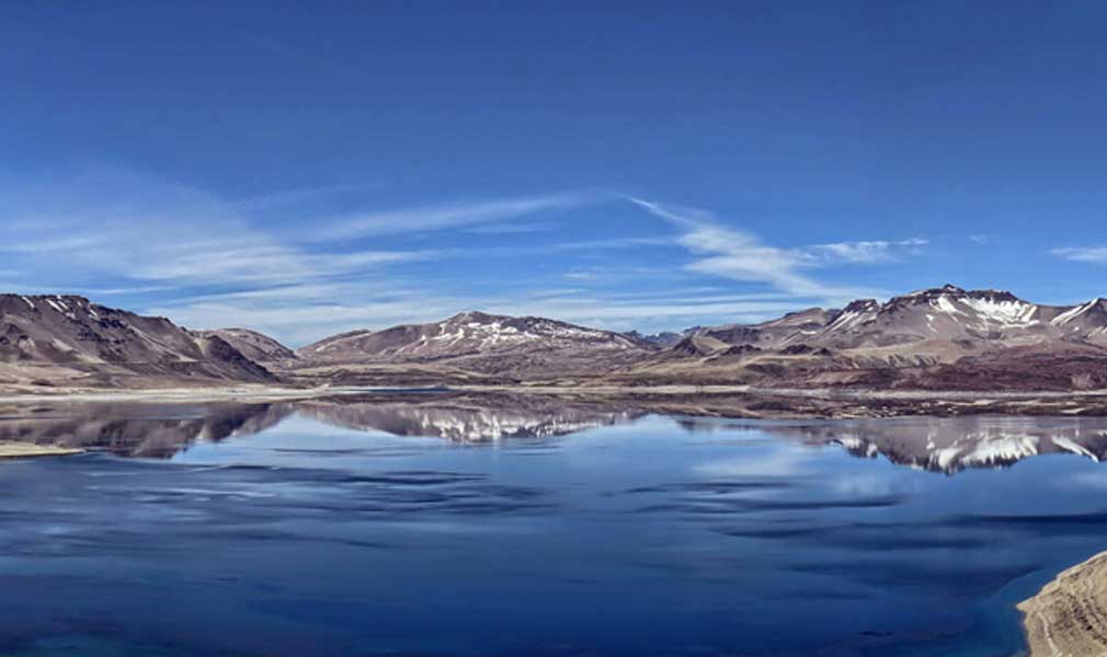
Chile , Laguna del Maule :
Special Report on Volcanic Activity (REAV), Maule Regions, Laguna del Maule Volcanic Complex, February 27, 2025, 11:30 a.m. local time (Continental Chile)
The National Geology and Mining Service of Chile (Sernageomin) announces the following PRELIMINARY information, obtained through the monitoring equipment of the National Volcanic Monitoring Network (RNVV), processed and analyzed at the Southern Andean Volcano Observatory (Ovdas):
On Thursday, February 27, 2025, starting at 06:40 a.m. (09:40 UTC), the monitoring stations installed near the Laguna del Maule volcanic complex recorded an increase in the occurrence of volcano-tectonic earthquakes (associated with the fracturing of rocks within the volcanic system), reaching a total of 104 earthquakes in the last 3 hours, characterizing this seismic episode as a swarm of volcano-tectonic earthquakes.
The characteristics of the earthquake after its analysis are as follows:
TIME OF ORIGIN: 07:10 local time (10:57 UTC)
LATITUDE: 36.092° S
LONGITUDE: 70.484° W
DEPTH: 5.5 km
LOCAL MAGNITUDE: 2.0 (ML)
Observation:
At the time of this report, the seismicity shows a decrease, both in occurrence and in seismic energy.
The volcanic technical alert is maintained at the GREEN level.
Source : Sernageomin
Photo : Senapred / Rayen Gho.
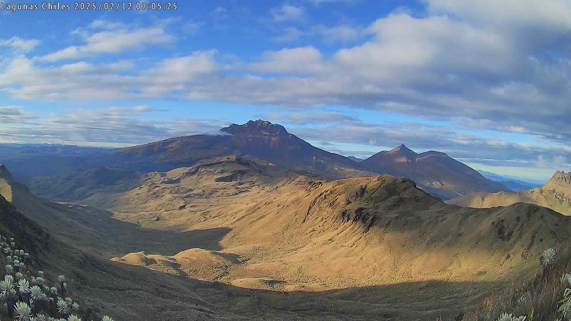
Colombia , Chiles / Cerro Negro :
San Juan de Pasto, February 25, 2025, 5:00 p.m. .
Following the monitoring of the activity of the Chiles / Cerro Negro volcanoes, the Colombian Geological Survey (SGC), an entity attached to the Ministry of Mines and Energy, reports that:
Between February 18 and 24, 2025, a decrease in seismic levels was observed. Compared to the previous period, the most notable changes were:
• A decrease in the frequency of earthquakes and the energy released was observed.
Fracture earthquakes continued to be predominant, followed by events associated with fluid dynamics, some of them with very low frequency content.
• Earthquakes associated with both rock fracturing and fluid movement, as well as those involving both phenomena, were located mainly in the collapse zone of the Chiles volcano, to the north, at distances of up to 2 km and at depths of between 2 and 5 km from the summit of the volcano (4,700 m above sea level). The maximum magnitude of these earthquakes was 1.6. Another group of earthquakes was located scattered in several sectors to the west, northeast and south of the Chiles volcano, at distances of up to 8 km and at depths of up to 10 km from the summit of the volcano, with a maximum magnitude of 1.6.
• Instruments that record the deformation of the Earth’s crust and satellite remote sensing continue to show changes associated with an inflationary process in this volcanic area.
Based on the above, the SGC recommends closely monitoring the developments through weekly bulletins and other information published through our official channels, as well as instructions from local and departmental authorities and the National Disaster Risk Management Unit (UNGRD).
Volcanic activity remains in yellow alert status: active volcano with changes in the behavior of the base level of monitored parameters and other manifestations.
Source et photo : SGC.