February 10 , 2025.
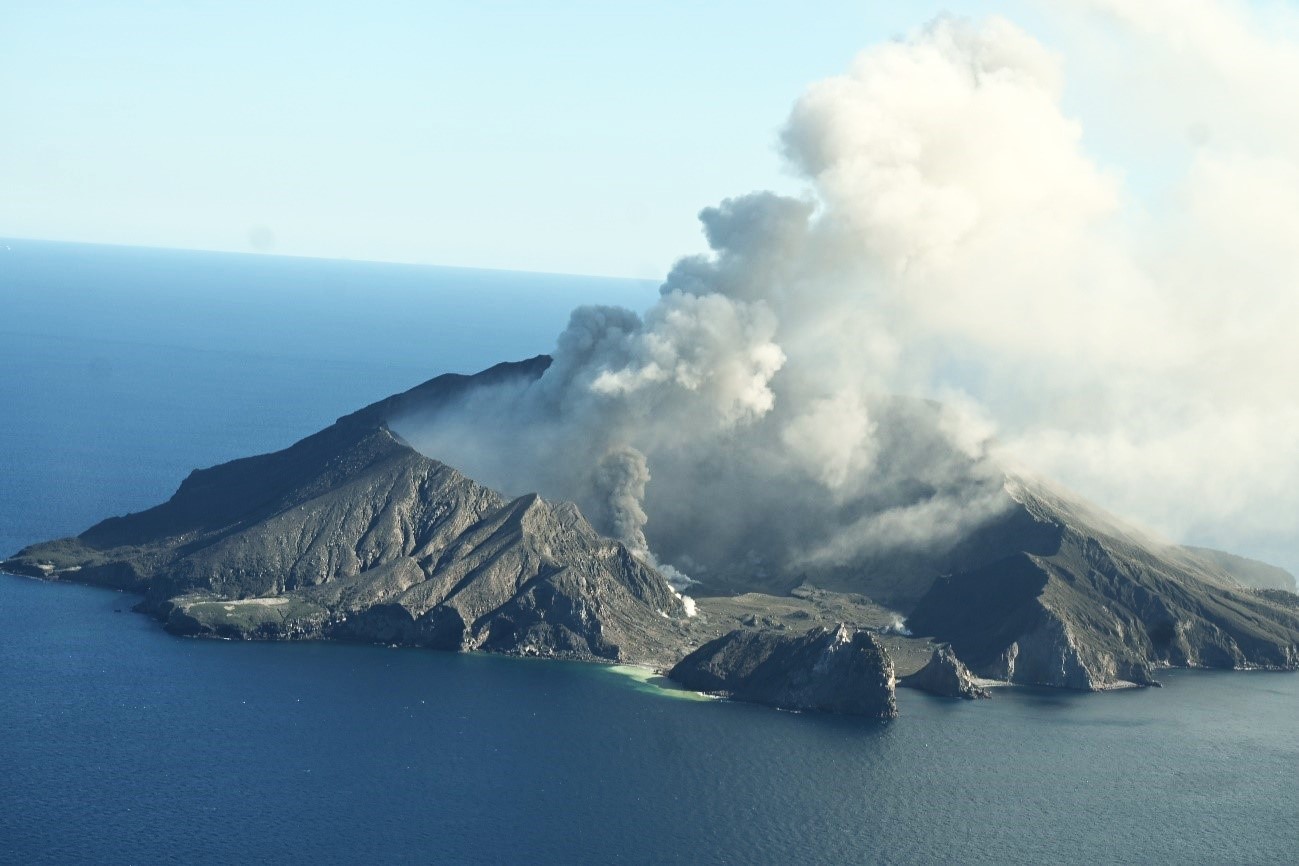
New Zealand , White Island :
Volcanic Activity Bulletin , Mon Feb 10 2025 12:30 PM;
Volcanic Alert Level remains at 2
Aviation Colour Code is lowered to Yellow
Whakaari / White Island continues to passively emit weak-to-moderate steam and gas plumes. No volcanic ash has been observed in the plume recently. The Volcanic Alert Level remains at 2 and the Aviation Colour Code is lowered to Yellow.
Activity at Whakaari / White Island is dominated by weak-to-moderate steam and gas plumes, as seen on our webcams at Whakatāne and Te Kaha, as well as on satellite imagery. Unlike what we’ve observed since late December when ash was regularly present in the steam and gas plumes, volcanic ash has not been observed during the past week.
Sometimes larger plumes are seen from the Bay of Plenty coast above and downwind of Whakaari, when weather conditions are clear and/or wind strength is lighter. Similarly, activity can change at short notice and produce stronger steam and gas plumes which are seen from the coast.
Without sensors on the island, our monitoring continues to rely on remote cameras, satellite imagery, and periodic observation and gas flights to monitor Whakaari.
Recent activity is consistent with moderate-heightened unrest and the Volcanic Alert Level therefore remains at Level 2. The lack of volcanic ash being emitted from the volcano means that the Aviation Colour Code is now lowered to Yellow. These levels acknowledge the current level of activity, but also reflect the degree of uncertainty about the level of unrest due to the current lack of consistent, usable real-time monitoring data. The level of volcanic activity could escalate back to levels seen in 2024, and the volcano can explosively erupt with little or no warning.
GNS Science’s Volcano Monitoring Group and National Geohazards Monitoring Centre will continue to closely monitor Whakaari / White Island for any changes in activity. We will provide further updates when information becomes available.
Source : Michael Rosenberg / Duty Volcanologist / Geonet
Photo : Geonet ( 08/2024)
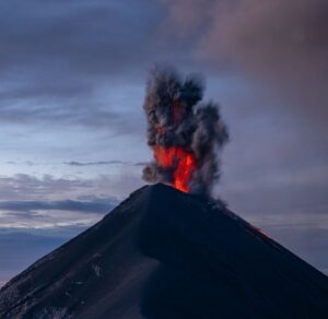
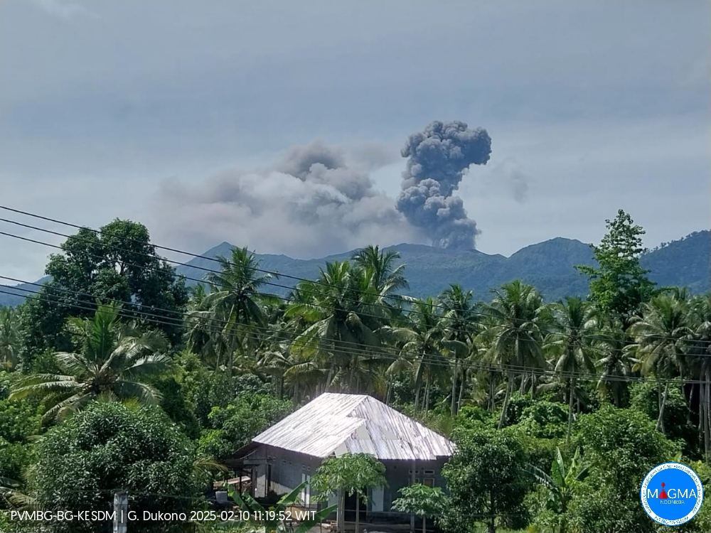
Indonesia , Dukono :
An eruption of Mount Dukono occurred on Monday, 10 February 2025, at 11:05 WIT with an observed ash column height of ±1000 m above the peak (±2087 m above sea level). The ash column was observed to be white to grey in colour with a thick intensity, oriented towards the southeast. At the time of writing, the eruption was still ongoing.
Seismicity Observation
242 eruption/explosion earthquakes with an amplitude of 6 to 34 mm and a duration of 41.15 to 151.61 seconds.
3 Distant tectonic earthquakes with an amplitude of 7 to 14 mm, and an earthquake duration of 48.44 to 84.76 seconds.
1 Continuous Tremor earthquake with an amplitude of 1-5 mm, dominant value 2 mm.
Recommendation
(1) People in the vicinity of Mount Dukono and visitors/tourists should not engage in activities, climb or approach the Malupang Warirang Crater within a radius of 4 km.
(2) Since volcanic ash eruptions occur periodically and the distribution of ash follows the direction and speed of the wind, so the area where the ash lands is not constant, residents around Mount Dukono are advised to always carry masks/nose and mouth covers to use when needed to avoid the threat of volcanic ash to the respiratory system.
Source et photo : Magma Indonésie .
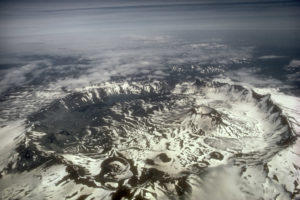
Chile , Laguna del Maule :
Special Report on Volcanic Activity (REAV), Maule Regions, Laguna del Maule Volcanic Complex, February 9, 2025, 08:50 local time (Continental Chile)
The National Geology and Mining Service of Chile (Sernageomin) announces the following PRELIMINARY information, obtained through the monitoring equipment of the National Volcanic Monitoring Network (RNVV), processed and analyzed at the Southern Andean Volcano Observatory (Ovdas):
On Sunday, February 9, 2025, at 05:44 (08:44 UTC), the monitoring stations installed near the Laguna del Maule volcanic complex recorded an increase in the occurrence of volcano-tectonic earthquakes (associated with rock fracturing), reaching a total of 125 earthquakes for the last 3 hours, characteristic of a volcanic-tectonic earthquake swarm. volcano-tectonics.
The characteristics of the earthquake after its analysis are as follows:
TIME OF ORIGIN: 08:18 local time (11:18 UTC)
LATITUDE: 36.108° S
LONGITUDE: 70.504° W
DEPTH: 7.8 km
LOCAL MAGNITUDE: 0.7 (ML)
Observation:
At the time of this report, a decrease in the energy and occurrence of earthquakes has been recorded.
The volcanic technical alert is maintained at GREEN level.
Source : Sernageomin
Photo : Senapred / Rayen Gho.
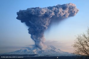
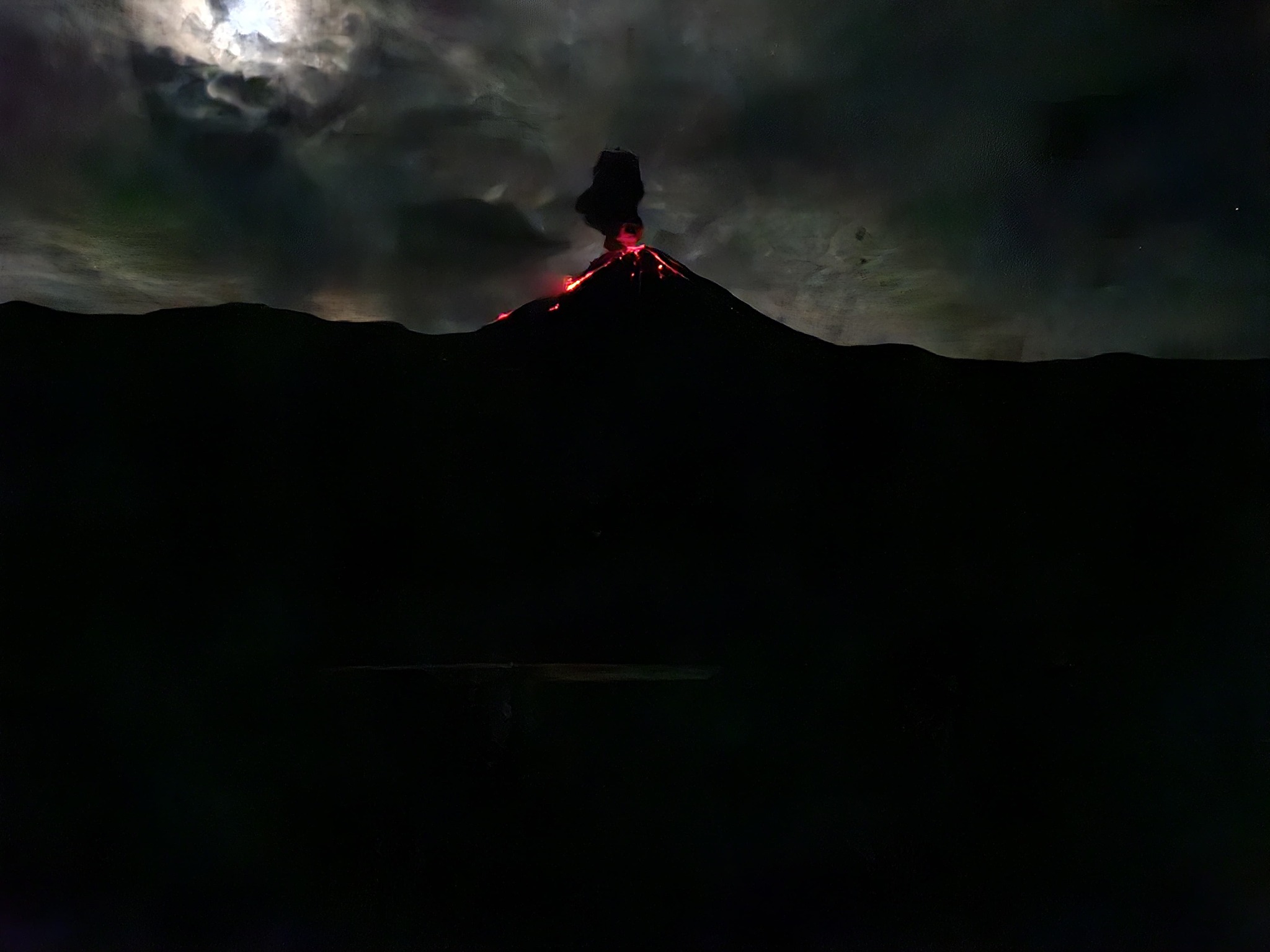
Ecuador , El Reventador .
DAILY REPORT ON THE STATE OF THE REVENTADOR VOLCANO , Sunday 09 February 2025.
Information Geophysical Institute – EPN.
Surface Activity Level: High , Surface Trend: No changes
Internal Activity Level: Moderate , Internal Trend: No changes
From 08 February 2025 , 11:00h to 09 February 2025 , 11:00h :
Seismicity:
The count of seismic events recorded at the station is detailed below.
Explosion (EXP) 75
Long Period (LP) 8
Emission Tremor (TREMI) 7
Harmonic Tremor (TRARM) 4
Rainfall/Lahars:
No rainfall has been recorded in the areas surrounding the volcano. **In the event of heavy rainfall, it could remobilize the accumulated material, generating mud and debris flows that would descend the flanks of the volcano and flow into adjacent rivers.
Emission/Ash Column:
Several gas and ash emissions were observed using surveillance cameras, with columns reaching heights of between 400 and 1000 meters above the crater level, heading towards the West and the Northwest, respectively. In relation to this activity, the Washington VAAC agency has published two reports associated with ash emissions, both reaching a height of 700 m above sea level, towards the Northwest.
Other monitoring parameter:
The MIROVA-MODIS and FIRMS satellite platforms detected 1 and 2 thermal anomalies respectively.
Observation:
Since yesterday afternoon, until the submission of this report, the volcano has remained mostly cloudy. However, during the night, surveillance cameras have repeatedly observed the descent of incandescent materials up to 800 meters below the level of the crater.
Alert level – SGR: Orange
Source : IGEPN
Photo : 07/2024 , volcanes ecuador/FB.
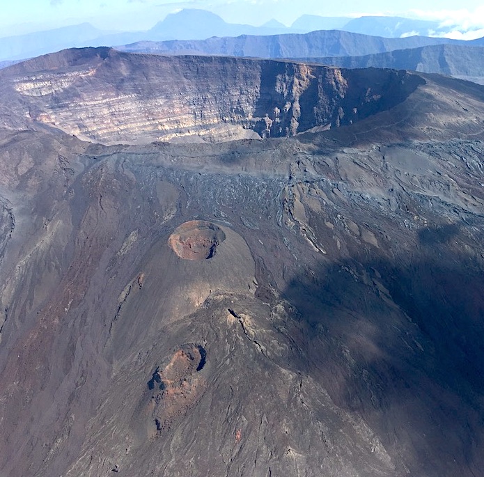
La Réunion , Piton de la Fournaise :
Press release, Institut de physique du globe de Paris / Piton de la Fournaise Volcanological Observatory, February 6, 2025 – 10:30 p.m. local time – 6:30 p.m. UTC
Earthquake felt
On Thursday, February 6, 2025, 9:50 p.m. (local time – or 5:50 p.m. UTC), an earthquake was felt by residents of the island, mainly in the western sector of the island.
This earthquake was recorded by the seismometers of the Piton de la Fournaise Volcanological Observatory. The first analyses of this earthquake made it possible to locate it, 5 km west-southwest of Cilaos, at a depth of 11 km (or a hypocentral distance of approximately 12 km). Its magnitude was measured at 2.3 on the Richter scale.
The OVPF staff is working to refine the location calculations for this event. Also, the information concerning the location and intensity could change marginally.
This type of event, felt by the population, is recorded several times a year. This event is isolated and is of tectonic origin. At present, this earthquake has not been followed by aftershocks.
Call for testimonies on felt earthquakes: the real intensities (effects of an earthquake in a given location) can only be correctly determined by collecting testimonies. If you felt this earthquake, even weakly, you are invited to report it to the BCSF (French Central Seismological Bureau) on the website http: //www. franceseisme .fr/
Source : direction de l’OVPF-IPGP
Photo : OVPF.