February 5 , 2025.
Hawaii , Kilauea :
Tuesday, February 4, 2025, 11:19 AM HST (Tuesday, February 4, 2025, 21:19 UTC)
19°25’16 » N 155°17’13 » W,
Summit Elevation 4091 ft (1247 m)
Current Volcano Alert Level: WATCH
Current Aviation Color Code: ORANGE
Activity Summary:
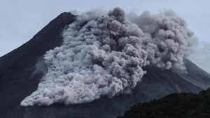
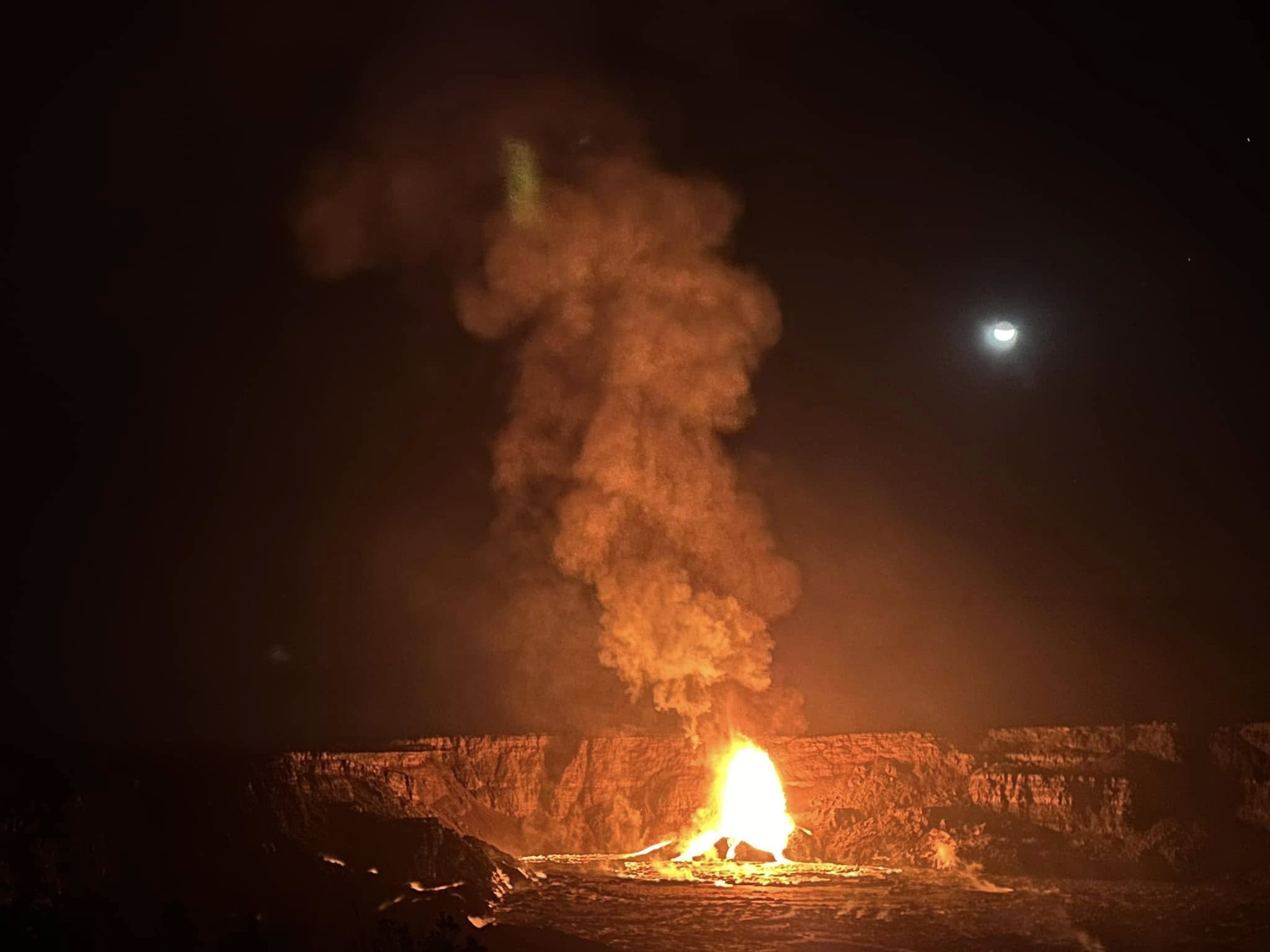
Kīlauea is erupting in Hawai’i Volcanoes National Park. Episode 8 of the ongoing summit eruption began at 9:52 p.m. HST on February 3, 2025.
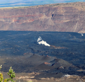
The is the eighth episode of Kīlauea’s ongoing eruption in Halemaʻumaʻu crater within Kaluapele (the summit caldera) that began on December 23, 2024. Fountain-fed lava flows from the north and south vents are erupting onto the crater floor. Lava fountains reached heights of up to 330 feet (100 meters) during the initial hours of episode 8, and were averaging heights of up to 160 feet (50 meters) at 9:20 a.m. on February 4. Current SO2 emission rates are estimated to be 10,000 t/d or higher. Deflationary tilt at the summit continues. Seismic tremor remains elevated. Earthquake counts remain low beneath the summit and rift zones. All eruptive activity is occurring in Hawai’i Volcanoes National Park. No unusual activity has been noted along Kīlauea’s East Rift Zone or Southwest Rift Zone.
Current hazards include volcanic gas emissions and windblown volcanic glass (Pele’s Hair) that may impact Hawai’i Volcanoes National Park and nearby communities.
During a monitoring overflight around 7:30 a.m. HST, USGS Hawaiian Volcano Observatory field crews observed that spatter had built up a small cone within the north vent of the 2024-2025 Kīlauea summit eruption cones. The vent was weakly spattering within the cone during the flight.
Summit Observations:
Vigourous, sustained lava fountains from both the north and south vents are feeding lava flows in Halema’uma’u crater. Fountains began erupting from the north vent at 9:52 p.m. HST and from the south vent at 11:50 p.m. HST on February 3. Fountains reached peak estimated heights of up to 330 feet (100 meters) during the first few hours of activity. Estimated fountain heights of 130 to 160 feet (40 to 50 meters) at the north vent, and 80 to 115 feet (25 to 35 meters) at the south vent, were being observed as of 9:20 a.m. on February 4. Active lava flows now cover approximately half of the crater floor.
The Uēkahuna tiltmeter (UWD) switched from inflation to deflation, and seismic tremor increased, at about 9:52 p.m. on February 3, the same time lava flows began erupting onto the crater floor. Deflationary tilt continues. UWD has recorded nearly 8 microradians of deflationary tilt since the beginning of episode 8. Seismic tremor remains elevated. No significant earthquakes were recorded in the summit region over the past 24 hours.
Weather conditions and episode timing have prevented accurate measurements of sulfur dioxide (SO2) emission rate since earlier in the eruption sequence. Based on emissions measured during earlier episodes and pauses, SO2 emission rates are estimated to be near 10,000 tonnes per day.
Strands of volcanic glass known as Pele’s Hair have been reported on surfaces throughout the summit area of Hawai’i Volcanoes National Park and surrounding communities.
Rift Zone Observations:
Rates of seismicity and ground deformation remain very low in the East Rift Zone and Southwest Rift Zone with no significant earthquake activity in the past 24 hours. Sulfur dioxide (SO2) from the East Rift Zone remains below detection limit.
Source : HVO
Photo : USGS / K. Lynn. Epic lava / FB
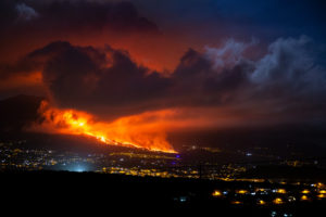
Italy , Stromboli :
WEEKLY BULLETIN, from January 27, 2025 to February 02, 2025. (issue date February 04, 2025)
SUMMARY OF ACTIVITY STATUS
In light of the monitoring data, it is highlighted:
1) VOLCANOLOGICAL OBSERVATIONS: During this period, intense eruptive activity was observed with splashes coming from the North crater area. The total hourly frequency was variable with average values of 9-13 events/h. The intensity of the explosions was low and medium in the North and Center-South crater areas.
2) SEISMOLOGY: The monitored seismic parameters do not show significant variations.
3) GROUND DEFORMATIONS: The ground deformation monitoring networks did not show significant variations over the past week.
4) GEOCHEMISTRY: SO2 flux at medium level.
Soil CO2 flux from the Pizzo area (STR02): it is at very high values
CO2/SO2 ratio in the plume (Stromboli Plume Network): very high values
Helium isotope ratio (R/Ra) dissolved in the thermal aquifer: last updated on 19 December 2024, high values
Soil CO2 flux in the San Bartolo area at medium values.
Soil CO2 flux in the Scari area at medium-high values.
5) SATELLITE OBSERVATIONS: The thermal activity observed by satellite in the summit area was generally low level with some isolated thermal anomalies of moderate level.

VOLCANOLOGICAL OBSERVATIONS
The eruptive activity of Stromboli was characterized by the analysis of images recorded by the INGV-OE surveillance cameras located at an altitude of 190 m (SCT-SCV) and at Punta dei Corvi (SPCT).
The explosive activity was produced mainly by four eruptive vents located in the northern area of the crater and by two vents located in the central-southern area.
Due to unfavorable weather conditions, the visibility of the crater terrace on 28 and 29 January was insufficient for a detailed description of the eruptive activity.
Observations of explosive activity captured by surveillance cameras
In the area of the northern crater (N), four active vents were observed that produced explosive activity of low intensity (less than 80 m in height) and sometimes of medium intensity (less than 150 m in height). In addition, at the vents of sector N2, splashing activity was observed, sometimes intense, during the days of January 27 and February 2. The products emitted were mainly composed of coarse materials (bombs and lapilli). The average frequency of explosions was variable, between 8 and 9 events/h.
In the Centre-South (CS) area, explosive activity was produced by at least two vents, the explosions were of medium intensity (less than 150 m high) emitting fine materials, while on February 1 and 2, the material produced was coarse (lapilli and bombs). The average frequency of explosions was variable, between 2 and 4 events/h
Source : INGV.
Photo : Stromboli stati d’animo / Sebastiano Cannavo
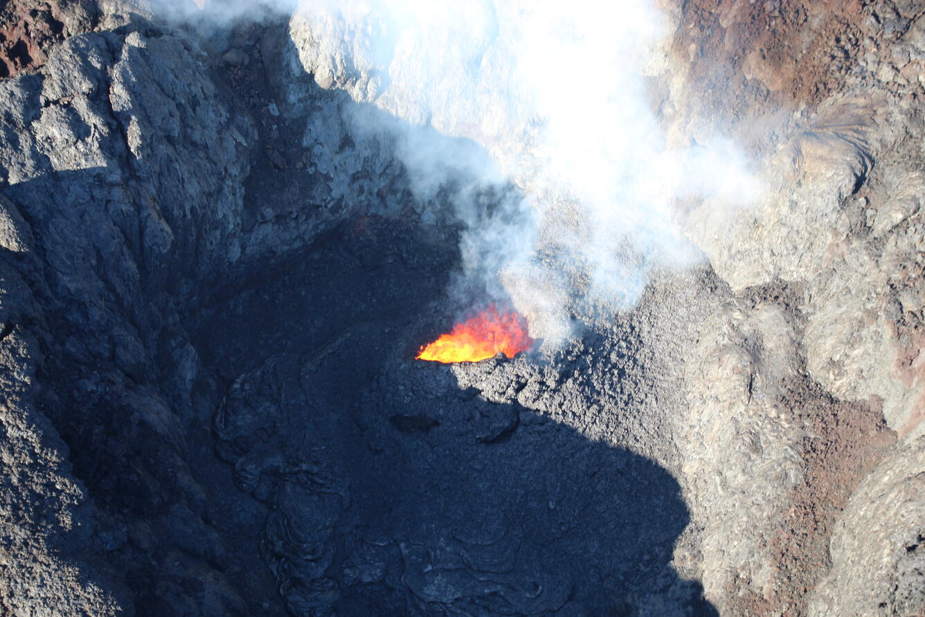
Italy / Sicily , Etna :
MONTHLY BULLETIN, REFERENCE MONTH JANUARY 2025. (issue date February 04, 2025)
SUMMARY OF ACTIVITY STATUS
In light of the monitoring data, it is highlighted:
1) VOLCANOLOGICAL OBSERVATIONS: Degassing activity in the summit craters.
2) SEISMOLOGY: Moderate seismic activity due to fracturing. Average amplitude of volcanic tremor in the low and medium-low levels.
3) INFRASOUND: Moderate infrasound activity with sources located in the Northeast Crater Area (NEC) and in the Southeast Crater Area (SEC).
4) GROUND DEFORMATIONS: Over the last month, the ground deformation monitoring networks have not recorded any significant variations.
5) GEOCHEMISTRY: SO2 flux at medium level
Soil CO2 flux (EtnaGas Network): increasing degassing values.
The partial pressure of dissolved CO2 in the aquifer (Ponteferro) shows values in seasonal variability.
Isotope ratio of peripheral sites: latest data on medium-high values (01/07/2025).
6) SATELLITE OBSERVATIONS: The thermal activity observed by satellite in the summit area was generally low level.
VOLCANOLOGICAL OBSERVATIONS
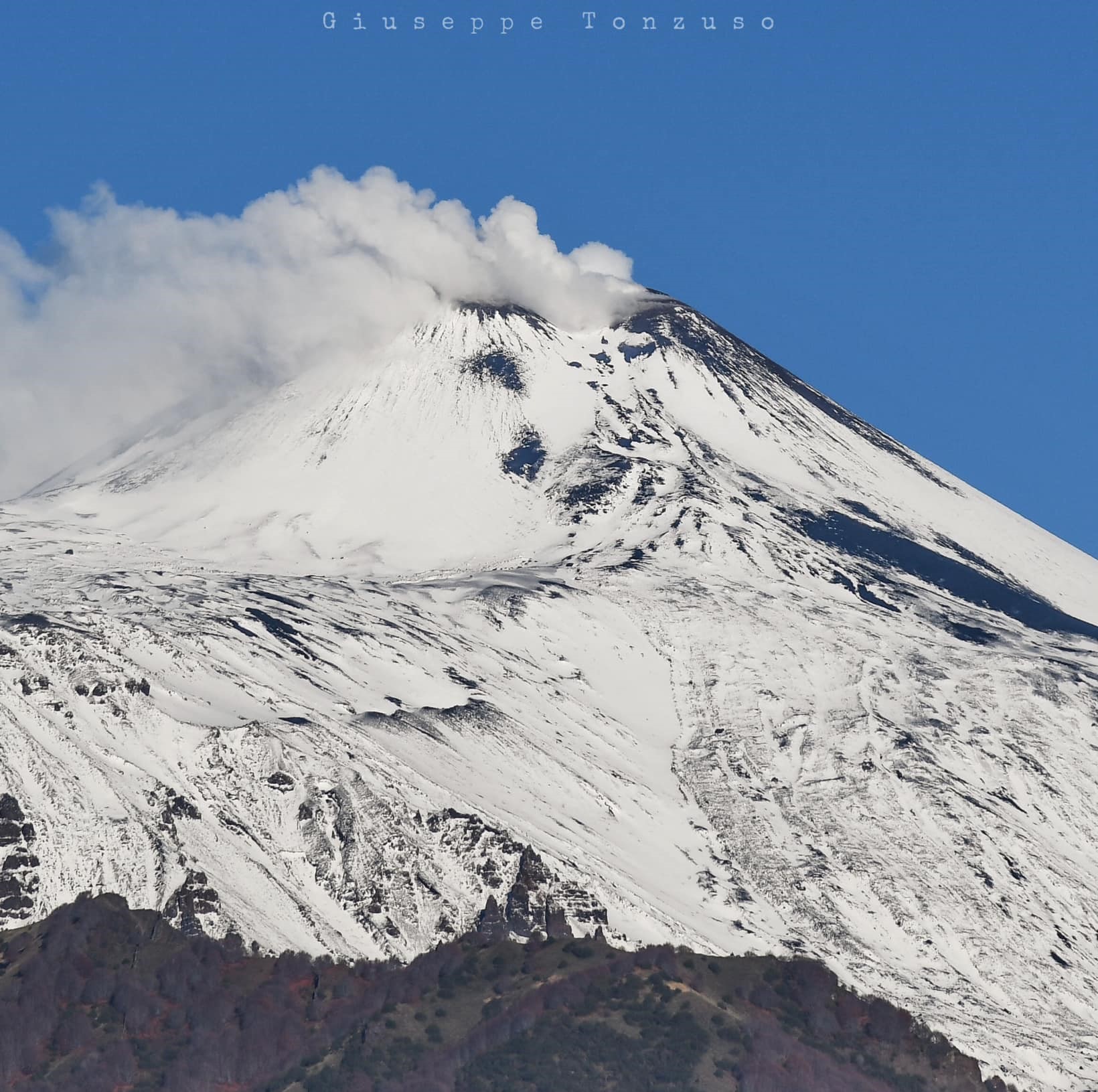
During the observation period, the monitoring of the volcanic activity of Etna was carried out by analyzing the images of the surveillance cameras of the INGV, Etna Observatory (INGV-OE) and by means of an inspection carried out on January 20.
Due to unfavorable weather conditions, the observation of volcanic activity by cameras was severely limited and discontinuous.
On days of visibility, the activity affecting the summit craters was mainly degassing.
On January 20, a survey was carried out at the base of the summit craters. The ground was covered by a layer of snow that had formed in the days preceding the inspection. At the western base of the South-Eastern crater, at an altitude between 2970 and 3060 m above sea level, a circular area without snow was observed, with little steam emission at some points. However, the area did not present significant thermal anomalies, as highlighted by the data acquired with the thermal camera. This area corresponds to an area that, since 2022, appears less snowy than the surrounding areas during the winter season.
Source : INGV
Photo : Giuseppe Tonzuso ( 7/12/2024)
Iceland , Reykjanes Peninsula :
The period of increased risk of volcanic eruption at Sundhnúkur could last several weeks
Adverse weather conditions in the coming days could affect the sensitivity of the monitoring network. Updated on 4 February at 13:45 UTC
Weather conditions in the coming days could affect monitoring capabilities
Magma accumulation under Svartsengi and associated land uplift continue
The period of increased risk of volcanic eruption could last up to a month or more
Seismic activity remains low
Risk assessment remains unchanged
The weather forecast for the coming days indicates a series of low pressure systems moving across the country, bringing strong southwesterly and southerly winds and precipitation. These weather conditions may affect measurement capabilities, particularly in terms of visibility and sensitivity of real-time seismic and GPS measurements. The Icelandic Meteorological Office will continue to monitor the situation closely, and the public is advised to stay informed of weather warnings and exercise caution when travelling.
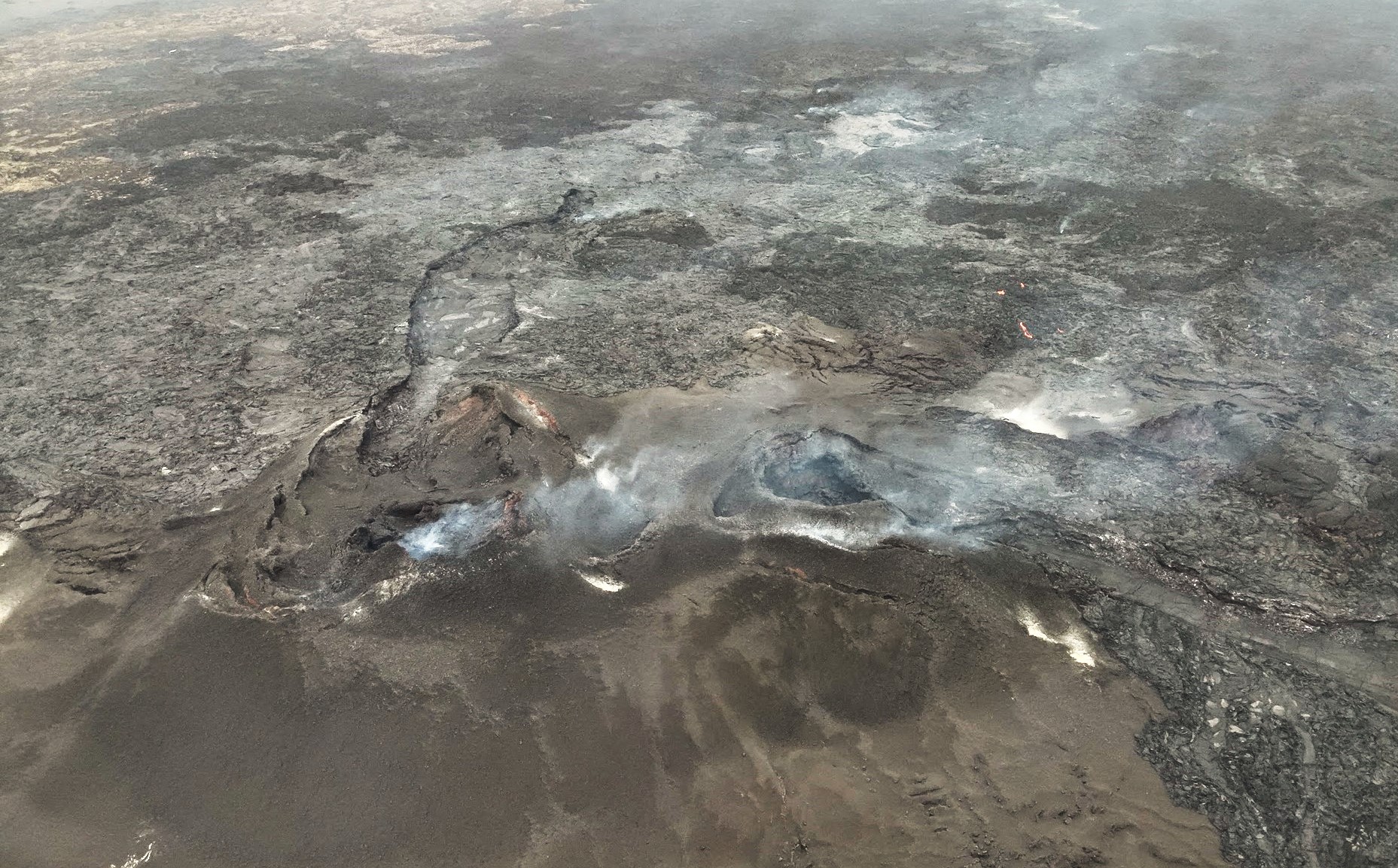
Deformation measurements continue to show ground uplift and magma accumulation beneath Svartsengi. As reported last week, the amount of magma accumulating beneath Svartsengi is now approaching the lower threshold considered necessary to trigger the next magma intrusion. Looking at recent eruptions at the Sundhnúkur crater row, they have occurred between three days and four weeks after reaching this lower threshold. However, this does not mean that the next event will occur within a month, but rather that experience suggests this is the most likely scenario.
Seismic activity near the Sundhnúkur craters has remained low since the end of the last eruption on 9 December. Only a few small earthquakes are recorded daily. However, poor weather conditions and strong winds can affect the sensitivity of the measurements.
The risk assessment remains unchanged and is valid until 11 February.
Source : IMO
Photo : Stóra-Skógfel , lProtection civile/Björn Oddsson .
Indonesia , Lewotobi Laki-laki :
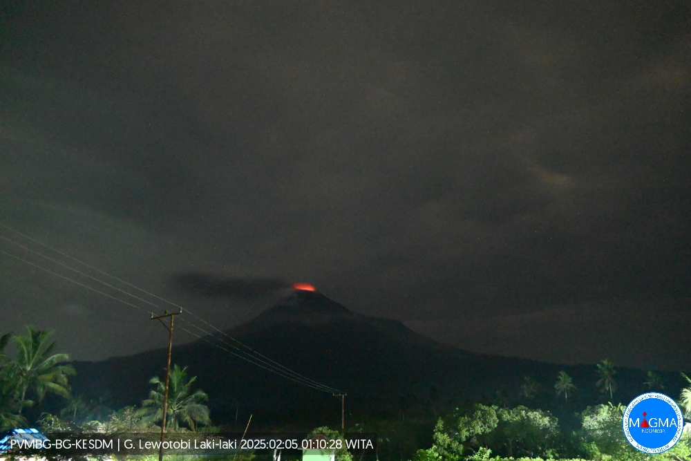
An eruption of Mount Lewotobi Laki-laki occurred on Wednesday, 5 February 2025 at 01:08 WITA with an observed ash column height of ±400 m above the peak (±1984 m above sea level). The ash column was observed to be grey in colour with a thick intensity, oriented towards the north and northeast. This eruption was recorded on a seismograph with a maximum amplitude of 28.1 mm and a duration of 121 seconds.
VOLCANO OBSERVATORY NOTICE FOR AVIATION – VONA
Issued : February 5 , 2025
Volcano : Lewotobi Laki-laki (264180)
Current Aviation Colour Code : ORANGE
Previous Aviation Colour Code : orange
Source : Lewotobi Laki-laki Volcano Observatory
Notice Number : 2025LWK036
Volcano Location : S 08 deg 32 min 20 sec E 122 deg 46 min 06 sec
Area : East Nusa Tenggara, Indonesia
Summit Elevation : 5069 FT (1584 M)
Volcanic Activity Summary :
Eruption with volcanic ash cloud at 17h08 UTC (01h08 local).
Volcanic Cloud Height :
Best estimate of ash-cloud top is around 6349 FT (1984 M) above sea level or 1280 FT (400 M) above summit. May be higher than what can be observed clearly. Source of height data: ground observer.
Other Volcanic Cloud Information :
Ash cloud moving from north to northeast. Volcanic ash is observed to be gray. The intensity of volcanic ash is observed to be thick.
Remarks :
Eruption recorded on seismogram with maximum amplitude 28.1 mm and maximum duration 121 second.
Source et photo : Magma Indonésie .