January 13 , 2025.
New Zealand , White Island :
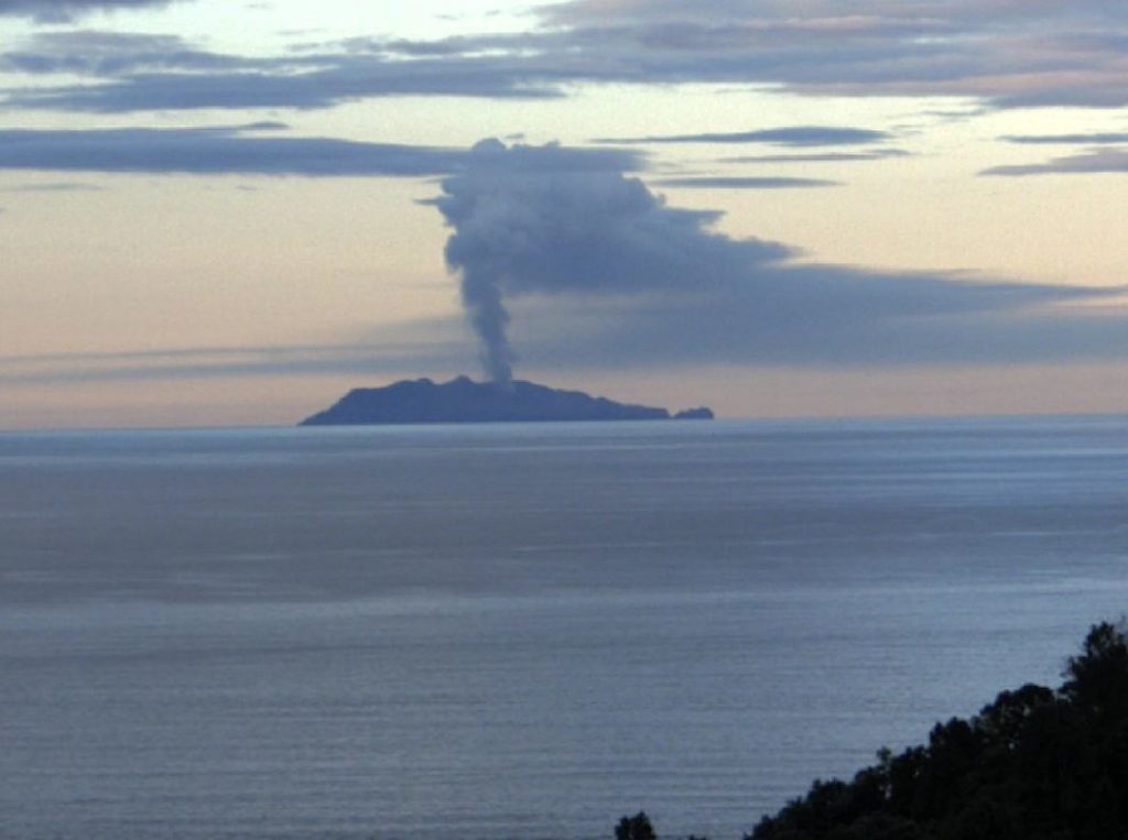
Steam and gas plumes at Whakaari with minor volcanic ash. Volcanic Alert Level remains at Level 2 and Aviation Colour Code is changed to Orange. Published: Mon Jan 13 2025 12:30 PM
Volcanic Alert Level remains at 2
Aviation Colour Code is raised to Orange
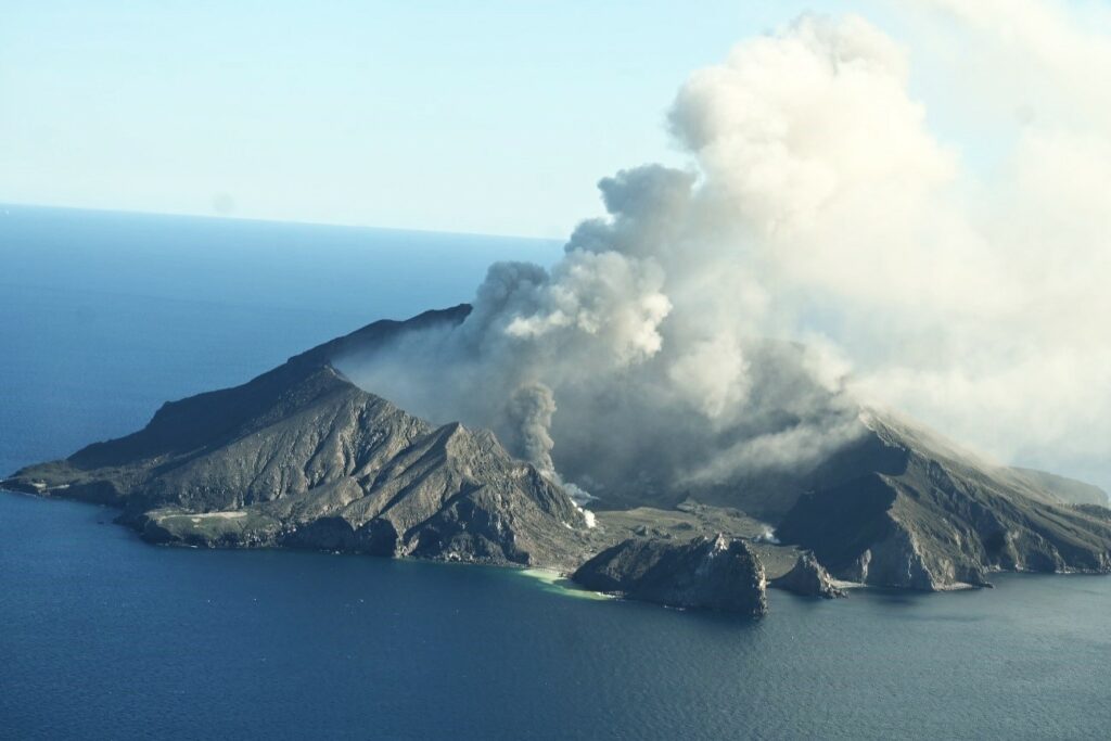
Whakaari/White Island is currently passively emitting a weak-to-moderate steam and gas plume that contains minor volcanic ash. The Volcanic Alert Level remains at Level 2 and the Aviation Colour Code is changed to Orange.
A weak-moderate steam and gas plume containing volcanic ash is currently being passively emitted from Whakaari, as seen on our webcams at Whakatāne and Te Kaha as well as on satellite imagery. These observations are used to re-assess the Aviation Colour Code, which is now changed to Orange.
Over the last 2-3 weeks the emissions from the volcano have primarily been weak-to-moderate steam and gas plume emissions. We have frequently ob-served very minor volcanic ash associated with the plume, and this has created hazy conditions down wind of the island. The NZ MetService has also detected small amounts of volcanic ash in satellite data on some days. The prevailing southerly wind is blowing the plume away from the mainland.
When the weather allows, a larger plume can sometimes be seen from the Bay of Plenty coast above and downwind of the island. Similarly, activity can change at short notice and produce stronger steam and gas plumes which are seen from the coast. These plumes occasionally contain volcanic ash.
Without sensors on the island, we continue to rely on remote cameras and satellite imagery to monitor Whakaari. We continue to monitor the island.
Recent activity is consistent with moderate-heightened unrest and the Volcanic Alert Level therefore remains at Level 2. The presence of minor volcanic ash being emitted from the volcano means that the Aviation Colour Code is changed to Orange. These levels acknowledge the current level of activity but also reflect the degree of uncertainty about the level of unrest due to the current lack of consistent, usable real-time monitoring data. The level of volcanic activity could escalate back to levels seen in 2024 and the volcano can explosively erupt with little or no warning.
Source : Geonet /Craig Miller , Duty Volcanologist
Photos : Geonet.
Indonesia , Karangetang :
Decrease in the activity level of Mount Karangetang, North Sulawesi, from level III (SIAGA) to level II (WASPADA).
Introduction
Karangetang Volcano is a stratovolcano, geographically located at coordinates 20°47 N latitude and 1250°24′ E longitude, its maximum height is approximately 1,784 m above sea level.
In November 2023, volcanic activity decreased, so that the activity level was lowered from level III (siaga) to level II (waspada) on 29 November 2023 at 16:00 WITA. In October 2024, activity appeared to have increased significantly, so that on 11 November 2024 at 13:00 WITA, the activity level had been raised from level II (waspada) to level III (siaga).
Visual observation
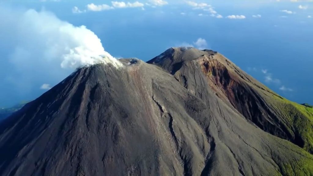
Period 1 – 10 January 2025 mostly sunny to rainy weather, the mountain is sometimes covered with fog, during sunny periods white smoke from the crater is observed with a maximum height of about 400 meters above the summit, weak to moderate winds to the North, North-East, East and South-East, there are no avalanches or eruptions. The condition of the northern crater was observed as emitting thin to thick white smoke, about 400 meters high above the summit, at night there was no visible incandescence above the lava dome, no avalanches were observed.
Instrumental observation
Seismicity recorded from 1 to 10 January 2025:
54 emission earthquakes
1 Tornillo earthquake,
28 hybrid/multiphase earthquakes,
24 shallow volcanic earthquakes,
53 deep volcanic earthquakes,
5 local tectonic earthquakes
143 distant tectonic earthquakes
3 continuous tremors.
Assessment
Visual observations of the height of the dominant smoke column were about 100 meters above the peak. The condition of the North Crater did not show significant changes, the incandescence above the dome is still visible at a height of 25 to 400 m.
Earthquake records show a decrease, earthquakes are dominated by surface earthquakes, namely emission earthquakes which are usually recorded at 5 events per day, while volcanic earthquakes are dominated by deep volcanic earthquakes recorded at 5 events per day, while avalanche earthquakes which are an indication of there are no effusive eruptions.
Based on visual and seismic data, the volcanic activity of Mount Karangetang shows a decrease in activity, so the activity level can be lowered to a lower level.
Potential Danger Threat
The accumulation of effusive eruptive materials in the valleys, slide paths of hot cloud avalanches can potentially cause avalanches downstream, so people living in the surrounding area and people who will cross the valley/river should be vigilant, in addition to this, one should also be aware of the occurrence of lahars during rainy periods at the summit
Conclusion
Based on the results of the volcanic activity assessment, the activity level of Karangetang has been lowered from level III (SIAGA) to level II (WASPADA) as of January 11 at 18:00 WITA.
Source : PVMBG
Photo : hshdude / esia
Indonesia , Ibu :
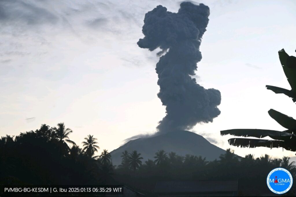
An eruption of Mount Ibu occurred on Monday, 13 January 2025 at 06:34 WIT with an observed ash column height of ± 2500 m above the peak (± 3825 m above sea level). The ash column was observed to be grey in colour with a thick intensity, oriented towards the West. This eruption was recorded on a seismograph with a maximum amplitude of 28 mm and a duration of 94 seconds.
VOLCANO OBSERVATORY NOTICE FOR AVIATION – VONA
Issued : January 13 , 2025
Volcano : Ibu (268030)
Current Aviation Colour Code : ORANGE
Previous Aviation Colour Code : orange
Source : Ibu Volcano Observatory
Notice Number : 2025IBU052
Volcano Location : N 01 deg 29 min 17 sec E 127 deg 37 min 48 sec
Area : North Maluku, Indonesia
Summit Elevation : 4240 FT (1325 M)
Volcanic Activity Summary :
Eruption with volcanic ash cloud at 21h34 UTC (06h34 local).
Volcanic Cloud Height :
Best estimate of ash-cloud top is around 12240 FT (3825 M) above sea level or 8000 FT (2500 M) above summit. May be higher than what can be observed clearly. Source of height data: ground observer.
Other Volcanic Cloud Information :
Ash cloud moving to west. Volcanic ash is observed to be gray. The intensity of volcanic ash is observed to be thick.
Remarks :
Eruption recorded on seismogram with maximum amplitude 28 mm and maximum duration 94 second.
Source et photo : Magma Indonésie.
Hawaii , Kilauea :
Sunday, January 12, 2025, 7:55 AM HST (Sunday, January 12, 2025, 17:55 UTC)
19°25’16 » N 155°17’13 » W,
Summit Elevation 4091 ft (1247 m)
Current Volcano Alert Level: WATCH
Current Aviation Color Code: ORANGE
Activity Summary:
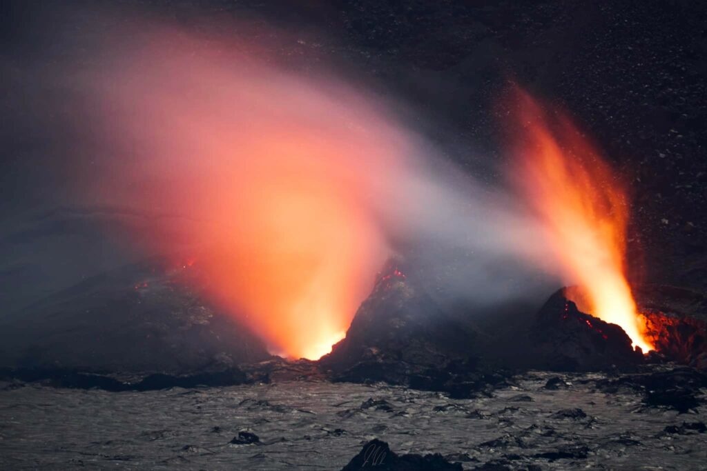
The summit eruption at Kīlauea volcano that began on December 23 has been paused since the evening of January 3. Beginning yesterday evening, very minor spattering has been visible within the northern eruptive vent, as lava remains close to the surface on the southwest side of Kaluapele, the volcano’s summit caldera. No unusual activity has been noted along Kīlauea’s East Rift Zone or Southwest Rift Zone.
Summit Instrumental Observations:
Seismicity in the summit region remains low, with only 1 small earthquake (below M2.0) detected in the past 24 hours. Seismic tremor remains near background levels, indicating very little activity at the eruptive vents. Summit tiltmeters reversed from deflationary tilt to inflationary tilt on January 3 around the same time that the single remaining lava fountain shut down; this inflationary tilt continues, but at a relatively low rate. The most recently measured sulfur dioxide (SO2) emission rate was approximately 500 tonnes per day on Friday, January 10. Though significantly lower than rates measured during more energetic eruptive activity, this value still represents above-background SO2 emissions, and the resulting hazard will be affected by wind conditions
.
Summit Eruption Observations:
After sunset yesterday evening, very minor spattering within the northern eruptive vent became visible in live stream camera views of the southwest side of Kaluapele, within Halema‘uma‘u crater. The vigor of this spattering varied throughout the night, with a peak phase just before 4:00 a.m. Spatter was likely not thrown any higher than 5–10 yards (meters), remaining within the vent. Intermittent spattering continues this morning at the northern vent, but after sunrise it has not been as clearly discernable in the daytime light. Periods of strong glow from the southern eruptive vent suggest that it may have exhibited similar behavior at times overnight.
These observations provide further evidence for active lava within the eruptive vents just a few yards (meters) below the crater floor, as spotted by a HVO helicopter overflight on Friday, January 10. At this time, no new lava flows have yet exited the vents. The area where HVO’s automatic laser rangefinder is pointing on the crater floor—a few hundred yards (meters) northeast of the vents—remains stable, so there is no ongoing emplacement of lava below surface crust on the crater floor.
Source : HVO
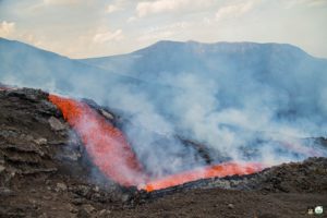
Photo : Josh Whitcomb , 10/01/2025
Ecuador , El Reventador :
DAILY REPORT ON THE STATE OF THE REVENTADOR VOLCANO, Sunday, January 12, 2025.
Information Geophysical Institute – EPN.
Surface Activity Level: High, Surface Trend: No Change
Internal Activity Level: Moderate, Internal Trend: No Change
From January 11, 2025, 11:00 a.m. to January 12, 2025, 11:00 a.m.:
Seismicity:
The count of seismic events recorded at the station is detailed below.
Explosion (EXP) 64
Long Period (LP) 6
Emission Tremor (TREMI) 10
Harmonic Tremor (TRARM) 1
Rainfall / Lahars:
Since yesterday afternoon until the publication of this report, thanks to the satellite and meteorological monitoring system, no rain has been recorded in the areas surrounding the volcano. **In the event of heavy rains, they could remobilize the accumulated materials, generating mud and debris flows that would descend the sides of the volcano and flow into adjacent rivers.
Emission / Ash Column:
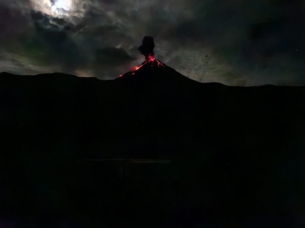
In the last 24 hours, several emissions of gas and ash have been observed using the surveillance camera system, reaching heights of between 300 and 700 meters above the crater level in the northwest, southwest and west directions. In relation to this activity, the VAAC agency in Washington issued 3 emission reports with heights between 700 and 1400 meters above the crater level in the West, Southwest and Northwest directions.
Other monitoring parameters:
The FIRMS satellite system recorded 1 thermal anomaly, the MIROVA-MODIS satellite system recorded 1 moderate thermal anomaly and the MIROVA-VIIRS satellite system recorded 1 moderate thermal anomaly and 1 weak thermal anomaly in the last 24 hours.
Observation:
Since yesterday, several episodes of incandescence have been recorded by the surveillance camera system, with its descent to 1000 meters below the crater level. At the time of writing this report, the volcano is cloudy.
Source : IGEPN
Photo : 07/2024 , Volcanes Ecuador / FB.


