November 28 , 2024.
Iceland : Reykjanes Peninsula :
Volcanic unrest remains stable over the past 24 hours
Hazard assessment lowered for Svartsengi and Grindavík
Updated 27. November at 16:00 UTC
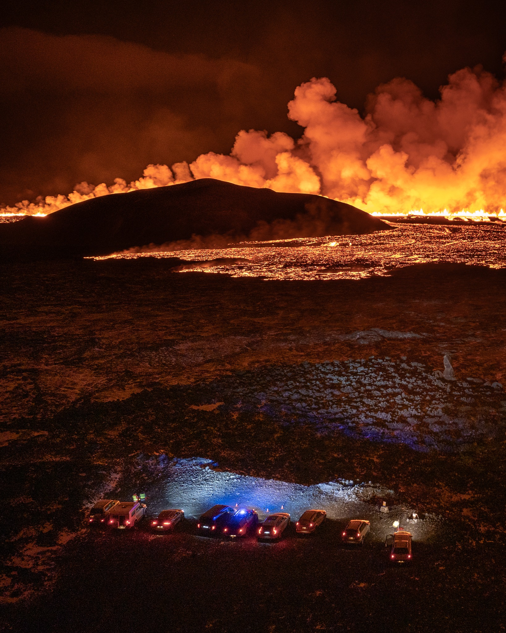
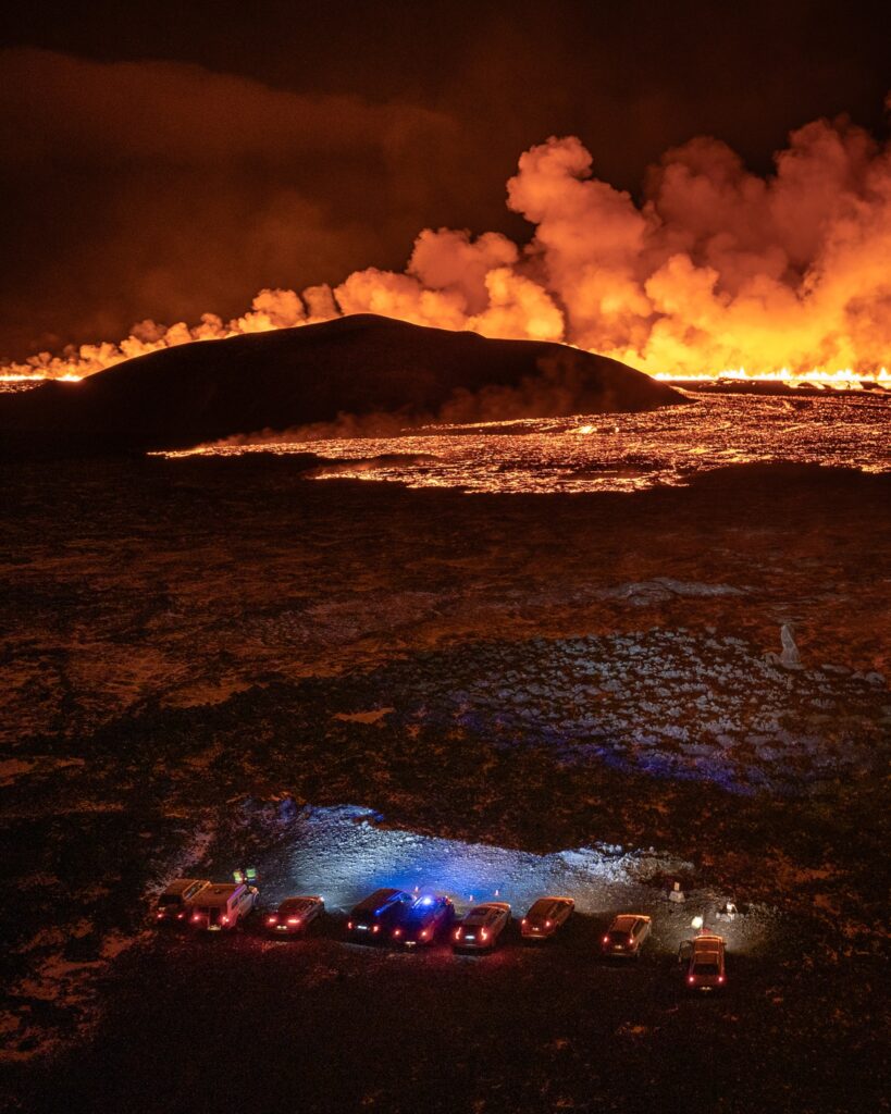
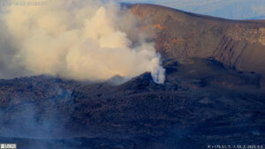
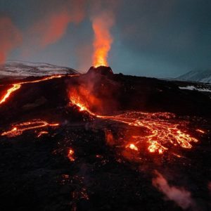
A single crater remains active, east of Stóra-Skógfell.
The lava flow continues to move eastward toward Fagradalsfjall.
Subsidence around Svartsengi has decreased, alongside diminishing volcanic activity.
Gas pollution may affect the capital region today.
Updated hazard assessment in effect until 29 November, assuming no changes.
The eruption has continued at a steady rate over the last 24 hours. Volcanic unrest remains stable, and the lava flow from the crater continues to move eastward toward Fagradalsfjall.
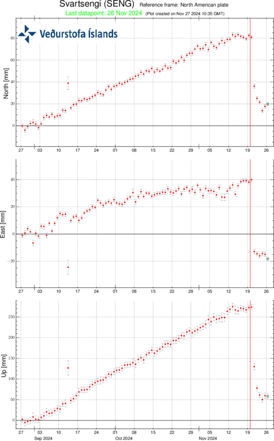
As volcanic activity decreases, subsidence around Svartsengi has slowed. Since day-to-day changes are minor, it is necessary to monitor the trend over several days to determine whether uplift has resumed. During the last two eruptions, it took about a week for uplift to become apparent after subsidence slowed. Thus, additional measurements over the next week will likely be needed to evaluate whether magma accumulation beneath Svartsengi will continue.
Displacements at GPS station SENG near Svartsengi over the past 90 days in the north, east, and vertical directions (top, middle, bottom). The lower graph shows vertical elevation changes in millimetres, with yesterday’s (26 November) measurement marked by a green dot. The red line indicates the start of the eruption.
Gas dispersion forecast
Our gas dispersion forecast estimates southwest winds today (Wednesday), carrying pollution north-eastward, possibly to the capital region. This evening, winds will shift to the west and later northwest, directing the pollution eastward and then south-eastward. Tomorrow (28 November), northeast winds are forecasted, which will carry pollution south-westward. Moss-fires at the eruption site are not expected.
Source : IMO
Photos : Jakob Vegerfors , IMO
Indonesia , Banda Api :
According to a news report the coordinator for the Banda Api observation post stated that the climbing route on the volcano was closed on 18 November due to increased seismicity. The coordinator noted that during 1 August-17 November there were 11 shallow volcanic earthquakes, 541 deep volcanic earthquakes, and 46 local and 250 distant tectonic earthquakes, respectively; three of the events were felt. The average number of earthquakes per day was between 13 and 30 events, though the average was as high as 40 per day. Though the volcano was sometimes obscured by weather conditions, diffuse white plumes were observed rising 20-30 m above the summit. The Alert Level remained at 2 (the second lowest level on a four-level scale) and the public was advised to stay 1 km away from the summit.
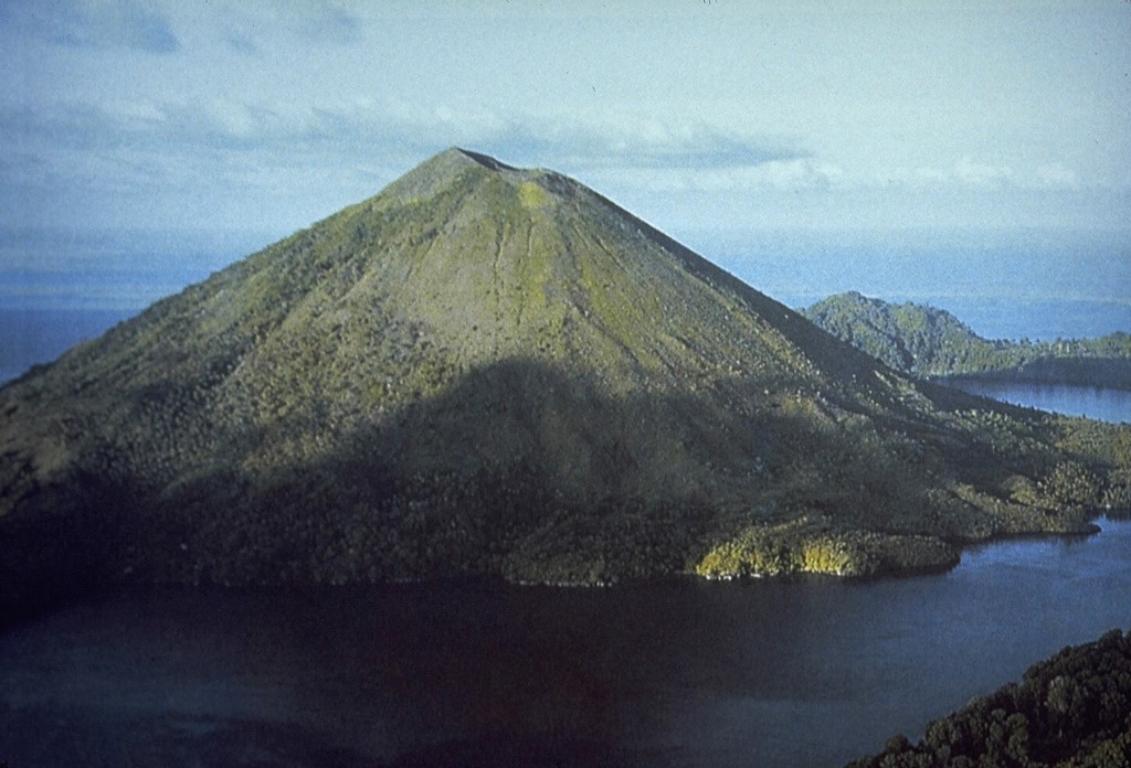
Banda Api volcano is seen here from the SW prior to a major eruption in 1988. The ridge in the right background is Neira Island; at the bottom right is the western tip of Lonthur Island. Both islands are remnants of calderas inside which the conical Gunung Api stratovolcano was constructed. One of many peaks named Gunung Api (« Fire Mountain ») in Indonesia, Banda Api is the most active volcano of the Banda arc
The 3-km-wide island of Banda Api is the northern-most volcano in the Banda arc and has a long period of recorded observation because of its key location in the Portuguese and Dutch spice trade. The basaltic-to-rhyodacitic volcano is located in the SW corner of a mostly submerged 7 km caldera. At least two episodes of caldera formation are thought to have occurred, with the arcuate islands of Lonthor and Neira considered to be pre-caldera remnants. A conical peak rises to about 600 m at the center of the island. Eruptions have been recorded since 1586 CE, mostly consisting of Strombolian eruptions from the summit crater, but larger explosive eruptions have occurred and occasional lava flows have reached the coast.
Source : GVP, PVMBG.
Photo: Tom Casadevall / 1988 , (U.S. Geological Survey) /GVP.
Japan , Kuchinoerabujima :
The Japan Meteorological Agency (JMA) reported that volcanic activity at Kuchinoerabujima had been declining since mid-August. The number of shallow volcanic earthquakes that had been frequent since the beginning of April, with most epicenters located near Furudake Crater, and few near Shindake Crater (just N of Furudake), had declined; no large-amplitude earthquakes had been recorded. There were no notable changes to hydrothermal fields from late October to mid-November. Sulfur dioxide gas emissions were at low levels, fluctuating between 20 and 60 tons per day, and occasionally below detectable limits. The Alert Level was lowered to 1 (on a scale of 1-5) at 11h00 on 20 November and the public was warned to exercise caution around the craters and not to enter restricted areas.
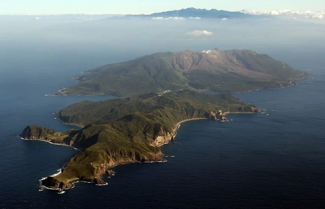
A group of young stratovolcanoes forms the eastern end of the irregularly shaped island of Kuchinoerabujima in the northern Ryukyu Islands, 15 km W of Yakushima. The Furudake, Shindake, and Noikeyama cones were erupted from south to north, respectively, forming a composite cone with multiple craters. All historical eruptions have occurred from Shindake, although a lava flow from the S flank of Furudake that reached the coast has a very fresh morphology. Frequent explosive eruptions have taken place from Shindake since 1840; the largest of these was in December 1933. Several villages on the 4 x 12 km island are located within a few kilometers of the active crater and have suffered damage from eruptions.
Sources: Japan Meteorological Agency (JMA) , GVP .
Photo : Asahi Shimbun
Colombie , Nevado del Ruiz :
Manizales, November 26, 2024, 4:00 p.m.
From the monitoring of the activity of the Nevado del Ruiz volcano, the Colombian Geological Survey (SGC), an entity attached to the Ministry of Mines and Energy, reports that:
During the week of November 19 to 25, 2024, the volcano continued with unstable behavior. Compared to the previous week, the main variations in the monitored parameters were:
– The seismic activity associated with the fracturing of rocks inside the volcanic edifice maintained similar levels in the number of earthquakes recorded and decreased in the seismic energy released. The recorded earthquakes were of magnitudes less than 1 (low energy level) and were located in the Arenas crater and on the different flanks of the volcano, mainly to the south-southwest, northeast and southeast, at distances of up to 10 km from the volcano. The depths of the events varied between less than 1 km and 7 km from the summit of the volcano. The seismic activity related to the lava dome (bulge or mound) located at the bottom of the crater maintained similar levels and continued to show low energy levels.
– Seismicity related to the activity of fluids inside volcanic conduits and associated with pulsatile ash emissions decreased the number of recorded earthquakes and increased the seismic energy released. The energy levels of these types of events ranged from low to moderate. On the other hand, long-period signals increased and had low energy levels. Despite the atmospheric conditions of high cloudiness existing in the volcanic area, it was possible to confirm several ash emissions and small changes in the temperature of the emitted material associated with some of these signals, thanks to the cameras (conventional or thermographic) used to monitor the volcano.
– The emission of water vapor and gases into the atmosphere continued from the Arenas crater. The degassing rates of sulfur dioxide (SO2) were variable. This week too
it was not possible to establish changes compared to previous weeks, since the wind direction did not favor the measurement stations. From satellite monitoring, similar values were observed in the SO2 degassing compared to the previous week.
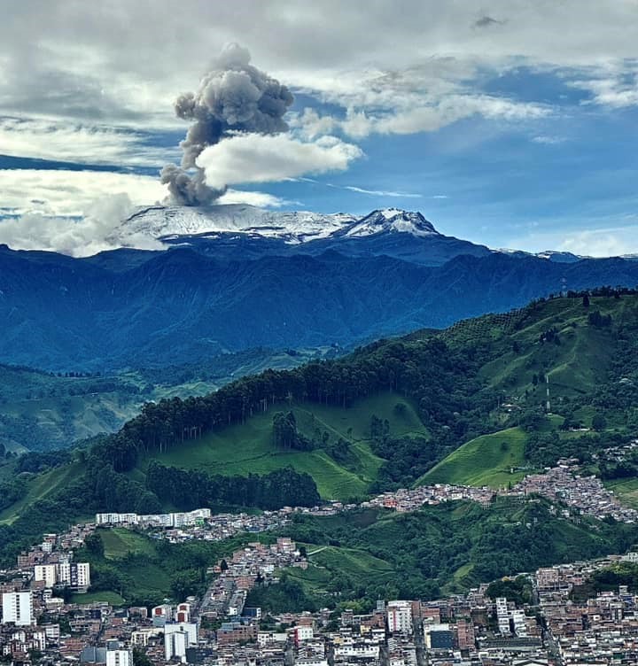
– The gas column reached a vertical height and maximum dispersion of 1300 m. This value was measured at the summit of the volcano several times on November 21 and 24. The dispersion direction of the columns showed a preferential trend towards the southwest of the volcano, mainly towards the end of the week.
– In the monitoring of thermal anomalies at the bottom of the Arenas crater, from satellite monitoring platforms, the detection of anomalies was limited due to the atmospheric conditions of high cloudiness prevailing in the area, however, some reports of anomalies of low energy levels were obtained.
Source : SGC
Photo : Alex Jimenez Matiz
Papua / New Guinea , Ulawun :
The Rabaul Volcano Observatory (RVO) reported that seismicity at Ulawun increased at around 16h00 on 19 November and was characterized as an increase in the magnitude of events resembling volcano-tectonic signals. Signals indicating volcanic tremors increased at around 18h30 on 20 November, increased again at around 20h15, and then slightly decreased and continued at that level. RVO recommended a declaration of Alert Level Stage 1 (the lowest level of a four-stage scale).
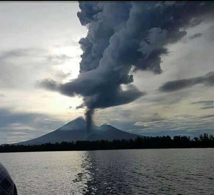
The symmetrical basaltic-to-andesitic Ulawun stratovolcano is the highest volcano of the Bismarck arc, and one of Papua New Guinea’s most frequently active. The volcano, also known as the Father, rises above the N coast of the island of New Britain across a low saddle NE of Bamus volcano, the South Son. The upper 1,000 m is unvegetated. A prominent E-W escarpment on the south may be the result of large-scale slumping. Satellitic cones occupy the NW and E flanks. A steep-walled valley cuts the NW side, and a flank lava-flow complex lies to the south of this valley. Historical eruptions date back to the beginning of the 18th century. Twentieth-century eruptions were mildly explosive until 1967, but after 1970 several larger eruptions produced lava flows and basaltic pyroclastic flows, greatly modifying the summit crater.
Sources: Rabaul Volcano Observatory (RVO) , GVP .
Photo : Auther A Balisi , 2023.

