October 17 , 2024.
Alaska , Spurr :
AVO/USGS Volcanic Activity Notice
Current Volcano Alert Level: ADVISORY
Previous Volcano Alert Level: NORMAL
Current Aviation Color Code: YELLOW
Previous Aviation Color Code: GREEN
Issued: Wednesday, October 16, 2024, 12:07 PM AKDT
Source: Alaska Volcano Observatory
Notice Number: 2024/A675
Location: N 61 deg 17 min W 152 deg 15 min
Elevation: 11070 ft (3374 m)
Area: Cook Inlet-South Central
Volcanic Activity Summary:
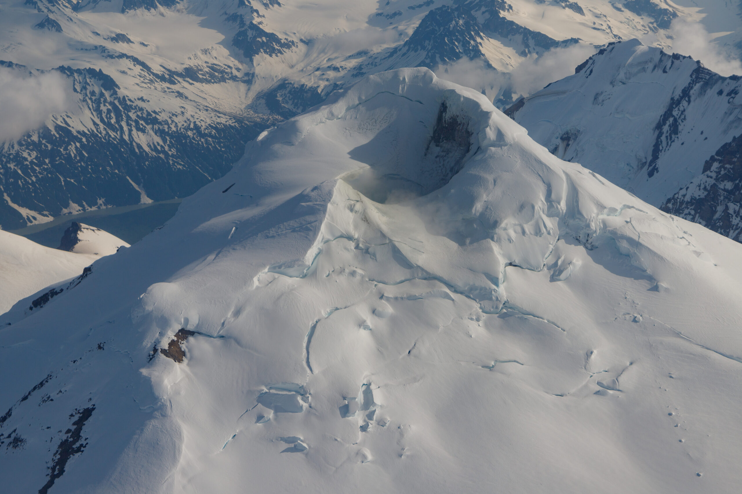
AVO has observed a gradual increase in volcanic unrest over a period of several months at Mount Spurr, located about 120 km (75 miles) west of Anchorage .GNSS receivers have detected sustained upward and outward ground deformation since March 2024. An increase in seismic activity has also been noted since April .Other indications of elevated activity include the development of a small lake in the summit crater in early summer of 2024.
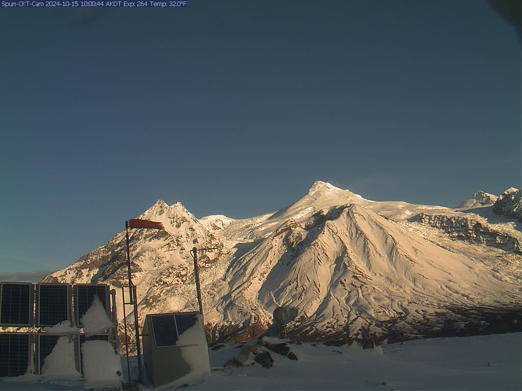
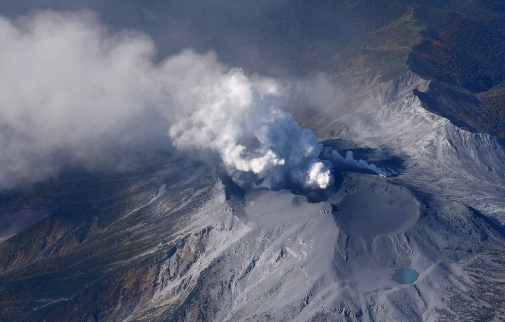
Mount Spurr on a cloudless sunny morning, as seen from AVO monitoring station CKT. Mount Spurr summit is the tallest point in the image, and there is a faint steam plume visible on the right side of the peak. Directly in front of and below the summit is Crater Peak, the vent location of Spurr’s most recent eruptions.
The largest magnitude earthquake detected in this current period of unrest is a M2.3 earthquake on October 6th. This increase in activity was described in detail in an Information Statement that AVO released on October 9th. Analysis of seismic data indicates a subtle increase in the rate and size of earthquakes over the past few weeks. Because this is a notable departure from the normal background seismicity of the volcano, AVO is raising the Aviation Color Code to YELLOW and the Volcano Alert Level to ADVISORY. However, there are no indications that an eruption is imminent. Often this type of seismicity and ground deformation will decline without producing an eruption.
AVO continues to closely monitor activity at Mount Spurr for signals that would indicate that the volcano is moving closer to an eruption. Based on previous eruptions, changes from current activity in the earthquakes, ground deformation, summit lake, and fumaroles would be expected if magma began to move closer to the surface. Therefore, it is very likely that if an eruption were to occur it would be preceded by additional signals that would allow advance warning.
Remarks:
Mount Spurr volcano is an ice- and snow-covered stratovolcano located on the west side of Cook Inlet approximately 120 km (75 mi) west of Anchorage. The only known historical eruptions occurred in 1953 and 1992 from the Crater Peak flank vent located 3.5 km (2 mi) south of the summit of Mount Spurr. These eruptions were brief, explosive, and produced columns of ash that rose up to 20 km (65,000 ft) above sea level and deposited several mm of ash in south-central Alaska, including approximately 6 mm (1/4 in) of ash on Anchorage in 1953. The last known eruption from the summit of Mount Spurr was more than 5,000 years ago. Primary hazards during future eruptions include far-traveled ash clouds, ash fall, pyroclastic flows, and lahars or mudflows that could inundate drainages all sides of the volcano, but primarily on the south and east flanks.
The Alaska Volcano Observatory (AVO) reported that low-level unrest at Spurr was ongoing. An extended outage of the seismic network occurred during February-April; elevated seismicity was already occurring when the network returned on 3 April. The rate of about 20 earthquakes per week and their magnitudes did not significantly change through mid-October . Over 900 located earthquakes were clustered in two areas; the earthquakes in one cluster were located at depths of 0-10 km beneath the volcano and those in the second cluster were located at depths of 20-35 km beneath an area SE of Crater Peak vent. The largest earthquake, a M 2.4, was recorded on 6 October. Inflation began to be detected in March by Global Navigation Satellite System (GNSS) stations on the flanks and has continued at a steady rate. A total of 4 cm of uplift was recorded by the stations closest to the source of deformation. The deformation was also confirmed in satellite radar data. A small lake formed in the summit crater sometime between 15 May and 15 June. During a 23 June overflight scientists observed the lake and estimated that it was approximately 3,800 square meters in area. Gas measurements detected low levels of sulfur dioxide and carbon dioxide at levels similar to the background levels measured in previous years. The summit crater lake grew to around 5,670 square meters by 18 September, was blue-green in color, and partially covered by ice. Active steaming was visible from vents along and above the NE lake shore and crater wall, and from a pit in the ice on the NE crater rim and had not changed in vigor during the current period of unrest.
Source : AVO , GVP.
Photos : Boyce, Ellie / Alaska Volcano Observatory / University of Alaska Fairbanks, Geophysical Institute , Mota, Rui / Alaska Volcano Observatory / U.S. Geological Survey ( june 2024).
Philippines , Taal :
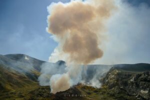
The Philippine Institute of Volcanology and Seismology (PHIVOLCS) reported that phreatic eruptive events at Taal periodically continued during 8-15 October. There were 1-2 phreatic events recorded almost daily during the week, with most reportedly lasting 3-13 minutes long. Hot fluids upwelling in the lake were persistently observed, and daily steam-and-gas emissions that were sometime voluminous rose as high as 3 km above the crater rim. Two volcanic earthquakes were detected during 8-9 October, two periods of volcanic tremor lasting two minutes long were recorded during 9-10 October, one volcanic earthquake was recorded during 11-12 October, and a period of tremor lasting 10 hours and 30 minutes was recorded during 12-13 October.
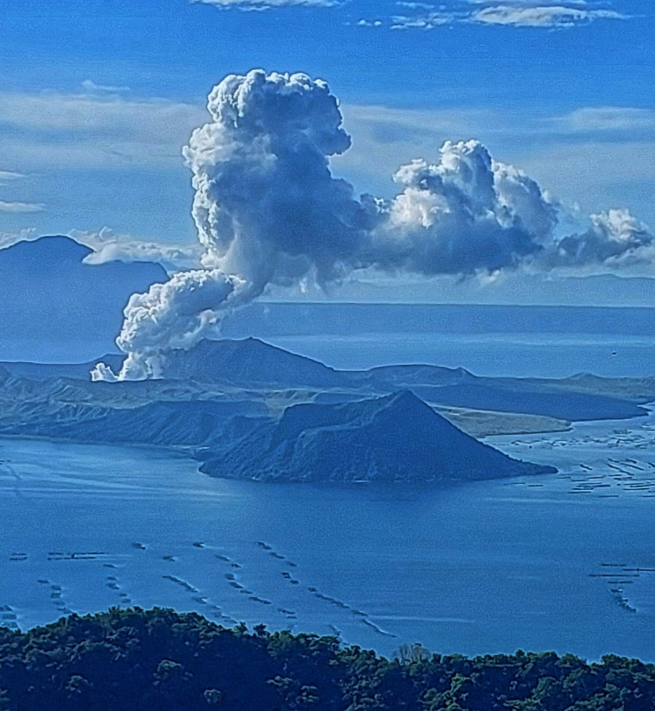
Sulfur dioxide emissions averaged 2,256 tonnes per day (t/d) on 9 October, 1,256 t/d on 12 October, and 2,064 t/d/ on 14 October, remaining at elevated levels. Vog was reported during 10-11 October. The Alert Level remained at 1 (on a scale of 0-5), and PHIVOLCS reminded the public that the entire Taal Volcano Island was a Permanent Danger Zone (PDZ) and recommended that the Main Crater and areas along the Daang Kastila fissure should remain prohibited.
Source : GVP. Philippine Institute of Volcanology and Seismology (PHIVOLCS) .
Photo : Auteur inconnu.
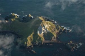
Chile , Copahue :
Special Report on Volcanic Activity (REAV), Biobio Region, October 16, 2024, 5:00 p.m. local time (continental Chile).
The National Geology and Mining Service of Chile (Sernageomin) publishes the following information obtained through the monitoring equipment of the National Volcanic Monitoring Network (RNVV), processed and analyzed at the Volcanological Observatory of the Southern Andes (Ovdas):
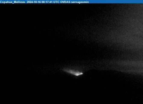
Since the last report published on 10/11/2024, the activity of the Copahue volcanic system has evolved, observing an absence of the crater lake and the appearance of nocturnal incandescence suggesting greater activity of its magmatic component.

The monitoring parameters recorded changes in surface activity, with the appearance of nocturnal incandescences (10/16) and thermal anomalies in MIROVA (www.mirova.it) with a maximum power of 4 MW (10/16).
In turn, SO2 anomalies have been detected in the atmosphere since 15/10 (www.mounts-project.com), as well as variations in the degassing dynamics.
Thanks to the surveillance cameras, since 10/08, an area with superficial sulfur deposits has been identified on the eastern slope of the volcano. It should be noted that the gradual decrease in the level of the crater lake began to be observed in July, its decline being confirmed by the high-resolution satellite images obtained in the first days of the current month.
The above suggests the interaction of the Copahue volcano magmatic system and its surface hydrothermal system. In this context, pyroclastic material emissions are expected, a condition observed in previous cycles.
The volcanic technical alert remains at GREEN level.
Source : Sernageomin
Photos : Dario G. Lazo ( archive 2019) , Sernageomin .
Indonesia , Ibu :
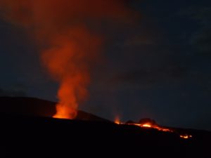
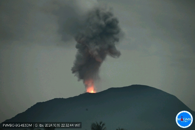
An eruption of Mount Ibu occurred on Wednesday, 16 October 2024 at 22:31 WIT with the height of the ash column observed at ± 700 m above the summit (± 2025 m above sea level). The ash column was observed to be grey in colour with a thick intensity, oriented towards the North-East. This eruption was recorded on a seismograph with a maximum amplitude of 8 mm and a duration of 71 seconds.
VOLCANO OBSERVATORY NOTICE FOR AVIATION – VONA
Issued : October 16 , 2024
Volcano : Ibu (268030)
Current Aviation Colour Code : ORANGE
Previous Aviation Colour Code : orange
Source : Ibu Volcano Observatory
Notice Number : 2024IBU945
Volcano Location : N 01 deg 29 min 17 sec E 127 deg 37 min 48 sec
Area : North Maluku, Indonesia
Summit Elevation : 4240 FT (1325 M)
Volcanic Activity Summary :
Eruption with volcanic ash cloud at 13h31 UTC (22h31 local).
Volcanic Cloud Height :
Best estimate of ash-cloud top is around 6480 FT (2025 M) above sea level or 2240 FT (700 M) above summit. May be higher than what can be observed clearly. Source of height data: ground observer.
Other Volcanic Cloud Information :
Ash cloud moving to northeast. Volcanic ash is observed to be gray. The intensity of volcanic ash is observed to be thick.
Remarks :
Eruption recorded on seismogram with maximum amplitude 8 mm and maximum duration 71 second.
The Pusat Vulkanologi dan Mitigasi Bencana Geologi (PVMBG) reported that activity at Ibu continued during 9-16 October. Daily gray or white-and-gray ash plumes that were sometimes dense generally rose 0.1-2 km above the summit and drifted NW, W, and SW; only white plumes were visible rising 100-200 m and drifting NE, SW, and W on 12 October. Some of the webcam images posted with the reports showed incandescence visible above the crater rim. At 0126 on 16 October an ash plume rose 4 km above the summit and drifted N and NE. The Alert Level remained at 3 (the second highest level on a four-level scale) and the public was advised to stay 4 km away from the active crater and 5 km away from the N crater wall opening.
Sources : Magma Indonésie , Pusat Vulkanologi et Mitigasi Bencana Geologi (PVMBG ) , GVP.
Photo : Magma Indonésie.
Japan , Suwanosejima :
The Japan Meteorological Agency (JMA) reported that eruptive activity at Suwanosejima’s Ontake Crater continued during 7-14 October. Crater incandescence was observed nightly in webcam images. Eruptive events at 02h21 and 07h50 on 7 October produced ash-and-gas plumes that rose 1.1-1.5 km above the crater rim; the plume from the second event drifted E. Ash-and-gas plumes were continuously emitted during 09h43-13h10, rose as high as 1.6 km above the crater rim, and drifted E. Ash-and-gas plumes from eruptive events at 03h33 and 15h40 on 10 October rose 1.3 km above the crater rim and drifted S and SE, respectively. Three eruptive events on 11 October, at 04h03, 07h37, and 11h30, produced ash-and-gas plumes that rose 1-1.3 km straight up above the crater rim or drifted SE. An ash-and-gas plume from an eruptive event at 13h52 on 13 October rose 1 km above the crater rim and drifted W. The Alert Level remained at 2 (on a 5-level scale) and the public was warned to stay at least 1.5 km away from the crater.
The 8-km-long island of Suwanosejima in the northern Ryukyu Islands consists of an andesitic stratovolcano with two active summit craters. The summit is truncated by a large breached crater extending to the sea on the E flank that was formed by edifice collapse. One of Japan’s most frequently active volcanoes, it was in a state of intermittent Strombolian activity from Otake, the NE summit crater, between 1949 and 1996, after which periods of inactivity lengthened. The largest recorded eruption took place in 1813-14, when thick scoria deposits covered residential areas, and the SW crater produced two lava flows that reached the western coast. At the end of the eruption the summit of Otake collapsed, forming a large debris avalanche and creating an open collapse scarp extending to the eastern coast. The island remained uninhabited for about 70 years after the 1813-1814 eruption. Lava flows reached the eastern coast of the island in 1884. Only about 50 people live on the island.
Sources: Japan Meteorological Agency (JMA) , GVP.
Photo : ontake , Masanori Genko