October 08 , 2024.
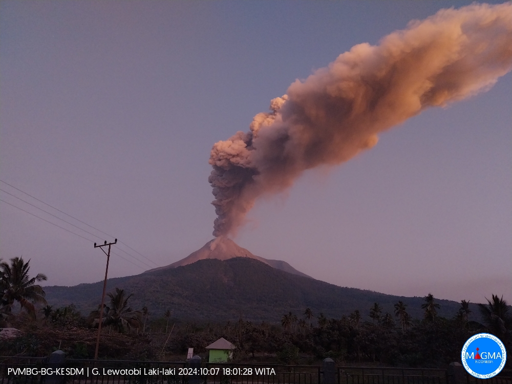
Indonesia , Lewotobi Laki-laki :
An eruption of Lewotobi Laki-laki occurred on Monday, October 7, 2024 at 17:52 WITA with the height of the ash column observed at ±1000 m above the summit (±2584 m above sea level). The ash column was observed to be gray with a thick intensity, oriented to the West and Northwest. This eruption was recorded on a seismograph with a maximum amplitude of 7.4 mm and a duration of 653 seconds.
VOLCANO OBSERVATORY NOTICE FOR AVIATION – VONA
Issued : October 07 , 2024
Volcano : Lewotobi Laki-laki (264180)
Current Aviation Colour Code : ORANGE
Previous Aviation Colour Code : orange
Source : Lewotobi Laki-laki Volcano Observatory
Notice Number : 2024LWK602
Volcano Location : S 08 deg 32 min 20 sec E 122 deg 46 min 06 sec
Area : East Nusa Tenggara, Indonesia
Summit Elevation : 5069 FT (1584 M)
Volcanic Activity Summary :
Eruption with volcanic ash cloud at 09h52 UTC (17h52 local).
Volcanic Cloud Height :
Best estimate of ash-cloud top is around 8269 FT (2584 M) above sea level or 3200 FT (1000 M) above summit. May be higher than what can be observed clearly. Source of height data: ground observer.
Other Volcanic Cloud Information :
Ash cloud moving from west to northwest. Volcanic ash is observed to be gray. The intensity of volcanic ash is observed to be thick.
Remarks :
Eruption recorded on seismogram with maximum amplitude 7.4 mm and maximum duration 653 second.
Source et photo : Magma Indonésie
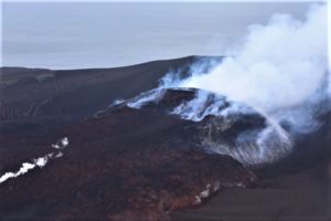
New Zealand , Ruapehu :
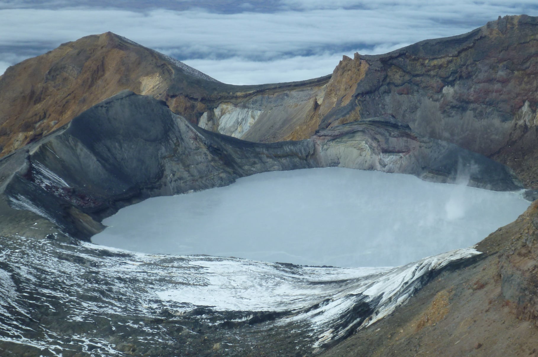
Minor volcanic unrest continues at Mt Ruapehu as lake remains cool. Volcanic Alert Level remains at 1. Published: Tue Oct 8 2024 9:00 AM
Since our last activity bulletin on Ruapehu (29 August), the temperature of Te Wai ā-moe (Ruapehu Crater Lake) has remained cool, declining from 11°C to 8°C, the lowest temperature measured since 1970. Our volcanic gas monitoring continues to measure low-moderate volcanic sulphur dioxide (SO₂) emissions. An eruption remains unlikely.
The Volcanic Alert Level remains at 1 and the Aviation Colour Code at Green.
Te Wai ā-moe (Ruapehu Crater Lake) temperature remains cool (Fig.1). Currently the daily mean lake temperature is around 8ºC, a drop of 3ºC since late-August. This is the lowest measured temperature since 1970, with a temperature of 9oC recorded in 1988. Usually, the lake temperature fluctuates in response to changes in volcanic heat input, and since mid-February there has been little heat coming in, so the temperature has been declining.

Figure 1. The daily mean temperature of Te Wai ā-moe (Ruapehu Crater Lake) since September 2023. The temperature has been declining since February and is now approximately 8C.
The eruptive history of Ruapehu has shown eruptions are more common when the lake is warmer than average, but also has a slightly higher than normal probability of erupting during cool periods.
The reduced heat flow into the lake suggests some mineral sealing of the vent areas. Although the amount of sulphur dioxide (SO₂) volcanic gas passing through the lake has also declined during 2024, the fact that we are still measuring gas indicates the vent is not completely blocked. This interpretation is supported by observations we made on 30 September of upwellings in the crater lake with slicks of sulphur floating on the lake surface.
The cooling of Te Wai ā-moe, together with declining SO₂ gas flux, is consistent with cooling of the hydrothermal system beneath the lake. Volcanic tremor levels, often generated by fluid and gas flow in the hydrothermal system, have remained low all year. We have seen no changes in any other monitored parameters.
However, an unheralded eruption might occur if there is a substantial and sudden release of gas that builds up pressure beneath a partly sealed vent below the lake. Our recent observations are consistent with ongoing, low-level volcanic unrest at Ruapehu. Low lake temperatures and low gas emissions indicate that the vent system beneath the lake is partially sealed, limiting heat and gas flow to the surface. We believe the possibility of an eruption is still low.
Monitoring indicators remain consistent with a low level of volcanic activity. As a result, the Volcanic Alert Level remains at 1. The Aviation Colour Code remains Green.
GNS Science and its National Geohazards Monitoring Centre continue to closely monitor Mt Ruapehu for further changes.
Source : Geonet / Steve Sherburn / Duty Volcanologist
Photo : Geonet ( 05/2022)
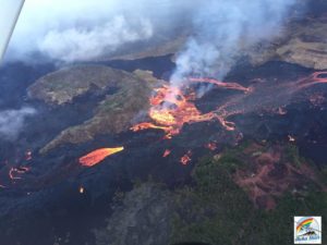
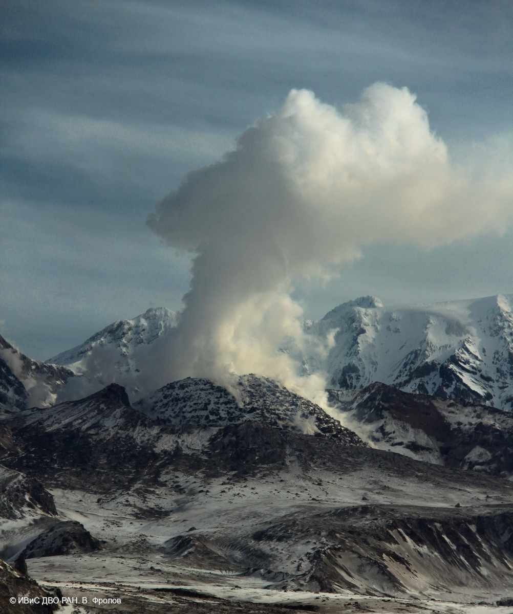
Kamchatka , Sheveluch :
VOLCANO OBSERVATORY NOTICE FOR AVIATION (VONA)
Issued: October 07 , 2024
Volcano: Sheveluch (CAVW #300270)
Current aviation colour code: ORANGE
Previous aviation colour code: orange
Source: KVERT
Notice Number: 2024-83
Volcano Location: N 56 deg 38 min E 161 deg 18 min
Area: Kamchatka, Russia
Summit Elevation: 3283 m (10768.24 ft), the dome elevation ~2500 m (8200 ft)
Volcanic Activity Summary:
Video and satellite data by KVERT shows a strong wind lifts ash from the southern slopes of Sheveluch volcano, and a plume of resuspended ash is extending about 215 km to the east of the volcano.
An extrusive-effusive eruption of the Sheveluch volcano continues. The danger of ash explosions up to 10 km (32,800 ft) a.s.l. remains. Ongoing activity could affect international and low-flying aircraft.
Volcanic cloud height:
2000-2500 m (6560-8200 ft) AMSL Time and method of ash plume/cloud height determination: 20241007/2135Z – Video data
Other volcanic cloud information:
Distance of ash plume/cloud of the volcano: 215 km (134 mi)
Direction of drift of ash plume/cloud of the volcano: E / azimuth 91 deg
Time and method of ash plume/cloud determination: 20241007/2050Z – Himawari-9 14m15
Remarks: a resuspended ash
Source : Kvert
Photo : V. Frolov. IVS FEB RAS ( 04/2024)
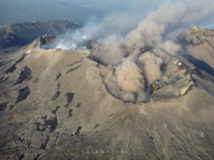
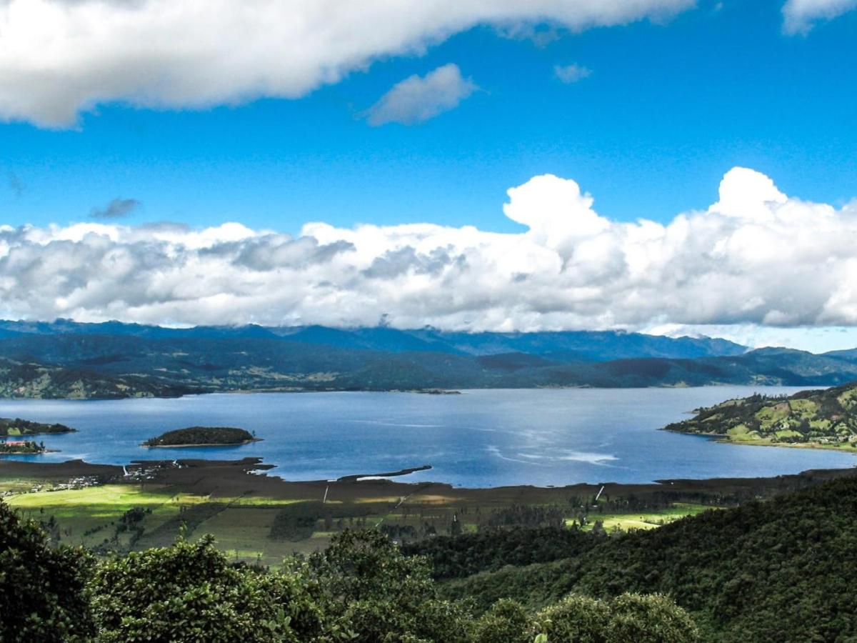
Colombia , Guamuez-Sibundoy Monogenetic Volcanic Field :
SEISMIC ACTIVITY REPORT GUAMUEZ (NARIÑO), AUGUST-SEPTEMBER 2024
On August 15, a seismic sequence was triggered located mainly to the east of the La Cocha lagoon in an area located on the border of the departments of Nariño and Putumayo. The temporal evolution of the sequence is consistent with that of a swarm, since a main earthquake is not distinguished. Six events had magnitudes between 3.0 and 3.8, being minor events, but given their superficial nature and proximity to populated centers, these earthquakes were reported as felt.
At the epicentral level, most of these earthquakes show an alignment in the Southeast / Northeast direction. In 2011, between September 28 and October 19, another sequence of earthquakes occurred, located at the epicenter in a very similar area.
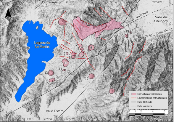
Map of faults and structural lineaments of the Guamuez-Sibundoy monogenetic volcanic field. Note the lineament of volcanic structures (1 to 5, 16 – 17) in the Central-Eastern part of the La Cocha lagoon.
The area of the epicenters near the water body of the Cocha lagoon is characterized by the presence of faults and lineaments associated with the Algeciras fault system that have a strong component of dextral direction. In addition, this system has a main southwest / northeast direction, which corresponds to an evolved structure with anastomosing geometry, which develops laterally by the union of secondary structures with lineaments approximately perpendicular to the major direction.
On the other hand, the locations of the seismic sources are located in the area of the Guamuez-Sibundoy monogenetic volcanic field, which has been inventoried to date with 22 monogenetic volcanic structures.
Discerning the cause of a seismic swarm in a fault- and lineament-influenced area with the presence of a volcanic field proves to be challenging since there is a wide range of feasible magmatic and tectonic mechanisms. Mechanisms such as high pore pressure diffusion, pressurization of fluid-filled reservoirs, magmatic intrusion processes, hydrofracturing or slow slip events can trigger a swarm.
Based on hypocenter distribution patterns and the fact that no changes have been detected in: deformation, some geochemical parameters and other types of surface manifestations, with no news in the volcanic context, suggests that the swarm presents for the moment more tectonic-type features associated with fault activity. The interaction of fluids modifying the pore pressure or a process derived from slow slip is not excluded. It is also not excluded that in the future a volcanic process resulting from a magmatic intrusion will occur under the conditions that determine the monogenetic volcanism of the area.
Source : SGC
Photos : SGC , Jhon Nestor Vivas.
Guatemala , Santiaguito :
Atmospheric conditions: Clear
Wind: South.
Precipitation: 22.2 mm.
Activity:
The Observatory reports activity in the Caliente dome, with moderate to abundant degassing columns continuously in a northerly direction. There are 2 to 7 weak to moderate explosions per hour, accompanied by moderate block avalanches, occasional incandescence in the dome due to lava extrusion, and accumulation of hot material mainly towards the southwest flank.
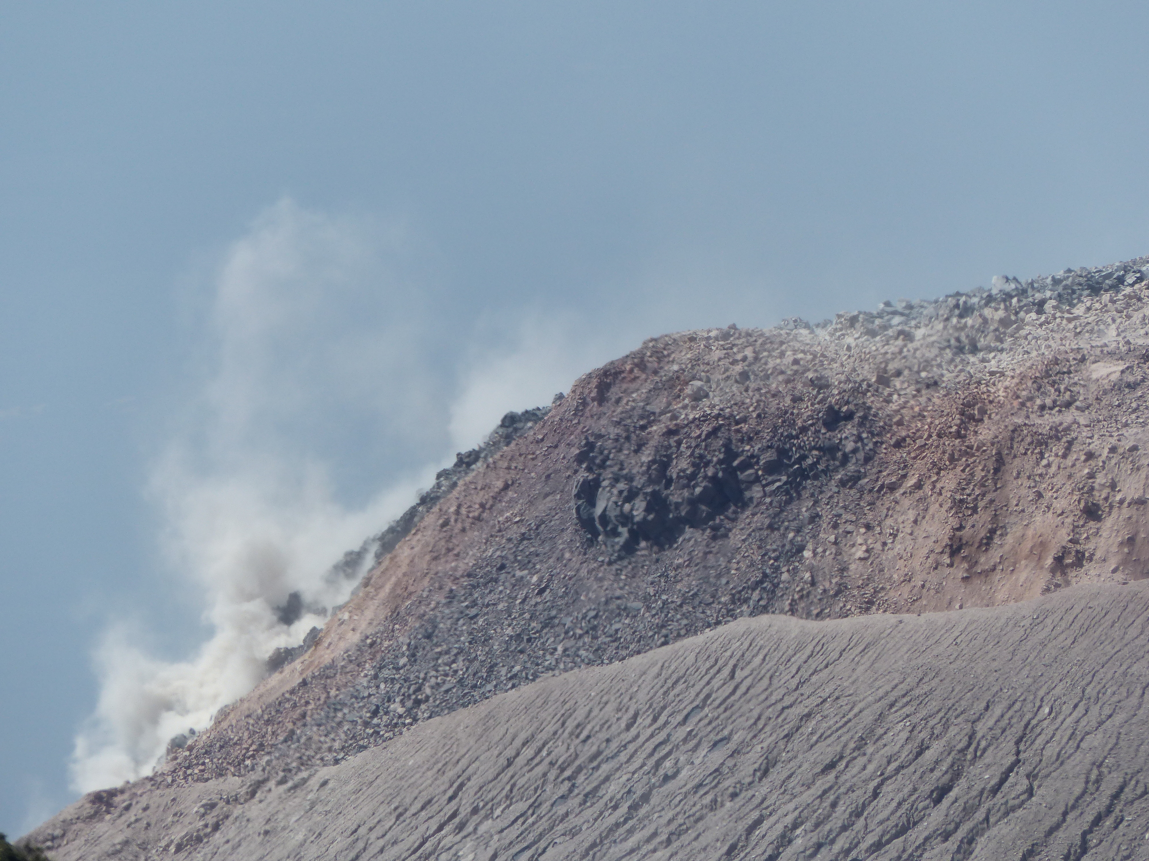
Moderate to strong explosions raise columns of gas and ash to heights of up to 3,400 meters above sea level (10,498 feet) and cause the descent of short-distance pyroclastic flows that extend along all the flanks and weak and/or strong avalanches that can be audible. several kilometers from the volcano. In the afternoon and evening, rains could cause lahars to descend in the channels that descend from the Caliente dome. The occurrence of moderate to strong block and ash flows is not excluded, as well as possible long-distance pyroclastic flows in different directions, so follow the recommendations of the special bulletin BESAN-004-2024.
Source : Insivumeh.
Photo : G Vitton