September 24 , 2024.
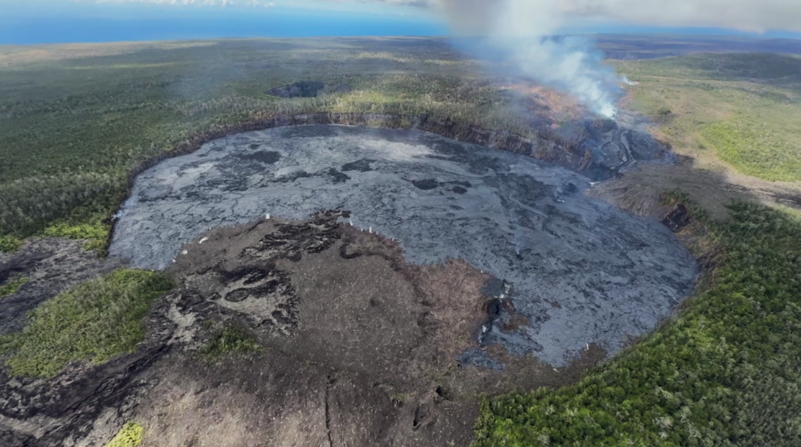
Hawaii , Kilauea :
HVO/USGS Volcanic Activity Notice
Current Volcano Alert Level: ADVISORY
Previous Volcano Alert Level: WATCH
Current Aviation Color Code: YELLOW
Previous Aviation Color Code: ORANGE
Issued: Monday, September 23, 2024, 8:12 AM HST
Source: Hawaiian Volcano Observatory
Notice Number: 2024/H341
Location: N 19 deg 25 min W 155 deg 17 min
Elevation: 4091 ft (1247 m)
Area: Hawaii
Volcanic Activity Summary:
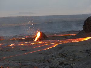
The middle East Rift Zone eruption of Kīlauea that began on Sunday, September 15 has ended and is unlikely to restart. The USGS Hawaiian Volcano Observatory (HVO) is lowering the Volcano Alert Level for ground-based hazards from WATCH to ADVISORY and the Aviation Color Code from ORANGE to YELLOW.
The eruption in and near Nāpau Crater had four eruptive phases between September 15 and September 20. The final eruptive activity from a small vent west of Nāpau Crater ended at about 10 AM HST on September 20. All observable and instrumental signs of potential for renewed eruptive activity have declined since that time. Seismicity in the area is extremely low and tremor, characteristic of magma within vents, is no longer being recorded by seismometers in the area. In addition, the ground deformation data that showed magma was moving from the summit to the middle East Rift Zone has slowed dramatically or stopped altogether. Volcanic gas emissions have decreased to near background levels. All of these factors indicate that this eruption has ended.
Recent eruptive activity took place in a remote area of Kīlauea’s middle East Rift Zone, within Hawaiʻi Volcanoes National Park. No changes have been detected in the lower East Rift Zone, or Southwest Rift Zone.
HVO is in close contact with Hawai‘i Volcanoes National Park and the Hawai‘i County Civil Defense Agency.
HVO will continue to closely monitor Kīlauea and adjust the alert level/aviation color code accordingly. Should volcanic activity change significantly, a new Volcanic Activity Notice will be issued.
Source : HVO
Photo : HVO , Capture d’écran 20/9/2024 .
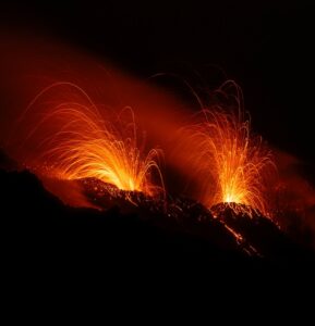
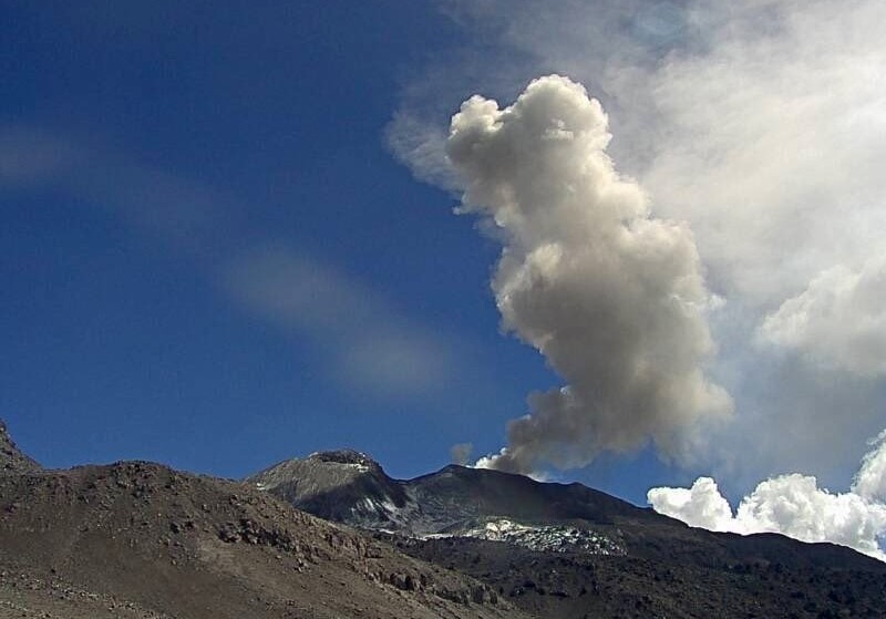
Italy / Sicily , Etna :
September 23, 2024, 23:15 (21:15 UTC) , Etna Activity Report .
The National Institute of Geophysics and Volcanology, Osservatorio Etneo, reports a series of impulsive explosions from the Northeast Crater starting at 21:10 UTC.
Further updates will be provided shortly.
September 23, 2024, 23:43 (21:43 UTC) , Etna Activity Report .
The National Institute of Geophysics and Volcanology, Osservatorio Etneo, reports that from 21:00 UTC a continuous intracrater explosive activity of the Northeast Crater is visible from surveillance cameras. This activity is accompanied by persistent degassing.
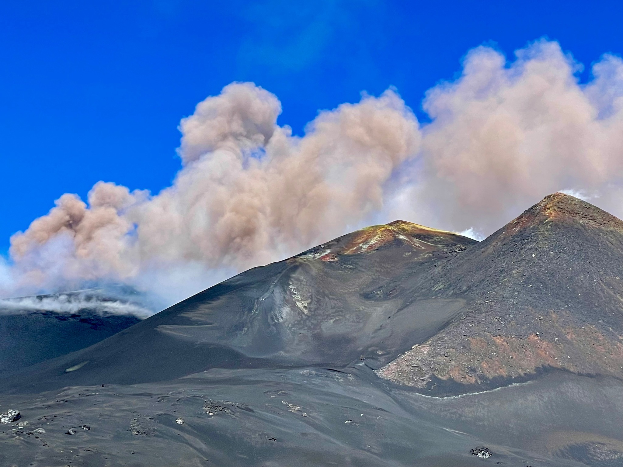
From a seismic point of view, the explosive sequence that started at 21:10 UTC produced an increase in volcanic tremor that reached high values. The average locations of the tremor correspond to the Bocca Nuova crater at an altitude of about 3000 meters above sea level. From an infrasound point of view, the explosive events are mainly located in correspondence with the North-East crater and to a lesser extent in correspondence with the South-East crater.
No significant variation is recorded on the signals of the ground deformation networks.
Further updates will be communicated shortly.
Source : INGV
Photo : Laura Lux ( 20/9/2024)
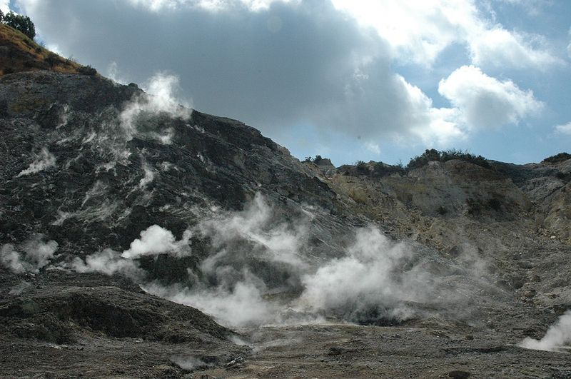
Italy , Campi Flegrei :
Weekly Bulletin, from 09 September 2024 to 15 September 2024. (Issue date 17 September 2024) .
SUMMARY STATUS OF ACTIVITY
In light of the monitoring data, it emerges:
1) SEISMOLOGY: In the week of 9 to 15 September 2024, in the Campi Flegrei area, 13 earthquakes of magnitude Md≥0.0 (Mdmax=1.8±0.3) were located.
2) DEFORMATIONS: Since the beginning of August, a reduction in the speed of ground uplift has been recorded, the preliminary average value of which is approximately 10±3 mm/month at the RITE GNSS station.
3) GEOCHEMISTRY: There are no significant variations in the geochemical parameters monitored in the reference week compared to the already known trends of increasing flow rates and heating of the hydrothermal system. The temperature sensor installed in a fumarole outlet 5 meters from the main Pisciarelli fumarole showed a temperature drop (~91°C), corresponding to the rain events that occurred during the week, then returned to the condensation temperature of the fumarolic fluid.
GEOCHEMISTRY
During the reference week, the data continuously monitored by the geochemical network did not show significant variations in the acquired parameters, although confirming the heating and pressurization trends of the hydrothermal system and the increase in the flow rate of emitted fluids.
In the Pisciarelli area (north-eastern external slope of the Solfatara), which in recent years has shown the greatest variations in the degassing process, the values of the soil CO2 flux recorded continuously by the FLXOV8 station highlight the continuation of the multi-year trends already identified. In the last week, the CO2 fluxes measured from the ground did not show significant variations compared to previous periods.
In the last week, the temperature showed a drop in temperature, reaching the minimum value of ~91°C, corresponding to the rainy events of Friday 13, and then returning to the value of ~94°, the condensation temperature of the fumarolic fluid.
Source : INGV
Photo : Manuel Mauer / Wikipédia ( 2019).
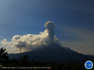
Indonesia , Kelimutu :
Kelimutu, East Nusa Tenggara Province, activity levels decreased from level II (waspada) to level I (normal).
Introduction
Kelimutu is a stratovolcano type volcano, with an elevation of 1384.5 m. Geographically, Mount Kelimutu is located at coordinates 08o45’30”S and 121o50’00E. Kelimutu has 3 crater lakes, namely Crater 1 (Tiwu Ata Polo), Crater 2 (Tiwu Koofai Nuwamuri) and Crater 3 (Tiwu Ata Bupu).
The last eruption occurred in June 1968 as a phreatic eruption in Crater 2 (Tiwu Koofai Nuwamuri) which was preceded by a hissing sound and a burst of blackish brown water in the western part of the lake.
Visual observation
Between 1 August and 22 September 2024, Mount Kelimutu is clearly visible until it is covered by mist. White smoke is observed from the main crater with a thin and strong intensity about 1-100 meters from the summit.
Visual observation of the craters
Crater I (Tiwu Ata Polo).
On 21 September 2024, the color of the crater lake changed from dark green to bluish green. Plumes are observed on the northeastern rim, the water temperature of the crater lake was measured at 24°C for an air temperature of 23°C.
On 15 September 2024, the water of the crater lake was dark green. Plumes are observed on the northeastern rim, the water temperature of the crater lake was measured at 22°C for an air temperature of 20°C.
Crater II (Tiwu Koofai Nuwamuri).
On 21 September 2024, the water of the crater lake was light blue, slight sulfur deposits were observed on the water surface of the central crater lake and on the edges of the crater walls, smoke from the crater was observed white, fine in intensity, low pressure, with a height of about 5 m. The sulfur odor was weak to moderate, the temperature of the crater lake water was measured at 30 °C at an air temperature of 24 °C.
On September 15, 2024, the water of the crater lake was light blue, slight sulfur deposits were observed on the water surface of the central crater lake and on the edges of the crater walls, crater smoke was observed white, low intensity, low pressure, with a height of about 5 m. The sulfur odor is weak to moderate, the temperature of the crater lake water is measured at 30 °C at an air temperature of 20 °C.

Crater III (Tiwu Ata Bupu).
On September 21, 2024, the water of the crater lake was dark green, the water of the crater lake appeared calm, the water temperature of the crater lake was measured at 22°C at an air temperature of 24°C.
On September 15, 2024, the water of the crater lake was dark green, the water of the crater lake appeared calm, the water temperature of the crater lake was measured at 21°C at an air temperature of 21°C.
Based on visual observations of infrared video surveillance, they show consistent color changes that are increasingly evident on the surface of craters I and II.
Instrumental observation
The seismicity during the period from August 1 to September 22, 2024 is as follows:
Period 1-31 August 2024:
1 shallow volcanic earthquake was recorded, 218 deep volcanic earthquakes, 27 local tectonic earthquakes, 1 felt earthquake and 77 distant tectonic earthquakes.
Period 1-22 September 2024:
126 deep volcanic earthquakes, 27 local tectonic earthquakes and 62 distant tectonic earthquakes were recorded.
Assessment and potential hazards
Based on visual and instrumental monitoring data, these show a decreasing trend in the changes in the color and temperature of the water of Crater Lake I and II as well as in the physical appearance of the lake water surface.
The distribution of sulfur deposits was observed on the water surface of Crater Lake II in the center and at the rim of the crater.
The change in color of the crater lake water, the reduction in sulfur distribution are supported by a decrease in seismicity and RSAM data, which indicate a decrease in activity.
Conclusions
The results of visual and instrumental monitoring show a decrease in the activity of Mount Kelimutu. Thus, the activity level of Mount Kelimutu has been lowered from level II (waspada) to level I (normal) from September 23, 2024 at 16:00 WITA.
Source : PVMBG.
Photo : Daniel Kordan / FB , 06/2023
Peru , Sabancaya :
Analysis period: from September 16, 2024 to September 22, 2024, Arequipa, September 23, 2024
Alert level: ORANGE
The Geophysical Institute of Peru (IGP) reports that the eruptive activity of the Sabancaya volcano continues. During this period, an average of 19 explosions per day have been recorded, with columns of ash and gas up to 2,000 m above sea level above the summit of the volcano. Therefore, the volcanic alert level remains at ORANGE
The IGP has recorded and analyzed the occurrence of 318 earthquakes of volcanic origin, associated with the circulation of magmatic fluids inside the Sabancaya volcano, as well as earthquakes related to rock fracturing. An average of 19 explosions per day have been recorded.
Columns of ash and gas have been observed up to 2000 m above sea level above the summit of the volcano. The predominant direction of these emissions has been towards the East, Southeast and West sectors of the volcano over a distance of less than 10 KM.
A slight inflation process continues to be recorded in the North sector (around the Hualca Hualca volcano).
Satellite recordings have identified the presence of 24 thermal anomalies, with a maximum value of 4 MW, associated with the presence of a lava body on the surface of the volcano’s crater.
Moderate emissions (502 tons/day) of sulfur dioxide (SO2) have been observed
RECOMMENDATIONS
• Maintain the orange volcanic alert level.
• Do not approach within a radius of less than 12 km of the crater.
Source : Cenvul
Photo : Ingemmet