September 17 , 2024 .
Hawaii , Kilauea :
HVO/USGS Volcanic Activity Notice
Current Volcano Alert Level: WATCH
Previous Volcano Alert Level: ADVISORY
Current Aviation Color Code: ORANGE
Previous Aviation Color Code: YELLOW
Issued: Monday, September 16, 2024, 12:23 AM HST
Source: Hawaiian Volcano Observatory
Notice Number: 2024/H250
Location: N 19 deg 25 min W 155 deg 17 min
Elevation: 4091 ft (1247 m)
Area: Hawaii
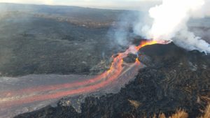
During a USGS Hawaiian Volcano Observatory overflight at approximately 10:30 a.m. HST on September 16, geologists observed steam rising above freshly erupted lava west of Nāpau Crater on the remote middle East Rift Zone of Kīlauea, within Hawaiʻi Volcanoes National Park. This eruption likely occurred between approximately 9–10 p.m. HST on September 15.
Volcanic Activity Summary:
The intrusion of magma that began yesterday, September 14, in Kīlauea’s middle East Rift Zone, continues, increasing the potential of an eruption in this region. Accordingly, the USGS Hawaiian Volcano Observatory (HVO) is raising the Volcano Alert Level for ground-based hazards from ADVISORY to WATCH and the Aviation Color Code from YELLOW to ORANGE.
Current activity is taking place in a remote area of Kīlauea’s middle East Rift Zone, within Hawaiʻi Volcanoes National Park. No changes have been detected in the lower East Rift Zone, or Southwest Rift Zone.
Intense and localized earthquakes between Maunaulu and Makaopuhi Crater, accompanied by ground deformation patterns indicative of underground crack growth began at approximately 6 p.m. HST on September 14, 2024. While the intensity of earthquake activity has decreased, continued ground deformation changes show that magma is still moving beneath the ground from summit storage chambers to the area between Maunaulu and Makaopuhi Crater.
Starting around 9 p.m. and continuing until 10 p.m this evening, infrasound instruments detected a strong signal typical of gas or steam venting and seismometers in the middle East Rift Zone are recording weak, sustained low frequency tremor. However, HVO’s webcam network has not shown any evidence of eruptive activity and GOES satellite data do not show any thermal anomalies at this time. Currently, strong rainfall in the area is complicating interpretation. In 2007, an intrusion in this area erupted a very small pad of lava approximately the size of half a football field, so it is possible a similarly small eruption could take place without detection in these conditions.
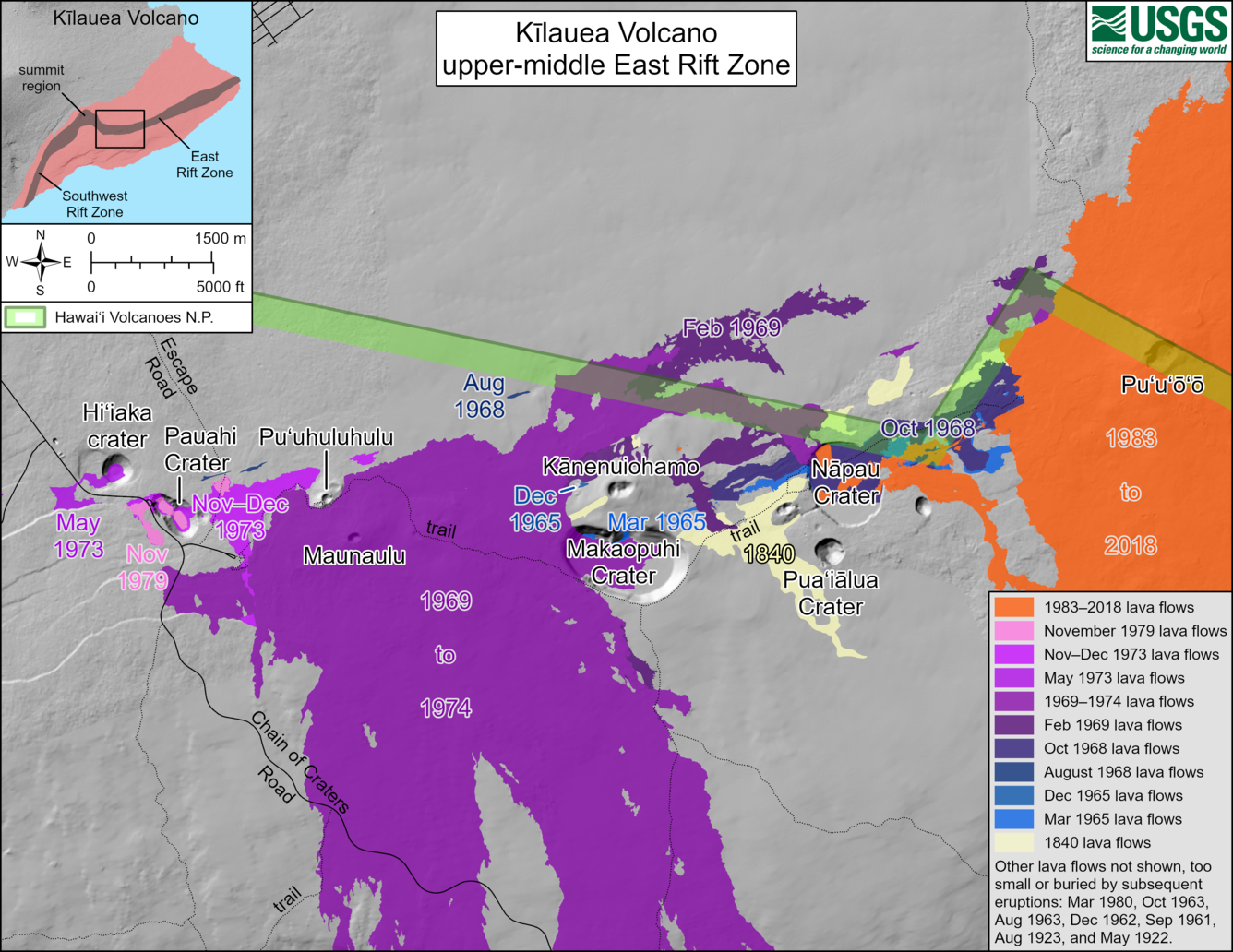
This reference map depicts the features on Kīlauea’s middle East Rift Zone, much of which is within Hawaiʻi Volcanoes National Park. Pit craters and lava flows are evidence of a long history of magma moving along this rift zone pathway. Numerous eruptions took place in this region during the 1960s–1970s. Most eruptions in this area during that timeframe lasted less than one day to about two weeks, though there were long-lived eruptions at Maunaulu (1969–1971 and 1972–1974) and Puʻuʻōʻō (1983–2018). The most recent eruption in this area took place over 35 years at and near the Puʻuʻōʻō vent (shown in orange on the map).
Numerous eruptions took place in this area during the 1960s–1970s, most of which lasted less than one day to about two weeks. Long-lived eruptions took place at Maunaulu (1969–1971 and 1972–1974) and Puʻuʻōʻō (1983–2018). The most recent eruption in this area took place over 35 years at and near the Puʻuʻōʻō vent. The location of any future outbreak will determine what areas could be in the path of new lava flows.
Volcanic Activity Summary , Monday, September 16, 2024, 11:33 AM HST
Kīlauea volcano erupted briefly last night, September 15, 2024, on the middle East Rift Zone in Hawaiʻi Volcanoes National Park. The Volcano Alert Level for ground-based hazards remains at WATCH and the Aviation Color Code remains at ORANGE at this time. Rates of seismicity and ground deformation beneath the summit, lower East Rift Zone, and Southwest Rift Zone remain low. Current activity is restricted to Kīlaueaʻs upper-to-middle East Rift Zone.
Kīlauea volcano erupted briefly last night just west of Nāpau Crater on the middle East Rift Zone. This eruption, which is now over, likely occurred between approximately 9:00 and 10:00 p.m. HST on Sunday 15, 2024, in a remote and closed area of Hawaiʻi Volcanoes National Park. Chain of Craters Road, which is closed, is located downslope and downwind of the new fissures. Continued degassing from the fissure system may pose a hazard to humans downwind of the eruption site. The eruption does not currently pose an immediate threat to human life or infrastructure.
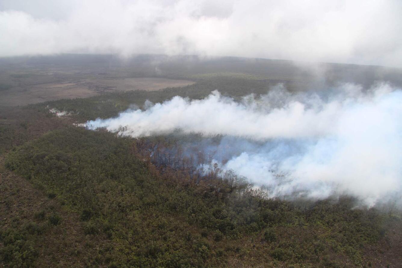
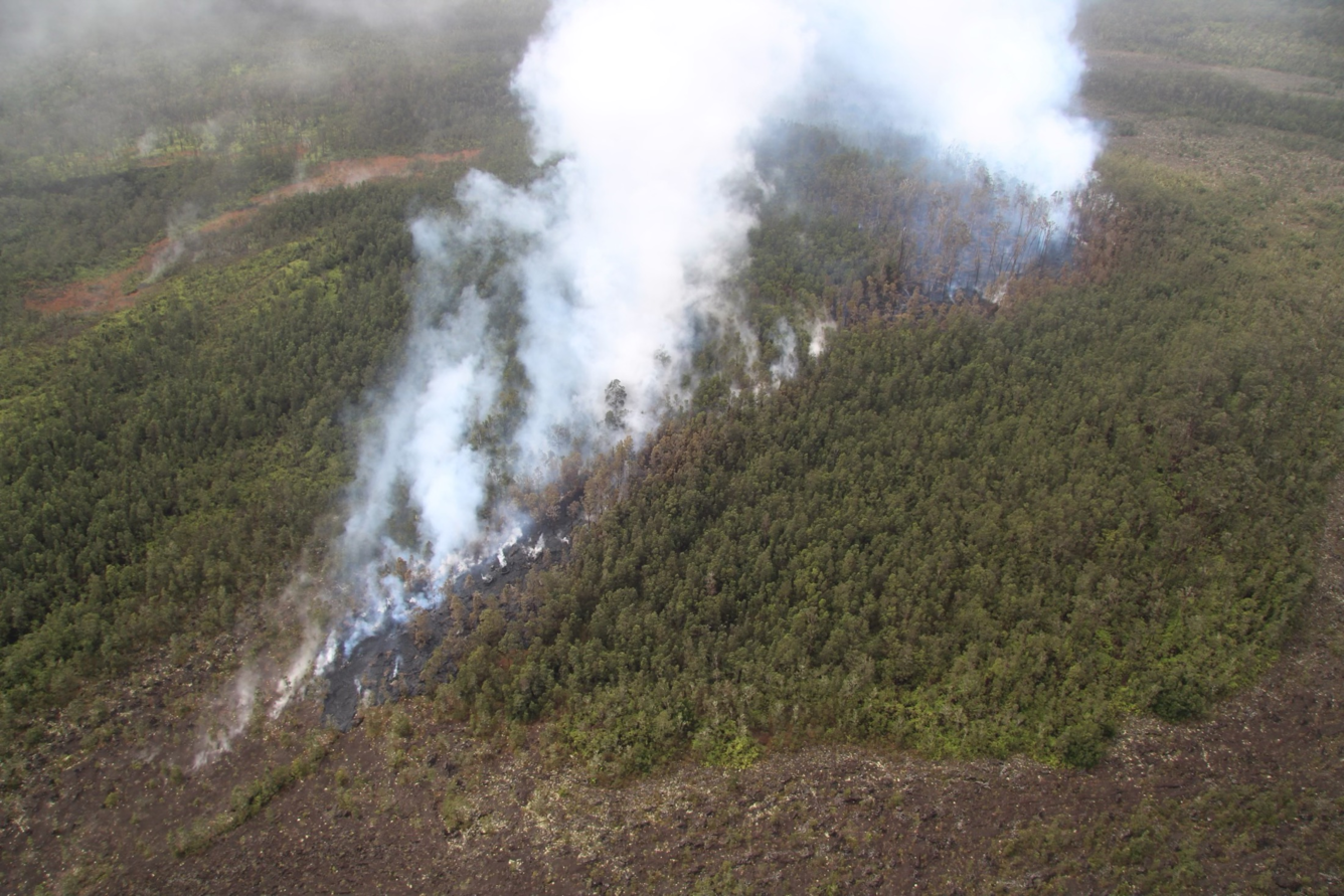
The eruption took place near the National Park Nāpau campsite (east of Kānenuiohamo and Makaopuhi Crater and west of Nāpau Crater). Small lava pads erupted from two fissure segments in a couple hundred meters (hundred yards). The lava extended 50 or so meters (yards) from the fissure vents, with the uprift fissure segment being larger than the downrift fissure segment. The eruption does not appear to have impacted Napau campground, but may have partly covered the pulu (Hawaiian tree fern) station nearby. Vegetation in the eruption area was burned and sulfur dioxide continues to de-gas from the vents. Residents of nearby subdivisions reported smelling volcanic gas and other smells related to this event during the evening of September 15.
Volcanic Activity Summary , Monday, September 16, 2024, 7:46 PM HST :
The eruption on the middle East Rift Zone of Kīlauea volcano resumed this evening, September 16, at approximately 6 p.m. HST. The eruption is occurring within a closed and remote area of Hawaiʻi Volcanoes National Park. The Volcano Alert Level for ground-based hazards remains at WATCH and the Aviation Color Code remains at ORANGE at this time. The eruption does not currently pose an immediate threat to human life or infrastructure. Chain of Craters Road, which is closed, is located downslope and downwind of the erupting fissures. Residents of nearby subdivisions may experience volcanic gas emissions (see hazards section below) related to this activity, which may wax and wane over the coming days
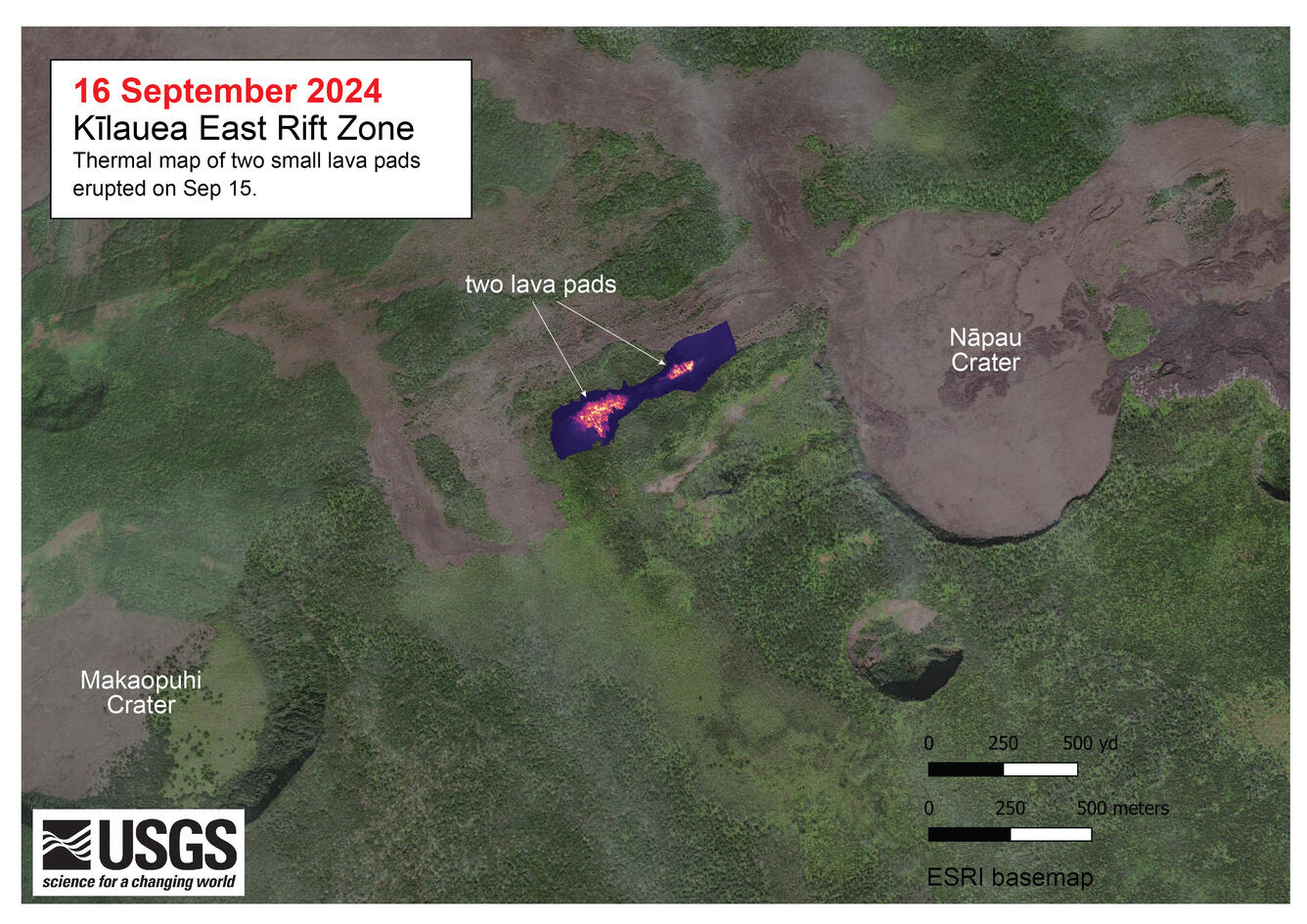
This thermal map shows two small lava pads erupted late on September 15, just west of Nāpau Crater on the East Rift Zone of Kīlauea. This small eruption resulted from magma intruding from the summit into the East Rift Zone, and was associated with an increase in earthquake activity along the rift. The largest of the two lava pads was only about 200 m (yards) long.
Current activity is restricted to Kīlaueaʻs middle East Rift Zone. Rates of seismicity and ground deformation beneath the lower East Rift Zone and Southwest Rift Zone remain low.
A magmatic intrusion has been ongoing in the area near Makaopuhi Crater on the middle East Rift Zone since September 14. A very small eruption occurred west of Nāpau Crater the evening of September 15 and has resumed this evening. The activity is visible in the PWcam: Live Panorama of Pu‘u‘ō‘ō West Flank from Pu‘u‘ō‘ō [PWcam].
HVO is continuing to closely monitor the middle East Rift Zone and in contact with Hawai‘i Volcanoes National Park and the Hawai‘i County Civil Defense Agency. Temporary closures have been implemented as a result of this elevated activity
Source : HVO
Photos : USGS / M. Zoeller , USGS
Indonesia , Ibu :
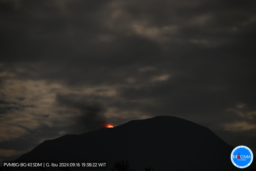
An eruption of Mount Ibu occurred on Monday, 16 September 2024 at 19:38 WIT with the height of the ash column observed at ±400 m above the summit (±1725 m above sea level). The ash column was observed to be white to grey in colour with a thick intensity, oriented towards the North-East. This eruption was recorded on a seismograph with a maximum amplitude of 28 mm and a duration of 48 seconds.
VOLCANO OBSERVATORY NOTICE FOR AVIATION – VONA
Issued : September 16 , 2024
Volcano : Ibu (268030)
Current Aviation Colour Code : ORANGE
Previous Aviation Colour Code : orange
Source : Ibu Volcano Observatory
Notice Number : 2024IBU778
Volcano Location : N 01 deg 29 min 17 sec E 127 deg 37 min 48 sec
Area : North Maluku, Indonesia
Summit Elevation : 4240 FT (1325 M)
Volcanic Activity Summary :
Eruption with volcanic ash cloud at 10h38 UTC (19h38 local).
Volcanic Cloud Height :
Best estimate of ash-cloud top is around 5520 FT (1725 M) above sea level or 1280 FT (400 M) above summit. May be higher than what can be observed clearly. Source of height data: ground observer.
Other Volcanic Cloud Information :
Ash cloud moving to northeast. Volcanic ash is observed to be gray. The intensity of volcanic ash is observed to be thick.
Remarks :
Eruption recorded on seismogram with maximum amplitude 28 mm and maximum duration 48 second.
Source et photo : Magma Indonésie .
Peru , Ubinas :
Analysis period: from September 01, 2024 to September 02, 2024. Arequipa, September 16, 2024.
Alert level: ORANGE
The Geophysical Institute of Peru (IGP) reports that the eruptive processes of the Ubinas volcano (Moquegua region) continue. During this period, no ash emissions have been recorded. The probability of explosive activity or ash emissions is maintained. Consequently, the volcanic alert level remains at YELLOW.
Analysis:
-The occurrence of 195 volcano-tectonic (VT) earthquakes was detected, associated with rock rupture processes occurring inside the volcano. In addition, 170 seismic signals were recorded, associated with the movements of volcanic fluids (gas and magma).
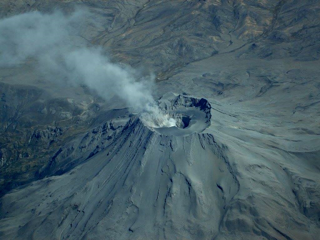
– The surveillance cameras identified emissions of gas and water vapor that reached heights of 1,300 m above the summit of the volcano, which were dispersed mainly towards the eastern and southeastern sectors of the Ubinas volcano.
-On the other hand, no deformation of the volcanic structure was observed.
– Slight emissions (216 t/d) of sulfur dioxide (SO2) were observed.
– Satellite monitoring has identified 55 thermal anomalies (maximum value of 12 MW) in the Ubinas crater, associated with the presence of a lava body in the crater.
RECOMMENDATIONS
• Keep the volcanic alert level at YELLOW
Source : Cenvul.
Photo : Auteur inconnu
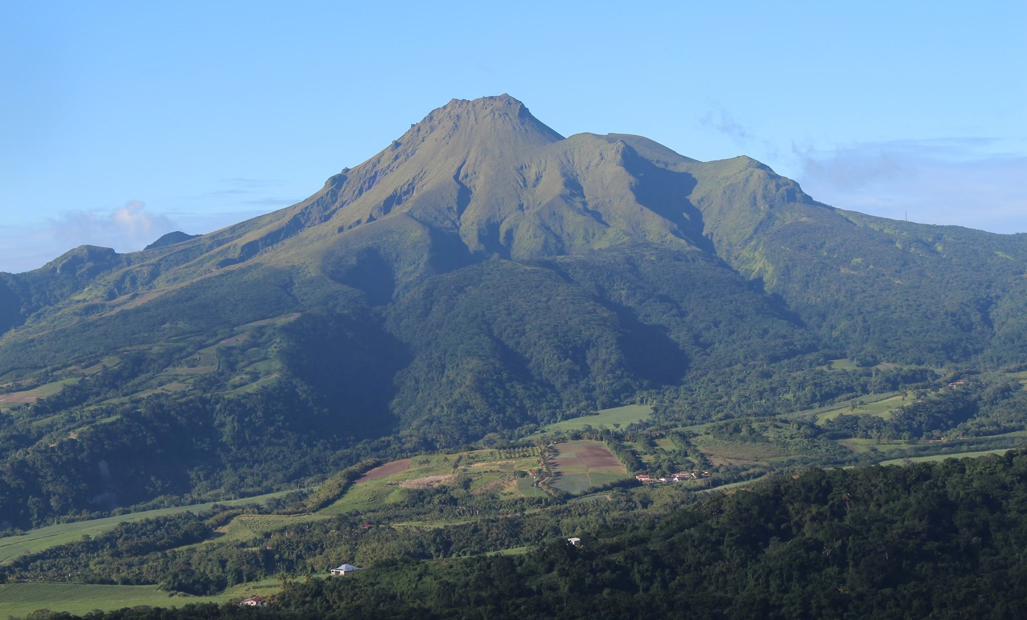
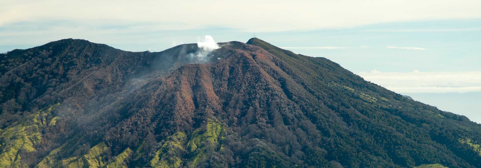
La Martinique , Mount Pelée :
In August 2024, volcanic seismic activity remained low compared to previous months. The seismic energy released by all superficial earthquakes is also low and no volcanic earthquakes were felt. The temperature and acidity (pH) of the thermal springs of the edifice show no significant variation. The deformations of the edifice are very low and seem stable in the short term. It should be remembered that during volcanic reactivation phases, periods of higher activity, particularly seismic, often alternate with phases of lower activity.
Volcano-tectonic (VT) seismicity
The 18 volcano-tectonic (VT) earthquakes recorded in August 2024 are all of very low energy (magnitude of duration less than -0.22) and only 5 could be located manually. A portion of the VT events were automatically detected by waveform recognition, and clearly identified as originating from one of the well-known seismically active zones at Mount Pelée, located between 0.4 and 1.4 km deep below the summit of the volcano.
The VT-type seismic activity observed since April 2019 could be a sign of increased activity in the hydrothermal system, which results from the interaction between superficial meteoric water, rocks and the presence of fluids (gas, hydrothermal water) heated and under high pressure in the deep zones of the magmatic system (more than 10 km) and which rise towards the more superficial zones of the hydrothermal system.
The probability of eruptive activity in the short term remains low. However, taking into account all the observations collected since the end of 2018 and their nature, and on the basis of the OVSM-IPGP observations recorded during the month of August 2024 and summarized in this bulletin, we cannot exclude a change in the situation in the medium term (years, months, weeks).
In accordance with the provisions planned by the authorities, the alert level is currently YELLOW = VIGILANCE
Source et photo : Institut de physique du globe de Paris, OVSM
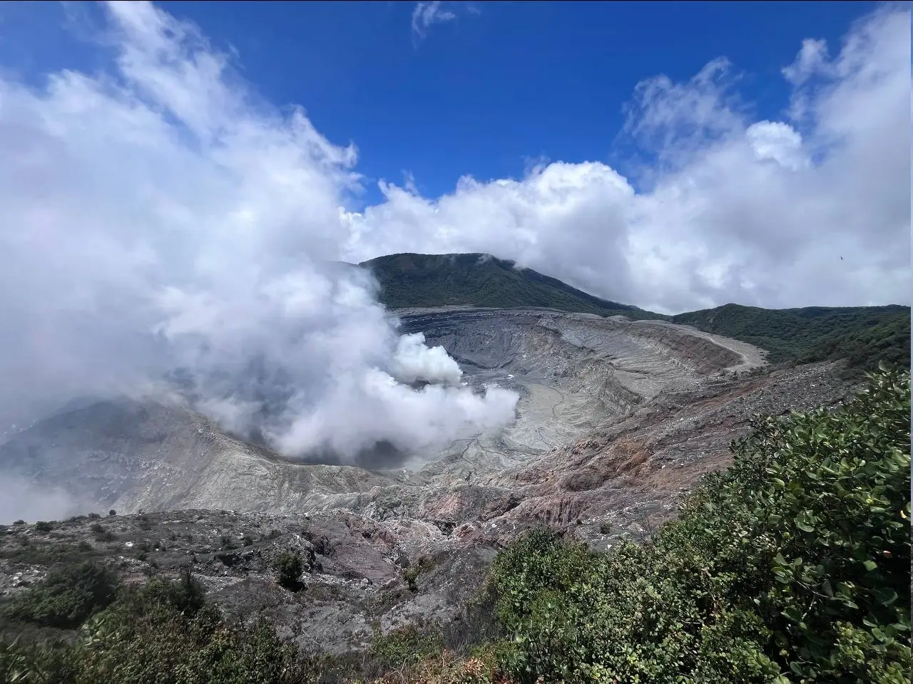
Costa Rica , Rincon de la Vieja / Poas :
Daily Volcano Status Report. Date: September 16, 2024 . Updated at: 10:59:00.
Rincón de la Vieja Volcano
Latitude: 10.83
Longitude: -85.324
Altitude: 1,916 meters
Observed activity:
2 small expirations were recorded at 12:32 yesterday and at 01:22 today. Neither of these generated lahar descent or ash emission. Volcano-tectonic activity north of the volcano ceased on Saturday, September 14 in the morning. Background tremor remains low in energy and variable in the frequency range. Sporadic long-period (LP) signals are recorded. In recent weeks, a slight contraction and subsidence of the base of the volcanic edifice as well as a northward movement of the summit station have been detected.
Environmental conditions:
The wind is blowing from the southwest and the summit is cloudy.
Activity level: Warning (2)
Poas Volcano
Latitude: 10.2
Longitude: -84,233
Altitude: 2,687 meters
Observed activity:
No eruption has been recorded in the last 24 hours. The H2S/SO2 and COS/SO2 ratios remain stable with values of 0.43 and 0.41 respectively. Between 09:45 and 10:15 SO2 concentrations exceeded 2 ppm at the visitors’ point of view. Seismic activity is maintained with a low and stable energy background tremor. Long-period low-amplitude (LP) signals and short tremors are recorded. No significant deformation is observed in the volcano. During the night, an incandescence was observed coming from vent A (south of the crater lake).
Environmental conditions:
The wind is blowing from the southwest and the summit is cloudy.
Activity level: Warning (2)
Source : Ovsicori
Photos : Auteur inconnu ( 2017) , RSN / Dr. Paulo Ruiz ( 05/2024).