September 14 , 2024.
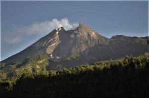
Italy , Stromboli :
Statement on Stromboli activity, 14 September 2024, 01:27 (23:27 UTC).
The National Institute of Geophysics and Volcanology, Osservatorio Etneo, reports that from 12:30 UTC yesterday, the Strombolian activity from the vents of the North Crater area has become progressively more frequent and energetic, as shown by video surveillance cameras. In the last few hours, almost continuous spattering has been observed, which has fueled a lava overflow visible yesterday from 20:15 UTC, when the cloud cover cleared. The lava flow is currently flowing on the upper part of the Sciara del Fuoco, reaching an altitude of about 450 m.
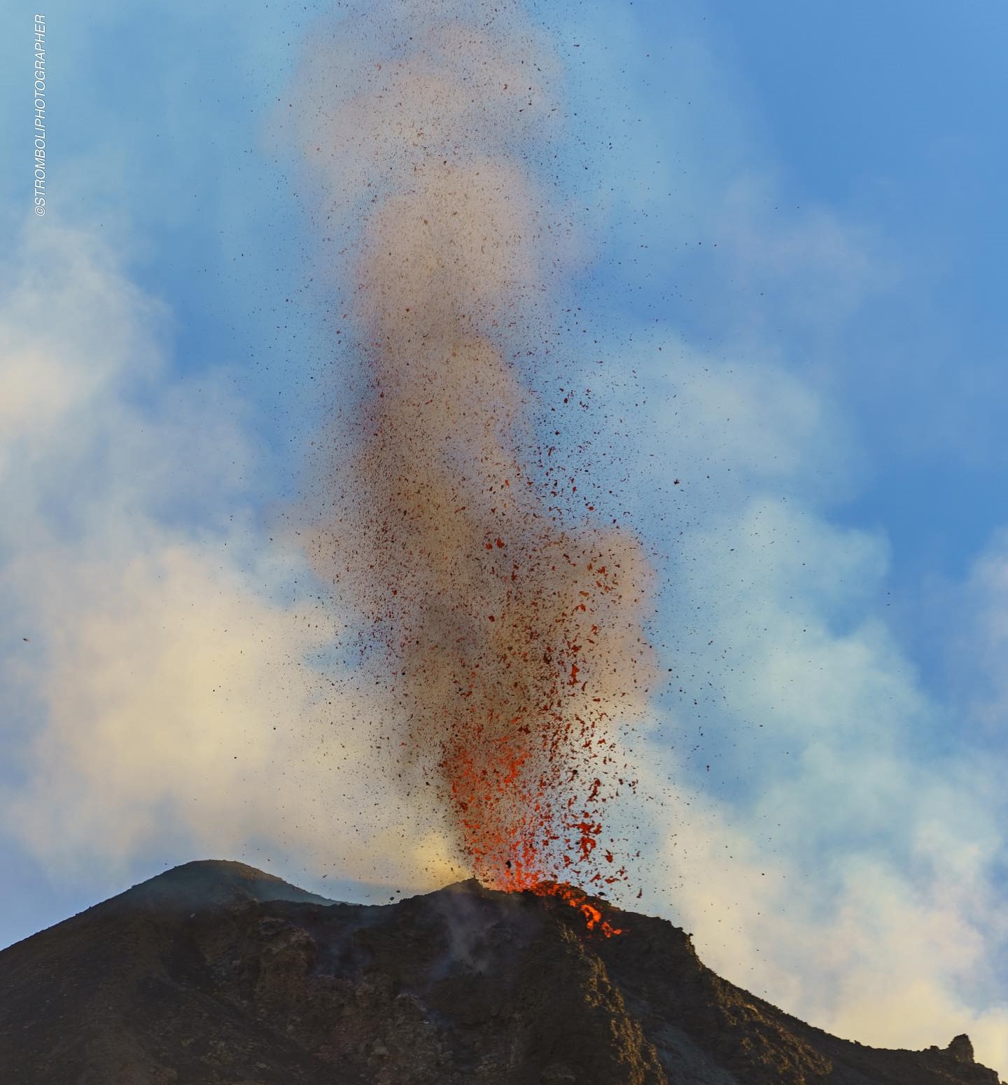
This activity is associated with hot material landslides along the slope and to the coastline.
From a seismic point of view, from about 12:30 UTC yesterday, the average tremor amplitude increased rapidly to very high values. Subsequently, after large oscillations, from about 21:40 UTC, the amplitude returned to high values.
Ground deformation monitoring networks do not show significant variations.
Further updates will be communicated shortly.
Source : INGV
Photo : Stromboli stati d’animo / Sebastiano Cannavo. ( 17/07/2024).
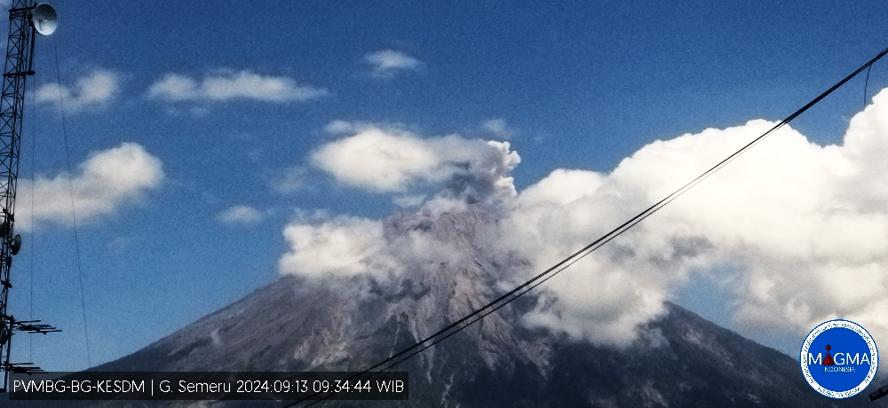
Indonesia , Semeru :
Semeru erupted on Friday, September 13, 2024 at 14:45 WIB with the height of the ash column observed at ± 600 m above the summit (± 4176 m above sea level). The ash column was observed to be white to gray in color with moderate to thick intensity, oriented towards the southwest and west. This eruption was recorded on a seismograph with a maximum amplitude of 23 mm and a duration of 109 seconds.
VOLCANO OBSERVATORY NOTICE FOR AVIATION – VONA
Issued : September 13 , 2024
Volcano : Semeru (263300)
Current Aviation Colour Code : ORANGE
Previous Aviation Colour Code : orange
Source : Semeru Volcano Observatory
Notice Number : 2024SMR2006
Volcano Location : S 08 deg 06 min 29 sec E 112 deg 55 min 12 sec
Area : East java, Indonesia
Summit Elevation : 11763 FT (3676 M)
Volcanic Activity Summary :
Eruption with volcanic ash cloud at 07h45 UTC (14h45 local).
Volcanic Cloud Height :
Best estimate of ash-cloud top is around 13683 FT (4276 M) above sea level or 1920 FT (600 M) above summit. May be higher than what can be observed clearly. Source of height data: ground observer.
Other Volcanic Cloud Information :
Ash cloud moving from southwest to west. Volcanic ash is observed to be white to gray. The intensity of volcanic ash is observed to be thick.
Remarks :
Eruption recorded on seismogram with maximum amplitude 23 mm and maximum duration 109 second.
Source et photo : Magma Indonésie.
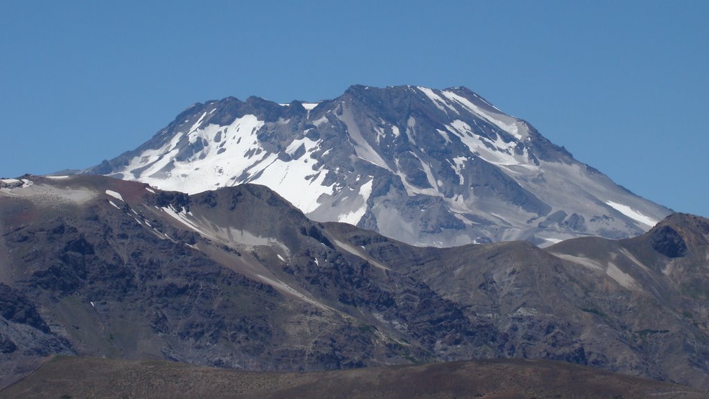
Chile , Descabezado Grande :
Seismology
The seismological activity of the period was characterized by the recording of:
62 VT type seismic events, associated with rock fracturing (Volcano-Tectonic). The most energetic earthquake had a Local Magnitude (ML) value equal to 2.1, located 3.6 km to the East-Southeast, at a depth of 4.3 km in reference to the 2011 crater.
1 LP type seismic events, associated with fluid dynamics within the volcanic system (Long Period). The size of the largest earthquake evaluated from the Reduced Displacement (DR) parameter was equal to 8 cm2.
Fluid Geochemistry
No anomalies have been reported in sulfur dioxide (SO2) emissions into the atmosphere in the area near the volcanic complex, according to data published by the Tropopheric Monitoring Instrument (TROPOMI) and the Ozone Monitoring Instrument (OMI) Sulphur Dioxide Group.
Satellite thermal anomalies
During the period, no thermal alerts were recorded in the area associated with the volcanic complex, according to the analytical processing of Sentinel 2-L2A satellite images, in combination with false-color bands.
Geodesy
There are no data associated with the monitoring of deformations using GNSS or satellite images for the reported period.
Surveillance cameras
The images provided by fixed cameras, installed near the volcanic complex, did not record degassing columns or variations related to surface activity.
A volcanic seismicity of lower energy and low recurrence continues to be observed, preferentially located near the emission center of the year 2011 and to the south of it. It is assumed that the volcanic deformation process remains active due to its previously measured rates. These conditions suggest that, even though there is a decrease in monitoring parameters, they are still above what is considered their basic threshold, therefore, the Technical Volcanic Alert is maintained at:
YELLOW TECHNICAL ALERT: Changes in the behavior of volcanic activity.
Source et photo : Sernageomin
Italy , Campi Flegrei :
Weekly Bulletin, from 02 September 2024 to 08 September 2024. (Issue date 10 September 2024) .
SUMMARY STATUS OF ACTIVITY
In light of the monitoring data, it emerges:
1) SEISMOLOGY: In the week of 2 to 8 September 2024, in the Campi Flegrei area, 24 earthquakes of magnitude Md≥0.0 (Mdmax=1.9±0.3) were located.
2) DEFORMATIONS: In the last month, there has been a reduction in the ground uplift speed whose preliminary average value is about 10±3 mm/month at the GNSS station of Rione Terra (RITE).
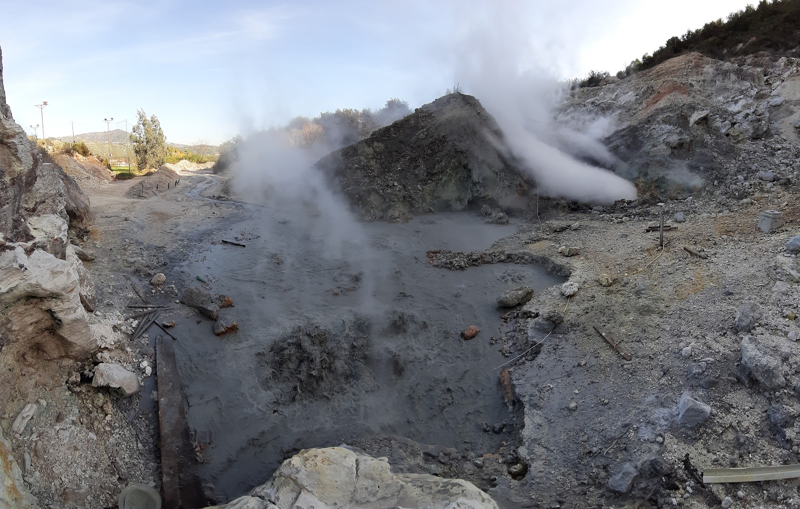
3) GEOCHEMISTRY: There are no significant variations in the geochemical parameters monitored in the reference week compared to the already known trends of increasing flow rates and heating of the hydrothermal system. The temperature sensor installed in a fumarole outlet 5 meters from the main fumarole of Pisciarelli showed an average value of ~94°C. The absence of liquid in the Pisciarelli pond remains.
SEISMOLOGY
From 2 to 8 September 2024, in the Campi Flegrei area, 24 earthquakes with magnitude Md≥0.0 (Mdmax=1.9±0.3; ) were located.
Starting from 19:11 UTC on 07 September 2024, a seismic swarm was recorded, composed of 7 earthquakes with 0.0≤Md≤1.5 (±0.3), occurring in the Solfatara-Pisciarelli area.
GROUND DEFORMATIONS:
Since mid-April 2024 (blue band in the figure), the average value of the uplift velocity in the maximum deformation zone is about 20 ± 3 mm/month at the Rione Terra GNSS station (RITE). During the last month, a reduction in the soil uplift velocity was observed, with a preliminary average value of about 10 ± 3 mm/month at the RITE GNSS station (gray band in the figure).
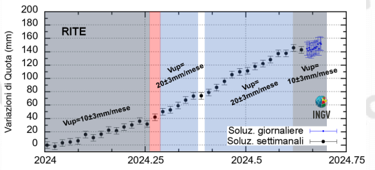
Figure: Time series of altitude changes of the RITE GNSS station from January 01, 2024 to September 08, 2024.
Data processing in Precise Point Positioning mode with PRIDE PPP-AR software.
The lift recorded at the RITE GNSS station is approximately 14.5 cm since January 2024 (Figure ).
Photos : Pisciarelli , Tullio Ricci, decembre 2019 , INGV.
Hawaii , Kilauea :
Friday, September 13, 2024, 8:45 AM HST (Friday, September 13, 2024, 18:45 UTC)
19°25’16 » N 155°17’13 » W,
Summit Elevation 4091 ft (1247 m)
Current Volcano Alert Level: ADVISORY
Current Aviation Color Code: YELLOW
Activity Summary:
Kīlauea is not erupting. Earthquake activity in Kīlauea’s upper East Rift Zone (UERZ) has been low over the last 24 hours. Additional pulses of unrest in the upper to middle East Rift Zone are possible and may evolve quickly.
Summit Observations:
89 earthquakes were detected beneath Kīlauea’s broader summit region over the past 24 hours, most were below magnitude-2 and at depths between 1 km – 3 km (0.6 mi – 1.9 mi) below the surface. Rates of deformation at the summit remain relatively low, with slightly fluctuating tilt at summit tiltmeters over the past day. An overall inflationary trend has been measured by GPS instruments in recent months. The most recent measurement of SO2 emission rate was 75 tonnes per day on August 20, 2024.
Rift Zone Observations:
Over the past 24 hours, there have been 188 earthquakes recorded beneath Kīlauea’s UERZ region and 34 earthquakes recorded within Kīlauea’s south flank. This is similar to earthquake counts from yesterday and still below the levels of activity seen during episodes of unrest. Rates of deformation have remained stable over the past 24 hours.
Activity in other parts of the East Rift Zone remains low. There were no significant changes at tiltmeter POC, located at Puʻuʻōʻō (the site of 1983–2018 eruptive activity) during the past day. GPS instruments have recorded periods of inflation in portions of the the middle East Rift Zone (MERZ) uprift of Puʻuʻōʻō during the past month. Measurements from continuous gas monitoring stations downwind of Puʻuʻōʻō in the MERZ remain below detection limits for SO2, indicating that SO2 emissions from this area are negligible.
Source : HVO
Photo : USGS / N. Deligne ( 02 / 2024).