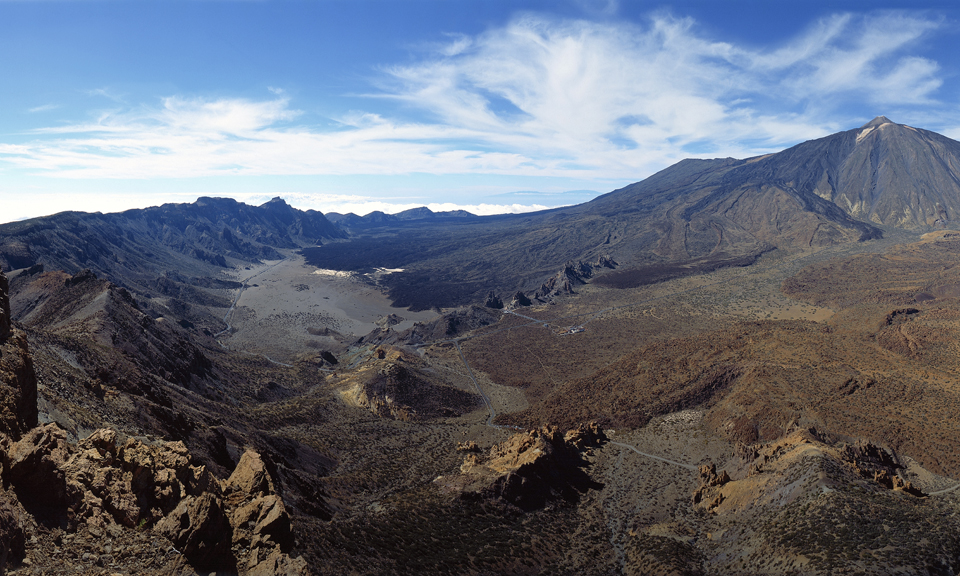
December 27, 2021. EN . Iceland : Reykjanes Peninsula , La Reunion Island : Piton de la Fournaise , Vanuatu Archipelago : Yasur , Ecuador : Sangay , Spain : Tenerife .

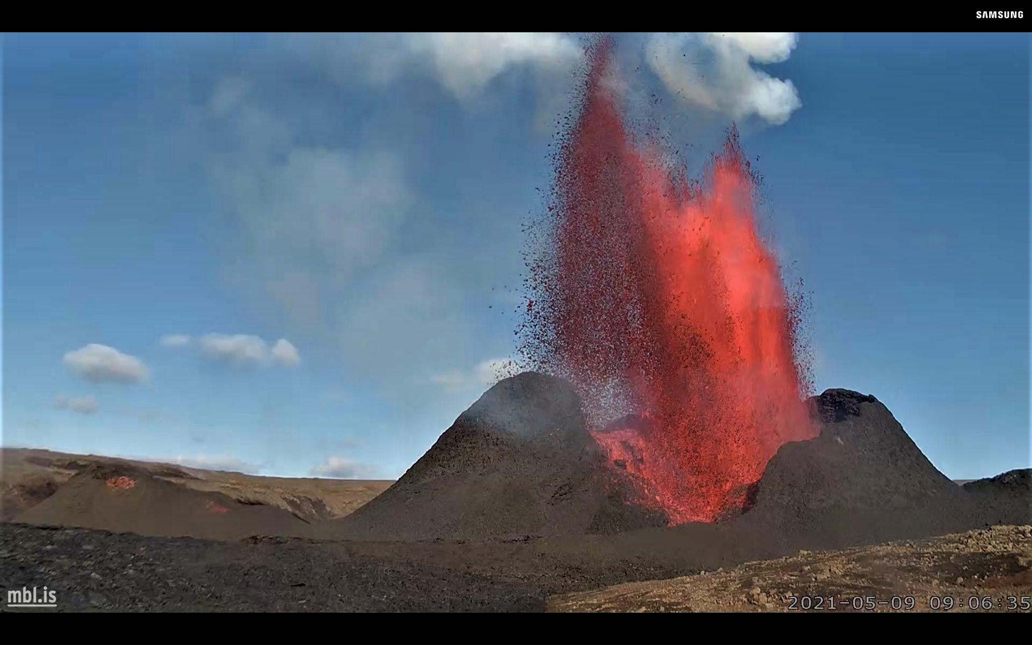
December 27 , 2021.


Iceland , Reykjanes Peninsula :

Update on the earthquake swarm in Geldingadalir , Update on 26.12. at 15:20

The earthquake swarm that started on 21st of December near Fagradalsfjall has continued over the Christmas holidays. Around 3000 earthquakes have been detected every day since the swarm started. Most of the activity is near Fagradalsfjall volcano but earthquakes have also been detected near the town of Grindavík and lake Kleifarvatn.

The earthquakes near Grindavík and Kleifarvatn are interpreted as triggered earthquakes due to increased pressure caused by a dike intrusion near Fagradalsfjall. On Christmas eve three earthquakes above M4 were detected near Grindavík, the largest one M4.8. There are no signs of magmatic intrusions in other places than by Fagradalsfjall. The earthquake activity by Fagradalsfjall is episodic with periods of very intense earthquake activity.

Latest InSAR images show clear signs of deformation over the period from 20 to 26 December. The deformation seen now is very similar to deformation observed in the end of February this year when a dike intrusion was starting near Fagradalsfjall. This InSAR data supports data from GPS measurements showing deformation in the same area.

At 15:25 an M3.9 earthquake occurred and a minute late another M3.6 earthquake was detected. Both of them were located 3 km W of Lake Kleifarvatn.This morning at around 05:10, four earthquakes were detected of magnitude 3 or larger in similar location. These earthquakes are interpreted as triggered earthquakes due to increased pressure caused by a dike intrusion near Fagradalsfjal.

Source : Vedur is.

Photos : IMO.


La Réunion Island , Piton de la Fournaise :

Press release of December 27, 2021 – 10:15 a.m.

The eruption that began on December 22, 2021 at around 3:30 a.m. local time continues. Over the last 24 hours the amplitude of the eruptive tremor (indicator of an emission of lava on the surface) still shows fluctuations. These fluctuations can be linked either to:
– the cone under construction which undergoes construction and dismantling phases, thus influencing the speed of the lava flows at the level of the vent;
– or to punctual releases of pockets of gas trapped in the supply ducts which can be released suddenly leading to an increase in the tremor.
The amplitude of the tremor is this morning at about 30% of its initial amplitude.

The lava tunnel activity set up at the foot of the cone since December 23, 2021, thanks to the closure of the cone, continues, with occasional resurgences of flows. Following
resurgences observed yesterday, a second mouth was visible at the foot of the cone this morning. The main flow does not emerge in a single channel until about a hundred meters downstream.
Lava fountain activity within the cone is low, and lava fountains exceed the height of the cone (<15m) only intermittently.
Interferometric data from satellite acquisitions on December 25 and 26, and processed by the ISDeform observation service, confirm that the surface deformations associated with
the magma injection on December 22 is decimetric and extends from the summit area to the eruptive site. The area between the southern edge of the Dolomieu crater and the Château Fort crater has thus deformed by around twenty centimeters. No significant deformation beyond the eruptive site is observed. These data agree with the data from the permanent GPS stations of the OVPF-IPGP.

Interferogram representing the deformations at Piton de la Fournaise associated with the eruption of December 22, 2021. In addition to measurements on the ground, a satellite technique called dInSAR also makes it possible to monitor the building’s inflation / deflation cycles associated with movements. magma in depth. To do this, the satellite “illuminates” an area of the ground with an electromagnetic wave and collects the signal reflected from the ground. Comparison of two measurements of this type of the same surface taken at different times allows the deformation of the surface to be imaged. Each complete color cycle (from red to blue) of the interferogram corresponds to 27.8 mm of surface displacement towards (positive) or away (negative) of the satellite (© ISDeform).

Over the last 24 hours:
– A single volcano-tectonic earthquake under the summit was recorded.
– Surface deformations no longer show significant deformation.
– The lava flow estimates, established by satellite method with the HOTVOLC platform (OPGC – Clermont Auvergne University), are between 3 and 12 m3 / sec. These variations can be explained by the method, which is based on the infrared radiation of the flow, the perception of which by the satellites can be largely influenced by the weather conditions at above the flows.
– The front of the flow, in graton, currently on a relatively flat area, moves only very slowly. The flow front advanced less than 100 meters between December 24 and 26.

Alert level: Alert 2-1 (eruption in the Enclos ).

Source : OVPF/IPGP.


Vanuatu Archipelago , Yasur :

19°32’0”S 169°26’30”E
Summit 1184ft (361m)
Current Volcano Alert Level: Level 2

Yasur volcano activity is continuing in the level of major unrest state. The Volcanic Alert Level remains at Level 2.

New observations on the ground suggest that the Yasur volcanic activity continues to produce loud explosions with emission of steam and ash including volcanic bombs that fall inside the crater. With this current activity and ongoing presence of volcanic gases and/or volcanic ash around the summit crater, the danger zone is now at 600 meter around the volcanic cone.

Analysis of the latest Yasur seismic data from the volcano monitoring system confirms that Yasur volcano activity is continuing in the major unrest level. The activity consists of ongoing explosions with gas plumes and/or volcanic ash. Some explosions remain intensified and volcanic projectiles or bombs may fall in and/or around the summit crater.

The Yasur Volcanic Alert Level (VAL) has remained in Level 2 since the 18th October 2016. The current observations are consistent with the activity of the Volcanic Alert Level 2. Level 2 indicates ‘Major level of unrest; Danger zone is reduced to 600 m around the volcanic cone. With this current volcanic activity, it is a useful reminder that eruptions can occur with little or no warning.

Source et photos : Geohazard.


Ecuador , Sangay :

DAILY REPORT ON THE STATE OF SANGAY VOLCANO. December 26, 2021.

Surface activity level: High, Surface trend: Ascending.
Internal activity level: High, Internal trend: Ascending.

Seismicity: From December 25, 2021, 11:00 a.m. to December 26, 2021, 11:00 a.m .:

Long period type events (LP) 56
Explosions (EXP) 117
Emission Tremors (TREMI) 15

Rains / Lahars:
No rain was recorded. ** In the event of heavy rains, they could re-mobilize the material accumulated in the gullies, generating mudslides and debris that would descend through the drains of the volcano and flow into adjacent rivers. **

Emission / ash column:
Low ash load gas emissions have been observed with heights of up to 1000 meters above crater level in a south-easterly direction. 3 VAAC ash emission alerts were recorded with directions to the South and Southeast, with altitudes of up to 1170 meters above crater level. There are no reports of ash fall at the national level.

Other monitoring parameters:
The MIROVA satellite recorded 2 high thermal alerts, of 756 and 438 MW during the last 24 hours. The FIRMS satellite records 58 thermal alerts in the last 24 hours.

Observation:
In the afternoon of yesterday, members of the network of volcanic observers (ROVE) near the city of Macas (province of Morona Santiago), reported noises coming from the Sangay volcano. These noises are perceptible by the presence of clouds and south-easterly winds. On the other hand, the seismic records show a slight increase in the intensity of the explosions in the last hours, however, these events are associated with the high levels, characteristic of the activity of the volcano. For the moment, the volcano sector is cloudy.

Alert level: yellow.

Source et photo : IG-EPN.


Spain , Tenerife :

Today we must also look at Tenerife, where there has been an ongoing seismic swarm for almost 5 years in the region of Adeje – Vilaflor with a seismic localization at about 5 to 8 km deep and that during of the last 5 days. Also, there are constraints around a seismic axis in the North-North-East-South-South-West direction which cause it to move seismically and, hopefully, will not last long, because if a path is cut in rock, magma will begin to move along this path.

Today’s earthquake at Icod de Vinos of M 1.1 at 9 km is very interesting since we also had another one of M 1.1 at 10 km on September 27 in an area that made a lot of talk in April – May 2004 (an eruption was expected in October 2004) and hopefully it stays calm, but every time it moves it’s dangerous. This area is also aligned with the Caldera area, the Adeje swarm and even a 2.7 earthquake in the south, denoting very clear regional efforts.

But the problem is neither the Icod de los Vinos earthquakes nor the Adeje earthquakes, the biggest problem is that this activity affects to some extent what is below the central Teide building / Pico Viejo in the center of the island of Tenerife. More precisely, it is necessary to refer to the phonolitic magmatic chamber which is located between 12 and 15 km under the caldera of Las Cañadas del Teide. The 2004 intrusion ended there, the 2016 intrusion in Adeje and subsequent ones also affect the magma chamber in one way or another, so the system is more complex than it looks.

Sources : Volcanes y Ciencia Hoy ( Henrique) , Involcan.

Photos : volcanoteide.com , Involcan.


27 Décembre 2021. FR. Islande : Peninsule de Reykjanes , La Réunion : Piton de la Fournaise , Archipel du Vanuatu : Yasur , Equateur : Sangay , Espagne : Tenerife .

27 Décembre 2021.


Islande , Peninsule de Reykjanes :

Mise à jour sur l’essaim de tremblements de terre à Geldingadalur , mise à jour le 26 Décembre à 15h20

L’essaim de tremblements de terre qui a commencé le 21 décembre près de Fagradalsfjall s’est poursuivi pendant les vacances de Noël. Environ 3000 tremblements de terre ont été détectés chaque jour depuis le début de l’essaim. La majeure partie de l’activité se situe près du volcan Fagradalsfjall, mais des tremblements de terre ont également été détectés près de la ville de Grindavík et du lac Kleifarvatn.

Les tremblements de terre près de Grindavík et Kleifarvatn sont interprétés comme des tremblements de terre déclenchés en raison d’une pression accrue causée par l’ intrusion d’un dyke près de Fagradalsfjall. La veille de Noël, trois tremblements de terre au-dessus de M4 ont été détectés près de Grindavík, le plus important M4.8. Il n’y a aucun signe d’intrusions magmatiques ailleurs qu’à Fagradalsfjall. L’activité sismique de Fagradalsfjall est épisodique avec des périodes d’activité sismique très intense.

Les dernières images InSAR montrent des signes clairs de déformation sur la période du 20 au 26 décembre. La déformation observée maintenant est très similaire à la déformation observée fin février de cette année lorsqu’une intrusion de dyke commençait près de Fagradalsfjall. Ces données InSAR prennent en charge les données des mesures GPS montrant une déformation dans la même zone.

À 15h25, un tremblement de terre de M3.9 s’est produit et une minute plus tard, un autre tremblement de terre de M3.6 a été détecté. Les deux étaient situés à 3 km à l’ouest du lac Kleifarvatn. Ce matin vers 05h10, quatre tremblements de terre de magnitude 3 ou plus ont été détectés dans un endroit similaire. Ces tremblements de terre sont interprétés comme des tremblements de terre déclenchés en raison d’une pression accrue causée par une intrusion de dyke près de Fagradalsfjal .

Source : Vedur is.

Photos : IMO.


La Réunion , Piton de la Fournaise :

Communiqué du 27 Décembre 2021 – 10h15

L’éruption débutée le 22 Décembre 2021 aux alentours de 3h30 heure locale se poursuit. Sur les dernières 24h l’amplitude du trémor éruptif (indicateur d’une émission de lave en surface) montre toujours des fluctuations. Ces fluctuations peuvent être liées soit :
– au cône en cours d’édification qui subit des phases de construction et de démantèlement, influant ainsi la vitesse des débits de lave au niveau de l’évent ;
– soit à des libérations ponctuelles de poches de gaz piégées dans les conduits d’alimentation qui peuvent être libérées soudainement entrainant une augmentation du trémor.
L’amplitude du trémor se situe ce matin à environ 30% de son amplitude initiale .

L’activité en tunnel de lave mise en place au pied du cône depuis 23 Décembre 2021, à la faveur de la fermeture du cône, se poursuit, avec des résurgences ponctuelles de coulées . Suite aux
résurgences observées hier, une deuxième bouche était visible au pied du cône ce matin. La coulée principale ne ressort en un chenal unique qu’une centaine de mètre plus en aval.
L’activité de fontaine de lave au sein du cône est faible et les fontaines de lave ne dépassent la hauteur du cône (<15 m) que de manière intermittente.
Les données interférométriques issues des acquisitions satellites du 25 et 26 décembre, et traitées par le service d’observation ISDeform, confirment que les déformations de surface associées à
l’injection du magma le 22 décembre sont décimétriques et s’étendent de la zone sommitale jusqu’au site éruptif. La zone située entre la bordure Sud du cratère Dolomieu et le cratère Château Fort s’est ainsi déformée d’une vingtaine de centimètre . Aucune déformation significative au-delà du site éruptif n’est observée. Ces données sont en accord avec les données des stations GPS permanentes de l’OVPF-IPGP .

Interférogramme représentant les déformations au Piton de la Fournaise associées à l’éruption du 22 décembre 2021. En plus des mesures au sol, une technique par satellite appelée dInSAR permet également de surveiller les cycles d’inflation / déflation de l’édifice associés aux mouvements du magma en profondeur. Pour cela, le satellite “illumine” une zone du sol avec une onde électromagnétique et collecte le signal réfléchi depuis le sol. La comparaison de deux mesures de ce type d’une même surface prises à des moments différents permet d’imager les déformations de la surface. Chaque cycle de couleur (du rouge vers le bleu) complet de l’interférogramme correspond à 27,8 mm de déplacement de la surface vers (positif) ou à l’opposé (négatif) du satellite (©ISDeform).

Sur les dernières 24h :
– Un seul séisme volcano-tectonique sous le sommet a été enregistré.
– Les déformations de surface ne montrent plus de déformation significative.
– Les estimations de débit de lave, établies par méthode satellite avec la plateforme HOTVOLC (OPGC – université Clermont Auvergne), sont comprises entre 3 et 12 m3 / sec. Ces variations
s’expliquent par la méthode, qui se base sur le rayonnement infra rouge de la coulée dont la perception par les satellites peut être largement influencée par les conditions météorologiques au
dessus des coulées.
– Le front de la coulée, en graton, actuellement sur une zone relativement plate, ne se déplace que très lentement. Le front de coulée a progressé de moins de 100 mètres entre le 24 et le 26 décembre.

Niveau d’alerte : Alerte 2-1 (éruption dans l’Enclos).

Source : OVPF/IPGP.


Archipel du Vanuatu , Yasur :

19°32’0″S 169°26’30″E
Sommet 1184ft (361m)
Niveau d’alerte volcan actuel : niveau 2

L’activité du volcan Yasur se poursuit dans un état de troubles majeurs. Le niveau d’alerte volcanique reste au niveau 2.

De nouvelles observations au sol suggèrent que l’activité volcanique du Yasur continue de produire de fortes explosions avec émission de vapeur et de cendres, y compris des bombes volcaniques qui retombent à l’intérieur du cratère. Avec cette activité actuelle et la présence continue de gaz volcaniques et/ou de cendres volcaniques autour du cratère sommital, la zone de danger est maintenant à 600 mètres autour du cône volcanique.  

L’analyse des dernières données sismiques Yasur du système de surveillance des volcans confirme que l’activité du volcan Yasur se poursuit au niveau des troubles majeurs. L’activité consiste en des explosions continues avec des panaches de gaz et/ou des cendres volcaniques. Certaines explosions restent intensifiées et des projectiles volcaniques ou des bombes peuvent retomber dans et/ou autour du cratère sommital.

Le niveau d’alerte volcanique de Yasur (VAL) est resté au niveau 2 depuis le 18 octobre 2016. Les observations actuelles sont cohérentes avec l’activité du niveau d’alerte volcanique 2. Le niveau 2 indique « niveau majeur de troubles ; La zone de danger est portée à 600 m autour du cône volcanique. Avec cette activité volcanique actuelle, c’est un rappel utile que les éruptions peuvent se produire avec peu ou pas d’avertissement.

Source et photos : Geohazard.


Equateur , Sangay :

RAPPORT QUOTIDIEN DE L’ETAT DU VOLCAN SANGAY . 26 Décembre 2021 .

Niveau d’activité Superficiel: Haut , Tendance de surface : Ascendante .
Niveau d’activité interne: Haut , Tendance interne : Ascendante.

Sismicité : Du 25 Décembre 2021, 11:00 au 26 Décembre 2021, 11:00 :

Evènements de type Longues périodes (LP) 56
Explosions (EXP) 117
Tremors d’émissions (TREMI) 15


Pluies / Lahars :
Aucune pluie n’a été enregistrée. ** En cas de fortes pluies, celles-ci pourraient remobiliser la matière accumulée dans les ravines, générant des coulées de boue et de débris qui descendraient à travers les drains du volcan et se déverseraient dans les rivières adjacentes.**

Emission / colonne de cendres :
Des émissions de gaz à faible charge de cendres ont été observées avec des hauteurs allant jusqu’à 1000 mètres au-dessus du niveau du cratère dans une direction Sud-Est. 3 alertes d’émission de cendres VAAC ont été enregistrées avec des directions vers le Sud et le Sud-Est, avec des altitudes allant jusqu’à 1170 mètres au-dessus du niveau du cratère. Il n’y a pas de rapports de chutes de cendres au niveau national.

Autres paramètres de surveillance :
Le satellite MIROVA enregistre 2 alertes thermiques élevées , de 756 et 438 MW au cours des dernières 24 heures. Le satellite FIRMS enregistre 58 alertes thermiques au cours des dernières 24 heures.

Observation:
Dans l’après-midi d’hier, des membres du réseau d’observateurs volcaniques (ROVE) à proximité de la ville de Macas (province de Morona Santiago), ont signalé des bruits provenant du volcan Sangay. Ces bruits sont perceptibles par la présence de nuages ​​et de vents de direction Sud-Est. D’autre part, les enregistrements sismiques montrent une légère augmentation de l’intensité des explosions au cours des dernières heures, cependant, ces événements sont associés aux niveaux élevés, caractéristiques de l’activité du volcan. Pour le moment, le secteur du volcan est nuageux.

Niveau d’alerte: jaune.

Source et photo : IG-EPN.


Espagne , Tenerife :

Aujourd’hui, il faut aussi regarder à Tenerife, où il y a eu un essaim sismique en cours depuis près de 5 ans dans la région d’Adeje – Vilaflor avec une localisation  sismique à environ 5 à 8 km de profondeur et cela au cours des 5 derniers jours . Egalement , on note des contraintes autour d’un axe sismique dans la direction Nord-Nord-Est-Sud-Sud-Ouest qui le font se déplacer sismiquement et, espérons-le, ne dureront pas longtemps, car si un chemin est coupé dans la roche, le magma commencera à se déplacer le long de ce chemin.

Le séisme d’aujourd’hui à Icod de Vinos de M 1,1 à 9 km est très intéressant puisque nous en avons également eu un autre de M 1,1 à 10 km le 27 septembre dans une zone qui a fait beaucoup parler en avril – mai 2004 (une éruption était attendue en octobre 2004) et il faut espérer qu’elle reste calme, mais à chaque fois qu’elle bouge, c’est dangereux. Cette zone est également alignée avec la zone de Caldera, l’essaim d’Adeje et même un séisme de 2,7 au Sud, dénotent des efforts régionaux très clairs.

Mais le problème, ce ne sont ni les tremblements de terre d’Icod de los Vinos ni le tremblements de terre à Adeje, le plus gros problème est que cette activité affecte dans une certaine mesure ce qui se trouve en dessous du bâtiment central Teide / Pico Viejo au centre de l’île de Tenerife. Plus précisément, il faut faire référence à la chambre magmatique phonolitique qui se situe entre 12 et 15 km sous la caldeira de Las Cañadas del Teide. L’intrusion de 2004 s’est terminée là, celle de 2016 à Adeje et celles qui ont suivi affectent également la chambre magmatique d’une manière ou d’une autre, le système est donc plus complexe qu’il n’y paraît.

Sources : Volcanes y Ciencia Hoy ( Henrique) , Involcan.

Photos : volcanoteide.com , Involcan.


December 19, 2021. EN. Spain : Tenerife , Spain / La Palma : Cumbre Vieja , Indonesia : Semeru , Chile : Villarica , Costa Rica : Turrialba / Poas , La Martinique : Montagne Pelée .

December 19 , 2021.


Spain , Tenerife :

SISMO-VOLCANIC ACTIVITY IN TWO ZONES OF THE CENTER OF TENERIFE, IN THE CALDERA AND ON ITS WEST SIDE IN THE REGION OF ADEJE AND GUIA DE ISORA.

These days, it was almost a monograph of La Palma. But Tenerife for several days shows seismic activity at around 6-8 km in the Adeje area and around 8-11 km in the Caldera and Guia de Isora area. The IGN, located around 11 in the region in 15 days. But when we remove this swarm, it turns out that in 14 days there were 59 located by Involcan in the same areas.
This is not new, it is an activity that started 5 years ago There had already been stronger swarms in this area, in October 2016, November 2017, November 2018, July 2019, December 2020 and more … we arrive at 2004. Seismicity has been located in the area since the 1980s.

The large triangular island of Tenerife is composed of a complex of overlapping Miocene-to-Quaternary stratovolcanoes that have remained active into historical time. The NE-trending Cordillera Dorsal volcanic massif joins the Las Cañadas volcano on the SW side of Tenerife with older volcanoes, creating the largest volcanic complex of the Canary Islands. Controversy surrounds the formation of the dramatic 10 x 17 km Las Cañadas caldera, which is partially filled by Teide stratovolcano, the highest peak in the Atlantic Ocean. The origin of the caldera has been variably considered to be due to collapse following multiple major explosive eruptions or as a result of a massive landslide (in a manner similar to the earlier formation of the massive La Orotava and Guimar valleys), or a combination of the two processes. The most recent stage of activity beginning in the late Pleistocene included the construction of the Pico Viejo and Teide edifices. Tenerife was perhaps observed in eruption by Christopher Columbus, and several flank vents on the Canary Island’s most active volcano have been active during historical time.


Teide volcano, the highest point on the island of Tenerife, towers above the scarp of the massive Orotava landslide, which occurred about 600,000 years ago. The light-colored area on the eastern foot of the volcano (left) is covered by tephra deposits from the Plinian Montana Blanca eruption about 2,000 years ago. Teide was constructed within the 10 x 16 km wide Las Cañadas caldera on the SW side of Tenerife. The large triangular island is composed of a complex of overlapping stratovolcanoes that have remained active into historical time.

It turns out that the central volcano of Tenerife is very large, the third largest on the planet by volume. While the Teide-Pico Viejo volcanic complex also erupts, these are not always basaltic eruptions. , the majority in this area are phonolitic, much more explosive and of course more powerful than that experienced in La Palma.
And let’s not forget, it is active too and where the phonolitic reservoir is located under the caldera, could indicate deep contributions.

Sources : GVP ,  Volcanes y Ciencia Hoy .

Photo : volcanoteide.com , Alexander Belousov, 2001 (Institute of Volcanology, Kamchatka, Russia).


Spain / La Palma , Cumbre Vieja :

December 18, 2021 09:00 UTC Volcanic monitoring continues in La Palma.

Since the last declaration a total of 40 earthquakes have been located on the island of La Palma, none of these earthquakes have been felt by the population.
The maximum recorded magnitude is 2.8 (mbLg), corresponding to yesterday’s earthquakes at 11:31 and 14:54 UTC, at a depth of 33 and 14 km, respectively. The minimum magnitude of localized seismicity was 0.9 mbLg.
Localized seismicity continues below the central area of Cumbre Vieja in the same areas as the previous days. The earthquakes mainly fall into two groups, 22 of the earthquakes are between 7 and 16 km deep and 15 earthquakes at depths greater than 30 km. Likewise, 3 shallow earthquakes were located in the area, with a depth of less than 4 km.

During the past 24 hours, no volcanic tremor has been observed in the records, keeping the seismic noise at levels close to the pre-eruptive period.
Since the cessation of the volcanic tremor signal on December 13 at 10:20 p.m., events of the low frequency (LP) type have continued to be detected in addition to localized volcano-tectonic earthquakes.
The island’s network of permanent GNSS stations does not show significant deformations that could be associated with volcanic activity.

In view of the image calibrated at 08:45 UTC, no type of emission is visible.
The height of the cone is measured by obtaining a value of 1122 m at sea level.

The eruptive process continues to show signs of exhaustion and the visible emission of volcanic gases is punctual and sporadic and is concentrated in the eruptive centers and offshoots of the volcanic tubes.

The scientific committee monitoring the eruption in Cumbre Vieja, La Palma, on Friday detected « a small flow » of lava on the surface on the flows that fall in the area of the cliff of Las Hoyas, although the « signs of depletion ”of the volcano persist. Its spokesperson, María José Blanco, indicated this Saturday after the meeting of the Volcanic Emergency Plan of the Canary Islands (Pevolca) that this « small lava flow » corresponds to « a vestige » which comes from a still volcanic tube active.

However, he stressed that in the absence of observable phenomena on the surface and those of the surveillance system « the signs of exhaustion are corroborated », without ruling out a rebound in Strombolian activity and the emission of flows.

Sources : IGN es , El Pais .

Photo : I love the world . Involcan .


Indonesia , Semeru :

VOLCANO OBSERVATORY NOTICE FOR AVIATION – VONA.

Issued : Décember 18 , 2021
Volcano : Semeru (263300)
Current Aviation Colour Code : ORANGE
Previous Aviation Colour Code : orange
Source : Semeru Volcano Observatory
Notice Number : 2021SMR85
Volcano Location : S 08 deg 06 min 29 sec E 112 deg 55 min 12 sec
Area : East java, Indonesia
Summit Elevation : 11763 FT (3676 M)

Volcanic Activity Summary :
Pyroclastic flow occured from the edge of lava deposit at 22h31 UTC ( 05h31 local )

Volcanic Cloud Height :
Ash-cloud is not visible

Other Volcanic Cloud Information :
Ash-cloud moving to South West

Remarks :
Lava flow is observed through the Southeast direction of the Semeru summit crater.

Clear to misty volcano. No smoke from the crater was observed.
It was observed 2 hot cloud avalanches with a sliding distance of 500 meters in the direction of Besuk Kobokan, as well as an emission of gray / white smoke with a height of 200 meters above the summit in a southwest direction. .

Seismicity is linked to the activity of magma as well as to tectonic activity.
– 2 hot cloud avalanches
– 5 avalanche earthquakes
– 12 earthquakes of emissions
– 3 deep volcanic earthquakes
– 8 distant tectonic earthquakes

Sources : Magma Indonésie , PVMBG.

Photo : Oystein Lund Andersen.


Chile , Villarica :

Special Report on Volcanic Activity (REAV), La Araucanía region, Villarrica volcano, December 17, 2020, 5:50 p.m. local time (Continental Chile)

The National Service of Geology and Mining of Chile (Sernageomin), on the basis of information obtained through the monitoring equipment of the National Volcanic Monitoring Network (RNVV), processed and analyzed in the Volcanic Observatory of the Southern Andes (Ovdas), and in relation to the activity of the Villarrica volcano, reports the following:

On Thursday, December 17, at 5:16 p.m. local time (8:16 p.m. UTC), IP cameras installed near the volcano recorded a pulse of particulate matter, associated with a long-period (LP) type earthquake.


The data obtained are as follows:
MAXIMUM HEIGHT OF THE COLUMN: 720 m with particle emission.
DISPERSAL DIRECTION: East-South-East (ESE)
REDUCED DISPLACEMENT: 7.7 cm2

Remarks :
At the time of publication of this report, the monitoring parameters do not show significant variations.

The volcanic alert remains at the level: Yellow.

Source : Sernageomin.

Photo : Volcanologia en Chile ( archive).


Costa Rica , Turrialba / Poas :

Turrialba volcano:

No eruption is reported.
Seismic activity is higher than yesterday.
At the time of this report, the winds are blowing from the southwest.

Significant degassing is observed in the main crater. The CO2 / SO2, H2S / SO2 gas ratios and the SO2 concentration are relatively stable: 19.9; 0.85 and 6.47 ppm, respectively. The volcanic deformation of the building is not significant.

Poas volcano:

No eruption is reported.
Seismic activity is similar, compared to yesterday.
At the time of this report, the winds are blowing from the southwest.


Due to the high cloud cover, it is not possible to make observations in the main crater. Both the H2S / SO2 ratio and the SO2 concentration remain relatively stable: 0.75 and 1.59 ppm; respectively. The SO2 concentration at the watchtower this morning was less than 1 ppm. There is no significant deformation of the volcanic building.

Source : Ovsicori.

Photos : Jean Paul Calvo /RSN , Ovsicori.


La Martinique , Montagne Pelée : 

Weekly report on the activity of Mount Pelée for the period from December 10 to 17, 2021.

Between December 10, 2021 at 4 p.m. (UTC) and December 17, 2021 at 4 p.m. (UTC), the OVSM recorded at least 27 volcano-tectonic earthquakes of magnitude less than or equal to 0.9 and located at l inside the volcanic edifice between 2.5 and 0.5 km deep below the surface. This volcano-tectonic-type superficial seismicity is associated with the formation of micro-fractures in the volcanic edifice. None of these earthquakes were felt by the population.


The shallow sea degassing zone between St Pierre and le Prêcheur is still observed. The IGP took fluid samples in order to understand the origin of this degassing and to assess its possible relationship with the hydrothermal system of Mount Pelée.

The vegetation grows back at the level of the main zone of degraded vegetation which is observed on the southwest flank of Mount Pelée, between the upper Claire river and the Chaude river. However, new areas of deteriorated and dead vegetation were detected by analysis of satellite images in the upper Claire River and near the hot springs.

The alert level remains YELLOW: vigilance.

Source : Direction de l’OVSM IPGP.

Photo : Jmp48 / Wikipedia

May 12, 2021. EN . Italy : Stromboli , Italy / Sicily : Etna , Iceland : Geldingadalur , Philippines : Bulusan , Chile : Cerro Hudson .

May 12 ,  2021.


Italy , Stromboli :

Weekly bulletin, from May 03, 2021 to May 09, 2021 (issue date May 11, 2021)

SUMMARY OF THE STATE OF ACTIVITY

In the light of surveillance data, it is highlighted:
1) VOLCANOLOGICAL OBSERVATIONS: Normal explosive volcanic activity of Strombolian type accompanied by sometimes intense projection activity in the N2 zone. The total frequency of events showed values ​​between medium (10 events / h) and medium-high (17 events / h).
The intensity of the explosions varied from low to medium-high in the North crater area and medium-high in the Center-South area.
2) SEISMOLOGY: The monitored seismological parameters do not show significant variations.
3) DEFORMATIONS: The variation of the radial component of the TDF station began on May 2, 2021 and continued during the week, until May 4, 2021.
4) GEOCHEMISTRY: SO2 flow at medium level
The C / S ratio in the plume is at average values, slightly increasing
The isotopic ratio of Helium shows average values.
5) SATELLITE OBSERVATIONS: The thermal activity in the summit area is at a moderate level.

Photo of the area of ​​the Stromboli crater on March 31, taken with a) shaded model of the terrain, the lines of different colors delimit the different areas of the crater; b) orthomosaic, the lines of different colors delimit the different areas of the crater; c) thermal ortho-image superimposed on the shaded terrain model, thermal anomalies are identifiable with white red yellow, cold areas are blue.

VOLCANOLOGICAL OBSERVATIONS
In the period under observation, the eruptive activity of Stromboli was characterized by the analysis of the images recorded by the surveillance cameras INGV-OE located at an altitude of 190 m, Punta Corvi and an altitude of 400 m.

Morpho-structural characterization of the crater area following the inspection of May 8, 2021.
Within the framework of the activities of the UNO project and the DPC / all convention. A, an ortho photo and a DSM (Digital Surface Model) of the crater area with a resolution of 7 and 25 cm, respectively, were processed. Direct on-site observation and morpho-structural analysis of the aforementioned areas made it possible to verify the following evolutions compared to the last morphological update of March 31, 2021 and to assess the state of the active vents:
(1) The area of ​​the N1 crater has widened by 8 m in the southwest direction and has 3 active vents
(2) In the area of ​​the N2 crater, 2 slag cones with a diameter of about 20 m and two other coalescers with a maximum elongation axis of 25 m were formed, where there were previously depressions of crater. It has 4 active mouths.
(3) The CS2 and CS1 crater areas are now merging and there are at least 10 mouths inside, of which 7 are active. The southwest edge widened a few meters in the southwest direction.
(4) The CS3 crater area has remained unchanged and has an inactive vent.


Description of the explosive activity captured by surveillance cameras.
In the area of ​​the North crater, the N1 crater produced explosions of varying intensity from low to medium-high (sometimes the products reached 250 m in height) emitting coarse materials (lapilli and bombs). The N2 vent, at four emission points, showed explosive activity of varying intensity from low to medium-high (sometimes the products reached 250 m in height) emitting mainly coarse materials with a throwing activity that was intense for short intervals on May 6. The average frequency of explosions varied from 8 to 13 events / h.
In the Center-South zone, there were at least three emission points with explosions, emitting coarse and fine materials, with medium and sometimes high intensity (the products exceeded 250 m in height).
The explosive activity showed average hourly frequency values ​​between 1 and 4 events / h.

PRESS RELEASE VOLCANIC ACTIVITY – STROMBOLI, May 11, 2021.

From around 08:00 a.m. on May 11, until 11:30 a.m. (UTC time), we observe by surveillance cameras and INGV personnel on the ground, a volcanic activity characterized by an intense activity of projections in the area. from the North crater. In particular, the activity was discontinuous with more intense phases between 8:10 a.m. and 9 a.m. and between 9:45 a.m. and 10:45 a.m., followed by short and more discontinuous phases. The Center-Sud crater sector produced explosive activity of varying and intense intensity. Overall, activity landed at a medium to high level to stay at an average level during the afternoon.


The SO2 flux showed values oscillating between a medium and high medium level, with progressive stages and a constant increase in coincidence with the intense projection activities. Since April, there has been a tendency to increase the degassing regime.
At the same time, from 08:05 hours (UTC time), an increase in the level of tremor of the top stations was observed, which reached medium to high values until 11:30 hours UTC and then returned to the levels. previous ones. The evolution of the VLP signals did not show variations either in number or in amplitude, which remains at low levels.
The available soil deformation data show no significant variation.

Source et photos : INGV.

Read the article :  https://www.ct.ingv.it/index.php/monitoraggio-e-sorveglianza/prodotti-del-monitoraggio/bollettini-settimanali-multidisciplinari/497-bollettino-settimanale-sul-monitoraggio-vulcanico-geochimico-e-sismico-del-vulcano-Stromboli20210511/file


Italy / Sicily , Etna : 

Weekly bulletin, from May 03, 2021 to May 09, 2021 (issue date May 11, 2021)

SUMMARY OF THE STATE OF ACTIVITY:

In the light of surveillance data, it is highlighted:

1) VOLCANOLOGICAL OBSERVATIONS: Degassing activity of summit craters and discontinuous Strombolian activity at the Southeast Crater, accompanied by low ash emissions.
2) SEISMOLOGY: significant swarm seismic activity, low level of tremor
3) INFRASOUND: Increase in infrasound activity.
4) DEFORMATIONS: There are no significant variations in the time series of soil deformation monitoring networks.
5) GEOCHEMISTRY: SO2 flow at medium-low level
The CO2 flux from the soil shows average values.
The partial pressure of dissolved CO2 in groundwater reaches background values.
No new data from the C / S ratio is available.
Helium isotopic ratio values ​​remain at high levels, although declining (sampling 04/23/2021).
6) SATELLITE OBSERVATIONS: The thermal activity in the summit area is at a low level.

Degassing of the summit of Etna with the central area of ​​the craters (Voragine and Bocca Nuova) on the left and the South-East crater on the right.

VOLCANOLOGICAL OBSERVATIONS
During the week, the monitoring of the volcanic activity at the level of the summit craters of Etna was carried out by analyzing the images of the network of surveillance cameras of the INGV Section of Catania, Etneo Observatory (INGV-OE).
During the week in question, the summit craters were affected by a variable degassing activity associated with a discontinuous Strombolian activity at the level of the Southeast Crater. In particular, intermittent and weak Strombolian activity was observed at the eastern mouth of the Southeast Crater, sometimes accompanied by small puffs of gray-brown ash, immediately dispersed in the summit area.

Volcanic tremor:
The magnitude of the tremor was low. The locations of the sources show a notable dispersion under the central craters and the Southeast Crater. The depths vary between 0.5 and 2.5 km above sea level.

Source : INGV.

Read the article https://www.ct.ingv.it/index.php/monitoraggio-e-sorveglianza/prodotti-del-monitoraggio/bollettini-settimanali-multidisciplinari/496-bollettino-settimanale-sul-monitoraggio-vulcanico-geochimico-e-sismico-del-vulcano-etna20210511/file

Photo: Giò Giusa


Iceland , Geldingadalur :

The magma fountains soar 300 meters into the air.

The volcanic projections that rise from the Geldingadalur crater reach a height of 300 meters when the power is at its highest. The crater that was created is now about 50 meters high.

Volcanologist Þorvaldur Þórðarson says the flow rate of the lava flow from Geldingadalur crater is always in the range of 5 to 10 cubic meters per second, and even closer to ten cubic meters. Updated results of lava flow and eruption measurements are expected today.

Around 1 p.m. yesterday, Monday, the crater jets were extremely high. They have been seen from many places. For example, they were clearly visible through the window of the Ríkisútvarp news agency in Efstaleit / Reykjavík. They always show up at a steady pace. The eruption seems to have stopped for a few minutes before setting off again in the crater and the magma is projected hundreds of meters into the air. It is an impressive sight, even from miles away.


The erupting volcano on the Reykjanes peninsula continues to surprise earth scientists, nearly two months after it started. According to the latest readings, lava flow is up by 70 percent and the eruption is twice as powerful as it has been for most of the time so far. “For an eruption to be growing in its eighth week is unusual and there are no signs we are about to see that stop. This is a different type of eruption than we are used to seeing,” says geophysicist Magnús Tumi Guðmundsson.
Data show that 95 percent of eruptions are most powerful at the beginning and then lose power gradually or quite suddenly. The eruption close to Fagradalsfjall appears to be an exception to that rule. “A significant increase in lava flow has occurred at Fagradalsfjall in recent weeks,” a press release from the University of Iceland earth sciences department confirms.

The increased lava flow appears to go hand-in-hand with the lava fountais that are being regularly throw high into the sky. The volcano’s new lava field now covers 1.8 square kilometres and has an overall mass of some 30 million cubic metres.

Most eruptions originate from a magma chamber under a central volcano. Pressure and the size of the chamber dictate how long and how big the eruption is. “But this eruption seems to be controlled by the eruption channel and how much it can transport. The channel that opened was particularly narrow and long,” the university report states—adding that the evidence suggests it is widening as time goes on.

Magnús Tumi says the data confirm what many have instinctively felt: that the eruption is getting bigger. It was not certain before, though, as the formerly stable eruption has become more volatile, so it is harder to compare.

Magnús Tumi says it is highly unusual for an eruption to be gaining strength two months in. He says there is no sign the current developments will change, and no way of knowing when the eruption will stop, or for how long it will continue growing in strength.

Source : RUV.

Photo: Hólmfríður Dagný Friðjónsd – RÚV , MBL .


Philippines , Bulusan : 

BULUSAN VOLCANO BULLETIN 12 May 2021 08:00 A.M.

In the past 24-hour period, the Bulusan Volcano Network recorded one hundred sixty-six (166) volcanic earthquakes. Ground deformation data from real-time electronic tilt monitoring recorded sustained inflation of the upper slopes that began 6 March 2021 consistent with short-term inflation of the edifice measured by continuous GPS monitoring since February 2021. These parameters generally indicate that shallow hydrothermal processes are occurring beneath the edifice.

Alert Level 1 status now prevails over Bulusan Volcano, which means that it is currently in an abnormal condition. Local government units and the public are reminded that entry into the 4-kilometer radius Permanent Danger Zone (PDZ) must be strictly prohibited and that vigilance in the 2-kilometer Extended Danger Zone (EDZ) on the southeast sector must be exercised due to the increased possibilities of sudden and hazardous phreatic eruptions. Civil aviation authorities must also advise pilots to avoid flying close to the volcano’s summit as ash from any sudden phreatic eruption can be hazardous to aircraft. Furthermore, people living within valleys and along river/stream channels especially on the southeast, southwest and northwest sector of the edifice should be vigilant against sediment-laden stream flows and lahars in the event of heavy and prolonged rainfall should phreatic eruption occur. DOST-PHIVOLCS is closely monitoring Bulusan Volcano’s condition and any new development will be communicated to all concerned stakeholders.

Source et photo : Phivolcs.


Chile , Cerro Hudson :

For the period evaluated, the seismic activity associated with rock fracturing (VT type events), whose locations are around the caldera, shows a slight increase in the quantity and energy of the events compared to the previous period. .
Two higher energy events stand out on April 17 and 23, both with a local magnitude (ML) of 2.9. They were located 4.1 km and 4.2 km, both southwest (SSW) of the center of the caldera with a depth of 4.1 and 1.8 km respectively.

The seismic activity associated with the fluid dynamics inside the volcano (type LP and HB) showed an increase in the number of long-term LP events compared to the previous fortnight, although they showed a decrease energy released. It should be noted that no hybrid earthquake was identified during the period analyzed.
The data provided by the GNSS stations recorded variations of 0.7 cm / month in the station located to the West-North-West of the volcanic building, however this variation would be attributable to seasonal effects.
No abnormal surface activity was recorded for the period evaluated.

Source : Cegemar.

Photo : Sernageomin.