January 23, 2024. EN. Philippines : Bulusan , Peru : Sabancaya , Vanuatu : Ambrym , Chile : Villarica , Guatemala : Fuego .

January 23 , 2024.


Philippines , Bulusan :

BULUSAN VOLCANO ADVISORY , 23 January 2024 , 01:30 AM
This is a notice of increased seismic activity at Bulusan Volcano.

A total of ninety-one (91) volcano-tectonic (VT) earthquakes associated with rock fracturing at 2 to 4 kilometers depth beneath the southwestern flanks have been recorded by the Bulusan Volcano Network (BVN) since 1:38 AM of 22 January 2024. The southwestern as well as southeastern flanks of Bulusan Volcano have been inflated since February 2023 based on ground deformation data from continuous GPS and electronic tilt monitoring. In contrast, degassing activity from the summit crater and active vents has been very weak to moderate when the volcano summit has been visible. Nonetheless, increased seismic activity and pressurization of the volcano edifice may indicate that hydrothermal processes may be occurring beneath the volcano and may lead to steam-driven eruptions at any of the summit vents.

The public is reminded that Alert Level 1 prevails over Bulusan Volcano, which means it is currently at low-level unrest with increased chances of steam-driven or phreatic eruptions. Local government units and the public are reminded that entry into the 4-kilometer radius Permanent Danger Zone (PDZ) should be prohibited and that vigilance in the 2-kilometer Extended Danger Zone (EDZ) on the southeast sector must be exercised due to the possibilities of sudden and hazardous phreatic eruptions. Civil aviation authorities must also advise pilots to avoid flying close to the volcano’s summit as ash from any sudden phreatic eruption can be hazardous to aircraft. Furthermore, people living within valleys and along river/stream channels should be vigilant against sediment-laden stream flows and lahars in the event of heavy and prolonged rainfall occurring simultaneous with phreatic eruption.

DOST-PHIVOLCS is closely monitoring Bulusan Volcano’s condition and any new development will be relayed to all concerned.

Source et photo : Phivolcs


Peru , Sabancaya :

Analysis period: from January 15, 2024 to January 21, 2024, Arequipa, January 22, 2024
Alert level: ORANGE

The Geophysical Institute of Peru (IGP) reports that the eruptive activity of the Sabancaya volcano remains at moderate levels, that is, with the recording of an average of 52 daily explosions, with columns of ash and of gas up to 2500 m altitude above the summit of the volcano. Consequently, the volcanic alert level remains at the ORANGE level

The IGP recorded and analyzed the occurrence of 320 earthquakes of volcanic origin, associated with the circulation of magmatic fluids inside the Sabancaya volcano, as well as earthquakes linked to the fracturing of rocks. An average of 52 explosions were recorded daily.


Columns of ash and gas have been observed at an altitude of up to 2500 m above the summit of the volcano. The predominant direction of these emissions was towards the West and South West sectors of the volcano over a distance of less than 10 KM.

We continue to record a slight inflation process in the northern sector (around the Hualca Hualca volcano).

Satellite recordings identified the presence of 11 thermal anomalies, with a maximum value of 17 MW, associated with the presence of a lava body on the surface of the volcano crater.

RECOMMENDATIONS
• Keep the volcano alert level in orange.
• Do not approach within a radius of less than 12 km from the crater.

Source : Cenvul

Photo : Zintia Roxana Fernández Licla


Vanuatu , Ambrym :

16°15’00”S 168°07’00”E
Summit Elevation 4377ft (1334m)
Current Volcano Alert Level: Level 2

Ambrym volcano activity has decreased from minor eruption to major unrest state. The Volcanic Alert Level degraded from Level 3 to Level 2.

Latest seismic analysis and observation has confirmed a decrease of the Ambrym volcano activity. The volcanic Alert now has degraded to Level 2. Ambrym volcano is now in the Major Unrest State. The current activity still consists of reduced emission of steam/gas and dimmer to no night glow compared to the past three (3) days.

Ground observation and our volcano monitoring system (webcam and seismic data) analysis from the 15th-17th January 2024 confirms the decrease of seismic activity and the emission of sulfur gas, ash and steam. This current volcanic activity shows that Ambrym volcano is currently in the major unrest state, consistent with the Alert Level 2.

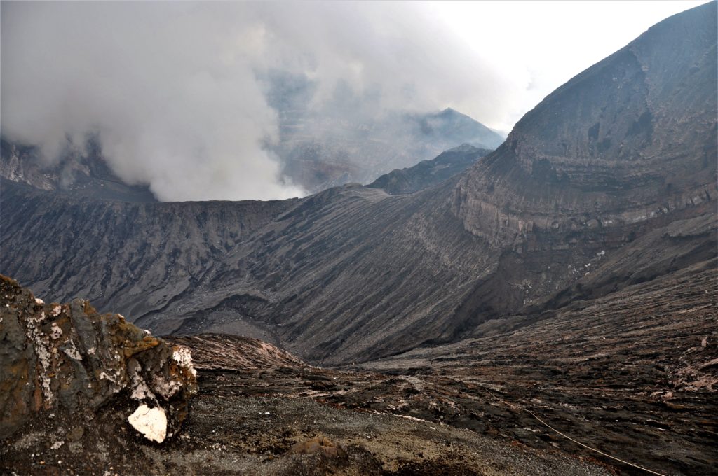
With the ongoing activity and the associated hazards, the danger zone at the summit is maintained at Danger Zone B .These danger zones are about 2 km around Benbow and 4 km around Marum craters including Maben-Mbwelesu, Niri-Mbwelesu and Mbwelesu. Additional danger zone is at the South-East of Ambrym within 500 meters from major cracks (Opened during the 2018 Eruption). It is a useful reminder that eruptions can occur at any level of unrest with little or no warnings.

Source : Geohazard.

Photo : G Vitton


Chile , Villarica :

Special Report on Volcanic Activity (REAV), La Araucanía and Los Ríos regions, Villarrica volcano, January 22, 2024, 04:40 local time (mainland Chile)

The National Geology and Mining Service of Chile (Sernageomin) announces the following PRELIMINARY information, obtained through the monitoring equipment of the National Volcanic Monitoring Network (RNVV), processed and analyzed at the Southern Andean Volcano Observatory (Ovdas):

From Monday January 18, 2024, at 2:21 a.m. local time (5:21 a.m. UTC), monitoring stations installed near the Villarrica volcano recorded a swarm of earthquakes associated with the fracturing of rocks (Volcano-tectonics) inside the system volcanic. This increase in seismicity occurs after the 3.9 magnitude earthquake reported in the previous bulletin.


Observation :

At the time of issuing this report, approximately 160 seismic events of the Volcano-tectonic (VT) type have been recorded in the last 3 hours, which remain ongoing, with a decreasing occurrence.

The locations are mainly concentrated in an area located around 4 to 5 km east-southeast of the main crater, with depths between 4 and 5.5 km.

No changes in the behavior of the fluid-type seismic activity of the volcano have been recorded, nor any associated surface activity observed.

The technical volcanic alert is maintained at YELLOW level.

Source : Sernageomin.

Photo : Auteur inconnu ( archive).


Guatemala , Fuego :

Weather conditions: Clear weather.
Wind: South and South-West.
Precipitation: 0.0 mm.

Activity:
The Fuego Volcano Observatory reports volcanic activity, which consists of small to moderate explosions, which occur at a frequency of 1 to 6 per hour, raising columns of gas and gray ash to heights between 4,400 and 4,700 meters above sea level (14,763 to 15,748). feet), which move variably toward the West, Northwest, North, and Northeast, carrying ash over distances of up to 30 kilometers or more.

Due to wind direction, low ash particle fall may occur over Yepocapa, Acatenango, Parramos and La Antigua Guatemala. The accelerated winds move the ashes into the upper part of the ravines and form ash curtains on the southwest, south and southeast flanks. The explosions lift incandescent material up to 100 meters above the crater and produce weak avalanches around the crater towards the Seca, Taniluyá, Ceniza and La Lajas ravines. The activity is occasionally accompanied by low rumbles and shock waves, as well as faint aircraft turbine sounds lasting less than a minute.

Source : Insivumeh

Photo : Conred.


January 14, 2024. EN. Iceland : Reykjanes Peninsula , Indonesia : Lewotobi Laki Laki , Vanuatu : Bembow (Ambrym) , Colombia : Nevado del Ruiz , Ecuador : Sangay .

January 14 , 2024.


Iceland , Reykjanes  Peninsula :

The possibility of an eruption is high in light of increased seismicity , Updated 14 January at 06:15 UTC

At around 03:00 UTC today, an intense series of earthquakes began at the Sundhnúksgígar crater row.

At the time of publication, over 200 earthquakes have been measured in the area, and the seismicity has moved towards the town of Grindavík.

So far, the largest recorded earthquake is 3.5 in magnitude, and it was measured at 04:07 UTC at Hagafell.

Both real-time GPS measurements and borehole pressure readings (from HS Orka) show major changes since the onset of today’s earthquake activity. These observations, in addition to the ongoing seismicity, confirm that magma is moving within the region.

Our assessment is that the possibility of an eruption is high, and that it could occur imminently.

Source et photo : IMO


Indonesia , Lewotobi Laki Laki :

VOLCANO OBSERVATORY NOTICE FOR AVIATION – VONA

Issued : January 13 , 2024
Volcano : Lewotobi Laki-laki (264180)
Current Aviation Colour Code : ORANGE
Previous Aviation Colour Code : orange
Source : Lewotobi Laki-laki Volcano Observatory
Notice Number : 2024LWK017
Volcano Location : S 08 deg 32 min 20 sec E 122 deg 46 min 06 sec
Area : East Nusa Tenggara, Indonesia
Summit Elevation : 5069 FT (1584 M)

Volcanic Activity Summary :
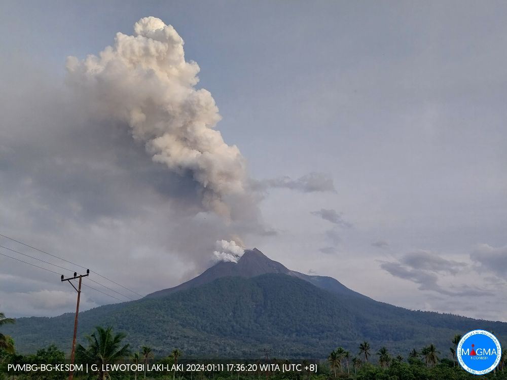
Eruption with volcanic ash cloud at 21h37 UTC (05h37 local).

Volcanic Cloud Height :
Best estimate of ash-cloud top is around 8269 FT (2584 M) above sea level or 3200 FT (1000 M) above summit. May be higher than what can be observed clearly. Source of height data: ground observer.

Other Volcanic Cloud Information :
Ash cloud moving from north to northeast. Volcanic ash is observed to be white to gray. The intensity of volcanic ash is observed to be thick.

Remarks :
Eruption and ash emission is continuing. Eruption recorded on seismogram with maximum amplitude 29 mm. Tremor recorded on seismogram with maximum amplitude 3 mm.

Source et photo: Magma Indonésie .


Vanuatu , Bembow ( Ambrym) :

16°15’00”S 168°07’00”E
Summit Elevation 4377ft (1334m)
Current Vanuatu Volcano Alert Level: Level 3

Ambrym volcano has increased its activity from minor unrest to minor eruption state. The Volcanic Alert Level is raised from Level 1 to Level 3.

Ambrym Volcano is now in the minor eruption state. The volcanic eruption is happening inside the Benbow Crater. The Danger Zone for life safety is limited at the Danger Zone B which is about 2km around Benbow and 4Km around Marum craters (Including Maben-Mbwelesu, Niri-Mbwelesu and Mbwelesu)

Observations from Ambrym Volcano Webcam and seismic data analysis on 13th January 2024 confirmed an eruption inside Benbow Crater from 2217hrs (10:17PM) local time. The activity consists of strong glow, loud explosion, gas and steam. People from Ambrym and neighboring islands may view gas plumes and observe volcanic glow.

The Alert Level for Ambrym volcano has been at the Level 1 since 10th October 2019. The current activity show that Ambrym volcano is undergoing a small-scale eruption. This is consistent with the Alert Level 3 activity. Level 3 indicates ‘Minor eruption; Danger is now at 2km around Benbow and 4km around Marum’. The possibility that the Ambrym volcano activity escalate to the level of moderate eruption (Level 4) is low for now.

Source et photo : Geohazard


Colombia , Nevado del Ruiz :

Weekly bulletin on the activity of the Nevado del Ruiz volcano

From the monitoring of the activity of the NEVADO DEL RUIZ VOLCANO, the MINISTRY OF MINES AND ENERGY through the COLOMBIAN GEOLOGICAL SERVICE (SGC) reports that:

In the week of January 2-8, 2024, the volcano continued to exhibit unstable behavior with moderate activity levels, particularly evident in seismicity and the persistence of thermal anomalies at the bottom of Arenas Crater. The main variations in the monitored parameters were:
– The increase in seismic activity associated with the fracturing of rocks inside the volcanic edifice, both in the number of earthquakes recorded and in the seismic energy released. The earthquakes were located mainly in the North-West and South sectors of the volcano, at distances less than 4 km from the Arenas crater and, to a lesser extent, in the Arenas crater and in the East-South-East and North-North-East of the volcano. Depths of the events varied between 1 and 7 km from the summit. During days 3 and 5, the highest seismicity rates of the week were recorded.
On January 3, most of the seismicity was located in the northwest sector of the volcano, at depths between 3 and 6 km with a maximum magnitude of 3.9. This magnitude was the largest of the week corresponding to the earthquake recorded on January 3 at 11:03 a.m., which was reported as felt by officials of the Los Nevados National Natural Park, SGC personnel on the ground and residents of the areas of influence . near the volcano and in the town of Manizales. On January 5, the seismic activity was located mainly in the southern sector, at depths between 3 and 4 km with a maximum magnitude of 2.8, corresponding to the earthquake of January 5 at 3:03 p.m.

– The reduction in seismicity linked to pulsatile emissions of ash and gas into the atmosphere both in terms of the number of earthquakes recorded and the seismic energy released. Seismic signals of this type had low to sometimes moderate energy levels. Some of these were associated with ash emissions or changes in the relative temperature of the emitted materials.
These phenomena were confirmed mainly thanks to the cameras used to monitor the volcano.
– The variability of sulfur dioxide (SO2) degassing rates with an increasing trend. The maximum height of the gas or ash column was 800 m vertical and 1,800 m dispersed.
These values were measured at the summit of the volcano on January 6, 2024. The direction of dispersion of the column was variable towards the North-West, West and South-West flanks of the volcano, generating ash falls in areas close to the volcano and in the city of Manizales.
– The persistence of thermal anomalies at the bottom of Arenas crater with moderate energy levels, detected from satellite monitoring platforms. During the week, several reports of thermal anomalies with these values were obtained due to the good weather conditions in the region.

Source : SGC

Photo : Julian Fernando Aranzazu Henao ( archive)


Ecuador , Sangay :

DAILY REPORT ON THE STATE OF THE SANGAY VOLCANO, Saturday January 13, 2024.
Information Geophysical Institute – EPN.

Surface activity level: High, Surface trend: No change
Internal activity level: High, Internal trend: No change

Seismicity: From January 12, 2024, 11:00 a.m. to January 13, 2024, 11:00 a.m.:

The number of seismic events recorded at the reference station over the past 24 hours is shown below. The level of seismic activity of the volcano remains high.

Explosion Event (EXP): 426

Precipitation/Lahars:
No rain was recorded in the volcano area. *In the event of heavy rains, these could remobilize the accumulated materials and generate mudflows with debris, which could descend down the sides of the volcano, flowing into adjacent rivers.

Emissions/ash column:
Thanks to the surveillance camera system and the GOES-16 satellite system, several ash emissions were observed, with heights between 500 and 1,500 meters above the level of the crater, in the southwest and west directions. South West. Likewise, this activity was reported through 4 alerts from the Washington VAAC agency, with heights of 900 meters above the level of the crater, in the West and South-West directions.

Gas:
At midday yesterday, the Mounts satellite system detected the emission of 150 tonnes of SO2 (sulfur dioxide).

Other monitoring parameters:
The FIRMS satellite system detected 25 thermal anomalies, the MIROVA-MODIS satellite system recorded 3 thermal anomalies and the MIROVA-VIIRS satellite system recorded 2 thermal anomalies.

Observation:
Since 6:10 p.m. (TL) yesterday, thanks to the IG-EPN Santa Rosa camera, a pyroclastic flow was observed in the Southeast ravine. This type of phenomenon could cause an increase in sediments in the Volcán River and consequently in the Upano River. In addition, during last night, several episodes of incandescence were recorded, with material descending to 1000 meters below the level of the crater. Until the close of this report, the volcano is cloudy.

Alert level: yellow

Source : IGEPN.

Photo :  Carlos Riera

14 Janvier 2024. FR. Islande : Péninsule de Reykjanes , Indonésie : Lewotobi Laki Laki , Vanuatu : Bembow ( Ambrym) , Colombie : Nevado del Ruiz , Equateur : Sangay .

14 Janvier 2024.


Islande , Péninsule de Reykjanes :

La possibilité d’une éruption est élevée compte tenu de l’augmentation de la sismicité. Mise à jour le 14 janvier à 06h15 UTC

Vers 03h00 UTC aujourd’hui, une intense série de tremblements de terre a commencé au niveau du cratère Sundhnúksgígar.

Au moment de la publication, plus de 200 tremblements de terre ont été mesurés dans la région et la sismicité s’est déplacée vers la ville de Grindavík.

Jusqu’à présent, le plus grand tremblement de terre enregistré est d’une magnitude de 3,5 et il a été mesuré à 04h07 UTC à Hagafell.

Les mesures GPS en temps réel et les relevés de pression dans les forages (de HS Orka) montrent des changements majeurs depuis le début de l’activité sismique d’aujourd’hui. Ces observations, ajoutées à la sismicité en cours, confirment que le magma se déplace au sein de la région.

Notre évaluation est que la possibilité d’une éruption est élevée et qu’elle pourrait se produire de manière imminente.

Source et photo : IMO


Indonésie , Lewotobi Laki Laki :

AVIS D’OBSERVATION DU VOLCAN POUR L’AVIATION – VONA

Publié : 13 janvier 2024
Volcan : Lewotobi Laki-laki (264180)
Code couleur aviation actuel : ORANGE
Code couleur aviation précédent : orange
Source : Observatoire du volcan Lewotobi Laki-laki
Numéro d’avis : 2024LWK017
Emplacement du volcan : S 08 degrés 32 min 20 sec E 122 degrés 46 min 06 sec
Zone : Nusa Tenggara Est, Indonésie
Altitude du sommet : 5069 FT (1584 M)

Résumé de l’activité volcanique :
Éruption avec nuage de cendres volcaniques à 21h37 UTC (05h37 locale).

Hauteur des Nuages Volcaniques :
La meilleure estimation du sommet du nuage de cendres se situe à environ 8 269 pieds (2 584 m) au-dessus du niveau de la mer ou 3 200 pieds (1 000 m) au-dessus du sommet. Peut être supérieur à ce qui peut être observé clairement. Source des données de hauteur : observateur au sol.

Autres informations sur les nuages volcaniques :
Nuage de cendres se déplaçant du Nord au Nord-Est. Les cendres volcaniques sont blanches à grises. L’intensité des cendres volcaniques est observée comme étant épaisse.

Remarques :
L’éruption et l’émission de cendres se poursuivent. Éruption enregistrée sur sismogramme avec une amplitude maximale de 29 mm. Tremor enregistré sur sismogramme avec une amplitude maximale de 3 mm.

Source et photo: Magma Indonésie .


Vanuatu , Bembow ( Ambrym) :

16°15’00″S 168°07’00″E
Altitude du sommet 4 377 pieds (1 334 m)
Niveau d’alerte actuel du volcan  : niveau 3

Le volcan d’Ambrym a augmenté son activité de troubles mineurs à un état d’éruption mineure. Le niveau d’alerte volcanique passe du niveau 1 au niveau 3.

L’éruption volcanique se produit à l’intérieur du cratère Benbow. La zone de danger pour la sécurité des personnes est limitée à la zone de danger B qui s’étend à environ 2 km autour du Benbow et à 4 km autour des cratères du Marum (y compris Maben-Mbwelesu, Niri-Mbwelesu et Mbwelesu).

Les observations de la webcam du volcan Ambrym et l’analyse des données sismiques du 13 janvier 2024 ont confirmé une éruption à l’intérieur du cratère du Benbow à partir de 22 h 17 (22 h 17), heure locale. L’activité consiste en une forte lueur, de fortes explosions, du gaz et de la vapeur. Les habitants d’Ambrym et des îles voisines peuvent observer des panaches de gaz et observer des lueurs volcaniques.

Le niveau d’alerte du volcan Ambrym est au niveau 1 depuis le 10 octobre 2019. L’activité actuelle montre que le volcan Ambrym subit une éruption à petite échelle. Ceci est cohérent avec l’activité d’alerte de niveau 3. Le niveau 3 indique « Éruption mineure ; Le danger est désormais à 2 km autour de Benbow et à 4 km autour de Marum’. La possibilité que l’activité du volcan Ambrym atteigne le niveau d’éruption modérée (niveau 4) est faible pour l’instant.

Source et photo : Geohazard


Colombie , Nevado del Ruiz :

Bulletin hebdomadaire sur l’activité du volcan Nevado del Ruiz

Du suivi de l’activité du VOLCAN NEVADO DEL RUIZ, le MINISTÈRE DES MINES ET DE L’ÉNERGIE à travers le SERVICE GÉOLOGIQUE COLOMBIEN (SGC) rapporte que :

Dans la semaine du 2 au 8 janvier 2024, le volcan a continué à présenter un comportement instable avec des niveaux d’activité modérés, particulièrement évidents dans la sismicité et la persistance d’anomalies thermiques au fond du cratère Arenas. Les principales variations des paramètres surveillés étaient :
– L’augmentation de l’activité sismique associée à la fracturation des roches à l’intérieur de l’édifice volcanique, tant dans le nombre de tremblements de terre enregistrés que dans l’énergie sismique libérée. Les tremblements de terre ont été localisés principalement dans les secteurs Nord-Ouest et Sud du volcan, à des distances inférieures à 4 km du cratère Arenas et, dans une moindre mesure, dans le cratère Arenas et dans les secteurs Est-Sud-Est et Nord-Nord-Est du volcan  . Les profondeurs des événements variaient entre 1 et 7 km par rapport au sommet . Durant les jours 3 et 5, les taux de sismicité les plus élevés de la semaine ont été enregistrés.
Le 3 janvier, l’essentiel de la sismicité était localisé dans le secteur Nord-Ouest du volcan, à des profondeurs comprises entre 3 et 6 km avec une magnitude maximale de 3,9. Cette magnitude était la plus grande de la semaine correspondant au séisme enregistré le 3 janvier à 11h03, qui a été signalé comme ressenti par les responsables du Parc Naturel National Los Nevados, le personnel du SGC sur le terrain et les habitants des zones d’influence. près du volcan et dans la ville de Manizales. Le 5 janvier, l’activité sismique s’est localisée essentiellement dans le secteur Sud, à des profondeurs comprises entre 3 et 4 km avec une magnitude maximale de 2,8, correspondant au séisme du 5 janvier à 15h03.

– La diminution de la sismicité liée aux émissions pulsatiles de cendres et de gaz dans l’atmosphère tant au niveau du nombre de séismes enregistrés que de l’énergie sismique dégagée. Les signaux sismiques de ce type présentaient des niveaux d’énergie faibles à parfois modérés. Certains d’entre eux étaient associés à des émissions de cendres ou à des changements dans la température relative des matériaux émis.
Ces phénomènes ont été confirmés principalement grâce aux caméras utilisées pour surveiller le volcan.
– La variabilité des taux de dégazage du dioxyde de soufre (SO2) avec une tendance à la hausse. La hauteur maximale de la colonne de gaz ou de cendres était de 800 m en vertical et de 1 800 m en dispersion.
Ces valeurs ont été mesurées au sommet du volcan le 6 janvier 2024. La direction de dispersion de la colonne était variable vers les flancs Nord-Ouest, Ouest et Sud-Ouest du volcan, générant des chutes de cendres dans les zones proches du volcan et dans le ville de Manizales.
– La persistance d’anomalies thermiques au fond du cratère Arenas avec des niveaux d’énergie modérés, détectées depuis les plateformes de surveillance satellitaire. Au cours de la semaine, plusieurs rapports d’anomalies thermiques avec ces valeurs ont été obtenus en raison des bonnes conditions météorologiques dans la région.

Source : SGC

Photo : Julian Fernando Aranzazu Henao ( archive)


Equateur , Sangay :

RAPPORT QUOTIDIEN DE L’ETAT DU VOLCAN SANGAY , Samedi 13 Janvier 2024 .
Information Geophysical Institute – EPN.

Niveau d’activité Superficiel: Haut , Tendance de surface : Sans changement
Niveau d’activité interne: Haut , Tendance interne : Sans changement

Sismicité : Du 12 Janvier 2024 , 11:00h au 13 Janvier 2024 , 11:00h : 

Le nombre d’événements sismiques enregistrés à la station de référence au cours des dernières 24 heures est présenté ci-dessous. Le niveau d’activité sismique du volcan reste élevé.

Evénement d’explosion (EXP) : 426


Précipitations / Lahars :
Aucune pluie n’a été enregistrée dans la zone du volcan. *En cas de fortes pluies, celles-ci pourraient remobiliser les matériaux accumulés et générer des coulées de boue avec des débris, qui pourraient descendre sur les flancs du volcan, se déversant dans les rivières adjacentes.

Colonne émissions/cendres :
Grâce au système de caméras de surveillance et au système satellite GOES-16, plusieurs émissions de cendres ont été observées, avec des hauteurs comprises entre 500 et 1 500 mètres au-dessus du niveau du cratère, dans les directions Sud-Ouest et Ouest-Sud-Ouest. De même, cette activité a été signalée à travers 4 alertes de l’agence Washington VAAC, avec des hauteurs de 900 mètres au-dessus du niveau du cratère, dans les directions Ouest et Sud-Ouest.

Gaz:
Hier à midi, le système satellite Mounts a détecté l’émission de 150 tonnes de SO2 (dioxyde de soufre).

Autres paramètres de surveillance :
Le système satellite FIRMS a détecté 25 anomalies thermiques, le système satellite MIROVA-MODIS a enregistré 3 anomalies thermiques et le système satellite MIROVA-VIIRS a enregistré 2 anomalies thermiques.

Observation:
Depuis 18h10 (TL) hier, grâce à la caméra Santa Rosa de l’IG-EPN, une coulée pyroclastique a été observée dans le ravin Sud-Est. Ce type de phénomène pourrait provoquer une augmentation des sédiments dans la rivière Volcán et par conséquent dans la rivière Upano. En plus, au cours de la nuit dernière, plusieurs épisodes d’incandescence ont été enregistrés, avec descente de matière à 1000 mètres sous le niveau du cratère. Jusqu’à la clôture de ce rapport , le volcan est nuageux.

Niveau d’alerte : jaune

Source : IGEPN.

Photo :  Carlos Riera

February 26, 2022. EN. Alaska : Pavlof , Indonesia : Merapi , Guatemala : Santiaguito , La Martinique : Mount Pelee , Hawaii : Kilauea , Vanuatu Archipelago : Ambrym .

February 26 , 2022.


Alaska , Pavlof :

55°25’2″ N 161°53’37 » W,
Summit Elevation 8261 ft (2518 m)
Current Volcano Alert Level: WATCH
Current Aviation Color Code: ORANGE

The eruption of Pavlof Volcano continues. Lava effusion continues from the vent just east of the volcano’s summit, sending a flow a short distance down the northeast flank of the volcano. The volcano was obscured by cloudy weather in satellite and web camera images for much of the week. Nevertheless, elevated surface temperatures were observed in satellite data on several days through cloud cover. Elevated seismicity, consisting of nearly continuous tremor, was detected throughout the week with an increase in tremor energy and small explosions observed in seismic and infrasound data early Thursday morning. Data from several seismic and infrasound stations on the south side of the volcano stopped flowing yesterday due to a telemetry issue. Data from stations on the north side of the volcano continue to be received.

Eruption of lava at Pavlof captured in this WorldView-3 image from January 19, 2022. A scoria cone is visible and steaming in a vent on the eastern flank of the volcano. An active lava flow is spilling out, extending 1.3 km east. Meltwater from interaction between the lava and snow and ice is then producing lahars that extend beyond the lava flow up to 4.4 km east from the vent. Minor ash deposits are also visible as dark streaks on the snow emanating from near the front of the lava flow, where steam generation is likely producing weak explosive activity.

Periods of lava fountaining from the vent on the volcano’s upper east flank have been occurring since mid-November 2021. This activity has built a small cone and sent flows down the flank that melt the snow and ice and produce variable amounts of meltwater. The meltwater typically incorporates loose debris on the flank of the volcano and forms thin (less than 2 m thick) lahars. The lahar deposits extend down the east-southeast flank for several kilometers, not quite to the base of the volcano.

Previous eruptions of Pavlof indicate that the level of unrest can change quickly and the progression to more significant eruptive activity can occur with little or no warning.

Pavlof is monitored by local seismic and infrasound sensors, satellite data, web cameras, and remote infrasound and lightning networks.

Source : AVO.

Photos : Dietterich, Hannah , Mulliken, Katherine (2018).


Indonesia , Merapi :

Merapi activity report from February 18 to 24, 2022.
– The weather around Mount Merapi is generally sunny in the morning and evening, while foggy in the afternoon.
– This week, a hot cloud was observed descending to the southwest, upstream of the Bebeng River with a slip distance of 1,800 m. It was reported that there was a fine ash rain in Pakem district on February 18, 2022. 173 lava avalanches were observed in the South West, dominating the Bebeng River with a maximum slip distance of 2,000 m .

– Drone data analysis showed that there were morphological changes in the southwestern and central domes of the crater due to extrusion activity in the form of avalanches and growth of the lava dome . The volume of the Southwest lava dome is 1,578,000 m3 and the central dome is 3,228,000 m3.
– The intensity of seismicity this week is still quite high. Mount Merapi’s deformation, which was monitored using EDM this week, showed a distance shortening rate of 0.2 cm/day.

– The rainfall intensity was 31 mm/hour for 50 minutes at Pos Babadan on February 18, 2022. No lahar or additional flow was reported in the rivers that originate on Mount Merapi.

Conclusion:
1. The volcanic activity of Mount Merapi is still quite high in the form of effusive eruption activity. The state of the activity is defined at the « SIAGA » level.
2. The current potential danger is lava avalanches and hot clouds in the South-South-West sector covering the Boyong River for a maximum of 5 km, the Bedog River, Krasak, Bebeng for a maximum of 7 km. The Southeast sector covers the Woro River for a maximum of 3 km and the Gendol River for a maximum of 5 km. Finally, the ejection of volcanic material in the event of an explosive eruption can reach a radius of 3 km around the summit.

Source : BPPTKG

Photo : Oystein Lund Andersen.


Guatemala , Santiaguito :

Activity:
The Observatory of the Santa María-Santiaguito Volcanic Complex indicates weak degassing 400 meters above the Caliente dome, as well as the descent of weak, moderate and strong avalanches. These boulder avalanches descend from the dome and lava flows on the western, southwest and southern flanks quite often, reaching the base of the dome. During the night and early in the morning, constant incandescence was observed in the Caliente dome and in the lava flows on the western flank.

Avalanche descent and wind remobilization are dispersing ash to the west and southwest, so there is a possibility of ashfall on Loma Linda, San Marcos Palajunoj and the San Luis area. Extrusion activity remains at a high level and continues to unstably pile material on the west flank lava flow as well as on the Caliente dome, thus maintaining the possibility that some of this material may collapse and disintegrate generating pyroclastic flows over long distances to the South-West, South and East. BESAN bulletin 003-2022 remains in effect.

Source : Insivumeh

Photo : Noticias Red GT San José del Golfo .


La Martinique , Mount Pelée :

Weekly report on the activity of Mount Pelée for the period from February 18 to 25, 2022.

Between February 18, 2022 at 4 p.m. (UTC) and February 25, 2022 at 4 p.m. (UTC), the OVSM recorded at least 35 volcano-tectonic earthquakes of magnitude less than or equal to 0.5. These earthquakes were located inside the volcanic edifice between 0.5 and 1.2 km deep below the surface. This superficial volcano-tectonic seismicity is associated with the formation of micro-fractures in the volcanic edifice.

During this period, the OVSM also recorded 1 hybrid type earthquake. This signal containing low frequencies is associated with the presence of fluids (gas, hydrothermal waters) in the volcanic edifice. None of these earthquakes were felt by the population.


The zone of degassing at sea at shallow depth between St Pierre and le Prêcheur is still observed. The IGP took fluid samples in order to understand the origin of this degassing and to assess its possible relationship with the Mount Pelée hydrothermal system.

An extension of two areas of degraded vegetation located between Morne Plume and the Rivière Chaude was observed during a helicopter flight carried out on February 9, with the support of Dragon 972, and confirmed by analysis of satellite images.

The alert level remains YELLOW: vigilance.

Source : Direction de l’OVSM IPGP.

Photo : Parc naturel Martinique  


Hawaii , Kilauea :

19°25’16 » N 155°17’13 » W,
Summit Elevation 4091 ft (1247 m)
Current Volcano Alert Level: WATCH
Current Aviation Color Code: ORANGE

Activity Summary:
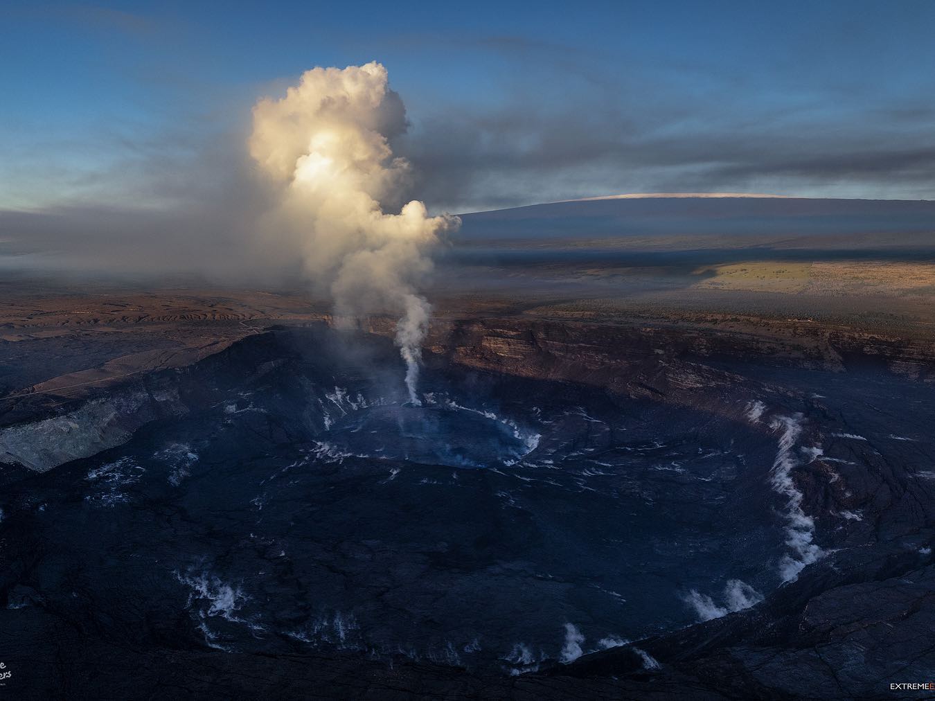
Lava effusion resumed at the summit eruption of Kīlauea Volcano beginning approximately 9:15 pm HST yesterday, about 6.5 hours after inflationary tilt started and less than 15 minutes after an increase in volcanic tremor. All activity remains confined to the active lava lake and west vent area within the western part of Halemaʻumaʻu with minor ooze outs along the margins of the Halemaʻumaʻu crater floor. All recent lava activity has been confined to the crater, and there are no indications of activity migrating elsewhere on Kīlauea.

Halemaʻumaʻu Lava Lake Observations:
Eruption of lava from the western vent into the active lava lake within Halemaʻumaʻu crater resumed at approximately 9:15 pm HST last night. Continuous flows of active lava are erupting from the west vent and flowing to the south, west, and into the western active lava lake. There were no significant ooze outs along the margins of the lava lake over the past 24 hours. This resumption of effusive activity corresponds with an increase in summit tilt of approximately 3.2 microradians with corresponding increase in tremor at the summit. The high point on the floor of Halema’uma’u crater has risen approximately 15 meters (49 feet) over the last 24 hours. The active lava lake is now approximately 96 meters (315 feet) deep relative to when lava emerged on September 29, 2021. The erupted volume is 45 million cubic meters (59 million cubic yards) of lava as measured on January 25, 2021.

Summit Observations:
At approximately 2:45 pm HST on February 24, 2022, tilt started to sharply increase by a total of approximately 3.2 microradians by 11:30 pm HST. At 11:30 pm HST yesterday tilt rates slowed and have since been steady. Seismic data shows that the volcanic tremor signal started to increase around 15 minutes (9:00 pm HST on February 24) before the resumption of effusive lava activity within the western part of the lava lake. Tremor now remains elevated and steady. Earthquake activity at the summit remains below background levels. A sulfur dioxide (SO2) emission rate of approximately ~340 tonnes per day (t/d) was measured on February 24.

Source : HVO.

Photos : HVO , Bruce Omori / Paradise Hélicopters .


Vanuatu Archipelago , Ambrym :

AMBRYM volcano ALERT BULLETIN, February 24, 2022, 12:57 p.m.

This is a reminder that volcanic activity at Ambrym continues at the major unrest level. The Volcanic Alert Level remains at Level 2.

The activity of the volcano consists of steam emission but the lava glow observed at night on the crater of Benbow has disappeared again since the beginning of February. A new scientific analysis suggests that the activity of the Ambrym volcano is likely to continue at the level of major unrest. Residents of Ambrym and neighboring islands will not see the volcanic glow at night. With this current volcanic activity, it’s a helpful reminder that eruptions can occur at any level of unrest without warning.


Volcanic hazards remain on the summit crater area and the southeastern part of Ambrym Island (e.g. major fissures of 2018). These are related to the presence of cracked areas. The presence of faults and active faults (major cracking) in the South East area of Ambrym is also dangerous, they will continue to be eroded and affected by earthquakes. The danger zone for vital safety in the summit area remains limited within the Benbow permanent exclusion zone and the Marum danger zone.
 
Source : Geohazard
 
Photo : G Vitton

26 Février 2022. FR. Alaska : Pavlof , Indonésie : Merapi , Guatemala : Santiaguito , La Martinique : Montagne Pelée , Hawaii : Kilauea , Archipel du Vanuatu : Ambrym .

26 Février 2022.


Alaska , Pavlof :

55°25’2″ N 161°53’37 » O,
Altitude du sommet : 8261 pieds (2518 m)
Niveau d’alerte volcanique actuel : ATTENTION
Code couleur actuel de l’aviation : ORANGE

L’éruption du volcan Pavlof continue. L’effusion de lave continue depuis l’évent juste à l’Est du sommet du volcan, envoyant une coulée sur une courte distance sur le flanc Nord-Est du volcan. Le volcan a été obscurci par le temps nuageux dans les images satellite et les caméras Web pendant une grande partie de la semaine. Néanmoins, des températures de surface élevées ont été observées dans les données satellitaires sur plusieurs jours à travers la couverture nuageuse. Une sismicité élevée, consistant en un tremor presque continu, a été détectée tout au long de la semaine avec une augmentation de l’énergie du tremor et de petites explosions observées dans les données sismiques et infrasonores tôt jeudi matin. Les données de plusieurs stations sismiques et infrasonores du côté Sud du volcan ont cessé de fonctionner hier en raison d’un problème de télémétrie. Les données des stations du côté Nord du volcan continuent d’être reçues.

Éruption de lave du Pavlof capturée dans cette image WorldView-3 du 19 janvier 2022. Un cône de scories est visible et fumant dans un évent sur le flanc Est du volcan. Une coulée de lave active se déverse, s’étendant sur 1,3 km à l’Est. L’eau de fonte de l’interaction entre la lave et la neige et la glace produit alors des lahars qui s’étendent au-delà de la coulée de lave jusqu’à 4,4 km à l’Est de l’évent. Des dépôts de cendres mineurs sont également visibles sous forme de stries sombres sur la neige émanant de près du front de la coulée de lave, où la génération de vapeur produit probablement une faible activité explosive.

Des périodes de fontaine de lave provenant de l’évent sur le flanc supérieur Est du volcan se produisent depuis la mi-novembre 2021. Cette activité a construit un petit cône et envoyé des écoulements sur le flanc qui font fondre la neige et la glace et produisent des quantités variables d’eau de fonte. L’eau de fonte incorpore généralement des débris sur le flanc du volcan et forme des lahars minces (moins de 2 m d’épaisseur). Les dépôts de lahar s’étendent sur le flanc Est-Sud-Est sur plusieurs kilomètres, pas tout à fait jusqu’à la base du volcan.

Les éruptions précédentes du Pavlof indiquent que le niveau d’agitation peut changer rapidement et que la progression vers une activité éruptive plus importante peut se produire avec peu ou pas d’avertissement.

Le Pavlof est surveillé par des capteurs sismiques et infrasonores locaux, des données satellitaires, des caméras Web et des réseaux de capteurs d’infrasons et de foudre à distance.

Source : AVO.

Photos : Dietterich, Hannah , Mulliken, Katherine (2018).


Indonésie , Merapi :

Rapport d’activité du Merapi du 18 au 24 février 2022 .
– Le temps autour du mont Merapi est généralement ensoleillé le matin et le soir, tandis que brumeux l’après-midi .
– Cette semaine, un nuage chaud a été observé , descendant au Sud-Ouest, en amont de la rivière Bebeng avec une distance de glissement de 1 800 m. Il a été signalé qu’il y avait une fine pluie de cendres dans le district de Pakem le 18 février 2022. 173 avalanches de lave ont été observées au Sud-Ouest, dominant la rivière Bebeng avec une distance de glissement maximale de 2 000 m.

– L’analyse des données par drone a montré qu’il y avait des changements morphologiques dans les dômes Sud-Ouest et central du cratère en raison de l’activité d’extrusion sous forme d’avalanches et de la croissance du dôme de lave. Le volume du dôme de lave Sud-Ouest est de 1 578 000 m3 et le dôme central est de 3 228 000 m3.
– L’intensité de la sismicité cette semaine est encore assez élevée. La déformation du mont Merapi, qui a été surveillée à l’aide de l’EDM cette semaine, a montré un taux de raccourcissement de la distance de 0,2 cm/jour.

– L’intensité des précipitations a été de 31 mm/heure pendant 50 minutes à Pos Babadan le 18 février 2022. Aucun lahar ou débit supplémentaire n’a été signalé dans les rivières qui prennent leur source sur le mont Merapi.

Conclusion:
1. L’activité volcanique du mont Merapi est encore assez élevée sous la forme d’une activité d’éruption effusive. L’état de l’activité est défini au niveau « SIAGA ».
2. Le danger potentiel actuel est constitué d’avalanches de lave et de nuages ​​chauds dans le secteur Sud-Sud-Ouest couvrant la rivière Boyong sur un maximum de 5 km, la rivière Bedog, Krasak, Bebeng sur un maximum de 7 km. Le secteur Sud-Est couvre la rivière Woro sur un maximum de 3 km et la rivière Gendol sur un maximum de 5 km. Enfin, l’éjection de matériel volcanique en cas d’éruption explosive peut atteindre un rayon de 3 km autour du sommet.

Source : BPPTKG

Photo : Oystein Lund Andersen.


Guatemala , Santiaguito :

Activité :
L’Observatoire du Complexe Volcanique Santa María-Santiaguito indique un dégazage faible à 400 mètres au-dessus du dôme Caliente, ainsi que la descente d’avalanches faibles, modérées et fortes . Ces avalanches de blocs descendent du dôme et des coulées de lave sur les flancs Ouest, Sud-Ouest et Sud assez souvent, atteignant la base du dôme. Pendant la nuit et tôt le matin, une incandescence constante a été observée dans le dôme  Caliente et dans les coulées de lave sur le flanc Ouest.

La descente d’avalanche et la remobilisation par le vent dispersent les cendres vers l’Ouest et le Sud-Ouest, il y a donc une possibilité de chute de cendres sur Loma Linda, San Marcos Palajunoj et la région de San Luis. L’activité d’extrusion reste à un niveau élevé et continue d’empiler de manière instable des matériaux sur la coulée de lave du flanc Ouest ainsi que sur le dôme Caliente, entretenant ainsi la possibilité qu’une partie de ces matériaux puisse s’effondrer et se désintégrer générant des coulées pyroclastiques sur de longue distances vers le Sud-Ouest, le Sud et l’Est. Le bulletin BESAN 003-2022 reste en vigueur.

Source : Insivumeh

Photo : Noticias Red GT San José del Golfo .


La Martinique , Montagne Pelée :

Bilan hebdomadaire de l’activité de la Montagne Pelée pour la période du 18 au 25 Février 2022 .

Entre le 18 Février 2022 à 16 heures (UTC) et le 25 Février 2022 à 16 heures (UTC), l’OVSM a enregistré au moins 35 séismes de type volcano-tectonique de magnitude inférieure ou égale à 0,5. Ces séismes ont été localisés à l’intérieur de l’édifice volcanique entre 0,5 et 1,2 km de profondeur sous la surface. Cette sismicité superficielle de type volcano-tectonique est associée à la formation de micro-fractures dans l’édifice volcanique.

Durant cette période , l’OVSM a aussi enregistré 1 séisme de type hybride . Ce signal contenant des basses fréquences  est associé à la présence de fluides ( gaz , eaux hydrothermales) dans l’édifice volcanique. Aucun de ces séismes n’a été ressenti par la population .


La zone de dégazage en mer à faible profondeur entre St Pierre et le Prêcheur est toujours observée. L’IGP a procédé à des prélèvements de fluides afin de comprendre l’origine de ce dégazage et d’évaluer sa relation éventuelle avec le système hydrothermal de la Montagne Pelée. 

Une extension de deux zones de végétation dégradée situées entre le Morne Plume et la rivière Chaude a été constatée lors d’un survol héliporté réalisé le 9 Février , avec le soutien du Dragon 972 , et confirmées par analyse d’images satellites. 

Le niveau d’alerte reste JAUNE : vigilance.

Source : Direction de l’OVSM IPGP.

Photo : Parc naturel Martinique  


Hawaii , Kilauea :

19°25’16 » N 155°17’13 » O,
Altitude du sommet : 4091 pieds (1247 m)
Niveau d’alerte volcanique actuel : ATTENTION
Code couleur actuel de l’aviation : ORANGE

Résumé de l’activité :
L’effusion de lave a repris lors de l’éruption au sommet du volcan Kīlauea à partir d’environ 21 h 15 HST hier, environ 6,5 heures après le début de l’inclinaison inflationniste et moins de 15 minutes après une augmentation des tremors volcaniques. Toute activité reste confinée au lac de lave actif et à la zone d’évent Ouest dans la partie Ouest du cratère Halema’uma’u avec des écoulements mineurs le long des marges du fond du cratère Halema’uma’u. Toute l’activité récente de lave a été confinée au cratère, et il n’y a aucune indication d’activité migrant ailleurs sur le Kīlauea.

Observations du lac de lave du cratère Halemaʻumaʻu :
L’éruption de lave de l’évent Ouest dans le lac de lave actif dans le cratère Halema’uma’u a repris vers 21h15 HST la nuit dernière. Des flux continus de lave active s’écoulent de l’évent Ouest vers le Sud, l’Ouest et dans le lac de lave actif Ouest. Il n’y a pas eu de suintement significatif le long des marges du lac de lave au cours des dernières 24 heures. Cette reprise de l’activité effusive correspond à une augmentation de l’inclinaison du sommet d’environ 3,2 microradians avec une augmentation correspondante du tremor au sommet. Le point culminant du fond du cratère Halema’uma’u s’est élevé d’environ 15 mètres (49 pieds) au cours des dernières 24 heures. Le lac de lave actif a maintenant une profondeur d’environ 96 mètres (315 pieds) par rapport au moment où la lave a émergé le 29 septembre 2021. 

Observations du sommet :
Vers 14 h 45 HST le 24 février 2022, l’inclinaison a commencé à augmenter fortement d’un total d’environ 3,2 microradians à 23 h 30 HST. À 23 h 30 HST hier, les taux d’inclinaison ont ralenti et sont depuis restés stables. Les données sismiques montrent que le signal de tremor volcanique a commencé à augmenter environ 15 minutes (21h00 HST le 24 février) avant la reprise de l’activité de lave effusive dans la partie Ouest du lac de lave. Le tremor reste maintenant élevé et stable. L’activité sismique au sommet reste inférieure aux niveaux de fond. Un taux d’émission de dioxyde de soufre (SO2) d’environ ~340 tonnes par jour (t/j) a été mesuré le 24 février.

Source : HVO.

Photos : HVO , Bruce Omori / Paradise Hélicopters .


Archipel du Vanuatu , Ambrym :

BULLETIN D’ALERTE du volcan d’ AMBRYM , 24 février 2022 , 12h57 .
 
Ceci rappelle que l’activité volcanique d’Ambrym se poursuit au niveau majeur des troubles. Le niveau d’alerte volcanique reste au niveau 2.
 
L’activité du volcan consiste en émission de vapeur mais la lueur de lave observée la nuit sur le cratère du Benbow a encore disparu depuis début février. Une nouvelle analyse scientifique suggère que l’activité du volcan Ambrym est susceptible de se poursuivre au niveau des troubles majeurs. Les habitants d’Ambrym et des îles voisines ne verront pas la lueur volcanique la nuit. Avec cette activité volcanique actuelle, c’est un rappel utile que des éruptions peuvent se produire à n’importe quel niveau de troubles sans avertissement.


Des dangers volcaniques subsistent sur la zone des cratères sommets et la partie Sud-Est de l’île Ambrym (par exemple, des fissures majeures de 2018). Ceux-ci sont liés à la présence de zones fissurées. La présence de failles et de failles actives (fissuration majeure) dans la zone Sud-Est d’Ambrym est également dangereuse, elles continueront d’être érodées et affectées par les tremblements de terre. La zone de danger pour la sécurité vitale dans la zone du sommet reste limitée à l’intérieur de la zone d’exclusion permanente du Benbow et de la zone de danger du Marum.
 
Source : Geohazard
 
Photo : G Vitton