September 05 , 2019.
Italy , Stromboli :
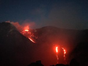
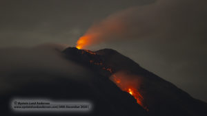
Stromboli Daily Bulletin of 09.04.2019
SUMMARY OF THE STATUS OF THE ACTIVITY
In light of the surveillance data, we highlight:
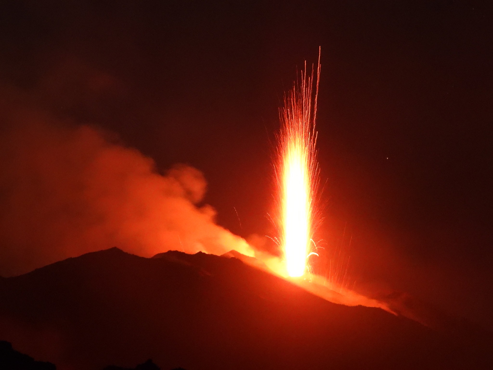
1) VOLCANOLOGICAL OBSERVATIONS: Normal explosive activity of Strombolian type accompanied by degassing activities.
2) SISMOLOGY: The seismological parameters do not show any significant changes.
3) DEFORMATIONS: There is no significant change regarding GNSS permanent networks and tilt meters.
4) GEOCHEMISTRY: the flow of SO2 indicates a degassing regime at a high level.
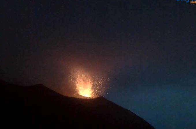
VOLCANOLOGICAL OBSERVATIONS
During the period, the eruptive activity of Stromboli was characterized by the analysis of thermal and visible images recorded by the network of cameras located at altitude 400 m (SQV and SQT), in Punta dei Corvi (SPCT ) and at 190 m (SCT). made difficult by adverse weather conditions. Data recorded over the last 24 hours indicate that the explosive activity has affected the two North and Central-South zones of the crater terrace. The average frequency of occurrence of explosions and their intensity are almost the same as those observed yesterday and described in the previous daily bulletin (Rep. No. 36.2 / 2019 of 03/09/2019). In conclusion, the observations indicate that the explosive activity, compared to the ordinary characteristics of Stromboli, is at a medium level.
Seismology:
The bulletin is established with data acquired from a maximum of 7 stations. The seismic activity recorded during the last 24 hours has the following characteristics: 1 seismic signal has been recorded, associated with a low amplitude landslide.
The number of very long period events (VLPs) provides a weekly average of about 32 events / hour. The magnitude of VLP events showed generally low values, with some events of medium to low amplitude.
The magnitude of the explosion earthquake showed generally low values, with some events of medium-low amplitude.
The amplitude of the volcanic tremor, estimated at the STR1 station, generally had mean-low values. An increase towards medium-high values was recorded between 00:00 and 03:00 approximately on 04/09. Values are then dropped back to medium-low values.
Source : INGV Vulcani .
Read the full article : file:///C:/Users/Utilisateur/AppData/Local/Packages/Microsoft.MicrosoftEdge_8wekyb3d8bbwe/TempState/Downloads/BollettinoGiornalieroStromboli20190904%20(1).pdf
Photos : Web cam via Alicja Szojer , Boris Behncke , 12 août 2019.
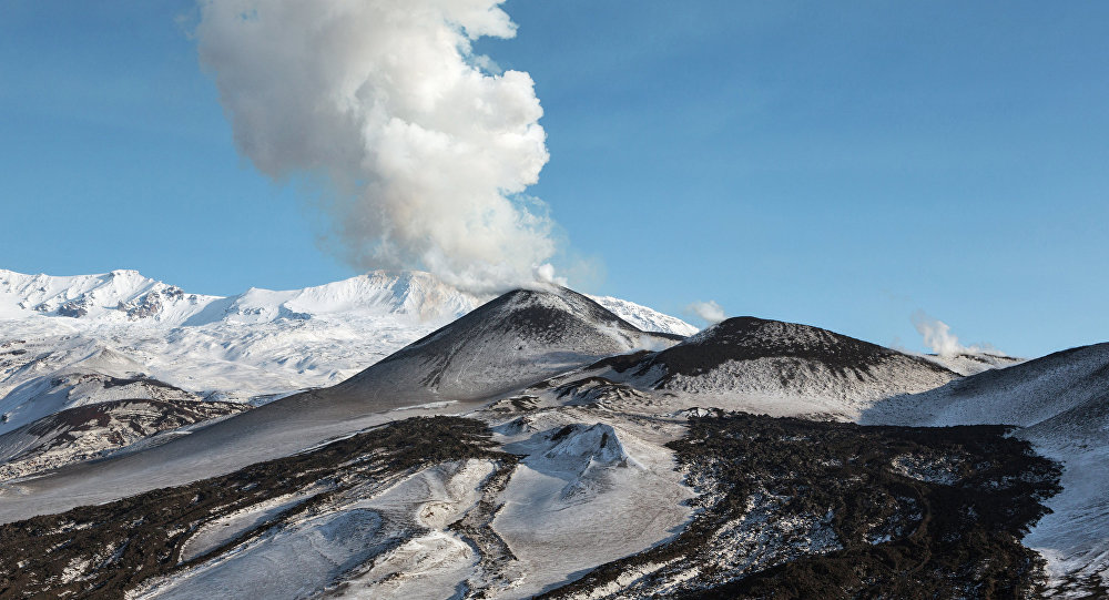
Kamchatka , Ebeko :
VOLCANO OBSERVATORY NOTICE FOR AVIATION (VONA).
Issued: September 05 ,2019
Volcano: Ebeko (CAVW #290380)
Current aviation colour code: ORANGE
Previous aviation colour code: orange
Source: KVERT
Notice Number: 2019-130
Volcano Location: N 50 deg 41 min E 156 deg 0 min
Area: Northern Kuriles, Russia
Summit Elevation: 3791.68 ft (1156 m)
Volcanic Activity Summary:
A moderate eruptive activity of the volcano continues. According to visual data by volcanologists from Severo-Kurilsk, explosions send ash up to 2.1-2.2 km a.s.l., an ash cloud drift to the east from the volcano.
A moderate eruptive activity of the volcano continues. Ash explosions up to 19,700 ft (6 km) a.s.l. could occur at any time. Ongoing activity could affect low-flying aircraft and airport of Severo-Kurilsk.
Volcanic cloud height:
6888-7216 ft (2100-2200 m) AMSL Time and method of ash plume/cloud height determination: 20190905/0348Z – Visual data
Other volcanic cloud information:
Distance of ash plume/cloud of the volcano: 2 mi (3 km)
Direction of drift of ash plume/cloud of the volcano: E / azimuth 85 deg
Time and method of ash plume/cloud determination: 20190905/0348Z – Visual data
Source : Kvert.
Photo : Sputnik . Alexandre Peraguis
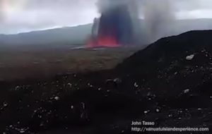
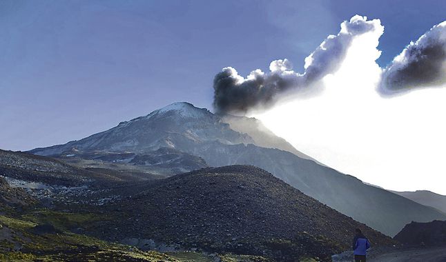
Peru , Ubinas :
Ash Falls Alert, issued on September 04, 2019, 08:44
Ashes direction: South and Southeast
Broadcast radius: 10 km
Villages: District of Ubinas and annexes
Recommendations:
Ashes can cause environmental problems and affect the health of the population. Before the ash falls, we recommend:
a) protect the eyes with lenses and wear masks to protect the respiratory tract.
(b) That the competent authorities and institutions make a permanent assessment of the impact of ashes on water, soil, air and the health of the population.
VOLCANIC ACTIVITY REPORT, Update of September 04, 2019, 08:00
Alert level: orange
During the last 24 hours, 2 explosions were recorded with the expulsion of ash and particulate matter (Lapilli). We continue to record seismic activity in relation to the rise of the magma. It is not excluded the occurrence of a new explosive activity with expulsion of ashes. It is suggested to maintain the orange alert level.
Last 6 hours:
Explosions: 2 (03/09/2019 13:58 local time and 04/09/2019, 5:51 am local time)
Earthquakes: 603
Emissions of ashes: in the event of ash production, these will be dispersed towards the South-East sectors of the volcano (district of Ubinas and deMatalaque). In case of explosion, towards the South sector, with winds of 50km / h.
Deformation: Without.
Thermal anomalies: 0.
Recommendations:
Keep the alert level in orange. Do not approach a radius of less than 10 km from the crater. In case of ash fall, cover your nose and mouth with damp cloths or masks. Keep the doors and windows of the houses closed.
Source : IGP Pérou.
Video : IGP via AFP.
Photo : larepublica.pe.
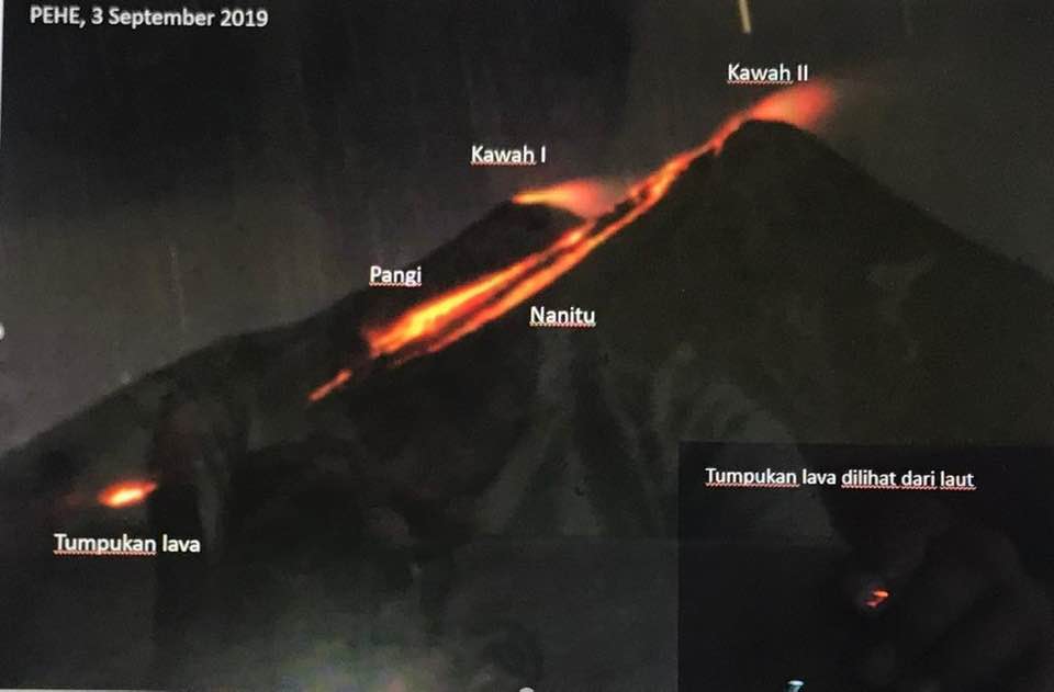
Indonesia , Karangetang :
Level of activity at Level III (SIAGA). The Karangetang (1,784 m above sea level) has been re-erupted since November 25, 2018.
VISUAL:
Clear and then cloudy, the wind blows weakly to the north. The Karangetang is clearly visible then covered with fog. White smoke from the crater is observed 100 m above the summit.
Lava flows were observed towards Kali Pangi, Nanitu and Sense with a sliding distance of 700 to 1500 m. Incandescences were observed at a height of 10 m.
The seismographs, on September 4, 2019, recorded:
75 avalanche earthquakes.
38 earthquakes of emission.
2 hybrid earthquakes
6 shallow volcanic earthquakes
1 earthquake felt
3 distant tectonic earthquakes
Tremor continuous with an amplitude of 0.25 mm, dominant value 0.25 mm.
Recommendation:
As of August 27, 2019, the technical recommendations were as follows:
The public and visitors / tourists are advised not to travel within 2.5 km of the main crater (South) and crater II (North), as well as in the sectoral expansion zone of Crater II. northwest 4 km and from the main crater west up to 3 km.
Communities living around rivers that originate at the summit of Mount Karangetang need to be prepared for the potential threat of lahars and sudden floods that can spread to the coast.
VONA:
The latest VONA code was YELLOW, published November 25, 2018 at 13:32 WITA, related to the volcanic ash emission from a height of approximately 2,284 meters above sea level or approximately 500 meters above the summit, the wind blowing to the East.
Source : PVMBG .
Photo : Surono Mbah Rono via Sherine France .