July 10 , 2019.
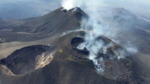
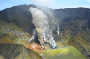
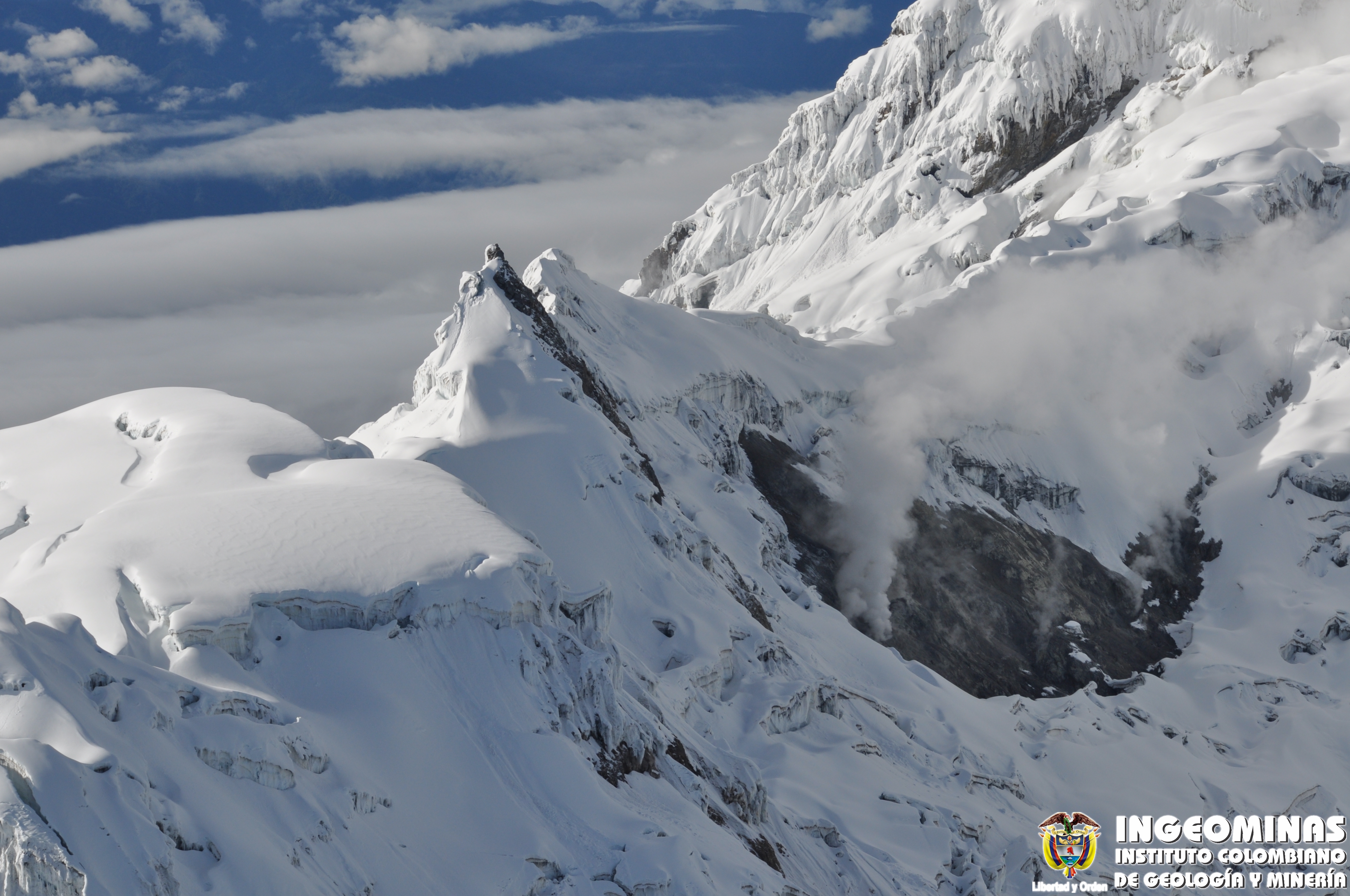
Colombia : Nevado del Huila ,
Weekly activity bulletin of Nevado del Huila
The level of activity of the volcano continues at the level: yellow activity level or (III): changes in the behavior of volcanic activity.
According to the analysis and evaluation of the information obtained through the surveillance network of the Nevado del Huila volcano, during the week of July 2 to 8, 2019, the Colombian Geological Service – Popayán volcanological and seismological observatory indicates than :
During the evaluated period, 191 seismic events were recorded, of which 132 were related to rock fracturing processes (type VT) and 59 to fluid dynamics in volcanic canals. Of these, 58 were classified as long-period type events (LP type) and one (1) as low-energy hybrid type (HB type).
The majority of localized earthquakes, associated with fracture processes, continue to be located northeast of the volcanic building, within a range of 13 to 19 km from the central peak, with depths between 6 and 12 km. a local magnitude less than M 2.0.
The images obtained during the week by the web cameras of Caloto, Tafxnú, Maravillas and La Palma showed a weak degassing of the volcanic system.
On July 5, a mobile measurement of SO2 emissions from the Nevado del Huila volcano was carried out between the cities of Tunía (Cauca) and Villarrica (Cauca). The calculated flow rate was 1271 t / day, which is considered low.
Sensors for monitoring soil deformation, magnetic fields and infrasound waves have not recorded any variations associated with changes in volcanic activity.
It is recalled that, although the seismic zone north-east of the volcano Nevado del Huila has VT-type seismicity, these events occur in a tectonically active zone and have so far not affected the other parameters of volcanic monitoring, therefore, the level of activity of the volcano has not changed, which continues to Amarillo or level III.
Source : SGC
Photo : Ingeominas.
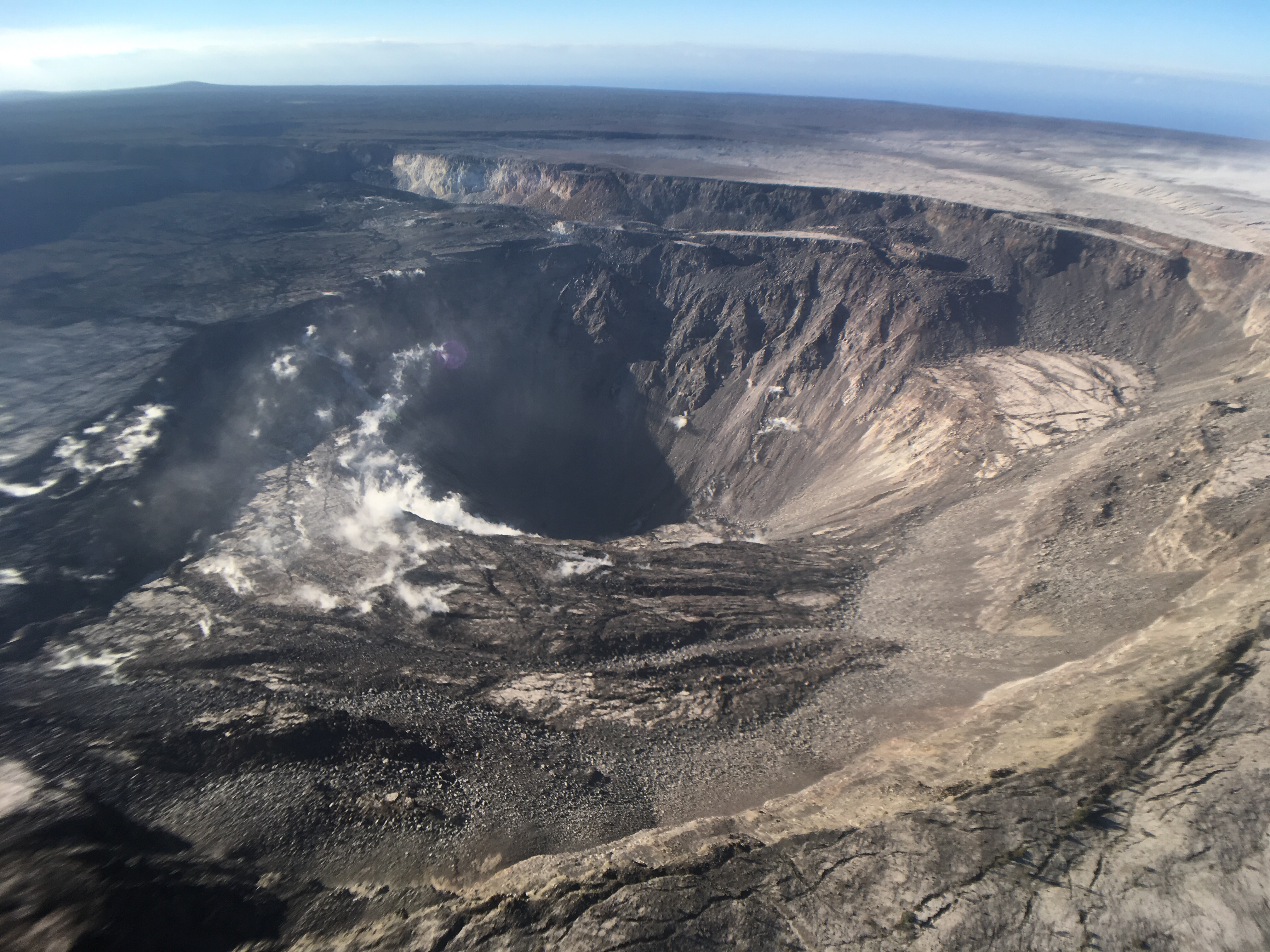
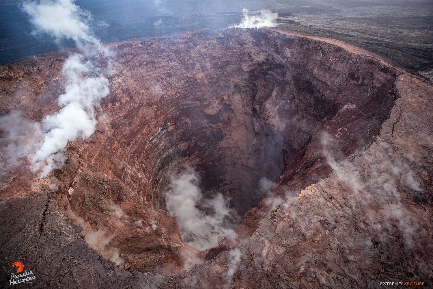
Hawaii , Kilauea :
19°25’16 » N 155°17’13 » W,
Summit Elevation 4091 ft (1247 m)
Current Volcano Alert Level: NORMAL
Current Aviation Color Code: GREEN
Activity Summary:
Kīlauea Volcano is not erupting. Monitoring data continue to show steady rates of seismicity and ground deformation, low rates of sulfur dioxide emission, and only minor geologic changes since the end of eruptive activity in September 2018.
As of June 25, Kīlauea Volcano is at NORMAL/GREEN.
Kīlauea remains an active volcano, and it will erupt again. Although we expect clear signs prior to the next eruption, the time frame of warning may be short.
Observations:
Monitoring data have shown no significant changes in volcanic activity over the past week. Rates of earthquake activity or seismicity across the volcano remain low. Real-time sulfur dioxide emission rates are low at the summit and are below detection limits at Puʻu ʻŌʻō and the Lower East Rift Zone.
Since early March, GPS stations and tiltmeters at the Kīlauea summit have recorded deformation consistent with slow magma accumulation within the shallow portion of the Kīlauea summit magma system (1-2 km or approximately 1 mile below ground level). However, gas measurements have yet to indicate significant shallowing of magma. HVO continues to carefully monitor all data streams at the Kīlauea summit for important changes.
Further east, GPS stations and tiltmeters continue to show motions consistent with slowed refilling of the deep East Rift Zone magmatic reservoir in the broad region between Puʻu ʻŌʻō and Highway 130 over recent weeks. While the significance of this pattern is unclear, monitoring data do not suggest any imminent change in volcanic hazard for this area. In addition to motion along the East Rift Zone, the south flank of Kīlauea continues to creep seaward at elevated rates following the May 4, 2018 M6.9 earthquake near Kalapana. HVO continues to carefully monitor all data streams along the Kīlauea East Rift Zone and south flank for important changes.
Source : HVO.
Photos : HVO , Bruce Omori .
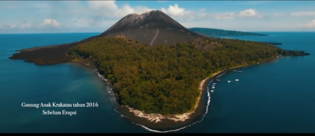
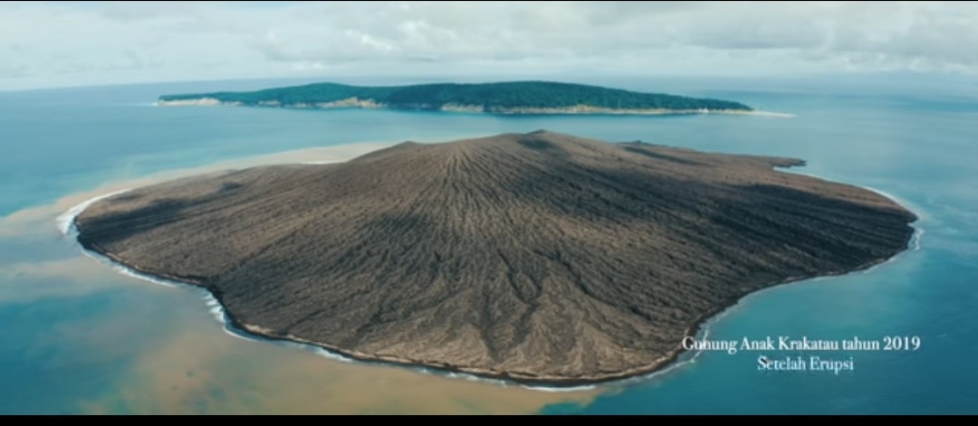
Indonesia , Anak Krakatau :
Level of activity at level II (Waspada), since March 25, 2019. G. Anak Krakatau (157 m altitude) has increased its volcanic activity since June 18, 2018, which was followed by an eruption of September 2018 to June 2019. In July 2019, eruptions still occur but of decreasing intensity.
Since yesterday and until this morning, the volcano was covered with fog. The smoke from the crater is not observed. The wind was weak in the northeast and west.
The seismographs, July 9, 2019 recorded:
1 earthquake emission.
Tremor continuous amplitude 1 – 20 mm, dominant value of 2 mm
Recommendation:
People / tourists are not allowed to approach the crater within 2 km.
VOLCANO OBSERVATORY NOTICE FOR AVIATION – VONA.
Issued: July 10 , 2019
Volcano: Anak Krakatau (262000)
Current Aviation Colour Code: ORANGE
Previous Aviation Colour Code: orange
Source: Anak Krakatau Volcano Observatory
Notice Number: 2019KRA129
Volcano Location: S 06 deg 06 min 07 sec E 105 deg 25 min 23 sec
Area: Lampung, Indonesia
Summit Elevation: 502 FT (157 M)
Volcanic Activity Summary:
Eruption with ash clouds at 04:04 UTC (11:04 local time). The eruption lasted for 22 seconds.
Volcanic Cloud Height:
Ash-cloud is not visible
Other Volcanic Cloud Information:
Anak Krakatau Volcano is not clear.
Remarks:
Eruption recorded on seismogram with maximum amplitude 48 mm and maximum duration 22 second.
Source : PVMBG , Magma Indonésie .
Phots : Ahmed Wahyu.
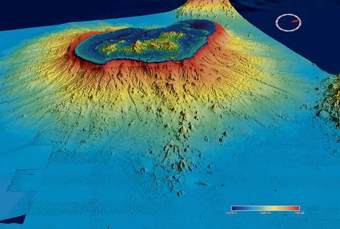
France , Mayotte Volcano:
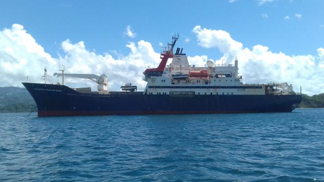
« One of the two most important basaltic eruptions of the past five hundred years! This is, according to Marc Chaussidon, director of the Paris Institute of Earth Physics (IPGP), the incredible event that French scientists are witnessing, at 3,500 meters deep, off the coast of France. archipelago of Mayotte. Conducted between 11 and 17 June by a team from the French Research Institute for Exploitation of the Sea (Ifremer), the IPGP and the Bureau of Geological and Mining Research (BRGM), the Mayobs 2 campaign, which has just ended on board the Marion-Dufresne, has discovered a gigantic lava flow, 2 or 3 kilometers southeast of the submarine volcano discovered in May.
Occupying an area of 8.71 km2 and reaching in places 75 meters thick, this large effusion represents a volume of 0.2 km3, sufficient to cover a city the size of Paris with a layer of 2 meters of rock in fusion. It did not appear on the statements that had been made four weeks ago, said Stephan Jorry, researcher at Ifremer and head of the mission: « This implies that it has appeared in the meantime, and this gives an idea of the scale of the volcanic phenomenon, which today focuses the attention of researchers. »
Unusual seismic activity:
The latter quickly learned not to be surprised by anything. When, in early 2019, they begin to deploy at sea, in Mayotte and on Grande-Glorieuse Island, their seismometers and their satellite positioning systems, it is then for them to only explain, as part of the program Tellus Mayotte, coordinated by the National Center for Scientific Research (CNRS), the unusual seismic activity found on the department. It has been affected since May 2018 by a long series of some 2,000 shocks (of magnitude greater than or equal to 3.5), among which about 30, of magnitude greater than 5, have been widely felt by the population. The detection of tremor waves – low-frequency seismic signals associated with the circulation of magma inside ducts – as well as the observation, after examination of the IGN’s GPS station data, of a significant displacement of the entire archipelago to the east (which, in one year, has migrated 10 cm and fell by 13 cm), make them suspect that this phenomenon of earthquake in « swarm » is associated to volcanism.
The hypothesis was vividly confirmed in May with the discovery, by 3500 meters of water, 50 kilometers east of Petite-Terre, of an active submarine volcano. 800 meters high, the latter, which escapes a plume of fluids rising over 2,000 meters and does not reach the surface, probably did not exist a year ago, now believe scientists: it would have appeared in the last six to eight months.
« In six to thirteen months, the submarine volcano has produced about 5 km3 of lava. This represents nearly 30% of the production of all oceanic wrinkles on the planet over a whole year! »
Extraordinary event:
What is certain, however, is that the current event is … huge! « In six to thirteen months, the submarine volcano has produced about 5 km3 of lava, » recalls Marc Chaussidon. This represents nearly 30% of the production of all oceanic wrinkles on the planet over a whole year! For the last half-millennium, only one example of a larger basaltic type eruption is known: Laki in Iceland, which in 1783-1784 spat 12.3 km3 of magma in 245 days. Even Kilauea volcano Hawaii is outdated. Between 1410 and 1470, the latter had exuded the equivalent of 5.2 km3 of magma but over half a century, not in a few months as in Mayotte! »
Permanent monitoring:
As for scientists, they intend to continue to follow the evolution of what is now the fourth active French volcano in inhabited areas, after the Piton de la Fournaise (La Réunion), Mount Pelee (Martinique) and Soufriere ( Guadeloupe). As early as July 12, a new Marion-Dufresne campaign, perhaps followed by another in August on another ship, will take off. Embarking an Autonomous Underwater Vehicle (AUV) and a Scampi-type towed vehicle, it is in charge of acquiring microbathymetric data of high precision from the seabed and collecting, finally, images of the phenomenon. Other projects will follow.
Source : Le Monde via Michael Jeanpierre. https://www.lemonde.fr/sciences/article/2019/07/08/naissance-du-quatrieme-volcan-actif-francais-a-mayotte_5486738_1650684.html