April 21 , 2019.
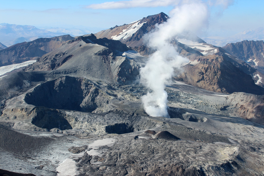
Chile , Planchon Peteroa :
During this period, 26 seismic events were recorded that were classified as volcano-tectonic (VT) types associated with rock fracturing processes. The event of greatest energy had a local magnitude (MI) of 2.2, located 2.8 km north of the active crater and at a depth of 7 km.
In addition, 518 long-period (LP) type earthquakes, related to fluid dynamics within the volcanic system, the largest of which with a displacement value (ROC) of 15.1 cm were recorded, located in the vicinity of the transmitting center, at a depth of 1.0 Km.
The frequency of the tremor seismic signal maintains a higher potential around 3.6 to 4 Hz, with reduced displacement values (DRc) of approximately 1 cm2.
The images provided by the IP camera show a constant degassing throughout the period evaluated. As of April 6th, a gas column of predominant gray color is detached, reaching a maximum height of 1500 m. Finally, on April 7th, the column presented variations in its coloration and its height, no more than 400m from the emission center with a color having a greater contribution of water vapor.
From the data obtained by three (3) GNSS stations, which measure the deformation in the volcanic complex, we observe small amplitude deformations with values less than 0.15 cm / month in the horizontal components and 0.4 cm / month in the vertical components. In particular there is a slight increase in the distance between the GNSS stations, which respond to a local change and not to a deformation of the volcanic structure.
No anomalies were reported in sulfur dioxide (SO 2) emissions to the atmosphere in the volcanic complex sector, according to data obtained by the Ozone Monitoring Instrument (OMI) Group Sulfur Dioxide (ODS). http: //so2.gsfc.nasa .gov /) and the National Service for the Environment, Data and Satellites (NESDIS) (http://satepsanone.nesdis.noaa.gov).
No thermal anomalies have been reported in the area associated with the volcanic complex, according to data published by Middle Observation InfraRed of Volcanic Activity (Mirova) on its website (http://www.mirovaweb.it/),
In agreement with the evaluated parameters, it is suggested a momentary stability of the volcanic complex coherent with the decrease of the superficial activity presented during the last days, with rare see no contribution of particulate materials in the column of emission and the decrease of signal energy in relation to fluid dynamics in volcanic ducts.
Considering the characteristic that presents the evolutionary process of the volcanic complex, it is not excluded the possibility of generation of new ash emissions of equal or higher intensities as observed previously.
As a result, the volcanic alert is maintained at the level:
YELLOW LEVEL: Changes in the behavior of volcanic activity – Probable time for an eruption: WEEKS / MONTH.
Observations: The current area of assignment is considered to be within 1,000 meters around the area of active craters.
Source : Sernageomin
Photos : Sernageomin.
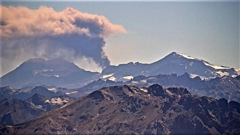
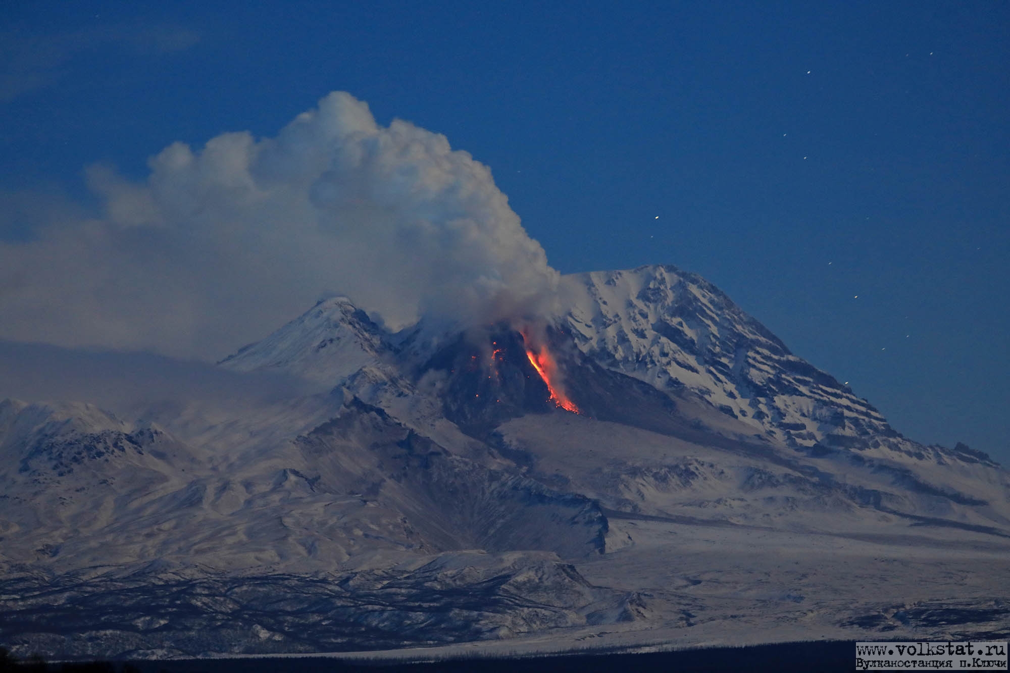
Kamchatka , Sheveluch :
VOLCANO OBSERVATORY NOTICE FOR AVIATION (VONA) .
Issued: April 20 , 2019
Volcano:Sheveluch (CAVW #300270)
Current aviation colour code:ORANGE
Previous aviation colour code:orange
Source:KVERT
Notice Number:2019-81
Volcano Location:N 56 deg 38 min E 161 deg 18 min
Area:Kamchatka, Russia
Summit Elevation:10768.24 ft (3283 m), the dome elevation ~8200 ft (2500 m)
Volcanic Activity Summary:
A growth of the lava dome continues (a viscous lava blocks extrude out on the northern part of it), a strong fumarolic activity and an incandescence of the dome blocks and hot avalanches accompanies this process. According to video data, gas-steam plume containing some amount of ash continies to drift to the east of the volcano.
Explosive-extrusive eruption of the volcano continues. Ash explosions up to 32,800-49,200 ft (10-15 km) a.s.l. could occur at any time. Ongoing activity could affect international and low-flying aircraft.
Volcanic cloud height:
11480-12464 ft (3500-3800 m) AMSL Time and method of ash plume/cloud height determination: 20190420/2350Z – Video data
Other volcanic cloud information:
Distance of ash plume/cloud of the volcano: 43 mi (70 km)
Direction of drift of ash plume/cloud of the volcano: E / azimuth 92 deg
Time and method of ash plume/cloud determination: 20190420/2330Z – Himawari-8
Source : Kvert .
Photo : Y. Demyanchuk / Volkstat ru.
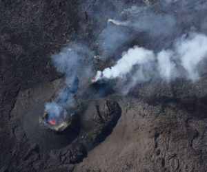
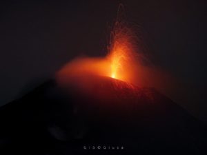
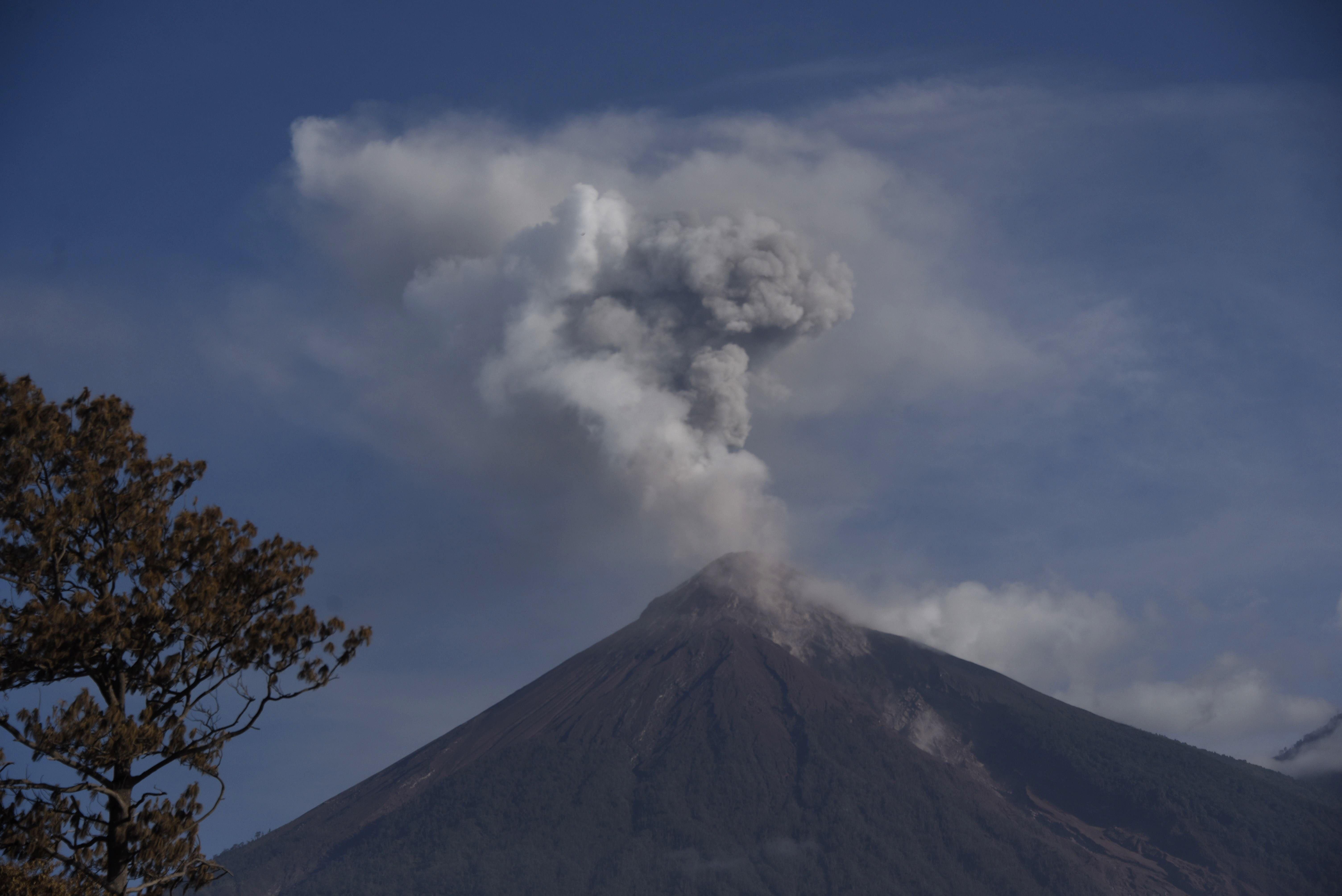
Guatemala , Fuego :
Type of activity: Vulcanian
Morphology: Composite Stratovolcano
Geographical location: 14 ° 28’54˝ Latitude N; 90 ° 52’54˝ Longitude O.
Height: 3,763msnm.
Weather conditions: Clear
Wind: North East at 5 km / h
Precipitation: 0.0 mm
Activity:
Presence of white fumarole of degassing at a height of 4300 m altitude (14108 feet), dispersing in a south and southwest direction. There are 17 to 20 weak, moderate and heavy explosions per hour that expel columns of gray ash at a height of 4,200 to 4,700 m (12,836 to 15,620 feet) dispersing over a distance of 12 to 15 kilometers. to the South and South West. At night and early in the morning, incandescence was observed, 300 to 350 meters above the crater, generating weak to moderate avalanches on the crater contour towards the ravines of Seca, Taniluyá, Ceniza, Trinidad and Las Lajas . The materials go down to the edge of the vegetation. Low to moderate rumblings are perceived which give rise to weak shock waves, causing vibrations in the roofs of houses, mainly in the communities to the west and southwest. A lava flow goes to the Seca ravine, on the west flank for an approximate length of 550 meters, the avalanches persist with incandescence after the explosions. There is a low, constant, engine-like noise of degassing, as well as falls of fine ash particles in communities such as Panimache I and II, Morelia, Finca Santa Sofia, Sangre de Cristo and others. located in this direction.
Source : Insivumeh.
Photo : Johan Ordonez.
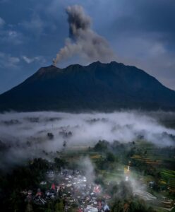
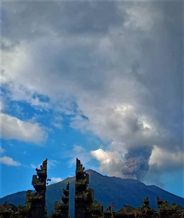
Indonesia , Agung :
VOLCANO OBSERVATORY NOTICE FOR AVIATION – VONA.
Issued: April 20 , 2019
Volcano: Agung (264020)
Current Aviation Colour Code: ORANGE
Previous Aviation Colour Code: orange
Source: Agung Volcano Observatory
Notice Number: 2019AGU16
Volcano Location: S 08 deg 20 min 31 sec E 115 deg 30 min 29 sec
Area: Bali, Indonesia
Summit Elevation: 10054 FT (3142 M)
Volcanic Activity Summary:
Eruption with volcanic ash cloud at 19h21 UTC (03h21 local). Eruption and ash emission is not continuing
Volcanic Cloud Height:
Best estimate of ash-cloud top is around 16454 FT (5142 M) above sea level, may be higher than what can be observed clearly. Source of height data: ground observer.
Other Volcanic Cloud Information:
Ash-cloud moving to west
Remarks:
Seismic activity is characterized by volcanic earthquake
Information about G. Agung’s eruption:
Mount Agung erupted in Bali on April 21, 2019 at 3:21 am WITA with the height of the ash column at ± 2,000 m above the summit (± 5,142 m above sea level). sea). The column of ash was gray, of thick intensity and inclined towards the South-West. This eruption is recorded on a seismogram of maximum amplitude of 25 mm and a duration of ± 2 minutes 55 seconds.
The eruption occurred at 3:21 pm
Currently, G. Agung is at alert level III (SIAGA) with recommendations:
Communities around Mount Agung and mountaineers / visitors / tourists must not ride or carry out any activity in the estimated risk zone within 4 km of Mount Agung crater. The estimated risk area is dynamic and continues to be evaluated. It can be modified at any time to follow the most recent G. Agung observation data.
Communities that live and move around rivers that are downstream of Gunung Agung are sensitized to potential secondary hazards in the form of descent of lahars that can occur especially during the rainy season and if eruptive material is still deposited in the area of the summit.
Source : Magma indonesia , PVMBG.
Photo : Peter Rendez Vous