May 17, 2024. EN. Indonesia : Ibu , Iceland : Reykjanes Peninsula , Russia / Kuril Islands : Ebeko , Philippines : Taal , Nicaragua : Conception .

May 17 , 2024.


Indonesia , Ibu :

Increased G. Ibu activity level from level III (SIAGA) to level IV (AWAS).

The results of the evaluation of G. Ibu’s activities in the North Moluccas province are presented as follows

Visual observation

Visual observations of Mount Ibu for the period May 1-15, 2024 observed white, gray and black smoke coming from the main crater of light, medium to thick intensity, 100-5,000 meters high from the summit. The weather is sunny to rainy, with light to moderate winds.

During this period there were eruptions of Mount Ibu, whose eruptive column tended to be higher and larger than usual.

On May 11, 2024 at 00:24 WIT, an eruption occurred with the height of the eruptive column observed approximately 4,000 meters above the peak, gray in color with thick intensity leaning towards the North and Northwest. Incandescence was observed, and the sound of rumbling and explosions could be heard all the way to the PGA station.
On May 12, 2024 at 00:58 WIT, an eruption occurred and lasted 3 minutes 20 seconds. The height of the eruptive column was not observed.
On May 13, 2024 at 09:12 WIT, an eruption occurred with the height of the eruptive column observed approximately 5,000 meters above the peak, gray in color with thick intensity oriented towards the North and Northeast. There was an explosion and roar all the way to the PGA Post.
On May 14, 2024 at 09:12 WIT, an eruption occurred and lasted 3 minutes 51 seconds. The height of the eruptive column was not observed.
On May 15, 2024 at 1:54 p.m. WIT, an eruption occurred with the height of the eruptive column observed at approximately 5,000 meters above the peak, gray in color with thick intensity oriented towards the West, and a sound of Roar could be heard all the way to the PGA Post.
On May 16, 2024 at 09:58 WIT, an eruption occurred with the height of the eruptive column observed approximately 5,000 meters above the peak, gray in color with thick intensity oriented towards the North and Northeast, and a roaring sound could be heard all the way to the PGA Post.

Instrumental observation
Between May 1 and 15, 2024, the seismicity recorded on Mount Ibu was 40 eruption earthquakes, 7 avalanche earthquakes, 1,850 emission earthquakes, 49 harmonic tremor, 13 « Tornillos » type earth, 7,590 shallow volcanic earthquakes, 80 deep volcanic earthquakes, 1 local tectonic earthquake, 132 distant tectonic earthquakes and 1 felt earthquake.

On May 13, 2024 at 1:14 p.m. WIT, the MMI II earthquake was recorded. According to the Ternate BMKG station, the source is 59 km northwest of Jailolo, in the North Moluccas, with a depth of 17 km. Since the tectonic earthquake incident, Drumbeat earthquakes have often appeared, especially after the eruption.
On May 15, 2024, the number of shallow volcanic earthquakes reached 2,830.
On May 16, 2024 at 10:55 a.m. WIT from the BMKG Ternate station, an earthquake with a magnitude of 2.8 was recorded, at a depth of 1 km, with the epicenter southwest of Tobelo, north of Moluccas.
On May 16, 2024, from 10:38 to 12:12 WIT, a series of shallow earthquakes with an average amplitude of 3 mm were recorded.

Seismicity graph of G. Ibu for the period from May 1 to 15, 2024

Assessment
Since around mid-April 2024, visual activity and seismicity, i.e. deep volcanic earthquakes, have seen a significant increase. Apart from this, a series of intense shallow earthquakes were also recorded, indicating an increase in pressure due to migration of magma to shallow depths.
The height of the eruptive column also tends to increase until it reaches 5,000 meters from the summit crater. The ejection of incandescent lava reached a radius of approximately 1.5 km from the crater rim.

Recommendation
Based on the results of visual and instrumental monitoring which show an increase in volcanic activity on Mount Ibu, the activity level of Mount Ibu was increased from level III (SIAGA) to level IV (AWAS) from from May 16, 2024 at 3:00 p.m. WIT.

Source : PVMBG


Iceland , Reykjanes Peninsula :

Magma accumulation beneath Svartsengi continues at a steady rate . About 16 million cubic meters of magma has been recharged to the magma reservoir since 16 March
Updated 16 May at 13:00 UTC

Magma accumulation beneath Svarstengi continues at a steady rate.
About 16 million cubic meters of magma has been added to the magma reservoir.
Increased probability of another dyke propagation and/or a volcanic eruption in the coming days.
Sundhnúkur crater row is the most likely location of another eruption.
An eruption could start with very little (or no) warning time

Around 80 earthquakes were detected in the area around the dyke intrusion yesterday, 15 May, most of them below M1.0. This is similar to the seismic activity that has been detected in recent days, but about 50 to 80 earthquakes have been measured per day, most of them occurring in two main areas, between Stóra-Skógfell and Hagafell and south of Þorbjörn. Signs of new magma migration from the Svartsengi reservoir to the previous diking area, may comprise localized small seismic swarms in and around the intrusion, rapid changes in deformation and pressure changes in boreholes in the area.


Magma accumulation continues beneath Svartsengi and land uplift is ongoing at the same rate as that observed since early April 2024. Therefore, there is still an increased probability that in the coming days a new dyke intrusion and another volcanic eruption in the Sundhnúkur crater row could occur.

Prior to previous dyke intrusions and volcanic eruptions, about 8 to 13 million cubic meters had been added to the magma reservoir before the reservoir failed and magma flowed from this to the Sundhnúkur crater row. Now, the amount of magma that has been added is more than the upper limit, as a total of ~16 million cubic meters have been added to the reservoir since 16 March, when the last eruption started.

Lesson learned from the Krafla Fires was that as the number of dyke propagations increases, more pressure is needed to trigger them. Therefore, it must be considered likely that magma will once again flow from the Svartsengi magma reservoir to the Sundhnúkur crater row, but there is an uncertainty as to when sufficient pressure will be reached to trigger a new dyke propagation and/or eruption.

Source : IMO

Photo : RÚV – Webcam à Orbirn


Russia / Kuril Islands , Ebeko :

VOLCANO OBSERVATORY NOTICE FOR AVIATION (VONA)

Issued: May 16 , 2024
Volcano: Ebeko (CAVW #290380)
Current aviation colour code: ORANGE
Previous aviation colour code: orange
Source: KVERT
Notice Number: 2024-26
Volcano Location: N 50 deg 41 min E 156 deg 0 min
Area: Northern Kuriles, Russia
Summit Elevation: 1156 m (3791.68 ft)

Volcanic Activity Summary:
A moderate explosive eruption of the volcano continues. According to visual data from Severo-Kurilsk, explosion sent ash up to 2.5 km a.s.l., and ash cloud drifted to the north-east of the volcano.
A moderate explosive eruption of the volcano continues. Ash explosions up to 6 km (19,700 ft) could occur at any time. Ongoing activity could affect low-flying aircraft and airport of Severo-Kurilsk

Volcanic cloud height:
2000-2500 m (6560-8200 ft) AMSL Time and method of ash plume/cloud height determination: 20240516/2106Z – Visual data

Other volcanic cloud information:
Distance of ash plume/cloud of the volcano: 5 km (3 mi)
Direction of drift of ash plume/cloud of the volcano: NE
Time and method of ash plume/cloud determination: 20240516/2106Z – Visual data

Source : Kvert

Photo : D. Ermolaev ( archive)


Philippines , Taal :

TAAL VOLCANO ADVISORY , 16 May 2024 , 07:00 PM

This is a notice of weak phreatic activity at Taal Volcano.

Four (4) minor successive phreatic or steam-driven eruptions at the Taal Main Crater occurred today between 08:54 AM to 08:57 AM, 11:07 AM to 11:10 AM, 01:48 PM to 01:50 PM and 05:37 PM to 05:38 PM based on visual and seismic observations. The events produced white steam-laden plumes that rose between 50 and 300 meters above the Main Crater before drifting west-northwest based on IP camera monitors. Sulfur dioxide (SO2) emissions increased on 13 May 2024 at 5,094 tonnes/day. Average SO2 emissions since January this year remain high at 8,686 tonnes/day. Weak phreatic activity is likely driven by the continued emission of hot volcanic gases at the Taal Main Crater and could be succeeded by similar events. The background levels of volcanic earthquake activity and ground deformation detected at Taal indicate that unrest is unlikely to progress into magmatic eruption.

DOST-PHIVOLCS reminds the public that Alert Level 1 prevails over Taal Volcano, which means that it is still in abnormal condition and should not be interpreted to have ceased unrest nor ceased the threat of eruptive activity. At Alert Level 1, sudden steam-driven or phreatic explosions, volcanic earthquakes, minor ashfall and lethal accumulations or expulsions of volcanic gas can occur and threaten areas within TVI. Furthermore, degassing of high concentrations of volcanic SO2 continues to pose the threat of potential long-term health impacts to communities around Taal Caldera that are frequently exposed to volcanic gas. DOST-PHIVOLCS strongly recommends that entry into TVI, Taal’s Permanent Danger Zone or PDZ, especially the vicinities of the Main Crater and the Daang Kastila fissure, must remain strictly prohibited. Local government units are advised to continuously monitor and assess preparedness of their communities and undertake appropriate response measures to mitigate hazards that could be posed by long-term degassing and related phreatic activity. Civil aviation authorities must advise pilots to avoid flying close to the volcano as airborne ash and ballistic fragments from sudden explosions and wind-remobilized ash may pose hazards to aircrafts.

DOST-PHIVOLCS is closely monitoring Taal Volcano’s activity and any new significant development will be immediately communicated to all stakeholders.

Source : Phivolcs

Photo : CNNPH , marcello Teofilo ( archive).


Nicaragua , Conception :

The Concepción volcano, on the island of Ometepe, in the Great Lake of Nicaragua, recorded a small to moderate explosion on Thursday accompanied by gas and ash, without causing damage or danger to the population, authorities reported.

The explosion of the Concepción, whose height reached 1,610 meters, was recorded at 2:20 p.m. local time (8:20 p.m. GMT), followed by the emission of ash and gas, according to the authorities, who activated an alert system on the Ometepe Island.

“The Concepción volcano caused an explosion of gas and ash with a column height (plume) approximately 2 kilometers high from the crater rim,” the Nicaraguan government said in a report.

The magnitude of this explosion is classified as small to medium, and it is estimated that the expelled ash will reach surrounding communities where a thin layer of ash (with an estimated maximum thickness of 1 millimeter) will fall, according to authorities.

At the time of writing, there are still small residual tremors associated with the explosion, while the degassing flow has returned to its normal parameters, according to the Executive.

« This event does not imply greater danger for the population, but there is the possibility that over the course of hours or days small explosions of gas and ash may occur, with characteristics lower than the current one. or similar,” he said.

Source : 100% Noticias.

Photo : La prensa.

17 Mai 2024. FR. Indonésie : Ibu , Islande : Péninsule de Reykjanes , Russie / Iles Kouriles : Ebeko , Philippines : Taal , Nicaragua : Conception .

17 Mai 2024.


Indonésie , Ibu :

Augmentation du niveau d’activité de G. Ibu du niveau III (SIAGA) au niveau IV (AWAS).

Les résultats de l’évaluation des activités de G. Ibu dans la province des Moluques du Nord sont présentés comme suit

Observation visuelle

Les observations visuelles du mont Ibu pour la période du 1er au 15 mai 2024 ont observé une fumée blanche, grise et noire provenant du cratère principal d’intensité légère, moyenne à épaisse, à 100-5 000 mètres de haut du sommet. Le temps est ensoleillé à pluvieux, avec des vents faibles à modérés .

Au cours de cette période, il y a eu des éruptions du mont Ibu, dont la colonne éruptive avait tendance à être plus haute et plus grande que d’habitude.

Le 11 mai 2024 à 00h24 WIT, une éruption s’est produite avec la hauteur de la colonne éruptive observée à environ 4 000 mètres au-dessus du pic, de couleur grise avec une intensité épaisse penchée vers le Nord et le Nord-Ouest. Une incandescence a été observée, et le bruit des grondements et des explosions ont pu être entendus jusqu’au poste PGA.
Le 12 mai 2024 à 00h58 WIT, une éruption s’est produite et a duré 3 minutes 20 secondes. La hauteur de la colonne éruptive n’a pas été observée.
Le 13 mai 2024 à 09h12 WIT, une éruption s’est produite avec la hauteur de la colonne éruptive observée à environ 5 000 mètres au-dessus du pic, de couleur grise avec une intensité épaisse orientée vers le Nord et le Nord-Est. Il y a eu un bruit d’ explosion et de rugissement jusqu’au PGA Post.
Le 14 mai 2024 à 09h12 WIT, une éruption s’est produite et a duré 3 minutes 51 secondes. La hauteur de la colonne éruptive n’a pas été observée.
Le 15 mai 2024 à 13h54 WIT, une éruption s’est produite avec la hauteur de la colonne éruptive observée à environ 5 000 mètres au-dessus du pic, de couleur grise avec une intensité épaisse orientée vers l’Ouest, et un son de rugissement pouvait être entendu jusqu’au PGA Post .
Le 16 mai 2024 à 09h58 WIT, une éruption s’est produite avec la hauteur de la colonne éruptive observée à environ 5 000 mètres au-dessus du pic, de couleur grise avec une intensité épaisse orientée vers le Nord et le Nord-Est, et un son de rugissement pouvait être entendu jusqu’au PGA Post.

Observation instrumentale

Entre le 1er et le 15 mai 2024, la sismicité enregistrés sur le mont Ibu était de 40 tremblements de terre d’éruption, 7 tremblements de terre d’avalanche, 1 850 tremblements de terre d’émissions, 49 tremor harmoniques, 13 tremblements de terre de type « Tornillos », 7 590 tremblements de terre volcaniques superficiels, 80 tremblements de terre volcaniques profonds, 1 tremblement de terre tectonique local, 132 tremblements de terre tectoniques lointains et 1 tremblement de terre ressenti.

Le 13 mai 2024 à 13h14 WIT, le tremblement de terre MMI II a été enregistré. Selon la station Ternate BMKG, la source se trouve à 59 km au Nord-Ouest de Jailolo, dans le Nord des Moluques, avec une profondeur de 17 km. Depuis l’incident du tremblement de terre tectonique, les tremblements de terre de type Drumbeat sont souvent apparus, surtout après l’éruption.
Le 15 mai 2024, le nombre de séismes volcaniques superficiels atteignait 2 830.
Le 16 mai 2024 à 10h55 WIT depuis la station BMKG Ternate, un tremblement de terre d’une magnitude de 2,8 a été enregistré, à une profondeur de 1 km, avec l’épicentre au Sud-Ouest de Tobelo, au Nord des Moluques.
Le 16 mai 2024, de 10h38 à 12h12 WIT, une série de tremblements de terre peu profonds d’une amplitude moyenne de 3 mm ont été enregistrés.

Graphique de sismicité du G. Ibu pour la période du 1er au 15 mai 2024

Évaluation
Depuis la mi-avril 2024 environ, l’activité visuelle et la sismicité, c’est-à-dire les tremblements de terre volcaniques profonds, ont connu une augmentation significative. En dehors de cela, une série de séismes intenses à faible profondeur ont également été enregistrés, indiquant une augmentation de la pression due à la migration du magma vers de faibles profondeurs.
La hauteur de la colonne éruptive a également tendance à augmenter jusqu’à atteindre 5 000 mètres du cratère sommital. L’éjection de lave incandescente a atteint un rayon d’environ 1,5 km depuis le bord du cratère.

Recommandation
Sur la base des résultats de la surveillance visuelle et instrumentale qui montrent une augmentation de l’activité volcanique sur le mont Ibu, le niveau d’activité du mont Ibu a été augmenté du niveau III (SIAGA) au niveau IV (AWAS) à partir du 16 mai 2024 à 15h00 WIT.

Source : PVMBG


Islande , Péninsule de Reykjanes :

L’accumulation de magma sous Svartsengi se poursuit à un rythme constant . Environ 16 millions de mètres cubes de magma ont été rechargés dans le réservoir magmatique depuis le 16 mars
Mise à jour le 16 mai à 13h00 UTC

L’accumulation de magma sous Svarstengi se poursuit à un rythme constant.
Environ 16 millions de mètres cubes de magma ont été ajoutés au réservoir de magma.
Probabilité accrue d’une autre propagation de dyke et/ou d’une éruption volcanique dans les prochains jours.
La rangée du cratère Sundhnúkur est l’emplacement le plus probable d’une autre éruption.
Une éruption pourrait commencer avec très peu (voire aucun) délai d’avertissement

Hier 15 mai, environ 80 tremblements de terre ont été détectés dans la zone autour de l’intrusion du dyke, la plupart étant inférieurs à M1,0. Ceci est similaire à l’activité sismique détectée ces derniers jours, mais environ 50 à 80 tremblements de terre ont été mesurés par jour, la plupart se produisant dans deux zones principales, entre Stóra-Skógfell et Hagafell et au Sud de Þorbjörn. Les signes d’une nouvelle migration de magma du réservoir de Svartsengi vers la zone du dyke précédent peuvent comprendre de petits essaims sismiques localisés dans et autour de l’intrusion, des changements rapides de déformation et des changements de pression dans les forages de la région.


L’accumulation de magma se poursuit sous Svartsengi et le soulèvement des terres se poursuit au même rythme que celui observé depuis début avril 2024. Par conséquent, il existe toujours une probabilité accrue qu’une nouvelle intrusion de dyke et une autre éruption volcanique dans la rangée de cratères de Sundhnúkur puissent se produire dans les prochains jours. .

Avant les intrusions de dykes et les éruptions volcaniques précédentes, environ 8 à 13 millions de mètres cubes avaient été ajoutés au réservoir de magma avant que le réservoir soit rempli et que le magma s’écoule de celui-ci vers la rangée de cratères de Sundhnúkur. Aujourd’hui, la quantité de magma ajoutée dépasse la limite supérieure, puisqu’un total d’environ 16 millions de mètres cubes ont été ajoutés au réservoir depuis le 16 mars, date du début de la dernière éruption.

La leçon tirée des éruptions du Krafla est qu’à mesure que le nombre de propagations de dykes augmente, plus de pression est nécessaire pour les déclencher. Par conséquent, il doit être considéré comme probable que le magma s’écoulera à nouveau du réservoir magmatique de Svartsengi vers la rangée de cratères Sundhnúkur, mais il existe une incertitude quant au moment où une pression suffisante sera atteinte pour déclencher une nouvelle propagation de dyke et/ou une éruption.

Source : IMO

Photo : RÚV – Webcam à Orbirn


Russie / Iles Kouriles , Ebeko :

AVIS D ‘OBSERVATION DU VOLCAN POUR L’AVIATION (VONA)

Publié : 16 mai 2024
Volcan : Ebeko (CAVW #290380)
Code couleur aviation actuel : ORANGE
Code couleur aviation précédent : orange
Source : KVERT
Numéro d’avis : 2024-26
Emplacement du volcan : N 50 degrés 41 min E 156 degrés 0 min
Région : Kouriles du Nord, Russie
Altitude du sommet : 1 156 m (3 791,68 pi)

Résumé de l’activité volcanique :
Une éruption explosive modérée du volcan se poursuit. Selon les données visuelles de Severo-Kurilsk, une explosion a envoyé des cendres jusqu’à 2,5 km d’altitude et un nuage de cendres a dérivé vers le Nord-Est du volcan.
Cette éruption continue. Des explosions de cendres jusqu’à 6 km (19 700 pieds) d’altitude pourraient survenir à tout moment. L’activité en cours pourrait affecter les avions volant à basse altitude et l’aéroport de Severo-Kurilsk

Hauteur des nuages volcaniques :
2 000-2 500 m (6 560-8 200 ft) AMSL Heure et méthode de détermination du panache de cendres/hauteur des nuages : 20240516/2106Z – Données visuelles

Autres informations sur les nuages volcaniques :
Distance panache de cendres/nuage du volcan : 5 km (3 mi)
Direction de dérive du panache de cendres/nuage du volcan : NE
Heure et méthode de détermination du panache/nuage de cendres : 20240516/2106Z – Données visuelles

Source : Kvert

Photo : D. Ermolaev ( archive)


Philippines , Taal :

AVIS D’ACTIVITE DU VOLCAN TAAL , 16 mai 2024 , 19h00

Avis de faible activité phréatique sur le volcan Taal.

Quatre (4) éruptions mineures successives phréatiques ou provoquées par la vapeur dans le cratère principal du Taal se sont produites aujourd’hui entre 08h54 et 08h57, 11h07 et 11h10, 13h48 et 13h50 et 17h37 à 17h38 sur la base d’observations visuelles et sismiques. Les événements ont produit des panaches blancs chargés de vapeur qui se sont élevés entre 50 et 300 mètres au-dessus du cratère principal avant de dériver vers l’Ouest-Nord-Ouest, d’après les moniteurs de caméras IP. Les émissions de dioxyde de soufre (SO2) ont augmenté le 13 mai 2024 à 5 094 tonnes/jour. Les émissions moyennes de SO2 depuis janvier de cette année restent élevées, à 8 686 tonnes/jour. La faible activité phréatique est probablement due à l’émission continue de gaz volcaniques chauds au niveau du cratère principal du Taal et pourrait être suivie par des événements similaires. Les niveaux de fond d’activité sismique volcanique et de déformation du sol détectés sur le Taal indiquent qu’il est peu probable que les troubles se transforment en éruption magmatique.

Le DOST-PHIVOLCS rappelle au public que le niveau d’alerte 1 prévaut sur le volcan Taal, ce qui signifie qu’il est toujours dans un état anormal et ne doit pas être interprété comme ayant cessé les troubles ni la menace d’activité éruptive. Au niveau d’alerte 1, des explosions soudaines provoquées par de la vapeur ou phréatiques, des tremors volcaniques, des chutes de cendres mineures et des accumulations ou expulsions mortelles de gaz volcanique peuvent se produire et menacer les zones de TVI. En outre, le dégazage de fortes concentrations de SO2 volcanique continue de constituer une menace d’impacts potentiels à long terme sur la santé des communautés autour de la caldeira du Taal qui sont fréquemment exposées au gaz volcanique. Le DOST-PHIVOLCS recommande fortement que l’entrée dans TVI, la zone de danger permanente ou PDZ du Taal, en particulier à proximité du cratère principal et de la fissure de Daang Kastila, reste strictement interdite. Il est conseillé aux autorités locales de surveiller et d’évaluer en permanence l’état de préparation de leurs communautés et de prendre des mesures d’intervention appropriées pour atténuer les dangers qui pourraient être posés par le dégazage à long terme et l’activité phréatique associée. Les autorités de l’aviation civile doivent conseiller aux pilotes d’éviter de voler à proximité du volcan, car les cendres en suspension et les fragments balistiques provenant d’explosions soudaines ainsi que les cendres remobilisées par le vent peuvent présenter des dangers pour les avions.

Le DOST-PHIVOLCS surveille de près l’activité du volcan Taal et tout nouveau développement important sera immédiatement communiqué à toutes les parties prenantes.

Source : Phivolcs

Photo : CNNPH , marcello Teofilo ( archive).


Nicaragua , Conception :

Le volcan Concepción, sur l’île d’Ometepe, dans le Grand Lac du Nicaragua, a enregistré jeudi une explosion faible à modérée accompagnée de gaz et de cendres, sans causer de dégâts ni de danger pour la population, ont rapporté les autorités.

L’explosion du Concepción, dont la hauteur atteint 1.610 mètres, a été enregistrée à 14h20 heure locale (20h20 GMT), suivie de l’émission de cendres et de gaz, selon les autorités, qui ont activé un système d’alerte sur l’île d’Ometepe.

« Le volcan Concepción a provoqué une explosion de gaz et de cendres avec une hauteur de colonne (panache) d’environ 2 kilomètres de haut à partir du bord du cratère », a indiqué le gouvernement du Nicaragua dans un rapport.

La magnitude de cette explosion est classée comme faible à moyenne, et on estime que les cendres expulsées atteindront les communautés environnantes où tombera une fine couche de cendres (d’une épaisseur maximale estimée à 1 millimètre), selon les autorités.

Au moment de la rédaction de ce rapport, il existe encore de petites secousses résiduelles associées à l’explosion, tandis que le flux de dégazage est revenu à ses paramètres normaux, selon l’Exécutif.

« Cet événement n’implique pas un plus grand danger pour la population, mais il existe la possibilité qu’au cours des heures ou des jours, de petites explosions de gaz et de cendres puissent se produire, avec des caractéristiques inférieures à l’actuelle ou similaire », a-t-il déclaré.

Source : 100% Noticias.

Photo : La prensa.

September 24, 2020. EN . La Réunion : Piton de la Fournaise , Colombia : Nevado del Ruiz , Ethiopia : Erta Ale , Chile : Nevados of Chillan.

September 24 , 2020 .


La Réunion , Piton de la Fournaise :

Activity bulletin for Wednesday September 23, 2020 at 11:15 a.m. (local time)
Recommended alert level: Vigilance

Since September 20, a resumption of seismicity has been observed under the Piton de la Fournaise. Thus between September 20 and 22, 21 earthquakes (Figure 1), of magnitude less than or equal to 1, were recorded and located under the Dolomieu crater between 1.7 and 2.2 km deep (Figure 2).

Figure 1: Histogram representing the number of superficial volcano-tectonic earthquakes recorded since September 1, 2020 (© OVPF-IPGP).


Figure 2: Location map (epicenters) and north-south and east-west sections (showing the location in depth, hypocenters) of the earthquakes recorded and located by the OVPF-IPGP between 20 and 22 September 2020 under the massif of Piton de la Fournaise. Only localizable earthquakes have been shown on the map (© OVPF-IPGP).


This seismicity is accompanied by a resumption of inflation (swelling) of the base and the top of the Piton de la Fournaise building. This building inflation remains very low for the moment and will have to be confirmed over time in the coming days.
This seismicity and deformation are synonymous with a pressurization of the superficial magmatic reservoir located about 2-2.5 km below the summit.

Soil CO2 fluxes also show a trend reversal since mid-August. After a long continuous phase of reduction of CO2 emissions in the soil following the last eruption (April 2-6, 2020), a new phase of increase has been observed since mid-August and has continued since. This increase in far-field CO2 is consistent with a deep rise in magma.

At the same time, the SO2 fluxes recorded in the air remain below the detection threshold. The concentrations of H2S and SO2 in the fumaroles in the summit area remain low and despite a slight tendency to increase the concentration of SO2 since August 2020, the concentrations are extremely low.

Note that this process of recharging the surface reservoir can last several days to several weeks before the roof of the reservoir weakens and breaks, thus giving rise to an injection of magma to the surface and an eruption, but can also stop without giving rise to an eruption in the short term.

Source : OVPF.

Read the article http://www.ipgp.fr/fr/ovpf/bulletin-dactivite-mercredi-23-septembre-2020-a-11h15-heure-locale

Photo : Nath Duverlie


Colombia , Nevado del Ruiz :

Nevado del Ruiz volcano activity level bulletin.
The activity level continues at Yellow Activity Level or (III): changes in the behavior of volcanic activity.

Regarding the monitoring of the activity of the Nevado del Ruiz volcano, the COLOMBIAN GEOLOGICAL SERVICE reports that:

During the last week, according to the results obtained by monitoring the activity through the various parameters evaluated, the Nevado del Ruiz volcano continued to show instability in its behavior. An acceleration of the volcanic process and consequently changes in the level of activity of the volcano is not excluded.
Seismicity related to fluid dynamics inside the volcanic conduits had similar levels in the number of events and in the seismic energy released compared to the previous week. This seismic activity was characterized by the appearance of continuous volcanic tremor, tremor pulses, long and very long period type earthquakes, which presented variable energy levels and spectral content. Three confirmed ash shows stand out on September 15 and 20.

During the week, there was an episode of low-energy « drumbeat » type seismicity associated with the movement of fluids in the volcanic conduits. This seismicity has been linked to the processes of ascent, location-growth and evolution of the lava dome at the bottom of the Arenas crater.
The seismicity generated by the fracturing of the rocks showed a slight decrease in the number of earthquakes and the seismic energy released, compared to the previous week. This type of seismicity was mainly localized in the Arenas crater and in the North-East and South sectors of the volcano. The depth of the earthquakes varied between 0.4 and 7.9 km. The maximum magnitude recorded during the week was 0.2 ML (local magnitude) corresponding to the earthquake recorded on September 19 at 04:00 (local time), located 2.8 km northeast of the Arenas crater, at a depth 3.8 km.

The Nevado del Ruiz volcano continues at the yellow activity level

Source : SGC.

Photo : Auteur inconnu.


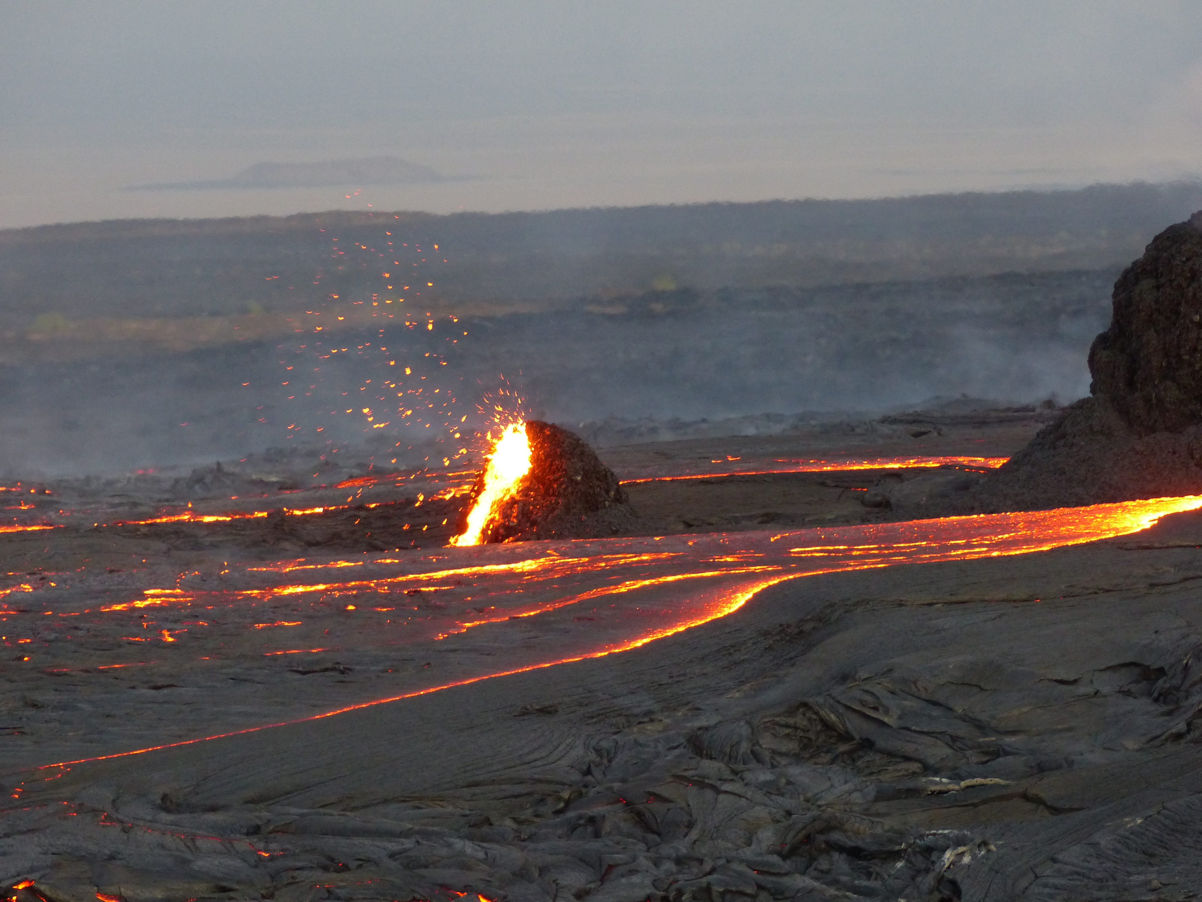
Ethiopia , Erta Ale :

13.6°N, 40.67°E
Elevation 613 m

Satellite data showed thermal anomalies in both of Erta Ale’s S and N pit craters in mid-August, though by 5 September only the N pit had anomalous temperatures.

Erta Ale is an isolated basaltic shield that is the most active volcano in Ethiopia. The broad, 50-km-wide edifice rises more than 600 m from below sea level in the barren Danakil depression. Erta Ale is the namesake and most prominent feature of the Erta Ale Range. The volcano contains a 0.7 x 1.6 km, elliptical summit crater housing steep-sided pit craters. Another larger 1.8 x 3.1 km wide depression elongated parallel to the trend of the Erta Ale range is located SE of the summit and is bounded by curvilinear fault scarps on the SE side.


Fresh-looking basaltic lava flows from these fissures have poured into the caldera and locally overflowed its rim. The summit caldera is renowned for one, or sometimes two long-term lava lakes that have been active since at least 1967, or possibly since 1906. Recent fissure eruptions have occurred on the N flank.

Source: GVP , Sentinel Hub.

Photo : Sylvie Vitton.


Chile , Nevados of Chillan :

36.868°S, 71.378°W
Elevation 3180 m

On 22 September SERNAGEOMIN reported that lava continued to advance down Nevados de Chillán’s NNE flank. Gas emissions and occasional explosions were also recorded. The Alert Level remained at Yellow, the second lowest level on a four-color scale, and residents were reminded not to approach the crater within 3 km. ONEMI stated that Alert Level Yellow (the middle level on a three-color scale) remained in place for the communities of Pinto and Coihueco, noting that as of 16 June the public should stay at least 3 km away from the crater on the SW flank and 5 km away on the NE flank.

The eruptive cycle of the Nevados de Chillán volcanic complex continues to evolve regularly, with the advance of the lava flow observed on the northern slope, added to the presence of the lava dome housed in the crater whose evolution begins to show signs of increased explosiveness, corroborated from satellite images.

Additionally, data from GNSS stations showed some minor variations, decreasing during this period. However, the recording of seismicity associated with the dynamics of fluids and explosions, thermal alerts, and recording of degassing and low height incandescence are consistent with the development of this type of surface magmatic body.

The current process is considered to be part of an intermittent eruptive dynamic with the emission of magmatic matter towards the surface and with a low level of explosiveness, it does not show signs which suggest for the moment a greater destabilization.

Source : GVP , Sernageomon , Segemar .

Photo : Josefauna.

11 Septembre 2019. FR . Colombie : Chiles / Cerro Negro , Italie / Sicile : Etna , Indonésie : Ibu , Alaska : Semisopochnoi .

11 Septembre 2019.


Colombie , Chiles / Cerro Negro :

Bulletin d’activité hebdomadaire des volcans Chiles et Cerro Negro
Le niveau d’activité des volcans se poursuit au niveau : NIVEAU JAUNE ■ (III): CHANGEMENTS DANS LE COMPORTEMENT DE L’ACTIVITÉ VOLCANIQUE.

À la suite des activités des VOLCANS CHILES ET CERRO NEGRO, le SERVICE GÉOLOGIQUE COLOMBIEN (SGC) signale que:

Pour la période du 3 au 9 septembre 2019, l’activité sismique dans la région des volcans Chiles – Cerro Negro a continué d’afficher des similitudes en nombre et en énergie sismique par rapport aux semaines précédentes, totalisant environ 757 événements pour la semaine évaluée. La sismicité prédominante est toujours associée à la fracturation de matériaux rocheux dans le bâtiment volcanique.


Les séismes ont été localisés principalement au Sud du complexe volcanique et principalement à des distances épicentrales inférieures à 7 km du volcan Chiles, à des profondeurs allant jusqu’à 9 km (en dessous du sommet) et à une magnitude locale maximale de 2,5 sur l’échelle de Richter. Aucun des tremblements de terre enregistrés n’a été ressenti par les habitants de la zone d’influence du complexe volcanique Chiles – Cerro Negro.

Les autres paramètres géophysiques et géochimiques de la surveillance volcanique n’ont pas montré de variations significatives.

Le service géologique colombien et l’Institut de géophysique de l’École polytechnique nationale de l’Equateur sont attentifs à l’évolution du phénomène volcanique et informent en temps utile les changements observés.

Source : SGC.

Photo : SGC.


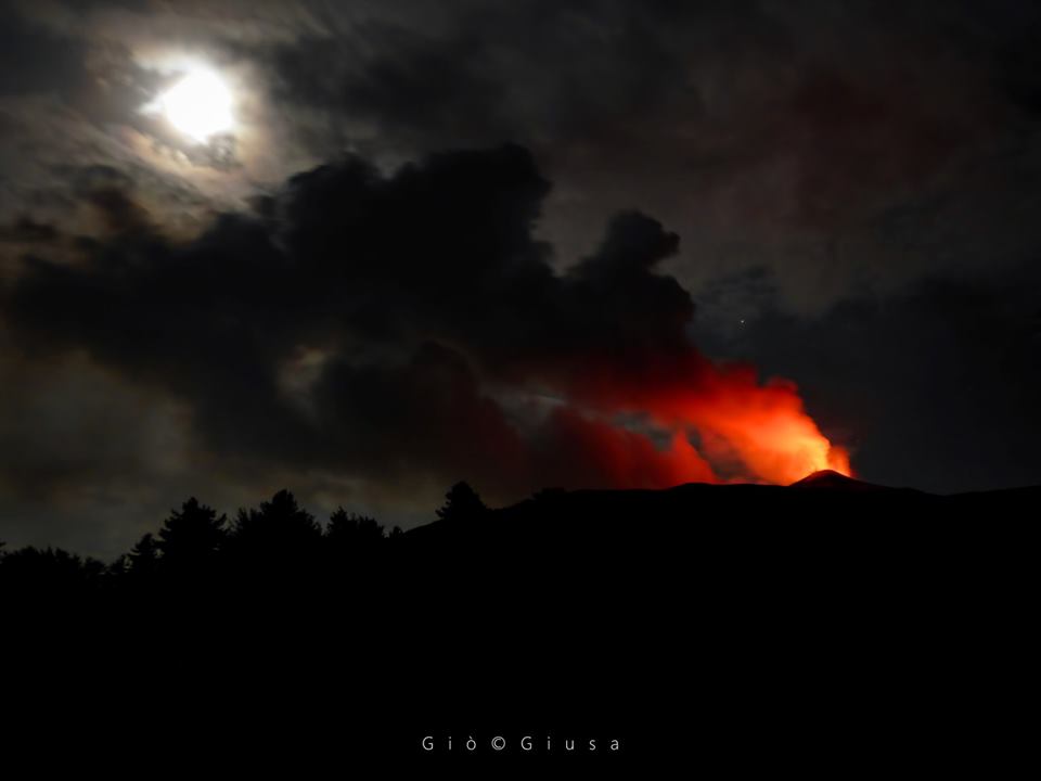
Italie / Sicile , Etna :

Apparemment , le tremor a connu une chute brutale. Aucune communication de l’INGV pour l’instant.

Il y a eu une grosse activité cette nuit .

Source : INGV.

Photo : Gio Giusa .


Indonésie , Ibu :

Niveau d’activité de niveau II (WASPADA). Le G. Ibu (1 340 m d’altitude) connait une éruption continue depuis 2008.

Depuis hier et jusqu’à ce matin, le volcan était clairement visible jusqu’à ce qu’il soit recouvert par le brouillard . La fumée issue du cratère est observée à une hauteur de 200 à 800 mètres au dessus du sommet du pic, la pression étant faible à modérée, sa couleur blanche-grise .Elle se déplace vers le Sud et l’Est avec une intensité faible, modérée et épaisse.

Les sismographes datés du 10 septembre 2019, ont enregistré:
77 tremblements de terre d’éruption
72 tremblements de terre d’explosion
46 tremors harmoniques.

Recommandation:
Les communautés autour du G. Ibu et les visiteurs / touristes ne doivent pas bouger, monter ni s’approcher dans un rayon de 2 km avec une expansion sectorielle  à 3,5 km de l’ouverture dans la partie Nord du cratère actif du G. Ibu.

VONA:
Le dernier code VONA a été envoyée avec le code de couleur ORANGE, publié le 4 septembre 2019 à 09h36, qui correspondait à une éruption dont la hauteur de la colonne de cendres se situait à environ 1625 mètres d’altitude ou à environ 300 mètres au-dessus du sommet. La colonne de cendres se déplaçait vers le Sud.

Source : PVMBG.

Video : Alex Djangu Trekker.


Alaska , Semisopochnoi : 

51 ° 55’44 « N 179 ° 35’52 » E,
Élévation du sommet : 2625 pi (800 m)
Niveau d’alerte volcanique actuel: ATTENTION
Code couleur de l’aviation actuel : ORANGE

Une activité éruptive de faible intensité pourrait se poursuivre sur le Semisopochnoi. L’activité sismique au cours de la dernière journée reste élevée avec des tremblements de terre de type basse fréquence mais aucune explosion n’a été détectée dans les données des capteurs d’infrasons régionales. Les observations satellites ont été en grande partie masquées par les nuages au cours de la journée écoulée.

Le Semisopochnoi est surveillé par un réseau sismique sur l’île et à distance par satellite et par des capteurs de foudre. Un réseau d’infrasons sur l’île d’Adak peut détecter les émissions explosives du Semisopochnoi avec un léger retard (environ 13 minutes) si les conditions atmosphériques le permettent.

Source : AVO.

Photo : Kim F.

February 03 , 2019. EN. Kamchatka : Sheveluch , Colombia : Nevado del Ruiz , Philippines : Mayon , Indonesia : Karangetang , Seismic crisis of Mayotte .

February 03 , 2019.


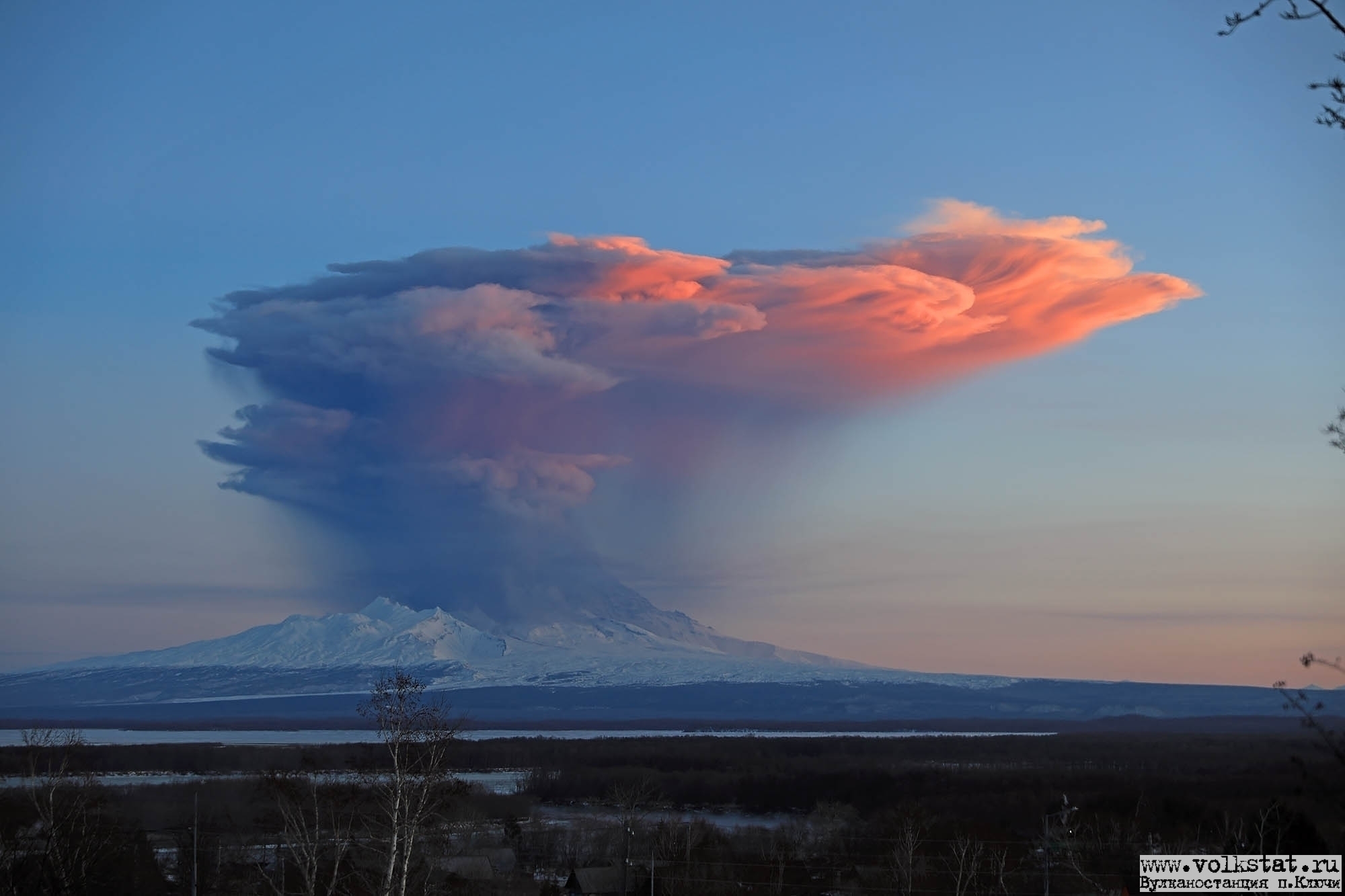
Kamchatka , Sheveluch :

VOLCANO OBSERVATORY NOTICE FOR AVIATION (VONA).

Issued: February 03 , 2019 
Volcano:Sheveluch (CAVW #300270)
Current aviation colour code:ORANGE
Previous aviation colour code:orange
Source:KVERT
Notice Number:2019-32
Volcano Location:N 56 deg 38 min E 161 deg 18 min
Area:Kamchatka, Russia
Summit Elevation:10768.24 ft (3283 m), the dome elevation ~8200 ft (2500 m)

Volcanic Activity Summary:
A growth of the lava dome continues (a viscous lava blocks extrude out on the northern part of it), a strong fumarolic activity and an incandescence of the dome blocks and hot avalanches accompanies this process. According to satellite data, a gas-steam plume with some amount of ash continues to drift to the south-west from the volcano.
Explosive-extrusive eruption of the volcano continues. Ash explosions up to 32,800-49,200 ft (10-15 km) a.s.l. could occur at any time. Ongoing activity could affect international and low-flying aircraft.

Volcanic cloud height:
11480-13120 ft (3500-4000 m) AMSL Time and method of ash plume/cloud height determination: 20190203/0314Z – VIRS
Other volcanic cloud information:
Distance of ash plume/cloud of the volcano: 49 mi (79 km)
Direction of drift of ash plume/cloud of the volcano: SW / azimuth 215 deg
Time and method of ash plume/cloud determination: 20190203/0314Z – VIRS

Source : Kvert.

Photo : Yu Demyanchuck / Volkstat ru.


Colombia , Nevado del Ruiz :

Weekly activity bulletin of the Nevado del Ruiz volcano
The level of activity continues at the level: Yellow activity level or (III): Modifications of the behavior of the volcanic activity.

With regard to monitoring the activity of the Nevado del Ruiz volcano, the COLOMBIAN GEOLOGICAL SERVICE announces that:

During the past week, seismicity induced by fracturing rocks part of the volcanic system resulted in a significant decrease in the number of earthquakes and seismic energy released over the previous week. Earthquakes were located mainly in the West-South-West, 4.7 km from the Arenas crater and, to a lesser extent in volcanic areas South-Southwest, Southeast, Northeast, and in the area of ​​Arenas crater. The depths of the earthquakes ranged between 1.0 and 6.8 km. The maximum magnitude recorded during the week was 0.9 ML (local magnitude), corresponding to a recorded earthquake on 22 January at 17 h 42 (local time), located in the West-South-West, at a depth 5.4 km.

Seismicity related to fluid dynamics within the ducts of the volcanic structure also showed similar levels in the number of earthquakes and released seismic energy compared to the previous week. This seismic activity was characterized by the appearance of slight pulses of volcanic tremor and earthquakes for a very long time. The earthquakes occurred mainly in the crater Arenas and its surroundings.

Volcanic deformation measured from electronic inclinometers has recorded slight changes in recent days, possibly associated with minor inflationary processes on the Nevado del Ruiz volcano.
The volcano continues to emit water vapor and gases into the atmosphere, among which is the sulfur dioxide (SO2), as evidenced by the values ​​obtained by the SCANDOAS stations installed in the region of the volcano. satellite image analysis. During the week, the NASA FIRMS and MIROVA portals reported several low-energy thermal anomalies.

The column of gas and steam reached a maximum height of 800 m, measured at the top of the volcano on 27 January. The direction of dispersion of the column was governed by the direction of the wind in the region, which prevailed towards the northwest of the volcano.

The Nevado del Ruiz volcano continues at the level of activity yellow.

Source : SGC

Photo : Cesar Rios.


Philippines , Mayon :

MAYON VOLCANO BULLETIN 03 February 2019 08:00 A.M.

Mayon Volcano’s seismic monitoring network recorded one (1) volcanic earthquake during the 24-hour observation period. Fair crater glow from the summit could be observed at night. Sulfur dioxide (SO2) emission was measured at an average of 845 tonnes/day on 01 February 2019. Precise leveling data obtained on 08-13 December 2018 indicate a slight inflation of the edifice relative to 22-31 October 2018. Continuous GPS and electronic tilt data further show pronounced inflation of the mid-slopes since June 2018, possibly due to aseismic magma intrusion deep beneath the edifice.


Alert Level 2 currently prevails over Mayon Volcano. This means that Mayon is at a moderate level of unrest. DOST-PHIVOLCS reminds the public that sudden explosions, lava collapses, pyroclastic density currents or PDCs and ashfall can still occur and threaten areas in the upper to middle slopes of Mayon. DOST-PHIVOLCS recommends that entry into the six kilometer-radius Permanent Danger Zone or PDZ and a precautionary seven kilometer-radius Extended Danger Zone or EDZ in the south-southwest to east-northeast sector, stretching from Anoling, Camalig to Sta. Misericordia, Sto. Domingo must be strictly prohibited. People residing close to these danger areas are also advised to observe precautions associated with rockfalls, PDCs and ashfall. Active stream/river channels and those identified as perennially lahar-prone areas on all sectors of the volcano should also be avoided especially during extreme weather conditions when there is heavy and prolonged rainfall. Civil aviation authorities must advise pilots to avoid flying close to the volcano’s summit as airborne ash and ballistic fragments from sudden explosions and PDCs may pose hazards to aircrafts.

Source : Phivolcs.

Photo : Omegashots


Indonesia , Karangetang :

Brief report on the observation of the ongoing activities of G. Karangetang, February 3, 2019

On February 2, 2019, a visual observation of the latest activities of Karangetang from the village of Batubulan was carried out. The observations were made by Yudia and Didi (observers of the Karangetang volcano). According to the observations made at about 10.45 am, the end of the avalanche and / or lava flow towards the Batuare River was observed as far as 2000 m from crater 2 (North) and avalanches and / or collapses to the Melebuhe River (north-east of Crater 2 and east of Kali Batuare) are erratic.

The Avalanche advance to the Melebuhe River was 2500 m from Crater 2. At the extreme, an accumulation of volcanic material could result in the formation of heat clouds. The distance from the lava point in the Melebuhe River to the coast is about 1000 m (1 km). Between Kali Batuare and Kali Melebuhe, there is a village called Niambangeng, Kampung Batubulan, with about 8 families (~ 21 people: 9 men, 9 women and 3 children). The PVMBG through the observers of the volcano coordinated with the BPBD, the National Police and TNI the closure of the road from the west of the Batuare River to Kali Melebuhe. For the moment, the alternative route used the east lane.

Currently, the status of Gunung Karangetang is at Level III (SIAGA) with the following recommendations:
• Communities around Karangetang Mountain and visitors / tourists should not climb or operate within 2.5 km of Kawah 2 (North Crater) and Main Crater (South Crater) in the direction of North-East-South-West and 3 km North-West.

View of the lava avalanche, February 2, 2019 lk. 11:05 CET The advance of Karangetang lava leading to the Malebuhe River (Batubulan camp), has a distance of 2500m from the summit and its distance from the road is 500m

• People living around the rivers that descend from the summit of Mount Karangetang must be prepared for the potential threat of lahars and sudden floods that can spread to the coast.
• It is recommended that the community around Mount Karangetang prepare a mask for the nose and mouth to anticipate the potential danger of airway disruption in the event of ash rain.

Source : PVMBG

Photos : Novryoz Takalamingan , PVMBG


Seismic crisis in Mayotte:

A seismic activity has affected the island of Mayotte since the beginning of May 2018. These earthquakes form a swarm with epicentres grouped at sea, 30 to 60 km east of the coast of Mayotte. The vast majority of these earthquakes are of low magnitude, but several events of moderate magnitude (at most M5.9) have been strongly felt by the population and have damaged some buildings. Since the month of July the seismic activity has decreased but a seismicity persists which some earthquakes felt. In January, the month was particularly active with 21 earthquakes> Magnitude> 4. In parallel, data from the Teria network GPS stations installed on the island of Mayotte, which are distributed by the Geographical Institute’s RGP of the National Geographical Institute (IGN), always indicate since July an overall displacement towards the East (about 12 cm since July) and a subsidence (subsidence of about 5-10 cm according to the sites since July Automatic and daily calculations have been set up at the OVPF (via the Gipsy software) in order to follow these deformations, as well as the source at their origin.For the last 3 months, the source in « depressurization The origin of these displacements could be located about thirty km east of Mayotte and about 35-45 km deep, suggesting that fluid transfers in the crust are still continuing.


Situation point of January 30 00:00 (Mayotte local time).
We counted since our last point of situation of January 10, 98 earthquakes of magnitude greater than or equal to 3.5 (that is to say on average 5 per day) of which 13 earthquakes of magnitude greater than or equal 4.0.
Since November 2018, we can see that the level of seismic activity is stable and constant in intensity and number of events.
It should be noted that an earthquake was also detected 80 km NW of Mamoudzou on 29 January 07h21 (M: 3.7).
13 earthquakes over the period therefore had a magnitude greater than 4.0, of which 2 were detected by the USGS, but we also count 22 earthquakes with a magnitude slightly lower than this threshold (around 3.8-3.9).


The island of Mayotte is part of the volcanic chain of the Comoros archipelago. Volcanism began about 20 million years ago, then spread to the west, forming successively the different islands of the archipelago, Mayotte, Anjouan, Mohéli, Grande Comore. The most recent volcanism is on Grande Comore, where the Karthala is a very active volcano whose last eruption was on January 12-15, 2007. On Mayotte, volcanism has continued, less actively, until current era, with the most recent dating back to the Quaternary (~ 4000 years). This volcanism and the moderate seismicity of this area are interpreted in two ways. This would be either the effect of a small hot spot, or a lithospheric deformation associated with the East African rift system.

Source : OVPF / BRGM

03 Fevrier 2019. FR. Kamchatka : Sheveluch , Colombie : Nevado del Ruiz , Philippines : Mayon , Indonésie : Karangetang , Crise sismique à Mayotte .

03 Février 2019.


Kamchatka , Sheveluch :

AVIS D’OBSERVATION DU VOLCAN POUR L’AVIATION (VONA).

Émis: 03 Février 2019 
Volcan: Sheveluch (CAVW # 300270)
Code couleur actuel de l’aviation: ORANGE
Code couleur d’aviation précédent: orange
Source: KVERT
Numéro de l’avis: 2019-32
Localisation du volcan: N 56 ° C 38 min E 161 ° C 18 min
Région : Kamtchatka, Russie
Élévation du sommet: 3283 m (10768,24 pi), élévation du dôme ~ 2500 m (8200 pi)

Résumé de l’activité volcanique:
La croissance du dôme de lave se poursuit (une lave visqueuse s’épanche sur le flanc Nord du volcan ), une forte activité fumerolienne , une incandescence des blocs du dôme et des avalanches chaudes accompagnent ce processus. Selon les données satellitaires, un panache de vapeurs et de gaz contenant une certaine quantité de cendres continue de dériver vers le Sud-Ouest du volcan.
L’éruption explosive-extrusive du volcan continue. Des explosions de cendres jusqu’à 32-1500-49.200 ft (10-15 km) d’altitude pourraient se produire à tout moment. Les activités en cours pourraient toucher les aéronefs internationaux volant à basse altitude.

Hauteur des nuages ​​volcaniques:
11480-13120 ft (3500-4000 m) AMSL Heure et méthode de détermination du panache de cendres / de la hauteur des nuages: 20190203 / 0314Z – VIRS
Autres informations sur les nuages ​​volcaniques:
Distance du panache de cendres / nuage du volcan: 79 km (79 km)
Direction de la dérive du panache de cendres / nuage du volcan: SW / azimut 215 °
Heure et méthode de détermination du panache de cendres / du nuage: 20190203 / 0314Z – VIRS.

Source : Kvert.

Photo : Yu Demyanchuck / Volkstat ru.


Colombie , Nevado del Ruiz :

Bulletin hebdomadaire d’activité du volcan Nevado del Ruiz
Le niveau d’activité se poursuit au niveau: Niveau d’activité jaune ou (III): Modifications du comportement de l’activité volcanique.

En ce qui concerne le suivi de l’activité du volcan Nevado del Ruiz, le SERVICE GÉOLOGIQUE COLOMBIEN annonce que:

Au cours de la semaine écoulée, la sismicité provoquée par la fracturation des roches faisant partie du système volcanique a entraîné une diminution significative du nombre de séismes et de l’énergie sismique libérée par rapport à la semaine précédente. Les séismes ont été localisés principalement dans le secteur Ouest-Sud-Ouest, à 4,7 km du cratère Arenas et, dans une moindre mesure, dans les secteurs volcaniques Sud-Sud-Ouest, Sud-Est, Nord-Est, ainsi que dans le secteur du cratère Arenas. Les profondeurs des séismes se situaient entre 1,0 et 6,8 km. La magnitude maximale enregistrée au cours de la semaine était de 0,9 ML (magnitude locale), correspondant à un séisme enregistré le 22 janvier à 17 h 42 (heure locale), située dans le secteur Ouest-Sud-Ouest, à une profondeur de 5,4 km.

La sismicité liée à la dynamique des fluides à l’intérieur des conduits de la structure volcanique a également montré des niveaux similaires dans le nombre de séismes et dans l’énergie sismique libérée par rapport à la semaine précédente. Cette activité sismique était caractérisée par l’apparition de légères impulsions de tremor volcanique et de séismes à très longue période. Les séismes se sont produits principalement dans le cratère Arenas et ses environs. 

La déformation volcanique mesurée à partir des inclinomètres électroniques a enregistré au cours des derniers jours de légers changements, éventuellement associés à des processus inflationnistes mineurs sur le volcan Nevado del Ruiz.

Le volcan continue d’émettre de la vapeur d’eau et des gaz dans l’atmosphère, parmi lesquels se distingue le dioxyde de soufre (SO2), comme en témoignent les valeurs obtenues par les stations SCANDOAS installées dans la région du volcan et l’analyse d’images satellite. Au cours de la semaine, les portails NASA FIRMS et MIROVA ont signalé plusieurs anomalies thermiques de faible niveau d’énergie.

La colonne de gaz et de vapeur a atteint une hauteur maximale de 800 m, mesurée au sommet du volcan le 27 janvier. La direction de dispersion de la colonne était régie par la direction du vent dans la région, qui prédominait vers le Nord-Ouest du volcan.

Le volcan Nevado del Ruiz continue au niveau d’activité jaune.

Source : SGC

Photo : Cesar Rios.


Philippines , Mayon :

BULLETIN D’ACTIVITE DU VOLCAN MAYON , 03 février 2019 , 08:00 AM.

Le réseau de surveillance sismique du volcan Mayon a enregistré un (1) séisme volcanique au cours de la période d’observation de 24 heures. Une incandescence du cratère sommital pouvait être observée la nuit. Les émissions de dioxyde de soufre (SO2) ont été mesurées en moyenne à 845 tonnes par jour le 1er février 2019. Les données de nivellement précises obtenues les 08-13 décembre 2018 indiquent une légère inflation de l’édifice par rapport au 22-31 octobre 2018. Les données continues d’inclinaison GPS et électronique indiquent une inflation prononcée des pentes  moyennes depuis juin 2018, probablement en raison d’une intrusion asismique du magma.


Le niveau d’alerte 2 prévaut actuellement sur le volcan Mayon. Cela signifie que le Mayon est à un niveau d’agitation modéré. Le DOST-PHIVOLCS rappelle au public que des explosions soudaines, des effondrements de lave, des courants de densité pyroclastiques ou PDC et des chutes de cendres peuvent toujours se produire et menacer des zones situées dans les pentes supérieures à moyennes du Mayon. Le DOST-PHIVOLCS recommande que pénétrer dans la zone de danger permanent (PDZ) de six kilomètres de rayon et dans une zone de danger étendue (ZDC) préventive de sept kilomètres de rayon dans le secteur Sud-Sud-Ouest à Est-Nord-Est, qui s’étend de Anoling, Camalig à Sta. Misericordia, Sto. Domingo soit strictement interdit. Les personnes résidant à proximité de ces zones dangereuses doivent également observer les précautions associées aux chutes de pierres, aux PDC et aux chutes de cendres. Il convient également d’éviter les canaux actifs de cours d’eau / rivières et ceux identifiés comme étant des zones à prédominance lahar persistante sur tous les secteurs du volcan, en particulier lors de conditions météorologiques extrêmes, en cas de précipitations abondantes et prolongées. Les autorités de l’aviation civile doivent conseiller aux pilotes d’éviter de voler à proximité du sommet du volcan, car des cendres et des débris balistiques aériens provenant d’explosions soudaines et des PDC pourraient présenter des risques pour les aéronefs.

Source : Phivolcs.

Photo : Omegashots


Indonésie , Karangetang :

Bref rapport sur l’observation des activités en cours du G. Karangetang , 3 février 2019

Le 2 février 2019, une observation visuelle des dernières activités du Karangetang depuis le village de Batubulan a été réalisée. Les observations ont été effectuées par Yudia et Didi (observateurs du volcan Karangetang). D’après les observations effectuées vers 10 h 45, la fin de l’avalanche et / ou de la coulée de lave vers la rivière Batuare a été observée aussi loin que 2 000 m depuis le cratère 2 (Nord) et les avalanches et / ou effondrements vers la rivière Melebuhe (au Nord-Est du cratère 2 et à l’Est de Kali Batuare) sont irrégulières.

L’avancée de l’avalanche observée jusqu’à la rivière Melebuhe se trouvait à 2500 m du cratère 2. Aux extrémités , une accumulation de matériaux volcaniques pourrait entraîner la formation de nuages ​​de chaleur. La distance entre la pointe de la lave dans la rivière Melebuhe jusqu’à la côte est d’environ 1000 m (1 km). Entre Kali Batuare et Kali Melebuhe, il y a un village appelée Niambangeng, Kampung Batubulan, avec environ 8 familles (~ 21 personnes: 9 hommes, 9 femmes et 3 enfants). Le PVMBG par le biais des observateurs du volcan a coordonné avec le BPBD, la police nationale et TNI la fermeture de la route allant de l’Ouest de la rivière Batuare à Kali Melebuhe. Pour le moment, la route alternative utilisée la voie de circulation Est.

Actuellement, le statut du Gunung Karangetang est de niveau III (SIAGA) avec les recommandations suivantes:
• Les communautés autour de la montagne Karangetang et les visiteurs / touristes ne doivent pas faire d’escalade ni d’ activité dans un rayon de 2,5 km autour du Kawah 2 (cratère Nord) et du cratère principal (cratère Sud) en direction du Nord-Est-Sud-Ouest et de 3 km au Nord-Ouest.

Vue sur l’avalanche de lave , le 2 février 2019 lk. 11h05 CET. L’avance de la lave du Karangetang menant à la rivière Malebuhe (camp de batubulan), a une distance de 2500m depuis le sommet et sa distance de la route est de 500m

• Les personnes vivant autour des rivières qui descendent du sommet du mont Karangetang doivent se préparer face à la menace potentielle de lahars et d’inondations soudaines pouvant se répandre jusqu’à la côte.
• Il est recommandé que la communauté autour du mont Karangetang prépare un masque pour le nez et la bouche afin d’anticiper le danger potentiel de perturbation des voies respiratoires en cas de pluie de cendres.

Source : PVMBG

Photos : Novryoz Takalamingan , PVMBG


Crise sismique à Mayotte :

Une activité sismique affecte l’île de Mayotte depuis le début du mois de mai 2018. Ces séismes forment un essaim avec des épicentres regroupés en mer, 30 à 60 km à l’Est de la côte de Mayotte. La grande majorité de ces séismes est de faible magnitude, mais plusieurs évènements de magnitude modérée (au maximum M5,9) ont été fortement ressentis par la population et ont endommagé certaines constructions. Depuis le mois de juillet l’activité sismique a diminué mais une sismicité persiste dont certains séismes ressentis. En janvier, le mois a été particulièrement actif avec notamment 21 séismes de Magnitude >4. En parallèle, les données des stations GPS du réseau Teria installées sur l’île de Mayotte, qui sont distribuées par le RGP de l’Institut Géographique
National (IGN), indiquent toujours depuis le mois de juillet un déplacement d’ensemble vers l’Est (d’environ 12 cm depuis juillet) et une subsidence (affaissement d’environ 5-10 cm suivant les sites depuis juillet  . Des calculs automatiques et journaliers ont été mis en place à l’OVPF (via le logiciel Gipsy) afin de suivre ces déformations, ainsi que la source à leur origine. Ainsi pour les 3 derniers mois, la source en « dépressurisation » à l’origine de ces déplacements pouvait être localisée à environ une trentaine de km à l’Est de Mayotte et à environ 35-45 km de profondeur  . Ceci suggère que des transferts de fluide dans la croûte se poursuivent toujours.


Point de situation du 30 janvier 00h00 (heure locale Mayotte) .
Nous avons dénombré depuis notre dernier point de situation du 10 janvier, 98 séismes de magnitude supérieure ou égale à 3.5 (soit en moyenne 5 par jour) dont 13 séismes de magnitude supérieure ou égale 4.0.
Depuis novembre 2018, nous pouvons constater que le niveau d’activité sismique est stable et constant en intensité et nombre d’évènements .
A noter qu’un séisme a également été détecté à 80 km au NO de Mamoudzou le 29 janvier 07h21 (M : 3.7).
13 séismes sur la période ont donc présenté une magnitude supérieure à 4.0 dont 2 détectés par l’USGS, mais nous dénombrons également 22 séismes d’une magnitude légèrement inférieure à ce seuil (autour de 3.8-3.9).


L’île de Mayotte fait partie de la chaîne volcanique de l’archipel des Comores. Le volcanisme y a débuté il y a environ 20 millions d’années, puis s’est propagé vers l’ouest, formant successivement les différentes îles de l’archipel, Mayotte, Anjouan, Mohéli, Grande Comore. Le volcanisme le plus récent se trouve sur Grande Comore, où le Karthala est un volcan très actif dont la dernière éruption remonte au 12-15 janvier 2007. Sur Mayotte, le volcanisme s’est prolongé, de façon moins active, jusqu’à l’époque actuelle, avec les datations les plus récentes remontant au Quaternaire (~4000 ans). Ce volcanisme et la sismicité modérée de cette zone sont interprétés de deux façons. Il s’agirait soit de l’effet d’un petit point chaud, soit d’une déformation lithosphèrique associée au système de rift est-africain.

Source : OVPF / BRGM