December 27 , 2025.
Italy / Sicily , Etna :
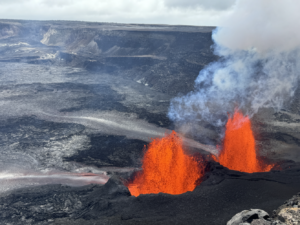
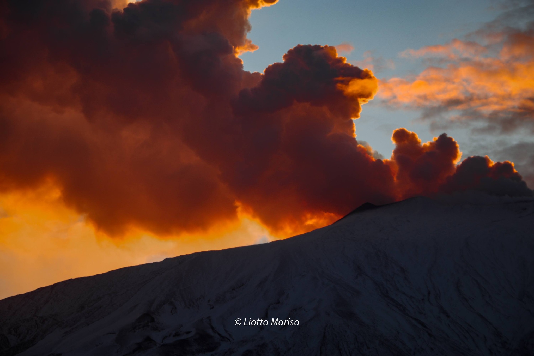
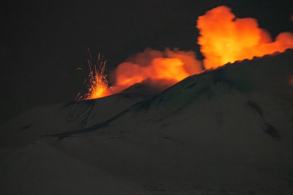
Etna Activity Update. December 26, 2025, 10:32 (09:32 UTC)
The National Institute of Geophysics and Volcanology, Observatorio Etneo, reports that intense and continuous Strombolian activity is currently underway in the Northeast Crater, with ejections of incandescent material occasionally falling back onto the cone’s flank, and the emission of moderate amounts of volcanic ash. The eruptive cloud is being carried by the wind to the northeast, and light ashfall has been reported in Piano Provenzana and Taormina. Sporadic Strombolian explosions also occurred overnight in the Bocca Nuova Crater, particularly from vent BN-2, with ejections of incandescent material reaching several tens of meters above the crater rim.
The average amplitude of volcanic tremor remains high, with a slight upward trend that began after midnight this evening. The center of gravity of the volcanic tremor sources remains in the Northeast Crater area, at an altitude of approximately 3,000 m. Infrasound events continue to occur at a very high frequency; average amplitudes are increasing, although no significant variation in maximum amplitudes has been observed. These events remain primarily localized in the Northeast Crater and, to a lesser extent, in the Bocca Nuova. The infrasound tremor episode reported in the previous press release ended yesterday at approximately 22:30 UTC, and another episode was observed today between 02:10 UTC and approximately 02:35 UTC. No further observations have been made since, although infrasound activity is virtually continuous.
Signals from the ground deformation monitoring network show that the trends that began on December 24th are continuing. In particular, the upward trend recorded by the DRUV inclinometer is holding steady. At 09:00 UTC, the overall increase reached nearly 100 nano-deformations.
The same trend continues at the ECP inclinometer in the summit area, where the overall variation reached nearly 2 microradians. A small transient variation (-5 nano-deformations and 0.15 microradians) was observed on both signals between 21:00 UTC and 23:30 UTC on December 25. No significant variation was observed on the GNSS network signals.
Further updates will be provided soon.
Source : INGV.
Photos : Marisa Liotta , Matteo Pagano .
Italy , Stromboli :
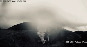
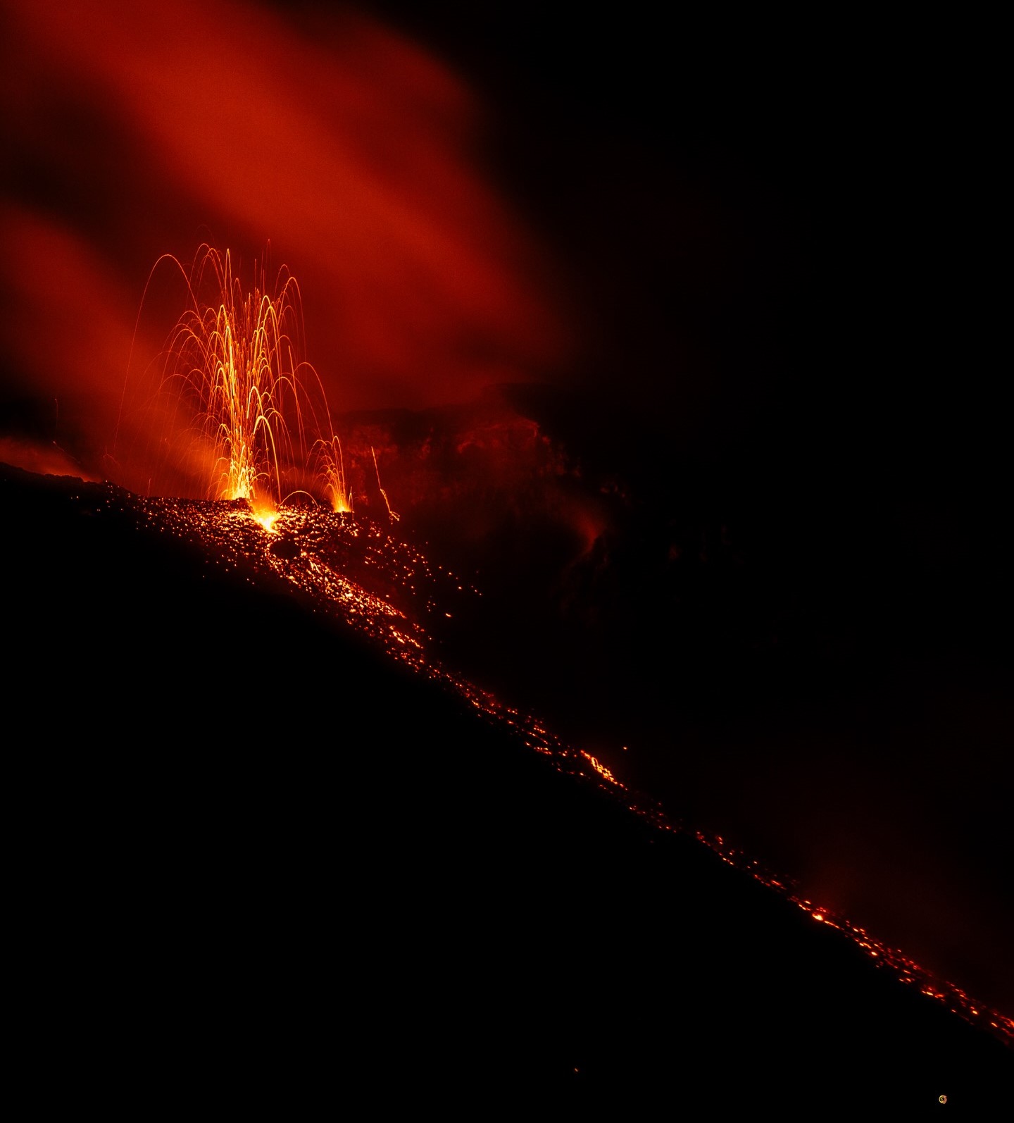
Stromboli Activity Update, December 26, 2025, 4:41 PM (3:41 PM UTC)
The National Institute of Geophysics and Volcanology, Etna Observatory, reports an ongoing lava flow.
Since this morning, images from surveillance cameras have shown a small lava flow erupting from the North Crater area onto the upper part of the Sciara del Fuoco. This flow, several tens of meters long, remained stationary for several hours. Meanwhile, normal Strombolian activity continues from various vents in the main areas of the crater.
From a seismic perspective, the average amplitude of volcanic tremors remained at normal levels. No significant changes were reported in the frequency and amplitude of explosion earthquakes.
Analysis of ground deformation signals revealed no significant changes in the tiltmeter and high-frequency GNSS network series.
Further updates will be provided shortly.
Source : INGV.
Photo : Stromboli stati d’animo / Sebastiano Cannavo
Iceland , Reykjanes Peninsula :
Increased Likelihood of an Eruption is ongoing on the Sundhnúkur Crater Row. Updated 23 December 2025
Key points
Magma accumulation continues at a slow but steady rate
As long as magma continues to accumulate, a new eruption must be expected
Uncertainty regarding the timing of the next eruption is greater when magma accumulation is slow
The hazard assessment remains unchanged until 6th of January unless activity changes
Adverse weather conditions in the coming days are likely to affect the sensitivity of monitoring instruments
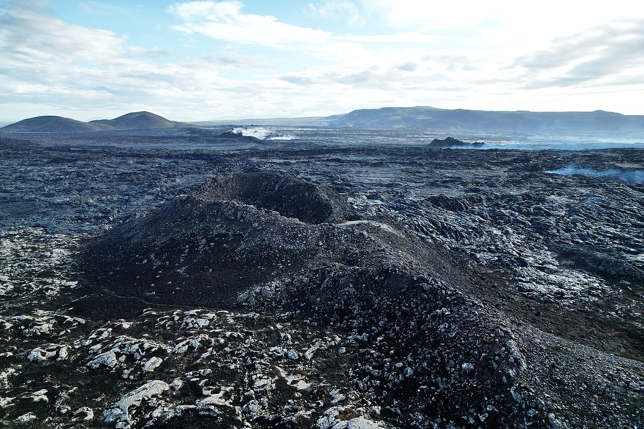
Magma accumulation slow but steady
Magma accumulation beneath Svartsengi remains slow but steady, comparable to recent weeks. As long as magma accumulation continues, the likelihood of a magma intrusion and volcanic eruption remains elevated; however, uncertainty regarding the timing of the next eruption increases when magma accumulation is slow. Given the current rate of accumulation, the uncertainty in timing spans several months.
Measurements and modelling indicate that since March 2024, the volume of magma required to trigger a magma intrusion or eruption has increased. The amount of magma that has accumulated beneath Svartsengi between eruptions since that time has ranged between 17 and 23 million cubic metres. Since the last eruption in July, just over 18 million cubic metres of magma has accumulated beneath Svartsengi.
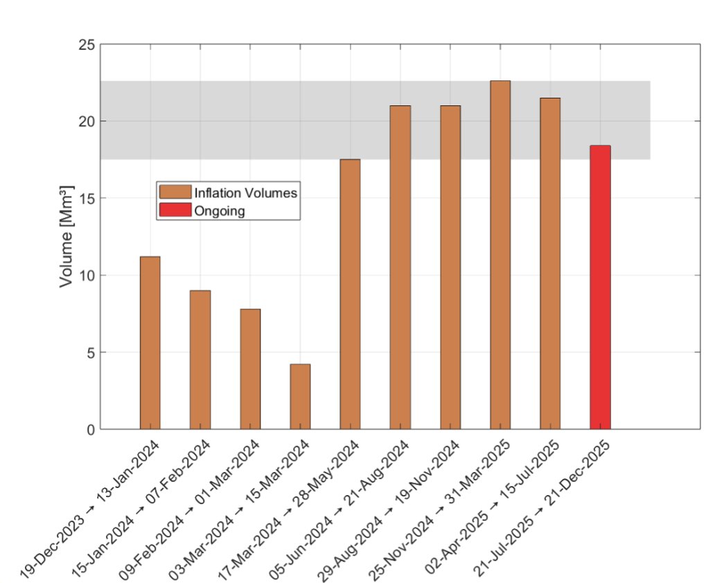
Results of model calculations showing the total volume for each magma accumulation period at Svartsengi since December 2023. The orange bars show the total volume accumulated between magma intrusions or eruptions. The red bar represents the volume accumulated since the July eruption to the present day. The grey shaded area indicates the range of inflation volumes required to accumulate beneath Svartsengi before triggering the next event.
Seismic activity remains low
Low seismic activity continues to be recorded in the Sundhnúkur area. Only five earthquakes have been detected over the past two weeks, the largest with a magnitude of 1.9, located between Þorbjörn and Hagafell on December 17th.
Source : IMO.
Photos : Steinninn , IMO.
Indonesia , Ibu :
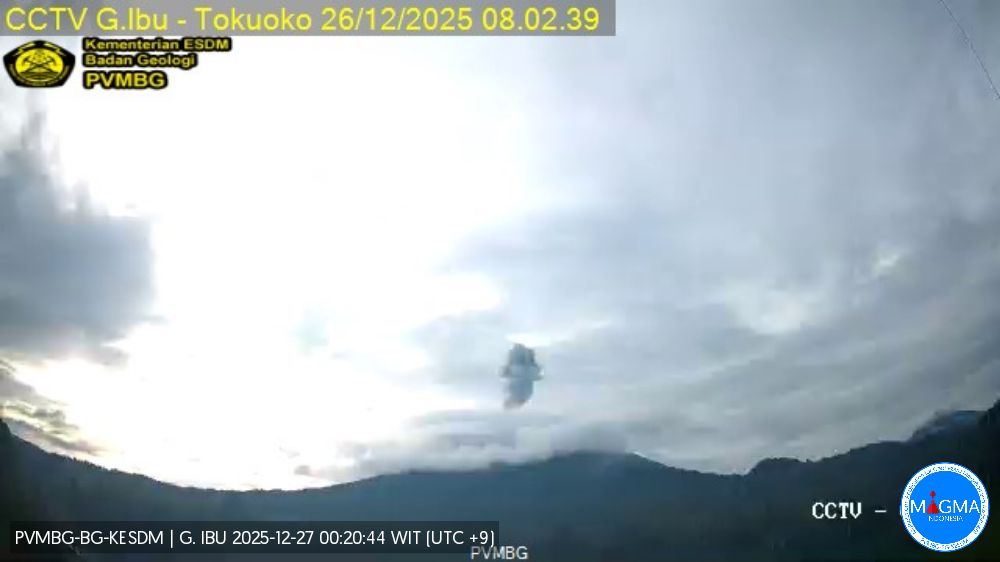
Mount Ibu experienced an eruption on Friday, December 26, 2025 at 3:27 PM (Jakarta local time). An ash column was observed approximately 900 meters above the summit (at an altitude of about 4,576 meters). This ash column, white to gray in color, was highly intense and drifted northeast. The eruption was recorded by a seismograph with a maximum amplitude of 22 mm and a duration of 108 seconds.
Seismic Observations
94 eruption earthquakes with amplitudes between 15 and 28 mm and durations of 37 to 78 seconds.
1 emission earthquake with an amplitude of 6 mm and a duration of 51 seconds.
5 harmonic tremors with amplitudes between 3 and 11 mm and a duration of 17 to 29 seconds.
117 low-frequency earthquakes with amplitudes between 2 and 11 mm and a duration of 17 to 29 seconds.
164 shallow volcanic earthquakes with amplitudes between 2 and 8 mm and a duration of 7 to 21 seconds.
2 deep volcanic earthquakes with amplitudes between 4 and 10 mm and a duration of 11 to 17 seconds.
Two local tectonic earthquakes with magnitudes between 6 and 15 mm and durations of 25 to 32 seconds.
Eight distant tectonic earthquakes with magnitudes between 3 and 28 mm and durations of 46 to 128 seconds.
Recommendations
1. Residents living around Mount Ibu and visitors/tourists are advised to refrain from all activities within a 2 km radius and a 3.5 km sector in the direction of the crater opening, in the northern part of the active Mount Ibu crater.
2. In case of ashfall, people engaging in outdoor activities are advised to wear a mask covering their nose, mouth, and eyes, as well as protective eyewear.
Source et photo : PVMBG.
Colombia , Chiles / Cerro Negro :
San Juan de Pasto, December 23, 2025, 4:25 PM
Regarding the monitoring of activity at the Chiles-Cerro Negro Volcanic Complex (CVCCN), the Colombian Geological Survey (SGC), an agency under the Ministry of Mines and Energy, reports the following:
During the period from December 16 to 22, 2025, the main variations in monitored parameters compared to the previous week were as follows:
● A slight decrease in frequency and a slight increase in released seismic energy were recorded. Seismicity related to rock fracturing within the volcanic edifice remains predominant, with some earthquakes associated with fluid dynamics.
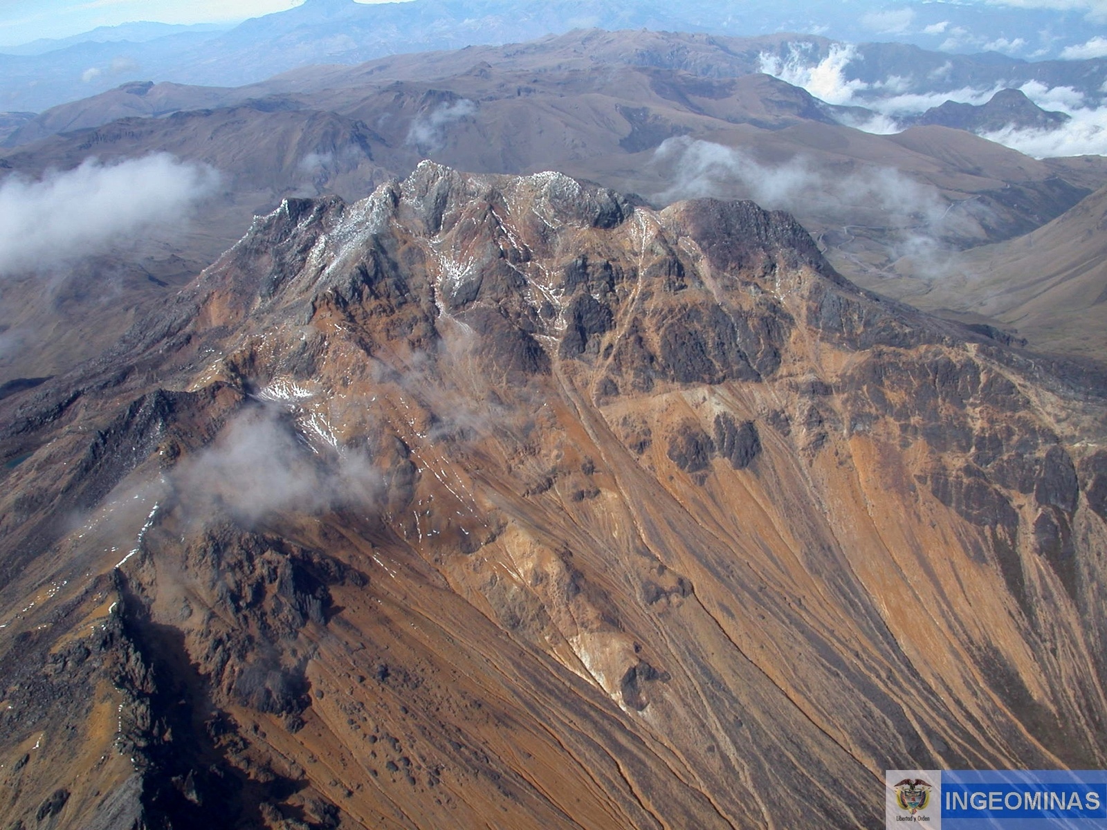
● Seismicity related to rock fracturing was concentrated southwest of Chiles Volcano, within a 3 km radius, at depths between 2 and 5 km. The following earthquakes were recorded: magnitudes 3.2 and 3.0, on December 19 at 9:22 PM; and the one on December 21 at 5:00 AM. None of these earthquakes were felt.
● Data from satellite sensors related to volcanic deformation, GNSS stations, and tiltmeters continue to show variations in the volcanic zone.
Based on the assessment and correlation of monitored parameters, the Geological Survey of Colombia (SGC) recommends closely monitoring their evolution through weekly bulletins and other information published through its official channels, as well as following instructions from local and departmental authorities and the National Unit for Disaster Risk Management (UNGRD).
Volcanic activity remains at the yellow alert level: Active volcano with changes in the reference behavior of monitored parameters and other manifestations.
Source et photo : SGC.