October 30 , 2025.
New Zélande , White Island :
Volcanic Activity Bulletin
Possible Whakaari/White Island eruption. Volcanic Alert Level has been increased to level 3 and Aviation Colour Code increased to Orange . Published: Thu Oct 30 2025 2:30 PM
Volcanic Alert Level is raised to 3
Aviation Colour Code is raised to Orange
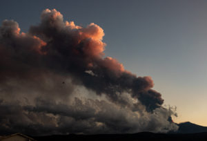
Based on webcam observations an eruption has possibly occurred at around 12:30 pm today. The Volcanic Alert Level increased to level 3 and the Aviation Colour Code raised to Orange.
Observations from the GeoNet cameras in the Bay of Plenty showed that a possible small-low energy eruption occurred at around 12:30 pm. Our colleagues at MetService have not detected volcanic ash in the observed plumes using satellite imagery. The event seems to have lasted for a few minutes and is now over.

VAL 3 will remain for at least 48 hours and will be reassessed by our Volcano Monitoring Group. Any significant changes in activity during that period will be communicated via VAB.
Earth Sciences NZ Volcano Monitoring Group and National Geohazards Monitoring Centre will continue to closely monitor Whakaari/White Island for any changes in activity. Without sensors on the Island, our monitoring continues to rely on remote cameras, satellite imagery, and periodic observation and gas flights to monitor Whakaari/White Island. We will provide further updates when information becomes available.
Source : Agnes Mazot / Duty Volcanologist
Photo : Archive Geonet.
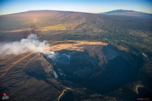
Iceland , Bárðabunga :
Today at 4:46 pm an earthquake of M5.4 was detected within the Bárðarbunga caldera followed by a few aftershocks. No felt reports have yet been received by IMO. Last time an event of this magnitude was on July 27th (5.2) this year and on February 22nd (5,2). In january this year a short but strong seismic swarm was detected in Bárðarbunga of wich the largest event was of M4.9.
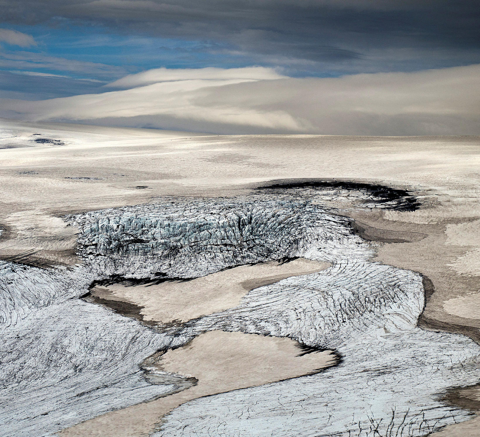
At 00:42 on October 29th an earthquake of magnitude 3.2 was recorded in Mýrdalsjökull. Earthquakes of this magnitude are not uncommon in Mýrdalsjökull, and a seismic swarm was recorded there on october 20th with the largest earthquake measured at 4.2 in magnitude. A few aftershocks have been recorded.
Source : IMO.
Photo : Mýrdalsjökull , mbl.is/RAX
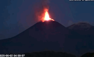
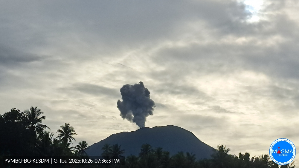
Indonesia , Ibu :
Mount Ibu erupted on Wednesday, October 29, 2025, at 11:57 PM WIT. An ash column was observed approximately 600 meters above the summit (at an altitude of about 1,925 meters). This thick, gray ash column drifted eastward. The eruption was recorded by a seismograph with a maximum amplitude of 28 mm and a duration of 62 seconds.
VOLCANO OBSERVATORY NOTICE FOR AVIATION – VONA
Issued : October 29 , 2025
Volcano : Ibu (268030)
Current Aviation Colour Code : ORANGE
Previous Aviation Colour Code : orange
Source : Ibu Volcano Observatory
Notice Number : 2025IBU1105
Volcano Location : N 01 deg 29 min 17 sec E 127 deg 37 min 48 sec
Area : North Maluku, Indonesia
Summit Elevation : 4240 FT (1325 M)
Volcanic Activity Summary :
Eruption with volcanic ash cloud at 14h57 UTC (23h57 local).
Volcanic Cloud Height :
Best estimate of ash-cloud top is around 6160 FT (1925 M) above sea level or 1920 FT (600 M) above summit. May be higher than what can be observed clearly. Source of height data: ground observer.
Other Volcanic Cloud Information :
Ash cloud moving to east. Volcanic ash is observed to be gray. The intensity of volcanic ash is observed to be thick.
Remarks :
Eruption recorded on seismogram with maximum amplitude 28 mm and maximum duration 62 second.
Source et photo : Magma Indonésie .
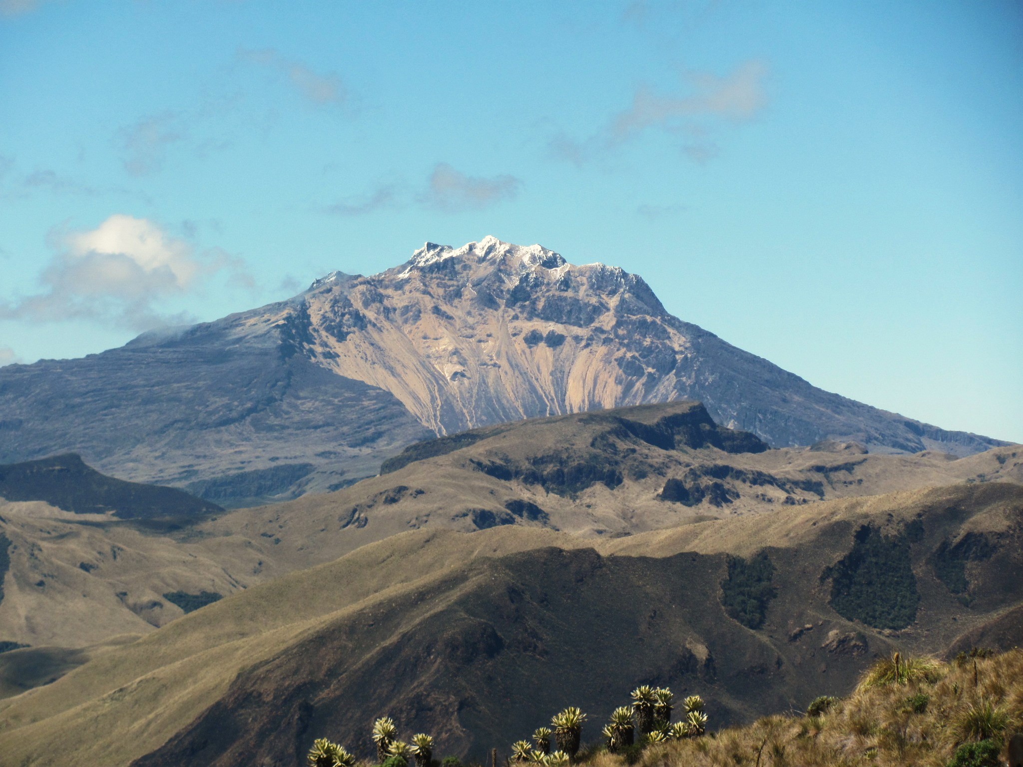
Colombia , Chiles / Cerro Negro :
San Juan de Pasto, October 28, 2025, 5:15 PM
Regarding the monitoring of activity at the Chiles-Cerro Negro Volcanic Complex (CVCCN), the Colombian Geological Survey (SGC), an agency under the Ministry of Mines and Energy, reports the following:
During the period from October 21 to 27, 2025, the main variations in monitored parameters compared to the previous week were as follows:
• A significant increase in the number of earthquakes was recorded. However, the seismic energy released was lower. This is explained by the fact that, during the week of October 14 to 20, 2025, the most powerful earthquake of the year (magnitude 3.7) was recorded, while the largest earthquake of this period was of magnitude 2.5.
• Seismicity associated with rock fracturing processes within the volcanic edifice continues to predominate, followed by fluid dynamics events and hybrid earthquakes. Earthquakes were primarily located beneath the summit of Chiles Volcano, within a 2 km radius. Although their depth reached 6 km at this source, most earthquakes were concentrated between 3 and 4 km. Other earthquakes were located within the CVCCN’s area of influence, up to 5 km from the summit of Chiles Volcano (4,700 m altitude).
Analysis of data from satellite sensors, GNSS stations, and tiltmeters continues to reveal variations in the volcanic zone. These variations are possibly linked to changes in seismic activity.
Based on the assessment and correlation of monitored parameters, the Colombian Geological Survey (SGC) recommends closely monitoring the evolving situation by referring to weekly bulletins and other information published through its official channels, as well as instructions from local and departmental authorities and the National Disaster Risk Management Unit (UNGRD).
Volcanic activity remains at the yellow alert level: active volcano with changes in the baseline behavior of monitored parameters and other manifestations.
Source et photo : SGC.
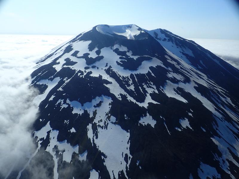
Alaska , Korovin :
AVO/USGS Volcanic Activity Notice
Current Volcano Alert Level: ADVISORY
Previous Volcano Alert Level: NORMAL
Current Aviation Color Code: YELLOW
Previous Aviation Color Code: GREEN
Issued: Wednesday, October 29, 2025, 10:22 PM AKDT
Source: Alaska Volcano Observatory
Notice Number: 2025/A656
Location: N 52 deg 19 min W 174 deg 8 min
Elevation: 5030 ft (1533 m)
Area: Aleutians
Volcanic Activity Summary:
A small explosion from Korovin Volcano was detected in seismic and infrasound data at 9:27 pm AKDT this evening, October 29, 2025 (5:27 UTC October 30, 2025). The Aviation Color Code and Alert Level are being raised to YELLOW/ADVISORY. Brief explosive events at Korovin Volcano can occur without significant precursory unrest. Fallout of ash is unlikely to extend much beyond the upper flanks of the volcano. Possible ash clouds generated by such events are expected to be small and dissipate quickly.
Remarks:
The Atka volcanic complex forms the northern part of Atka Island, located about 16 km north of the community of Atka and 1,761 km southwest of Anchorage. The Atka volcanic complex includes a possible older caldera and several younger vents, including Korovin Volcano, Mount Kliuchef, and Sarichef Volcano. Korovin Volcano, a 1553-m-high (5030 ft) stratovolcano, has been the site of most historical volcanic activity, and has a small, roiling crater lake that occasionally produces energetic steam emissions. Korovin has erupted several times in the past 200 years, including 1973, 1987, and 1998, and has likely had small ash emissions as recently as 2005. Typical recent Korovin eruptions produce minor amounts of ash and occasional but small lava flows. Reports of the height of the ash plume produced by the 1998 eruption ranged as high as 10,600 m (35,000 feet) above sea level. Mount Kliuchef is composed of a series of five vents aligned northeast–southwest. The two main summit vents of Kliuchef appear relatively young and the easternmost was probably the source of an 1812 eruption that is sometimes attributed to Sarichef.
Source : Ovsicori.
Photo : Kelly, Peter