September 13 , 2025 .
Alaska , Katmai / Omok :
ALASKA VOLCANO OBSERVATORY INFORMATION STATEMENT , U.S. Geological Survey
Thursday, September 11, 2025, 3:56 PM AKDT (Thursday, September 11, 2025, 23:56 UTC)
58°16’44 » N 154°57’12 » W,
Summit Elevation 6716 ft (2047 m)
Current Volcano Alert Level: NORMAL
Current Aviation Color Code: GREEN
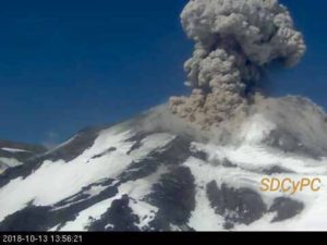
Strong northwesterly winds in the vicinity of Katmai and the Valley of Ten Thousand Smokes have picked up loose volcanic ash erupted during the 1912 Novarupta-Katmai eruption and are carrying it to the southeast. The National Weather Service has issued a SIGMET for this low-level event and suggests that the maximum cloud height is 4,000 ft (1.2 km) above sea level.
This phenomenon is not the result of recent volcanic activity and occurs during times of high winds and dry snow-free conditions in the Katmai area and other young volcanic areas of Alaska. No eruption is in progress. All of the volcanoes of the Katmai area (Griggs, Katmai, Novarupta, Mageik, Martin, Snowy and Trident) remain at Aviation Color Code GREEN and Alert Level NORMAL. Resuspended volcanic ash should be considered hazardous and could be damaging to aircraft and health.
AVO/USGS Volcanic Activity Notice
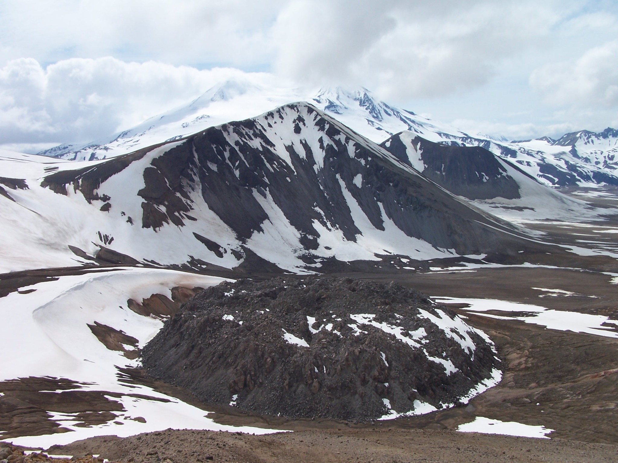
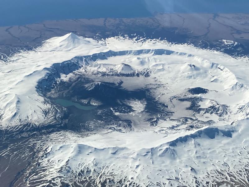
Volcano: Okmok (VNUM #311290)
Current Volcano Alert Level: NORMAL
Previous Volcano Alert Level: UNASSIGNED
Current Aviation Color Code: GREEN
Previous Aviation Color Code: UNASSIGNED
Issued: Wednesday, September 10, 2025, 12:23 PM AKDT
Volcanic Activity Summary:
Data flow from the seismic network at Okmok volcano has been restored to allow local monitoring. The Aviation Color Code is now GREEN and the Volcano Alert Level NORMAL.
Remarks:
Okmok volcano is a 6-mile-wide caldera that occupies most of the eastern end of Umnak Island, located 75 miles southwest of Unalaska/Dutch Harbor in the eastern Aleutian Islands. Okmok has had several eruptions in historic time typically consisting of ash emissions occasionally to over 30,000 feet ASL but generally much lower; lava flows crossed the caldera floor in 1945 and 1958. Prior to 2008, the volcano last erupted in February 1997 producing lava flows and intermittent ash emissions over the course of several months. The nearest settlement is Nikolski, population about 35, roughly 45 miles west of the volcano.
Source : AVO
Photos : P. Izbekov, AVO/UAF-GI. USGS, DGGS , Mees, Burke .
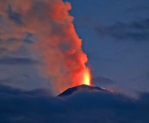
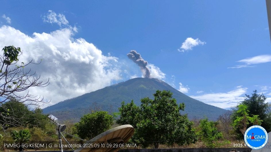
Indonesia , Ili Lewotolok :
An eruption of Mount Ili Lewotolok occurred on Wednesday, September 10, 2025, at 9:29 a.m. (local time). An ash column was observed about 800 m above the summit (or about 2,223 m above sea level). The ash column was white to gray in color, with greater intensity oriented toward the west.
Seismic Observations
33 eruption earthquakes with amplitudes ranging from 2.8 to 16.7 mm and lasting from 30 to 60 seconds.
43 emission earthquakes with amplitudes ranging from 3.6 to 4.7 mm and lasting from 27 to 41 seconds.
2 deep volcanic earthquakes with amplitudes ranging from 1.7 to 20.1 mm and lasting from 14 to 16 seconds.
Recommendations
At Activity Level III (Siaga):
[1] Residents living near Mount Ili Lewotolok, as well as visitors, mountaineers, and tourists, are advised to refrain from entering or carrying out activities within a 3 km radius of the activity center of Mount Ili Lewotolok. Be aware of the potential dangers of lava avalanches and pyroclastic flows originating from the southern, southeast, western, and northeast sectors of Mount Ili Lewotolok.
(2) The public is advised not to panic if they hear a rumbling noise coming from the crater of Mount Ili Lewotolok, as this noise is characteristic of volcanic activity during an eruption. This powerful rumbling noise can cause severe vibrations in several parts of the building, including windows and glass doors.
Source et photo : Magma Indonésie .
Colombia , Galeras :
San Juan de Pasto, September 9, 2025, 5:10 p.m.
Regarding the monitoring of the activity of the Galeras Volcano, the Colombian Geological Survey (SGC), an entity affiliated with the Ministry of Mines and Energy, reports that:
During the week of September 2 to 8, 2025, the main variations in the monitored parameters compared to the previous week were:
● A slight increase in the number of earthquakes was recorded, accompanied by a decrease in the seismic energy released. Seismicity related to rock fracture processes within the volcanic edifice continued to predominate.
● In general, earthquakes associated with rock fractures were located in two main sources.
One, close to the main crater, with depths less than 1 km (reference level around 4,200 m altitude) and magnitudes less than 1.0. The other source was located about 5 km northeast of the active cone, at depths between 8 and 11 km and with a maximum magnitude of 1.7.

● Gas emissions were recorded from the fumarole fields of El Paisita, to the north, Las Chavas, to the west of the active cone, and from the floor of the main crater, with low white columns and variable dispersion depending on the wind direction.
● Other volcanic monitoring parameters showed stability.
Based on the above, the SGC recommends closely monitoring developments through weekly bulletins and other information published through our official channels, as well as instructions from local and departmental authorities and the National Disaster Risk Management Unit (UNGRD).
Volcanic activity remains on alert. Yellow: Active volcano with changes in the baseline behavior of monitored parameters and other manifestations.
Source et photo : SGC
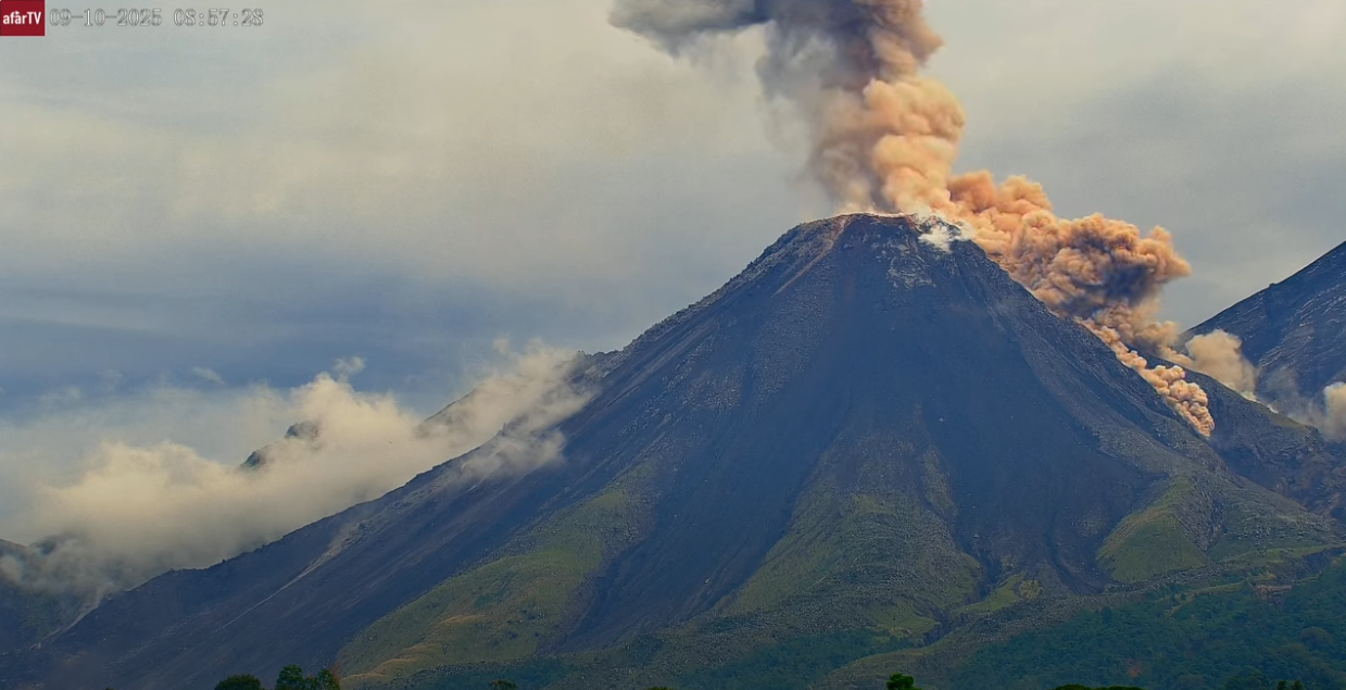
Guatemala , Santiaguito :
Weather: Clear
Wind: Northeast
Precipitation: 83.6 mm
Activity
Constant degassing is observed above the Caliente dome, reaching an altitude of 400 meters and dispersing towards the west and southwest. Weak to moderate explosions have been recorded, with a column of gas and ash reaching up to 800 meters above the dome, dispersing towards the southwest. During the night and early morning, incandescence is observed on the dome and its western and southwest flanks, due to recurring avalanches that descend them. The possibility of the formation of pyroclastic density currents cannot be ruled out; therefore, the recommendations of special bulletin BESAN-063-2025 should be followed.
In the presence of rain within the volcanic perimeter, small lahars can be produced by the rivers on the southern flank (Nimá I Tambor, Cabello de Ángel, among others). It is therefore advisable to follow the recommendations of special bulletin BESAN-012-2025.
Source : Insivumeh
Photo : Santiaguito , Afar tv
Iceland , Vatnajökull :
Earthquake of magnitude 3.1 detected on Vatnajökull Glacier this morning
An earthquake measuring 3.1 occurred on Vatnajökull glacier just before 7 a.m. this morning. Its epicenter was located 12 kilometers east of Hamrin and it was measured at a depth of four to five kilometers.
According to Steinunn Helgadóttir, a natural hazard specialist at the Icelandic Meteorological Office, this was an isolated event.
„It was just a single earthquake, and no aftershock activity has been detected so far, but we will continue to monitor the area,“ she said.
Helgadóttir added that in December last year, an earthquake of similar magnitude was measured in the same area.
Source : Iceland monitor Mbl is
Photo : mbl.is/Árni Sæberg