September 4 , 2025.
Hawaii , Kilauea :
HAWAIIAN VOLCANO OBSERVATORY DAILY UPDATE , U.S. Geological Survey
Wednesday, September 3, 2025, 8:26 AM HST (Wednesday, September 3, 2025, 18:26 UTC)
19°25’16 » N 155°17’13 » W,
Summit Elevation 4091 ft (1247 m)
Current Volcano Alert Level: WATCH
Current Aviation Color Code: ORANGE
Activity Summary:
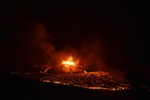
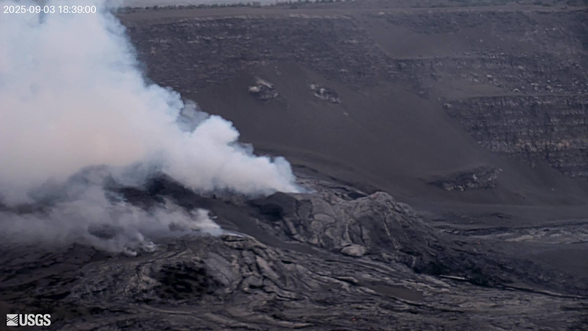
Episode 32 of the ongoing Halemaʻumaʻu eruption ended abruptly at 8:01 p.m. HST on September 2 after 13.4 hours of continuous fountaining. Lava fountains at the north vent reached up to 500 ft (150 m) during this episode. The north vent stopped erupting at 7:49 p.m. HST while the south and intermediate vents stopped erupting at 8:01 p.m. HST. Fountains from the south and intermediate vents remained smaller, less than 80 feet (25 meters) for most of the eruption, but the intermediate vent fountain height peaked at 100-160 ft (30-50 m) during the eruption.
Summit Observations:
Volcanic gas emissions have greatly decreased. Lava flows from this episode on the floor of Halemaʻumaʻu within the southern part of Kaluapele (Kīlauea caldera) may continue to exhibit slow movement or incandescence as they cool and solidify over the coming days. Approximately 12,500,000 cubic yards (9,600,000 cubic meters) of lava were erupted at an average of 250 cubic yards per second (>200 cubic meters per second) during the fountaining phase. Lava flows from this episode covered 40-50% of the floor of Halemaʻumaʻu within the southern part of Kaluapele (Kīlauea caldera).
The Uēkahuna tiltmeter (UWD) recorded about 25 microradians of deflationary tilt during this episode. The end of the eruption was coincident with a rapid change from deflation to inflation at the summit and a decrease in seismic tremor intensity. The Uēkahuna tiltmeter (UWD) has recorded just over 2 microradian of inflationary tilt since the episode ended.
Elevated degassing continues from the vent. Average sulfur dioxide (SO2) emission rates during inter-episode pauses are typically 1,200 to 1,500 t/d, though emission rates vary on short time scales in association with gas-pistoning.
Source et photo : HVO .
Japan , Shinmoedake :
The Japan Meteorological Agency (JMA) reported that activity continued at Shinmoedake (Shinmoe peak, a stratovolcano of the Kirishimayama volcano group) during 26 August-2 September. Fumarolic plumes rose as high as 100 m above the fissures on the W flank. The number of volcanic earthquakes located beneath Shinmoedake, first detected in late October 2024, continued to be frequent; a short-duration volcanic tremor was detected around 08h00 on 31 August. At 04h53 on 28 August an ash plume rose 5.5 km above the crater rim and drifted S. Significant ashfall reported in areas downwind, including in Kirishima City (21 km SW) and Miyakonojo City (30 km SE), was enough to obscure the lines on some roads.
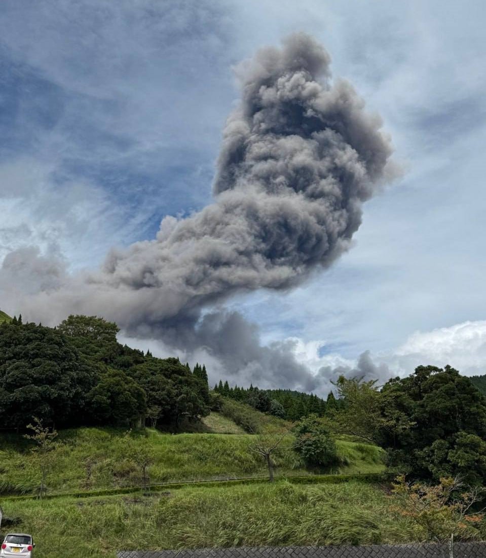
Ashfall was also reported in Soo City (32 km SSE) and Kanoya City (60 km S). Ash plumes were continuous through the morning and early afternoon; the plumes rose 4.5 km above the crater rim and drifted S at 05h23, then rose to 3.7 km at 09h00 before stopping at 14h50. A period of ash emissions was recorded from 18h23 on 28 August to 08h30 on 29 August, with ash plumes rising 700-1,300 m above the crater rim and occasionally drifting N. Continuous ash plumes rose as high as 600 m above the crater rim and drifted N during 05h42-08h30 on 30 August. At 13h23 on 30 August an ash plume rose 300 m above the crater rim ana drifted NW.
The Alert Level remained at 3 (on a 5-level scale) and the public was warned to exercise caution within 3 km from Shinmoedake Crater.
Sources: Japan Meteorological Agency (JMA) , GVP.
Photo : via Alex Terry / FB .
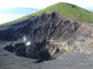
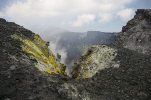
Kamchatka , Karymsky :
The Kamchatkan Volcanic Eruption Response Team (KVERT) reported that moderate activity continued at Karymsky during 21-28 August. Satellite images showed a weak thermal anomaly over the volcano on 22 and 26 August and ash plumes rising around 1.5 km above the summit were drifting 100 km E during 26-27 August; the volcano was quiet or obscured by clouds on the other days of the week. The Aviation Color Code remained at Orange (the third level on a four-color scale). Dates and times are provided in Coordinated Universal Time (UTC); specific events are indicated in local time where specified.
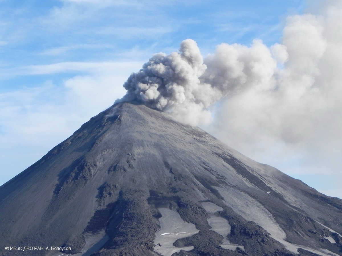
Karymsky, the most active volcano of Kamchatka’s eastern volcanic zone, is a symmetrical stratovolcano constructed within a 5-km-wide caldera that formed during the early Holocene. The caldera cuts the south side of the Pleistocene Dvor volcano and is located outside the north margin of the large mid-Pleistocene Polovinka caldera, which contains the smaller Akademia Nauk and Odnoboky calderas. Most seismicity preceding Karymsky eruptions originated beneath Akademia Nauk caldera, located immediately south. The caldera enclosing Karymsky formed about 7600-7700 radiocarbon years ago; construction of the stratovolcano began about 2000 years later. The latest eruptive period began about 500 years ago, following a 2300-year quiescence. Much of the cone is mantled by lava flows less than 200 years old. Historical eruptions have been vulcanian or vulcanian-strombolian with moderate explosive activity and occasional lava flows from the summit crater.
Sources: Kamchatkan Volcanic Eruption Response Team (KVERT) , GVP.
Photo : A. Belousov, IVS FEB RAS
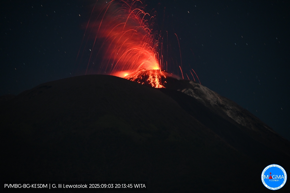
Indonesia , Ili Lewotolok :
An eruption of Mount Ili Lewotolok occurred on Wednesday, September 3, 2025, at 8:13 PM WITA. An ash column was observed about 500 m above the summit (about 1,923 m above sea level). The ash column was white to gray in color, with a strong intensity directed toward the west. This eruption was recorded by seismograph with a maximum amplitude of 22.4 mm and a duration of 55 seconds.
Seismic Observations
42 eruption earthquakes with amplitudes between 8.4 and 32.2 mm and durations of 36 to 64 seconds.
48 emission earthquakes with amplitudes between 1.6 and 8.7 mm and durations of 25 to 48 seconds.
4 non-harmonic tremors with amplitudes between 2.1 and 4.6 mm and durations of 114 to 141 seconds.
Recommendations
At activity level III (SIAGA):
[1] Residents living near Mount Ili Lewotolok, as well as visitors, mountaineers, and tourists, are advised to refrain from entering or engaging in any activity within a 3 km radius of the activity center of Mount Ili Lewotolok. Be aware of the potential dangers of lava avalanches and pyroclastic flows emanating from the south, southeast, west, and northeast sectors of Mount Ili Lewotolok.
(2) The public is advised not to panic if they hear a rumbling noise coming from the crater of Mount Ili Lewotolok, as this noise is characteristic of volcanic activity during an eruption. This powerful rumbling noise can cause severe vibrations in several parts of the building, particularly windows and glass doors.
Source et photo : Magma Indonésie .
Colombia , Chiles / Cerro Negro :
San Juan de Pasto, September 2, 2025, 6:55 p.m.
Regarding the monitoring of the activity of the Chiles-Cerro Negro Volcanic Complex (CVCCN), the Colombian Geological Survey (SGC), an entity affiliated with the Ministry of Mines and Energy,
reports that:
From August 26 to September 1, 2025, the main variations in the monitored parameters compared to the previous week were:
● A notable increase in the number and released seismic energy was observed.
Seismicity associated with fractures continued to predominate, and a significant amount of seismicity associated with fluid dynamics was also observed.
● The earthquakes were located mainly beneath the summit and in the collapse zone of Chiles Volcano, at distances of less than 1 km, at depths between 2 and 4 km from its summit (approximately 4,700 m above sea level), and with a maximum magnitude of 2.2.
● Data recorded by satellite sensors and ground-based measuring stations continue to indicate changes related to inflationary processes in the volcanic area.
Based on the evaluation and correlation of monitored parameters, the SGC recommends closely monitoring their development through weekly bulletins and other information published through our official channels, as well as instructions from local and departmental authorities and the National Disaster Risk Management Unit (UNGRD).
Volcanic activity remains on alert. Yellow: Active volcano with changes in the baseline behavior of monitored parameters and other manifestations.
Source et photo : SGC.