May 19 , 2025.
Indonesia , Lewotobi Laki-laki :
SPECIAL REPORT ON THE CHANGE IN LEWOTOBI’S ACTIVITY LEVEL FROM LEVEL III (SIAGA) TO LEVEL IV (AWAS) ON MAY 18, 2025
Lewotobi Laki-laki volcano, in East Nusa Tenggara, again exhibited increased activity with several eruptions occurring today, from 11:29 WITA to 13:47 WITA. The eruption produced an eruptive column reaching 3,000 to 5,500 meters above the mountain’s summit, or approximately 7,000 meters above sea level. The observed eruptive column was dark gray in color and directed toward several points around the mountain’s slopes. The eruption was accompanied by a moderate to loud rumble, heard from the nearest monitoring station. Visual data show very significant changes, and instrumental observation results show changes in the amplitude of the eruption’s tremor, which is increasing, so the potential for a larger eruption than before may occur. As of the writing of this report, eruptive activity was still ongoing. Ash was reportedly emitted continuously in bursts, indicating unstable volcanic activity. Residents around the mountain are urged to remain vigilant and follow the instructions of authorities and volcano monitoring agencies.
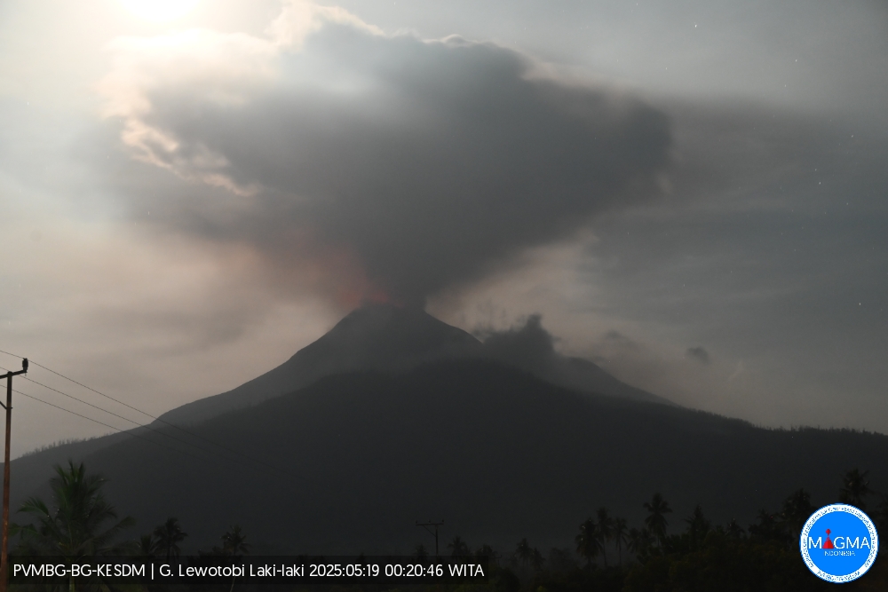
The results of visual and instrumental analysis show that the activity of the Lewotobi Laki-laki volcano is still relatively high. Therefore, the activity level of this volcano was raised from level III (SIAGA) to level IV (AWAS) at 8:00 p.m. WITA. The public and tourists are advised not to engage in any activities within a 6 km radius and within a 7 km west-northeast direction of the eruption center, and to remain calm and follow local government guidelines. The public is also urged not to readily believe information from unclear sources.
Furthermore, communities living near disaster-prone areas should be aware of the risk of lahar flooding during heavy rainfall, particularly in river basins originating at the summit of Mount Lewotobi Laki-laki, such as Dulipali, Nobo, Hokeng Jaya, and Nurabelen. Residents affected by ash rain are advised to wear masks or mouth and nose coverings to protect their respiratory tract. The local government should continue to coordinate with the Lewotobi Laki-laki Observation Post in Pululera Village and the Volcanology and Geological Disaster Mitigation Center (PVMBG), Geological Agency. The latest information on volcanic activity can be accessed via the official Magma Indonesia website and the Geological Agency’s official social media channels.
Source et photo : PVMBG
Hawaii , Kilauea :
Sunday, May 18, 2025, 9:47 AM HST (Sunday, May 18, 2025, 19:47 UTC)
19°25’16 » N 155°17’13 » W,
Summit Elevation 4091 ft (1247 m)
Current Volcano Alert Level: WATCH
Current Aviation Color Code: ORANGE
Activity Summary:
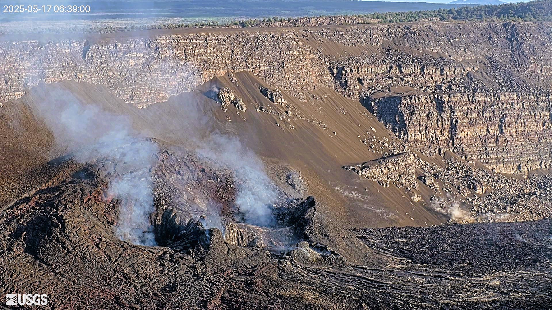
The Halema‘uma‘u eruption remains paused on May 18. Episode 23 is likely to begin in the next 3-6 days. Episode 22 ended at 3:29 p.m. HST on May 16.
Both the north and south vents were incandescent last night but overnight glow from the episode 22 lava flows was greatly diminished.
Kīlauea’s current eruption in Halemaʻumaʻu crater within Kaluapele (the summit caldera) began on December 23, 2024. There have now been 22 episodes separated by pauses in activity.
Summit Observations:
Episode 22 was preceded by small, sporadic gas-piston events that produced spatter fountains and short lava flows that began at 10:45 p.m. HST on May 15. Five more gas-piston overflows occurred in the early morning of May 16 (00:30; 1:00; 1:25; 1:54; 2:43 a.m. HST) until 4:40 a.m. when dome fountains overflowed the vent. By 5:13 sustained high fountaining began. Sustained fountains from the north vent peaked at 800-1000 feet (200-300 meters) high around 6:00 a.m. HST and began to oscillate in height around 328-492 feet (100-150 meters) after this time. Fountains fed multiple lava streams. Lava flows from this episode covered up to 40% of the floor of Halemaʻumaʻu within Kaluapele (Kīlauea caldera). The estimated volume of erupted lava is 3.8 million cubic meters (5 million cubic yards).
Orange glow was visible overnight from both vents, indicating that magma remains close to the surface within the conduits.
The tiltmeter at Uēkahuna (UWD) recorded 10 microradians of deflation during episode 22. Tilt rapidly switched to inflation at 3:29 p.m. HST on May 16. This morning, UWD has recorded approximately 4 microradians of inflationary tilt since the end of episode 22. Low level tremor continues along with a small number of shallow earthquakes.
Sulfur dioxide (SO2) emission rates this morning are expected to be similar to rates recorded during prior pauses, typically around 1,200 tonnes per day (t/d).
Summit eruption webcams:
The B2, KW, and F1 summit webcams are currently offline due to eruption impacts. Other HVO summit webcams are functioning and online.
Source et photo : HVO
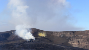
Ecuador , Sangay :
SANGAY VOLCANO DAILY STATUS REPORT, Sunday, May 18, 2025.
Information Geophysical Institute – EPN.
Surface Activity Level: High, Surface Trend: Descending
Internal Activity Level: Moderate, Internal Trend: No Change
Seismicity: From May 17, 2025, 11:00 a.m. to May 18, 2025, 11:00 a.m.:
Seismicity:
Below is the count of seismic events recorded at the reference station.
Explosion (EXP): 176
Rainfall/Lahars:
Since yesterday afternoon, no rain has been recorded in the volcano area. **Heavy rains could remobilize accumulated material, generating mud and debris flows that would cascade down the sides of the volcano and flow into adjacent rivers**.
Emission/Ash Column:
Yesterday afternoon, due to weather conditions in the region, no gas or ash emissions from the volcano were detected using surveillance cameras.
Similarly, the Washington VAAC agency has not released any reports of surface activity.
Observation:
From yesterday afternoon until the closing of this report, incandescence was recorded at the crater level using surveillance cameras; in addition, the volcano remained cloudy with no new developments.
Alert Level: Yellow
Source : IGEPN
Photo : Volcan Sangay / FB.
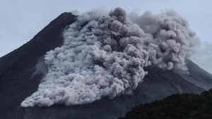
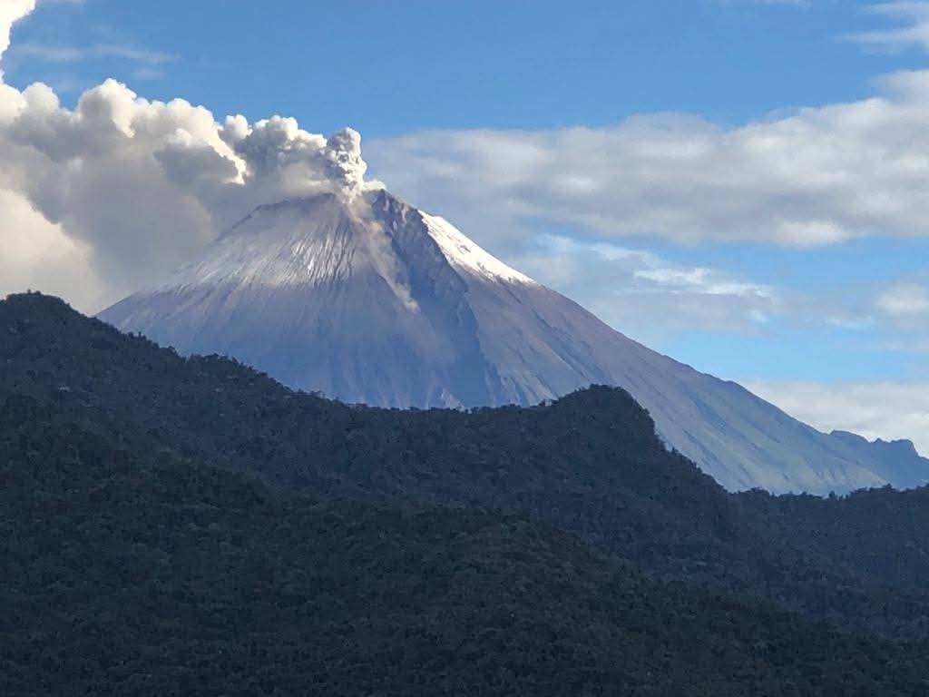
Guatemala , Fuego :
Weather Conditions: Clear.
Wind: Northeast.
Precipitation: 0.0 mm.
Activity:
At times, activity within the crater has been observed, with white and blue fumaroles dispersing to the west and southwest. At night, abundant incandescence is observed within the crater. Weak to moderate explosions have also been observed, ejecting ash that dispersed to the west and southwest. Some explosions generate rumbling sounds accompanied by shock waves and degassing noises.
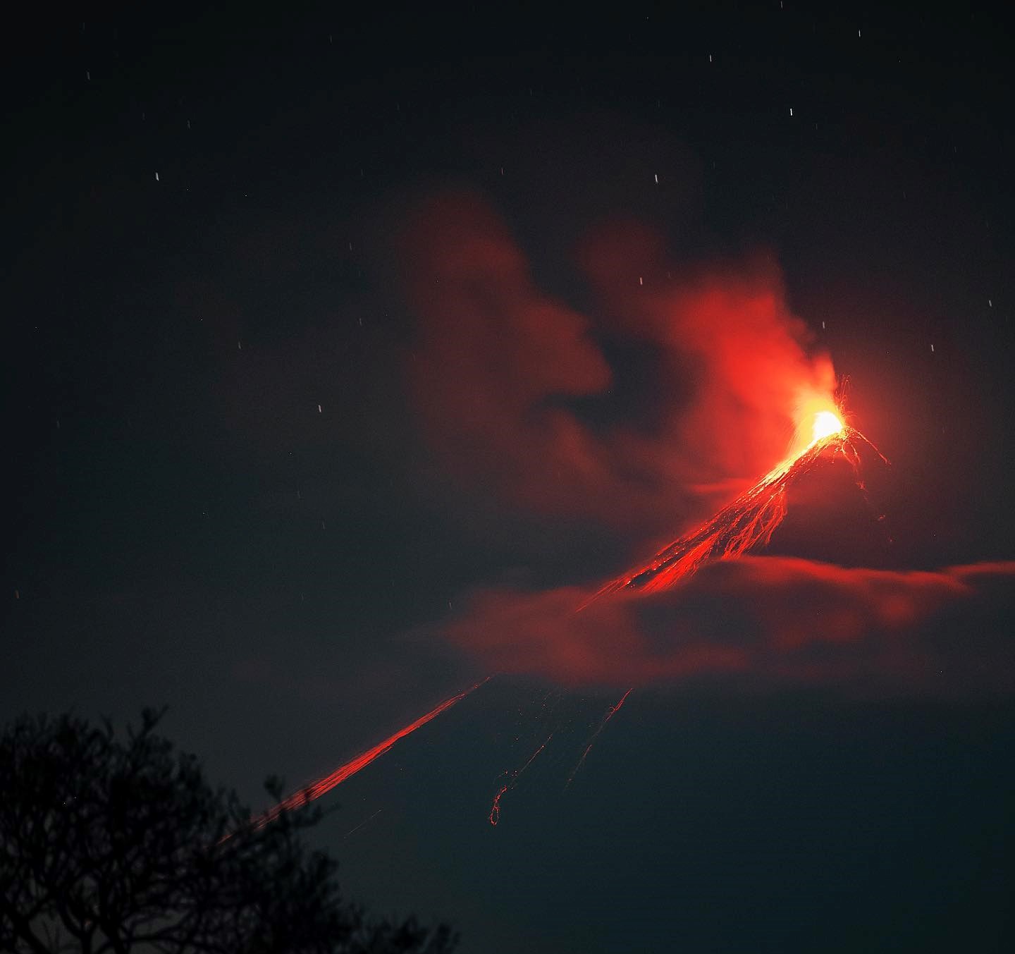
Constant avalanches are recorded on the west and southwest flanks towards the Ceniza and Seca ravines. Moderate explosions eject ballistic projections up to a distance of one kilometer around the crater. It is therefore dangerous to remain on the plateau as it is an area that ballistic projections can easily reach. Please note that atmospheric conditions cause strong winds, rain, and low temperatures on the volcanoes. In the afternoon and evening, rains can generate lahars, so caution should be exercised when driving vehicles through the rivers.
Source : Insivumeh .
Photo : Diego Rizzo
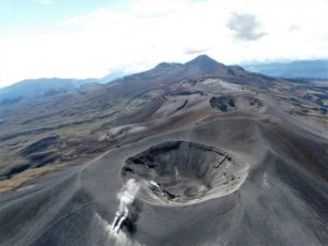
Peru , Sabancaya :
Analysis period: May 5, 2025 to May 11, 2025, Arequipa, May 12, 2025
Alert level: YELLOW
The Peruvian Geophysical Institute (IGP) reports that eruptive activity at the Sabancaya volcano remains at a low level. During this period, an average of 0 daily explosions was recorded, with only columns of ash and gas up to 1,000 m above the volcano’s summit. Therefore, the Volcanic Alert Level has been lowered to Yellow.
The IGP recorded and analyzed the occurrence of 25 volcanic earthquakes, associated with the circulation of magmatic fluids within the Sabancaya volcano, as well as earthquakes related to rock fracturing. No explosions were recorded during this period.

Columns of ash and gas were observed up to 1,000 m above the volcano’s summit. The predominant direction of these emissions was toward the east and southeast of the volcano over a distance of less than 10 km.
No significant deformation of the volcanic edifice was recorded.
No thermal anomalies were identified.
Moderate emissions (211 tons/day) of sulfur dioxide (SO2) were observed.
RECOMMENDATIONS
• Maintain the Yellow Volcanic Alert Level.
• Do not approach within a radius of 6 km of the crater.
Source : Cenvul
Photo : Benjamin Bernard