February 17 , 2025.
Indonesia , Ibu :
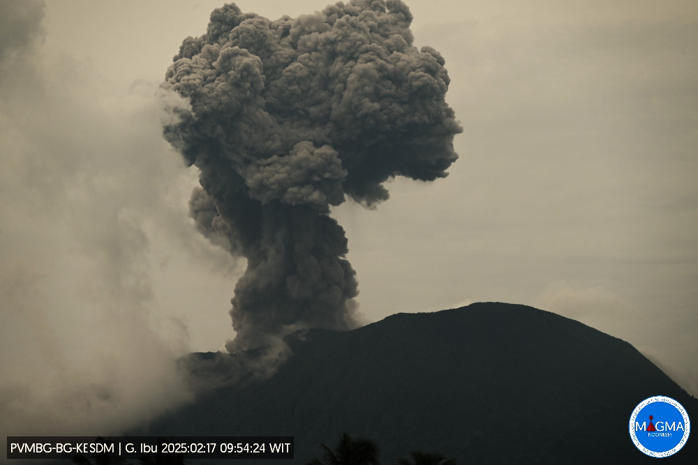
An eruption of Mount Ibu occurred on Monday, 17 February 2025, at 09:53 WIT with an observed ash column height of ± 800 m above the peak (± 2125 m above sea level). The ash column was observed to be grey in colour with a thick intensity, oriented towards the North-West. This eruption was recorded on a seismograph with a maximum amplitude of 28 mm and a duration of 79 seconds.
The volcano eruption continues, explosions at 10:11, 10:59, 11:23, 11:45 etc….
VOLCANO OBSERVATORY NOTICE FOR AVIATION – VONA
Issued : February 17 , 2025
Volcano : Ibu (268030)
Current Aviation Colour Code : ORANGE
Previous Aviation Colour Code : orange
Source : Ibu Volcano Observatory
Notice Number : 2025IBU327
Volcano Location : N 01 deg 29 min 17 sec E 127 deg 37 min 48 sec
Area : North Maluku, Indonesia
Summit Elevation : 4240 FT (1325 M)
Volcanic Activity Summary :
Eruption with volcanic ash cloud at 00h53 UTC (09h53 local).
Volcanic Cloud Height :
Best estimate of ash-cloud top is around 6800 FT (2125 M) above sea level or 2560 FT (800 M) above summit. May be higher than what can be observed clearly. Source of height data: ground observer.
Other Volcanic Cloud Information :
Ash cloud moving to northwest. Volcanic ash is observed to be gray. The intensity of volcanic ash is observed to be thick.
Remarks :
Eruption recorded on seismogram with maximum amplitude 28 mm and maximum duration 79 second.
Source et photo : Magma Indonésie .
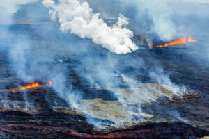
Hawaii , Kilauea :
The current eruption is marked by episodic fountaining not seen in any of the other Halemaʻumaʻu eruptions since 2020. Fountains and lava flows have erupted from two vents that we refer to as the north vent and south vent. Each previous fountaining episode lasted from a few hours to over a week and has been accompanied by strong deflation of the summit region. Pauses between the fountaining episodes have been marked by an immediate change from deflation to inflation as the magma chamber recharges and repressurizes.
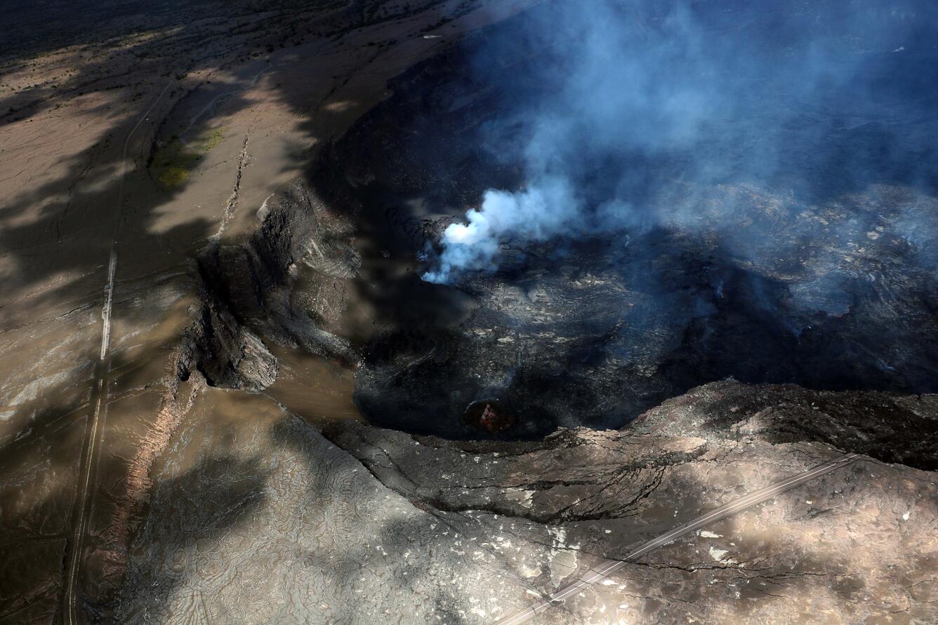
The north and south vents in Halema‘uma‘u were partially hidden in the shadows of clouds during the monitoring overflight at 12:30 p.m. HST today, February 12, but the plumes of volcanic gas emissions helped to illuminate their positions. The closed portion of Crater Rim Drive in Hawai‘i Volcanoes National Park is visible in the left part of the photograph, with brown tephra material from the recent eruption episodes blanketing the ground surface downwind of the vents. The portion of Crater Rim Drive that collapsed into the caldera during 2018 is visible in the lower right portion of the image.
Episode 9 lasted for 22 hours and 30 minutes. The rapid change from deflation to inflation at the same time the eruption paused on February 12 coupled with glow from the vents over the nights since episode 9 ended suggests another episode will take place. The rate of inflation since episode 9 ended suggests that a new episode is most likely to start in the next 1-4 days, between today, February 16, and Wednesday February 19, if the rate remains relatively consistent.
HVO continues to closely monitor Kīlauea and is in contact with Hawai‘i Volcanoes National Park and the Hawai‘i County Civil Defense Agency about eruptive hazards.
Source : HVO
Photo : USGS / P. Dotray
Ecuador , El Reventador .
DAILY STATE REPORT OF THE REVENTADOR VOLCANO , Sunday, February 16, 2025.
Information Geophysical Institute – EPN.
Surface Activity Level: High , Surface Trend: No Change
Internal Activity Level: Moderate , Internal Trend: No Change
From February 15, 2025, 11:00 a.m. to February 16, 2025, 11:00 a.m.:
Seismicity:
The count of seismic events recorded at the station is detailed below.
Explosion (EXP) 74
Long Period (LP) 23
Emission Tremor (TREMI) 3
Harmonic Tremor (TRARM) 1
Rainfall / Lahars:
The rains in the volcano area generated a small secondary mudflow on the southern flank of the volcano. Its occurrence does not imply an increase in the internal activity of the volcano.
Emission/ash column:
Since yesterday afternoon, several emissions of gas and ash have been recorded thanks to the network of surveillance cameras at heights between 700 and 1,100 meters above the crater level in the West and Southeast directions. In connection with this activity, the Washington-VAAC agency has published three emission reports with heights between 700 and 1,000 meters above the crater level in the West and Southeast directions.
Gas:
The Mounts satellite system reported 6.2 tons of SO2 measured at 13:41 TL on 02/15/2025.
Other monitoring parameter:
The MIROVA-LANDSAT satellite system recorded 1 thermal anomaly in the last 24 hours.
Observation:
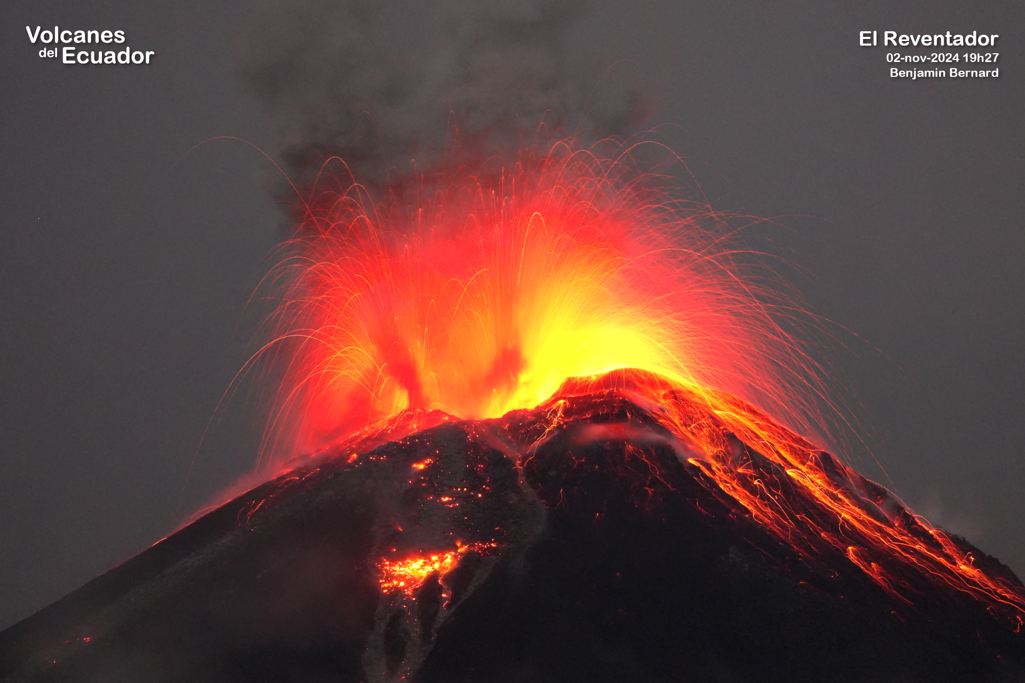
During the night and early morning, surveillance cameras recorded several episodes of incandescent material falling on the southeast flank of the volcano up to 1,000 meters below the crater level. At the time of writing, the volcano remains completely cloudy.
Niveau d’alerte – SGR : Orange
Source : IGEPN
Photo : Volcanesdelecuador (02-nov-2024 19h27, CC BY-NC Benjamin Bernard) .
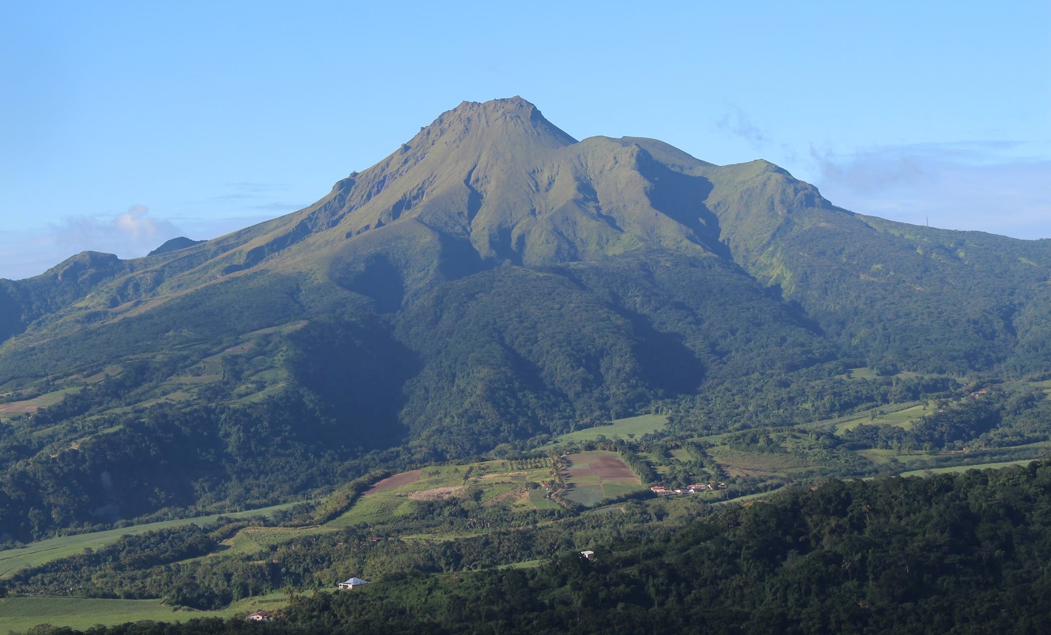
La Martinique Island , Mount Pelée :
Weekly report, Institut de physique du globe de Paris / Observatoire volcanologique et seismologique de Martinique
Saint-Pierre, February 14, 2025 at 3:00 p.m. local time (GMT-4)
Volcanic activity remains low this week with 1 earthquake of volcanic origin observed.
Between February 7, 2025 at 4:00 p.m. (UTC) and February 14, 2025 at 4:00 p.m. (UTC), the OVSM recorded 1 low-energy earthquake of the volcano-tectonic type. This earthquake was clearly identified as coming from one of the well-known seismically active zones at Mount Pelée, located between 1.0 and 1.4 km deep below the summit of the volcano. The superficial seismicity of the volcano-tectonic type is associated with micro-fracturing in the volcanic edifice in connection with the global reactivation of the volcano observed since the end of 2018.
This earthquake was not felt by the population.
The previous week, the OVSM had not recorded any earthquakes of volcanic origin. As of February 14, 2025 and during the last 4 weeks, the OVSM has therefore observed a total of 3 volcanic earthquakes, or an average of 0 to 1 earthquake per week.
During the volcanic reactivation phases of volcanoes similar to Mount Pelée, it is usual to observe seismic activity that varies in intensity and frequency.
For more details on observations and interpretations of volcanic activity over the longer term, refer to the OVSM monthly bulletins.
The alert level is currently YELLOW: vigilance.
Source : Direction de l’OVSM-IPG
Photo : OVSM IPGP
Guatemala , Santiaguito :
Weather conditions: Clear
Wind: North
Precipitation: 0.0 mm.
Activity:
A significant degassing is observed above the crater. Weak to moderate explosions are recorded, expelling columns of gas and ash that reach up to 900 meters high above the crater and disperse towards the South-East and South. According to numerical models, the wind direction is expected to change towards the South-West during the morning and will remain predominantly in this direction for the rest of the day.
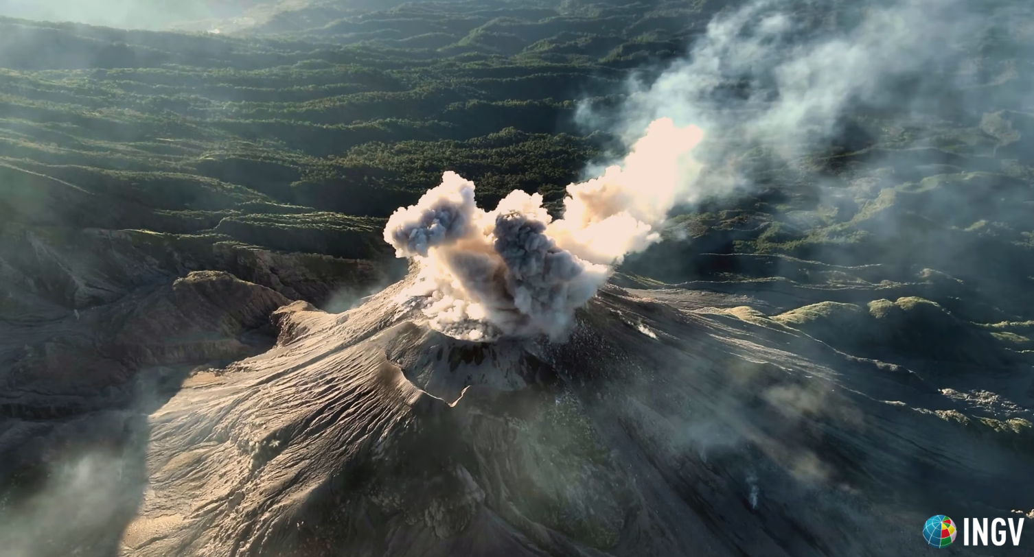
La nuit et tôt le matin, une incandescence a été observée dans le cratère du dôme Caliente et sur le promontoire dans la direction Ouest-Sud-Ouest. Des avalanches de blocs faibles, modérées et quelques fortes sont enregistrées sur la coulée de lave, sur le flanc Sud et sur le flanc Sud-Est. La possibilité de coulées de blocs et de cendres modérées à fortes, ainsi que de coulées pyroclastiques sur de longues distances dans différentes directions, ne peut être exclue, par conséquent, il ne faut pas rester à proximité ou dans les lits des rivières proches des pentes du volcan.
Source : Insivumeh.
Photo : capture d’écran INGV Dr. Riccardo Civico