December 16 , 2024.
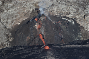
New Zealand , White Island :
Volcanic Activity Bulletin . Mon Dec 16 2024 3:00 PM
Whakaari / White Island is currently emitting larger steam and gas plumes. Occasional passive emission of volcanic ash has been observed. The volcano is not actively erupting but the current activity could be leading to a new eruptive episode. The Volcanic Alert Level remains at 2 and the Aviation Colour Code is raised to Orange.
During a routine gas measurement flight on December 14, the emissions from the active vent changed and include more volcanic ash than when measurement started an hour earlier. The results from the gas flight along with satellite observations, show a general increase in sulphur-dioxide (SO2) and carbon dioxide (CO2) emissions from the volcano. These are taken together to indicate a new eruptive episode maybe starting.
During the gas measurement flight on 14 December, we observed minor volcanic ash emissions and an increase in gas emission rates. On 10 December, a larger steam and gas plume was also visible above Whakaari. This was evident on our webcams at Whakatāne and Te Kaha as well as on satellite imagery. When the weather allows, a larger plume can sometimes be seen from the Bay of Plenty coast above the island. The observations during the gas flight are the only signs of volcanic ash in the plume to date. Ash emission has not been visually noted from our webcams, or via Metservice’s analyses of satellite imagery.
Without sensors on the island, we continue to rely on remote cameras and satellite imagery to monitor Whakaari. The changes in activity and what we observed from May to September suggest fresh magma is driving a change in activity. To date only very minor ash emissions have been noted near and on the island. We are planning an observation flight to make more observations and monitor potential changes in the crater area.
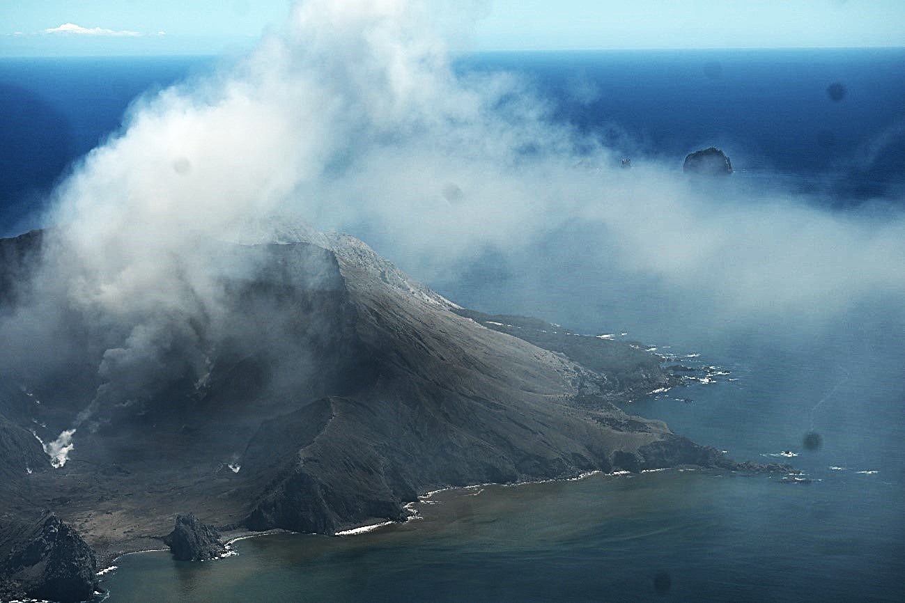
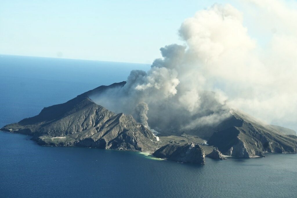
Image of Whakaari White Island on 14 December 2024 taken during the gas measurement flight. Showing the volcanic ash emission from the active vent and the gas and steam plume drifting down wind.
Recent activity is consistent with moderate-heightened unrest and the Volcanic Alert Level therefore remains at Level 2 and the Aviation Colour Code is raised to Orange. These levels acknowledge the current level of activity but also reflect the degree of uncertainty about the level of unrest due to the current lack of consistent, usable real-time monitoring data. The level of volcanic activity could escalate back to levels seen earlier in the year and the volcano can erupt with little or no warning.
Source : Geonet / Agnès Mazot , Duty Volcanologist.
Photos : Geonet ( 08/2024 ) , ( 15/12/2024).
Indonesia , Raung :
VOLCANO OBSERVATORY NOTICE FOR AVIATION – VONA
Issued : Décember 15 , 2024
Volcano : Raung (263340)
Current Aviation Colour Code : YELLOW
Previous Aviation Colour Code : unassigned
Source : Raung Volcano Observatory
Notice Number : 2024RAU002
Volcano Location : S 08 deg 07 min 30 sec E 114 deg 02 min 31 sec
Area : East java, Indonesia
Summit Elevation : 10662 FT (3332 M)
Volcanic Activity Summary :
Increasing in volcanic activity.
Volcanic Cloud Height :
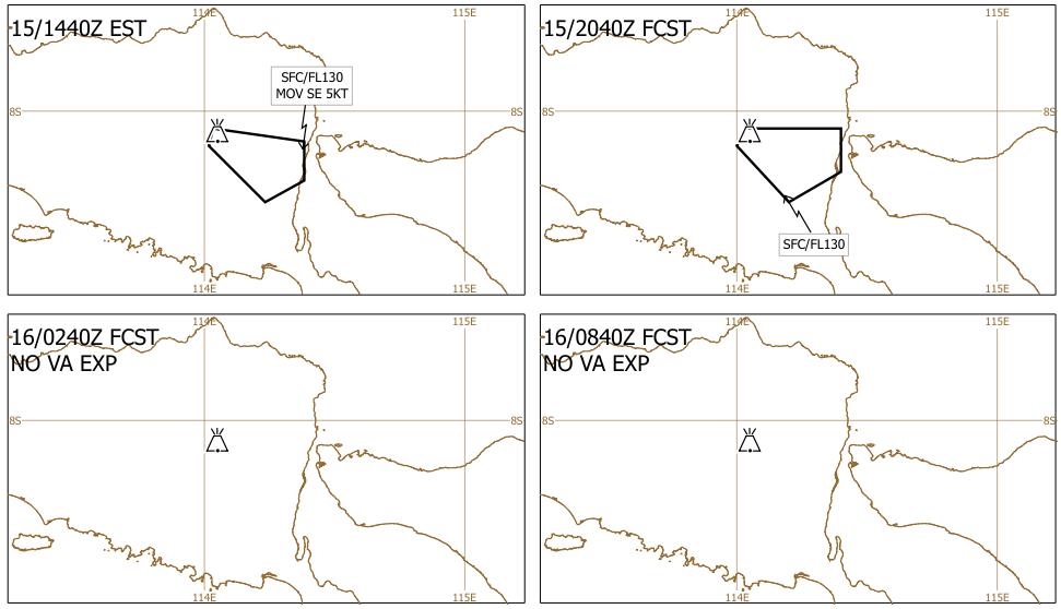
Best estimate of ash-cloud top is around 12262 FT (3832 M) above sea level or 1600 FT (500 M) above summit. May be higher than what can be observed clearly. Source of height data: ground observer.
Other Volcanic Cloud Information :
Ash cloud moving from east to southeast. Volcanic ash is observed to be white. The intensity of volcanic ash is observed from medium to thick.
Remarks :
Tremor recorded on seismogram with maximum amplitude 9 mm. seismic activity is dominated by volcanic tremor
Seismicity observation:
6 emission earthquakes with an amplitude of 5 to 20 mm and earthquake duration of 28 to 46 seconds.
3 deep tectonic earthquakes with an amplitude of 14-29 mm, and earthquake duration 68-147 seconds.
1 continuous tremor with an amplitude of 0.5 to 11 mm, dominant value of 1.5 mm.
12/15/2024: Ash clouds from Raung (Java) at an altitude of 4000 m (VAAC Darwin image).
Source : Magma Indonésie
Photo : Istimewa ( 7/2022).
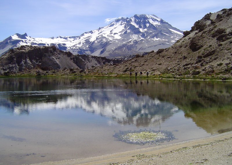
Chile , Descabezados Grande :
Seismology
The seismological activity of the period was characterized by the recording of:
84 VT type seismic events, associated with rock fracturing (Volcano-Tectonic). The most energetic earthquake had a local magnitude (ML) value equal to 3.4, located 1.4 km to the North-Northwest of the volcanic edifice, at a depth of 2.9 km in reference to the main crater of the volcano.
2 LP type seismic events, associated with fluid dynamics within the volcanic system (Long Period). The size of the largest earthquake evaluated from the Reduced Displacement (DR) parameter was equal to 2 cm2.
Fluid Geochemistry
No anomalies have been reported in sulfur dioxide (SO2) emissions to the atmosphere in the area near the volcanic group, according to data published by the Troposphere Monitoring Instrument (TROPOMI) and the Ozone Monitoring Instrument (OMI) Sulfur Dioxide Group.
Thermal anomalies by satellites
During the period, no thermal alerts were recorded in the area associated with the volcanic group, according to the analytical processing of Sentinel 2-L2A satellite images, in combination with false-color bands.
Geodesy
According to the line length data provided by the GNSS network, which measures the deformation of the volcanic system, very low elongation and shortening rates are observed, not exceeding 0.05 cm/month, so it is concluded that there is no evidence of deformation. According to interferometry (InSar), there is also no evidence of deformation of said system.
Surveillance cameras
The images provided by the fixed camera, installed near the group, did not record degassing columns or variations related to surface activity.
The seismic activity recorded has shown a subtle and progressive increase in recent years. Despite this, the general activity suggests stability of the volcanic system.
The volcanic technical alert is maintained at:
GREEN TECHNICAL ALERT: Active volcano with stable behavior – There is no immediate risk.
Source : Sernageomin .
Photo : Wikiheinz
Ecuador , El Reventador :
DAILY STATE REPORT OF THE REVENTADOR VOLCANO , Sunday, December 15, 2024.
Information Geophysical Institute – EPN.
Surface Activity Level: High , Surface Trend: No Change
Internal Activity Level: Moderate , Internal Trend: No Change
From December 14, 2024, 11:00 a.m. to December 15, 2024, 11:00 a.m.:
Seismicity:
The count of seismic events recorded at the station is detailed below.
Explosion (EXP) 71
Long Period (LP) 12
Emission Tremor (TREMI) 14
Harmonic Tremor (TRARM) 7
Rainfall / Lahars:
Since yesterday afternoon until the publication of this report, thanks to the satellite and meteorological monitoring system, no rain has been recorded in the areas surrounding the volcano. **In the event of heavy rains, they could remobilize the accumulated materials, generating mud and debris flows that would descend the sides of the volcano and flow into the adjacent rivers.
Column emissions / ash:
In the last 24 hours, thanks to the surveillance camera system, several emissions of gas and ash have been observed, the columns of which have reached heights of between 500 and 1,100 meters above the level of the crater, with directions Northeast, Southeast and Southwest. In relation to this activity, the VAAC agency in Washington has published three reports of emissions with a column height equal to 1000 meters above the crater level, which were directed towards the Southeast and South.
Another monitoring parameter:
In the last 24 hours, the FIRMS satellite system recorded 9 thermal anomalies, while the MIROVA-MODIS and MIROVA-VIIRS systems each detected 2 thermal anomalies.
Observation:
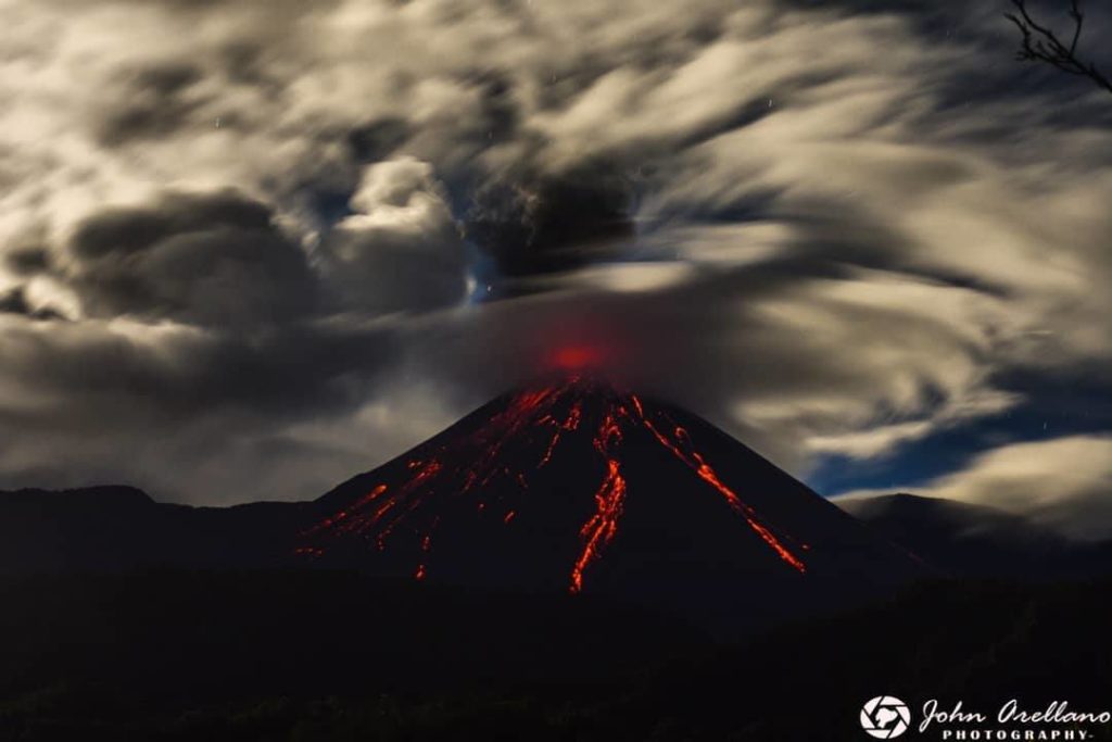
Since yesterday afternoon and until the delivery of this report, the volcano has remained mostly cloudy. However, during the last night, thanks to the network of surveillance cameras, several periods of descent of incandescent material were observed, reaching up to 800 meters below the crater level.
Source : IGEPN
Photo : John Arellano ( 2019).
Mexico , Popocatepetl :
December 15, 11:00 (December 15, 17:00 GMT)
Activity of the last 24 hours
38 exhalations were detected, accompanied by water vapor, volcanic gases and a small amount of ash. In addition, 551 minutes of very low amplitude tremors were recorded, of which: 451 minutes were high frequency and 100 minutes were harmonic, as well as a volcano-tectonic earthquake recorded today at 00:12 with a magnitude of 1.8.
The National Center for Communication and Civil Protection Operations (Cenacom) reported this morning a slight ash fall in the municipality of Tetela del Volcán, Morelos.
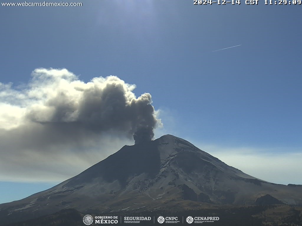
During the morning and at the time of this report, a continuous emission of water vapor, volcanic gases and ash was observed, with dispersion towards the Southeast (SE).
The Popocatépetl volcanic alert fire is in yellow phase 2.
The scenarios anticipated for this phase are:
A few small to moderate explosions
Occurrence of tremors of varying amplitude
Light to moderate ash rains in the surrounding towns and in some more distant towns
Ejection of incandescent fragments within the 12-kilometer exclusion radius
The occurrence of lahars can be expected to descend into the ravines, due to the accumulation of ash on the slopes and its interaction with the rains expected in the coming weeks.
Possibility of pyroclastic flows not reaching the populations
Source et photo : Cenapred.

