October 01 2024.
Italy , Stromboli :
Statement on Stromboli activity, 01 October 2024 05:14 (03:14 UTC) .
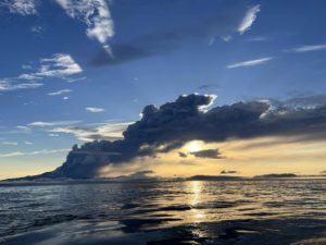
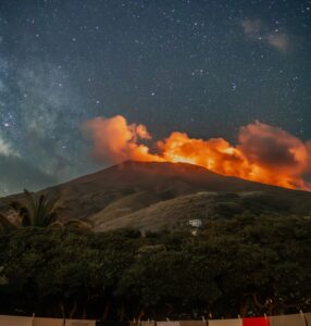
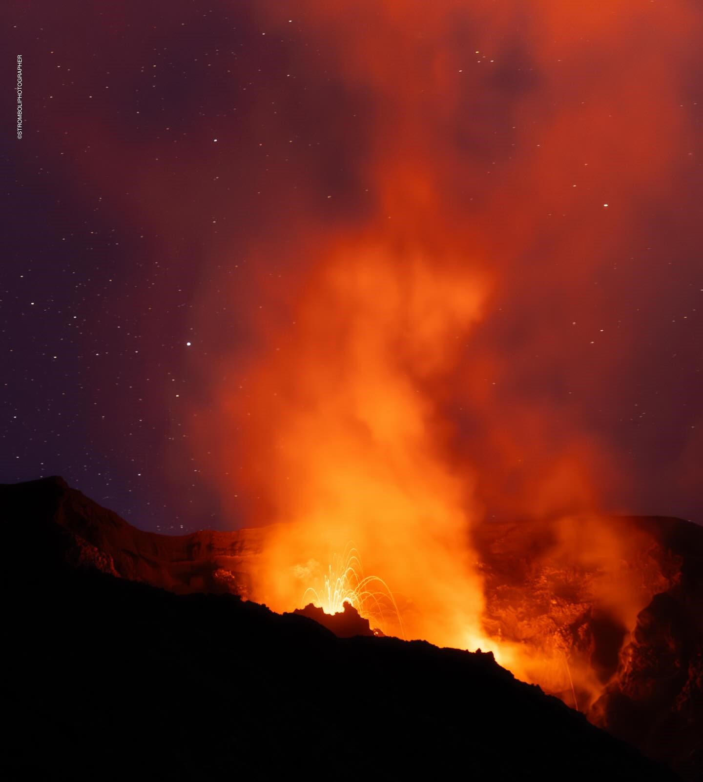
The National Institute of Geophysics and Volcanology, Osservatorio Etneo, reports that from 00:45 UTC the Strombolian activity from the vents of the North Crater area has become progressively more frequent and energetic. From 01:00 UTC, the activity is subject to almost continuous splashes that feed an overflow of lava. Slides of hot material are also observed along the slope and up to the coast.
From about 12:15 UTC yesterday, September 30, a gradual increase in the amplitude of the seismic signal was observed, which went from a medium level to a very high level. From about 00:50 UTC today, October 1, a new and sudden increase in the amplitude was observed, reaching the most energetic value around 01:00 UTC.
From the point of view of ground deformations, there are no significant variations.
Further updates will be communicated shortly.
Source : INGV
Photo : Stromboli stati d’animo / Sebastiano Cannavo.
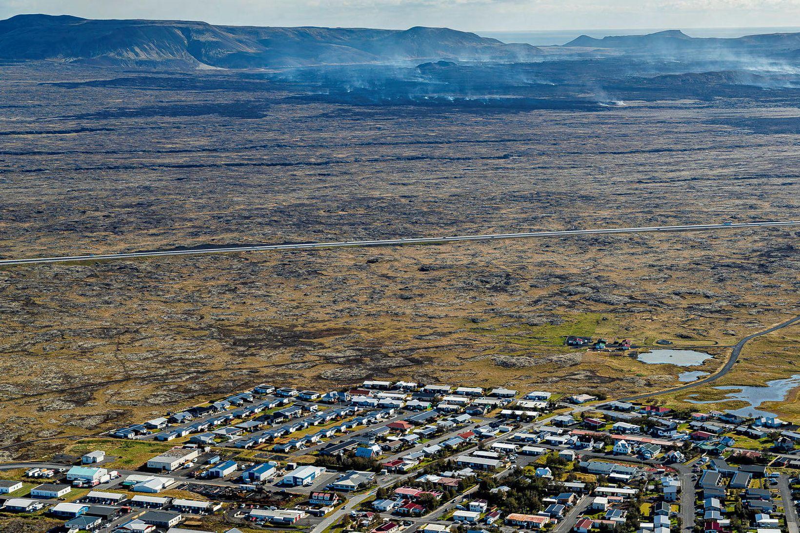
Iceland , Reykjanes Peninsula :
The risk of a shield eruption seems to be increasing.
The probability of a shield eruption in the Sundhnúkagígar crater row is increasing over time. This would mean that the Reykjanesbraut road is not the only infrastructure on the Reykjanes Peninsula that is at risk. Such an eruption could last for several years, even decades. This is what volcanology professor Þorvaldur Þórðarson says in an interview with Morgunblaðið.
These eruptions often give rise to shield volcanoes, but the eruption must last long enough to form large shields such as Skjaldbreiður, which took about 30 to 100 years to form. Most of the eruptions since last December have started between Mount Sundhnúkur and Mount Stóra-Skógfell. If another eruption occurs there, the likelihood of a prolonged eruption increases, according to Þórðarson. But how likely is that?
« It is a possibility, and I think the longer it goes on, the more likely it becomes, » says Þórðarson, adding:
« If it continues like this, it will eventually turn into a very prolonged eruption and then form a lava shield. » There is at least one possibility, and if it happens, more than just the Reykjanesbraut road will be engulfed by lava. »
This is not the most likely scenario
He says it is not the most likely scenario, and in fact rather unlikely, but nevertheless the probability increases.
Could this eruption then last a few months?
« Yes, or even years or decades. »
He says the general feeling among scientists is that lava shields form during a long eruption. However, it is not clear exactly how such eruptions occur.
« They could start with many small eruptions, which would then become larger and larger until we have an eruption so large and powerful that we would have a lava lake in the main crater. It would become large enough to absorb a significant amount of lava, and then it would break apart on its own and spread the lava all around. But the flow from below – it’s constant in this lava lake – so the eruption can last much longer than a month, » he says, noting that something like this happened in Hawaii in 1983. That eruption lasted 35 years.
Source : icelandmonitor . mbl.is .
Photo : mbl .is / Árni Sæberg.
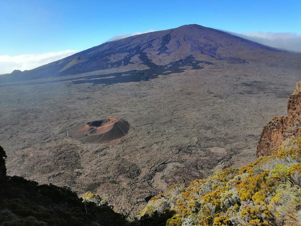
La Réunion , Piton de la Fournaise :
Press release from the Institut de physique du globe de Paris , Piton de la Fournaise Volcanological Observatory . October 30, 2024 – 09:00 local time – 05:00 UTC
Earthquake felt
On Sunday, September 29, 2024, 20:45 (local time – or 16:45 UT), an earthquake was felt by residents of the island, in the Salazie cirque, mainly in the Hell Bourg, Mare à Poule d’Eau and Bois Pomme area.
This earthquake was recorded by the seismometers of the Piton de la Fournaise Volcanological Observatory. The first analyses of this earthquake made it possible to locate it, 19 km deep under the Salazie cirque. Its magnitude was measured at 1.6 on the Richter scale. There is currently a high level of uncertainty about its location.
OVPF staff are working to refine the location calculations for this event. Also, information regarding location and intensity may change marginally.
This type of event, felt by the population, is recorded several times a year. This event is isolated and is of tectonic origin. At present, this earthquake has not been followed by aftershocks.
Call for testimonies on felt earthquakes: the real intensities (effects of an earthquake in a given place) can only be correctly determined by collecting testimonies. If you felt this earthquake, even weakly, you are invited to report it to the BCSF (French Central Seismological Bureau) on the site http://www.franceseisme.fr/
Source : Direction de l’OVPF-IPGP
Photo : Nath Duverlie ( 2020)
Peru , Sabancaya :
Analysis period: from September 23, 2024 to September 29, 2024, Arequipa, September 30, 2024
Alert level: ORANGE
The Geophysical Institute of Peru (IGP) reports that the eruptive activity of the Sabancaya volcano continues. During this period, an average of 18 explosions per day have been recorded, with columns of ash and gas up to 2,300 m above sea level above the summit of the volcano. Therefore, the volcanic alert level remains at ORANGE
The IGP has recorded and analyzed the occurrence of 287 earthquakes of volcanic origin, associated with the circulation of magmatic fluids inside the Sabancaya volcano, as well as earthquakes related to rock fracturing. An average of 18 explosions per day have been recorded.
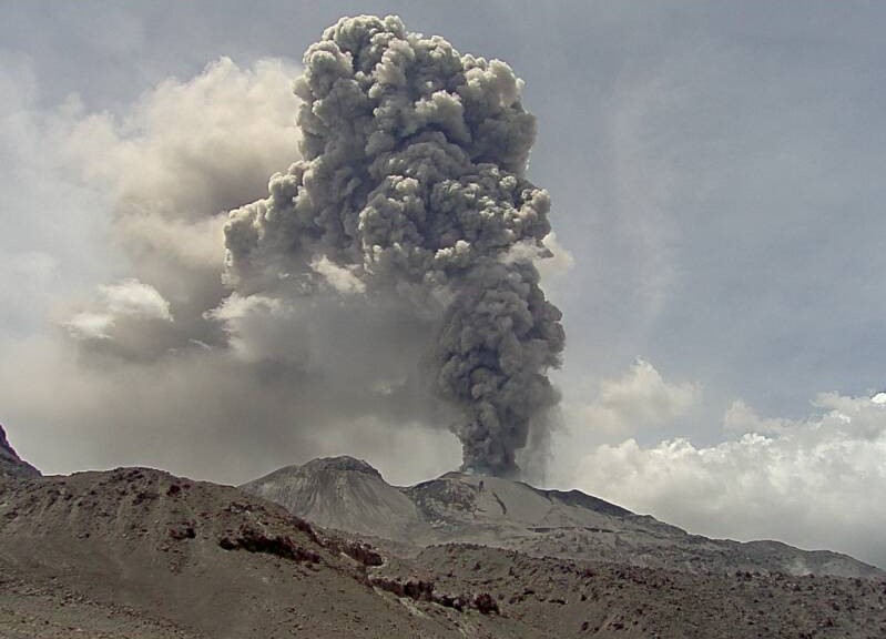
Columns of ash and gas have been observed up to 2300 m above sea level above the summit of the volcano. The predominant direction of these emissions has been towards the southern and southeastern sectors of the volcano over a distance of less than 10 KM.
A slight inflation process continues to be recorded in the northern sector (around the Hualca Hualca volcano).
Satellite recordings have identified the presence of 19 thermal anomalies, with a maximum value of 9 MW, associated with the presence of a lava body on the surface of the volcano’s crater.
Moderate emissions (729 tons/day) of sulfur dioxide (SO2) have been observed
RECOMMENDATIONS
• Maintain the orange volcanic alert level.
• Do not approach within a radius of less than 12 km of the crater.
Source : Cenvul
Photo : Ingemmet
Guatemala , Santiaguito :
Weather conditions: Clear.
Wind: Northeast.
Precipitation: 2.8 mm.
Activity:
The Observatory reports activity on Caliente Dome, with moderate to abundant degassing columns continuing in a west and southwest direction. There are 3 to 8 weak to moderate explosions per hour, accompanied by moderate block avalanches, occasional incandescence in the dome of the dome due to lava extrusion, and accumulation of hot material mainly toward the southwest flank. Moderate and strong explosions elevate columns of gas and ash to heights of up to 3,400 meters above sea level (10,498 feet) and cause pyroclastic flows to descend short distances that extend along all flanks as well as weak and/or strong avalanches that may be audible. several kilometers from the volcano.

In the afternoon and evening, rains could cause lahars to descend into the channels that descend from the Caliente dome. The appearance of moderate to strong block and ash flows is not excluded, as well as possible pyroclastic flows over long distances in different directions. The recommendations of the special bulletin BESAN-004-2024 should be followed.
Source : Insivumeh .
Photo : Explorandoguatemala ( 2016)