March 10 , 2024.
La Réunion , Piton de la Fournaise :
Press release from the Paris Institute of Globe Physics, Piton de la Fournaise Volcanological Observatory. March 8, 2024 – 2:45 p.m. (local time) – 10:45 a.m. (UTC time)
Increased seismicity
Since March 5, 2024, an increase in seismicity has been observed under the Piton de la Fournaise. Thus 13 volcano-tectonic earthquakes were recorded on March 5, 7 on March 6 and 7 on March 7 (Figure 1). These earthquakes are of low magnitude (<1), most cannot be localized but some of these events could be located between 1.5 and 2 km depth under
the Dolomieu crater.
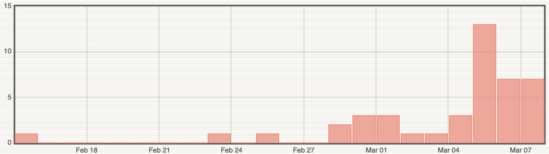
Figure 1: Histogram representing the number of superficial volcano-tectonic earthquakes recorded since February 15, 2024 (© OVPF-IPGP).
This seismicity follows a resumption of inflation of the volcanic edifice since the second half of February. This inflation – whose source is centered under the summit – is linked to the pressurization of the superficial reservoir, located at approximately 1.5-2 km depth under the Dolomieu crater.

The appearance of seismicity at the roof of the reservoir shows that this pressurization process is intensifying, even if the magnitude and number of earthquakes remain moderate.
Note that this process of pressurization of the surface reservoir can last several days to several weeks before the roof of the reservoir weakens and ruptures, thus giving rise to an injection of magma towards the surface and an eruption, but can also stop without giving rise – in the short term – to an eruption.
Alert level: Vigilance
Source : OVPF
Photos : OVPF , Imaz Press.
Indonesia , Ibu :
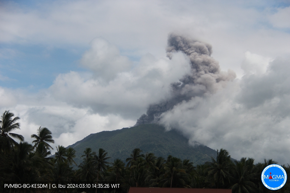
An eruption of Mount Ibu occurred on Sunday, March 10, 2024 at 2:22 p.m. WIT, with the height of the ash column observed to be ±1,000 m above the summit (±2,325 m above sea level). the sea). The ash column was observed to be gray with thick intensity, oriented towards the South and South-West. This eruption was recorded on a seismograph with a maximum amplitude of 28 mm and a duration of 203 seconds.
SEISMICITY OBSERVATIONS.
16 eruption/explosion earthquakes with an amplitude of 15 to 28 mm and a duration of 22 to 70 seconds.
2 avalanche earthquakes with an amplitude of 4 to 6 mm and a duration of 25 to 45 seconds.
30 emission earthquakes with an amplitude of 2 to 14 mm and earthquake duration of 8 to 40 seconds.
2 harmonic tremors with an amplitude of 2 to 6 mm and an earthquake duration of 25 to 50 seconds.
43 Shallow volcanic earthquakes with an amplitude of 2 to 14 mm and an earthquake duration of 6 to 12 seconds.
RECOMMENDATION
1. Communities around Mount Ibu and visitors/tourists should not practice activities within a radius of 2.0 km and a sectoral extension of 3.5 km towards the crater opening in the northern part of the active crater from Mount Ibu.
2. In the event of falling ash, people who carry out activities outside the home are advised to wear nasal, oral (mask) and eye (glasses) protection.
Source et photo : Magma Indonésie.
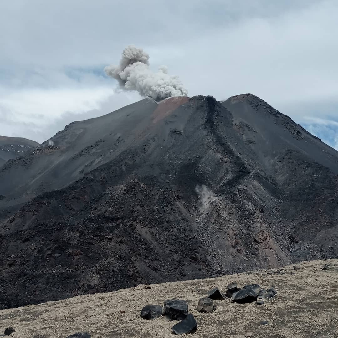
Chile , Nevados de Chillan :
Seismology
The seismological activity of the period was characterized by the recording of:
90 seismic events of type VT, associated with the fracturing of rocks (Volcano-Tectonics). The most energetic earthquake had a Local Magnitude (ML) value equal to 1.8, located 1.4 km east-northeast of the volcanic building, at a depth of 3.8 km in reference to the crater active.
8 LP type seismic events, associated with fluid dynamics inside the volcanic system (Long Period type). The size of the largest earthquake evaluated from the Reduced Displacement (RD) parameter was equal to 5.2 cm2.
Fluid geochemistry
Sulfur dioxide (SO2) emissions data obtained by the differential optical absorption spectroscopy (DOAS) equipment, corresponding to the Chillán station, installed 1.5 km in the South-South-East direction ( SSE) of the active crater, presented an average SO2 flow value of 246 ± 74 t/d, with a maximum of 431 t/d on February 24.
No anomalies have been reported in emissions of sulfur dioxide (SO2) into the atmosphere in the area near the volcanic complex, according to data released by Tropopheric Sulfur Dioxide Monitoring Group (TROPOMI) and Ozone Monitoring Instrument (OMI). ).
Satellite thermal anomalies
During the period, no thermal alerts were recorded in the area associated with the volcanic complex, according to the analytical processing of Sentinel 2-L2A satellite images, in combination of false color bands.
Geodesy
Data provided by 5 GNSS stations, which measure the deformation of the volcanic complex, show that the positions of the stations have remained stable in recent months, with some of them observing an annual cyclical trend with a maximum amplitude of 2 cm. Vertical displacements show positive trends with rates below 0.3 cm/month, while horizontal displacements remain below 0.5 cm/month. In conclusion, there is no evidence of deformation of the volcanic system for the period evaluated.
Surveillance cameras
The images provided by the fixed camera, installed near the complex, recorded regular degassing, with a maximum column height of 60 m on February 12.
Activity remained at levels considered low, suggesting stability of the volcanic system.
The technical volcanic alert is maintained in:
GREEN TECHNICAL ALERT: Active volcano with stable behavior – There is no immediate risk
Source et photo : Sernageomin.
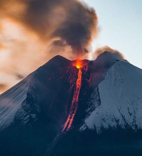
Ecuador , Sangay :
DAILY REPORT ON THE STATE OF THE SANGAY VOLCANO, Saturday March 9, 2024.
Information Geophysical Institute – EPN.
Surface activity level: High, Surface trend: No change
Internal activity level: High, Internal trend: No change
Seismicity: From March 8, 2024, 11:00 a.m. to March 9, 2024, 11:00 a.m.:
The number of seismic events recorded at the reference station over the past 24 hours is shown below. The level of seismic activity of the volcano remains high.
Explosion Event (EXP): 1227
Precipitation/Lahars:
Rains were recorded in the volcano area without generating mudslides or debris. Additionally, an increase in the flow of the Upano River was recorded using cameras. *In the event of heavy rains, these could remobilize the accumulated materials, generating mud and debris flows which would descend the sides of the volcano and flow into adjacent rivers.
Emissions/ash column:
During the last 24 hours, the network of surveillance cameras recorded an emission of gas and ash whose column reached a height of 600 meters above the level of the crater, which was heading towards the West-South- West. On the other hand, thanks to the GOES-16 satellite system, several gas and ash trails were recorded with heights between 800 and 1,000 meters above the level of the crater, in the West and West-North directions. West. Concerning these emissions, the Washington VAAC has published four reports of emissions in the West and West-Northwest directions with heights of 900 meters above the crater level.
Other monitoring parameters:
The MIROVA-VIIRS satellite system recorded 1 thermal anomaly, while the MIROVA-MODIS system recorded 2 thermal anomalies and the FIRMS system recorded 26 thermal anomalies in the last 24 hours.
Observation:
Since yesterday afternoon until the publication of this report, thanks to the surveillance camera system, the volcano has remained generally cloudy. However, at night, several episodes of incandescence were recorded at the level of the crater, with material falling into the southeast ravine up to 1,100 meters below the level of the crater.
Alert level: yellow
Source : IGEPN.
Photo : AlexBoasphoto.
Mexico , Popocatepetl :
March 9, 11:00 a.m. (March 9, 5:00 p.m. GMT). Activity from the last 24 hours
6 low intensity exhalations were detected and 1,399 minutes of high frequency, low amplitude tremors were identified. Both volcanic events were accompanied by water vapor, other gases and ash.
CENACOM (National Center for Communications and Civil Protection Operations) reports today light ash falls in the municipalities of Huejotzingo, Chiautzingo, San Felipe Teotlalcingo, San Salvador el Verde, San Martín Texmelucan, San Matías Tlalancaleca, San Miguel Xoxtla, Tlaltenango, Juan C. Bonilla, Tepeaca, Acajete, Puebla Capital, San Andrés Cholula, San Pedro Cholula, Cuautlancingo (San Juan Cuautlancingo) and Amozoc de Mota, in the state of Puebla.
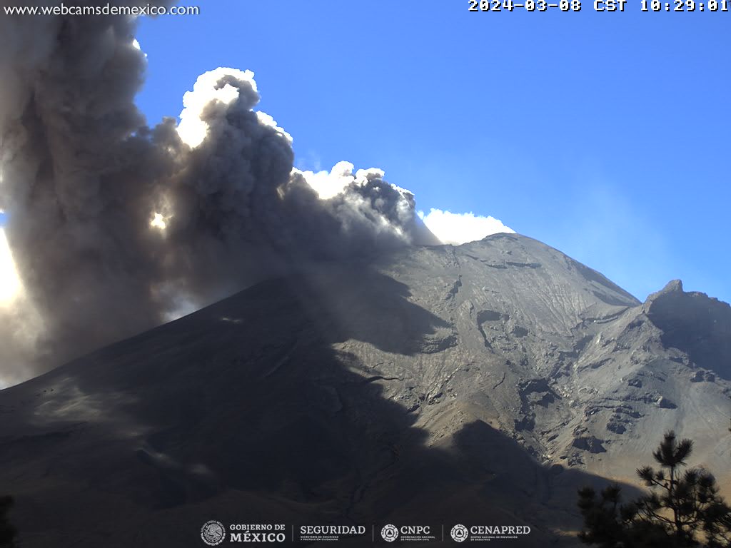
During this morning and at the time of this report, an emission of volcanic gases and ash is observed, with dispersion towards the East (E).
The Popocatépetl volcanic warning fire is in yellow phase 2.
The scenarios planned for this phase are:
A few small to moderate explosions
Appearance of tremors of variable amplitude
Source et photo : Cenapred.