September 13 , 2019.
Italy / Sicily , Etna :
COMMUNICATION on the volcanic activity of September 12, 2019 at 09:46:02 (UTC) – ETNA.
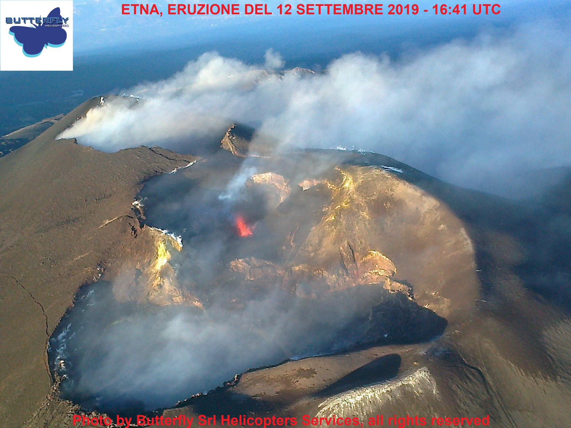
The National Institute of Geophysics and Volcanology, Osservatorio Etneo, announces that the improvement in weather conditions, starting around 18:00 UTC around September 11, has shown us that explosive activity continues with a variable intensity in the Northeast crater despite the general decrease compared to previous days. In addition, as of this morning, September 12, ash emissions have been observed from the crater of Voragine. In particular, the events were recorded at 04:15:30 UTC, at 05:20:00 UTC, at 06:16:30 UTC, at 07:10:00 UTC, at 09:04:10 UTC, at 09 : 10: 30 UTC and at 09:17: 30 UTC. Ash emissions gradually increased in frequency and produced diluted ash that quickly dispersed into the summit area.
The SO2 flux measured by the FLAME Etna network at 09:15 UTC records a daily SO2 flow value that is average and below the attention threshold of 5000 t / d.
On September 11, around 12 pm UTC, a gradual decrease in the amplitude of volcanic tremors was observed. Subsequently, the amplitude showed fluctuations around the medium-high values, which remain.
Regarding the location of the tremor spring, during the past 24 hours, it has continued to be confined to the Northeast crater zone, at altitudes ranging from 2,000 to 2,800 m.
https://www.facebook.com/1716786028369949/videos/2464274793651824/
One of the explosions that have been happening for a few hours in the crater of the Voragine (often also called « Central ») of Etna on the morning of September 12, 2019. Video recorded by the thermal surveillance camera of the INGV-Osservatorio Etneo on the Montagnola (EMOT), on the southern slope of the volcano.
The September 11 crosstalk activity was located in the Northeast crater, but the occurrence rate of events decreased. Currently, the source of infrasound events is located in the Voragine crater.
No significant changes were observed in soil deformation monitoring networks.
COMMUNICATION on volcanic activity from September 12, 2019 at 12:10:47 pm (UTC) – ETNA.
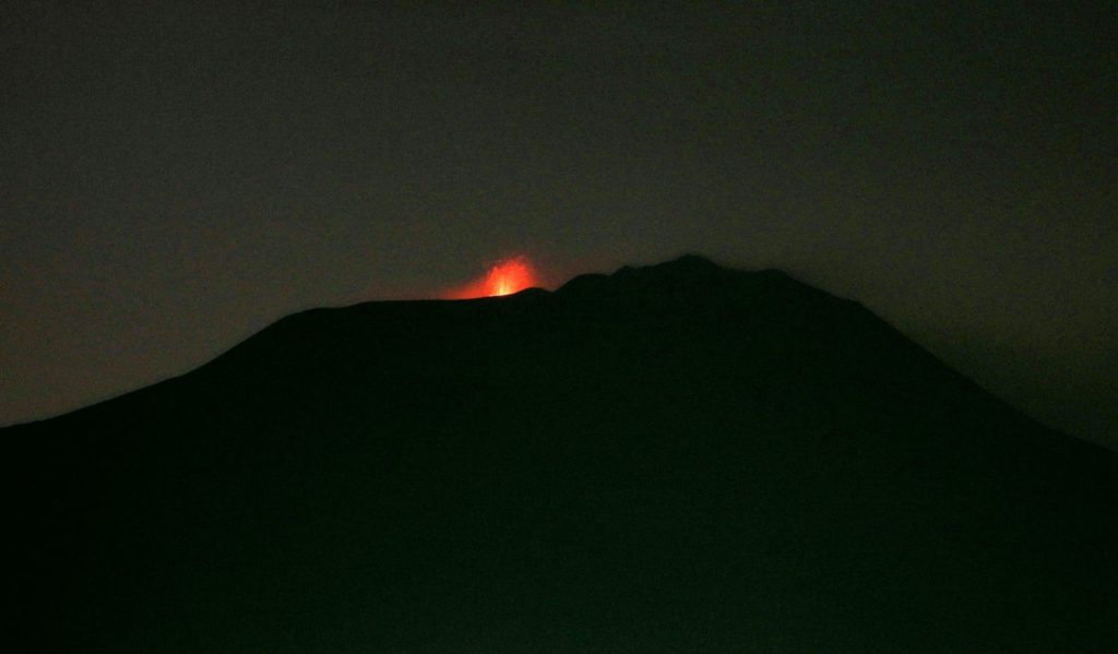
The National Institute of Geophysics and Volcanology, Osservatorio Etneo, announces that as of 10:00 UTC, erupting activity in the Voragine crater has increased, from occasional ash expulsions to near-continuous strombolian activity. , which does not produce ash emissions. Strombolian activity is accompanied by strong detonations heard in Zafferana Etnea, Aci S. Antonio, Pedara and in the surrounding areas. The SO2 flux measured by the Etna FLAME network at 12:00 UTC recorded an average daily value of approximately 4,800 t / g, with a threshold of 5,000 t / d.
Intra-daily SO2 data indicated maximum flow values between 6000 and 8000 t / d. The amplitude of the volcanic tremor remains high, the location of the source of the tremor is confined in the area of the crater of Voragine, at altitudes oscillating between 2800 and 3000 meters. From approximately 09:00 UTC, infrasound activity increased with the occurrence rate of events in the Voragine crater. The soil strain monitoring networks did not detect any particular anomalies.
Source : INGV Vulcani.
Photos : Joseph Nasi / Butterfly helicopters ( via Marco Neri ), INGV.
Video : INGV.
Hawaii , Mauna Loa :
19°28’30 » N 155°36’29 » W,
Summit Elevation 13681 ft (4170 m)
Current Volcano Alert Level: ADVISORY
Current Aviation Color Code: YELLOW
Activity Summary:
Mauna Loa Volcano is not erupting. Rates of deformation and seismicity have not changed significantly in the past week and persist above long-term background levels.
Observations:
During the past week, approximately 49 small-magnitude earthquakes (all smaller than M2.5) were detected beneath the upper elevations of Mauna Loa. Most of the earthquakes occurred at shallow to intermediate depths of less than 10 km (~6 miles) below ground level.
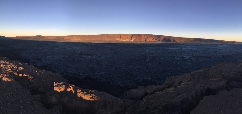
An early morning view looking north across Moku‘āweoweo, Mauna Loa’s summit caldera, from a spot near the summit cabin on the volcano’s south caldera rim. Frost covered much of the caldera floor that was still shadowed, and weak steaming issued from the usual areas. Overall, there were no significant changes observed at the summit. The 1940 and 1949 cones are visible in the sunlit area at left, and the gap that connects the caldera to South Pit is visible at the far left. Photos by M. Patrick, 09-08-2019.
Global Positioning System (GPS) and Interferometric Synthetic Aperture Radar (InSAR) measurements show continued summit inflation, consistent with magma supply to the volcano’s shallow storage system.
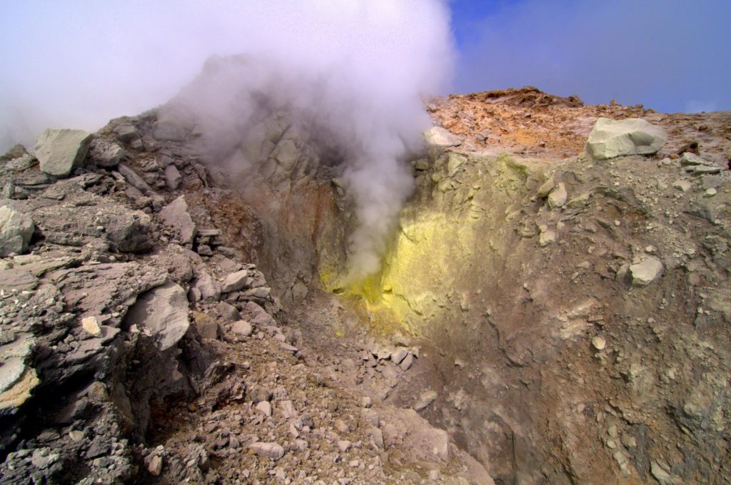
No significant changes in volcanic gas release were measured at Sulphur Cone on the Southwest Rift Zone. Fumarole temperatures remain stable at Sulphur Cone and within the summit caldera.
Source : HVO.
Kamchatka , Sheveluch :
56.64 N, 161.32 E;
Elevation 10768 ft (3283 m), the dome elevation ~8200 ft (2500 m)
Aviation Colour Code is ORANGE
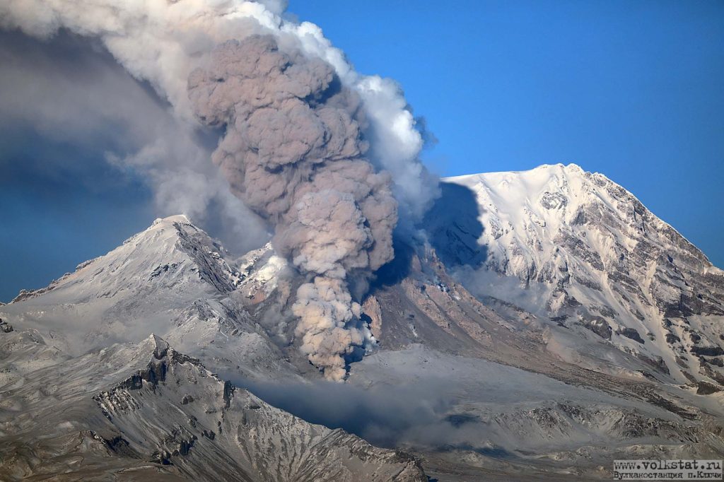
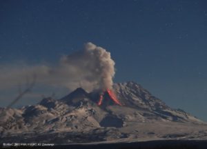
Explosive-extrusive eruption of the volcano continues. Ash explosions up to 32,800-49,200 ft (10-15 km) a.s.l. could occur at any time. Ongoing activity could affect international and low-flying aircraft.
A growth of the lava dome continues, a strong fumarolic activity sometimes with some amount of ash, and an incandescence of the dome blocks and hot avalanches accompanies this process. Video and satellite data by KVERT showed ash emissions on 12 September, a gas-steam plume with some amount of ash extended for 50 km to the east-south-east of the volcano; resuspended ashes were recorded on 11-12 September, and ash plumes extended for 250 km to the east-south-east of the volcano; a thermal anomaly over the volcano was noting on 06-09 and 12 September, the volcano was obscured by clouds during other days of the week.
Source : Kvert.
Photo : Volkstat ru .
La Guadeloupe , La Soufrière :
Thursday, September 12, 2019 at 17:15 local time
Sequence of earthquakes in La Soufrière area of Guadeloupe – Basse Terre
A sequence of volcanic earthquakes began Monday, September 9, 2019 at 00h58, local time (Monday, September 9, 2019 4h58 universal time TU *) in the area of the volcano of La Soufrière. As of 12 September 2019 at 16:35 local time, the OVSG-IPGP networks recorded 199 earthquakes of very small magnitude (M <1).
No earthquakes were reported. The events are located at a depth of <2.5 km under the summit of the dome of La Soufrière.
The alert level remains: yellow, vigilance.
Source : direction de l’OVSG-IPGP.
Photo : F. BEAUDUCEL/IPGP 2010.
Chile , Copahue :
Special Volcanic Activity Report (REAV) Biobío Region, Copahu Volta 12 September 2019, 16:00 local time (mainland Chile)
The National Geological and Mining Service of Chile (Sernageomin) discloses the following PRELIMINARY information, obtained through the monitoring equipment of the National Volcanic Monitoring Network (NVRN), processed and analyzed at the Volcanological Observatory of the South Andes (OVDAS) ):
From Wednesday, September 11, 2019 at 16:57 local time (19:57 UTC), the volcanic monitoring stations near the Copahue volcano recorded a low-energy long-period seismicity (LP), in correlation with infrasound signals and associated volcanic surface activity at the crater level, manifested by the occurrence of small explosions, with gas and ash emissions generating ash columns at low altitudes.
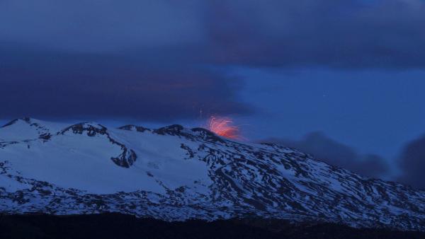
The higher energy explosion was recorded on 11 September 2019 at 22:45 local time (01:45 UTC), associated with a long-period type (LP) earthquake, with a maximum reduced displacement value (DRc) of 1.7 cm2. with a dominant frequency of 3.4 Hz observed in the « Copahue » seismological station (COP), and emitting a 250m column above the crater. Moreover, during the night, it was possible, when the weather conditions allowed, to observe an incandescence and ballistic projections of volcanic materials of high temperature on the surroundings of the emission point.
The instability of the system that could be caused by a slow magmatic contribution to more superficial levels continues. Due to the above, there are still conditions that would allow greater instability of the volcanic system, involving the emission of ash and / or the possibility of minor explosions affecting areas near the crater. For the above, the technical alert level is retained.
Source : Sernageomin.
Photo : Auteur inconnu.

