August 19 , 2025.
Indonesia , Lewotobi Laki-laki :
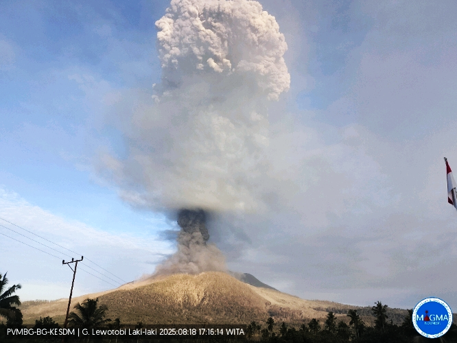
An eruption occurred at Lewotobi Laki-laki on Monday, August 18, 2025, at 5:12 PM (local time). The observed ash column rose to about 6,000 m above the summit (about 7,584 m above sea level). The ash column was gray and dense, oriented toward the west and northwest. At the time of writing, the eruption was still ongoing.
VOLCANO OBSERVATORY NOTICE FOR AVIATION – VONA
Issued : August 18 , 2025
Volcano : Lewotobi Laki-laki (264180)
Current Aviation Colour Code : RED
Previous Aviation Colour Code : orange
Source : Lewotobi Laki-laki Volcano Observatory
Notice Number : 2025LWK378
Volcano Location : S 08 deg 32 min 20 sec E 122 deg 46 min 06 sec
Area : East Nusa Tenggara, Indonesia
Summit Elevation : 5069 FT (1584 M)
Volcanic Activity Summary :
Eruption with volcanic ash cloud at 09h12 UTC (17h12 local).
Volcanic Cloud Height :
Best estimate of ash-cloud top is around 24269 FT (7584 M) above sea level or 19200 FT (6000 M) above summit. May be higher than what can be observed clearly. Source of height data: ground observer.
Other Volcanic Cloud Information :
Ash cloud moving from west to northwest. Volcanic ash is observed to be gray. The intensity of volcanic ash is observed to be thick.
Remarks :
Eruption and ash emission is continuing. Eruption recorded on seismogram with maximum amplitude 47.3 mm. Tremor recorded on seismogram with maximum amplitude 37 mm.
Source et photo : Magma Indonésie .
Hawaii , Kilauea :
HAWAIIAN VOLCANO OBSERVATORY DAILY UPDATE , U.S. Geological Survey
Monday, August 18, 2025, 9:58 AM HST (Monday, August 18, 2025, 19:58 UTC)
19°25’16 » N 155°17’13 » W,
Summit Elevation 4091 ft (1247 m)
Current Volcano Alert Level: WATCH
Current Aviation Color Code: ORANGE
Activity Summary:
Kīlauea is not erupting. Episode 30 of the ongoing Halemaʻumaʻu eruption ended abruptly at 12:55 p.m. HST on August 6 after 12 hours of continuous fountaining. Lava fountains reached up to 165 ft (50 m) and erupted lava covering 80% of the crater floor during this episode. A new fissure vent that transected the south wall of Halemaʻumaʻu ceased erupting at 4:40 a.m. HST on the morning of August 6. Models now show that episode 31 fountains are likely to start between August 18 and August 22. Strong glow and visible spattering associated with drainback events show magma has risen high in the north vent. Gas-pistoning resumed just after 2:00 AM HST. Episode 31 could start today but is more likely August 19 or 20.
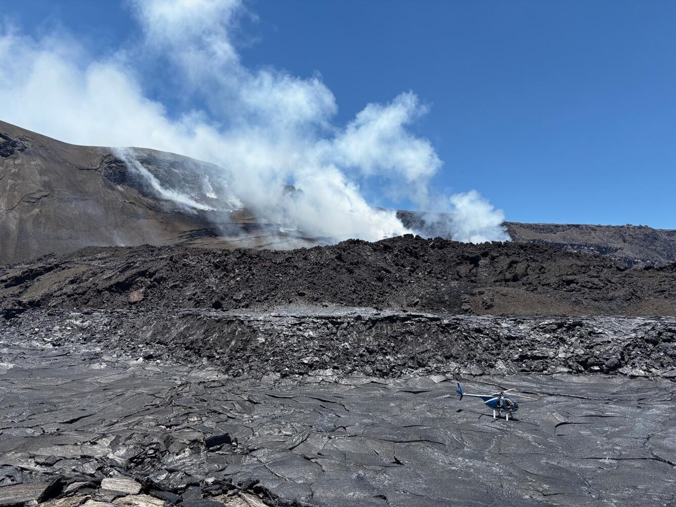
View of the lava/tephra pool from the sampling point on the temporary fissure of Episode 30. The helicopter landed on the crater floor on new pahoehoe lava that formed while the fissure vent talus slope was erupting.
Summit Observations:
Strong glow and visible spattering associated with drainback events show magma has risen high in the north vent. Gas-pistoning resumed just after 2:00 AM HST. Moderate to strong persistent glow was visible at both the north vent and the cracks above it overnight. Low to moderate continuous tremor persisted overnight along with increasing tremor bursts overnight. The low-frequency tremor bursts are characteristic of gas-pistoning of magma. Variations in gas-piston events are consistent with long term variability of shallow seismicity between episodes. The onset and strengthening of glow within the north vent may indicate that magma is slowly getting closer to the surface. Images from an overflight on August 6th showed that episode 30 flows had covered nearly 80% the Halemaʻumaʻu crater floor, which now includes the old down dropped block.
The Uēkahuna tiltmeter (UWD) recorded about 22.5 microradians of deflationary tilt during episode 30. The end of the eruption was coincident with a rapid change from deflation to inflation at the summit and a decrease in seismic tremor intensity. The Uēkahuna tiltmeter (UWD) has recorded just over 20 microradians of inflationary tilt since episode 30 ended.
Elevated degassing continues from the vent. Average sulfur dioxide (SO2) emission rates during inter-episode pauses are typically 1,200 to 1,500 t/d, though emission rates vary on short time scales in association with gas-pistoning.
Source : HVO.
Photo : USGS / K. Mulliken
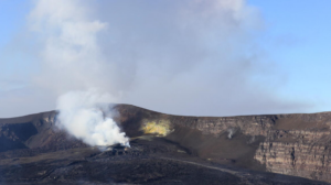
Indonesia , Karangetang :
Increased seismicity at Mount Karangetang, North Sulawesi, August 18, 2025
Karangetang Volcano is a stratovolcano rising to an altitude of 1,784 meters. It is located on Siau Island, in the Siau-Tagulandang-Biaro Regency, North Sulawesi Province. Eruptions from Mount Karangetang are characterized by strombolian eruptions, lava dome formation, incandescent lava avalanches, lava flows, and pyroclastic flows. Eruptive activity can originate from both the North Crater and the South Crater (Main Crater). The last eruption occurred on September 5, 2023, when eruptive material in the form of lava avalanches flowed into the Batuawang River, approximately 1,000 meters from the summit of Mount Karangetang. Volcanic activity is currently at level II (WASPADA) since January 11, 2025 at 6:00 PM WITA (Central Indonesia Time).
Seismic monitoring on August 17, 2025, showed an increase in seismic activity, particularly emission earthquakes, which began on August 5, 2025, with 40 recorded per day. Activity remained high. On August 17, 2025, the number of emission earthquakes increased significantly, reaching 96 recorded per day, followed by 13 harmonic tremors recorded daily. This increase in seismic activity requires increased vigilance, given the potential hazards of Mount Karangetang, including magmatic eruptions and pyroclastic avalanches sliding down valleys from the eruption foci in the North and South craters. The risk of effusive eruptions from Mount Karangetang, characterized by the growth of lava domes or lava flows sliding down valleys, is also significant.
Due to the increase in seismicity and the continued activity level at Level II (waspada), the public is advised to avoid entering or carrying out activities within a 1.5 km radius around the North and South Craters, as well as within a 2.5 km radius southwest and south of the South Crater. The public is advised to remain calm and adhere to the recommendations issued by the Geological Agency through the Center for Volcanology and Geological Risk Reduction, and not to be influenced by false and irresponsible information regarding the volcanic activity of Karangetang.
Source : PVMBG.
Photo : hshdude / esia
Kamchatka , Klyuchevskoy :
VOLCANO OBSERVATORY NOTICE FOR AVIATION (VONA)
Issued: August 18 , 2025
Volcano: Klyuchevskoy (CAVW #300260)
Current aviation colour code: YELLOW
Previous aviation colour code: orange
Source: KVERT
Notice Number: 2025-80
Volcano Location: N 56 deg 3 min E 160 deg 38 min
Area: Kamchatka, Russia
Summit Elevation: 4750 m (15580 ft)
Volcanic Activity Summary:
The explosive-effusive eruption of the Klyuchevskoy volcano, which lasted from 20 April to 16 August, 2025, has ended. Only fumarole activity of the volcano is currently observed.
A gas-steam activity of the volcano continues. Ongoing activity could affect low-flying aircraft.
Volcanic cloud height: NO ASH CLOUD PRODUSED
Other volcanic cloud information: NO ASH CLOUD PRODUSED
Source : Kvert.
Photo : Andrew Matseevsky
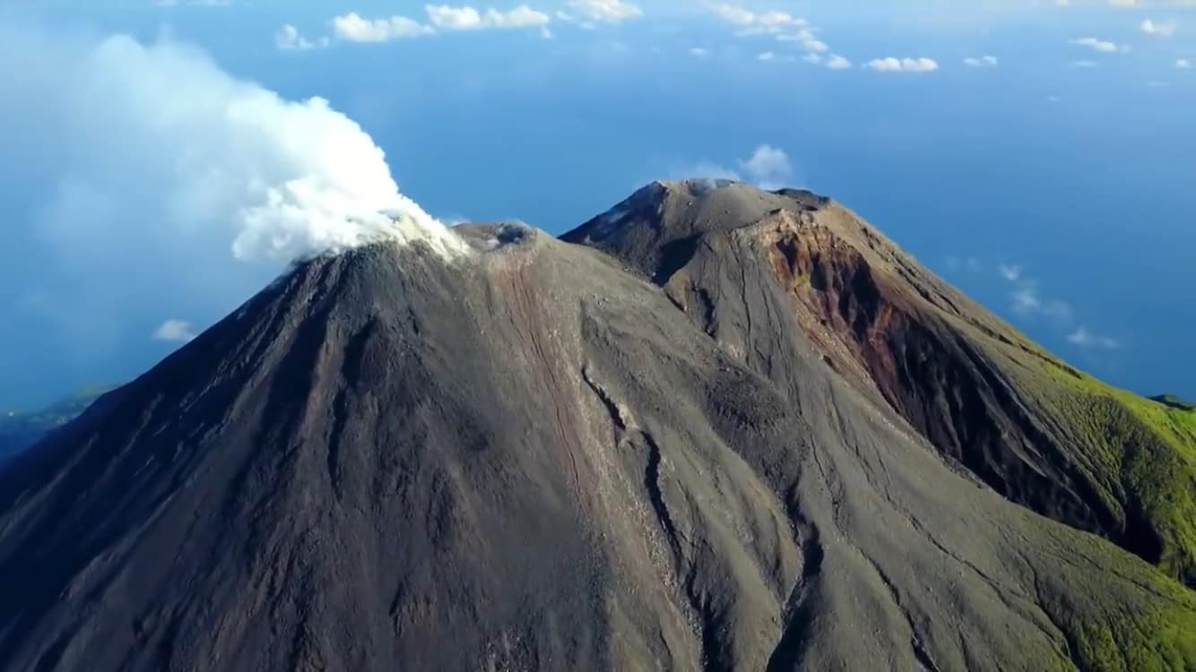
Mexico , Popocatepetl :
August 18, 11:00 a.m. (August 18, 5:00 p.m. GMT)
Activity in the past 24 hours
Forty-two low-intensity exhalations accompanied by water vapor, volcanic gases, and small amounts of ash were detected. In addition, 842 minutes of low-amplitude tremor were recorded, including 737 minutes of high-frequency tremor and 105 minutes of harmonic tremor.
At the time of writing, visibility toward the volcano was limited due to cloudy skies. However, during the early morning hours, a continuous emission of water vapor and volcanic gases was observed in a westerly direction.
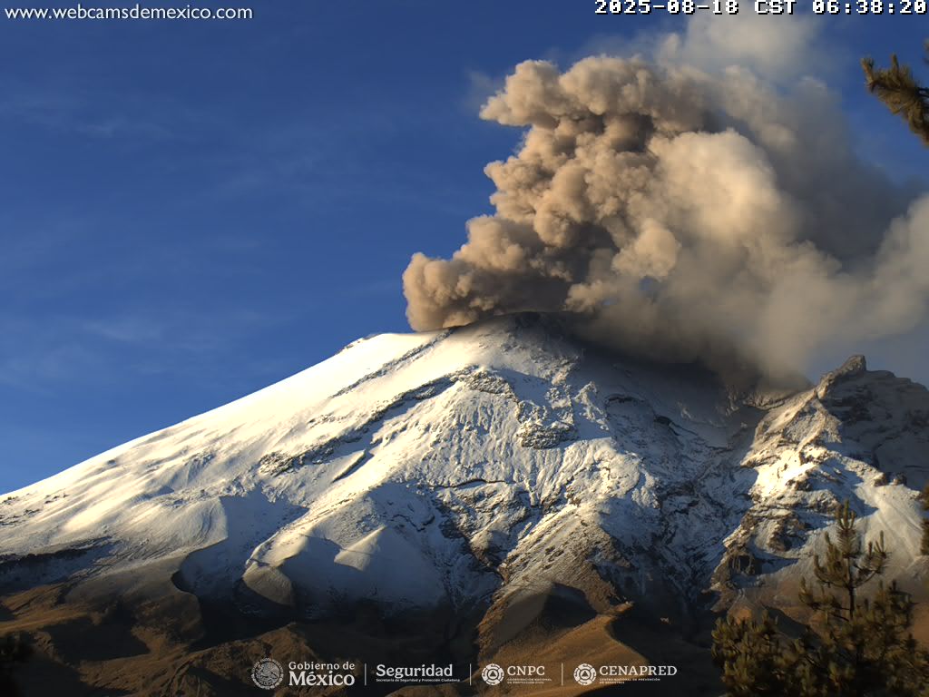
The Popocatépetl volcano fire alert is at Yellow Phase 2.
The expected scenarios for this phase are as follows:
Some minor to moderate explosions
Occurrence of tremors of varying amplitude
Light to moderate ashfall in surrounding towns and some more distant towns
Expulsion of incandescent fragments within a 12-kilometer exclusion radius
Lahars descending into ravines are expected due to ash accumulation on the slopes and its interaction with precipitation expected in the coming weeks
Possibility of pyroclastic flows not reaching towns
Source : Cenapred.