August 17 , 2025 .
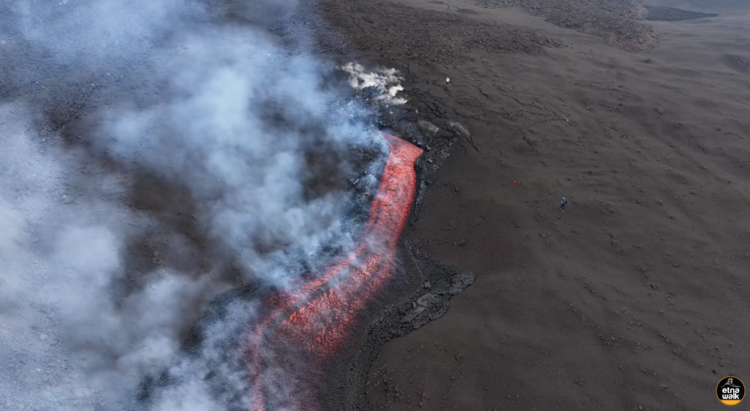
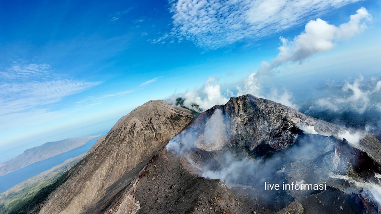
Italy / Sicily , Etna :
Etna Activity Update, August 16, 2025, 7:45 PM (5:45 PM UTC).
The National Institute of Geophysics and Volcanology, Osservatorio Etneo, reports that, based on analysis of satellite images and volcanological observations, the lava flow at 9:40 GMT was still active, spreading slowly southward. The most advanced front was located at an altitude of approximately 2,450 meters.
Moderate explosive activity continued in the southeast crater, with varying intensity.
Volcanic tremor remained average, with sources located just north of the Southeast Crater, at approximately 3,000 meters above sea level.
Infrasound activity was moderate, with events primarily located in the Southeast Crater. Weather conditions could affect the counting and localization of infrasound events.
Signals from the tiltmeter and deformation meter networks for ground deformation monitoring show no significant changes. Further updates will be provided shortly.
Source : INGV
Photo : Etna Walk / Giuseppe Distefano / FB. ( capture d’écran )
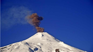
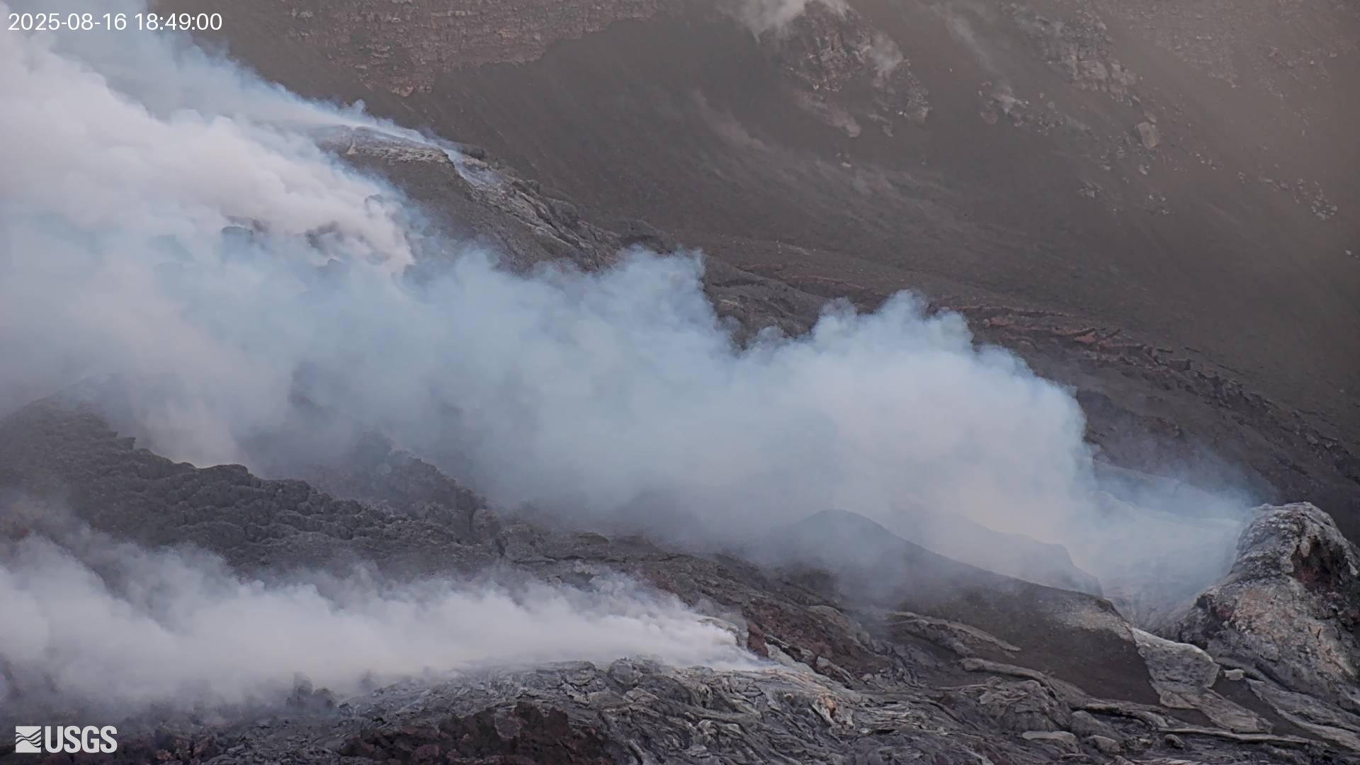
Kamchatka , Klyuchevskoy :
VOLCANO OBSERVATORY NOTICE FOR AVIATION (VONA)
Issued: August 16 , 2025
Volcano: Klyuchevskoy (CAVW #300260)
Current aviation colour code: ORANGE
Previous aviation colour code: orange
Source: KVERT
Notice Number: 2025-79
Volcano Location: N 56 deg 3 min E 160 deg 38 min
Area: Kamchatka, Russia
Summit Elevation: 4750 m (15580 ft)
Volcanic Activity Summary:
A summit explosive-effusive eruption of the volcano continues. Video and satellite data by KVERT showed explosions sent ash up to 6-6.5 km a.s.l., and ash plume is extending for 190 km to the north-east of the volcano.
An explosive-effusive eruption of the volcano continues. The danger of ash explosions up to 10 km (32,800 ft) a.s.l. remains. Ongoing activity could affect international and low-flying aircraft.
Volcanic cloud height:
6000-6500 m (19680-21320 ft) AMSL Time and method of ash plume/cloud height determination: 20250815/2340Z – Video data
Other volcanic cloud information:
Distance of ash plume/cloud of the volcano: 190 km (118 mi)
Direction of drift of ash plume/cloud of the volcano: NE / azimuth 42 deg
Time and method of ash plume/cloud determination: 20250815/2320Z – Himawari-9 14m15
Source : Kvert
Photo : Andrey Kobylko.
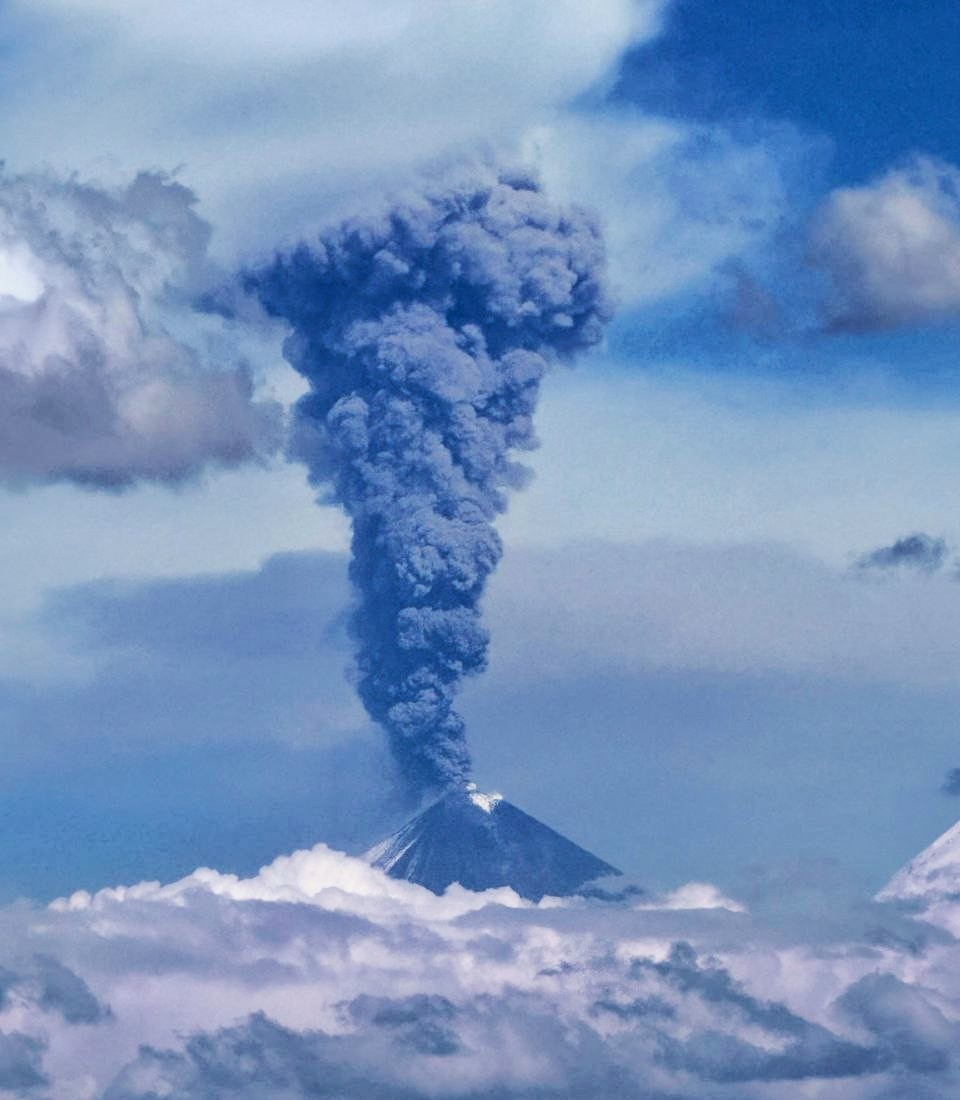
Indonesia , Lewotobi Laki-laki :
MOUNT LEWOTOBI LAKI-LAKI ACTIVITY LEVEL CHANGE FROM LEVEL III (SIAGA) TO LEVEL IV (AWAS) August 16, 2025, 8:00 a.m. WITA (Central Indonesia Time)
The volcano is clearly visible, covered in moderate fog. White and gray smoke is observed coming from the main crater, of thin, moderate, or thick intensity, approximately 50 to 1,000 meters above the summit. An eruption occurred, reaching an altitude of 800 to 900 meters above the summit, with a gray ash column. Avalanches occurred, but the distance and direction of the ashfall were not visually observed.
Seismic data from August 8 to 15, 2025, included:
7 eruption earthquakes,
4 avalanche earthquakes,
43 emission earthquakes,
3 harmonic tremors,
215 non-harmonic tremors,
43 low-frequency earthquakes,
24 deep volcanic earthquakes,
6 local tectonic earthquakes,
61 distant tectonic earthquakes.
Seismic data show a gradual increase at shallow depths, as evidenced by an increase in nonharmonic tremor seismic activity. The last eruption occurred on August 9, 2025, and at the time of writing, no subsequent eruptions have occurred. This indicates accumulated pressure within the volcano, which, if elevated, could trigger an explosive eruption. Based on previous records, explosive eruptions are usually preceded by a short period of increased activity. It is therefore important to be vigilant for an increase in deep volcanic earthquakes and nonharmonic tremor, as this could be a sign of very high gas pressure within the mountain, even though seismic data have not yet shown a major spike.
Over the past week, deformation monitoring using tiltmeters has indicated significant swelling of the volcano’s body, which could trigger an explosive eruption. At the same time, GNSS data began to show an increase in its average vertical position, indicating that the magma inflow from the depths is slowly shifting to shallower areas.
The results of visual and instrumental analyses indicate that the activity of the Lewotobi Laki-laki volcano has increased, leading to the raising of the Volcano Alert Level from Level III (SIAGA) to Level IV (AWAS) effective August 16, 2025, at 8:00 a.m. WITA (Central Indonesian Time). The following recommendations are recommended: the public and tourists are advised to refrain from any activity within a 6 km radius and a 7 km radius southwest-northeast of the eruption site, to remain calm, and to follow the instructions of local authorities. The public is also asked to ignore information from questionable sources.
Source : PVMBG
Photo : via Vulcaniya / FB.
Ecuador , El Reventador :
DAILY STATUS REPORT OF REVENTADOR VOLCANO, Saturday, August 16, 2025.
Information Geophysical Institute – EPN.
Surface Activity Level: High, Surface Trend: No change
Internal Activity Level: Moderate, Internal Trend: No change
From August 15, 2025, 11:00 a.m. to August 16, 2025, 11:00 a.m.:
Seismicity:
Below is the count of seismic events recorded at the reference station.
Explosion (EXP) 79
Long Period (LP) 15
Emission Tremor (TREMI) 5
Harmonic Tremor (TRARM) 2

Rainfall / Lahars:
No rainfall has been recorded in the volcano area. **Heavy rainfall could remobilize accumulated material, generating mud and debris flows that would cascade down the volcano’s flanks and flow into adjacent rivers.
Emissions / Ash Column:
Since yesterday afternoon, surveillance cameras have observed several gas and ash emissions reaching heights of between 600 and 1,300 meters above the crater, in a westerly direction. In connection with this activity, the Washington-based VAAC agency has issued two reports of ash emissions reaching heights of 800 meters above the crater, in a northwesterly direction.
Observation:
Last night and early this morning, several falls of incandescent material were recorded on the flanks of the volcano, reaching up to 1,000 meters below the crater level. The volcano remained cloudy most of the time.
Alert Level – SGR: Orange
Source : IGEPN
Photo : 02/11/2024 , Benjamin Bernard / volcanesdelecuador
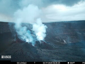
Hawaii , Kilauea :
HAWAIIAN VOLCANO OBSERVATORY DAILY UPDATE , U.S. Geological Survey
Saturday, August 16, 2025, 9:14 AM HST (Saturday, August 16, 2025, 19:14 UTC)
19°25’16 » N 155°17’13 » W,
Summit Elevation 4091 ft (1247 m)
Current Volcano Alert Level: WATCH
Current Aviation Color Code: ORANGE
Activity Summary:
Kīlauea is not erupting. Episode 30 of the ongoing Halemaʻumaʻu eruption ended abruptly at 12:55 p.m. HST on August 6 after 12 hours of continuous fountaining. Lava fountains reached up to 165 ft (50 m) and erupted lava covering 80% of the crater floor during this episode. A new fissure vent that transected the south wall of Halemaʻumaʻu ceased erupting at 4:40 a.m. HST on the morning of August 6. Volcanic gas emissions have greatly decreased. Models now show that episode 31 fountains are likely to start between August 18 and August 21. The window has been shifted a day later due to overnight slowing of inflation.
Summit Observations:
Moderate to occasionally strong glow persistent glow was visible at both the north vent and the cracks above it overnight. There was no glow from the south vent or the southern fissure. Low to moderate continuous tremor and along with weak low-frequency tremor bursts have been observed over the past 4 days. The low-frequency tremor bursts are characteristic of gas pistoning of magma. Variations in gas-pistion events are consistent with long term variability of shallow seismicity between episodes. The onset and strengthening of glow within the north vents may indicates that magma is slowly getting closer to the surface. Images from an overflight on August 6th showed that episode 30 flows had covered nearly 80% the Halemaʻumaʻu crater floor, which now includes the old down dropped block.
The Uēkahuna tiltmeter (UWD) recorded about 22.5 microradians of deflationary tilt during this episode. The end of the eruption was coincident with a rapid change from deflation to inflation at the summit and a decrease in seismic tremor intensity. The Uēkahuna tiltmeter (UWD) has recorded just under 18 microradians of inflationary tilt since the episode ended.
Elevated degassing continues from the vent. Average sulfur dioxide (SO2) emission rates during inter-episode pauses are typically 1,200 to 1,500 t/d, though emission rates vary on short time scales in association with gas pistoning.
Source et photo : HVO