October 09 , 2024.
Italy , Stromboli :
WEEKLY BULLETIN, from September 30, 2024 to October 06, 2024. (issue date October 08, 2024)
SUMMARY STATUS OF ACTIVITY
In light of the monitoring data, it emerges:
1) VOLCANOLOGICAL OBSERVATIONS: During the period under consideration, intense eruptive activity was observed with splashing from the northern area of the crater, the formation of a lava flow on October 1 and a major event occurring on October 6 in both areas of the crater. The total hourly frequency fluctuated between average values (7 to 10 events/h). The intensity of the explosions was low in the northern crater area and medium-high in the central-southern area.
2) SEISMOLOGY: The monitored seismological parameters do not show any significant variations, with the exception of the appearance at 00:17 UTC on 10/06 of a seismic event correlated with a major explosion.
3) GROUND DEFORMATIONS: The ground deformation monitoring networks on the island did not show significant variations, with the exception of the TDF inclinometer station which recorded a modest transient on October 6 during the big explosion and a permanent variation of about 5 microradians in the afternoon of the same day.
4) GEOCHEMISTRY: SO2 flux at medium level
CO2 flux from the ground in the STR02 summit area, the latest data date back to September 29 and are at average values.
CO2/SO2 ratio in the plume last week between average and high values.
The helium isotope ratio in the thermal aquifer is at average values (R/Ra = 4.34).
CO2 flux at Mofeta in the San Bartolo area: decreasing with average values.
CO2 flux at Scari: medium-high values around 148 g/m2/day,
5) SATELLITE OBSERVATIONS: The thermal activity observed by satellite in the summit area was generally low to moderate with some high-level thermal anomalies corresponding to the major explosion produced by the North Crater area on 6 October 2024 and subsequent activity.
VOLCANOLOGICAL OBSERVATIONS
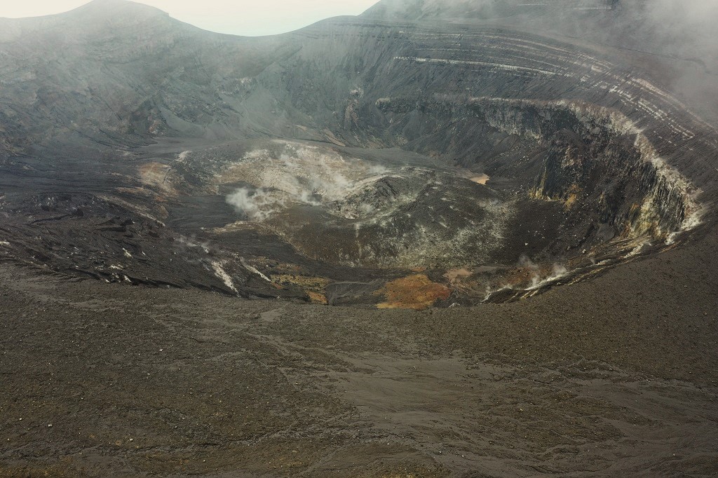
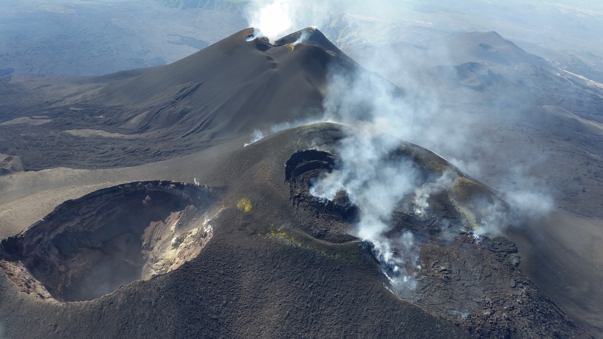
During the observed period, the eruptive activity of Stromboli was characterized through the analysis of images recorded by the INGV-OE surveillance cameras located at altitude 190 m (SCT-SCV) and at Punta dei Corvi (SPCT). The explosive activity was mainly produced by 2 (two) eruptive vents located in the North Crater area and by 2 (two) vents located in the Central South area.
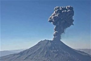
On October 1, a lava flow occurred in the North Crater area, while on October 6, a major explosion affected both areas of the crater.
Observations of explosive activity captured by surveillance cameras
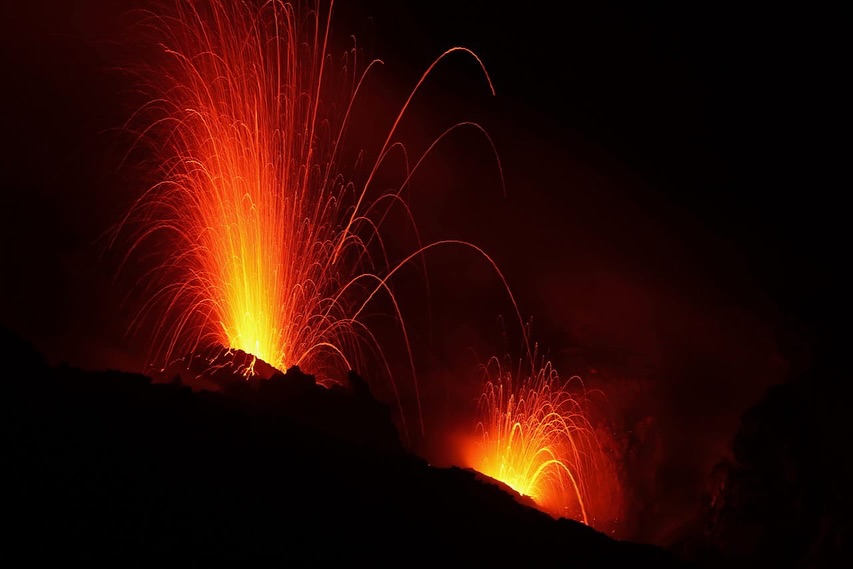
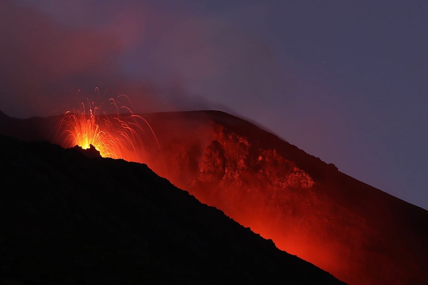
In the North Crater (N) area, two active vents were observed that produced low-intensity explosive activity (less than 80 m high). In addition, splashes were observed, sometimes intense, on 30 September, 1 and 6 October. The products of the eruption were mainly coarse materials (bombs and lapilli). The average frequency of explosions ranged from 5 to 8 events/h.
In the Centre-South (CS) area, explosive activity was produced by at least two chimneys. The explosions varied in intensity from medium (less than 150 m high) to high (more than 250 m high) and emitted fine materials, sometimes mixed with coarse products. The average explosion frequency ranged from 1 to 3 events/h
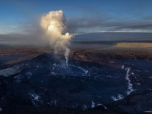
October 1st lava flow and October 6th major explosive event
On October 1st, after intense spattering activity in the North Crater area, starting at about 01:00 UTC, a lava flow formed that flowed into the pre-existing canyon and reached the coast, giving rise to a small accumulation of lava products. At 18:00 UTC, the lava flow appeared underfed and cooling.
On October 6th, a major explosive event affected the North and South-Central Crater areas.
At 00:17:22 UTC, the explosive sequence begins with the major energetic event located in the North Crater area. The mainly coarse products (lapilli, bombs and lava shreds) were distributed in a rose pattern, with abundant fallout on the Sciara del Fuoco. The duration of the first explosion was about 50 s. The sequence continued with at least three main explosions, located in the South-Central area, which formed mainly fine materials with an admixture of coarse materials; other weak ash explosions followed. Most of the products that rolled along the Sciara flowed into the pre-existing canyon without reaching the coastline. The total duration of the event was about 3 min. Subsequently, for about two hours, a lava flow advanced on the Sciara, fed by the spattering activity in the Northern area.
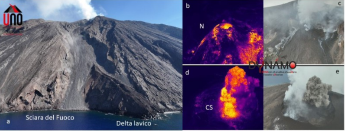
Drone image of the Sciara del Fuoco, the image shows the lava delta of the flow of the eruptive activity of 4-11 July, and the area of the North (N) and South Center (CS) crater on the thermal and visible (respectively b, d; c, e).
Drone surveys
On 7 October, as part of the activities of the Att. DPC-INGV and the UNO and DYNAMO projects, drone surveys were carried out on the thermal and visible aspects of the Sciara del Fuoco and the crater area in order to characterize the morpho-structural structure of the crater area and the Sciara del Fuoco.
Thanks to the processing of the data acquired by the drone, a digital surface model (DSM) with a resolution of 6 cm was obtained, in which the current post-eruptive structure of July of the summit crater area emerges, the red jagged lines delimit the edges of the craters. In image (b): details of the cinder cone placed in the North crater area and the Center-South crater area, the red circles indicate the active vents while the double yellow and red circles delimit the degassing vents.
Statement on Stromboli activity, 08 October 2024, 19:03 (17:03 UTC)
The National Institute of Geophysics and Volcanology, Osservatorio Etneo, reports that from 16:30 UTC, from the images of the INGV-OE surveillance cameras, a modest spattering activity is observed in the area of the North crater that feeds a lava overflow. At 16:50 UTC, the spattering activity is slightly increasing.
From a seismic point of view, around 16:33 UTC today, an increase in the values of the average amplitude of the volcanic tremor was observed, which went from a medium level to a high level. No significant changes have been reported in the occurrence rate of explosion earthquakes.
Regarding deformations, the stations of the GNSS monitoring network do not show significant variations.
Further updates will be communicated shortly.
Source : INGV
Photos : Thomas Bretscher via Stromboli stati d’animo , INGV.
Saint Vincent and the Grenadines , La Soufrière :
St Vincent: Thermal anomaly detected at La Soufriere volcano
The volcano still remains at a Green Alert Level
The public has been advised not to visit the La Soufriere volcano in St Vincent and the Grenadines as a low thermal anomaly (temperatures above existing background/base levels) was detected at the summit of the La Soufriere volcano by the NASA FIRMS hot spot detection system on Sunday.
This is according to information received from the Seismic Research Centre at 2:38 pm today.
This low thermal anomaly as detected by NASA FIRMS is currently ongoing.
The National Emergency Management Organisation (NEMO) in a statement says potential scenarios associated with the detection of the thermal anomaly include a Sulphur fire in the crater, a small phreatic (steam) eruption that may have exposed hot underlying rocks, or the start of new extrusion of lava in the crater.
Advertisement
Analysis of multigas data collected on October 4 by the NEMO Soufriere Monitoring Team, and further reconnaissance via sea along the West Coast today are still underway. Further updates will be given following the analysis of the multigas data and the conclusions from the visual observations.
The volcano still remains at a Green Alert Level – This means that the volcano is quiet; seismic and fumarolic (steam vent) activities are at or below the historical level at this volcano.
No other unusual activity has been observed.
In the meantime, NEMO is advising persons not to visit the volcano at this time and that the La Soufriere Trail remain closed.
It added that there should be no unauthorised visits to the summit until further notice.
Source : caribbean . loopnews.com /
Photo : NEMO
Italy / Sicily , Etna :
WEEKLY BULLETIN, from September 30, 2024 to October 06, 2024. (issue date October 08, 2024)
SUMMARY STATUS OF ACTIVITY
In light of the monitoring data, it emerges:
1) VOLCANOLOGICAL OBSERVATIONS: Degassing activity at the summit craters and minor intra-crater explosive activity at the Northeast crater.
2) SEISMOLOGY: Low seismic activity due to fracturing. Average amplitude of volcanic tremor at the average level.
3) INFRASOUND: Moderate infrasound activity with sources located mainly in correspondence with the Northeast crater.
4) GROUND DEFORMATIONS: Over the past week, ground deformation monitoring networks have not recorded significant changes
5) GEOCHEMISTRY: SO2 flux at medium-high level
Soil CO2 flux remains low and decreasing
Partial pressure of dissolved CO2 in groundwater shows values within seasonal variability
Helium isotope ratio: No update available.
6) SATELLITE OBSERVATIONS: Thermal activity observed by satellite in the summit area was generally low to moderate.
VOLCANOLOGICAL OBSERVATIONS
During the week in question, the monitoring of the volcanic activity of Etna was carried out thanks to the images of the surveillance camera network of the National Institute of Geophysics and Volcanology, Osservatorio Etneo (INGV-OE). In the early hours of October 2, surveillance cameras revealed an intra-crater explosive activity at the North-East crater (CNE). Throughout the week, the usual degassing of the summit craters continued, in particular from an area located on the border between the Bocca Nuova craters (near BN1, currently buried under the products of the Voragine activity in July-August 2024) and Voragine.
SEISMOLOGY
Seismicity: During the week in question, no seismic event of magnitude 2 or greater was recorded.
Volcanic tremor: During the week in question, the average amplitude of volcanic tremor remained within the range of average values. In particular, the centroid of tremor sources is located in the area of the central craters in a depth range mainly between 2,500 and 3,000 meters above mean sea level.
Source : INGV
Photo : Etnair srl
Colombia , Chiles / Cerro Negro :
San Juan de Pasto, October 8, 2024, 3:55 p.m.
From the monitoring of the activity of the Chiles and Cerro Negro volcanoes, the Colombian Geological Survey (SGC), an entity attached to the Ministry of Mines and Energy, reports that:
During the week of October 1 to 7, 2024, the activity of these volcanoes showed variations in their records that are part of a stable behavior. Compared to the previous week, the main variations in the monitored parameters were:
• A significant increase in seismic occurrence was recorded, but with a decrease in the levels of released energy.
• Seismicity associated with rock fracture was predominant in terms of occurrence and released energy.
• The recording of seismicity related to the movement of fluids inside volcanic conduits continued, with some events showing a very low frequency.
• Fracture earthquakes were located in three areas. The first, located at the summit and in the collapse zone to the north of the summit of Chiles Volcano, at distances between 0 and 1.5 km, with depths between 2 and 5 km from the summit (4,700 m) and a maximum magnitude of 1.7. The second area was located to the south of Chiles Volcano, at distances between 1.3 and 3 km, with depths between 3 km and 5 km and magnitudes less than 1. The third area was located to the east-northeast of the summit of Cerro Negro, at distances between 0.6 and 3 km, with depths between 3 and 5 km and magnitudes less than 1. Some earthquakes were located scattered in the region of the two volcanoes at distances less than 18 km and with a maximum magnitude of 1.2. • Field sensors and remote satellite sensors that record deformations continued to show changes associated with an inflationary process in the volcanic area.
Based on the above, the SGC recommends closely monitoring its evolution through weekly bulletins and other information published through our official channels, as well as instructions from local and departmental authorities and the National Disaster Risk Management Unit (UNGRD).
Volcanic activity remains in yellow alert status: active volcano with changes in the behavior of the base level of the monitored parameters and other manifestations.
Source et photo : SGC.
Alaska , Great Sitkin :
Lava continues to erupt slowly at Great Sitkin Volcano. Ongoing activity is adding to a thick lava flow that fills most of the summit crater. Small earthquakes associated with the ongoing lava eruption continue. Nothing unusual was observed in satellite imagery; web camera images were cloudy over the past day.
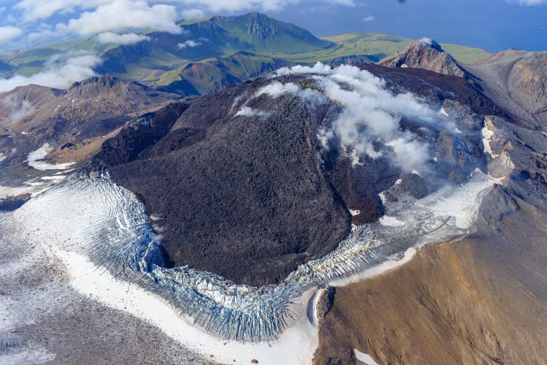
Un seul événement explosif s’est produit en mai 2021 et a été suivi par l’éruption de lave en cours qui a commencé en juillet 2021. Aucun événement explosif ne s’est produit depuis mai 2021. Des capteurs sismiques et infrasons locaux et des webcams sont utilisés pour surveiller le Great Sitkin ainsi que des réseaux régionaux de capteurs d’infrasons et de foudre et des données satellites.
Source : AVO
Photo : Loewen, Matt / Alaska Volcano Observatory / U.S. Geological Survey. ( 09/2023 )